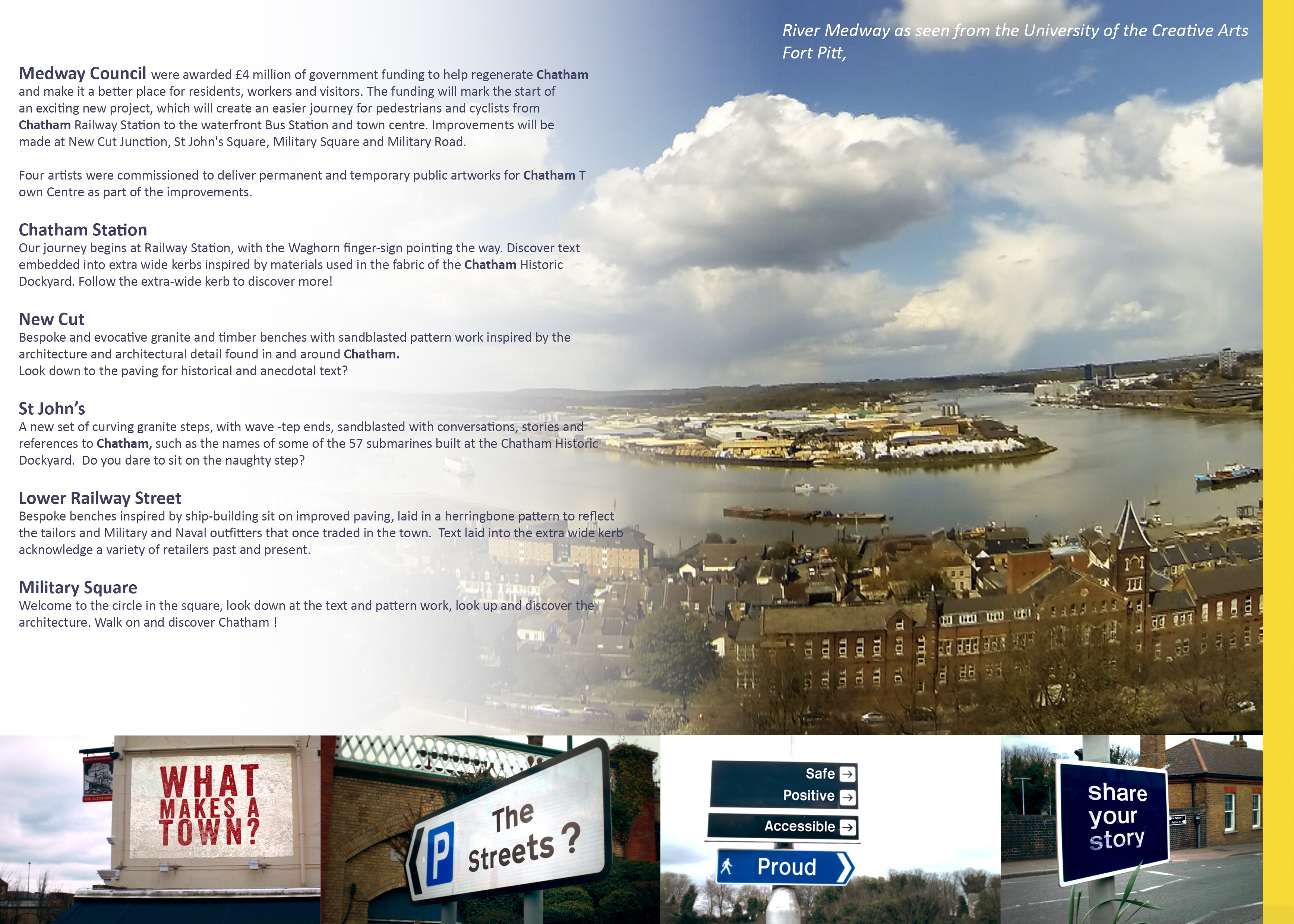
Draft Magazine – Cover: THESE ARE OUR STREETS. Image: Christopher Tipping
We have always planned to create a magazine or booklet…some form of printed publication or other, with which to celebrate and record our progress, our ideas, the stuff that got away…but mostly our collaboration with each other and with the people along our route. We may still be able to deliver this a a hard-copy paper publication at some point in the future, as a way or marking the project – or as an online event.
The following images will take you with us on part of our journey to create the draft and concepts for the work you can now see embedded into the pavements of Railway Street and Military Square. The content has been generated in collaboration with other artists and creatives, commissioned to deliver specific aspects of our work, but who directly and indirectly contributed so brilliantly to the outcome. FrancisKnight Public Art Consultants, Rob Young– Writer, Xtina Lamb– Printmaker, Simon Williams– Filmmaker & Paul Baker – Graphic Designer.
There were many versions of these pages made, as we decided how best to represent what had been done. Here are just a few…
Draft Magazine – Page 1: THESE ARE OUR STREETS. Image: Christopher Tipping
“I’m not from Chatham, I’m just visiting…I come here a lot – Every Day !”.
The voices represented here are everyday voices of people in Chatham. Writer Rob Young sent time talking to small businesses and the people who worked in them along our route. He is a good listener with an exceptional ear for a ‘one liner’; a swagger, a forgotten hero, a heartfelt sentiment softly spoken. These overheard or anecdotal lines have been captured in stone set into the paving. Not all could be used. Many are reproduced here for the first time.
Draft Magazine – Pages 2 & 3: THESE ARE OUR STREETS. Image: Christopher Tipping
This was a draft layout for the information page – a bit of what we were planning. It is quire ambitious, but we actually achieved an enormous amount.
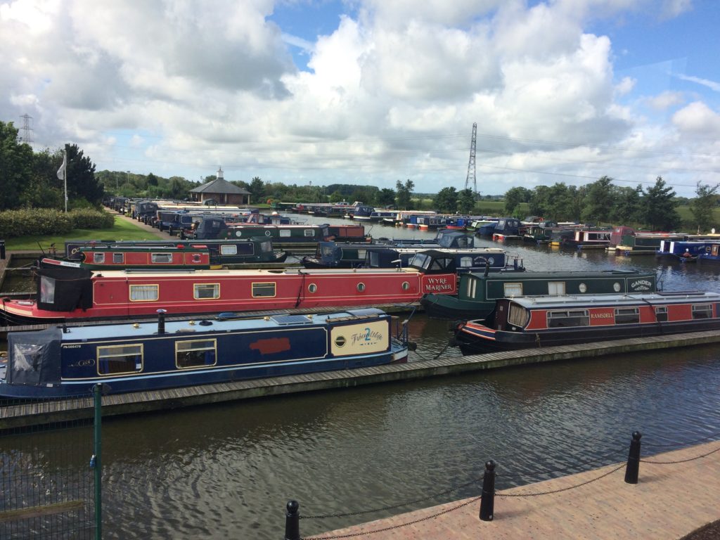
Draft Magazine – Pages 4 & 5: THESE ARE OUR STREETS. Image: Christopher Tipping
The fantastic panorama of the River Medway was taken by Filmmaker Simon Williams from the roof terrace of Fort Pitt, now the UCA RochesterCampus. The mock-up street signs were the outcome of a collaboration between Rob Young, Simon Williams and myself.
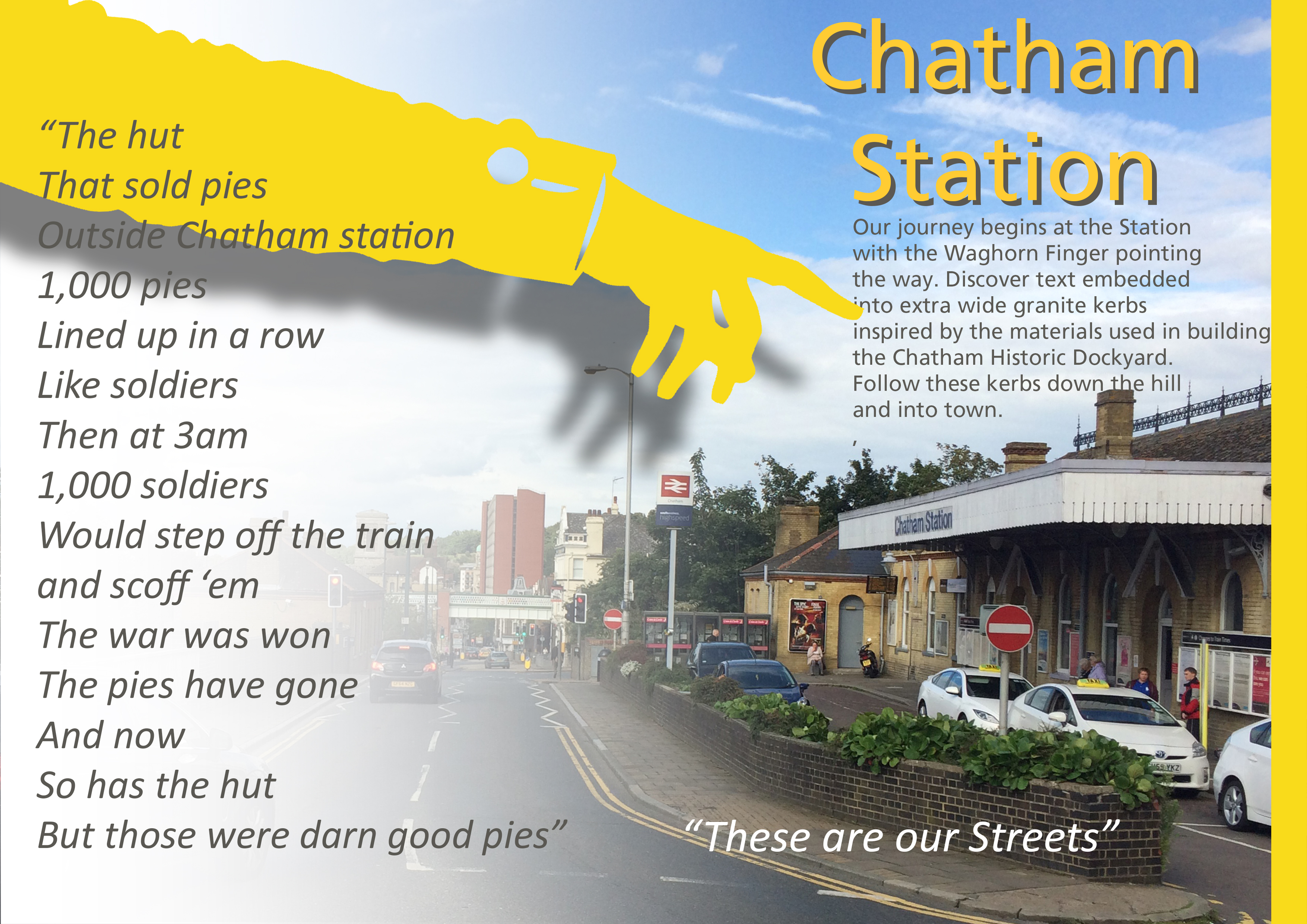
Draft Magazine – Pages 6 & 7: THESE ARE OUR STREETS. Image: Christopher Tipping
1000 Pies Lined up in a row like Soldiers…
Chatham Station and it’s approaches were always at the head of our scheme. Designs and public art have been prepared and approved, to become a part of the regeneration of the Station, which has just started on site. Click on this link to find out more.
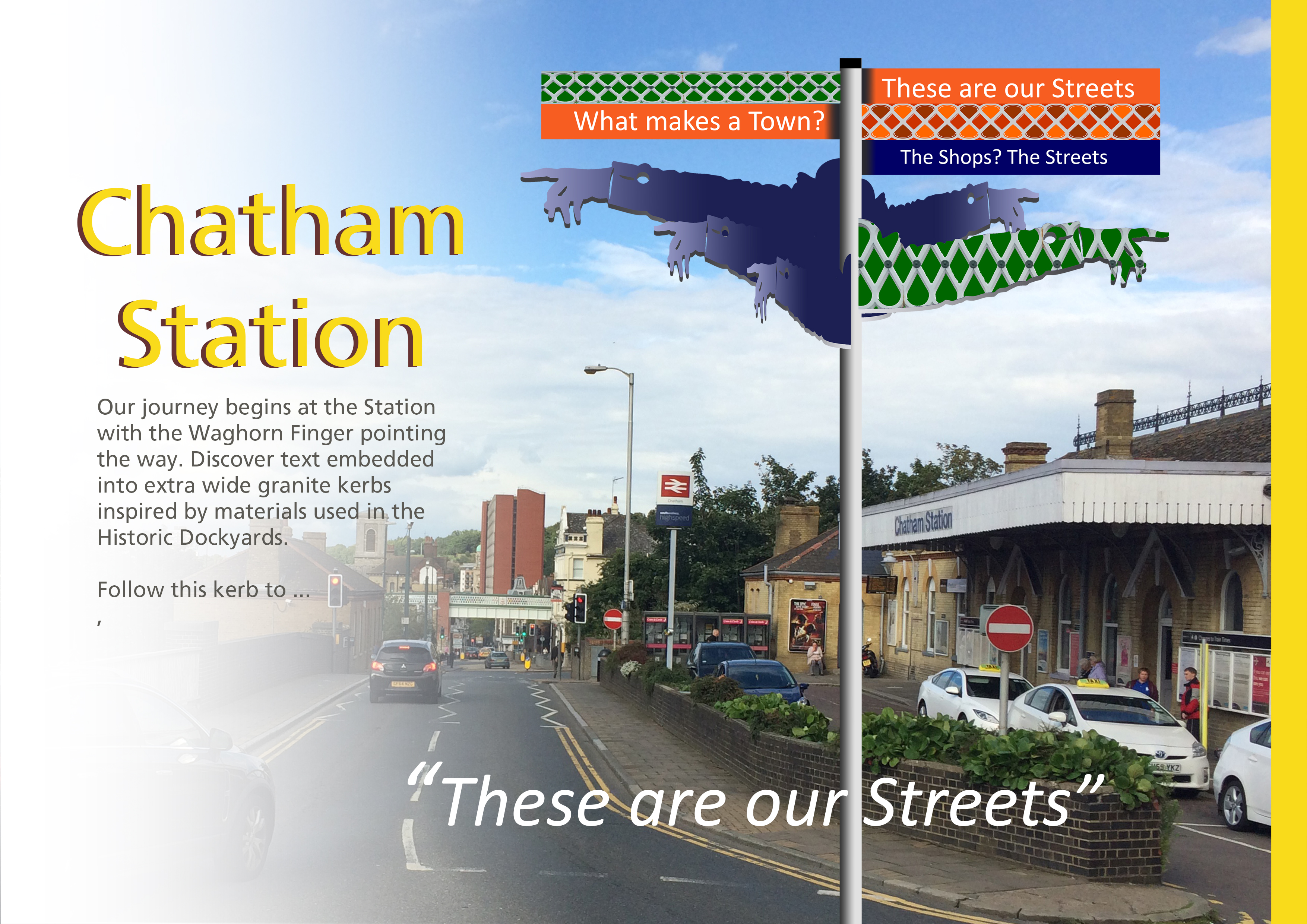
Draft Magazine – Pages 6 & 7 V2 : THESE ARE OUR STREETS. Image: Christopher Tipping
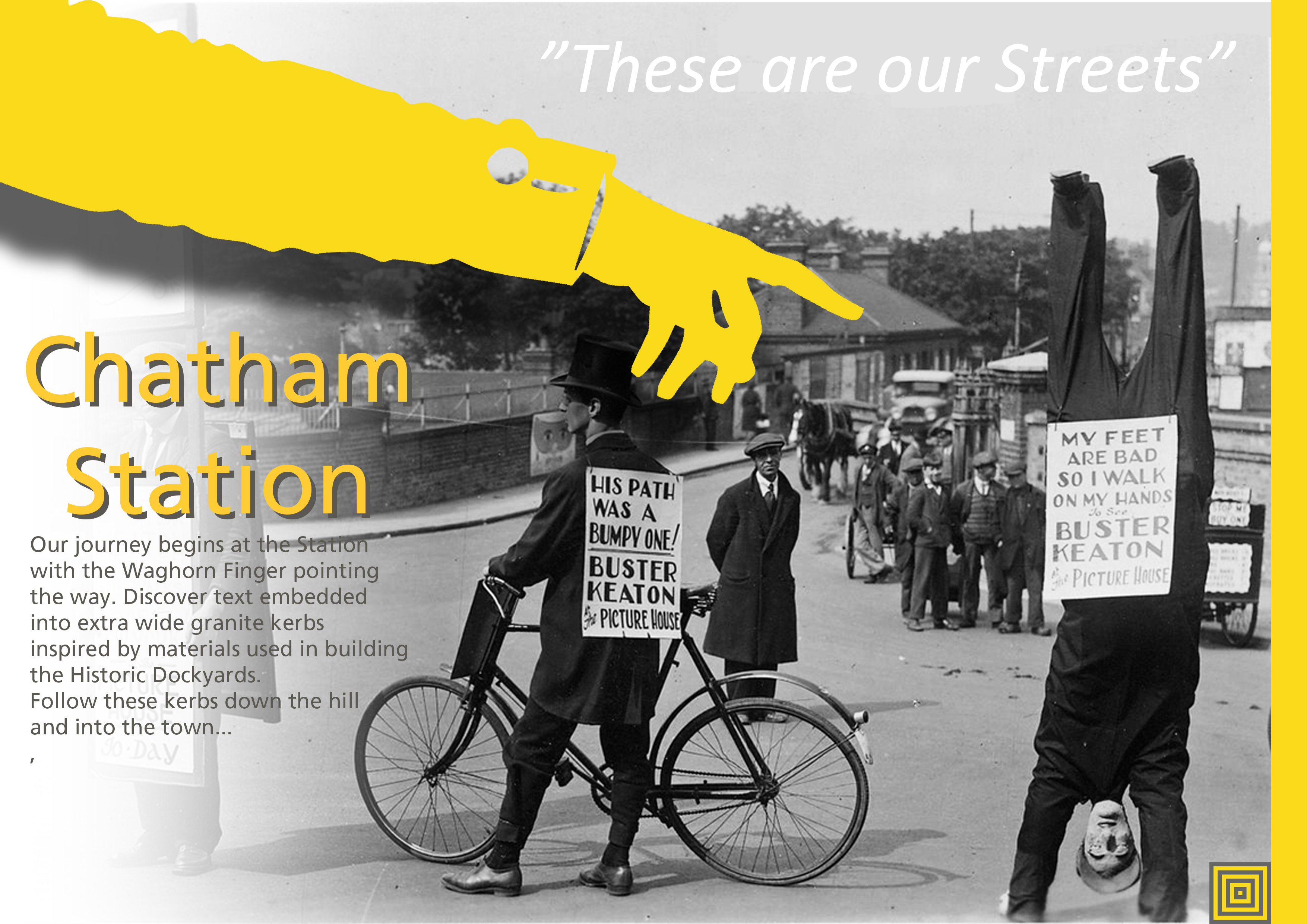
Draft Magazine – Pages 6 & 7 V3 : THESE ARE OUR STREETS. Image: Christopher Tipping. Archive Photograph by Kind Permission of MALSC
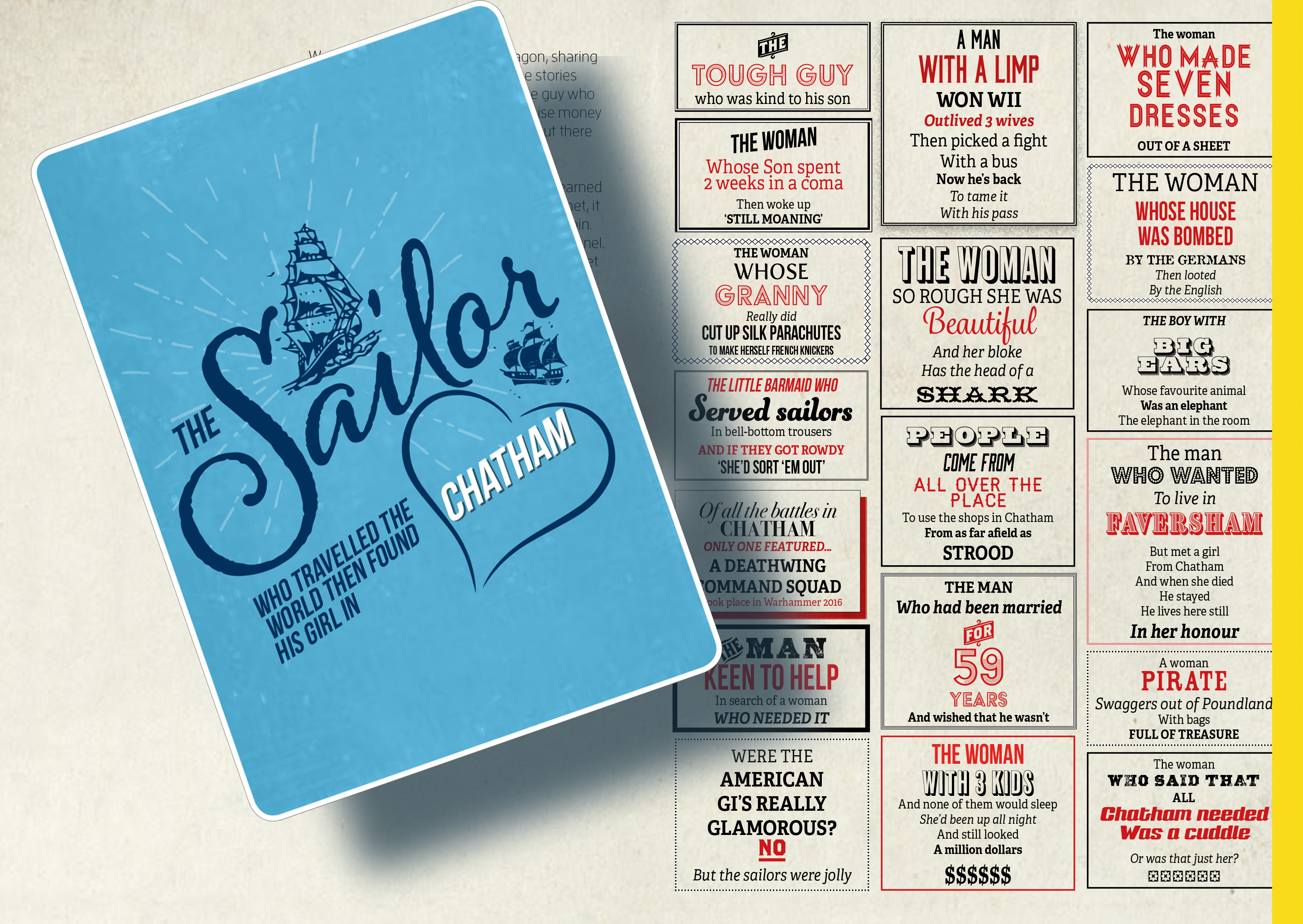
Draft Magazine – Pages 8 & 9 V2 : THESE ARE OUR STREETS. Image: Christopher Tipping.
The Sailor who travelled the world…the found his girl in Chatham
Draft Magazine – Pages 10 & 11 V1 : THESE ARE OUR STREETS. Image: Christopher Tipping.
An imaginary tale…The Story of Tommy Johnson of Margate by Rob Young
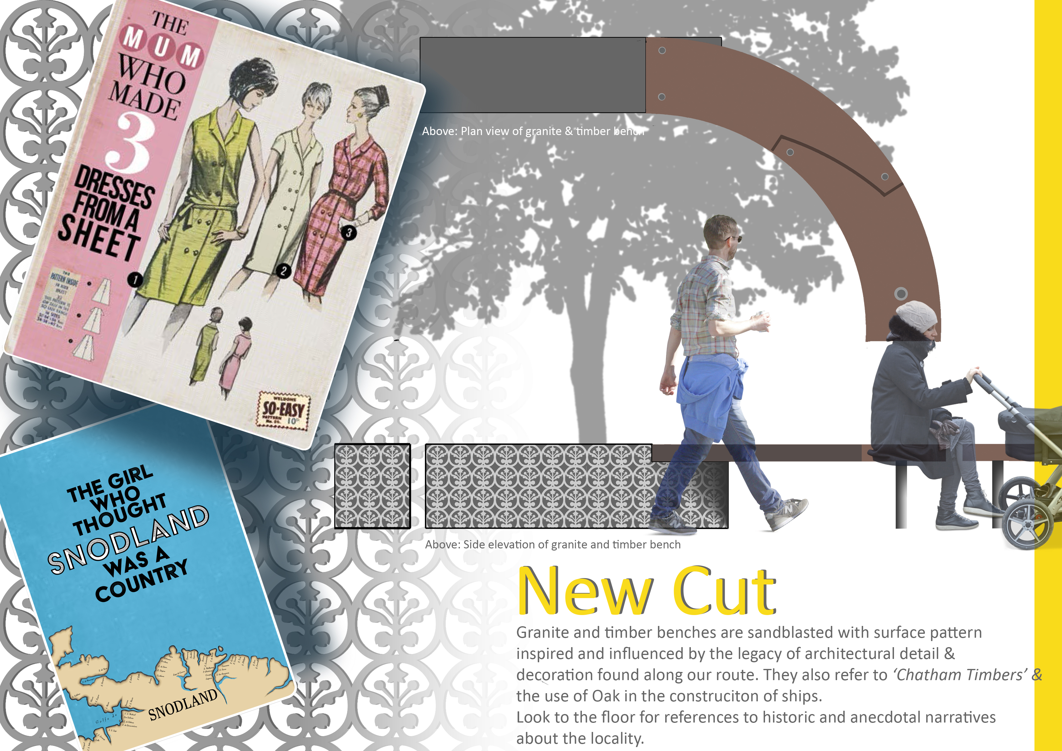
Draft Magazine – Pages 12 & 13 V1 : THESE ARE OUR STREETS. Image: Christopher Tipping.
Draft designs for granite or cast iron paving slabs. Rochester Riverside. Image: Christopher Tipping
“A creek separates the marsh here from Cory’s Wharf – apparently into which the watermill discharged…” “The marsh was full of logs (a huge stack of wooden piles from Rochester Old Bridge) and was home to many rabbits – wild rabbits, grey, brown and black…” ‘It was said that the Foord Familystocked the marsh, with animals from their farm at Darland’. Stephen Hannington – Bygone Kent Magazine – Rochester’s Long Lost Common Part Two –
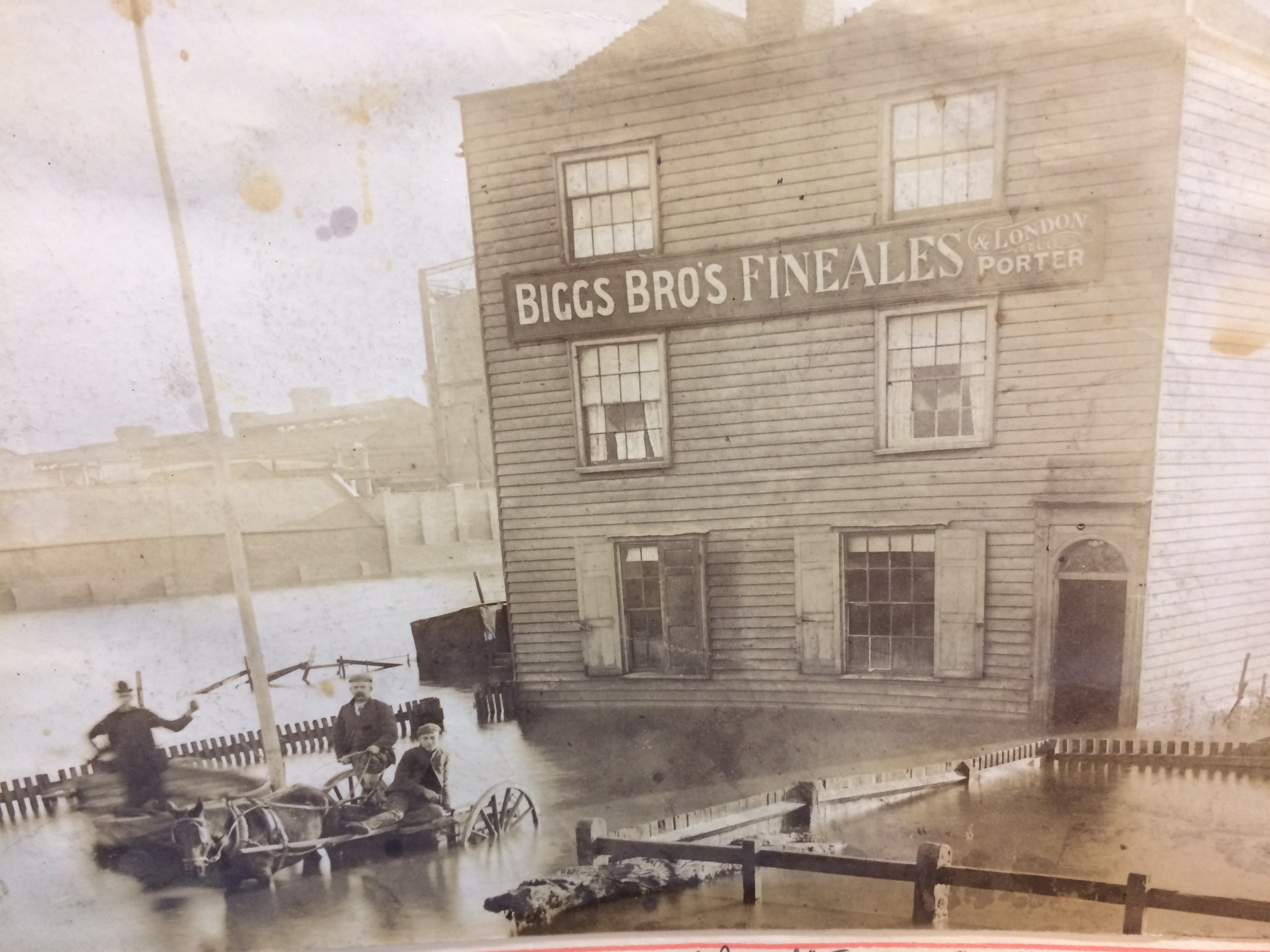
‘Floods of 1897 and 1928 inundated this area – the flooding in1897 was called The Great Flood and attributed to a record high tide on 29th November’. The image below shows the Homeward Bound Public House inundated by the flood waters. The Gas Holders of the Gasworks, can be seen in the background. The Gasworks, on Gas House Way was one of the earliest built in the UK in 1818. The area was known as Gas House Marshes. Image by kind permission of Medway Archives and Local Studies Centre.
The Homeward Bound Public House at Gas House Point inundated by the great flood of 1837. Image: By kind permission of MALSC
I thought I might post the artwork for all of the proposed granite and cast iron paving slab units. I can then add any historic anecdotes, images or information, which have caught my attention and may be of further interest. I’ll cover all these in this and the next two posts. 1 of 3
Draft designs for granite or cast iron paving slabs. Rochester Riverside. Image: Christopher Tipping
CAST IRON UNIT ‘BRICKIES‘ STACKIES STUMPIES’. You can also add MUDDIES to this list as well! All colloquial names for the trades associated with Medway Barges built in and operating out of the Rochester Riverside site. Brickies carried up to 40,000 bricks on the up river journey to London and came back laden with London’s rubbish. Stackies were piled high with Hay and Straw. Stumpies could take cement, lime, timber, clay, coal, bricks, hops and other commodities. Muddies are self explanatory…the carried clay and mud dug from the banks of the Medway Estuary and destined for local brickworks.
Draft designs for granite or cast iron paving slabs. Rochester Riverside. Image: Christopher Tipping
CAST IRON UNIT ‘GOLDEN SAMPHIRE’. ‘To the northwest the Medway Estuary consists of an extensive area of marshland, comprising of salt marsh and intertidal mudflats. The River remains tidal at this point and estuarine conditions would have dominated most of the site’s past.’ Ref: KCC HER 012. 2014 -371. Golden Samphire grows on estuary mudflats and salt march. It is rare and I have used it as it represents the efforts being made by the client team to build upon the heritage and legacy of the natural environment with it’s diverse flora and fauna.
Draft designs for granite or cast iron paving slabs. Rochester Riverside. Image: Christopher Tipping
GRANITE UNIT ‘BLUE BOAR CREEK’. “Blue Boar Wharf was our playground”. Edwin Harris
Blue Boar Creek is the one of the more distinctively named and well remembered places on our site. It also gave name to Blue Boar Lane, Blue Boar Hard, Blue Boar Lower Yard, Blue Boar Upper Yard, Blue Boar Lane Foundry and Blue Boar Pier. ‘Blue Boar Hard Pier: November 26th 1886′ as seen at the Medway Archives is set of beautiful, hand painted drawings of plans for a new Pier by draughtsman William Hoelking. Some details are referred to as ‘DOLPHINS’ & ‘DUMMY’. MALSC Ref: Plan 1 of 4 (002) MP/B/30/1 (1 of 4).
Blue Boar Hard Pier: November 26th 1886. Image: By kind permission of MALSC. Ref: Plan 1 of 4 (002) MP/B/30/1 (1 of 4).Blue Boar Hard Pier: November 26th 1886. Image: By kind permission of MALSC. Ref: Plan 1 of 4 (002) MP/B/30/1 (1 of 4).
William BanksCity Surveyor has also signed this document. William was born in about 1850 at Edmonton. He married Anne Mary Everett in June 1876 at Islington. In 1891, he and his family were living at at 10 Albany Road, Rochester, William was by then aged 40 and a surveyor for the city of Rochester.
‘What is now left of Blue Boar Creek and the river beyond at Limehouse Reach, lies deathly silent. Coal is not longer unloaded from colliers at Cory’s Wharf. So too is the Pier, once festooned with skiffs and rowing boats, where formerly small boys with rod and line and a jar of worms could fish away the school holidays’. John K. Austin from his publication ‘Yesterday’s Medway’. Johns has been involved with this project from the outset, having been consulted by the project Architects BPTW on his local knowledge as a historian, author, teacher and artist.
Draft designs for granite or cast iron paving slabs. Rochester Riverside. Image: Christopher Tipping
GRANITE UNIT ‘THE FIVE BROTHERS’ William Higham had a Barge Building business on Blue Boar Hard. He was born in 1838 in Lewes Sussex. On 27th October 1864 he married Fanny Elizabeth Blake in Strood. By 1881 they had 9 children and lived in a private house on Victoria Street, Rochester. William employed 11 men and 7 boys. THE FIVE BROTHERS was the last barge built at this yard alongside DOROTHY in 1901.
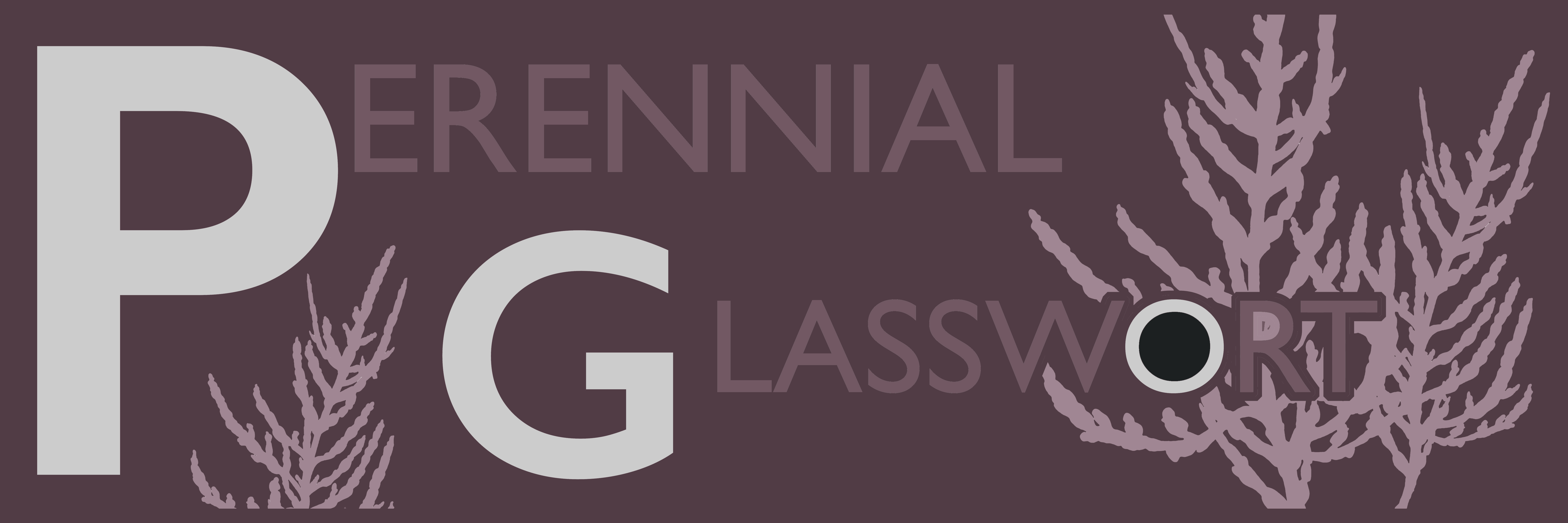
Draft designs for granite or cast iron paving slabs. Rochester Riverside. Image: Christopher Tipping
GRANITE UNIT ‘PERENNIAL GLASSWORT’. ‘The Medway Estuary is believed to be the most important area in North kent for wintering wildfowl in numbers of international significance. The saltmarsh serves as a roosting area for waders at high tide. Several scarce plant species include: golden samphire, perennial glasswort and one-flowered glasswort. The estuary is one of the best places in Britain for the study of glassworts. The grazing marsh has breeding and wintering birds of interest; the former include lapwing, redshank, pochard, mallard and gadwall, while in winter large flocks of may wildfowl and wader species are present.’ Ref: Environmental Stresses and Resource Use in Coastal Urban and Peri Urban Regions. DPSIR Approach to SECOA’s 17 Case Studies.
Draft designs for granite or cast iron paving slabs. Rochester Riverside. Image: Christopher Tipping
GRANITE UNIT ‘COAL: METER HEAVER WHIPPER’. Colloquial names for trades employed in the Coal business.Frederick Furrell was born in 1807 and died in 1877. Frederick Furrell & Son were Coal Merchants based at Furrell’s Wharf, a He was also an Alderman & Shipowner. He had ten children with his wife Katherine who he had married on February 25th 1832 at St Margaret’s Church in Rochester. Fred was Mayor of Rochester in 1855. Furrell’s Wharf was a 30m length of post and plank revetment of Oak and Elm Posts, most likely made from re-used ships timbers was in use in 1865 making it one of the oldest sites for industry on Rochester Riverside. It was accessed via Furrell’s Road.
His name also lived on as ‘Furrells Pond’, “where children swam and skated in Icy weather – The site flooded during exceptionally high tides” . Edwin Harris
Furrells Wharf was also the destination of many travelling shows, menageries and circuses – such as Wombwells Wild Beasts & Edmonds Menagerie – George Sangers Circus, Pinder’s Circus, Middletons’ Marionettes.
Coal was a major industry at Rochester, with several businesses engaged, most notable William Cory & Son of Fenchurch Street London were registered in 1896 after taking over he business of coal factors, merchants and Lightermen of William Cory & Son of Rochester at Rochester Coal Wharf.
Draft designs for granite or cast iron paving slabs. Rochester Riverside. Image: Christopher Tipping
The last pieces of production artwork have now been signed off. Most of the front elevation of the building has now been installed. Weirdly I’ve not yet been up to see it. Been pretty busy here in Ramsgate.
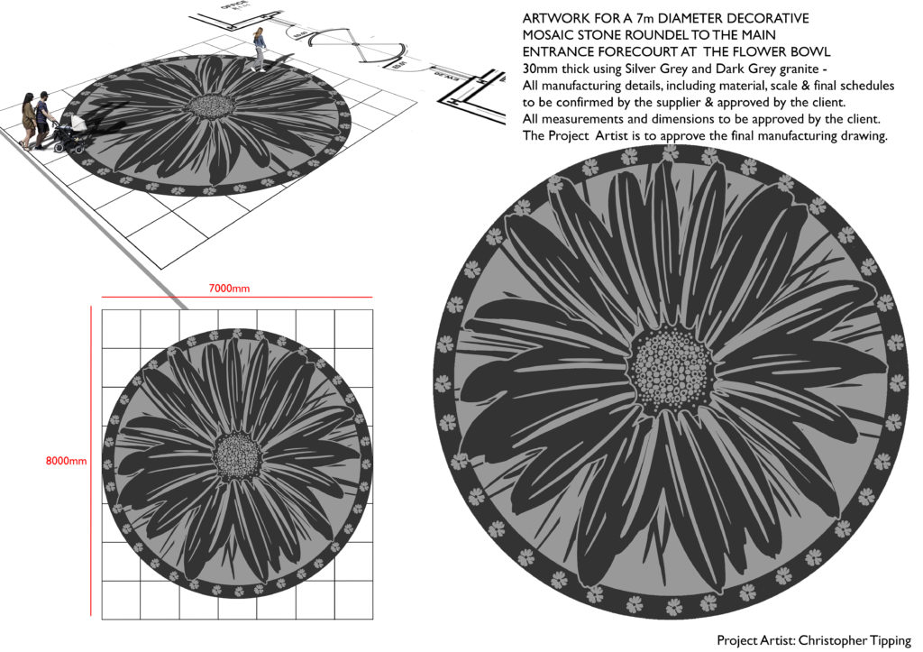
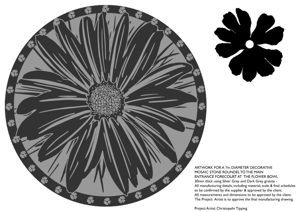
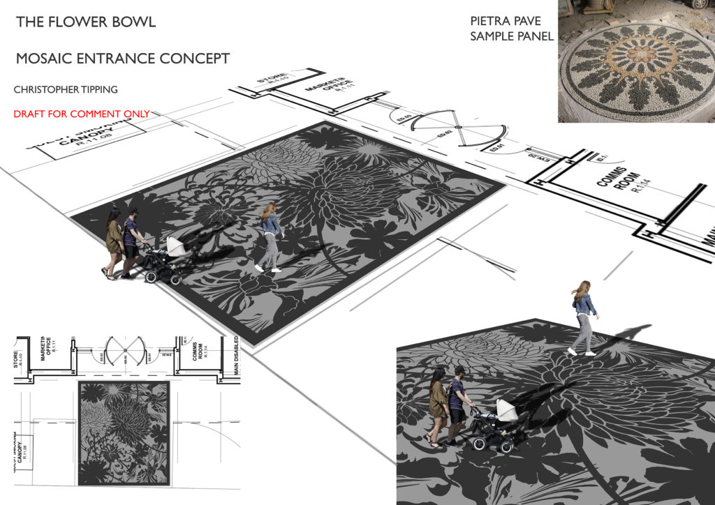
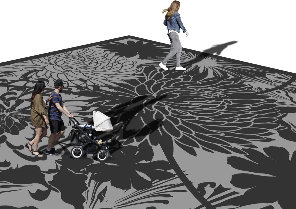
A good thing is that Guy Topping commissioned a further piece of work from me – a 7m diameter granite mosaic of a large flower for the main entrance threshold. The manufacturing work was commissioned from Bannister Hall Landscape Supplies and will be manufactured in China.
The Flower Bowl. Draft for granite mosaic paving entrance feature. Image: Christopher TippingThe Flower Bowl. Draft for granite mosaic paving entrance feature. Image: Christopher TippingThe Flower Bowl. Draft for granite mosaic paving entrance feature. Image: Christopher TippingThe Flower Bowl. Draft for granite mosaic paving entrance feature. Image: Christopher Tipping
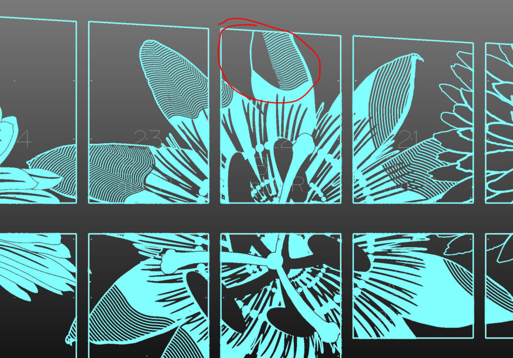
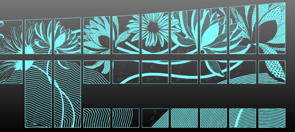
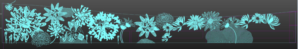
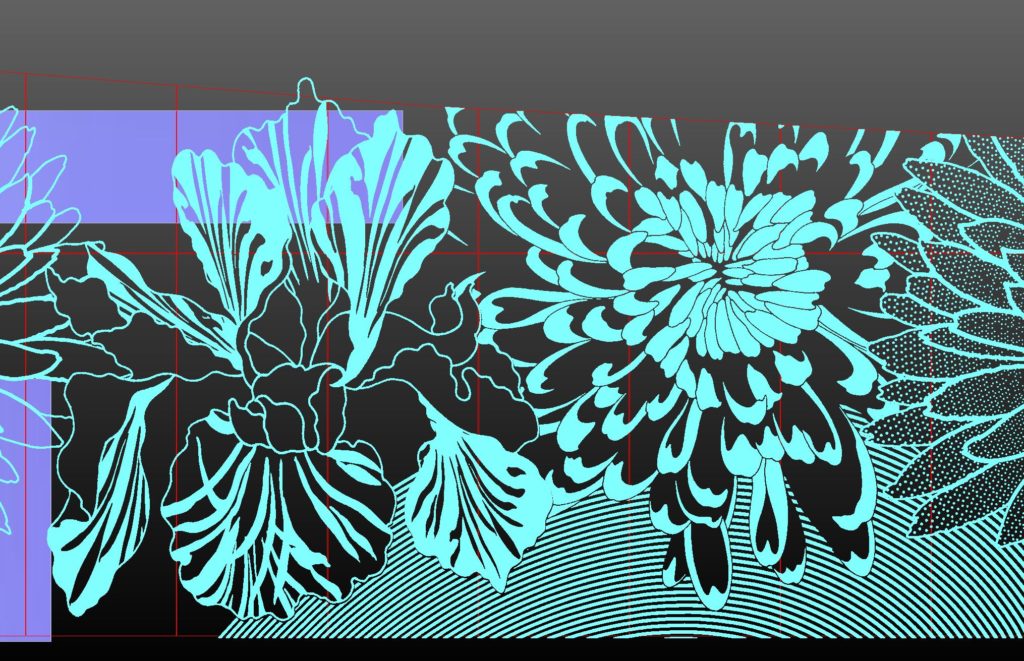
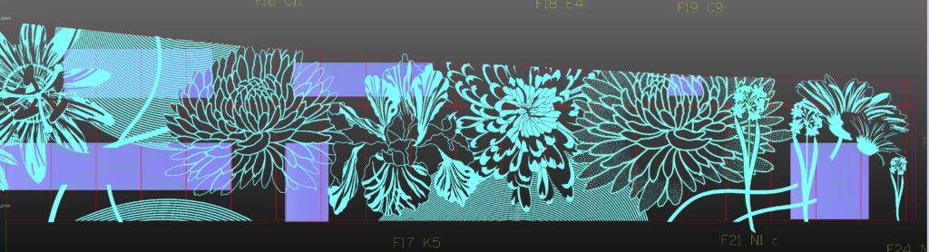
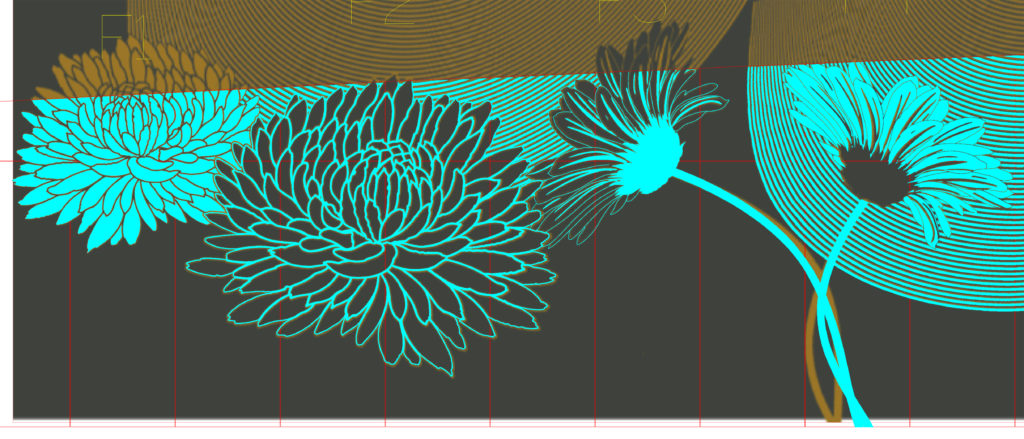
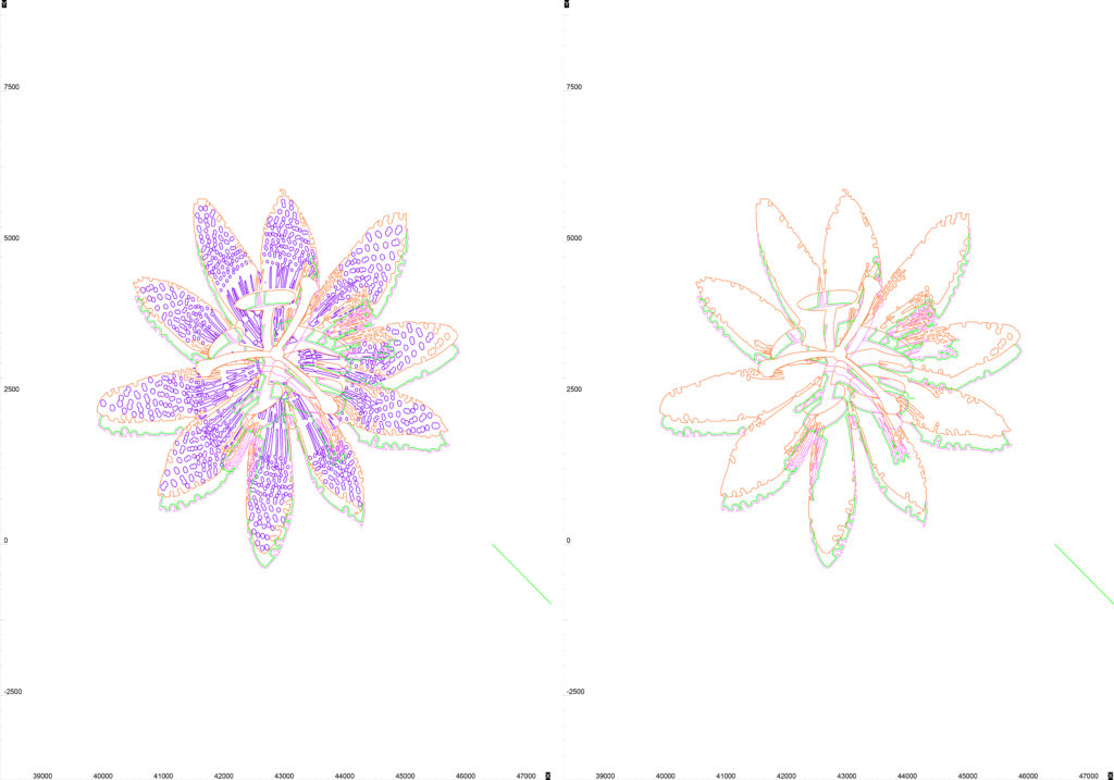
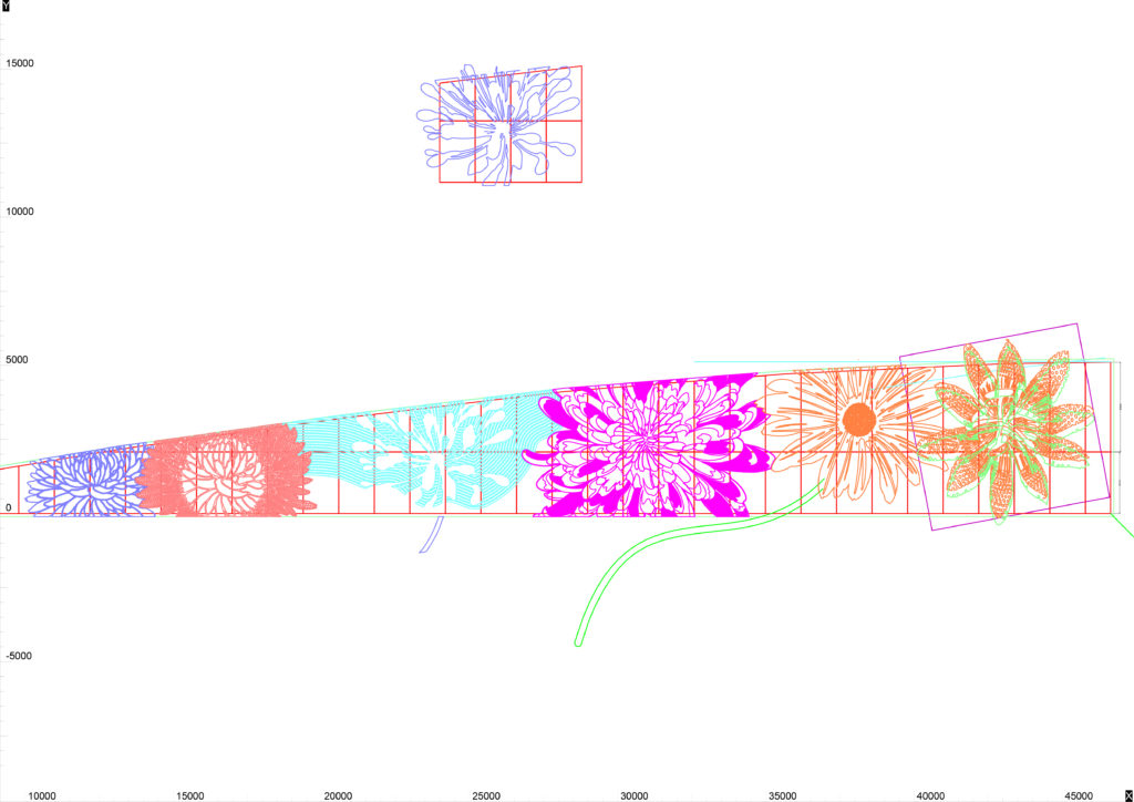
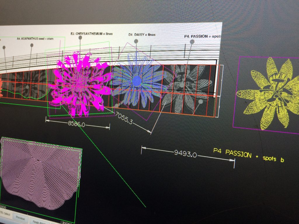
I have been incredibly lucky to collaborate once again with Mark Durey at The Cutting Room in Huntingdon. I worked with Mark on the cnc cut facade for the new Heart of the Campus Building at Sheffield Hallam University Collegiate Campus. I am indebted to him for bringing these projects to life in way I could not deliver on my own. My colleague Sarah Alldritt also deserves a big thanks for her work translating my original artwork into ai vectors. Mark imports these digital files and re-builds the artwork through an Alphacam CAD CAM softwareprogramme to create the work. That may seem a straightforward digital process created by clever software …let me tell you that it is not. The translation from my artwork to end product is anything but straightforward in this instance. Mark is the key here. He has a clear understanding of how the programmes work – but – more importantly he is prepared to go ‘off-road’ and put his experience to task, problem solving and bringing an entirely bespoke service into play to produce the outcomes you see. I am lucky to have him as a collaborator.
Mark has an individual methodology at play whilst creating the cutting files. He adds colour to enable him to plan the work and – indirectly, I find these images inspiring and creative in themselves. Probably annoyingly I am always asking for screenshots of particular details.
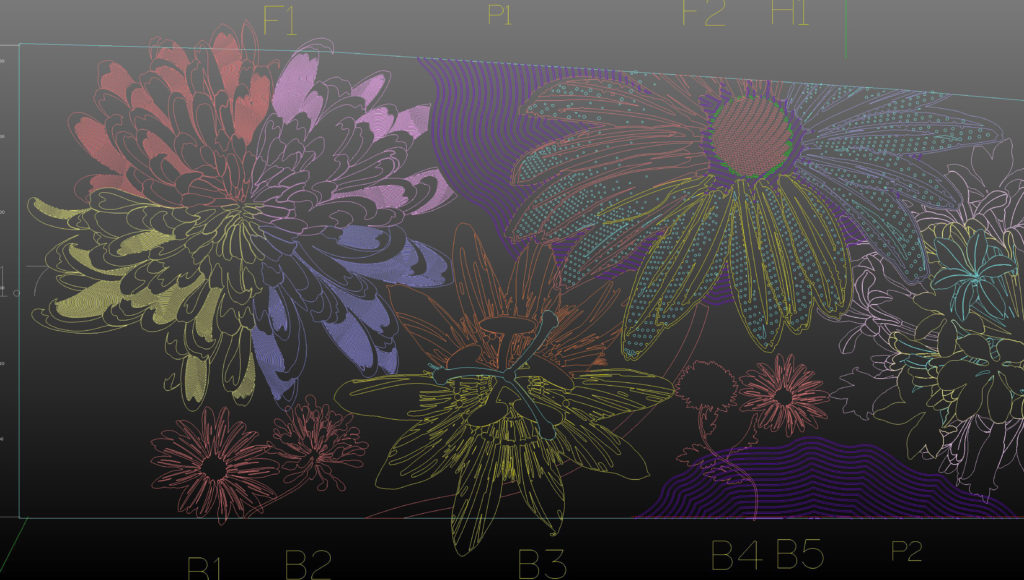
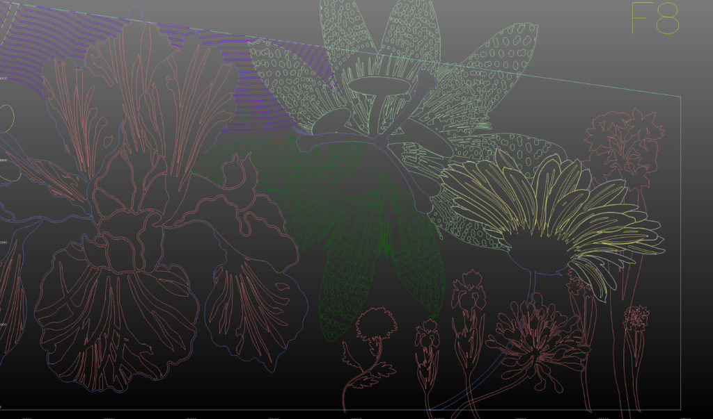
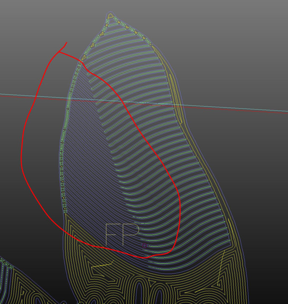
Manufacturing drawings for The Flower Bowl cnc routed elevations. Image: Mark DureyManufacturing drawings for The Flower Bowl cnc routed elevations. Image: Mark DureyManufacturing drawings for The Flower Bowl cnc routed elevations. Image: Mark DureyManufacturing drawings for The Flower Bowl cnc routed elevations. Image: Mark DureyManufacturing drawings for The Flower Bowl cnc routed elevations. Image: Mark DureyManufacturing drawings for The Flower Bowl cnc routed elevations. Image: Mark DureyManufacturing drawings for The Flower Bowl cnc routed elevations. Image: Mark DureyManufacturing drawings for The Flower Bowl cnc routed elevations. Image: Mark DureyManufacturing drawings for The Flower Bowl cnc routed elevations. Image: Mark DureyManufacturing drawings for The Flower Bowl cnc routed elevations. Image: Mark DureyManufacturing drawings for The Flower Bowl cnc routed elevations. Image: Mark DureyManufacturing drawings for The Flower Bowl cnc routed elevations. Image: Mark DureyManufacturing drawings for The Flower Bowl cnc routed elevations. Image: Mark Durey
The latest image by the client Guy Topping – the left hand elevation for The Flower Bowl Main Entrance – but how did we get to this point?
Main Entrance Elevation in progress at The Flower Bowl. Image: Guy Topping
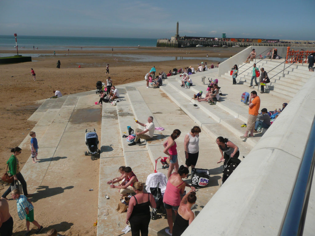
The last decade has seen Margate’s cultural landscape flourish with the dual success of Turner Contemporary and a resurgent Dreamland to book-end the seafront panorama. Successful regeneration by Thanet Council has also brought significant and tangible changes to the Old Town. One of the most significant outcomes delivered by the Council without fanfare or drama however, has been the Margate Flood & Coastal Protection Scheme – also known more fondly as Margate Steps. A scheme funded by the Environment Agency to the tune of £6million pounds and brought in on time and under budget …and somewhat under the radar. This example of coastal civil engineering encompassed not only the Steps, but the Harbour Arm and Sea Wall along Marine Drive. This elegant and functional concrete stepped revetment structure has also brought a much needed and highly activated public realm and pedestrian space to the Town.
Throughout its history, a major catalyst for change and development in Margate had been the destructive force of storms and storm surges. These pages are taken from the Contextual Research Document, which I delivered in collaboration with the project team.
Margate Flood & Coastal Protection Scheme – Contextual Research Text Image: Christopher TippingMargate Flood & Coastal Protection Scheme – Contextual Research Text Image: Christopher TippingMargate Flood & Coastal Protection Scheme – Contextual Research Text Image: Christopher Tipping
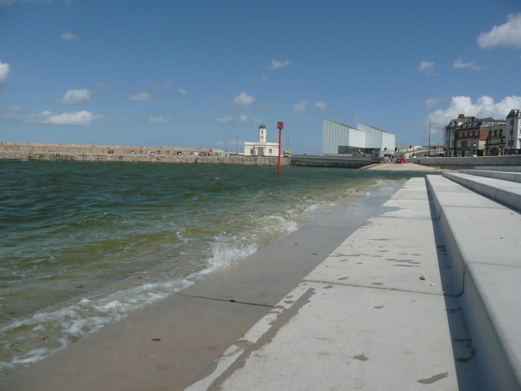
Margate Flood & Coastal Protection Scheme – Towards Turner Contemporary May 2013. Image: Christopher Tipping
I was commissioned as project artist on the scheme by Thanet District Council & the Environment Agency in December 2010. My role was to uncover and present interpretive & contextual information & develop concepts with which to influence the design process & inform the structure & detailing of this major sea defence works. The work has now been completed and the project officially opened in May 2013.
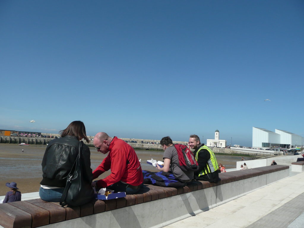
Margate Flood & Coastal Protection Scheme – lunch al fresco May 2013. Image: Christopher Tipping
Being part of an integrated design team from an early point was critical in enabling the contextual work, via a contribution to the detailed DESIGN & ACCESS STATEMENT , to influence the physical form of the structure, within its constraints as a sea defence work.
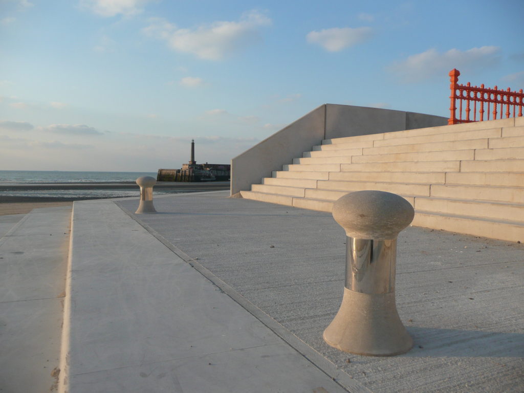
Margate Flood & Coastal Protection Scheme – evening light March 2013. Image: Christopher Tipping
The public realm and amenity space which the project afforded Margate’s sea front has been a tremendous addition to an enlivened and highly activated sea front promenade which has Turner Contemporary and the Harbour Arm at one end & Margate Station & Dreamland at the other.
Margate Flood & Coastal Protection Scheme – The New King’s Stairs May 2013. Image: Christopher Tipping
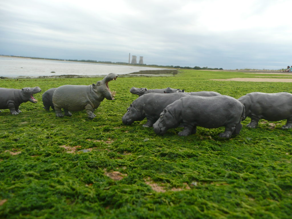
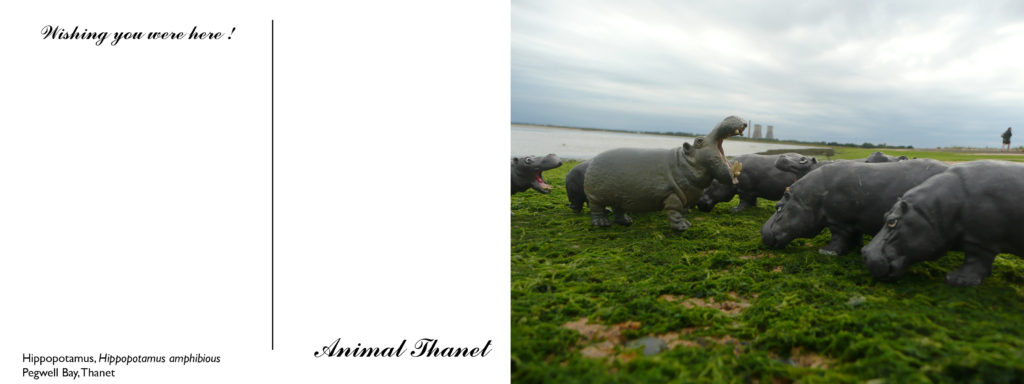
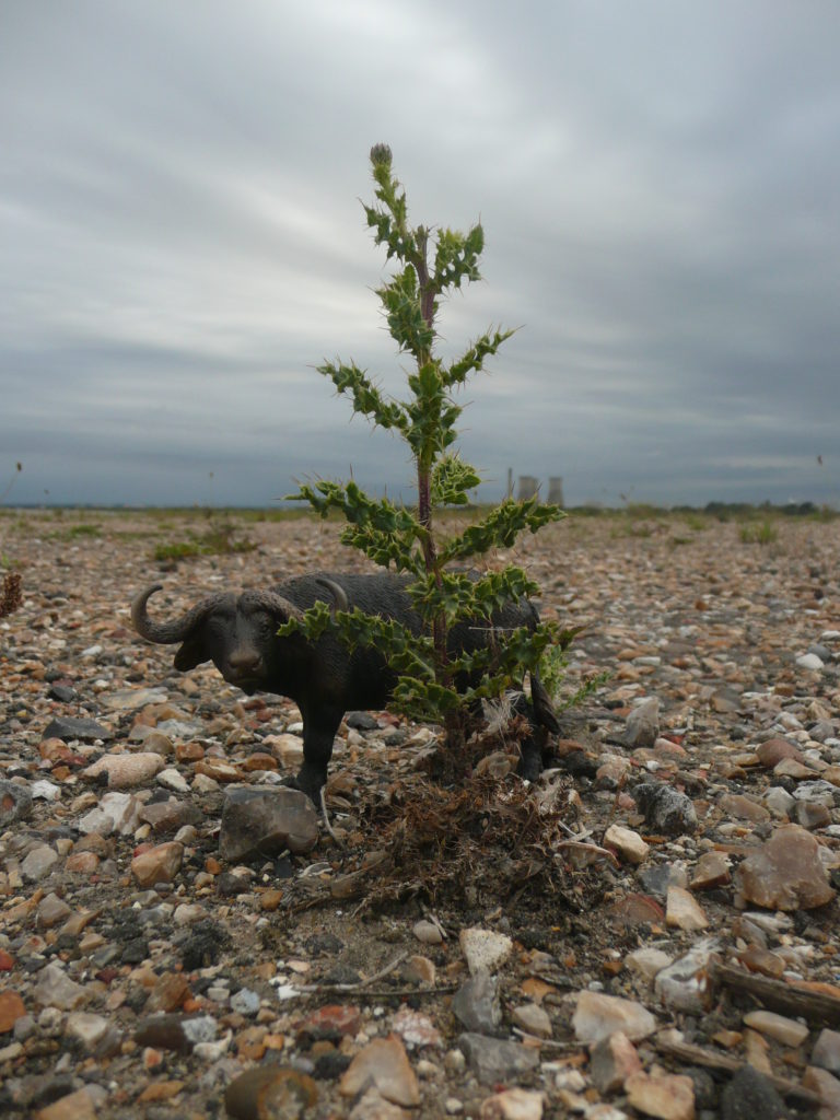
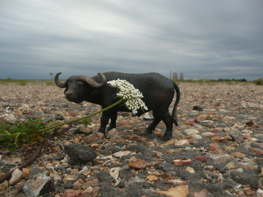
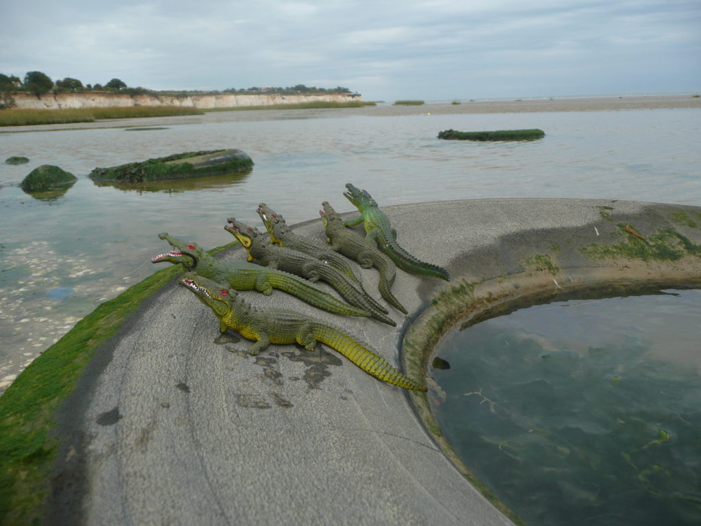
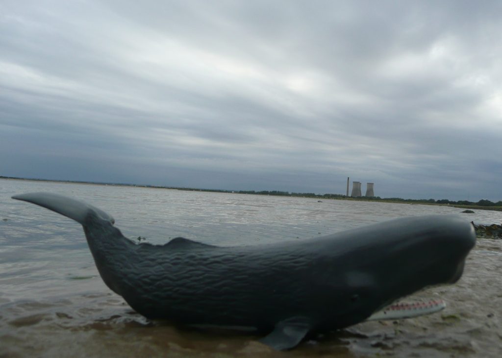
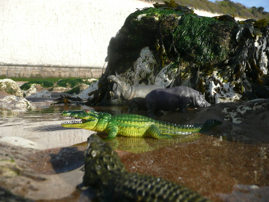
In 2011, I took a series of Animal Thanet images entitled Pegwell Safari – down on the abandoned concrete apron of the former Pegwell Bay Hoverportat Pegwell Bay, Thanet. These images formed part of a postal art project.
Some of the images show the cooling towers & chimney of the former Richborough Power Station, which were demolished by explosives at 09.07am on 11th March 2012.
These images consider & reflect wider concerns for the natural world, particularly focussed on the lives of its wild animals, conservation, loss of habitat, diminishing numbers, poaching, extinction and callous exploitation, which holds a mirror to our humanity. We may soon only have plastic versions of our wild neighbours to play with. The last decade has witnessed the slow & horrible realisation that our negative impact on the planet and particularly our plastic pollution of almost every environment, is a catastrophe for the world around us.
Hippopotamus amphibious Pegwell Bay, Thanet with Richborough Cooling Towers in the background. Image: Christopher TippingHippo Postcard Project – Hippopotamus amphibious Pegwell Bay, Thanet with Richborough Cooling Towers in the background. Image: Christopher TippingPlains Zebra, Equus zebra Pegwell Bay, Thanet. Image: Christopher TippingPlains Zebra, Equus zebra Pegwell Bay, Thanet. Image: Christopher TippingBuffalo, Syncerus caffer, Pegwell Bay, Thanet. Image: Christopher TippingBuffalo, Syncerus caffer, Pegwell Bay, Thanet. Image: Christopher TippingNile Crocodile. Crocodylus niloticus, Pegwell Bay, Thanet. Image: Christopher TippingPlains Zebra, Equus zebra Pegwell Bay, Thanet. Image: Christopher TippingSperm Whale, Physter macrocephalus, Pegwell Bay, Thanet. Image: Christopher Tipping
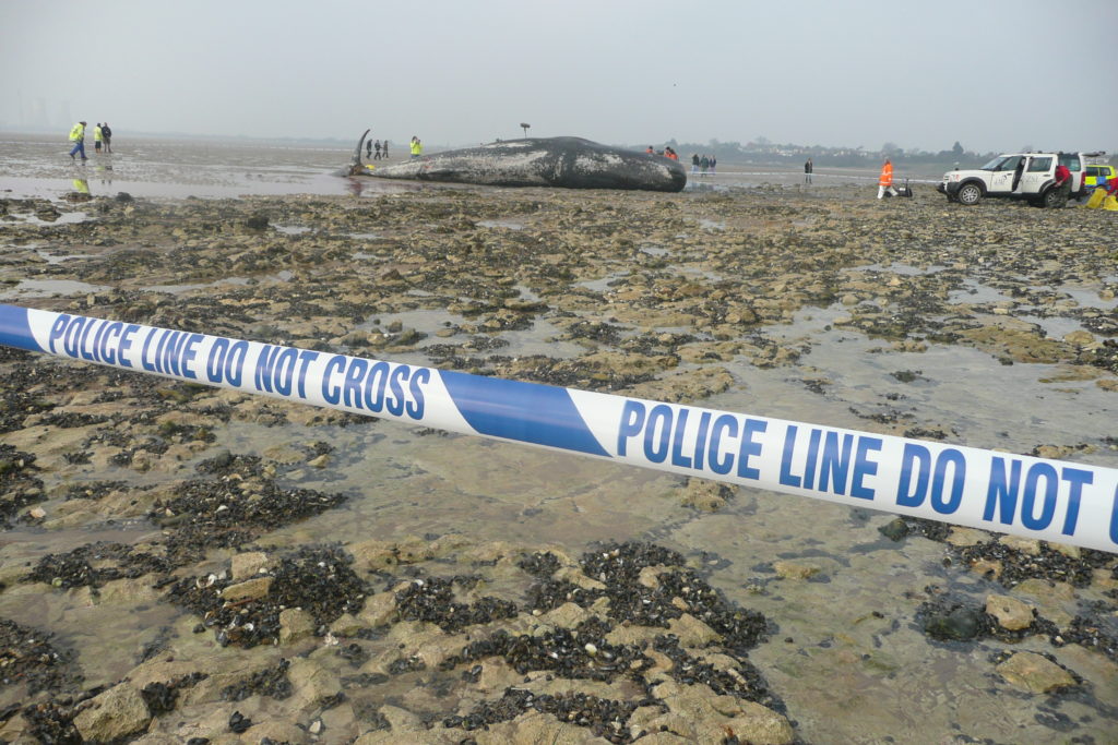
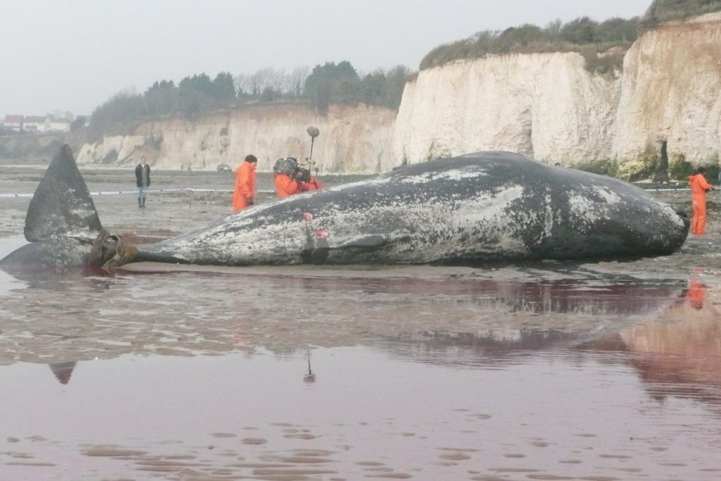
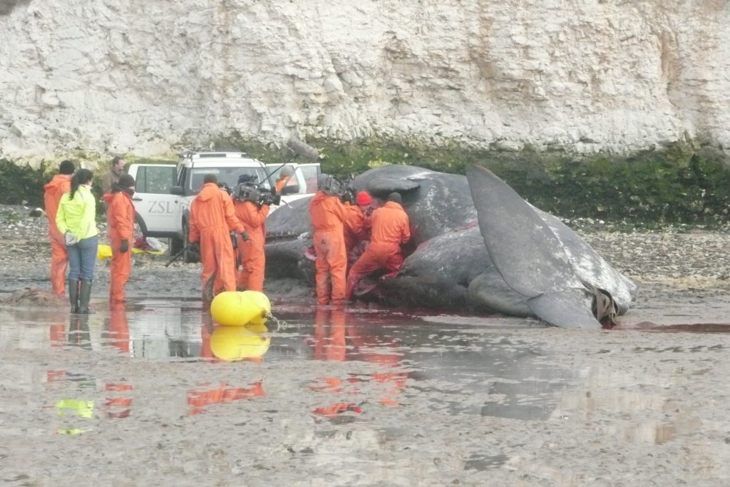
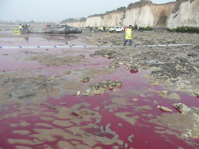
In March 2011 a Sperm Whale beached and died at Pegwell Bay. I remember running along the beach at low tide all the way from Ramsgate to see it. A whale necropsy was carried out the following day, which was astonishing to see.
Sperm Whale beached at Pegwell Bay March 2011 Image: Christopher TippingSperm Whale beached at Pegwell Bay March 2011 Image: Christopher TippingNecropsy of Sperm Whale beached at Pegwell Bay March 2011 Image: Christopher TippingNecropsy of Sperm Whale beached at Pegwell Bay March 2011 Image: Christopher Tipping
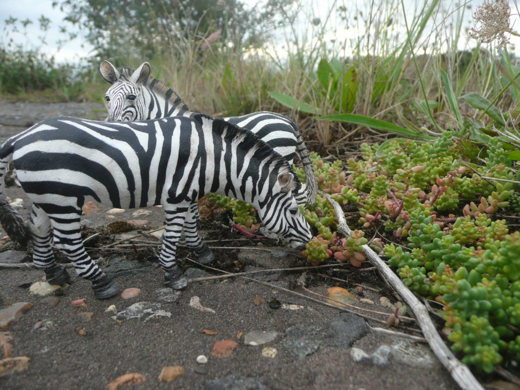
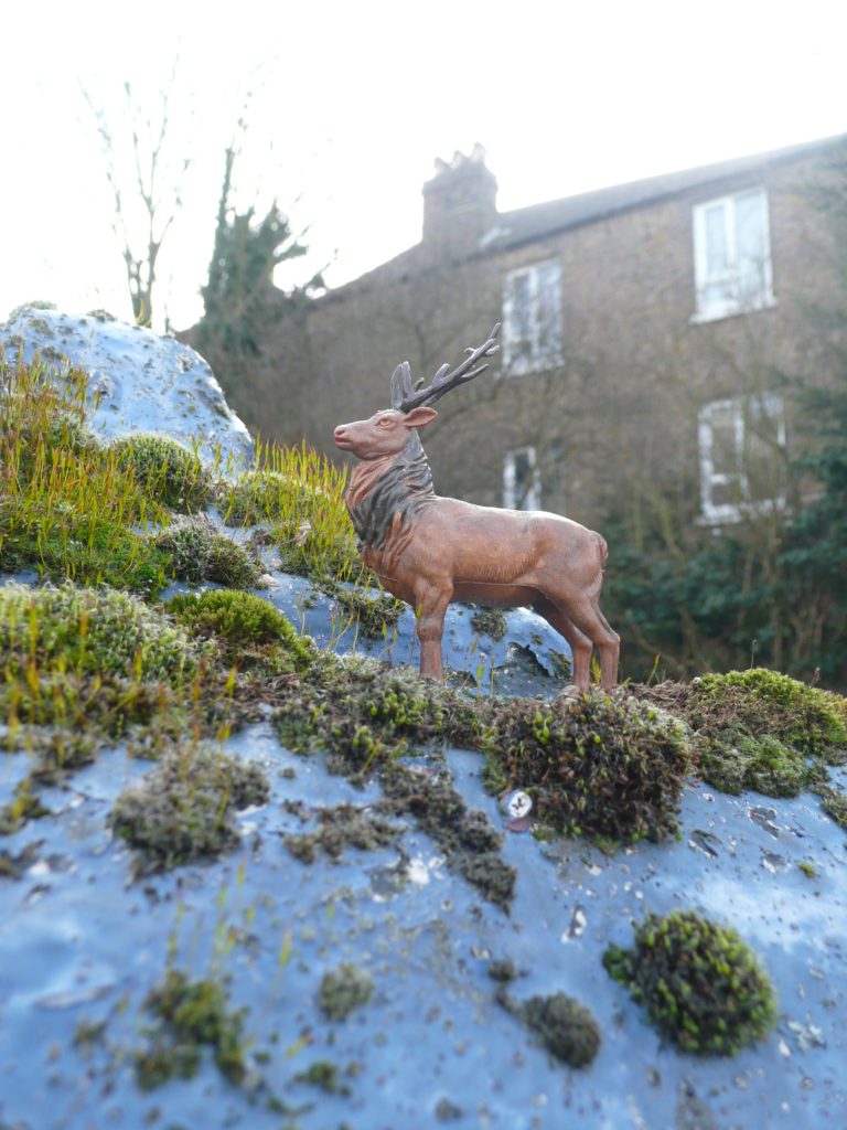
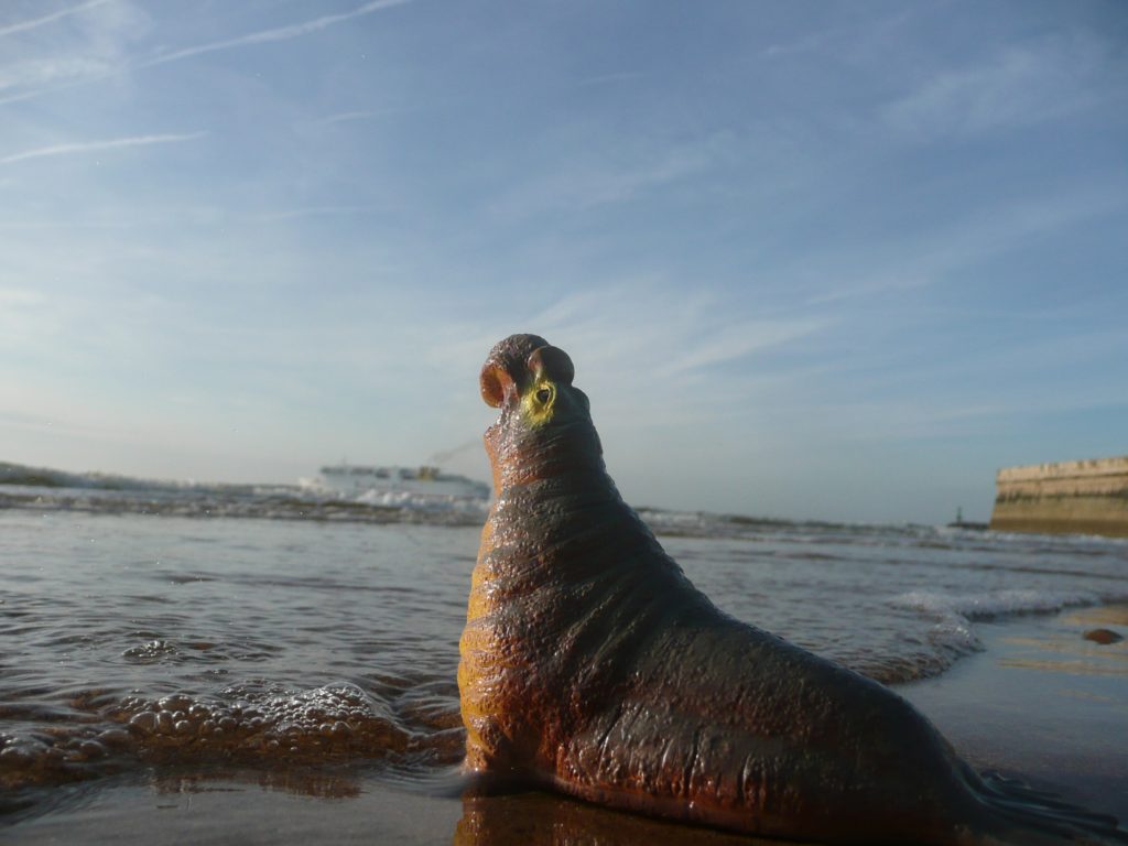
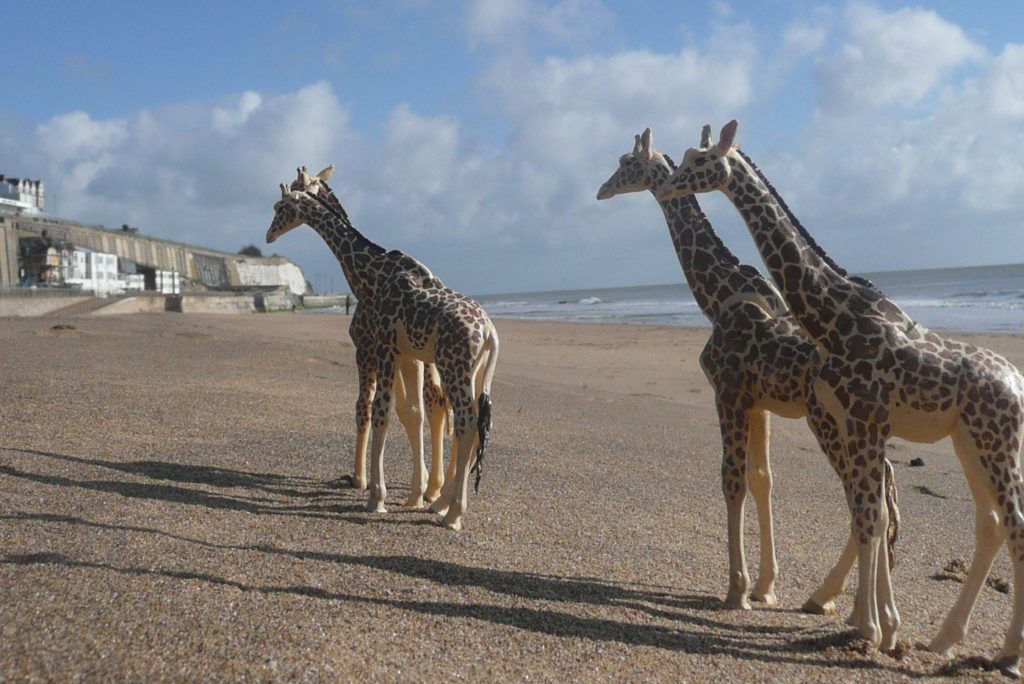
Other images were taken earlier in April 2008, of plastic animals from my collection at various sites in Ramsgate and along Ramsgate Main Sands and the Thanet Coast –
Red Deer Stag, Cervus elaphus, Ramsgate Gate Post. Image: Christopher Tipping 2008Northern Elephant Seal, Mirounga angustirostris, Ramsgate Main Sands. Image: Christopher Tipping 2008
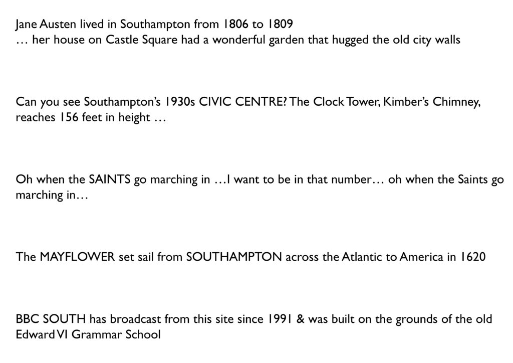
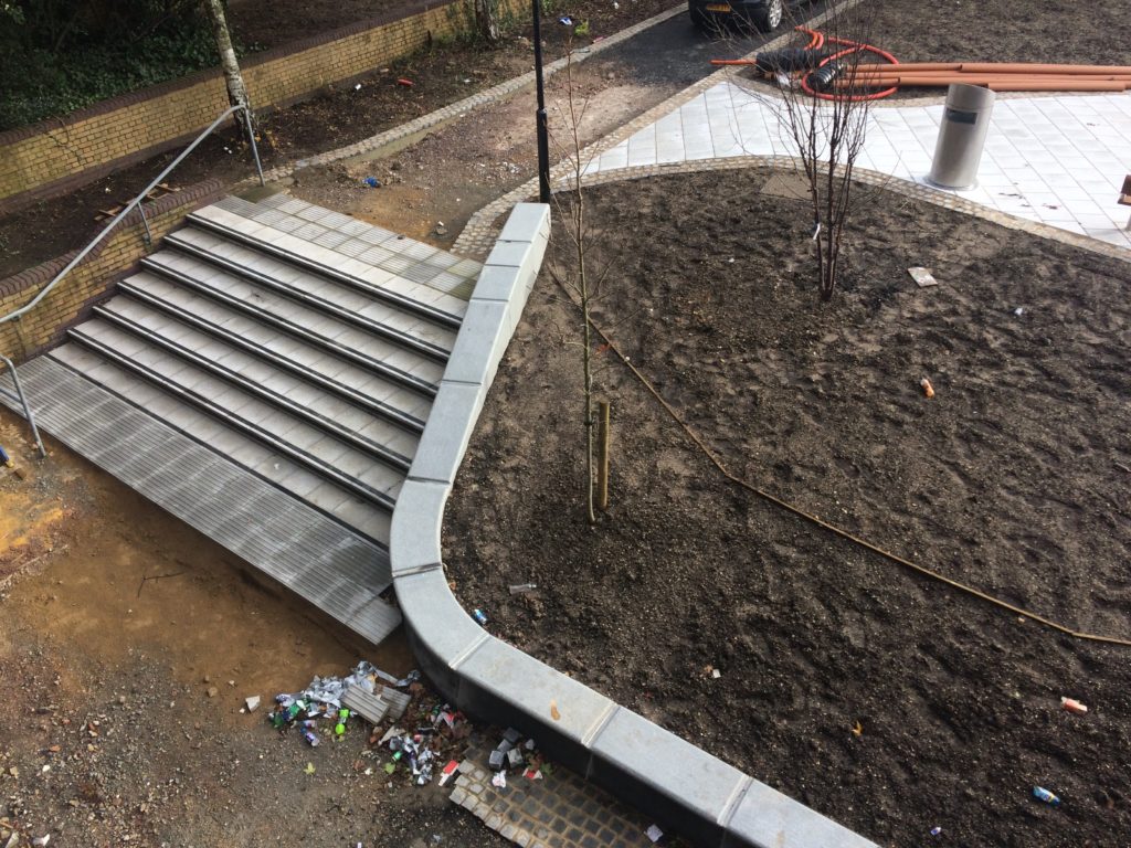
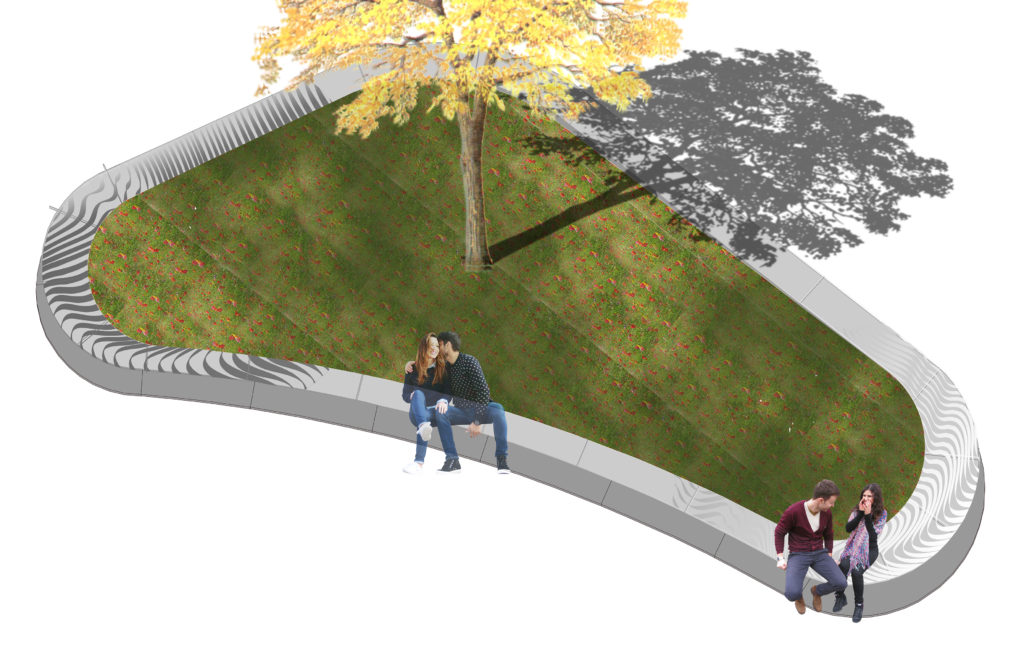
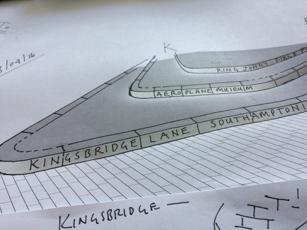
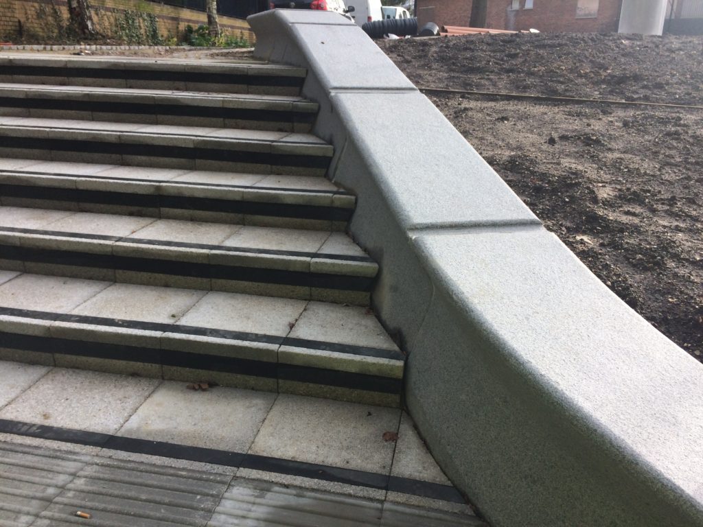
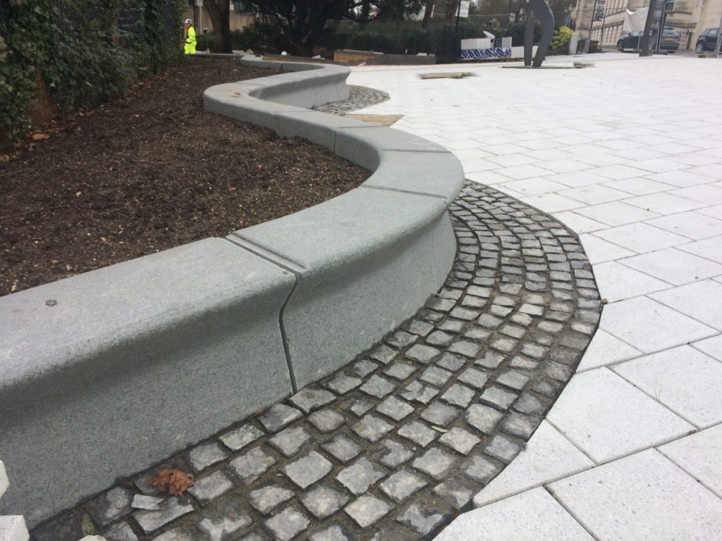
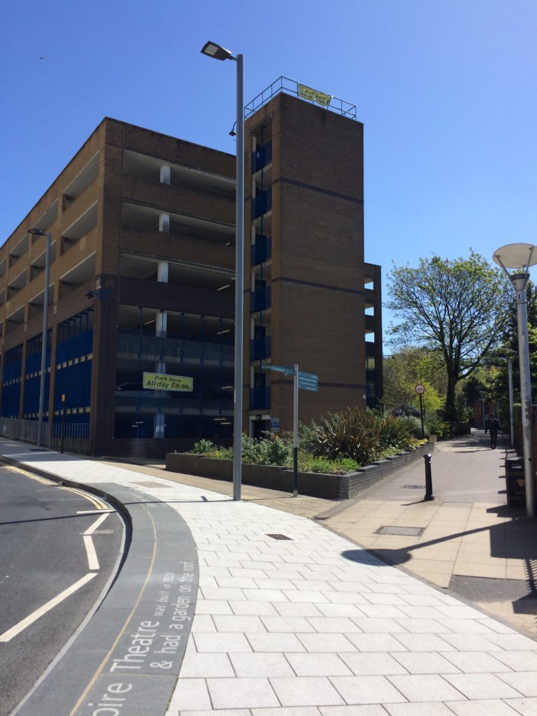
Kingsbridge Lane in Southampton is a historically important and longstanding pedestrian-only route with no vehicular access. This makes the site significant to Southampton. It is a long surviving link to the western route in and out of Southampton along the coastal strand, which formed the northern shore of the River Test Estuary until the early 20th Century. The footpath runs along a narrow strip of land between the existing railway tunnel and the historic and long abandoned tunnel of the Southampton to Salisbury Canal, which ran along what is now Blechynden Terrace, linking Central Station to the Guildhall Square &Cultural Quarter. My role within this project was to develop a contextual response to the site, which would, hopefully, influence the landscape design and regenerative design process in collaboration Simon Taylor of Balfour Beatty Living Places , Southampton City Council and Hardscape.
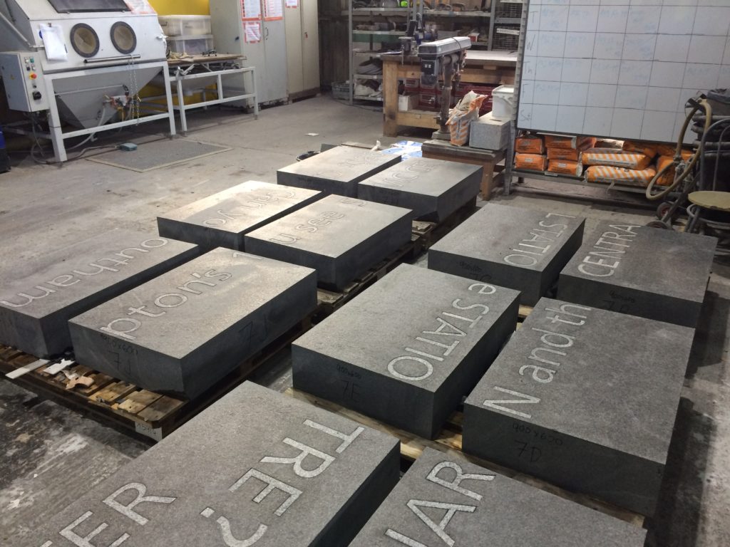
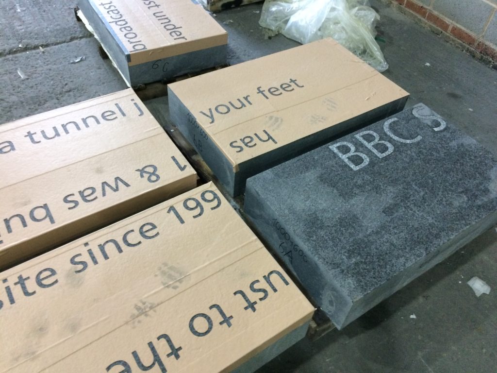
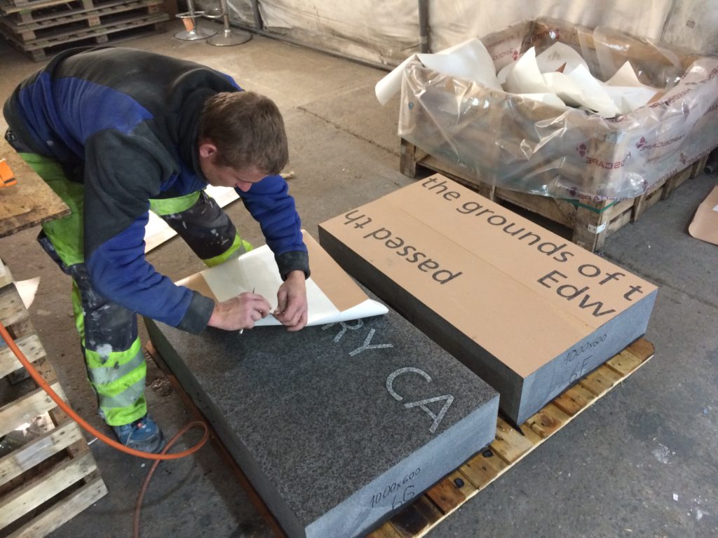
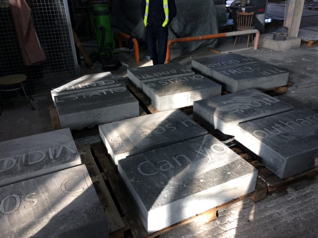
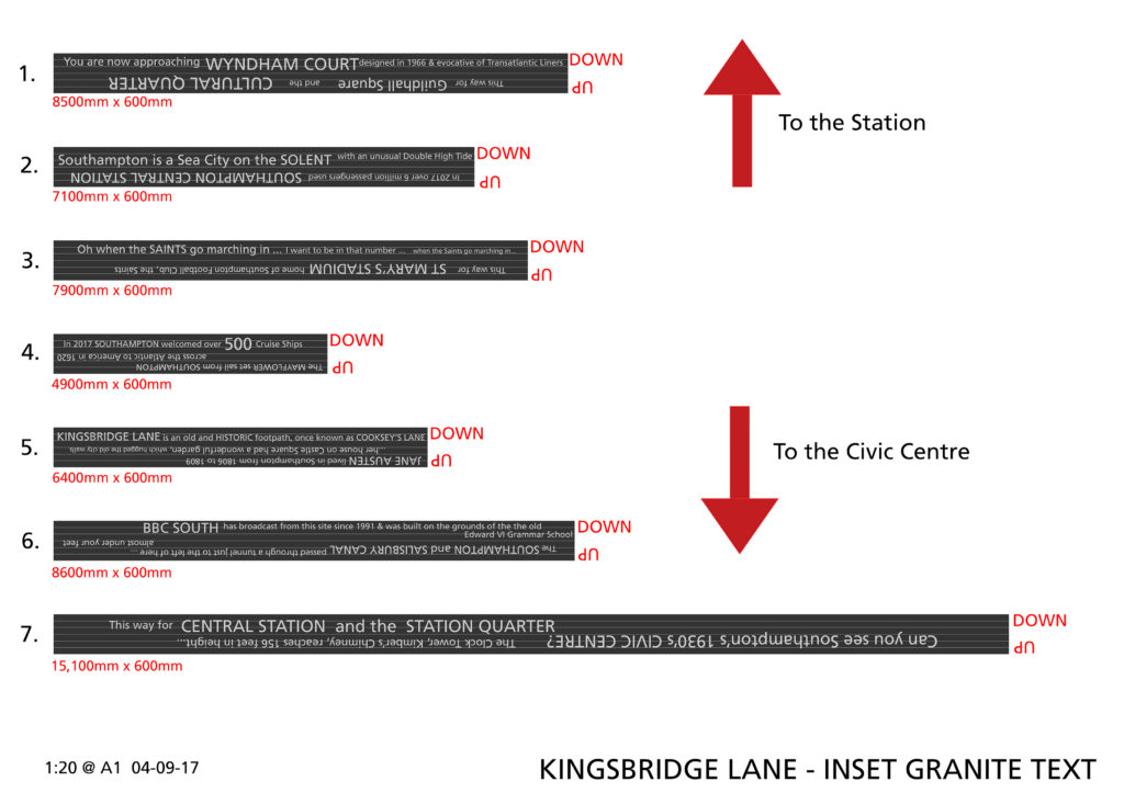
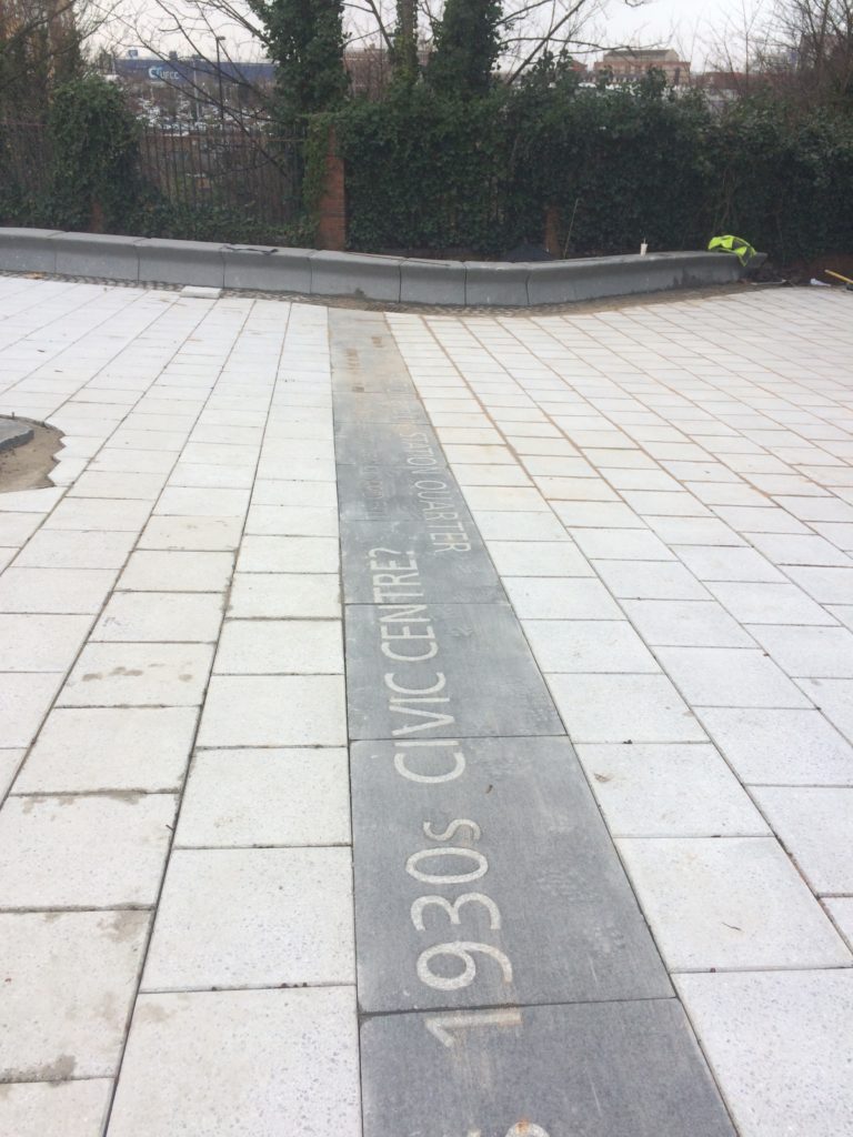
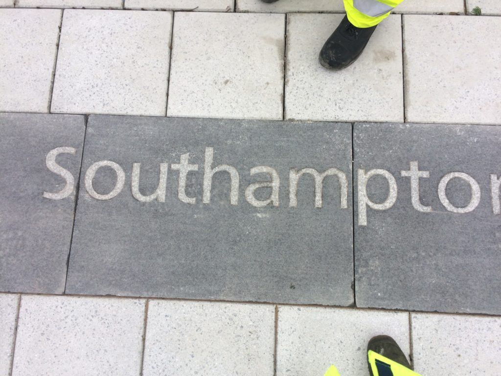
Contextual drafts – ‘BBC SOUTH has broadcast from this site since 1991 & was built on the grounds of the old Edward VI Grammar School’. Image: Christopher TippingBasalt Blocks with inset granite text set out during manufacture at Hardscape. Image: Christopher TippingBasalt Blocks awaiting sandblasting with text during manufacture at Hardscape. Image: Christopher TippingBasalt Blocks during sandblasting with text. Manufactured by Hardscape. Image: Christopher TippingBasalt Blocks with inset granite text set out during manufacture at Hardscape. Image: Christopher TippingGranite benches & retaining walls, Kingsbridge Lane, January 2018 during regeneration works on site. Image: Christopher TippingGranite benches, retaining walls and steps – Kingsbridge Lane, January 2018 during regeneration works on site. Image: Christopher TippingArtwork draft for granite benches and retaining walls. Image: Christopher TippingArtwork draft for granite benches, steps and retaining walls. Image: Christopher TippingGranite benches & retaining walls, Kingsbridge Lane, January 2018 during regeneration works on site. Image: Christopher TippingGranite benches & retaining walls, Kingsbridge Lane, January 2018 during regeneration works on site. Image: Christopher TippingFinal Text setting for Basalt Strips. Kingsbridge Lane, Southampton. Image: Christopher Tipping
Granite benches, retaining walls & Black Basalt slabs with inset and sandblasted contextual text – Kingsbridge Lane, January 2018 during regeneration works on site. Image: Christopher TippingBlack Basalt strips with inset and sandblasted contextual text, cross the footpath at intervals – Kingsbridge Lane, January 2018 during regeneration works on site. Image: Christopher Tipping
The footpath is busy, particularly at peak travel times, but is tired, with aged materials and and unkept vibe, even more striking now that the route connects the two recently completed ‘Quarters’, Cultural & Station – what is does have is brilliant a clear sight lines – with the Civic Centre Clocktower, Wyndham Court, Central Station and Southampton Docks all visible at points along the route.
The proposals for creative public realm interventions at Kingsbridge Lane are a direct response to the following:
Preservation of the historic legacy and contextual significance of the local area –
Topography – there is a 9m fall in height from the top of the route to the bottom –
Kingsbridge Lane as a primary pedestrian route today, linking Southampton Station Quarter to the Cultural Quarter, city centre & east to west pedestrian axis –
A practical need to screen existing Network Rail buildings and car park along the southern and northern boundaries of the site –
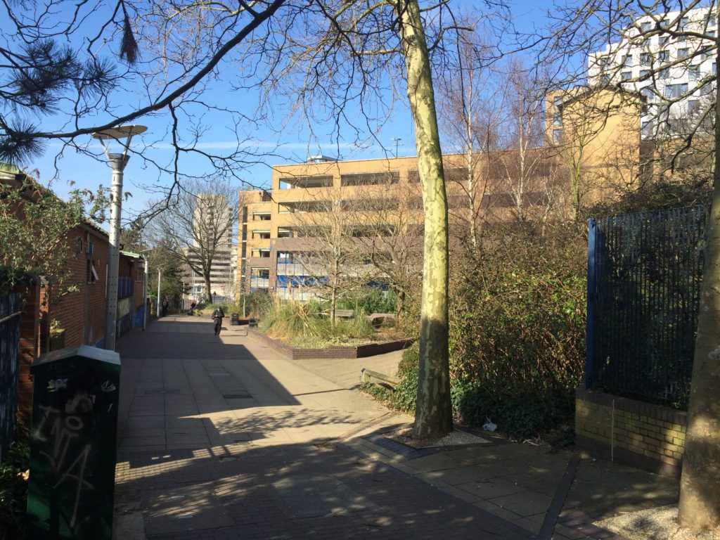
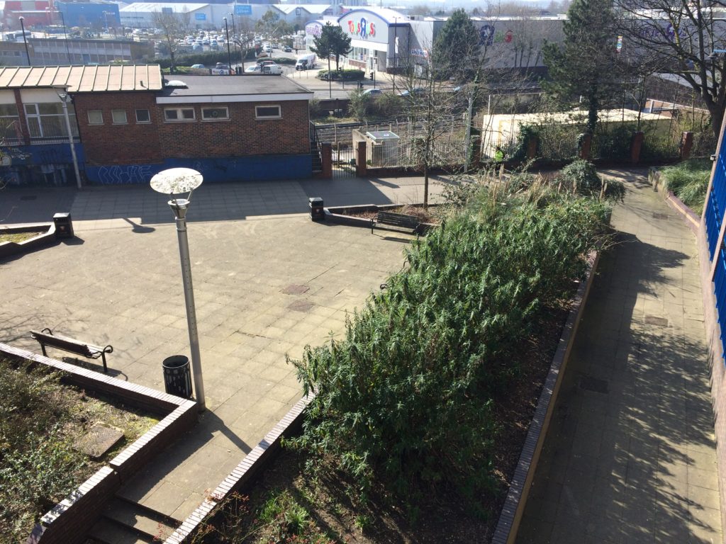
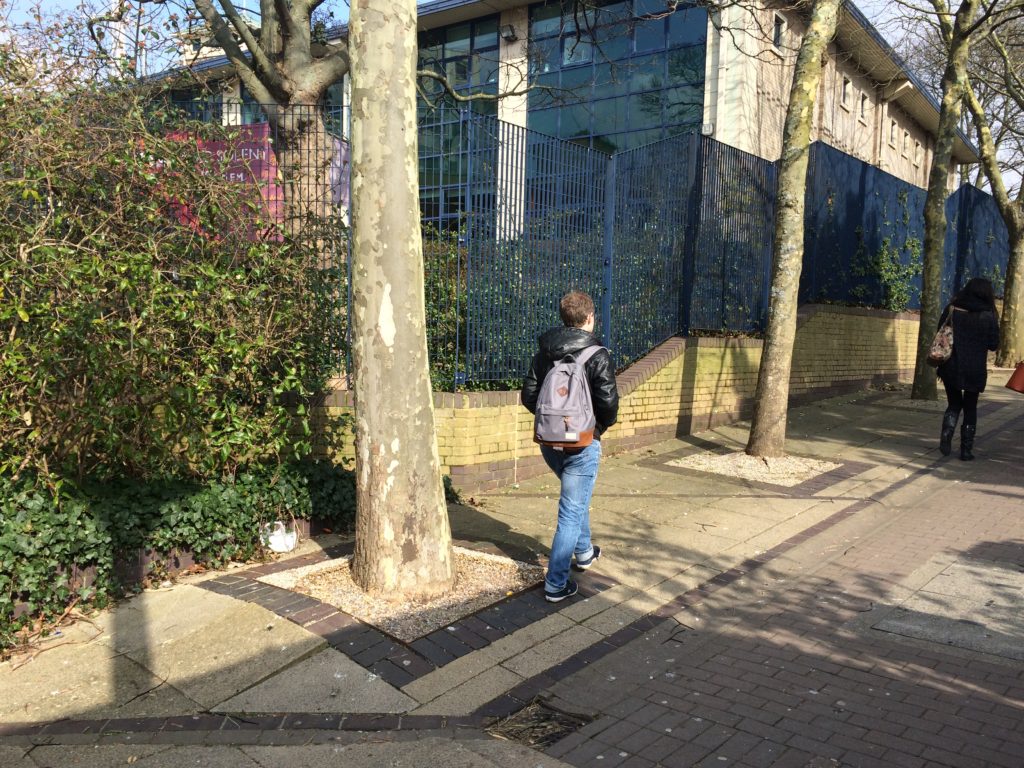
Entrance to Kingsbridge Lane is on the right hand side of this image from June 2016, prior to regeneration works starting. Image: Christopher TippingKingsbridge Lane March 2016 prior to regeneration. Image: Christopher TippingKingsbridge Lane March 2016 prior to regeneration. Image: Christopher TippingKingsbridge Lane March 2016 prior to regeneration. Image: Christopher TippingKingsbridge Lane March 2016 prior to regeneration. Image: Christopher TippingKingsbridge Lane March 2016 prior to regeneration. Image: Christopher Tipping
My work here is an extension of the ‘Canal Shore’ concepts and research underpinning the Station Quarter North Project completed a couple of years earlier in 2016, which I had been involved with since 2012. The text below set out the background of this work.
‘Inspiration, aspiration & delivery…
As project artist, I undertook a detailed investigation into the neighborhood’s social history, geography, ecology and culture to uncover hidden structures, which inform the area’s current form, identity & reputation. This site-specific & research-led activity assisted in driving the creative concept & rationale, which now underpins the general spatial layout, character and interpretation of the new proposals. I worked as part of an integrated design team including Engineers, Landscape Architects, Designers and specialist contractors. This collaborative process allowed me to work creatively, whilst being fully supported by the wider project team.
‘Southampton’s lost district: A landscape rediscovered’
An understanding of the site’s past physical condition drives the overall theme and character of the landscape & public realm interventions: a wooded valley, a meandering stream, the curve of the historic shoreline & the ill fated Southampton & Salisbury Canal. The primary human activities on the site over time, as evidenced by residential, industrial & cultural histories have been influential in drawing individual & collective ‘voices’ from the locality which will serve to imbue any outcomes with a distinctive & renewed sense of place.
This site, adjacent to the shoreline of the Test Estuary has always been a point of confluence. The main route West in & out of the city ran along the shoreline. In medieval times this route along the shore was known and ‘The Strand’. At a point marked by Achards Bridge, which crossed the Rollesbrook Stream to enter the River Test, the city boundary with Millbrook was established.
Today this point is almost exactly opposite the entrance to Southampton Station. Blechynden Terrace is considered to be built along the line of the filled in canal basin of the Southampton & Salisbury Canal. The historic shoreline and the highest point to which the tide rises was along the line of the road.
‘Canal Shore’ developed as a singular response to this research, which is supported by a broader influence, which has pervaded the whole site.
The artwork ‘Canal Shore’ is a consolidation of all that the site has to offer, both contextually and historically. In part it traced the line of the old shoreline & the only East to West route out of the city along the shingle beach from earliest times. It was the route of an ill-fated 19th Century canal. It is now a busy road and part of the transportation network of the city. Its route forms part of the perimeter of our site, so as a single element it has the capacity to help to unify the site and draw other more disparate elements together. The work represents the confluence of both historic and contemporary transportation routes within the city.
The location of the work dictates that it adds a tangible physical presence & value to the site. However, the materials and design are significant too. The black basalt kerb is deliberately large scale & incredibly robust, but has been engineered and designed with a particular aesthetic to blend well with its dual function. It considers traffic flow & movement through the site by allowing for transport access across its width, with elegant dropped kerb sets and large-scale corner quadrants. We have extended the width of the kerb to emphasize its importance as a marker of the historic shoreline of West Bay and the River Test Estuary, but also as a reference to the former Canal coping stone edge. Its function a physical kerb edge on the highway not only indicates that it is fit for purpose, but it deliberately aligns itself to the East to West axis of this transportation and pedestrian route within the City, extending and connecting to existing routes to the Cultural Quarter, QEII Mile and future Maritime Promenade’.
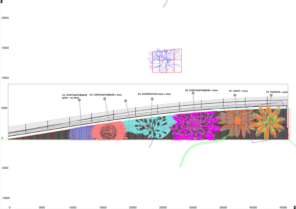
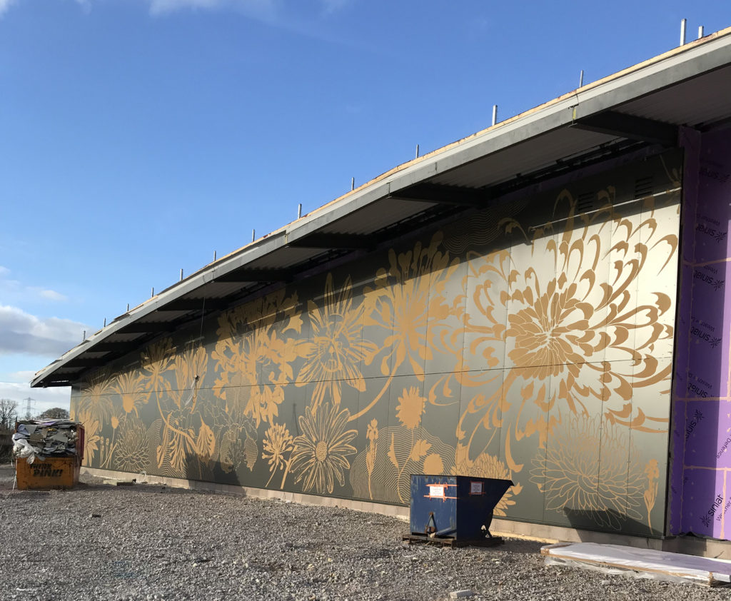
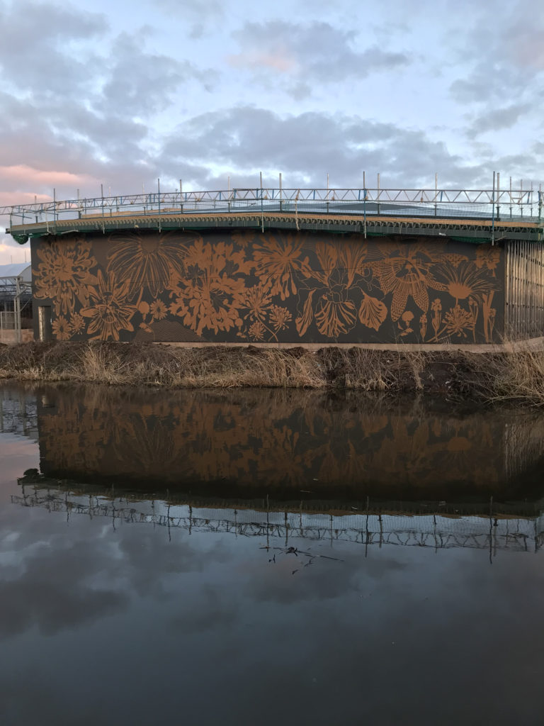
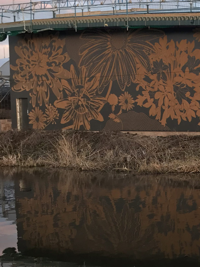
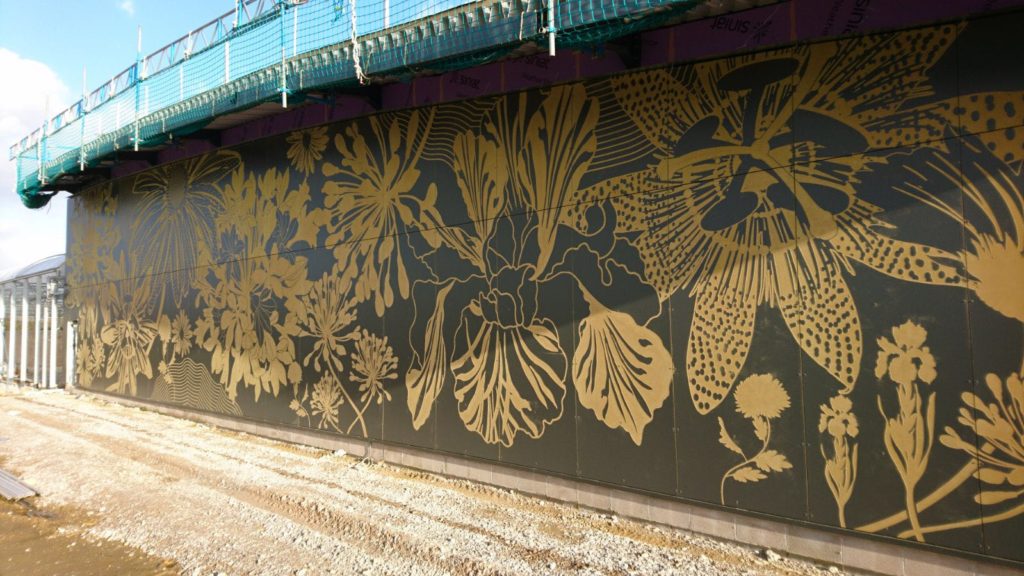
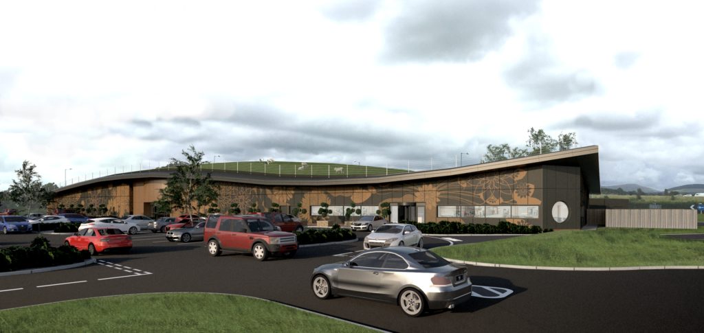
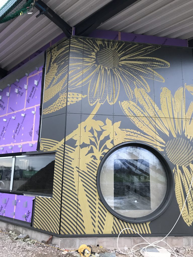
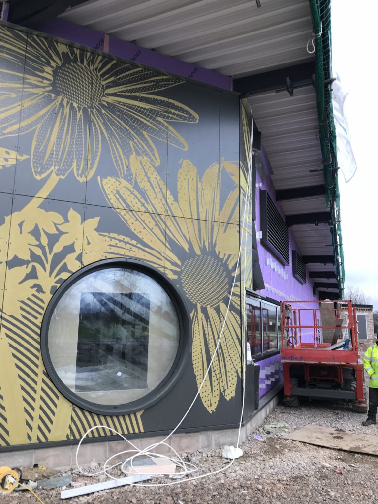
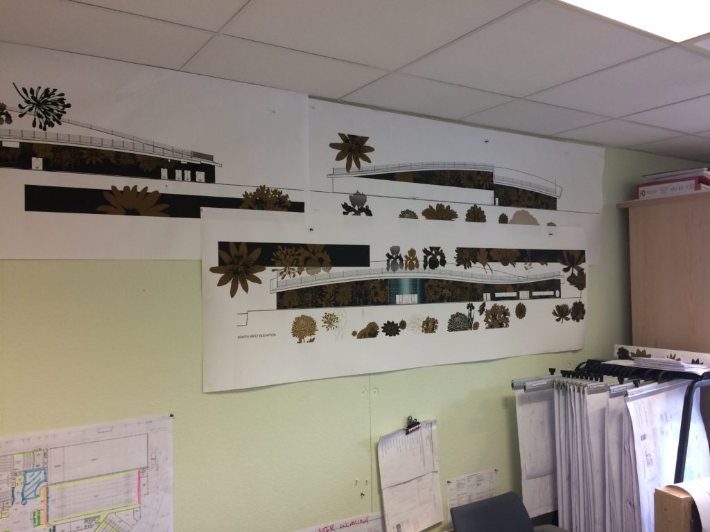
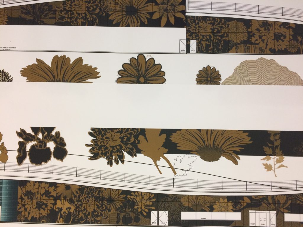
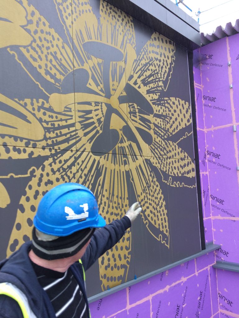
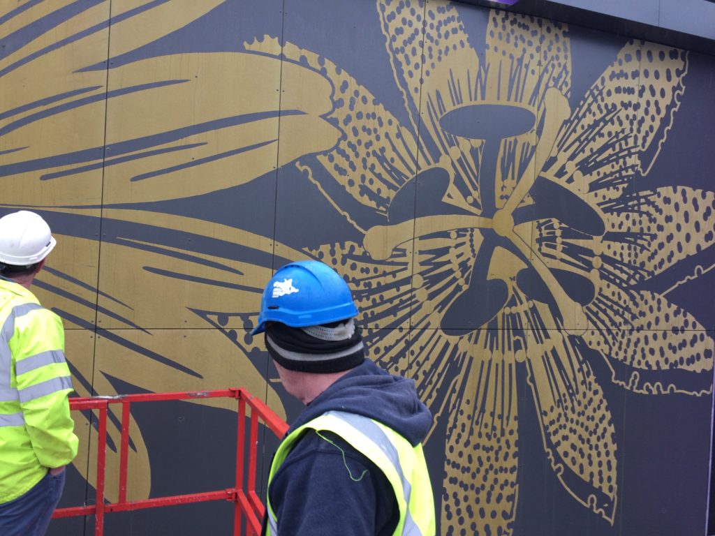
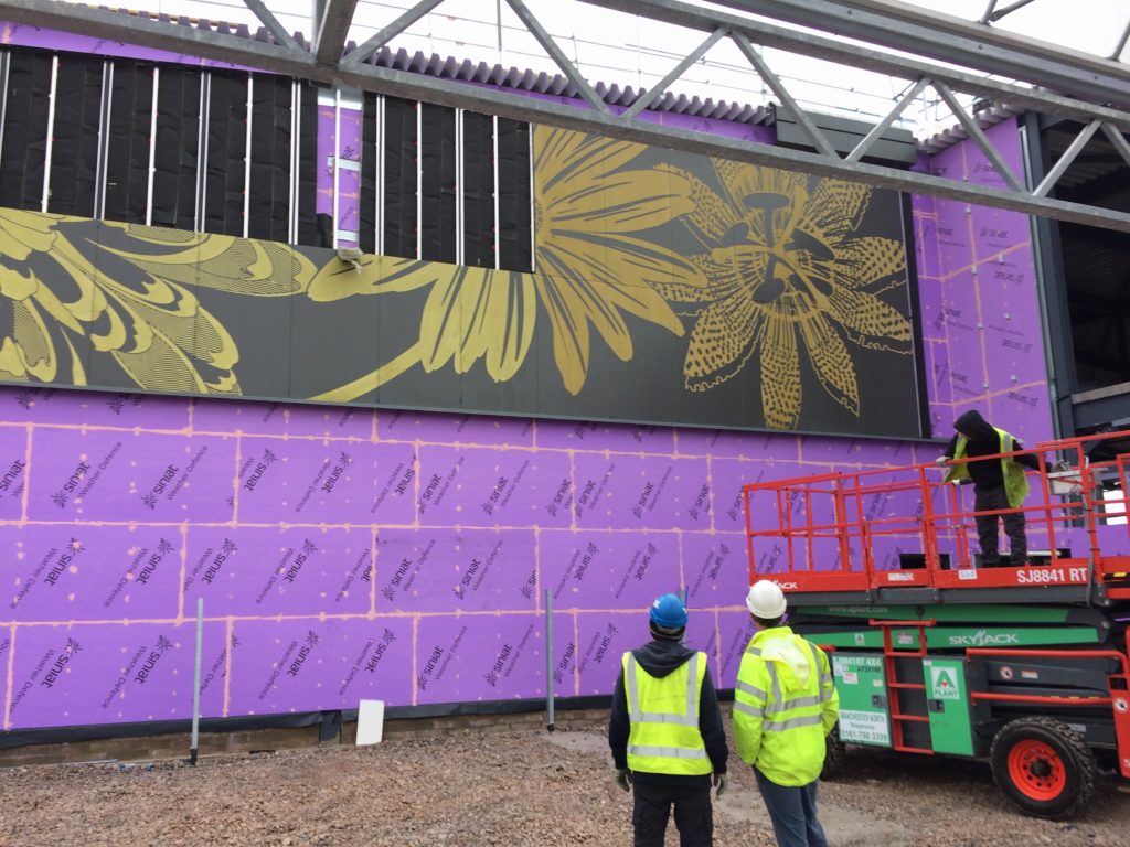
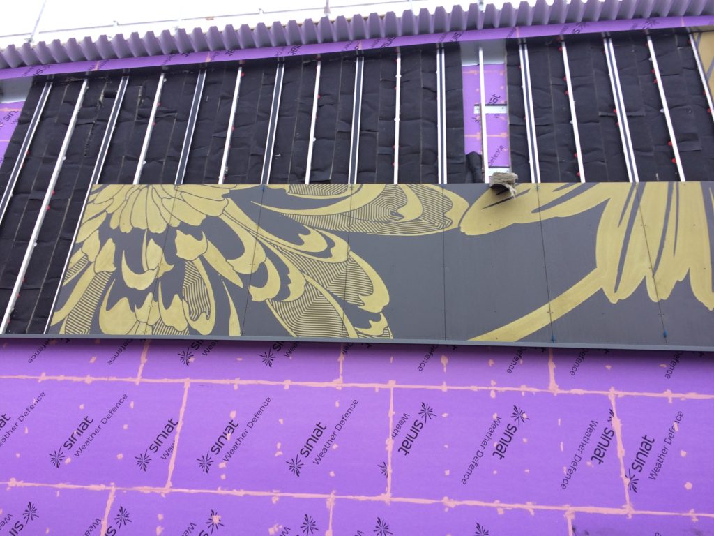
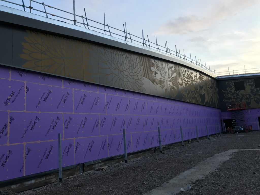
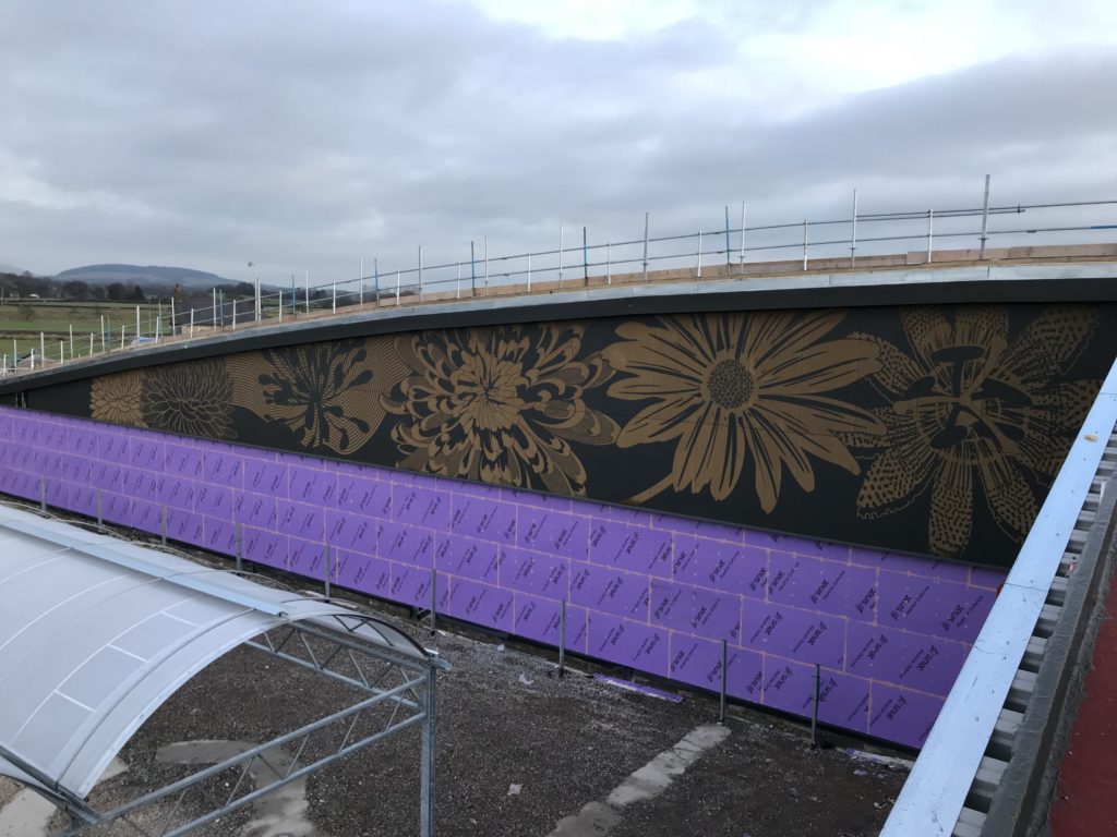
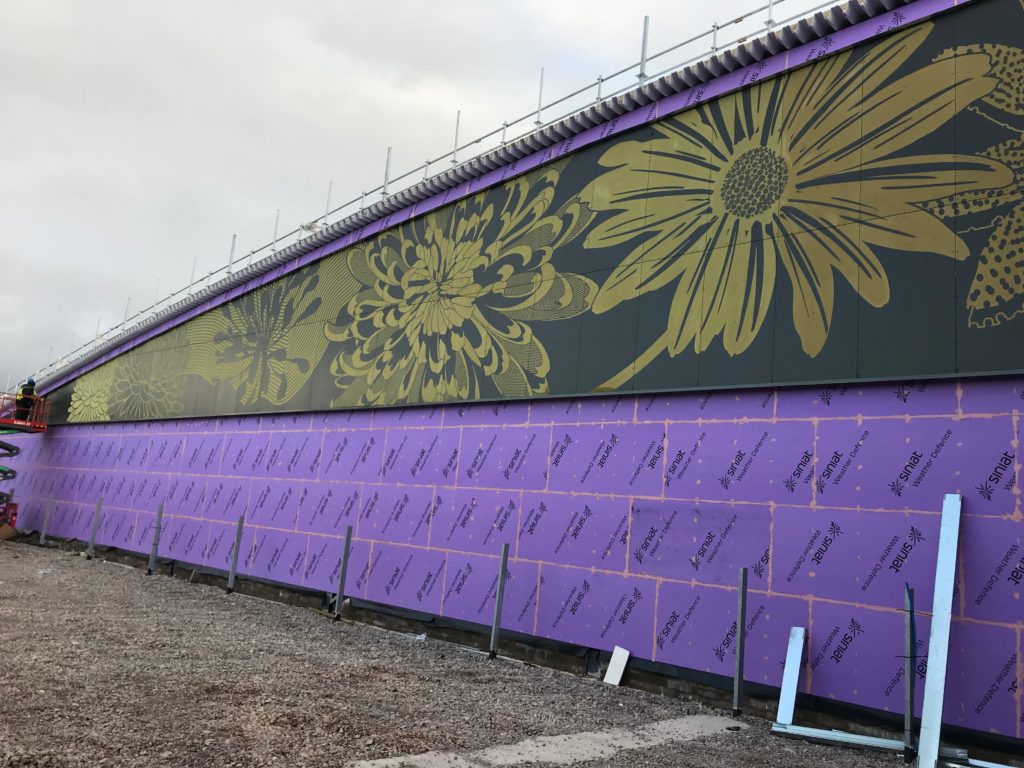
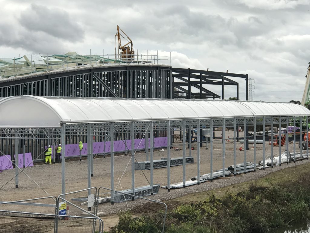
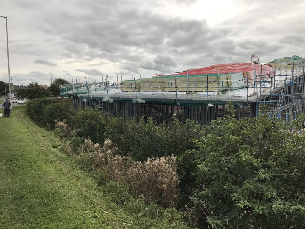
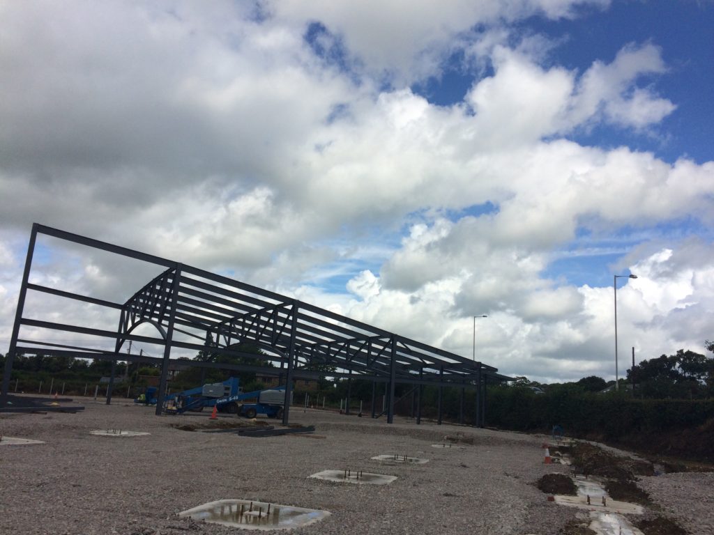
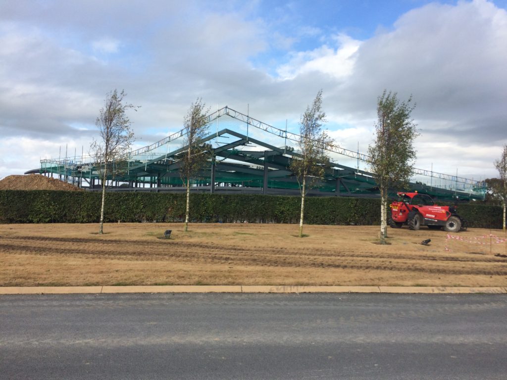
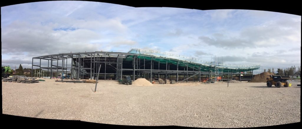
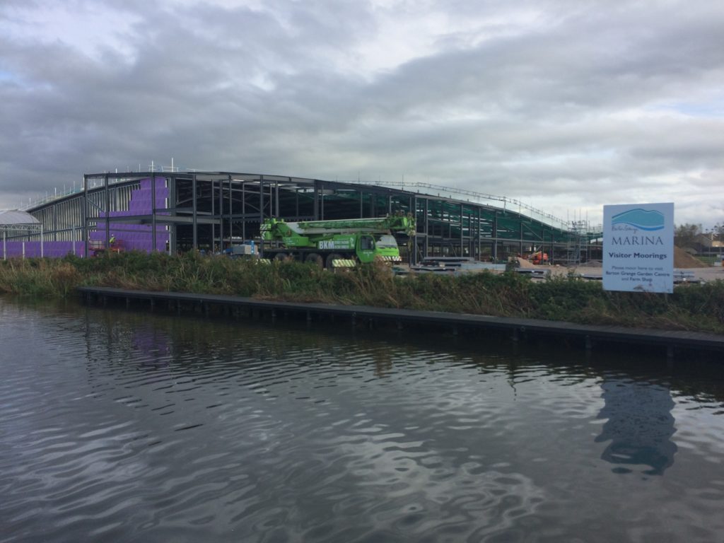
In July 2017 I was commissioned by Guy Topping, Managing Director of the multi award winning Barton Grange Garden Centre in Brock, Preston to design artwork to wrap around the external elevation rain screen of a new mixed use Leisure Centre he was developing to be called The Flower Bowl.I was initially contacted by Jenni Muston of Rockpanelwhose exterior cladding boards were specified for the work. Jenni put me in touch with Guy. I had previously collaborated with Jenni and project Architects HLM, on a project for Sheffield Hallam UniversityCollegiate Campus. The new ‘HEART OF THE CAMPUS’building was completed in 2015. As an award winning Garden Centre, the client was obviously keen to promote its long association with plants, trees and especially with flowers. The artwork is a celebration of flowers, inspired not so much by botanical accuracy, rather the abstract illustrative, super graphic nature of flowers at large scale, exploding like fireworks in celebration across the elevations of the building. The local landscape and textile heritage of Preston also contributed to research and concept development carried out at the Harris Museum.
Christopher Tipping. Section 7 Elevation during installation. The Flower Bowl 2018. Image: Guy ToppingChristopher Tipping. Section 7 Elevation during installation. The Flower Bowl 2018. Image: Guy ToppingChristopher Tipping. Section 7 Elevation during installation. The Flower Bowl 2018. Image: Guy ToppingChristopher Tipping. Section 7 Elevation during installation. The Flower Bowl 2018. Image: Guy ToppingChristopher Tipping. Section 7 Elevation during installation. The Flower Bowl 2018. Image: Aztec Industrial Roofing Ltd.
The artwork was developed for production & manufacture in partnership with The Cutting Room in Huntingdon, with whom I collaborated on the Sheffield Hallam project. I am indebted to them for their commitment to the project. The boards are being installed on site by Aztec Industrial Roofing Ltdunder the project main contractor Truman Design & Build.The installation & handling of the artwork boards on site has been & continues to be excellent.The project Architectural Consultants are WAJW .
A draft artist visual for The Flower Bowl by WAJW Architects showing indicative elevations and green roof with grazing sheep. Image: WAJWCranked corner, Sections 5 to 6 during installation. The Flower Bowl under construction. Image: Aztec Industrial Roofing Ltd.Cranked corner, Sections 5 to 6 during installation. The Flower Bowl under construction. Image: Aztec Industrial Roofing Ltd.Draft artwork in production. The Flower Bowl. Image: Christopher TippingDraft artwork in production. The Flower Bowl. Image: Christopher TippingDraft artwork and flower iconography in development. The Flower Bowl. Image: Christopher TippingDraft artwork and Chrysanthemum flower iconography in development. The Flower Bowl. Image: Christopher TippingDraft artwork and Water Lily flower iconography in development. The Flower Bowl. Image: Christopher TippingDraft artwork and Iris flower iconography in development. The Flower Bowl. Image: Christopher Tipping
Christopher Tipping. Section 2 Elevation during installation by Aztec. The Flower Bowl 2018. Image: Aztec Industrial Roofing Ltd.Christopher Tipping. Section 2 Elevation during installation. The Flower Bowl 2018. Image: Christopher TippingChristopher Tipping. Section 2 Elevation during installation. The Flower Bowl 2017. Image: Christopher TippingChristopher Tipping. Section 2 Elevation during installation. The Flower Bowl 2017. Image: Christopher Tipping
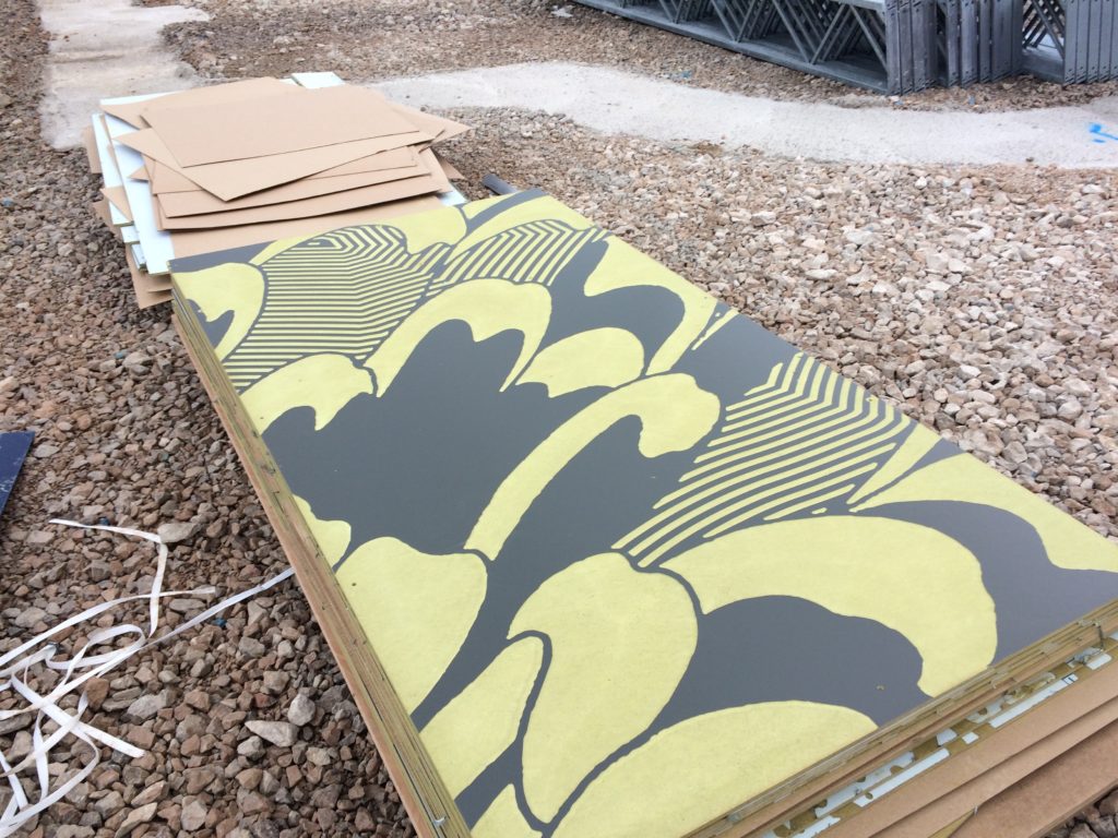
When the Rockpanel Board is first cnc cut and installed, the exposed colour is yellow, which fairly quickly weathers to a darker & richer colour.
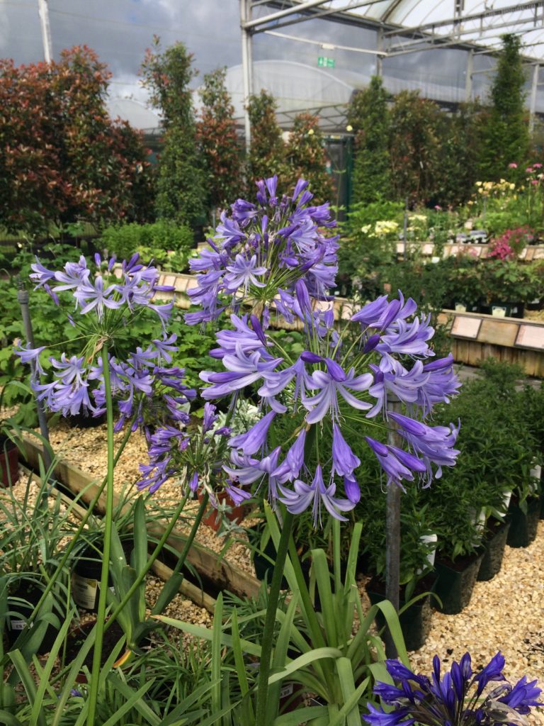
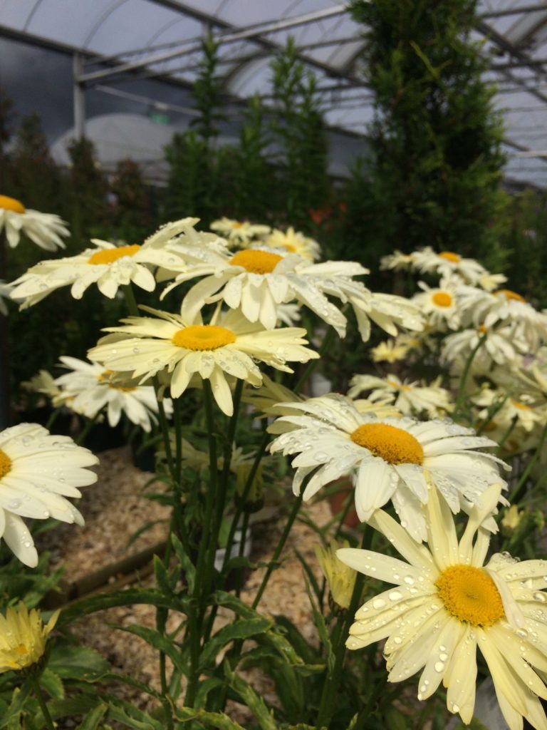
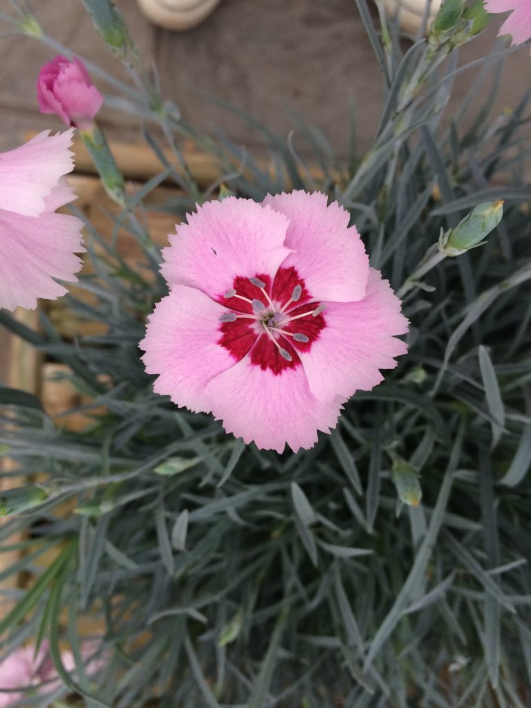
Christopher Tipping. Section 2 Elevation. Boards awaiting installation. The Flower Bowl 2017. Image: Christopher TippingSection 2 Elevation during installation. The Flower Bowl 2017. Image: Christopher TippingSection 2 Elevation during installation. The Flower Bowl 2017. Image: Guy ToppingSection 2 Elevation during installation. The Flower Bowl 2017. Image: Guy ToppingSection 2 Elevation during installation. The Flower Bowl 2017. Image: Guy ToppingAgapanthus – Barton Grange Garden Centre – Research. Image: Christopher TippingBarton Grange Garden Centre – Research. Image: Christopher TippingFlower research at Barton Grange for The Flower Bowl. Image: Christopher TippingThe Flower Bowl under construction. Image: Guy ToppingThe Flower Bowl under construction. Image: Guy ToppingThe Flower Bowl, September 2017. Image: Christopher TippingThe Flower Bowl, October 2017. Image: Christopher TippingThe Flower Bowl, adjacent Canal – October 2017. Image: Christopher TippingThe Flower Bowl, adjacent to the Lancaster Canal – September 2017. Image: Christopher Tipping
The Canal Basin here is managed by the Barton Grange Garden Centre.
Barton Grange & The Flower Bowl is well positioned on the A6 Preston to Lancaster road, the M6, the London to Glasgow high speed mainline and the Lancaster Canal. Image: Christopher TippingFront of house under construction. Section 6 – The Flower Bowl October 2017. Image: Christopher TippingBuilding under construction. Section 6 – The Flower Bowl October 2017. Image: Christopher Tipping
This new development of 64 Extra Care Apartments at Orchard Park, recently delivered in April this year by The Riverside Group is called ‘Harrison Park’, 100 years after Jack Harrison VC a former Hull FC Rugby League Star was killed at Oppy Wood, Arras, France in 1917 during the First World War.
Today – the 3rd May 2017 marks the day all four Hull Pals Battalions took part on the attack on Oppy Wood.
A Pinterest Board of research images about Orchard Park and its history, can be found here.
Hull is currently celebrating City of Culture 2017status, so there is much to do and see there ! –
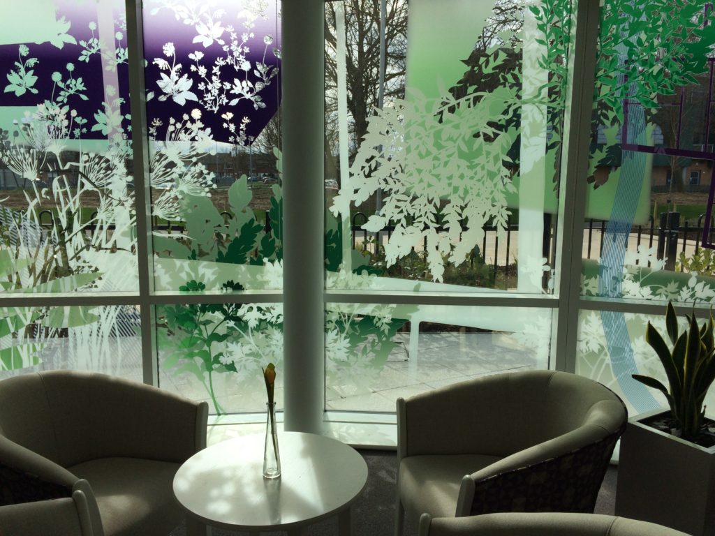
Detail: Glazing Vinyl installation Harrison Park, Hall Rd, Hull Extra Care. Artist: Christopher TippingDetail: Glazing Vinyl installation Harrison Park, Hall Rd, Hull Extra Care. Artist: Christopher Tipping
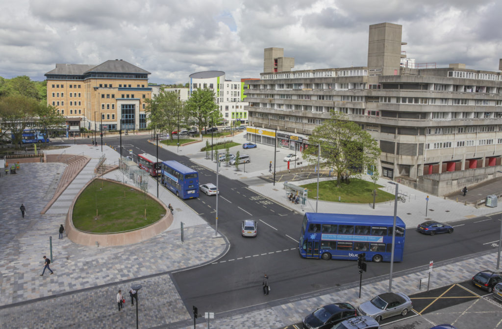
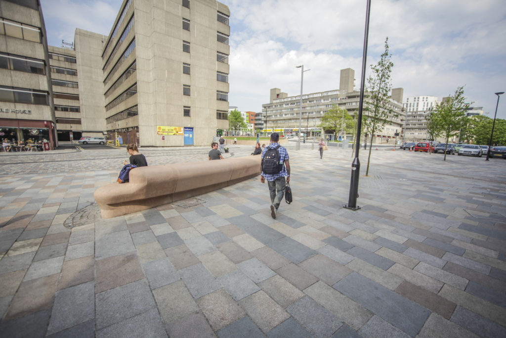
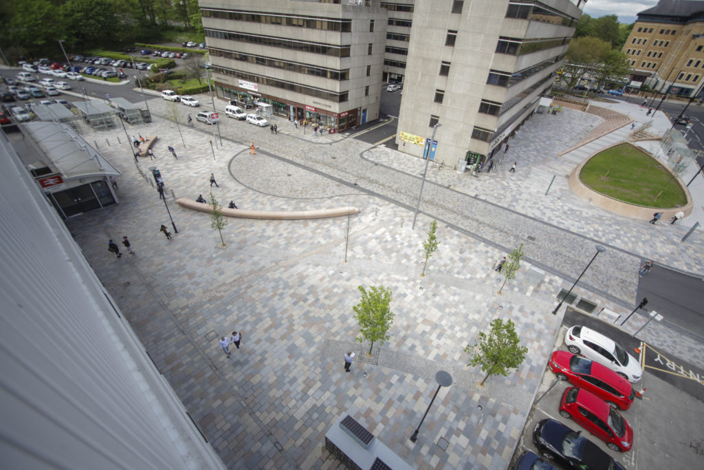
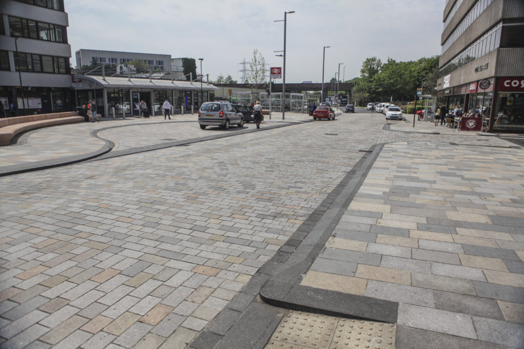
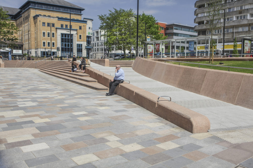
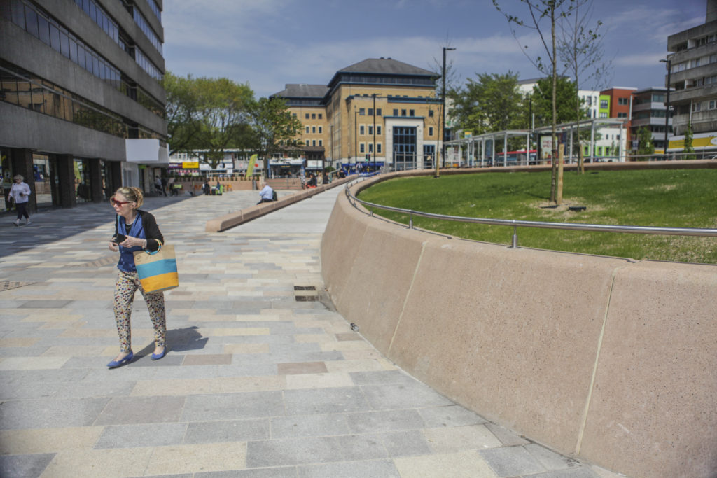
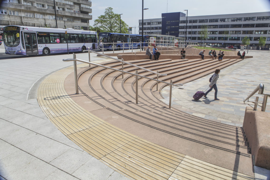
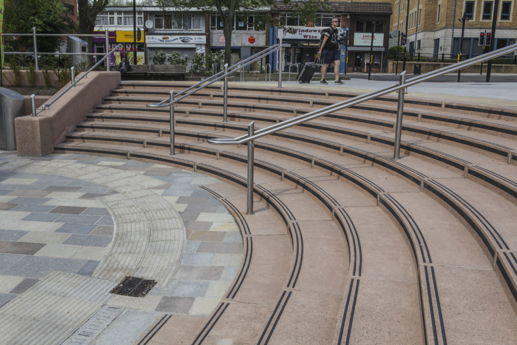
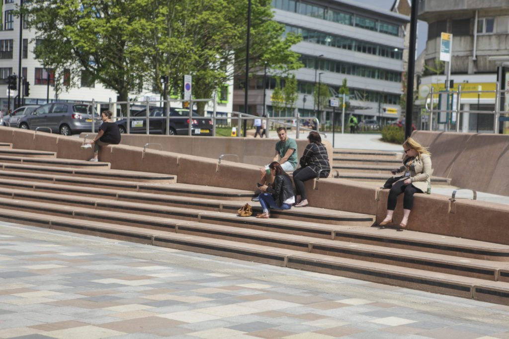
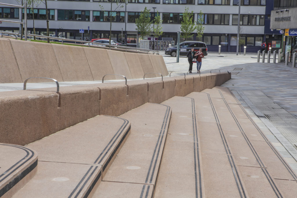
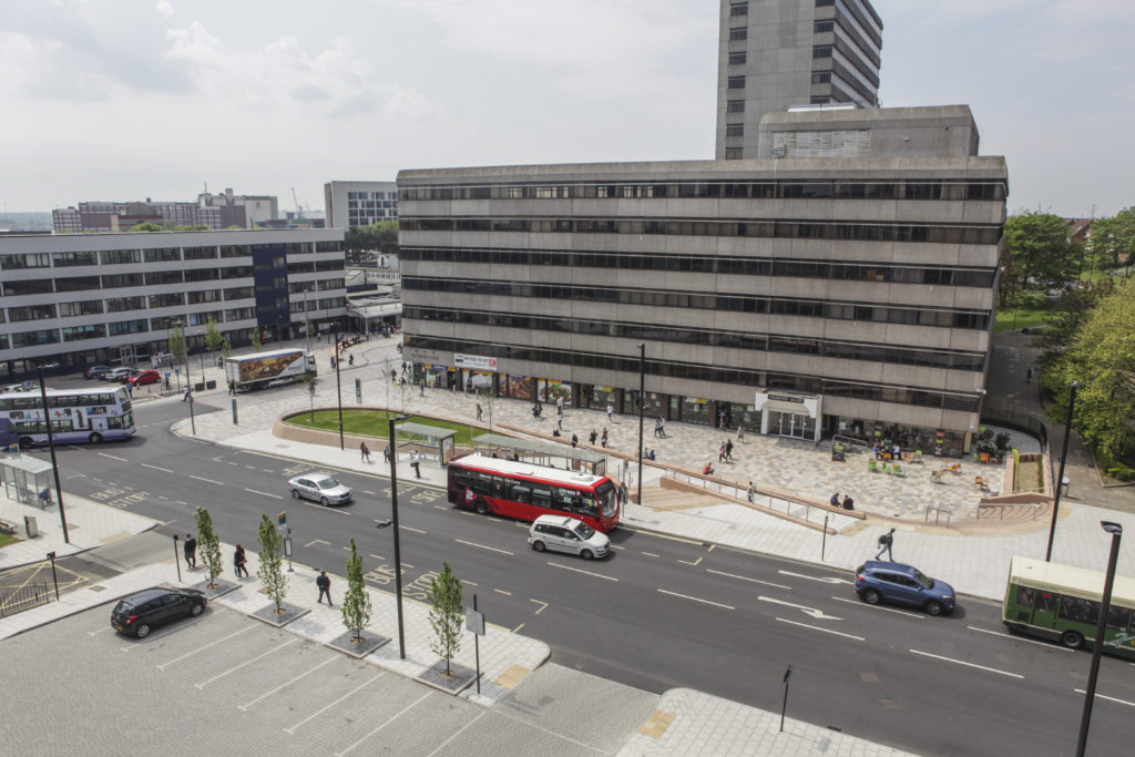
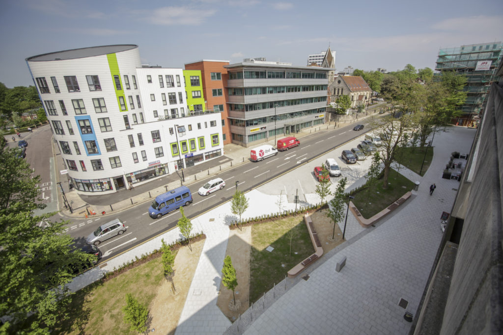
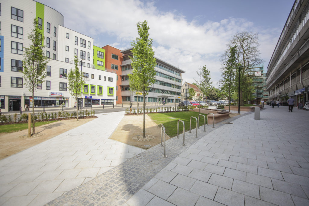
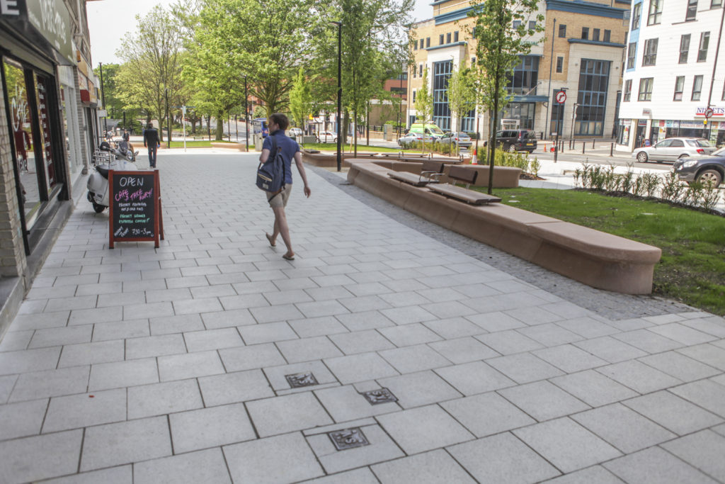
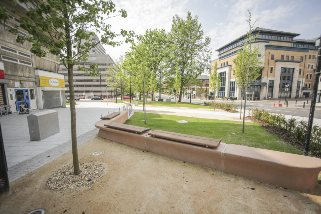
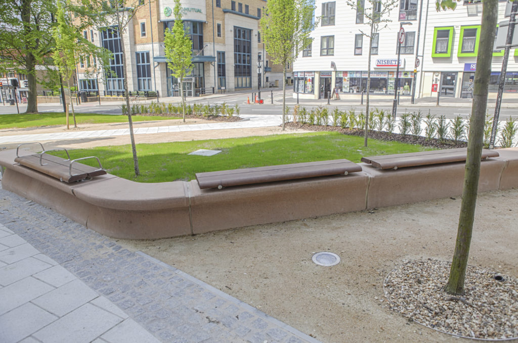
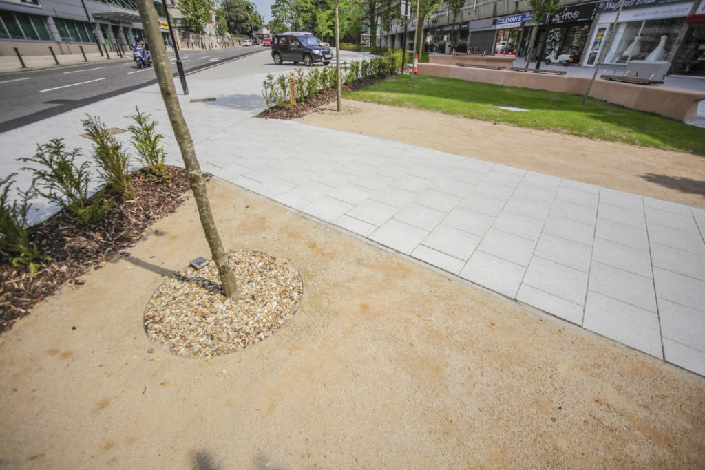
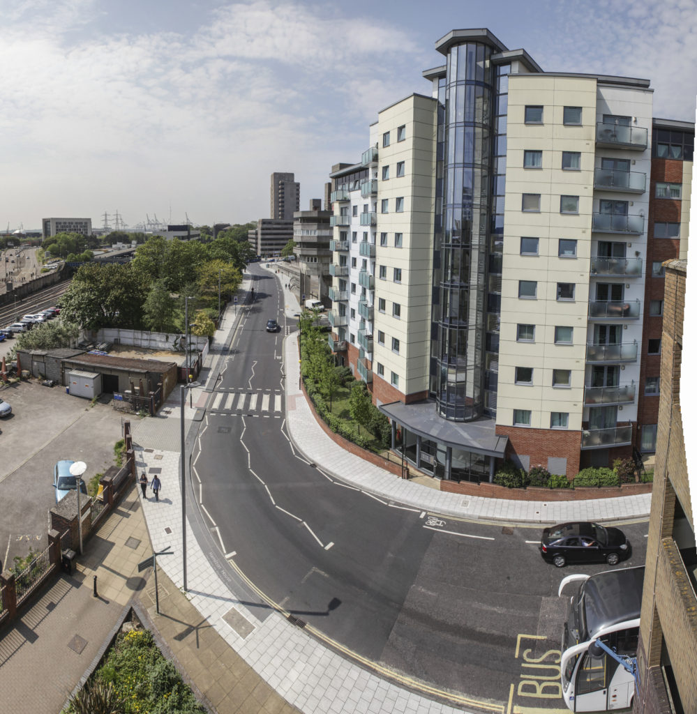
Southampton Station Quarter North was shortlisted for the 2016 Solent Design Awards, which were awarded in November 2016 – A much needed update on the project. Better late than never !
Southampton Station Quarter North – Public Realm. Image: Wilson Massie. Project Artist: Christopher Tipping
Although our project was not one of the winners… it was very encouraging that the collaborative approach which delivered the project and the role of our Champions Group, which endured throughout the build programme was recognised via the shortlist process.
‘The Solent Design Awards are all about the encouragement of quality place-making; schemes that create special places, lift communities, create richer experiences … not just iconic buildings, but also the places in-between’.
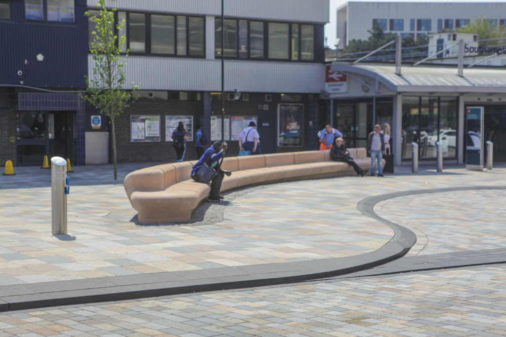
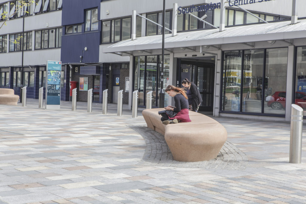
The following set of images from the site were produced by Wilson Massie of Balfour Beatty Living Places – thanks Wilson !
Southampton Station Quarter North – Station Forecourt. Image: Wilson Massie. Project Artist: Christopher TippingSouthampton Station Quarter North – Station Forecourt. Image: Wilson Massie. Project Artist: Christopher TippingSouthampton Station Quarter North – Station Forecourt. Image: Wilson Massie. Project Artist: Christopher TippingSouthampton Station Quarter North – Station Forecourt. Image: Wilson Massie. Project Artist: Christopher TippingSouthampton Station Quarter North – Station Forecourt, Southbrook Road. Image: Wilson Massie. Project Artist: Christopher TippingSouthampton Station Quarter North – Frobisher House Forecourt. Image: Wilson Massie. Project Artist: Christopher TippingSouthampton Station Quarter North – Frobisher House Forecourt. Image: Wilson Massie. Project Artist: Christopher TippingSouthampton Station Quarter North – Amphitheatre Steps, Frobisher House Forecourt. Image: Wilson Massie. Project Artist: Christopher TippingSouthampton Station Quarter North – Amphitheatre Steps, Frobisher House Forecourt. Image: Wilson Massie. Project Artist: Christopher TippingSouthampton Station Quarter North – Amphitheatre Steps, Frobisher House Forecourt. Image: Wilson Massie. Project Artist: Christopher TippingSouthampton Station Quarter North – Amphitheatre Steps, Frobisher House Forecourt. Image: Wilson Massie. Project Artist: Christopher TippingSouthampton Station Quarter North – Views from Wyndham Court. Image: Wilson Massie. Project Artist: Christopher TippingSouthampton Station Quarter North – View along Commercial Road from Wyndham Court. Image: Wilson Massie. Project Artist: Christopher TippingSouthampton Station Quarter North – View along Commercial Road from Wyndham Court. Image: Wilson Massie. Project Artist: Christopher TippingSouthampton Station Quarter North – View along Commercial Road from Wyndham Court. Image: Wilson Massie. Project Artist: Christopher TippingSouthampton Station Quarter North – View along Commercial Road from Wyndham Court. Image: Wilson Massie. Project Artist: Christopher TippingSouthampton Station Quarter North – View along Commercial Road from Wyndham Court. Image: Wilson Massie. Project Artist: Christopher TippingSouthampton Station Quarter North – View along Commercial Road. Image: Wilson Massie. Project Artist: Christopher TippingSouthampton Station Quarter North – View along Blechynden Terrace towards the Station. Image: Wilson Massie. Project Artist: Christopher Tipping
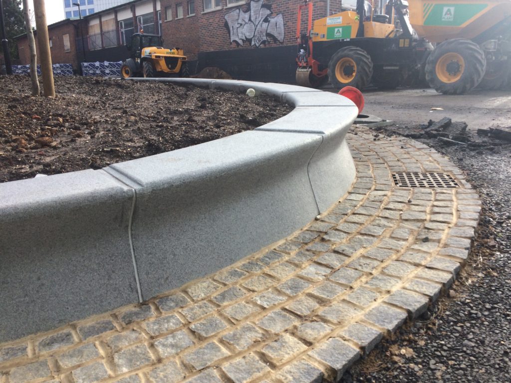
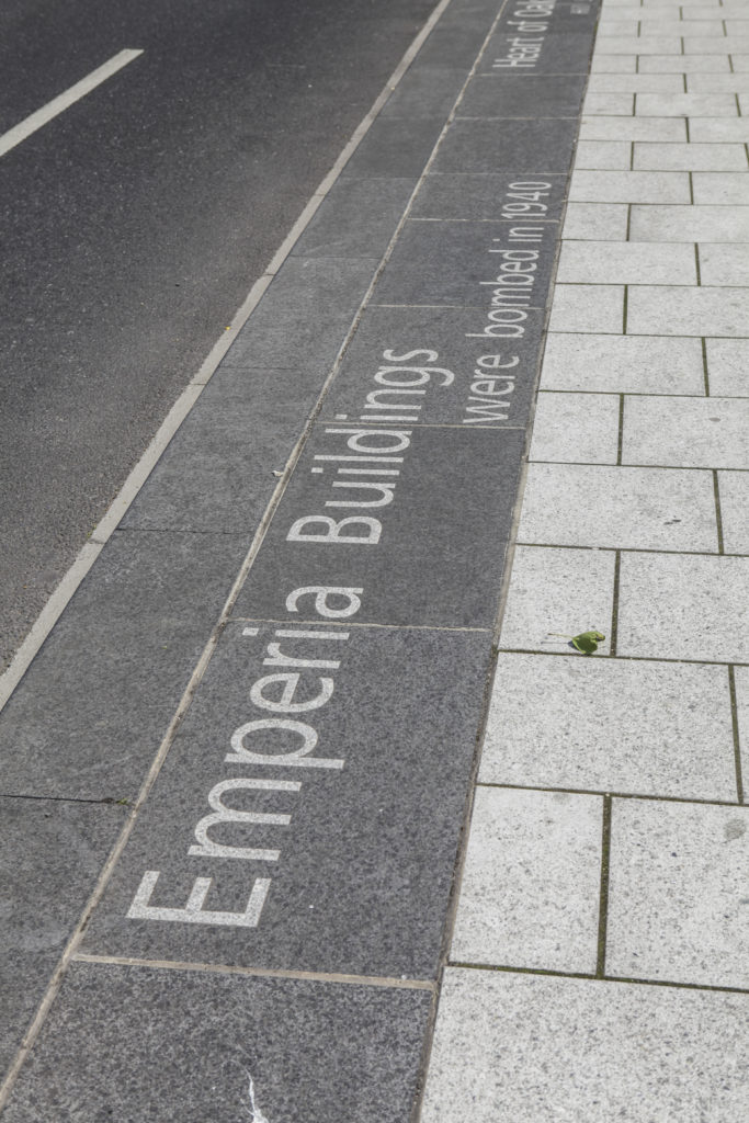
The artwork ‘Canal Shore’ runs for almost 200m along the South side of Blechynden Terrace. Bespoke extra wide Black Basalt kerbs are inset with white granite text referencing the site.
Quarter North – View of Basalt Kerb along Blechynden Terrace towards the Station. Image: Wilson Massie. Project Artist: Christopher Tipping
With thanks to Hardscapefor their excellent collaboration on the ‘Canal Shore’ artwork.