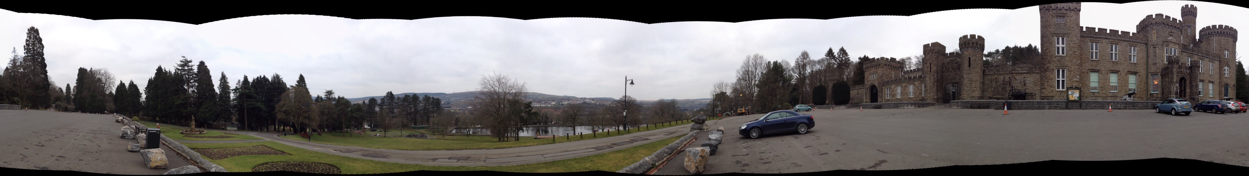
Cyfarthfa Castle was built in 1825 by William Crawshay. It cost £30,000 and was home to the Crawshay’s until 1889. Merthyr Tydfil Corporation bought it in 1909, and it was turned into a school and museum.
Cyfarthfa Castle, Merthyr Tydfil. Image: Christopher Tipping
I met with Kelly Powell – acting Museums Officer, Benjamin Price – Education and Interpretation Officer, Chris Parry – Community Officer and Michelle Lewis – Community Officer.
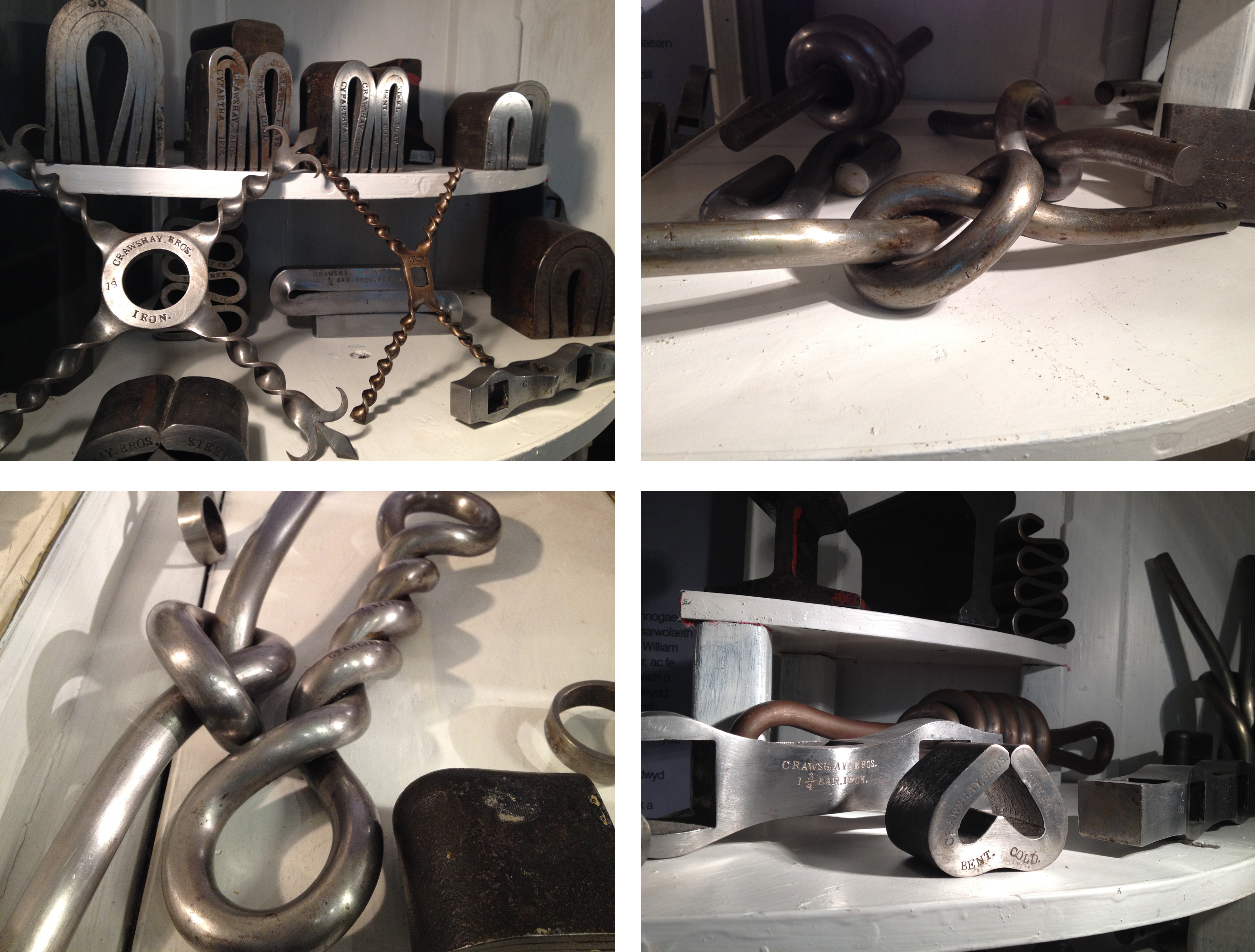
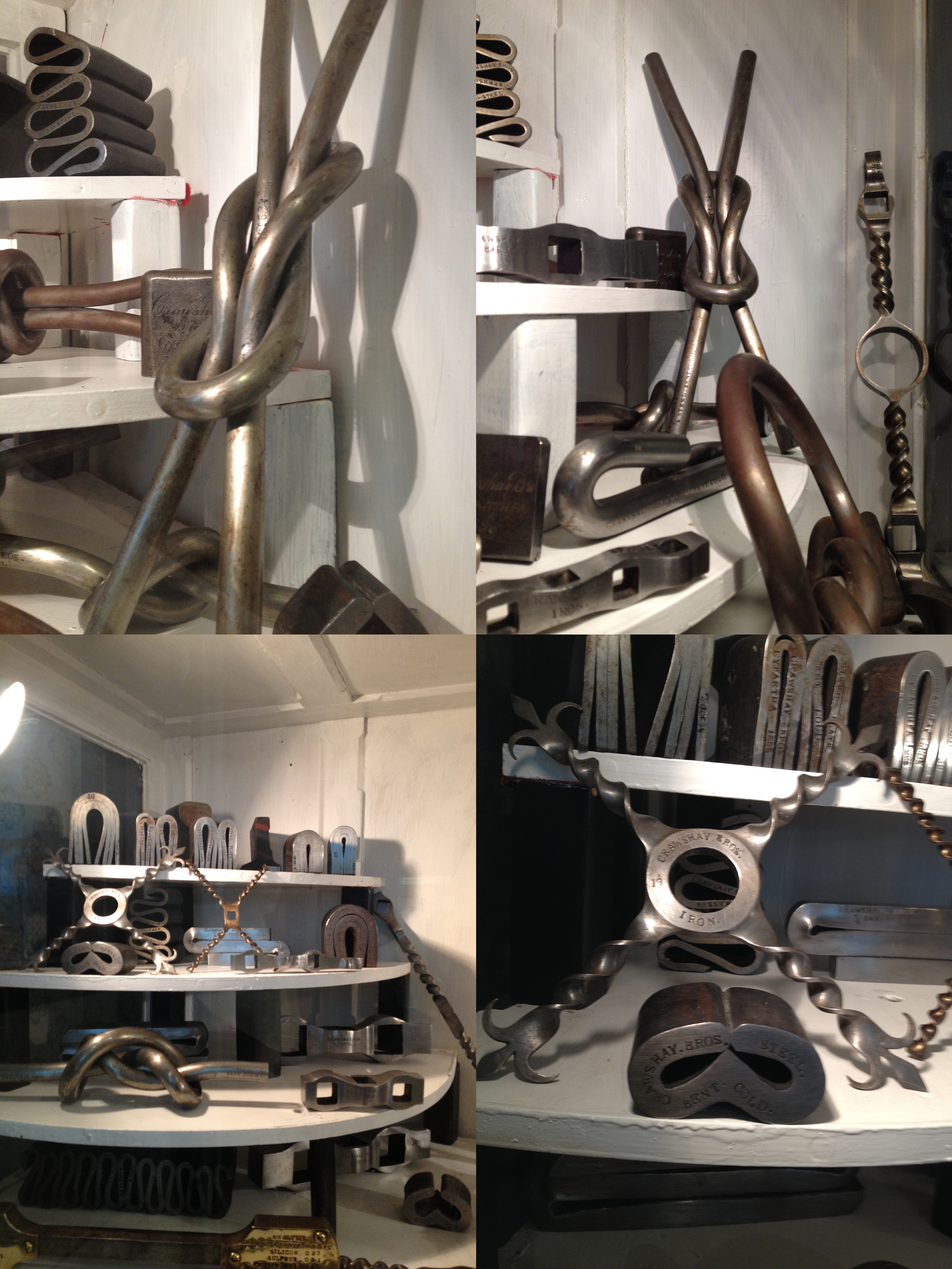
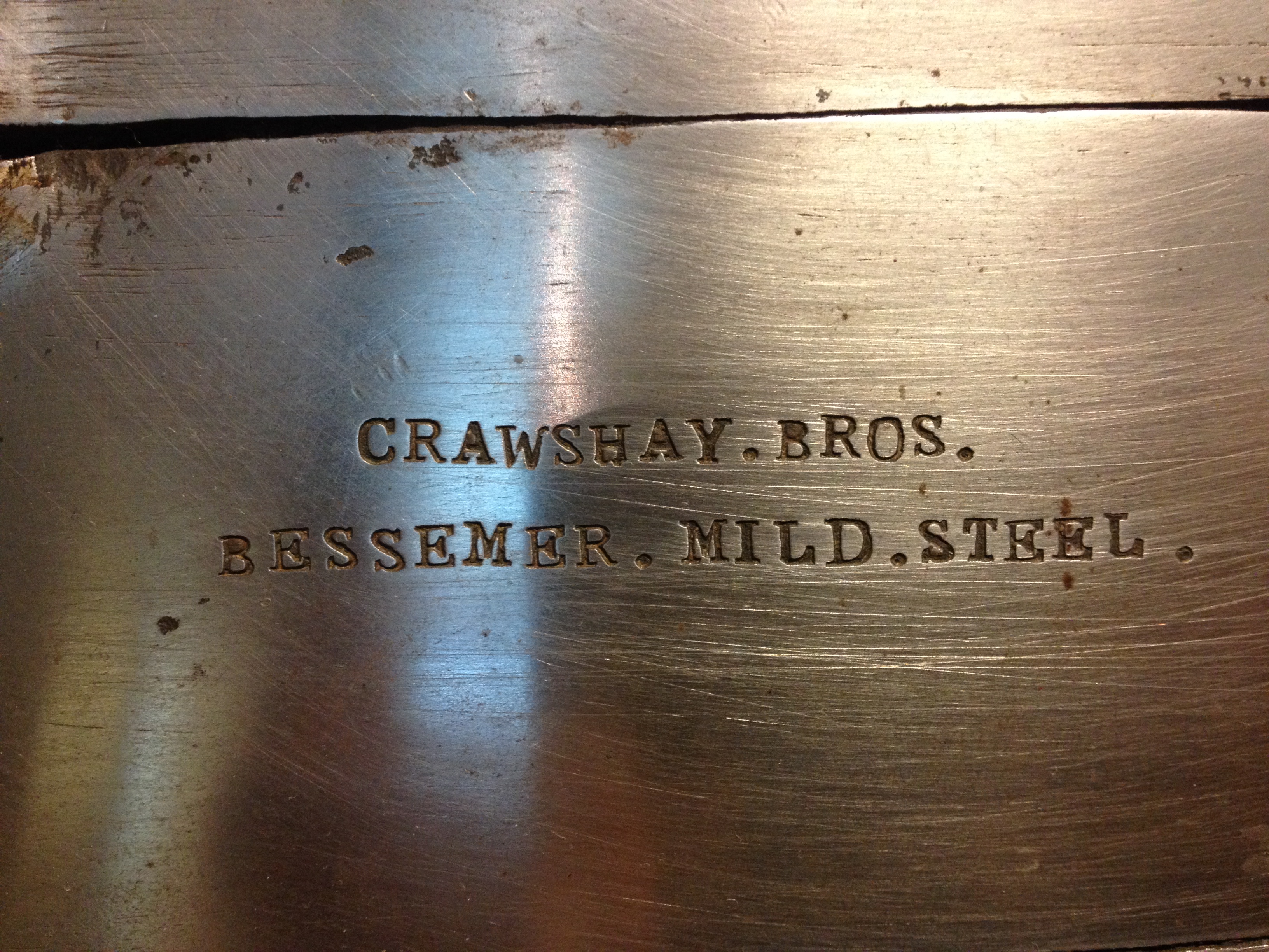
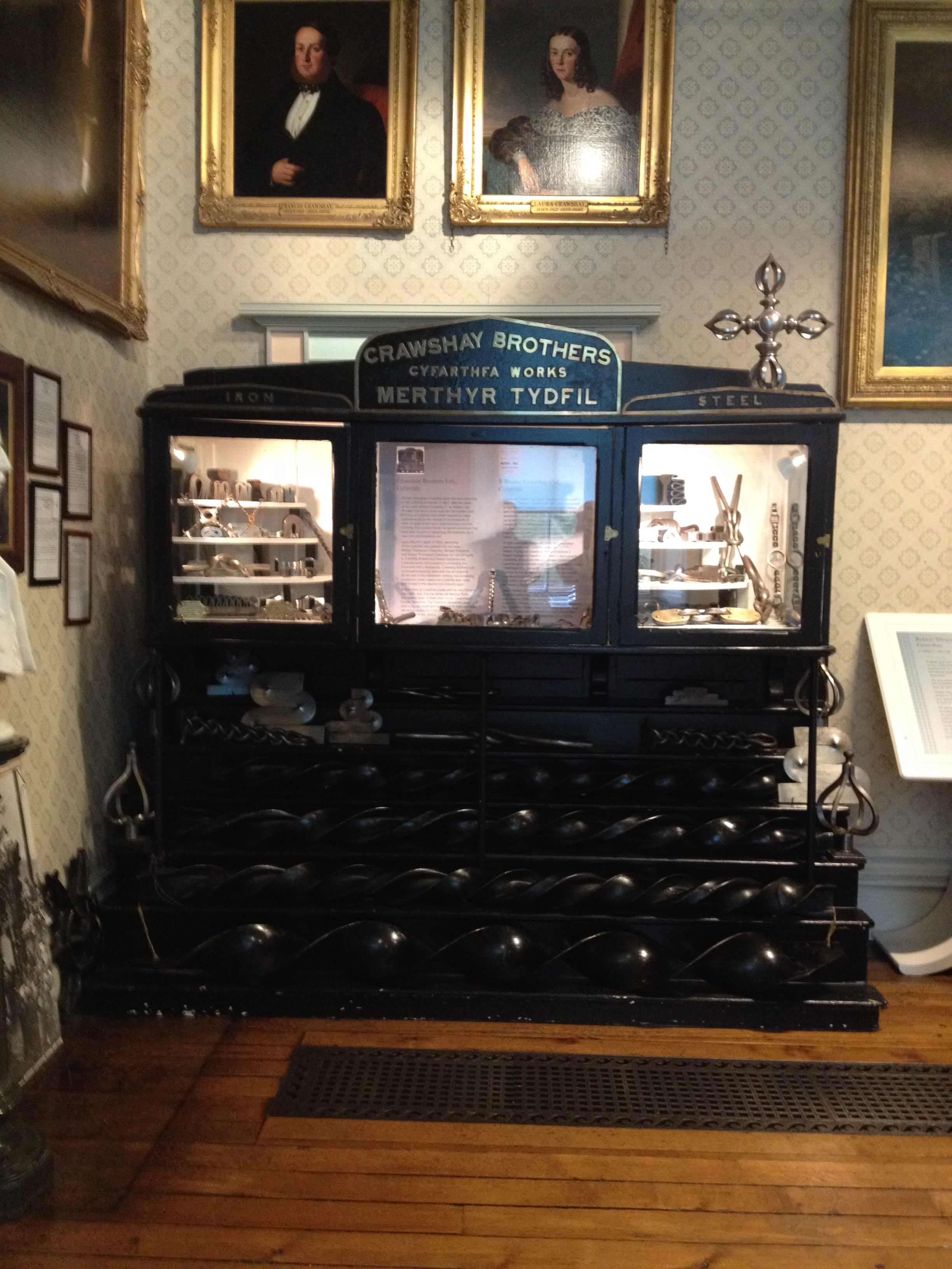
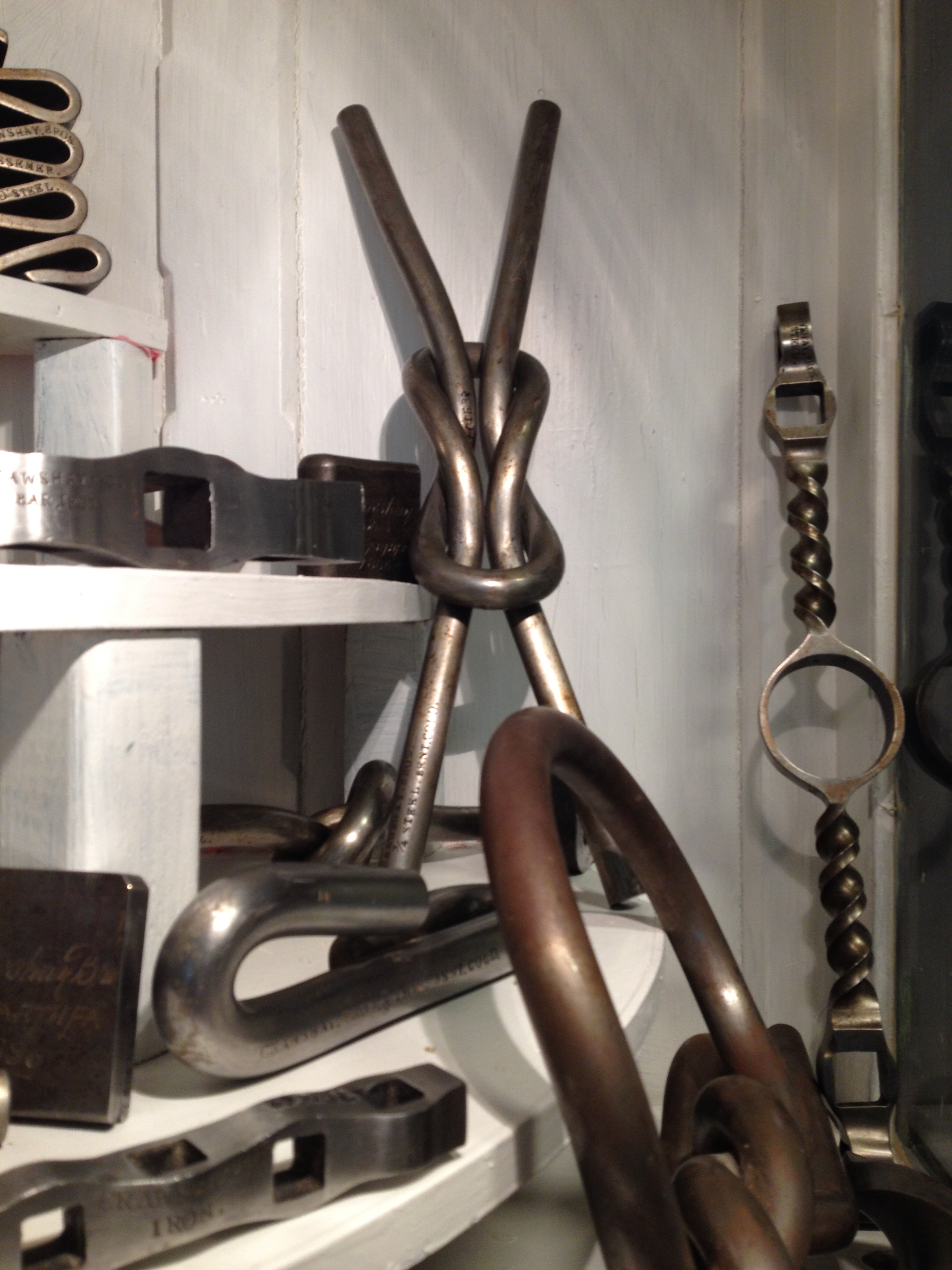
Images taken from a Cabinet of Iron samples manufactured by the Cyfarthfa Ironworks, on display at the Cyfarthfa Castle Museum & Gallery. Images by permission of Cyfarthfa Castle Museum & GalleryImages taken from a Cabinet of Iron samples manufactured by the Cyfarthfa Ironworks, on display at the Cyfarthfa Castle Museum & Gallery. Images by permission of Cyfarthfa Castle Museum & GalleryImage taken from a Cabinet of Iron & steel samples manufactured by the Cyfarthfa Ironworks, on display at the Cyfarthfa Castle Museum & Gallery. Images by permission of Cyfarthfa Castle Museum & GalleryImage: A Cabinet of Iron samples manufactured by the Cyfarthfa Ironworks, on display at the Cyfarthfa Castle Museum & Gallery. Images by permission of Cyfarthfa Castle Museum & GalleryImage taken from a Cabinet of Iron & steel samples manufactured by the Cyfarthfa Ironworks, on display at the Cyfarthfa Castle Museum & Gallery. Image by permission of Cyfarthfa Castle Museum & Gallery
Samples such as these by the Cyfarthfa Ironworks, were made for no other reason that to illustrate and show off the skills of the workers in manipulating iron and steel. Many, if not all of these samples were bent cold !
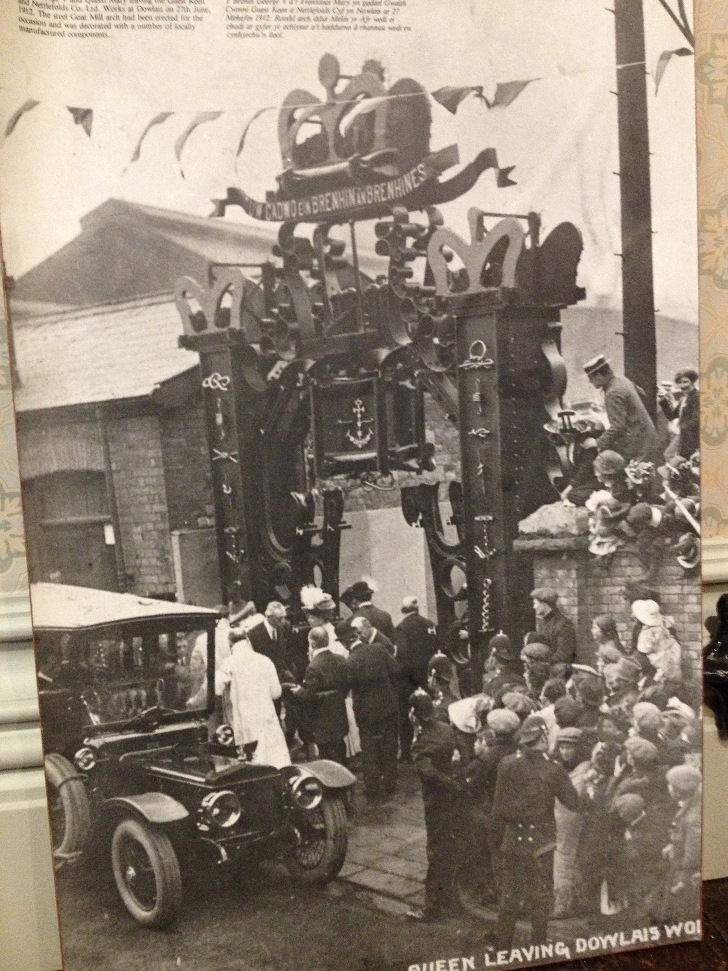
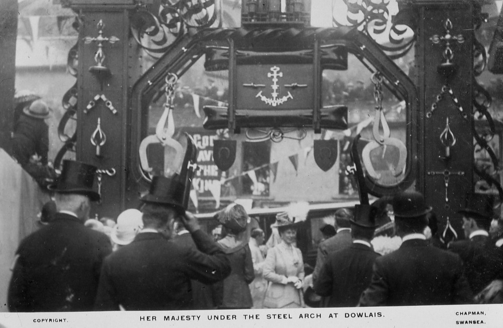
On 27th June 1912, King George V and Queen Mary visited Dowlais Ironworks. A spectactular steel archway – the ‘Goat Mill Arch’, had been erected for the occasion, & decorated with many locally made manufactured steel components, very similar to, if not the same as those on display in the Castle Museum.
Image of the Royal Visit to Dowlais in 1912 and the Goat Mill Arch by permission of Cyfarthfa Castle Museum & GalleryImage: Detail of the Royal Visit to Dowlais in 1912 and the steel Goat Mill Arch erected to mark the occasion. Image by permission of http://www.alangeorge.co.uk/
During the same Royal Visit, a triumphant arch of locally mined coal had been erected. It had formed an entrance into Dowlais House, the former home of ironmaster John Josiah Guest and Lady Charlotte Guest, translator of the Mabinogion.
The Coal Arch – erected for the visit of King George V and Queen Mary in 1912. Image by permission of http://www.alangeorge.co.uk/The Coal Arch was still standing in 1956, when a decision was made to demolish the structure. Image by permission of http://www.alangeorge.co.uk/
12th February 2015 – Treforest, South Wales – the birthplace of SIR TOM JONES !
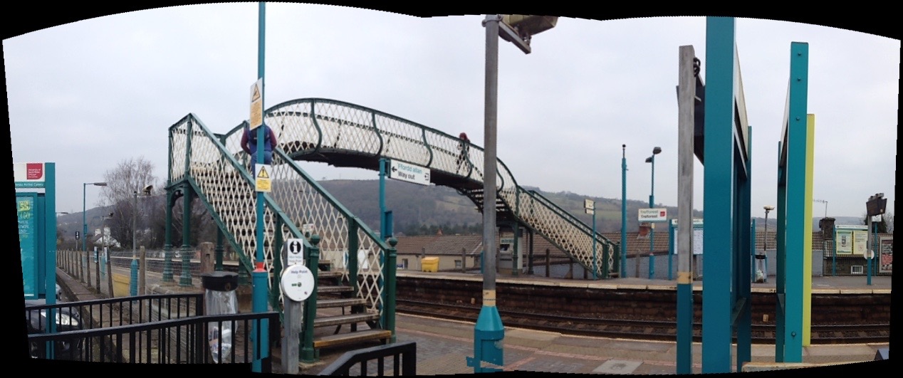
Treforest Station Railway Footbridge. Image: Christopher TippingTreforest Station Railway Footbridge. Image: Christopher Tipping
I met with Dr Chris Evanstoday to discuss the history of iron production in Merthyr Tydfil and the legacy and impact of this on contemporary Merthyr Tydfil and its aspirations & current regeneration programme. This is in light of contextual research I am doing in regard to the new Bus Station project and Link bridge feasibility study.
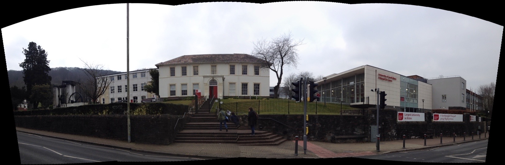
Ty Crawshay, Treforest, once the home of Francis Crawshay and now part of the University of South Wales.
We discussed a number of things including:
Francis Crawshay – an eccentric member of the Crawshays of Cyfarthfa, who had portraits of his workers painted which was, at the time highly unusual, giving a remarkable insight into the lives of ordinary working people. He was something of a Druidic character, building stone circles and mounds.
The Upland Landscape of the Brecon Beacons & its importance in both the past and the future of Merthyr Tydfil. Merthyr is a product of this upland landscape & could make much more of this relationship.
The Taff Trailand how visitors could experience & relate to Merthyr as a gateway to the Brecons.
The Creativity and Flair of the great engineers and innovators who were central to the Industrial Revolution in Merthyr not being sufficiently celebrated. Watkin George,William Edwards, William Williamsworked at the cutting edge of technology and innovation. Even factory buildings were classically proportioned. Merthyr was a hub of creative knowledge, that became not only world famous, but exported this knowledge all over the world – even sending expertise to set up new Ironworks in Russia for example. The town generated and maintained international contacts, becoming an international crossroads of industry.
Elemental Processes of ironworking – extremely labour intensive. The ability to standardize products and replicate to order under these conditions was testament to the degree of control over processes these manufactories had. Confidence in their technology and how to utilise it successfully
Impact on landscape – early extraction methods included damming rivers and streams and then breaking the dam to allow the raging waters to scour the top soils and expose the iron ore beds. Cinder Tips, & Slag Heaps
Power – the control and management of water was at the heart of Merthyrs advancement. Transport was the other – Canals, Tramways, Railways, Roads, River.
Power – Napoleonic Economy & Rise to Wealth – Atlantic Trade – Iron and Slaves – Dr Chris Evans Research
The dominant theme in this project is transport & transport links. Fluid and effective connectivity for cars, trains, buses and pedestrians alike. My role is specifically to try to ‘influence’ the design process being delivered by the teams involved in the Bus Station & Link Bridge. Creative Influence can be brought via research into the heritage and legacy of the town. Contextual research can also look at the practicalities of what a Bus Station or a shared pedestrian and cyclist Footbridge require to function. I can also investigate the aspiration and hope for the future which both of these elements of the town’s infrastructure could bring. All these threads of influence can combine to create a visual and conceptual aesthetic to use as a tool to aid the design and engineering process.
Social history in Merthyr Tydfil has shaped and re-shaped this landscape over a few hundred years perhaps more than natural history did since the last Ice Age. If you look at old OS Maps of Merthyr Tydfil from around 1840 to 1960, patterns of use and development begin to emerge. Transport leads the way, starting with the management of water: rivers, streams, ponds, canals, reservoirs, culverts & aqueducts. Railways, roads, embankments, cuttings, tunnels & spoil heaps all enable the efficient delivery & transportation of goods and materials, whilst also removing & storing waste products. All this happened in a fairly small locality, geographically speaking. This had a fundamental impact on the landscape. Maps show this impact in patterns and textures to evoke a man-made industrial environment. Even the The architecture of industry – buildings, factories, furnaces is also rich in patterns and repeating systems.
I am very grateful for the permission of Merthyr Tydfil CBC Librariesto allow me to photograph the maps in their collection. As these maps are also over 50 years old, the Ordnance Surveyrequest only that the following information is added to each image: ‘Reproduced from the (add date) Ordnance Survey map’.
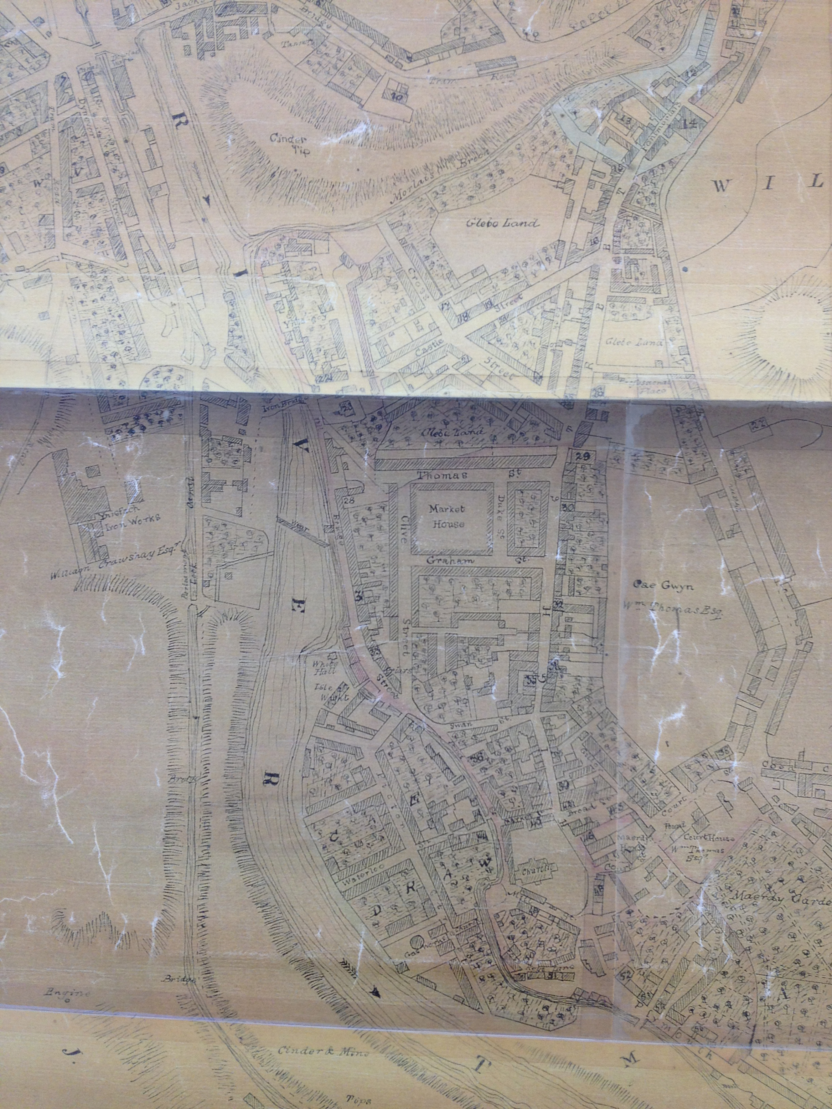
These are my annotations upon an OS Map of Merthyr Tydfil of 1876. Reproduced from the 1876 Ordnance Survey Map. Collection of Merthyr Tydfil CBC Libraries.
The annotated detail of the 1876 OS Map of Merthyr Tydfil Town Centre, shows the present day approximate positions of the following: Left to Right –
The College at Merthyr Tydfil
The current pedestrian footbridge
The proposed site of the new Bus Station on Swan Street
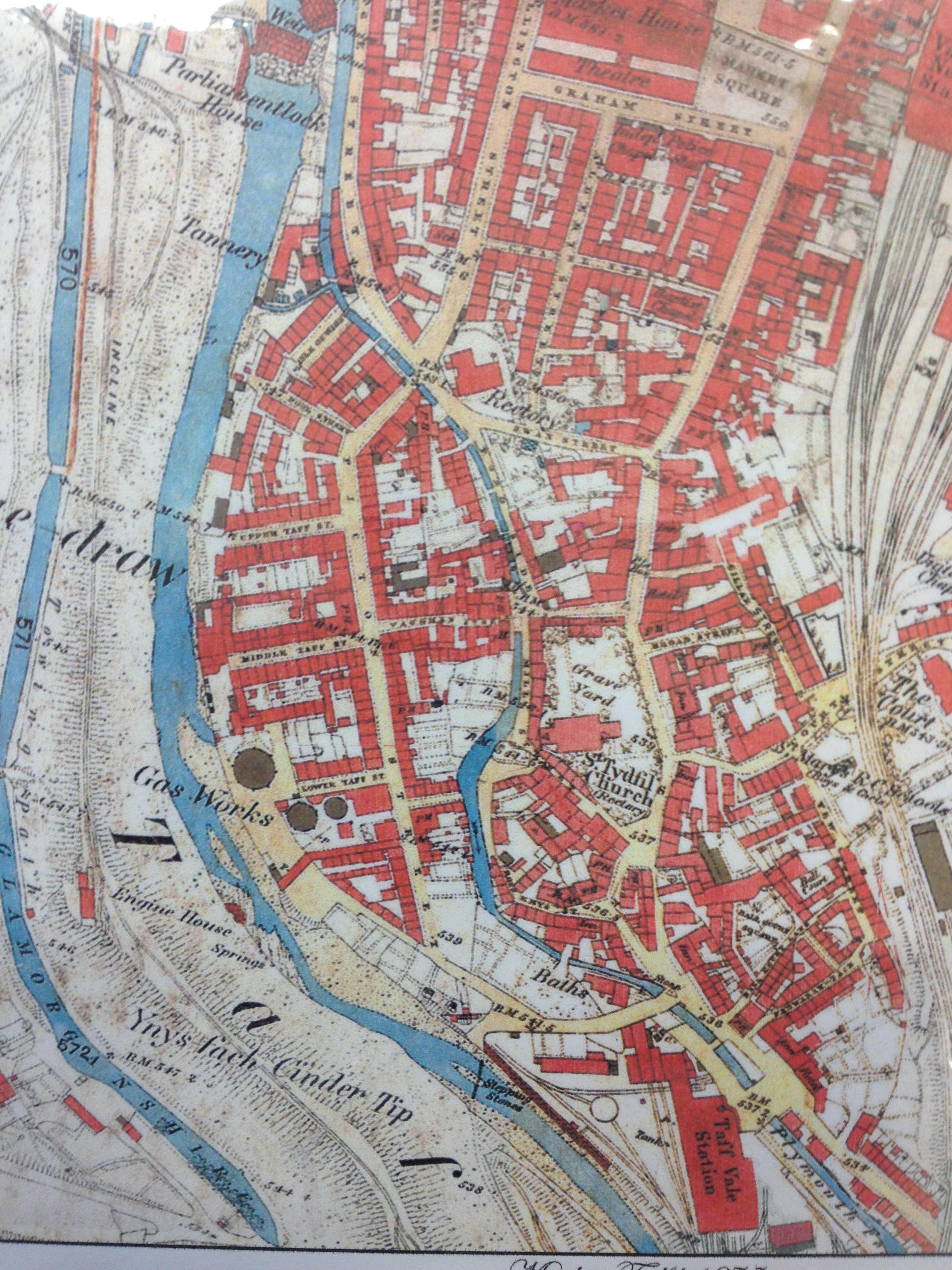
Detail of OS Public Health Map of 1875 – showing the weirs crossing the Taff. The Glamorganshire Canal can be seen to the left. Reproduced from the 1875 Ordnance Survey Map. Collection of Merthyr Tydfil CBC Libraries.
The image above showing the weirs on the River Taff is the exact site of the current pedestrian footbridge link form the College at Merthyr Tydfil, to the St Tydfil Shopping Centre.
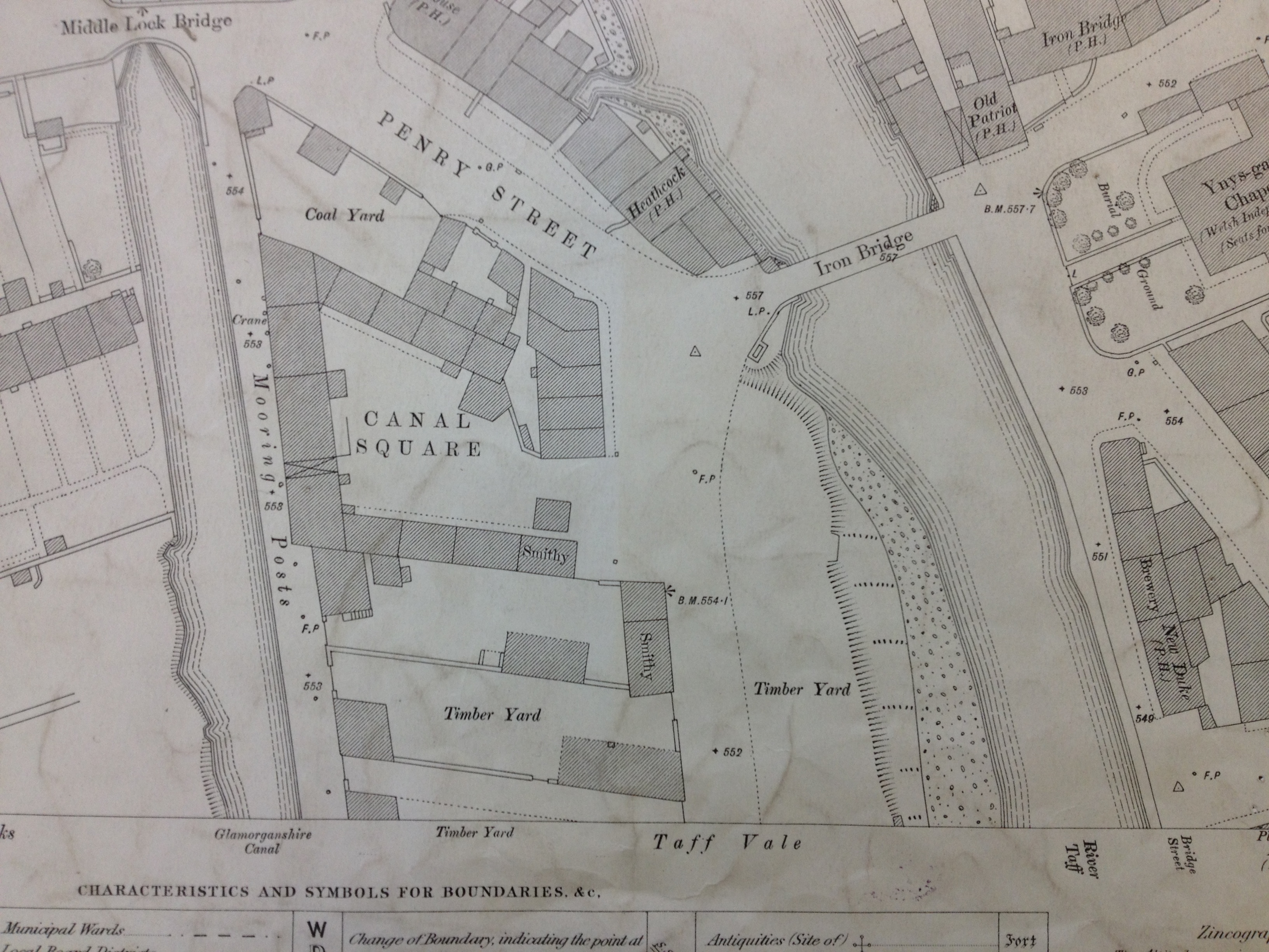
Detail of OS Public Health Map of 1875 – showing the original Iron Bridge at Ynysgau crossing the Taff. The Glamorganshire Canal can be seen to the left. Reproduced from the 1875 Ordnance Survey Map. Collection of Merthyr Tydfil CBC Libraries.
The Ynysgau Iron Bridge of 1799 is just a few hundred yards upstream from the weirs in the previous image. The Glamorganshire Canal is clearly seen on the left.
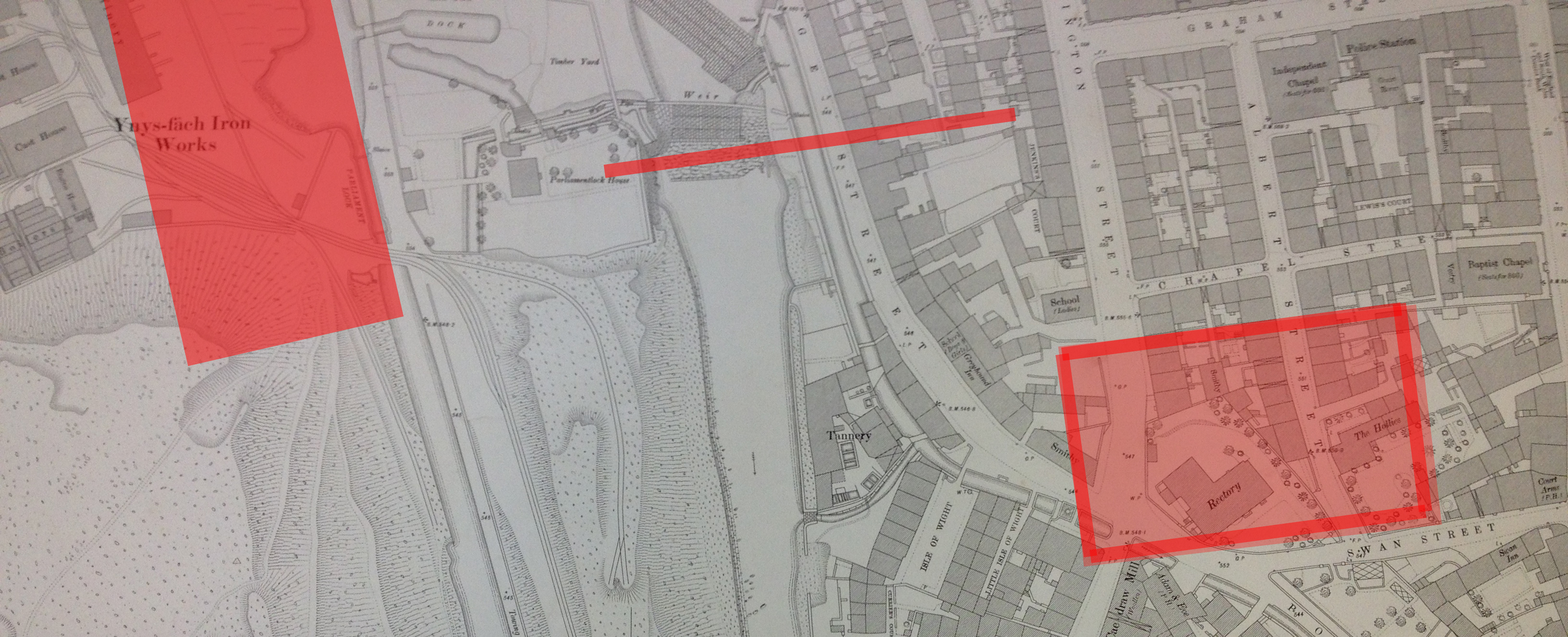
Detail of OS Public Health Map of 1875 – showing the large Rectory building on Swan Street, Cae-Draw, top right. The River Taff is on the left of the image. Reproduced from the 1875 Ordnance Survey Map. Collection of Merthyr Tydfil CBC Libraries.
The Buildings on Swan Street in the above image – including the large Rectory and the adjacent property called The Hollies, were demolished at some point during the 1960’s to make way for new developments and roads. The Hollies Medical Centre and the Police Station – both built on this site, are now being demolished to make way for the new Bus Station.
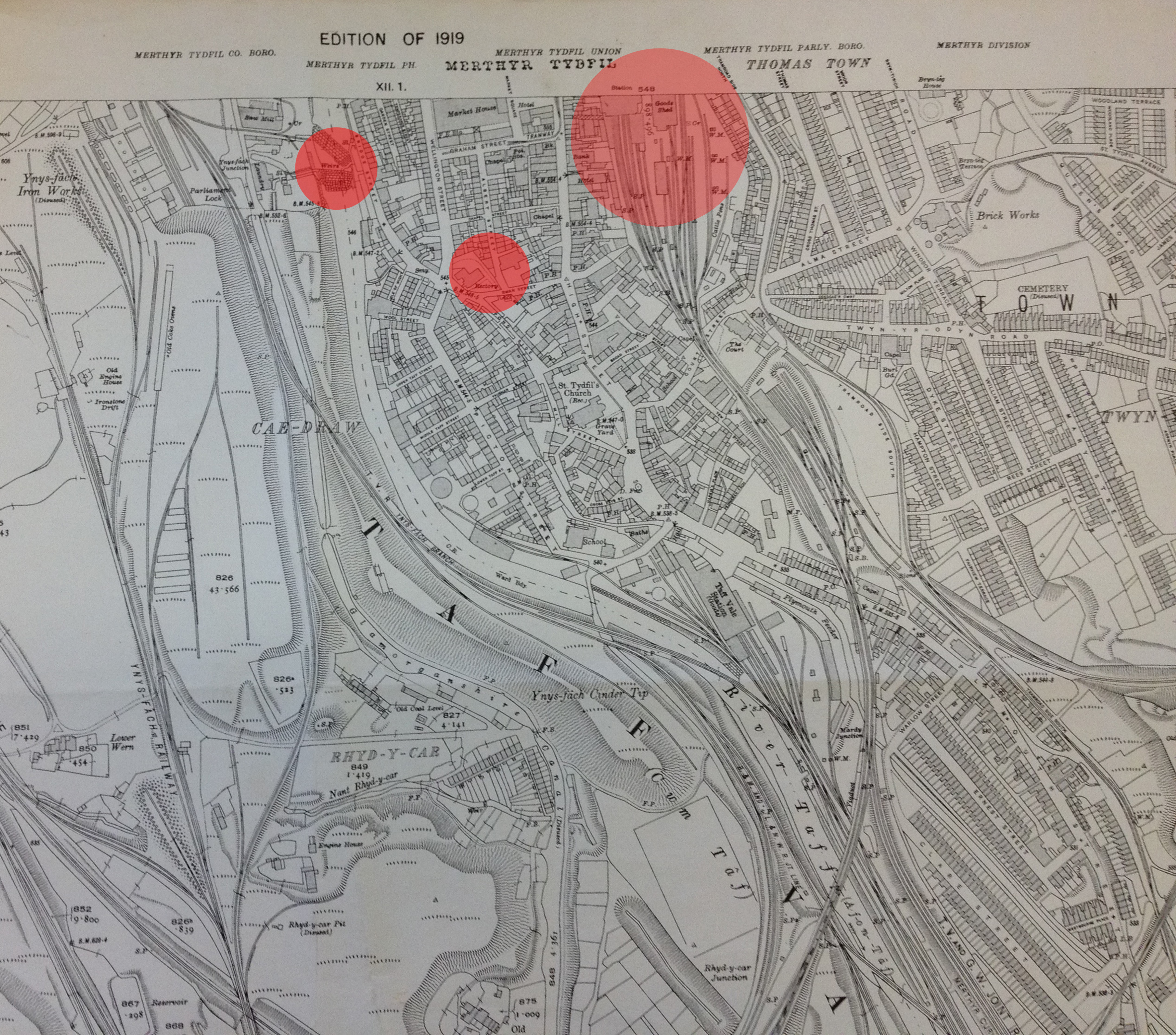
Reproduced from the 1919 Ordnance Survey Map of Merthyr Tydfil and surrounding areas. Collection of Merthyr Tydfil CBC Libraries.
The above detail from an OS map of 1919, has been annotated by me to show the positions of the existing pedestrian footbridge (left), the site for the new Bus Station (middle) and the site of the old Merthyr Tydfil Train Station (right). The train Station was built on the site of the current Tesco Store in the centre of town. The original station building was by I.K.Brunel.
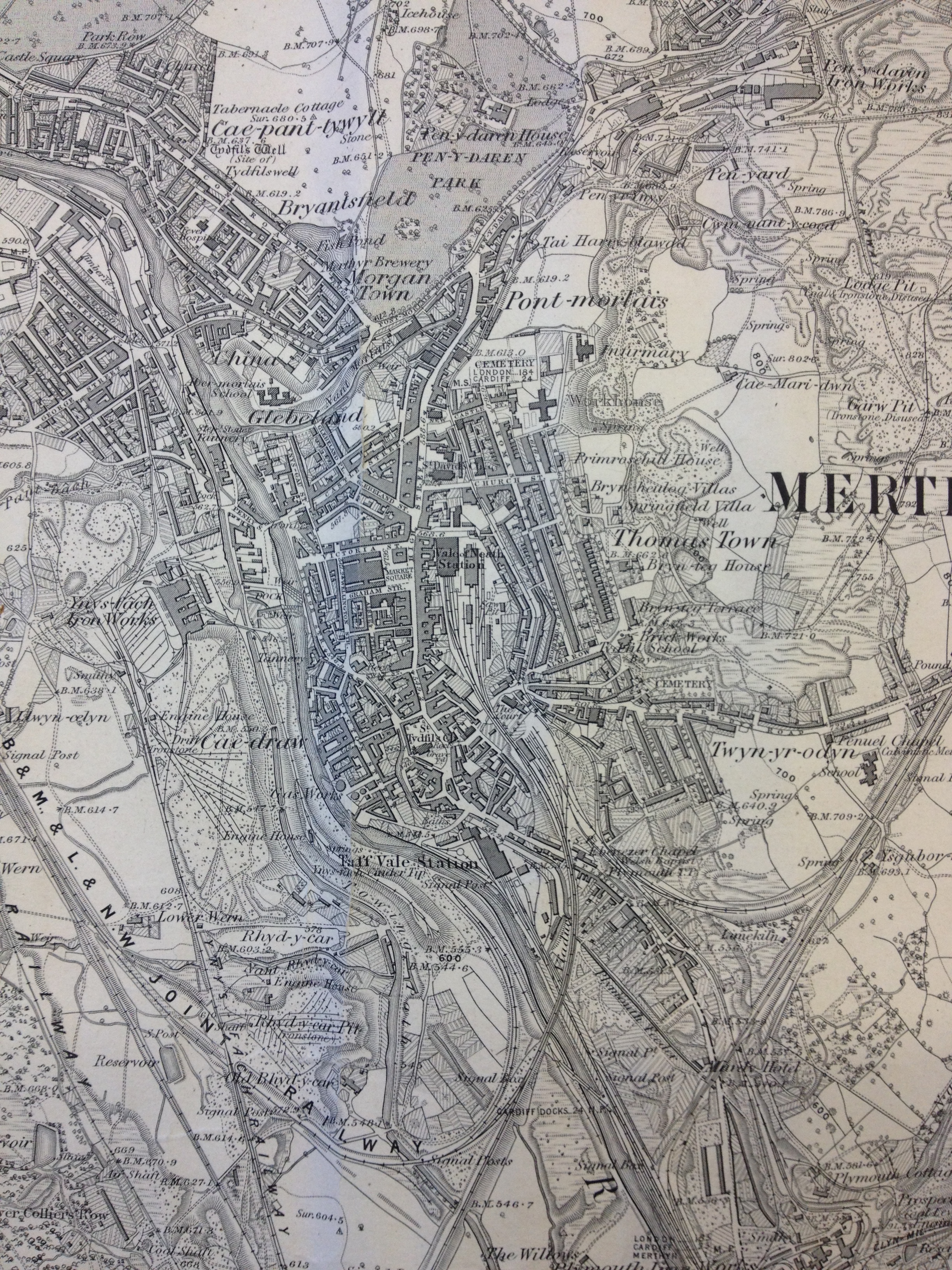
A detail from an OS map of Merthyr Tydfil and Cyfarthfa Iron Works. Reproduced from the 1865 Ordnance Survey Map. Collection of Merthyr Tydfil CBC.
I very much like the interconnectivity between the Ironworks – in pink – and the railway tracks and River Taff. The word that keeps coming to mind is ‘Confluence’, – describing the point at which two bodies of water meet. In this case – the dynamic interchange of the man-made and the the natural – albeit controlled – forces of water.
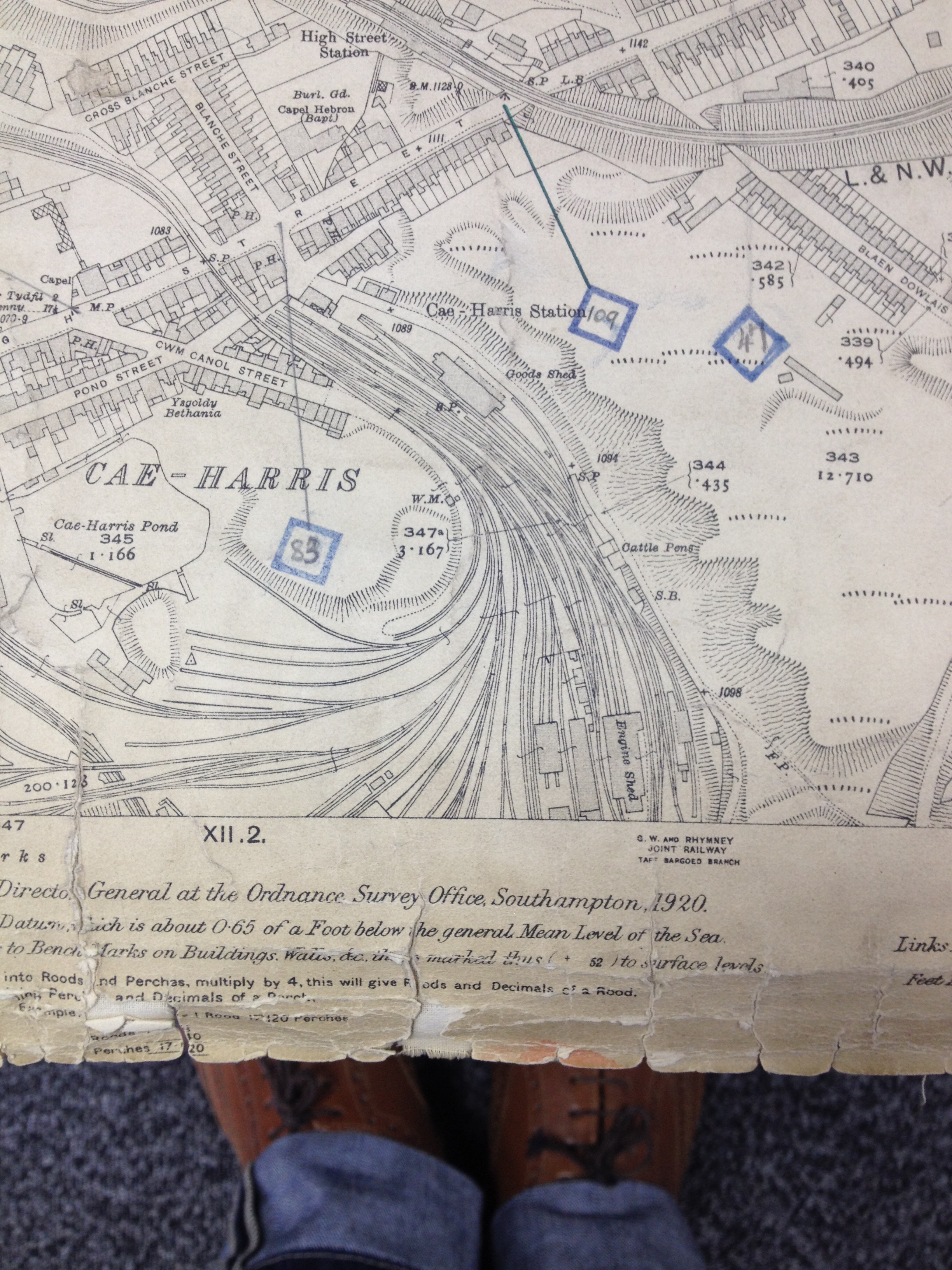
Railway tracks at Cae-Harris, Dowlais. Reproduced from the 1920 Ordnance Survey Map. Collection: Merthyr Tydfil CBC
The branching patterns of rail tracks are fluid and respond to the local topography.
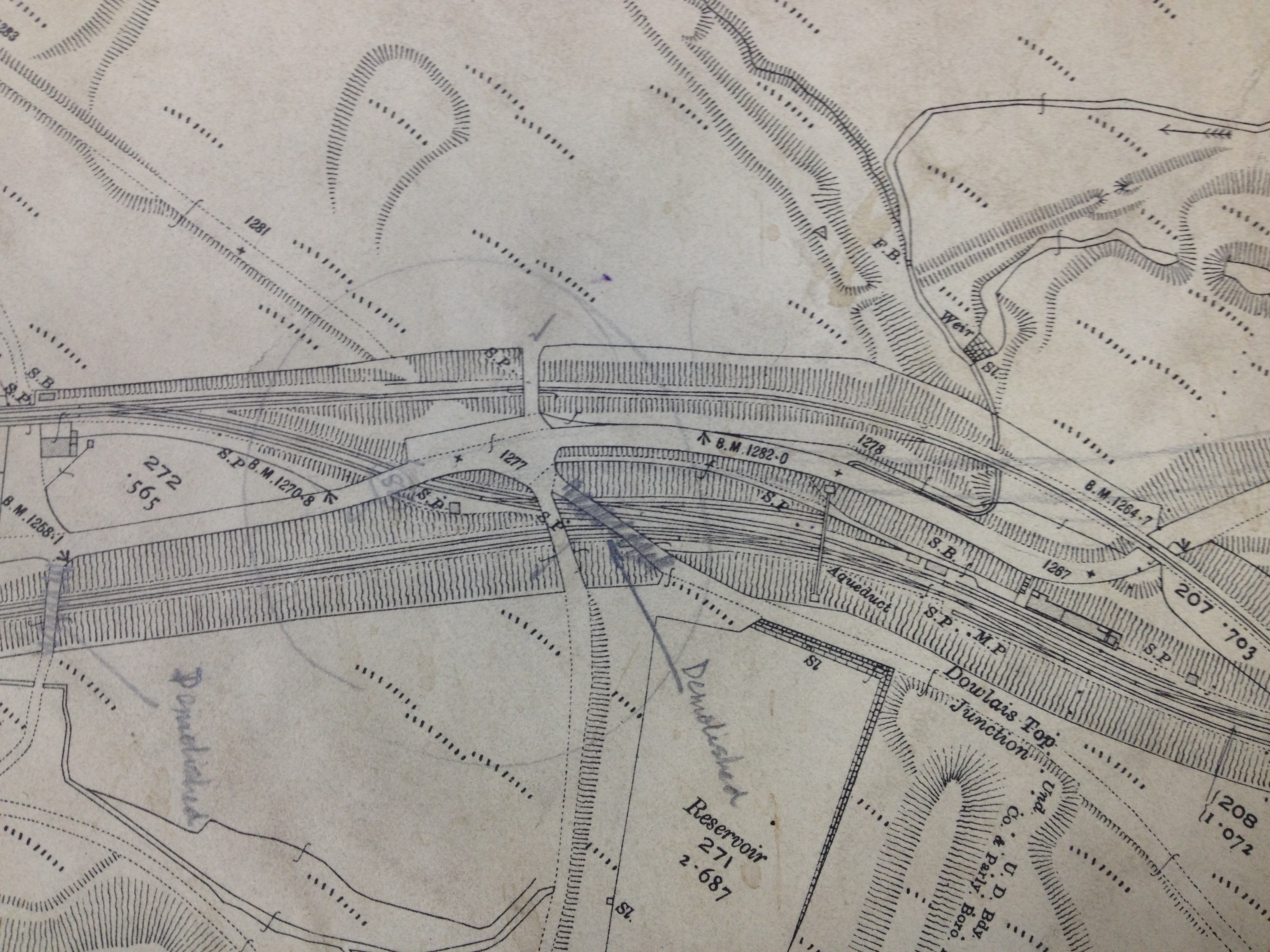
Detail: Railway tracks & cuttings at Dowlais Top, Merthyr Tydfil Reproduced from the 1920 Ordnance Survey Map. Collection: Merthyr Tydfil CBC
The above detail is from the 1920 OS Map above, shows rail lines in cuttings with embankments and raised trackways and crossing points.
A detail from an OS map of Merthyr Tydfil Town Centre. Reproduced from the 1836 Ordnance Survey Map. Collection of Merthyr Tydfil CBC Libraries.
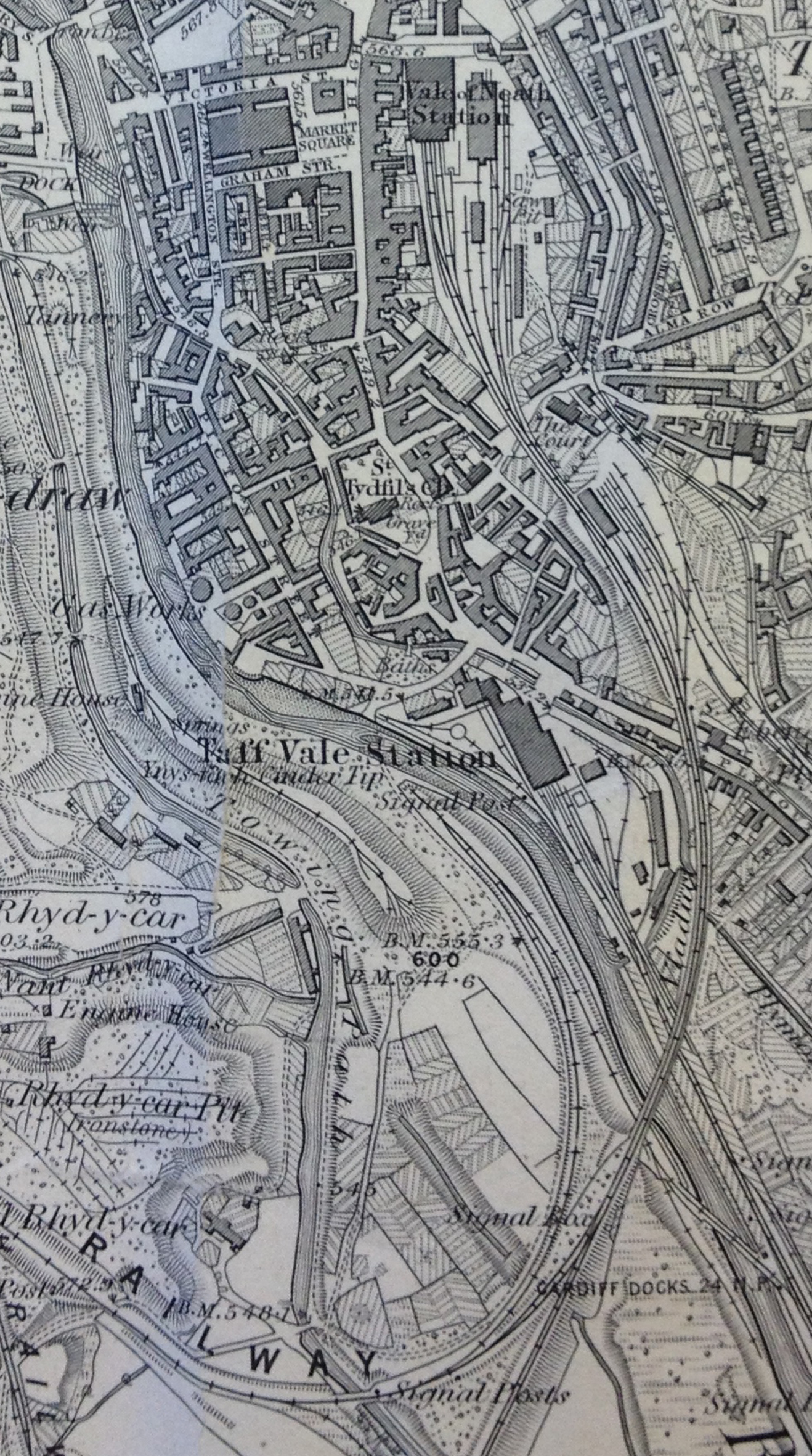
This lovely map clearly shows the positions of the Iron Bridge of 1799 & the weir on the River Taff. The pedestrian footbridge of 1970 crosses immediately downstream of the weir linking the College – on the site of the former Ynysfach Iron works, to the St Tydfil Shopping Centre – which was built upon the site of the old Market Square– seen on this map. Swan Street is also clearly marked – a couple of streets below the Market Buildings. This is the site for the new Bus Station. The Old Station was at the top of the map on the site known as Glebeland– originally land belonging to the Church.
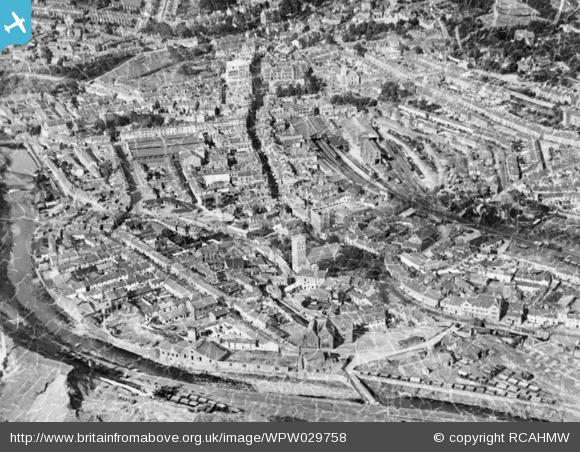
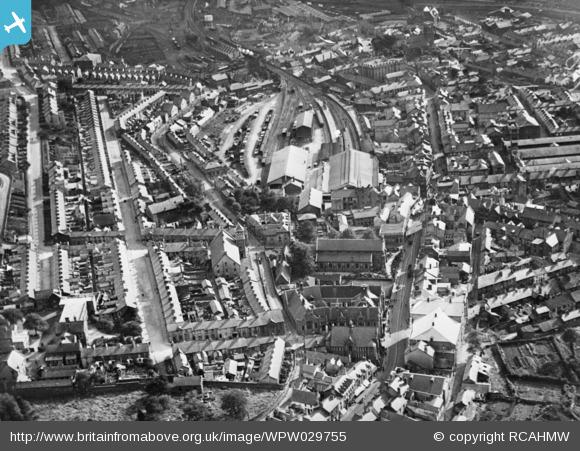
These images of Old Merthyr Tydfil come from the website Britain From Above– they really serve to show how dense the footprint of the town was in 1929. This pattern of community within the town centre remained pretty much unchanged until the 1950’s.
Detail of OS Public Health Map of 1851 – showing Cyfarthfa Iron works. Reproduced from the 1851 Ordnance Survey Map. Collection of Merthyr Tydfil CBC Libraries.Detail of OS Public Health Map of 1851 – showing Ynysfach Iron Works. The Glamorganshire Canal can be seen to the right. Reproduced from the 1851 Ordnance Survey Map. Collection of Merthyr Tydfil CBC Libraries.Merthyr Tydfil Map. Reproduced from the 1875 Ordnance Survey Map. Collection of Merthyr Tydfil CBC Libraries.Reproduced from the 1885 Ordnance Survey Map of Merthyr Tydfil and surrounding areas. Collection of Merthyr Tydfil CBC Libraries.
This 1885 OS Map of Merthyr Tydfil and surrounding areas is richly – almost decoratively detailed with the patterns of industrial development.
Railways in particular, dominate the landscape with curvilinear arcs branching and dovetailing into one another. The scene at the time must have been frenetic and constantly moving. What the map cannot easily show is the variation in topography and the ways in which the rail tracks were over-sailing one another in cuttings, over bridges and on raised embankments.
Detail. Reproduced from the 1885 Ordnance Survey Map of Merthyr Tydfil and surrounding areas. Collection of Merthyr Tydfil CBC Libraries.
The detail above illustrates the complexity of transportation & landscape management and how it interweaves in the landscape. Train Stations and Sidings, various roads and trackways, River Taff, Glamorganshire Canal with towing path, reservoirs, cinder tips, working quarries, disused workings. Sitting tightly in the midst of it all is the dense footprint of the Town Centre.
I have now made two visits to Merthyr Tydfil & am preparing to go up again this week for two days to meet with the project team and Capita, who will be delivering the Bus Station. Capita recently completed the The River Taff Central Link and Bridge – a new road system that connects Merthyr Learning Quarterat the existing Penry Street Bridge, through Avenue De Clichy, across the new road bridge located south of Swan Street, and via the new road in front of the College. The new bridge is a major landmark for the town.
The town centre is fascinating & has some wonderful architecture. Just remember to look up above the shop fronts to see the architectural detail! Key anchor buildings are still extant & a good deal of regeneration is breathing new life into these buildings and by default, back into the town centre. The RedHouse, an arts and cultural centre – in the former Town Hall – is a singular example of great regeneration practice & takes in the adjoining Penderyn Square – “As part of the Heritage Quarter development, a new civic square outside the renovated Old Town Hall will be a key focal point for the cultural identity of Merthyr Tydfil. The square will be a vibrant environment that will host events across the year celebrating the heritage of the town”.
I have done a lot of walking and am talking to whoever I can to enlighten me on the legacy and heritage of the town, but also about its aspiration and spirit for the future.
I have also been asked to contribute to a feasibility study commissioned by Merthyr Tydfil CBC, to look into replacing the existing footbridge link from the College, to St Tydfil’s Shopping Centre with a new footbridge which also extends to the site of the new Bus Station on Swan Street. The project is being delivered by Mott MacDonald & Knight Architects. This pedestrian connectivity is a critical element in unifying the accessibility of trains, buses and pedestrian routes in the town. It serves also to improve and build upon the visual impact a new footbridge may have as a landmark attraction and destination along the Taff Trail, bringing more tourists and visitors to the town centre.
The site of the new Bus Station on Swan Street. Image: Christoher Tipping
This site, on the corner of Swan Street and Avenue de Clichy was until recently, the home of the Hollies Health Centre, which has now moved to state of the art new facilities in the Keir Hardie Health Park at Cyfarthfa. The old buildings have now been demolished. The old Police Station – right & centre of picture, is also in process of demolition to make way for the Bus Station. The back of the St Tydfil’s Shopping Centre can be see on the left of this image.
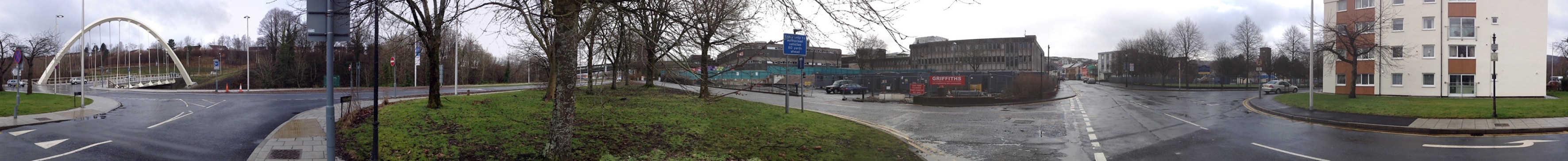
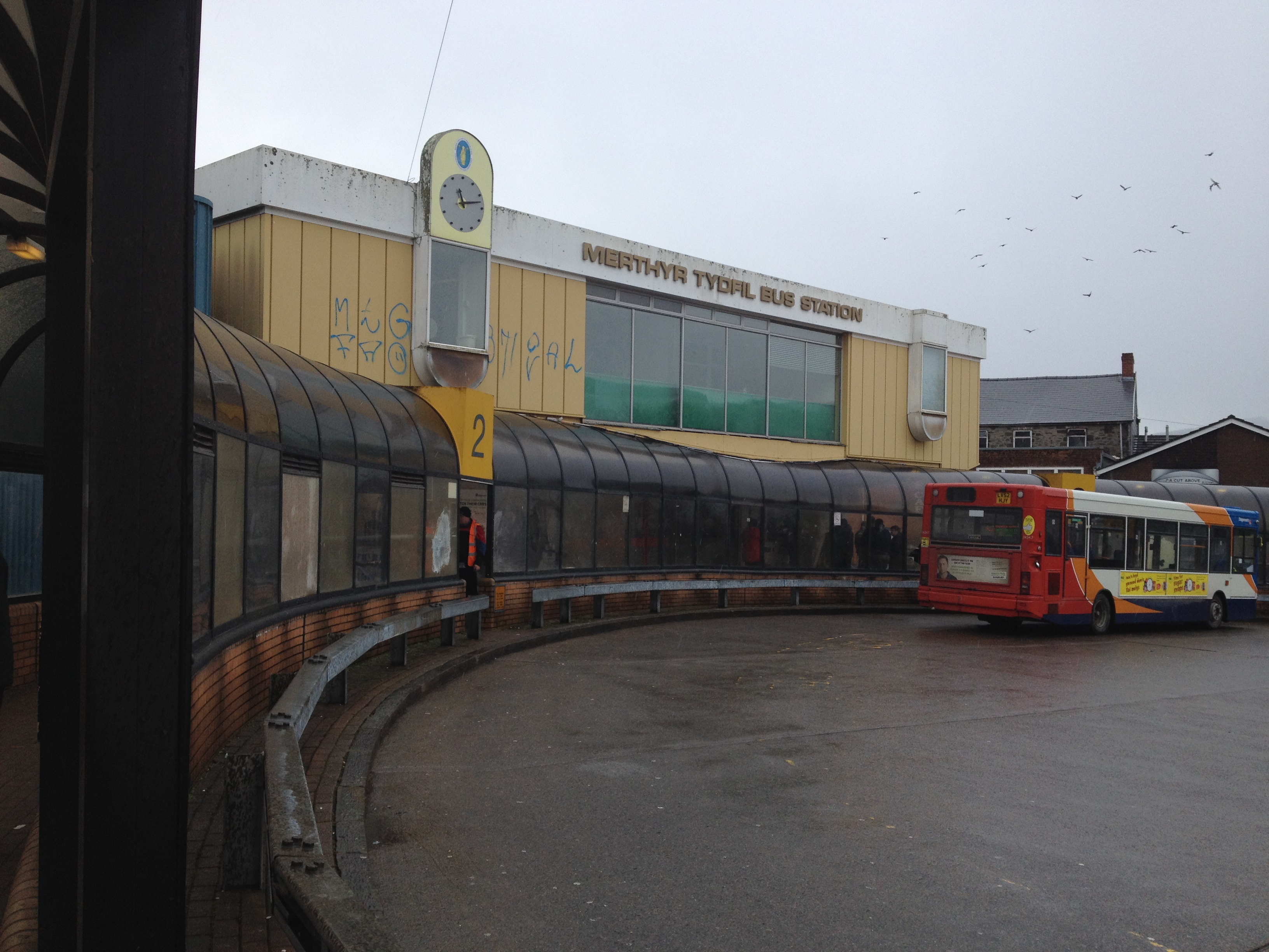
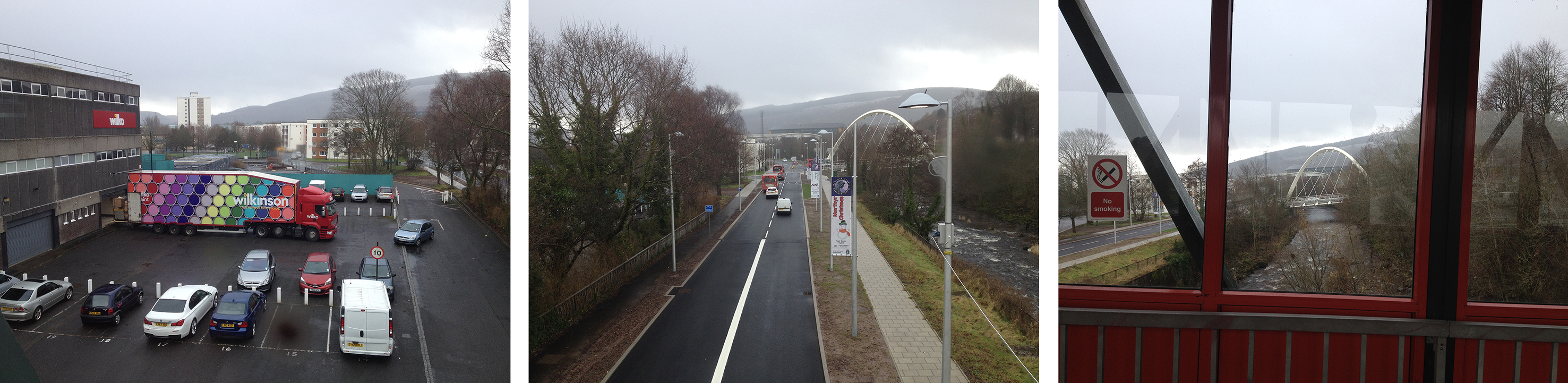
The new Bus Station site as seen from the new River Taff Road bridge. Image: Christopher Tipping360 Panoramic image of the Swan Street site. Residential flats and two schools lie to the south of the site & a sensitive response is imperative. Image: Christopher TippingThe current Bus Station off Castle Street. Image: Christopher Tipping
This image looks grim, but to be fair, the weather on the day was dreadful ! If you turned around, the views out to the surrounding hills are great, even on a horrible day. Castle Street now leads onto the new River Taff Central Link Road at one end and the Redhouse at the other – both, great examples of the power of regeneration schemes in the town to make credible changes.
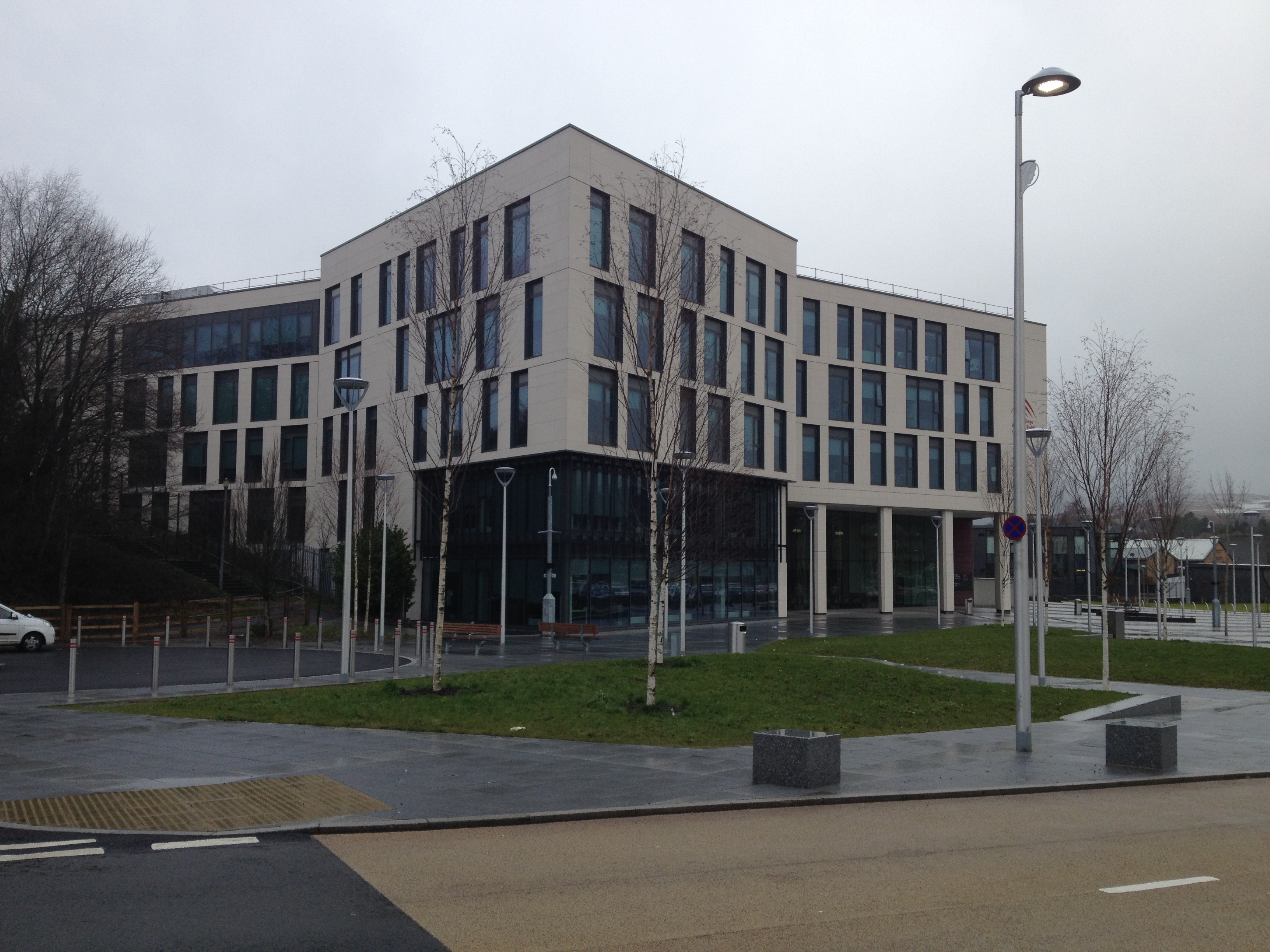
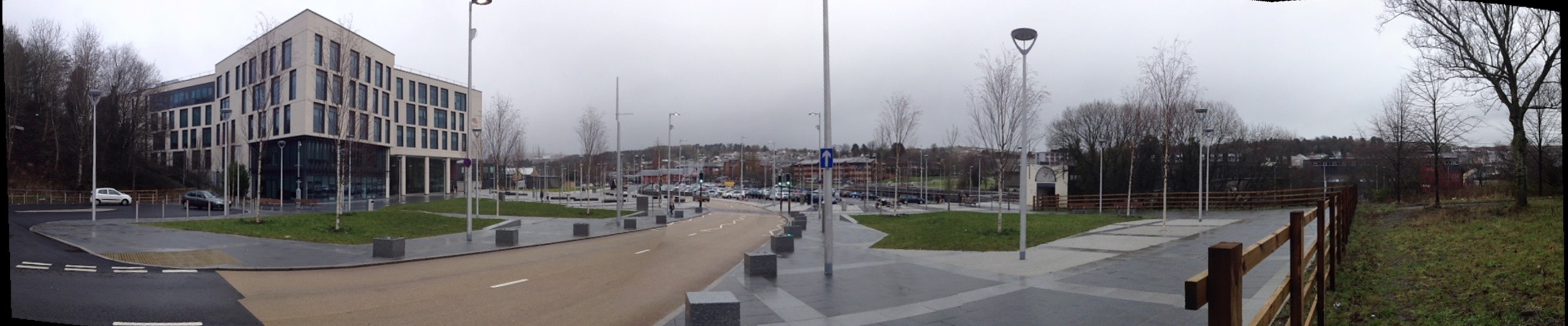
The College, Merthyr Tydfil, which opened on September 2nd 2013. Image: Christopher TippingPanoramic image of the College at Merthyr Tydfil showing the new road and extensive public realm. The River Taff footbridge is at the far right of this image. Image: Christopher Tipping
This area was the site of the former Ynysfach Ironworks, owned and run by the Crawshay Family of Cyfarthfa Ironworks. The new road seen running through the site above almost follows the path of the former Glamorganshire Canal,which was fully opennd in 1794 and declined progressively between 1898 & 1951. Much of the Canal route is now buried beneath the A470 Cardiff to Merthyr Tydfil Truck Rd.
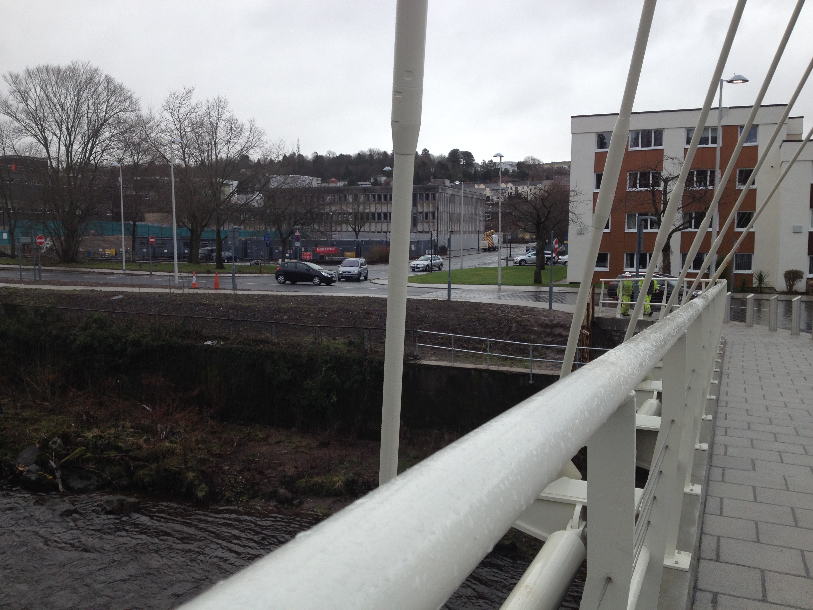
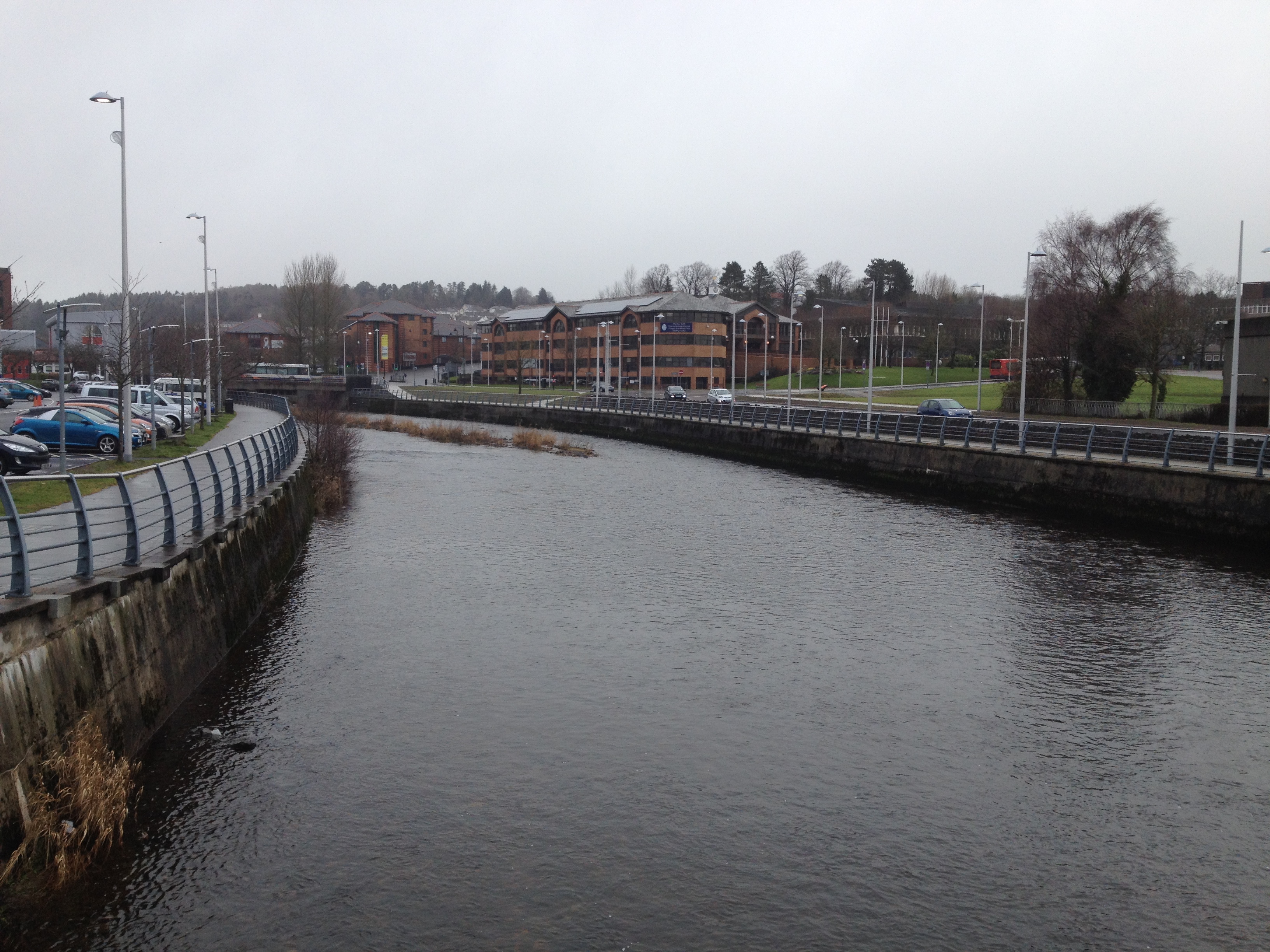
The view upstream from the River Taff Footbridge. towards the Civic Centre. Image: Christopher Tipping
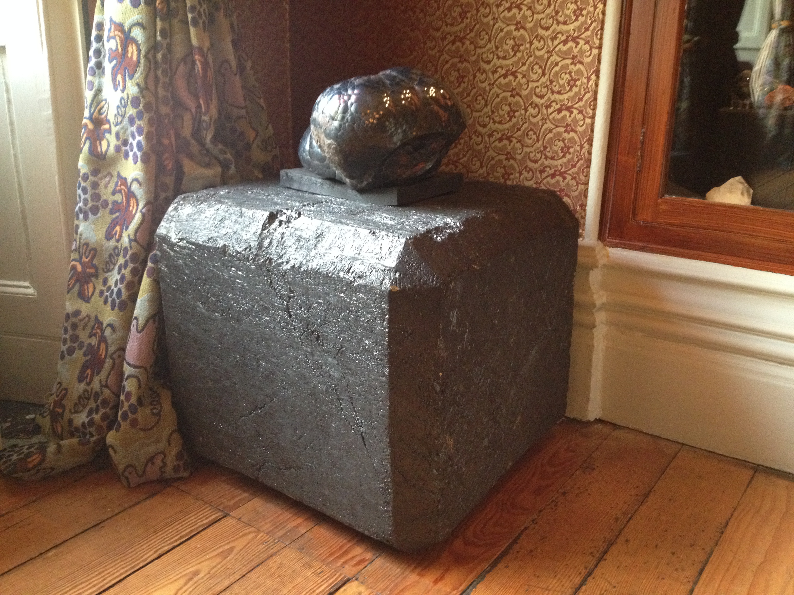
Where the River Taff meanders to the left in the above image and turns the corner, was the site of the Ynysgau Iron Bridge, one of the first Cast Iron Bridges built anywhere in the world, started in 1799 & completed in 1800. The bridge was designed and built by Watkins George, a brilliant engineer working for Richard Crawshay of CyfarthfaIronworks, known as the Iron King. The bridge was constructed for the workforce to cross the Taff to reach the Ironworks. It was dismantled in 1963 and is now stored by Merthyr Tydfil CBC.
Sections and details of the Ynysgau Iron Bridge, dismantled in 1963 and now stored by Merthyr Tydfil CBC. Image: Christopher Tipping
Communications and advances in transport were critical factors behind the expansion of Iron production during the Industrial Revolution. Natural water supplies found in the Taff and its tributaries & streams provided the source of power, but this had to be managed and controlled. Innovation and technological advances were the powerhouses.
Merthyr Tydfil may no longer claim to be the Iron Capitol of the world, but transport and innovation continues to be the catalyst for change in the area.
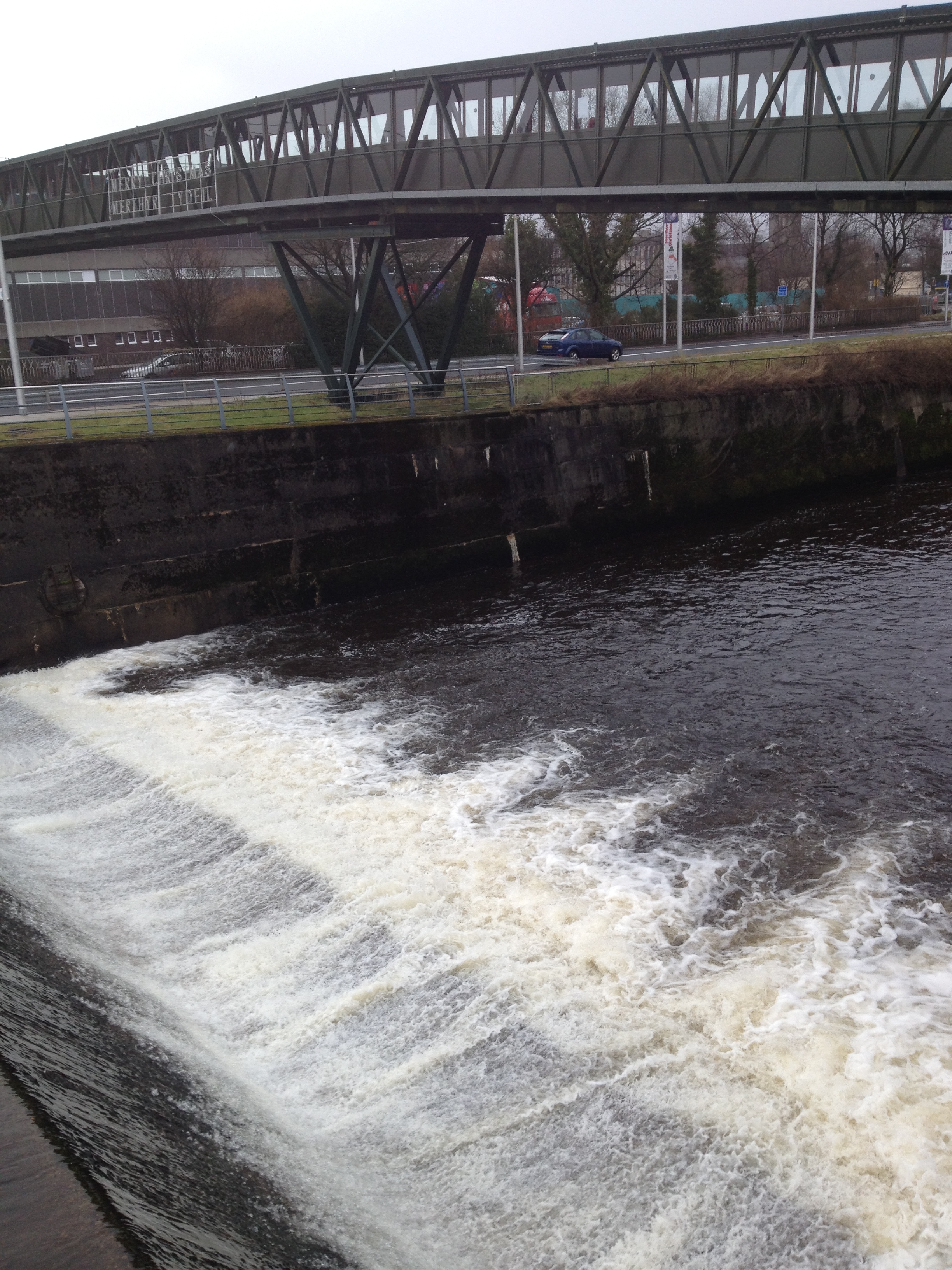
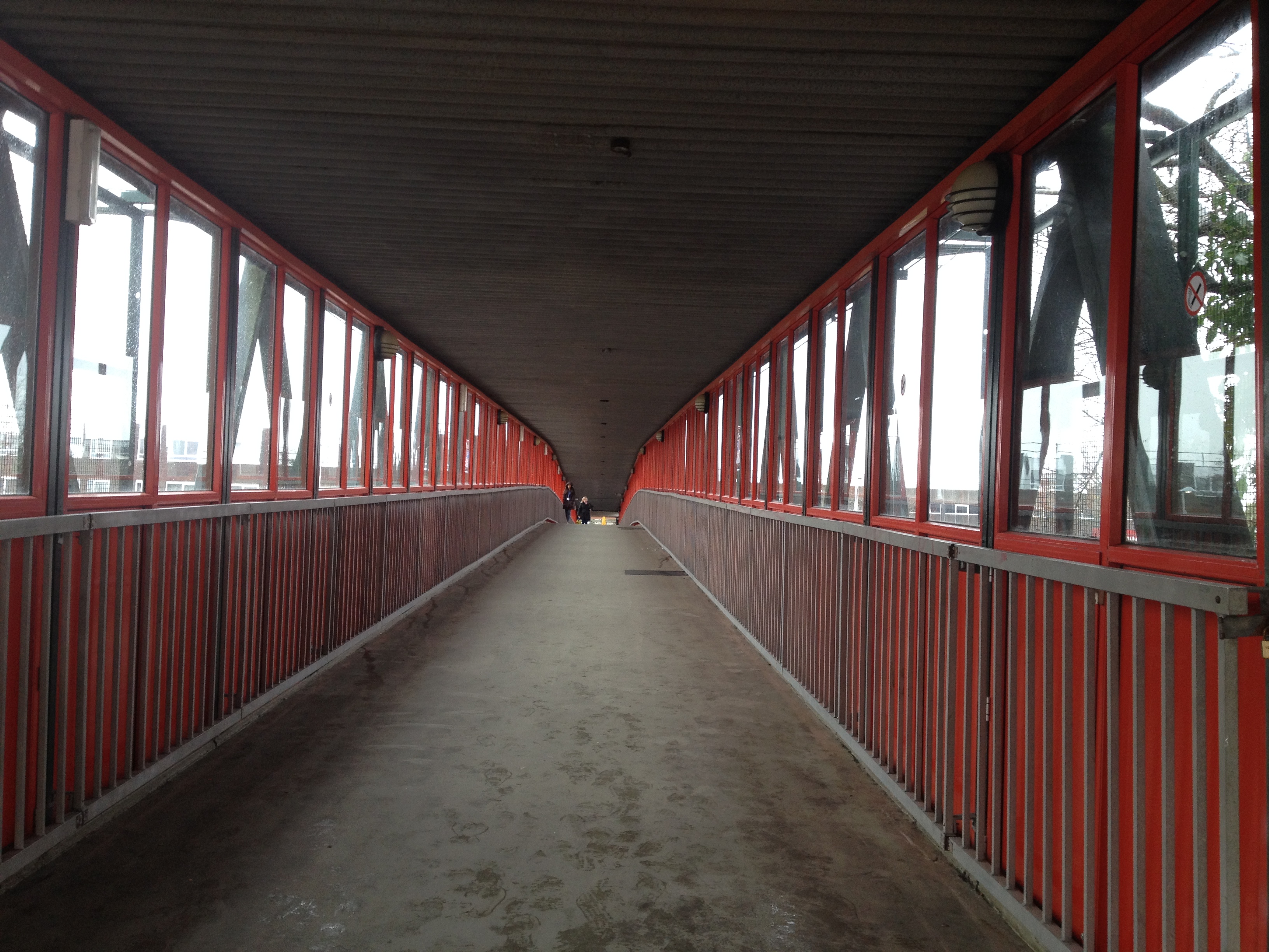
The River Taff footbridge crosses just below the weir from the College to St Tydfils Shopping Centre. Image: Christopher TippingThe footbridge was built in the early 1970’s but wasn’t always covered. The bridge spans not only the River Taff, but the Avenue de Clichy & Wilkinson’s Carpark . Image: Christopher TippingLooking downstream from the footbridge the views change between retail carpark, highway and river. Image: Christopher Tipping
This distinct zoning of views as one crosses the bridge could also change considerable during the year. It’s a great feature from where to see the town – its downfall being that it isn’t particularly good to look at ! A new footbridge would have the potential to exploit this fact too and make the most of the opportunities presented.
Great news to end 2014 & a promising start to 2015 !
On 22nd December 2014 I was appointed as the artist to the team for the new bus station at Merthyr Tydfil.
“The appointed artist will work as part of a multi disciplinary design team to look for opportunities to contribute to the design of the bus station both in terms of function and aesthetics. The development of a new Central Bus Station for Merthyr Tydfil is one of the last major regeneration projects for the heart of the town centre.
Through extensive public consultation held in June 2014, the majority of the public recognised the need to relocate the bus station; however concerns were raised over anti-social behaviour, accessibility and close proximity to a residential area. It is critical that the design addresses these concerns whilst looking for a contemporary design that has a unique appearance which is respectful to the surrounding area.
This is an excellent opportunity for an artist to make a real contribution to the design of an important part of the town’s transport infrastructure and a critical building within the townscape. The appointed artist will be expected to bring a new perspective to the design team crossing traditional skills boundaries and linking different design disciplines.”
The brief and scope is wide ranging at this stage, but is focussed on the use of research led contextual studies with which to influence the design process and eventual outcome of the project.
I will be starting work on the project in January 2015 & look forward to working & collaborating with the people of Merthyr Tydfil as soon as possible.
This blog will be made open to everyone involved in the project to review, comment upon & contribute to the programme and research.