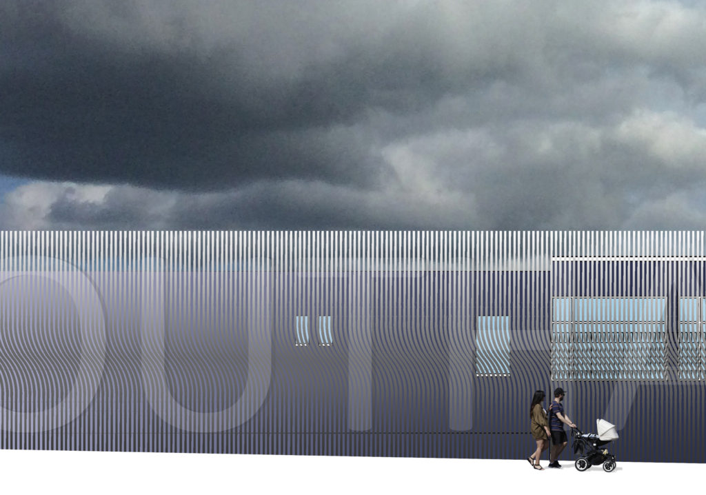
Creative Public Realm proposals for Chatham Railway Station. Lead Artist: Christopher Tipping
‘Medway Council successfully secured £700,000 from the government’s Local Growth Fund through the South East Local Enterprise Partnership (SELEP) to contribute towards the £1.4m upgrade, with Network Rail match-funding the windfall through its National Station Improvement Programme’. Medway Council
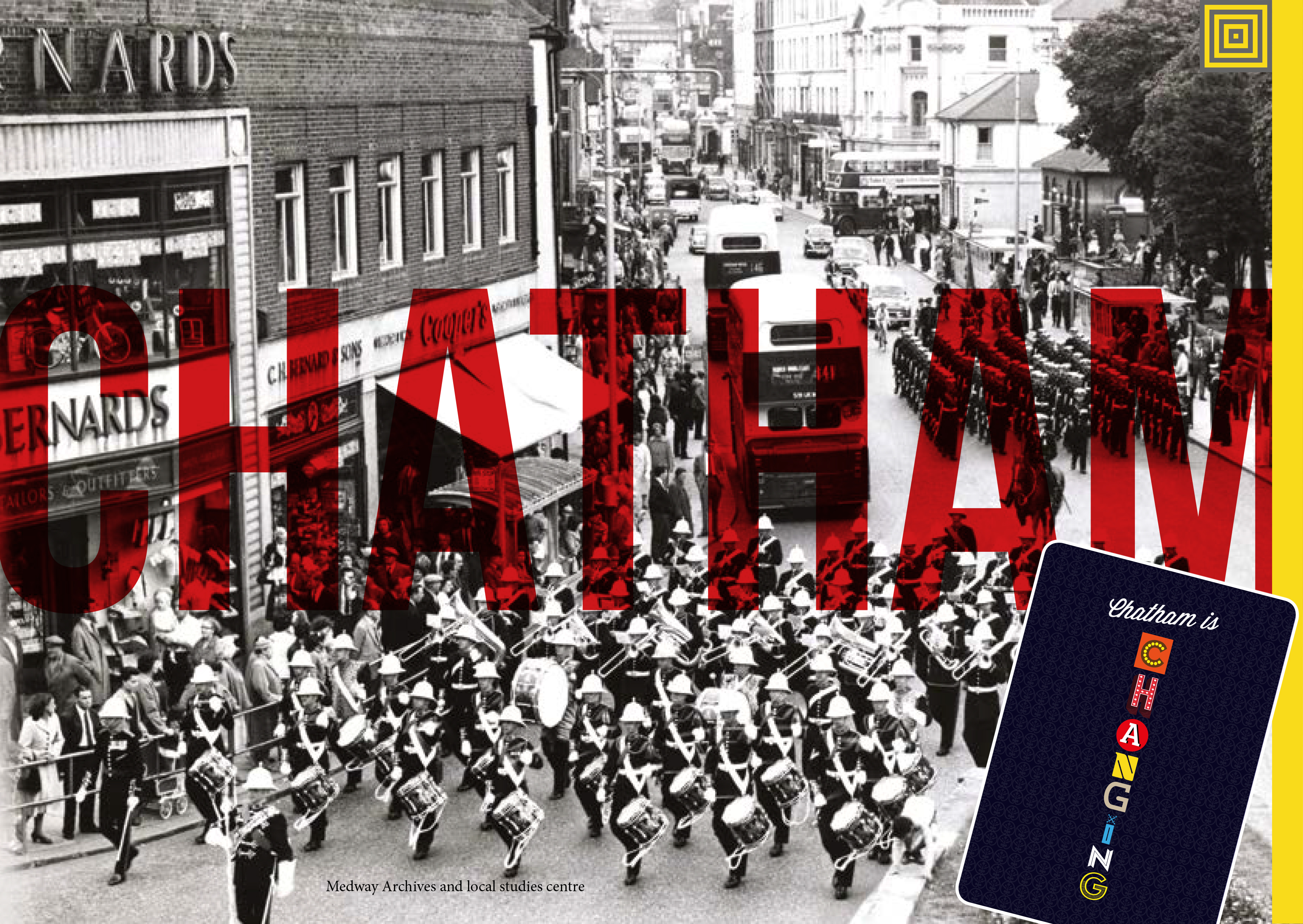
This was great news to see this project being promoted on Linkedin this week by Medway Council. Following the near completion of public realm works and embedded public art along Railway Street and Military Road, including New Cut, St John’s Steps and Military Square, Chatham Railway Station is now about to undergo its long awaited regeneration too, at the head of our works as part of the Chatham Placemaking Project.
I made one of the first posts about Chatham Station on this blog back in September 2015 in the very early stages of our research and contextual work on the project. Click on this link for more information.
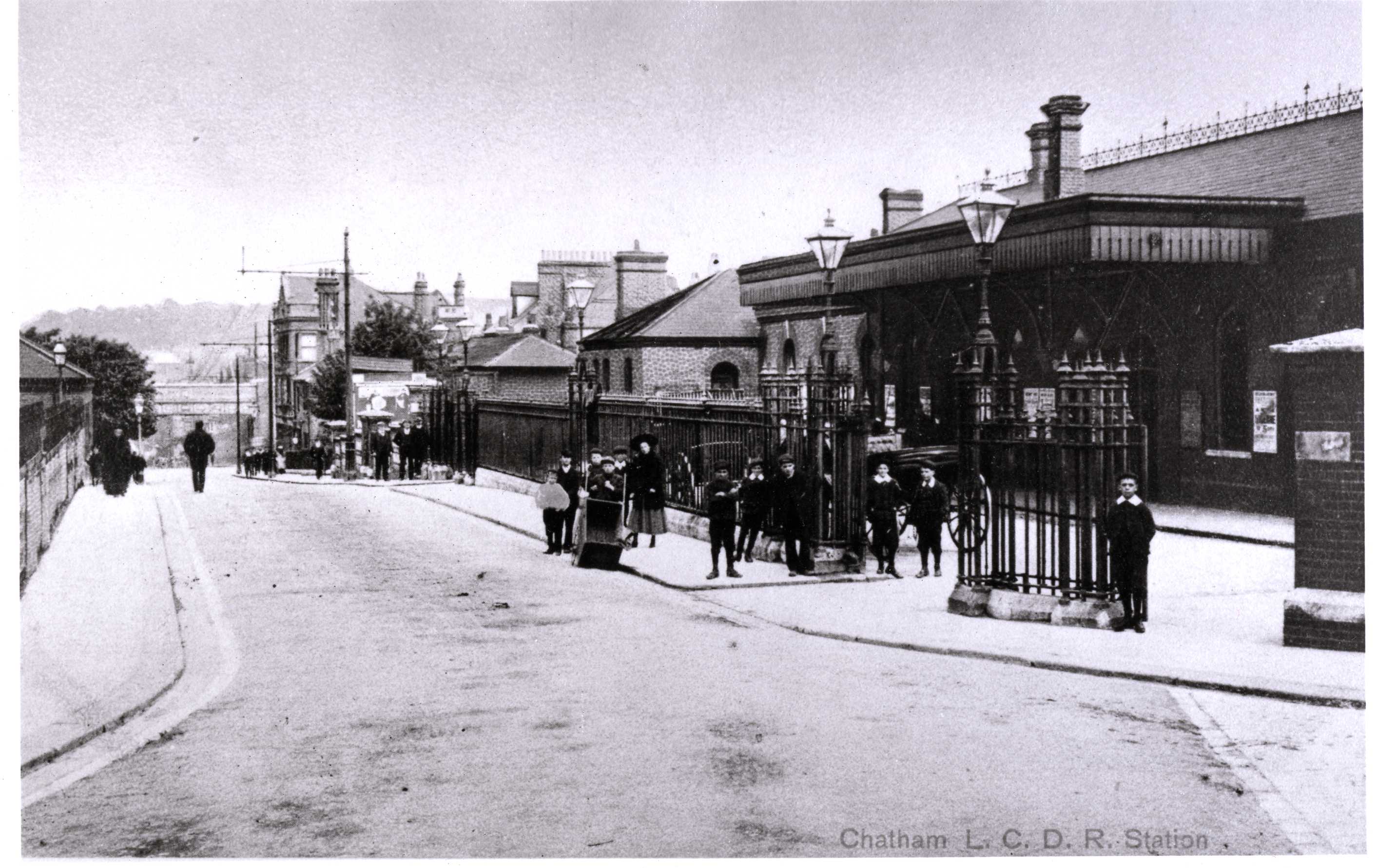
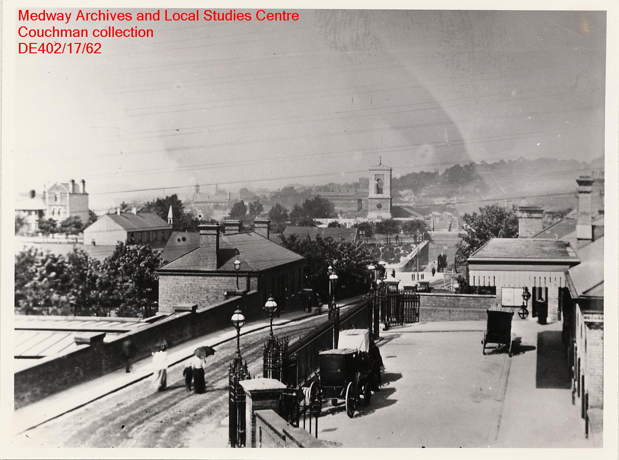
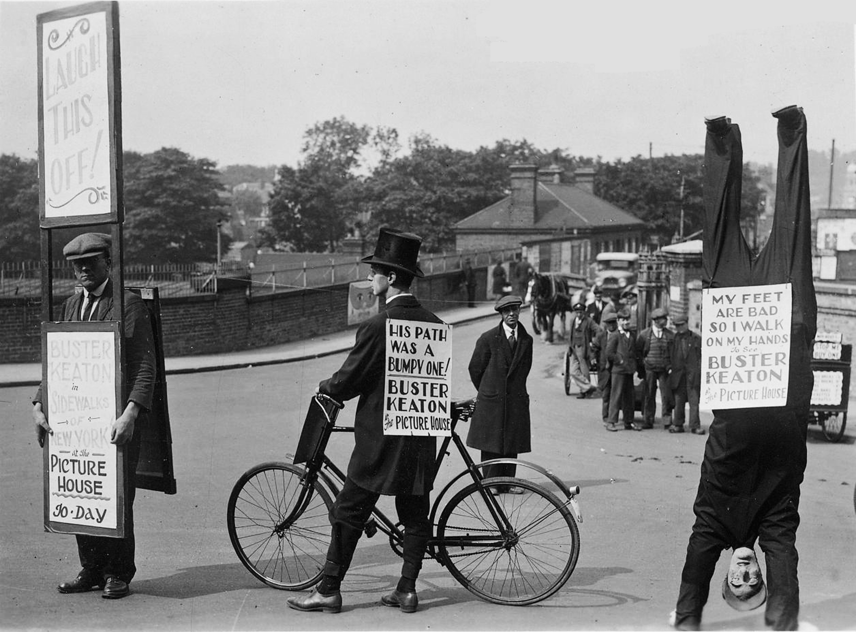
Chatham Railway Station 2015. Image: Christopher TippingChatham Railway Station 1910. Historic Image: by kind permission of Medway Archives and Local Studies CentreChatham Railway Station – Date unknown. Historic Image: Copyright of and by kind permission of Medway Archives and Local Studies Centre – Couchman CollectionChatham Railway Station – Date unknown. Image: Copyright and by kind permission of Medway Archives and Local Studies Centre – Couchman Collection.
Many draft proposals and developments of conceptual and contextually based responses to the site were developed and considered. The final detailed designs for public art interventions were presented to Medway Council and their partners Network Rail in January 2018. This work dovetails with works already carried out and continues themes and material choices and finishes established at the outset of the scheme.
The following images highlight the proposals we put forward at the beginning of 2018.
Creative Public Realm proposals for Chatham Railway Station – Page 1. Lead Artist: Christopher Tipping
Creative Public Realm proposals for Chatham Railway Station – Page 2. Lead Artist: Christopher Tipping
Creative Public Realm proposals for Chatham Railway Station – Page 3. Lead Artist: Christopher Tipping
Creative Public Realm proposals for Chatham Railway Station – Page 4. Lead Artist: Christopher Tipping
Creative Public Realm proposals for Chatham Railway Station – Page 5. Lead Artist: Christopher Tipping
Creative Public Realm proposals for Chatham Railway Station – Page 6. Lead Artist: Christopher Tipping
Creative Public Realm proposals for Chatham Railway Station – Page 7. Lead Artist: Christopher Tipping
Creative Public Realm proposals for Chatham Railway Station – Page 8. Lead Artist: Christopher Tipping
Creative Public Realm proposals for Chatham Railway Station – Page 9. Lead Artist: Christopher Tipping
Creative Public Realm proposals for Chatham Railway Station – Page 10. Lead Artist: Christopher Tipping
Creative Public Realm proposals for Chatham Railway Station – Page 11. Lead Artist: Christopher Tipping
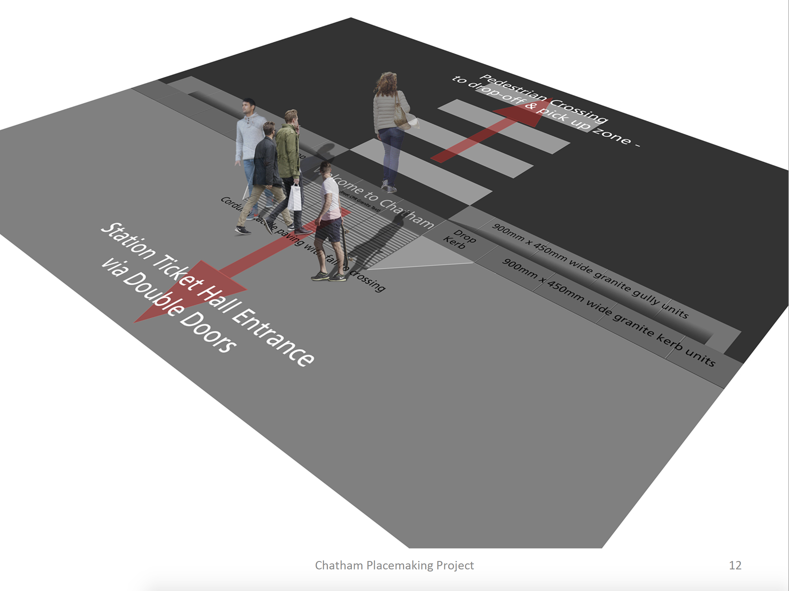
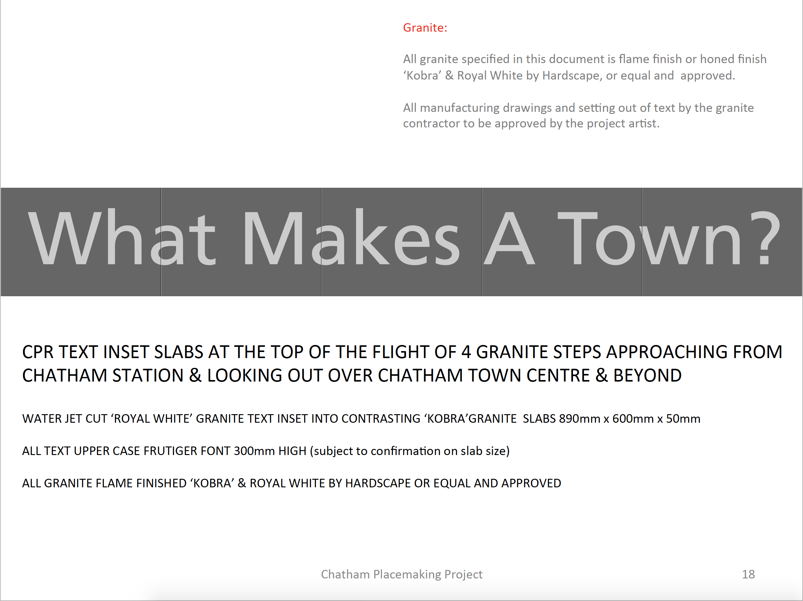
Creative Public Realm proposals for Chatham Railway Station – Page 12. Lead Artist: Christopher Tipping
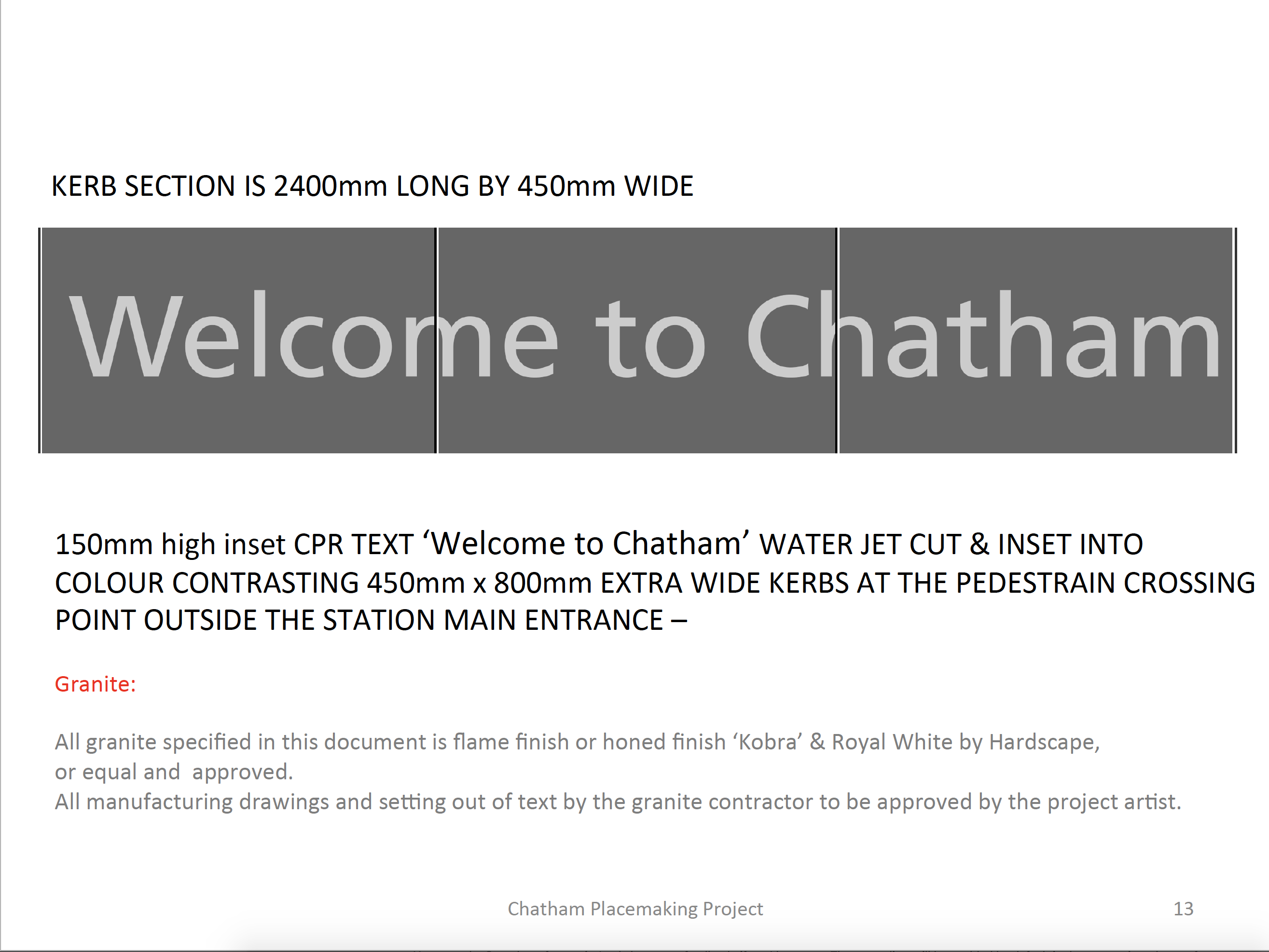
Creative Public Realm proposals for Chatham Railway Station – Page 13. Lead Artist: Christopher Tipping
Creative Public Realm proposals for Chatham Railway Station – Page 14. Lead Artist: Christopher Tipping
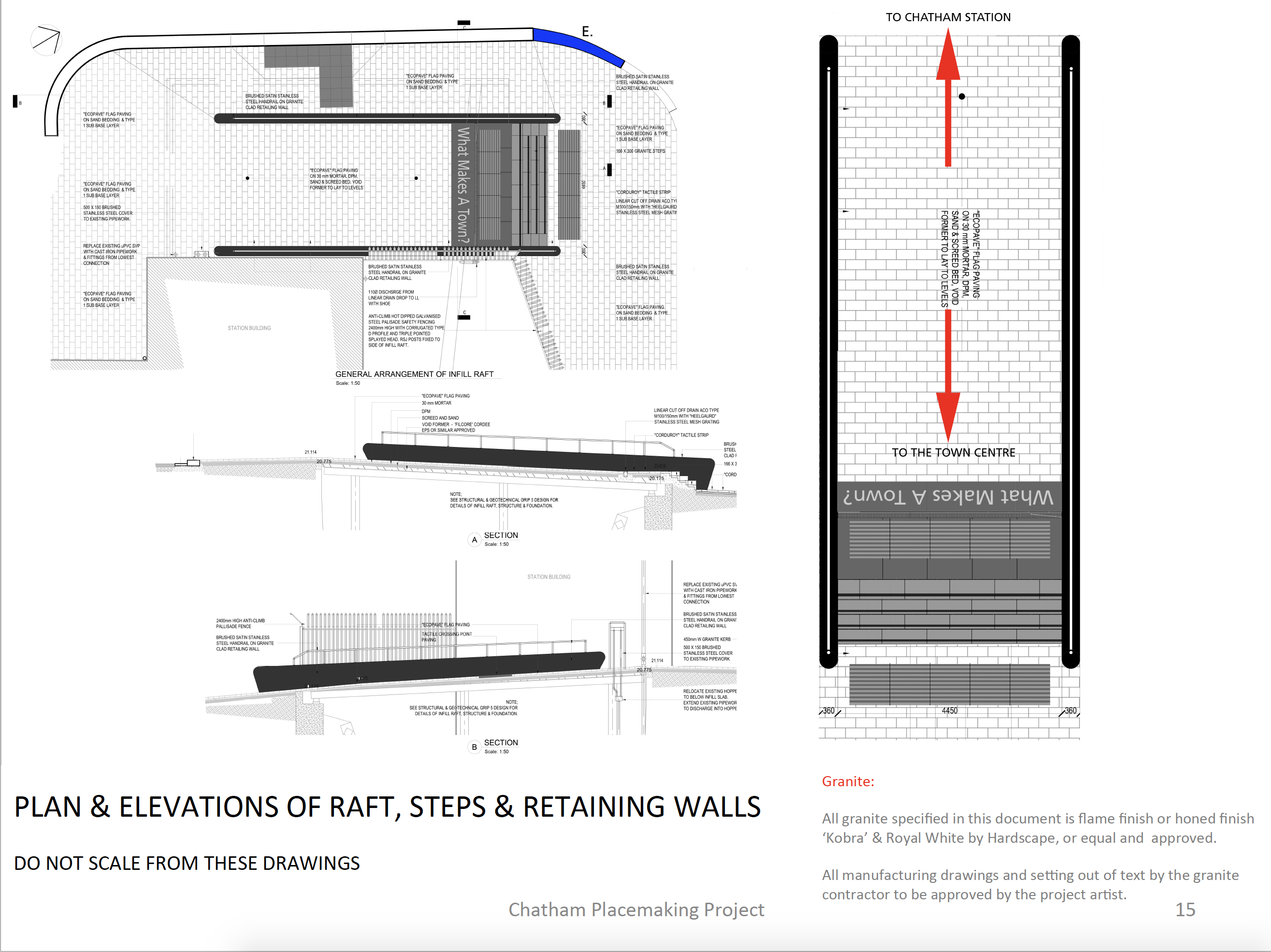
Creative Public Realm proposals for Chatham Railway Station – Page 15. Lead Artist: Christopher Tipping
Creative Public Realm proposals for Chatham Railway Station – Page 16. Lead Artist: Christopher Tipping
Creative Public Realm proposals for Chatham Railway Station – Page 17. Lead Artist: Christopher Tipping
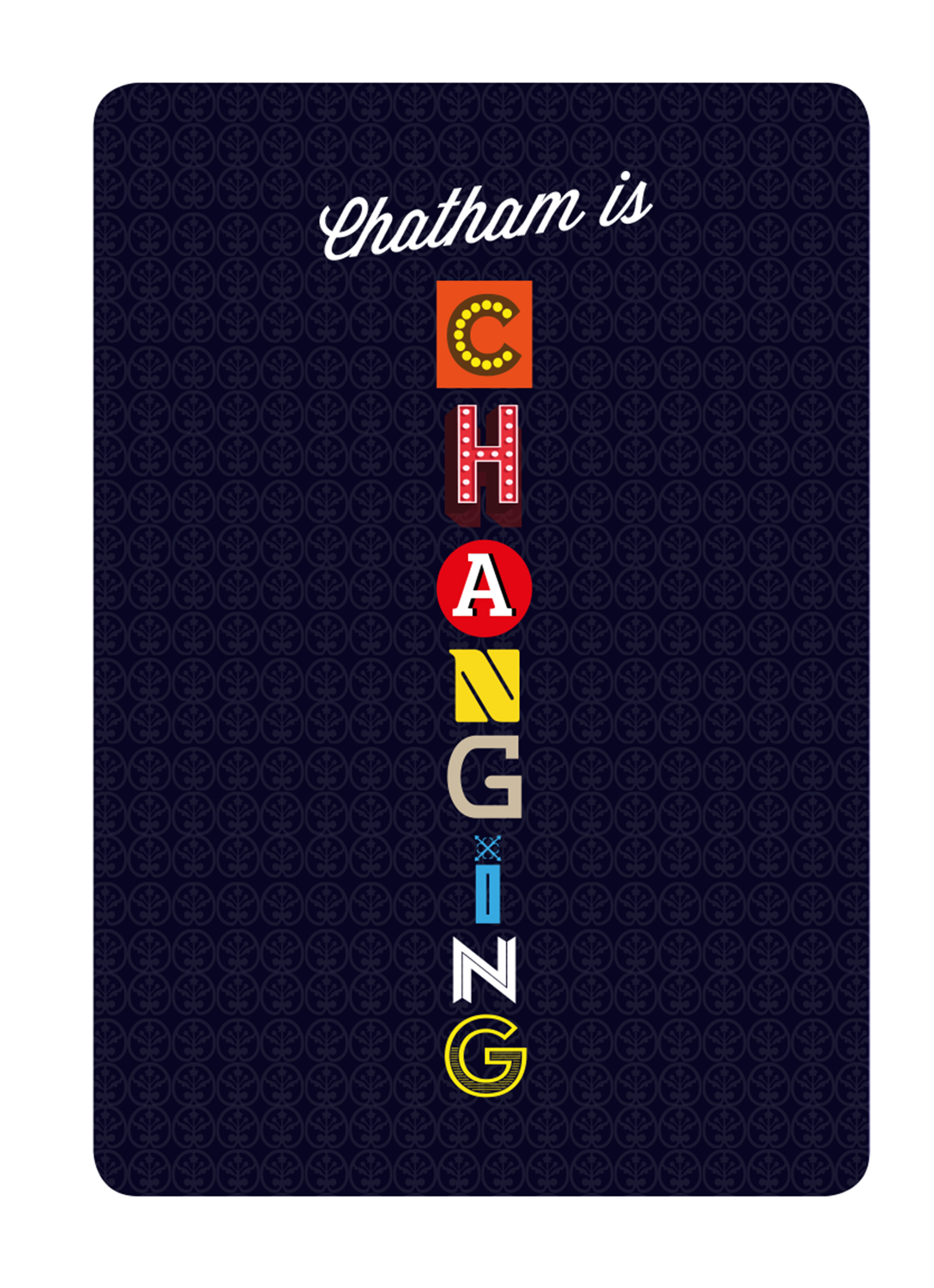
Creative Public Realm proposals for Chatham Railway Station – Page 18. Lead Artist: Christopher TippingTHESE ARE OUR STREETS for the Chatham Placemaking Project. Image & Artwork: Simon Williams. Lead Artist: Christopher Tipping
Draft Magazine – Playing Card Graphics by Paul Baker with text by Rob Young. THESE ARE OUR STREETS. Image: Christopher Tipping.
THESE ARE OUR STREETSPart Three…! We have always planned to create a magazine or booklet…some form of printed publication or other, with which to celebrate and record our progress, our ideas, the stuff that got away…but mostly our collaboration with each other and with the people along our route. We may still be able to deliver this a a hard-copy paper publication at some point in the future, as a way or marking the project – or as an online event.
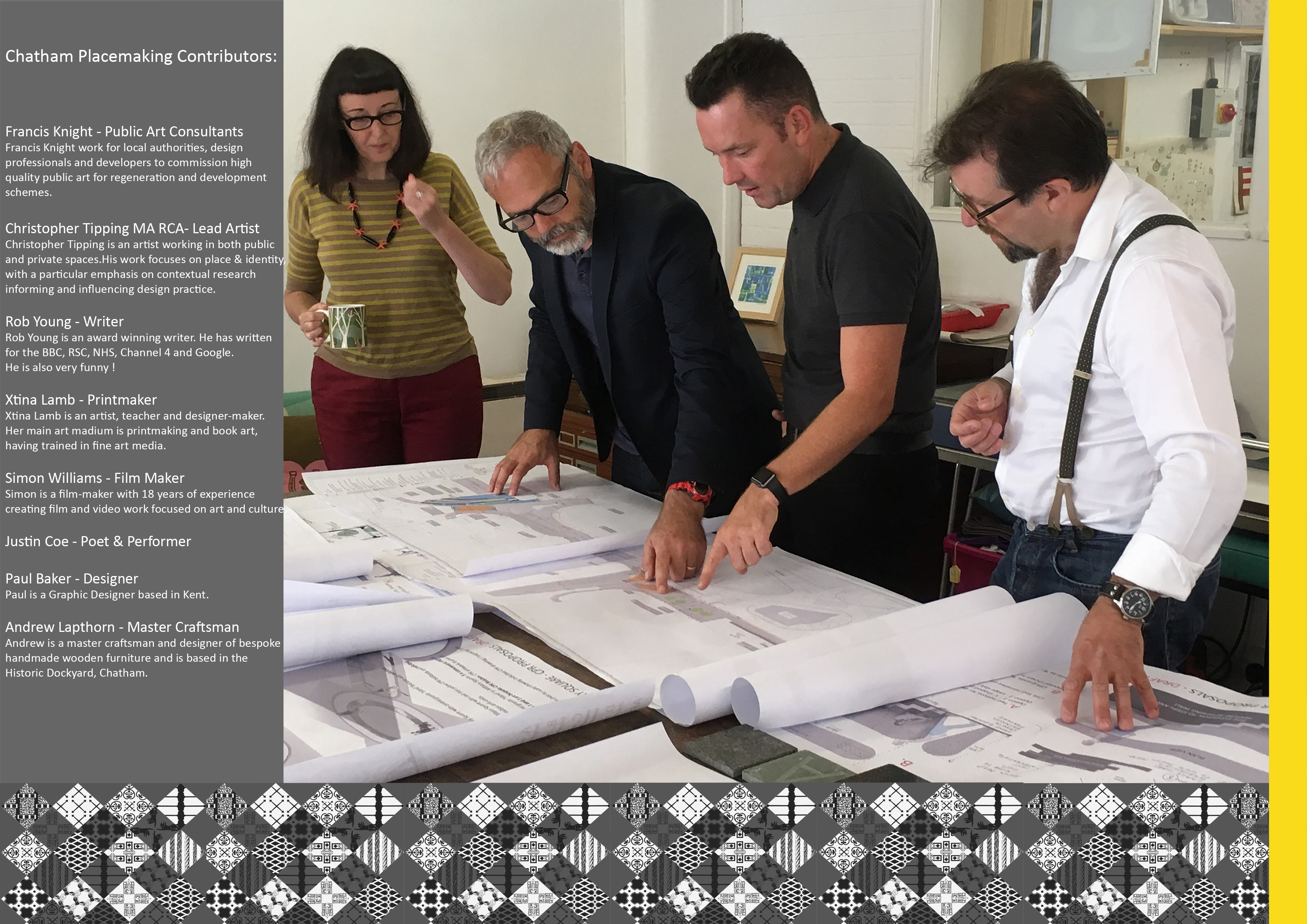
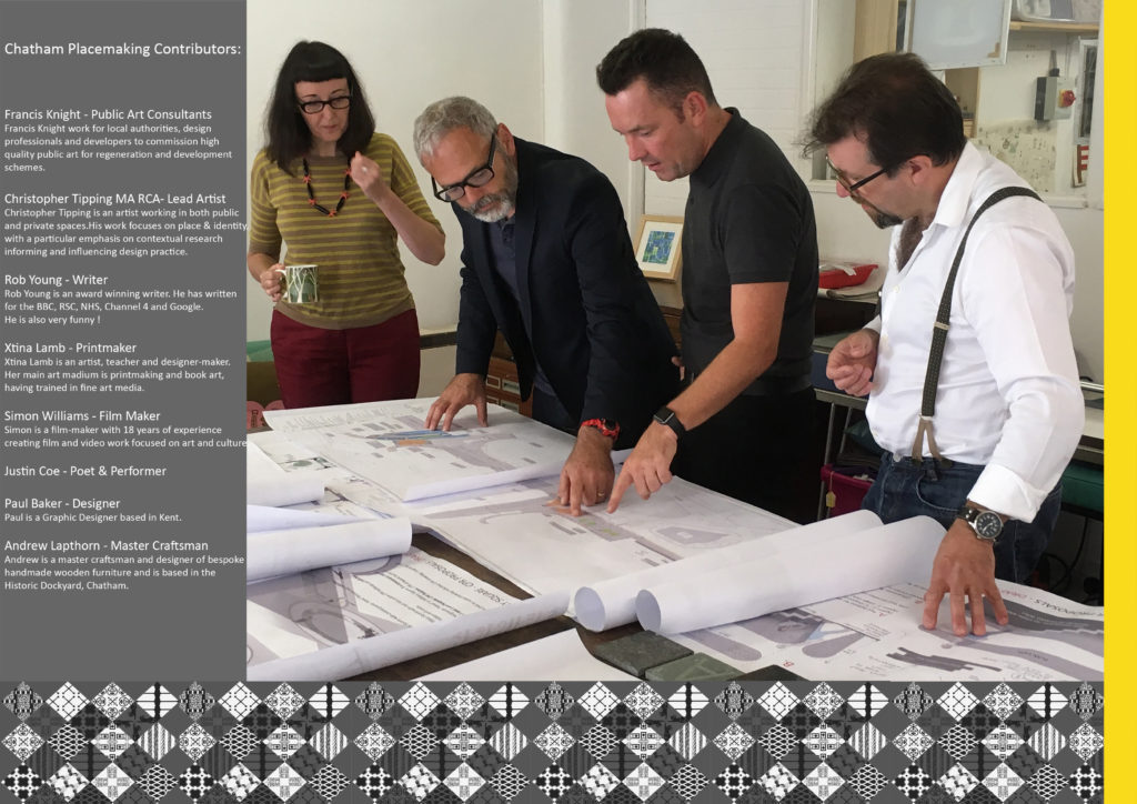
The following images will show you part of our journey to create the draft and concepts for the work you can now see embedded into the pavements of Railway Street and Military Square. The content has been generated in collaboration with other artists and creatives, commissioned to deliver specific aspects of our work, but who directly and indirectly contributed so brilliantly to the outcome. FrancisKnight Public Art Consultants, Rob Young– Writer, Xtina Lamb– Printmaker, Simon Williams– Filmmaker & Paul Baker – Graphic Designer.
Draft Magazine – Pages 34 & 35 FINAL : THESE ARE OUR STREETS. Image: Christopher Tipping. Group Photograph by FrancisKnight. Chatham Patterns by Xtina Lamb
Above Image: From left to right – Xtina Lamb, Christopher Tipping, Simon Williams, Rob Young at a project meeting in Rochester with FrancisKnight, September 2016
Draft Magazine – Playing Card Graphics by Paul Baker with text by Rob Young. THESE ARE OUR STREETS. Image: Christopher Tipping.Draft Magazine – Playing Card Graphics by Paul Baker with text by Rob Young. THESE ARE OUR STREETS. Image: Christopher Tipping.
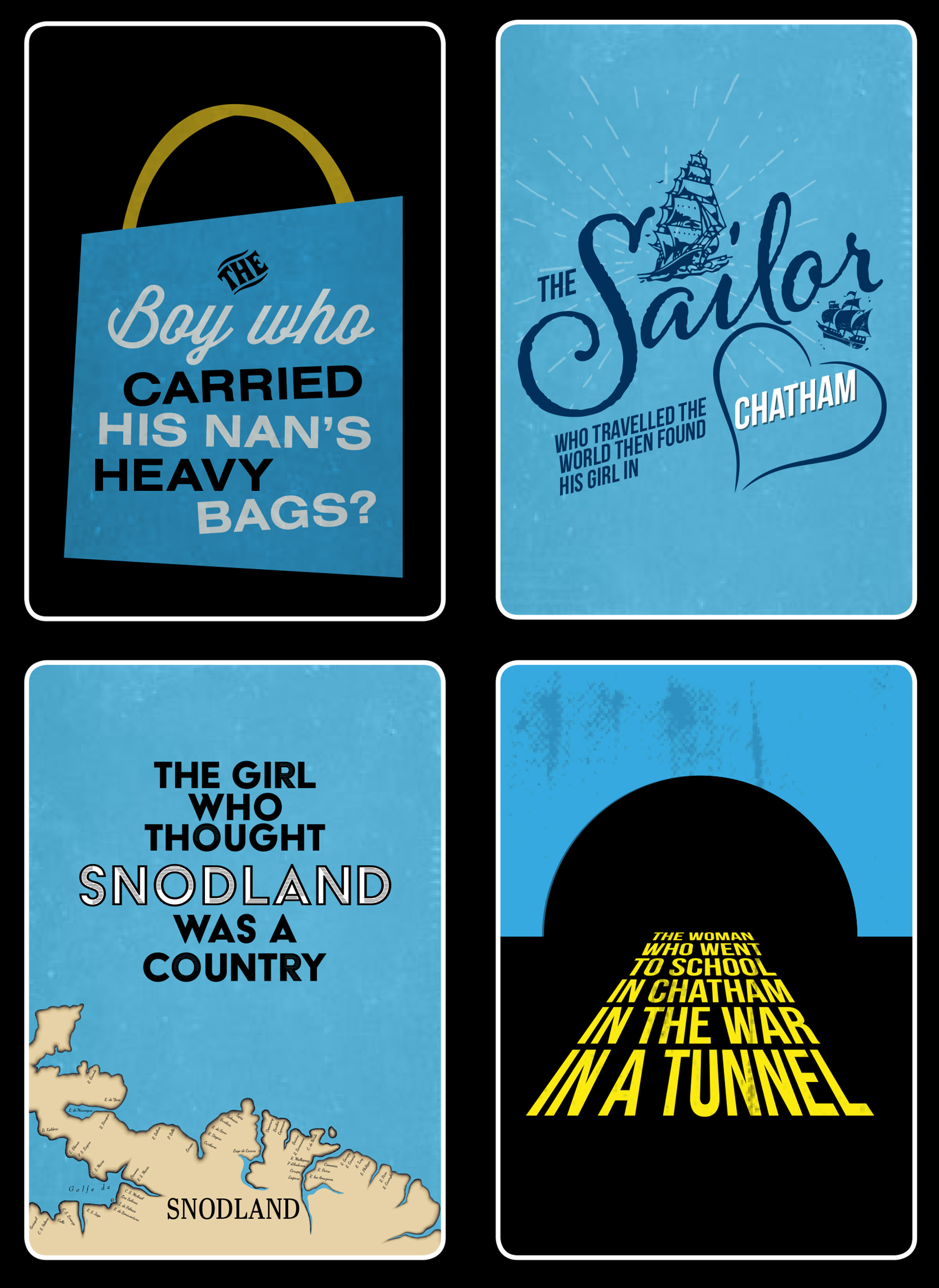
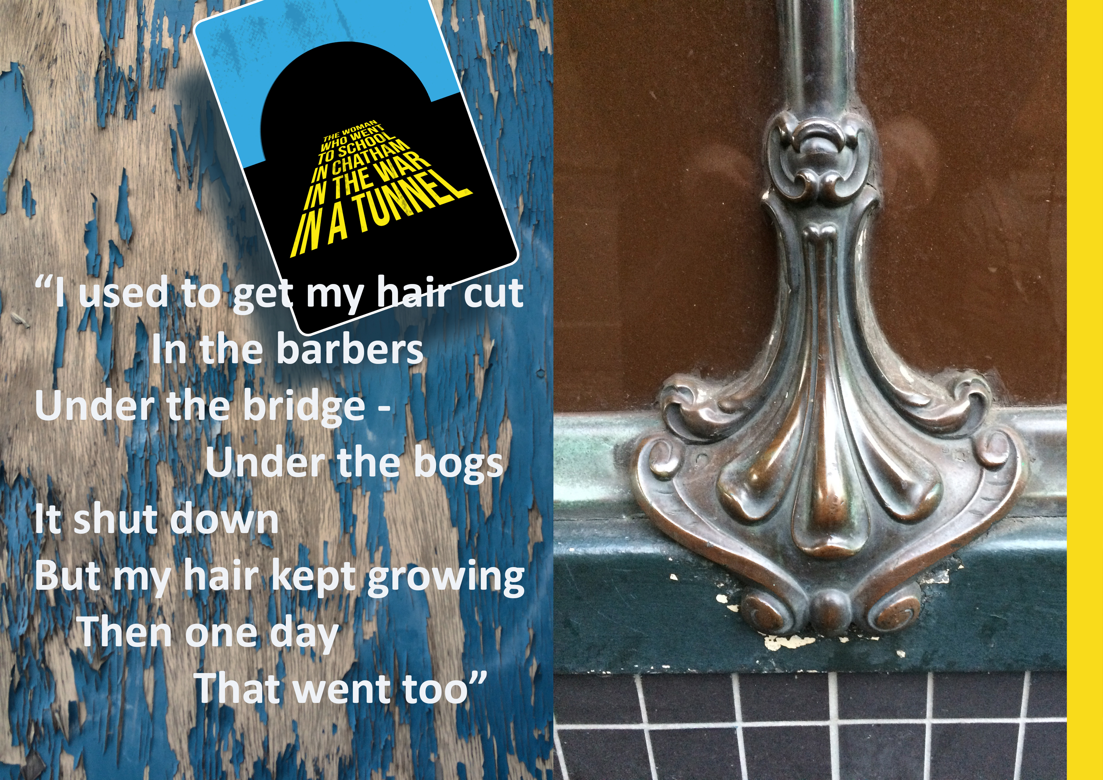
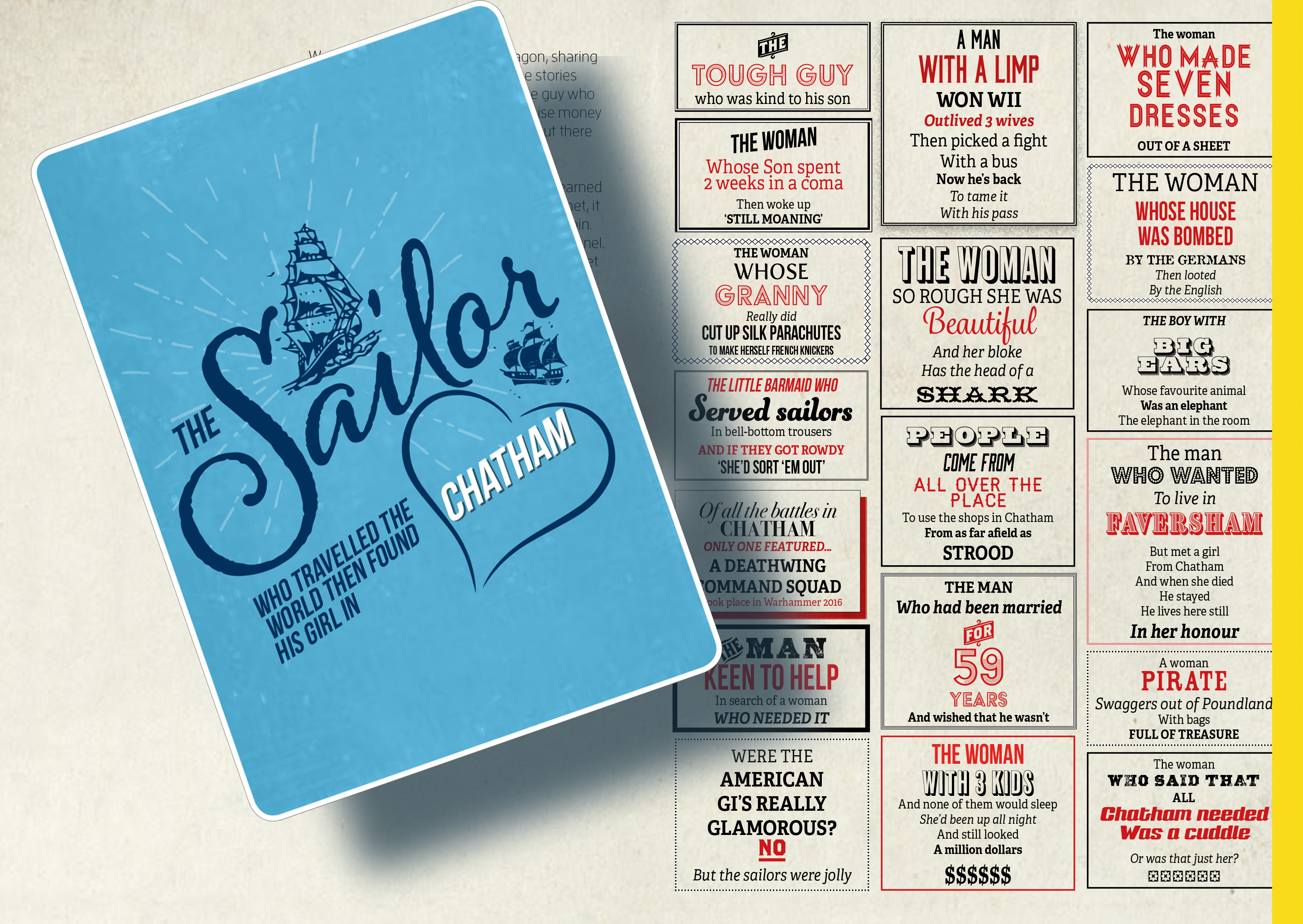
Graphic Designer Paul Baker with writer Rob Young devised these Playing Cards posters carrying anecdotal, conversational or overheard words on the streets of Chatham
Draft Magazine – Colour Key Page Icons. THESE ARE OUR STREETS. Image: Christopher Tipping.
Draft Magazine – Colour Key Page Icons. THESE ARE OUR STREETS. Image: Christopher Tipping.
Draft Magazine – Pages 24 & 25 V1 : THESE ARE OUR STREETS. Image: Christopher Tipping.Draft Magazine – Colour Key Page Icons. THESE ARE OUR STREETS. Image: Christopher Tipping.
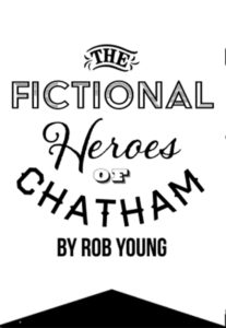
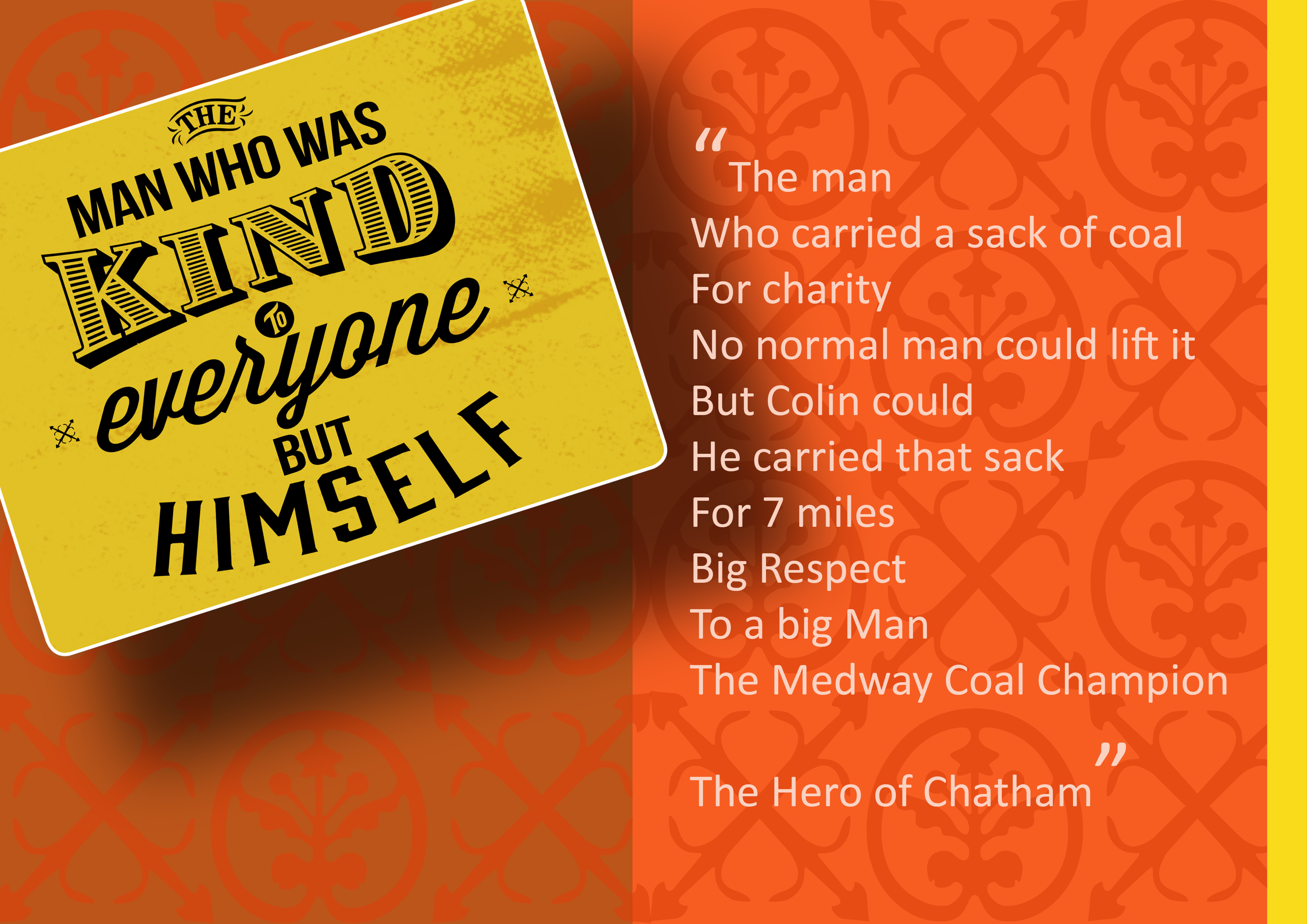
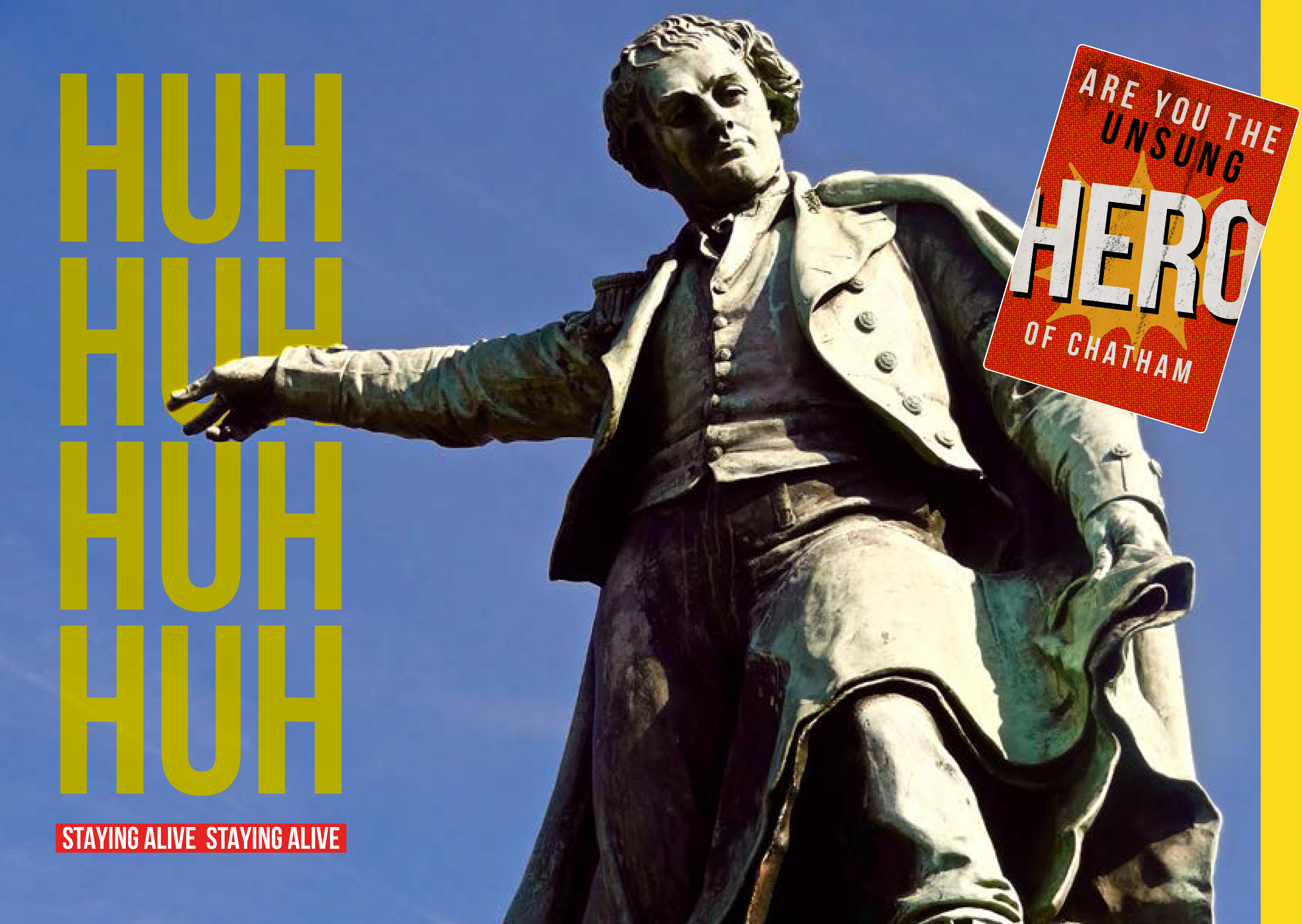
Fictional Heroes of Chatham are a series of fictional stories about Chatham’s past by our project writer Rob Young developed in response to time spent walking and talking on the streets of Chatham.
The fictional story below is about a Chatham Hero, Davey Pitt, who worked on the New Cut Viaduct
Draft Magazine – Pages 26 & 27 V1 : THESE ARE OUR STREETS. Image: Christopher Tipping.
Draft Magazine – Pages 28 & 29 V1 : THESE ARE OUR STREETS. Image: Christopher Tipping.
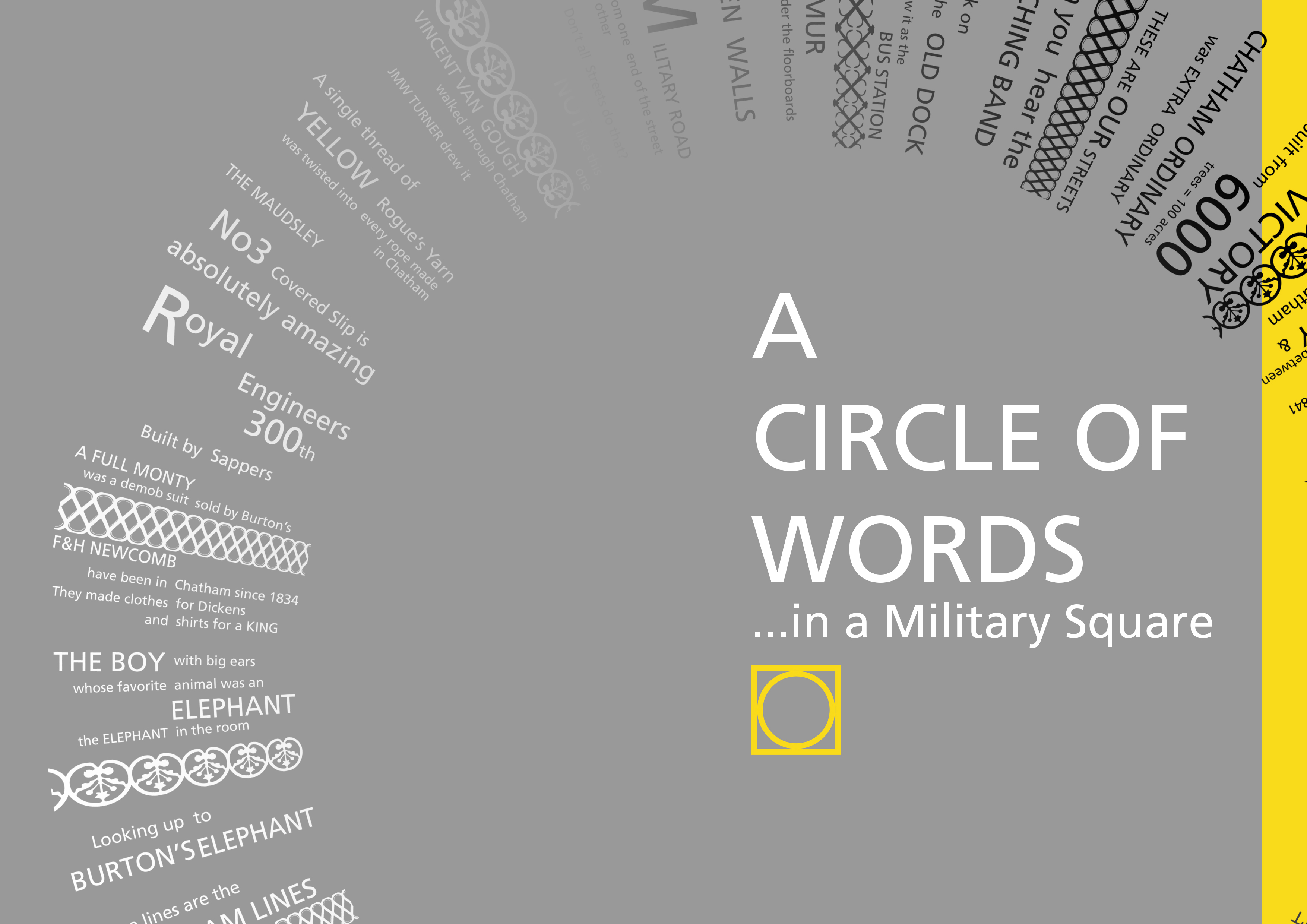
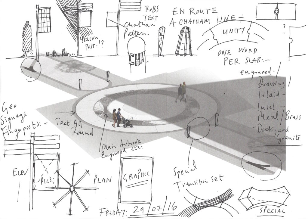
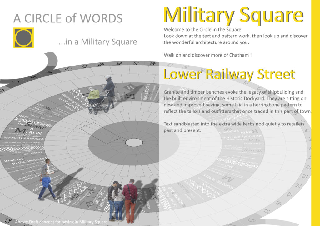
A CIRCLE OF WORDS IN A MILITARY SQUARE
Draft Magazine – Pages 24 & 25 V1A : THESE ARE OUR STREETS. Image: Christopher Tipping.
Draft Magazine – Pages 24 & 25 V3 : THESE ARE OUR STREETS. Image: Christopher Tipping.
Draft Magazine – Pages 30 & 31 V1 : THESE ARE OUR STREETS. Image: Christopher Tipping. Archive Photograph by kind permission of MALSC
Draft Magazine – Pages 30 & 31 V1 : THESE ARE OUR STREETS. Image: Christopher Tipping. Artwork & Text by Rob YoungDraft Magazine – Pages 34 & 35 FINAL : THESE ARE OUR STREETS. Image: Christopher Tipping. Group Photograph by FrancisKnight. Chatham Patterns by Xtina Lamb
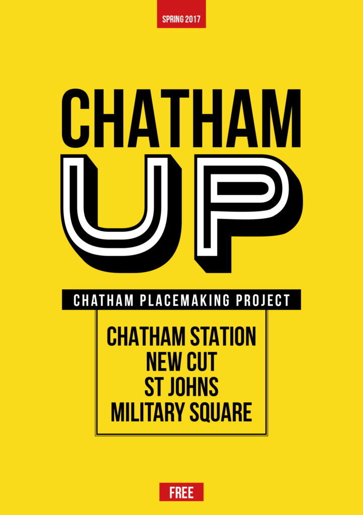
THESE ARE OUR STREETS Part Two…CHATHAM UP ! We have always planned to create a magazine or booklet…some form of printed publication or other, with which to celebrate and record our progress, our ideas, the stuff that got away…but mostly our collaboration with each other and with the people along our route. We may still be able to deliver this a a hard-copy paper publication at some point in the future, as a way or marking the project – or as an online event.
The following images will show you part of our journey to create the draft and concepts for the work you can now see embedded into the pavements of Railway Street and Military Square. The content has been generated in collaboration with other artists and creatives, commissioned to deliver specific aspects of our work, but who directly and indirectly contributed so brilliantly to the outcome. FrancisKnight Public Art Consultants, Rob Young– Writer, Xtina Lamb– Printmaker, Simon Williams– Filmmaker & Paul Baker – Graphic Designer.
Draft Magazine – Optional Cover: CHATHAM UP. Image: Christopher Tipping
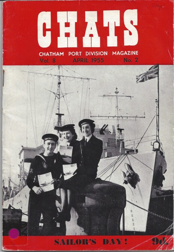
The yellow cover was the first logo and layout we created…the inspiration for this as well as the overall style and approach to the magazine concept came from looking at archive print magazines and periodicals at the Medway Archives and Local Studies Centre in Strood. We were drawn to copies of CHATS magazine – the Chatham Port Division Magazine from 1955.
The A5 size and very distinctive 1950’s advertising inside were just what we were looking for.
CHATS Magazine – The Chatham Port Division Magazine. Volume 8, April 1955 Volume . By Kind Permission of MALSC
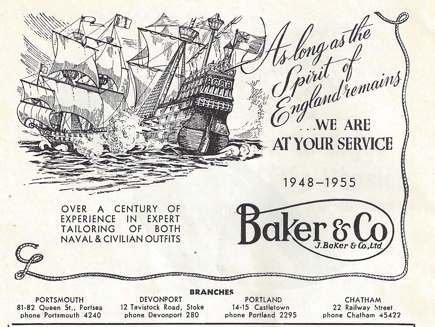
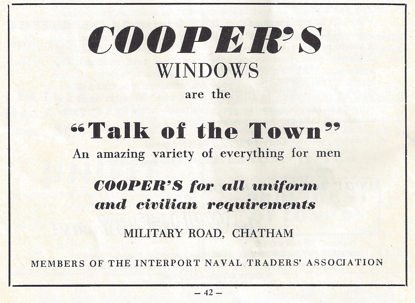
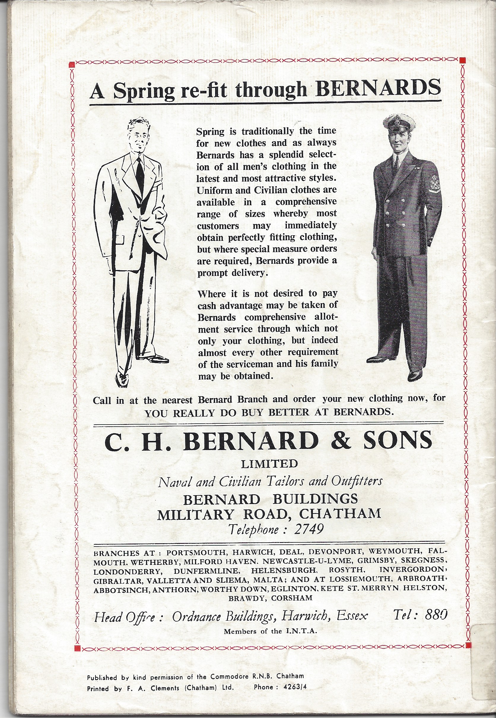
It can’t really be a surprise that such a massive military and naval presence in Chatham was serviced by local outfitters. What is interesting is that so many of these had businesses on Military Road and Railway Street. At the Medway Archives and Local Studies Centre, there is a collection of print magazines and periodicals. An amazing selection of adverts for military and civilian outfitters are contained within – almost all of them along our route of Railway Street and Military Road. I managed to find a copy to buy – Vol.8 April 1955 No. 2
Amongst some that I listed were –
“Over a century of experience in expert tailoring of both naval and civilian outfits”.
W.Cooper – ‘Cooperstyle’Regimental Blazers! 56 Military Road –
Gieves Ltd – 13 Military Road –
Unifit – 40 Military Road –
Baker & Co – 22 Railway Street – “As long as the Spirit of England Remains, we are at your service”.
A. Fleming & Co. Outfitters Ltd Contractors to the Admiralty– 15 Railway Street –
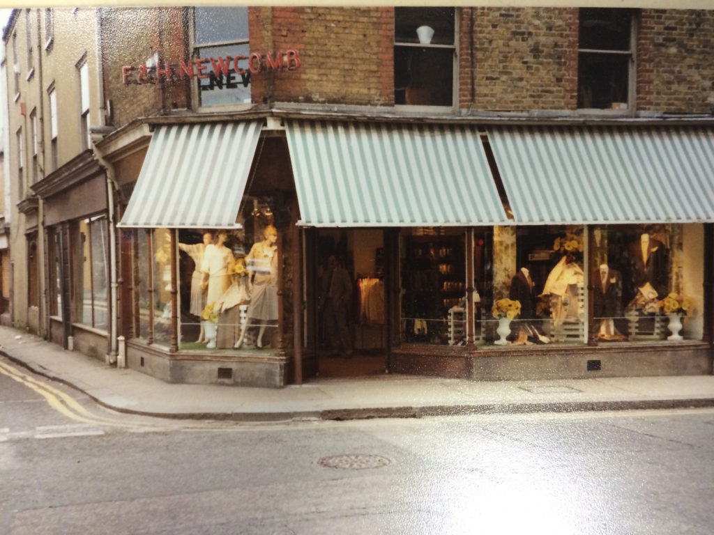
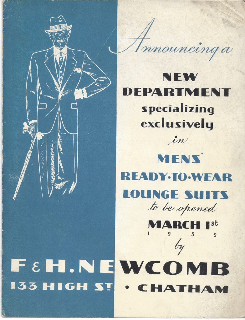
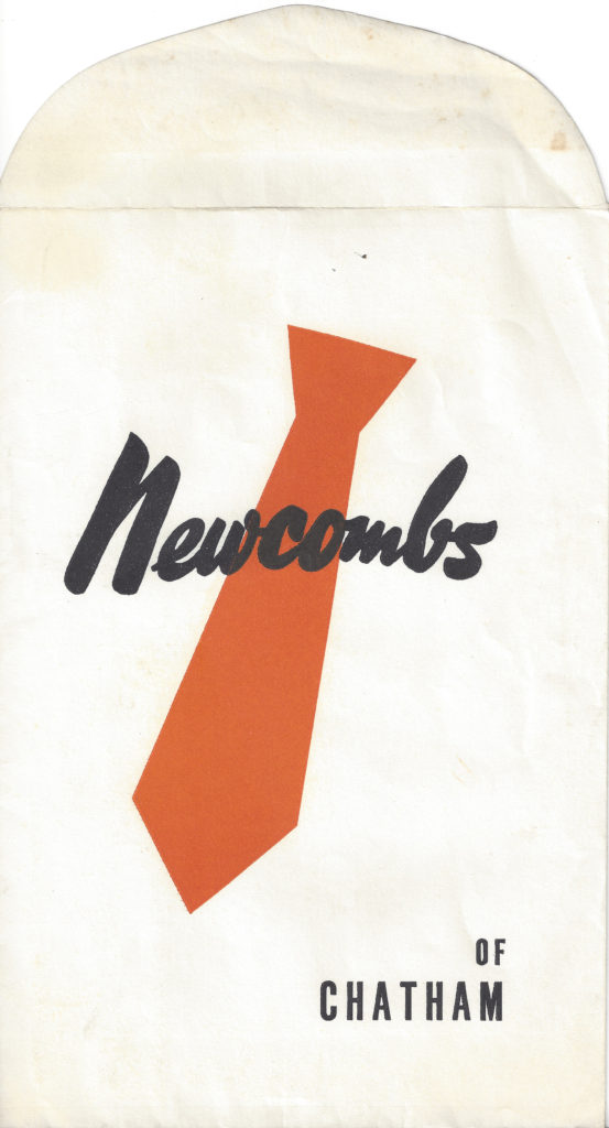
F & H Newcombe – Military, Naval and General Outfitters – Railway Street –
C.H Bernard & Sons – Bernard Buildings, Military Road
Military Outfitters, Baker & Co. 22 Railway Street, Chatham. CHATS Magazine. Collection of Christopher Tipping
Coopers Windows are the Talk of the Town. CHATS Magazine Vol 8 April 1955 No 2. Collection of Christopher Tipping
C.H Bernard & Sons Naval & Civilian Tailors and Outfitters. CHATS Magazine. Collection of Christopher Tipping
The other clear inspiration for me was the archive of Newcomb’s the tailors. They opened for business in 1854. After the original shop was demolished when the Sir John Hawkins flyover was built, the business moved along the High Street to the corner of Medway Street. Mr Gerald Newcomb is still trading as Penguins Dress Hire. Gerald is the 7th generation to run the firm and has himself been in the industry for 45 years.
‘The family has served the great and the good for almost 180 years. Figures such as Charles Dickens, Lord Kitchener, Lord Byron and Lord Tennyson have enjoyed the service we offer – our workrooms were a hive of activity as we created shirts for King Edward VII!’
This historic business fits into our Chatham Placemaking Project primarily because of its strong association with our route and the long association with style, craft and a strong sense of local community – Newcomb’s also had a Ladies Clothes Shop on Railway Street – the advertising for the business and associated images from their archives was inspirational.
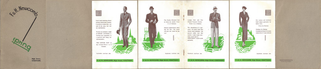
F & H Newcomb had premises on the corner of High Street and Globe Lane and Ladies Shop on Railway Street. Image: F & H Newcomb ArchiveF & H Newcomb Print Advertising. Image: By kind permission of Gerald Newcomb, F & H Newcomb Archive
F & H Newcomb. Associated Trade Print Advertising. Image: By kind permission of Gerald Newcomb, F & H Newcomb Archive
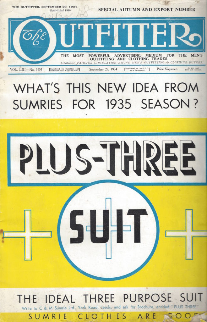
F & H Newcomb. Associated Trade Print Magazine September 1934. Image: By kind permission of Gerald Newcomb, F & H Newcomb Archive
F & H Newcomb. Associated Trade Print Advertising. Image: By kind permission of Gerald Newcomb, F & H Newcomb ArchiveF & H Newcomb. Associated Trade Print Advertising. Image: By kind permission of Gerald Newcomb, F & H Newcomb Archive
…and so, back to our Magazine Pages…
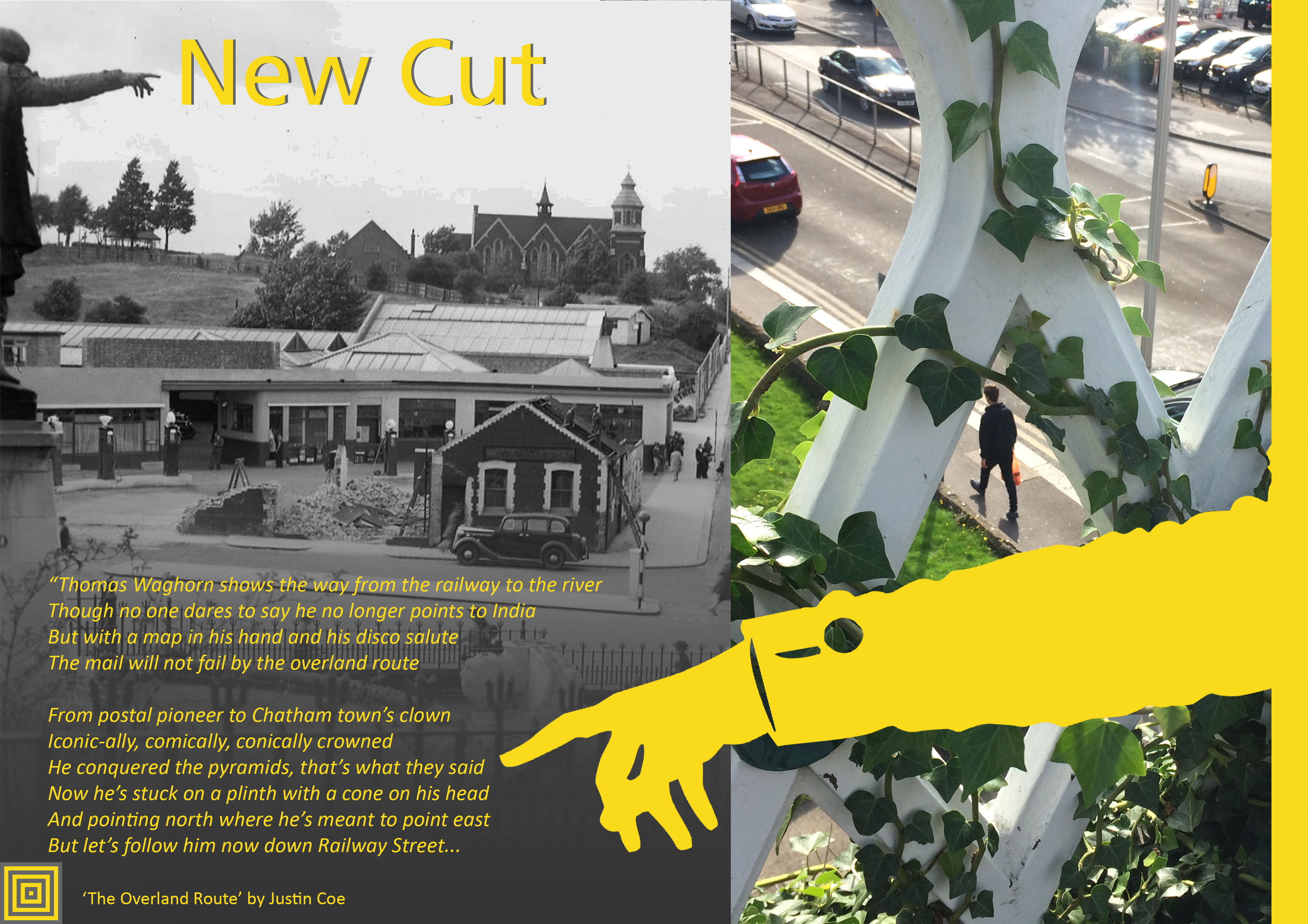
Draft Magazine – Pages 14 & 15 V1 : THESE ARE OUR STREETS. Image: Christopher Tipping.
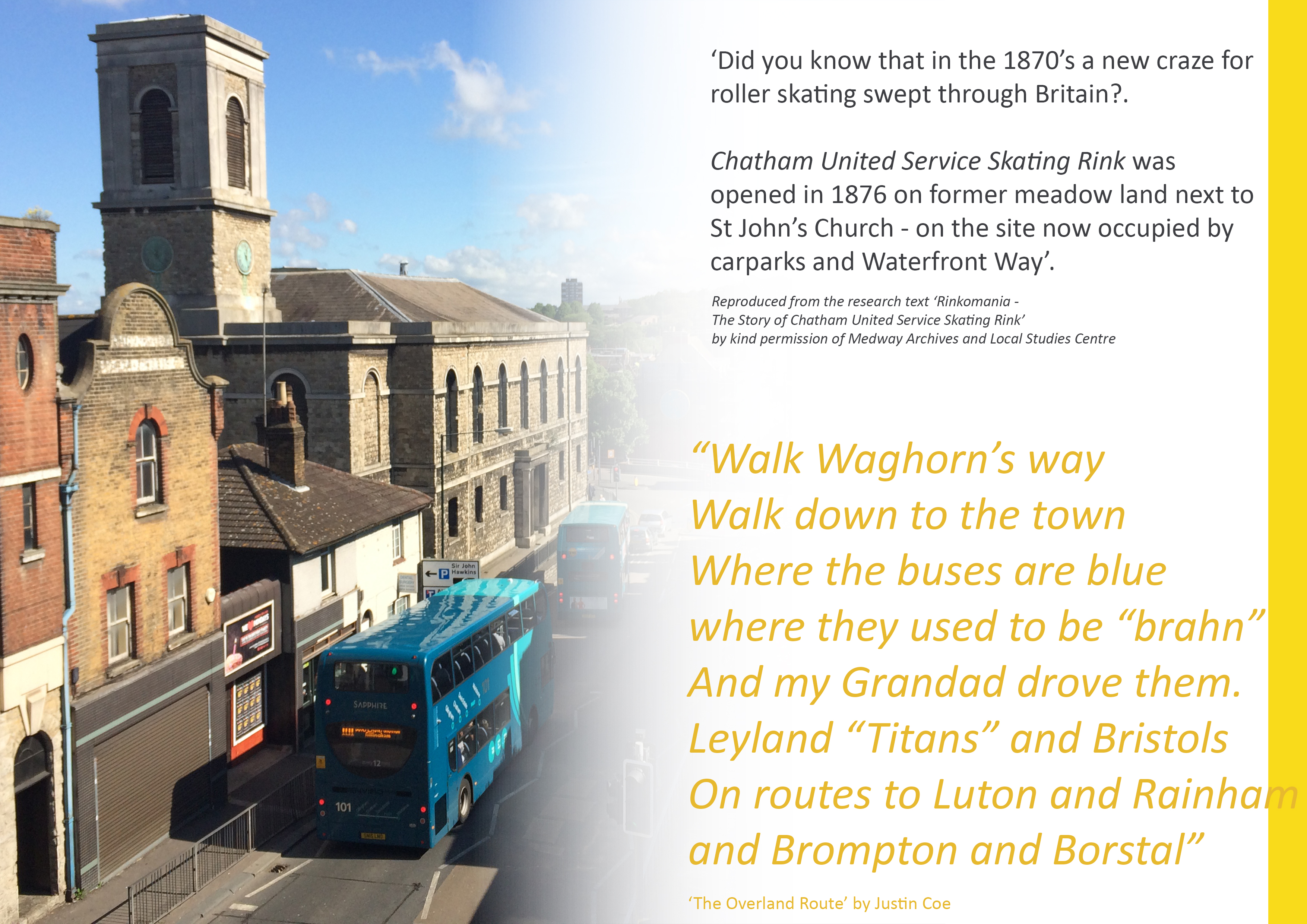
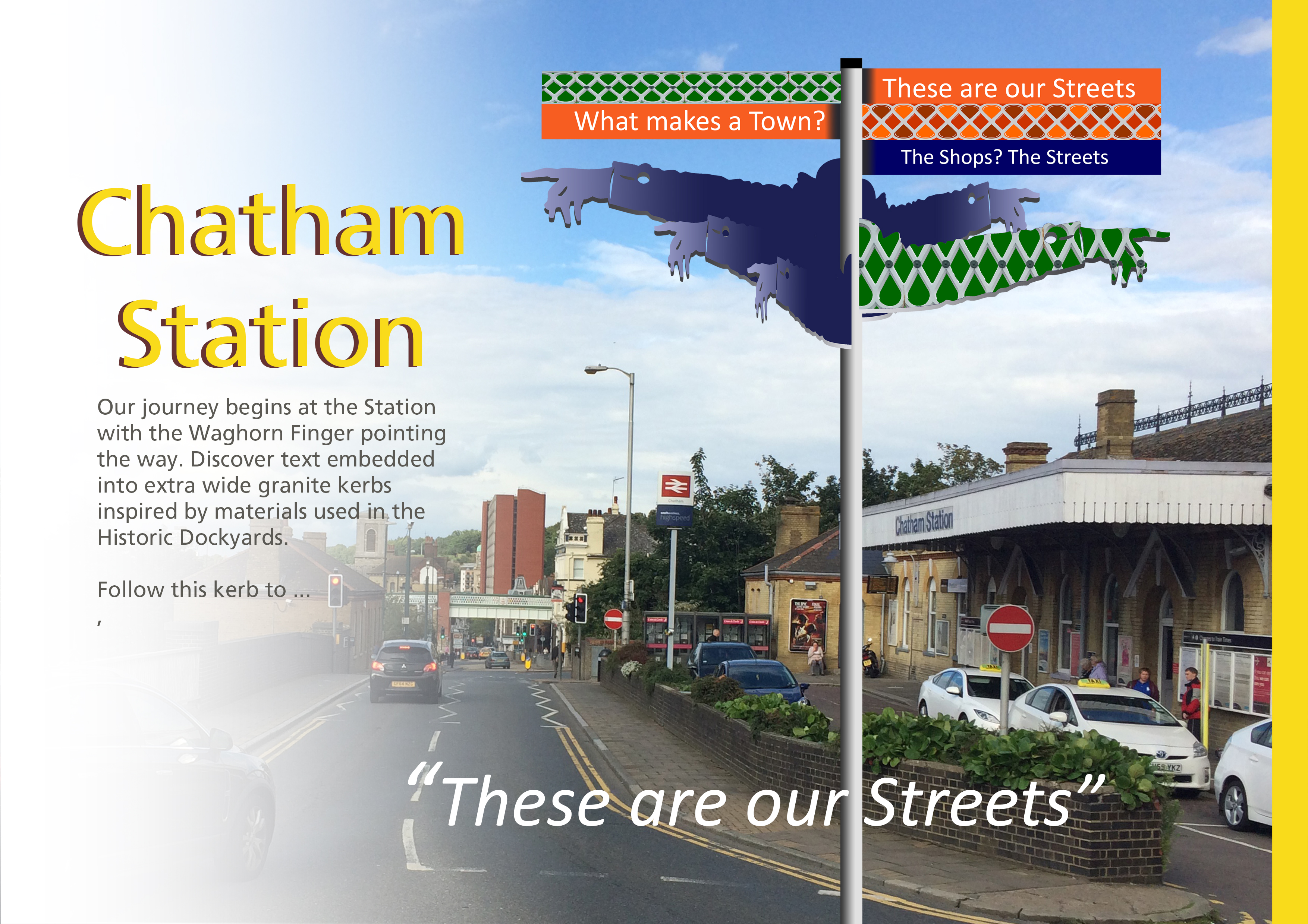
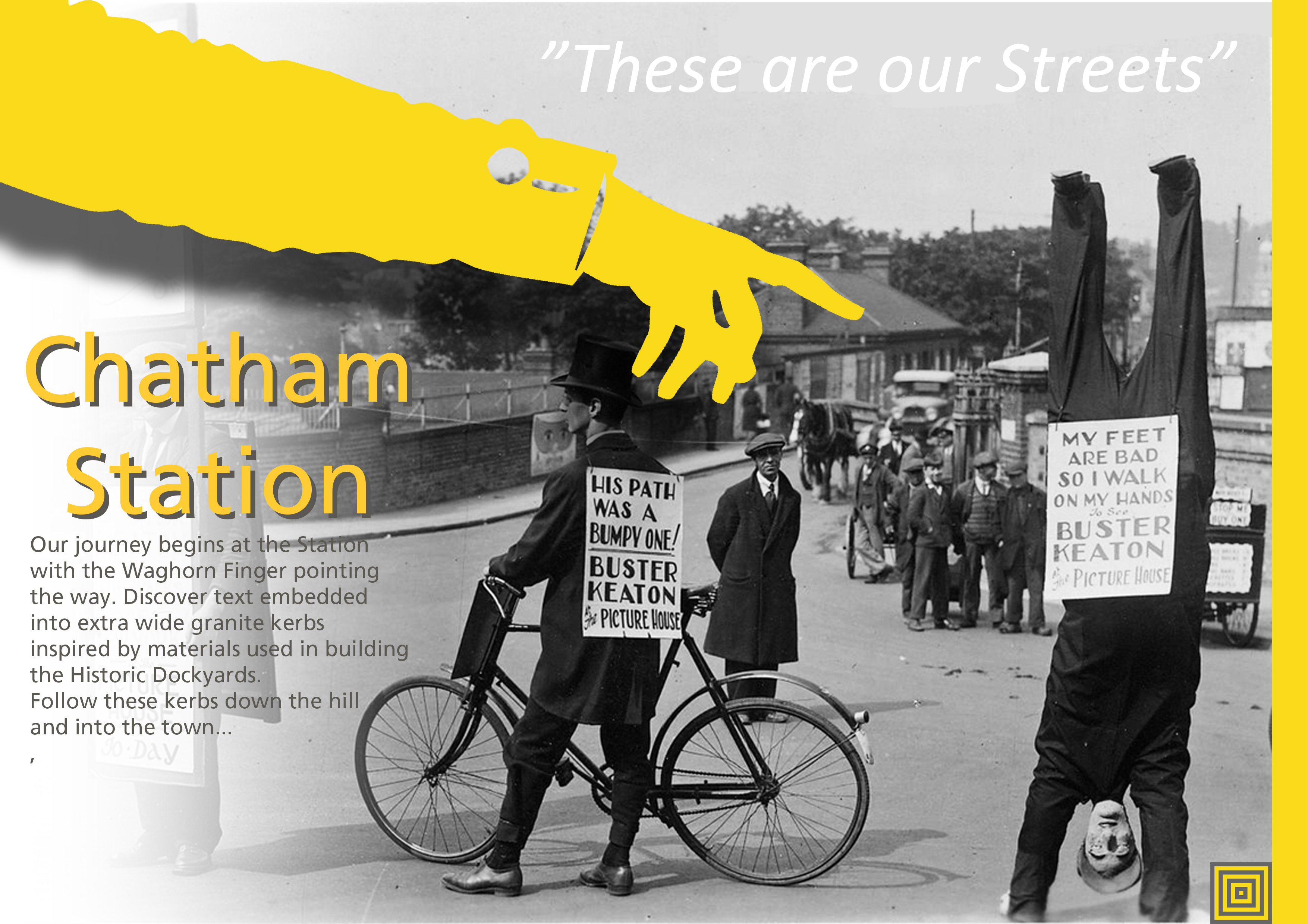
We love Thomas Waghorn…we also appointed a performance Poet, Justin Coe, to come up with a suitably witty and succinct take on our journey down Railway Street to the River, which he performed in the street in a lively film by Simon Williams. Click here for a link to the film. “The Overland Route c/o Thomas Waghorn’.
Draft Magazine – Page 15 Option V1 : THESE ARE OUR STREETS. Image: Christopher Tipping.
Draft Magazine – Page 15 Option V2 : THESE ARE OUR STREETS. Image: Christopher Tipping.
Draft Magazine – Pages 16 & 17 V1 : THESE ARE OUR STREETS. Image: Christopher Tipping.
Draft Magazine – Pages 18 & 19 V1 : THESE ARE OUR STREETS. Image: Christopher Tipping. Archive Image: Lady in Fur Coat on Military Road by Kind Permission of MALSC
Draft Magazine – Pages 20 & 21 V1 : THESE ARE OUR STREETS. Image: Christopher Tipping.
Draft Magazine – Pages 22 & 23 V1 : THESE ARE OUR STREETS. Image: Christopher Tipping.
Draft Magazine – Cover: THESE ARE OUR STREETS. Image: Christopher Tipping
We have always planned to create a magazine or booklet…some form of printed publication or other, with which to celebrate and record our progress, our ideas, the stuff that got away…but mostly our collaboration with each other and with the people along our route. We may still be able to deliver this a a hard-copy paper publication at some point in the future, as a way or marking the project – or as an online event.
The following images will take you with us on part of our journey to create the draft and concepts for the work you can now see embedded into the pavements of Railway Street and Military Square. The content has been generated in collaboration with other artists and creatives, commissioned to deliver specific aspects of our work, but who directly and indirectly contributed so brilliantly to the outcome. FrancisKnight Public Art Consultants, Rob Young– Writer, Xtina Lamb– Printmaker, Simon Williams– Filmmaker & Paul Baker – Graphic Designer.
There were many versions of these pages made, as we decided how best to represent what had been done. Here are just a few…
Draft Magazine – Page 1: THESE ARE OUR STREETS. Image: Christopher Tipping
“I’m not from Chatham, I’m just visiting…I come here a lot – Every Day !”.
The voices represented here are everyday voices of people in Chatham. Writer Rob Young sent time talking to small businesses and the people who worked in them along our route. He is a good listener with an exceptional ear for a ‘one liner’; a swagger, a forgotten hero, a heartfelt sentiment softly spoken. These overheard or anecdotal lines have been captured in stone set into the paving. Not all could be used. Many are reproduced here for the first time.
Draft Magazine – Pages 2 & 3: THESE ARE OUR STREETS. Image: Christopher Tipping
This was a draft layout for the information page – a bit of what we were planning. It is quire ambitious, but we actually achieved an enormous amount.
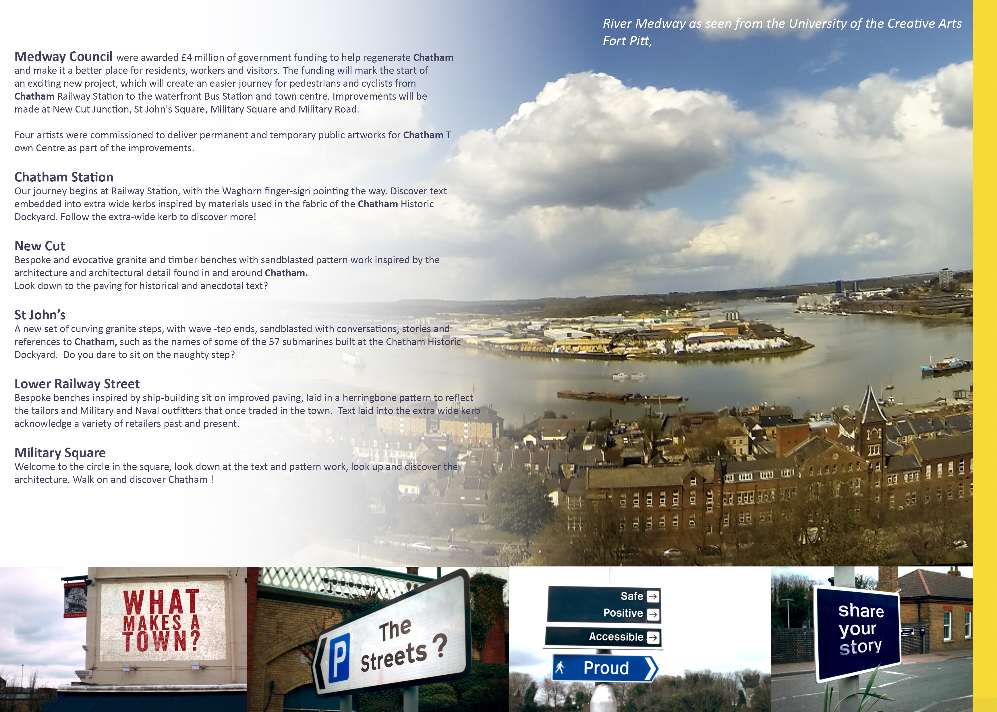
Draft Magazine – Pages 4 & 5: THESE ARE OUR STREETS. Image: Christopher Tipping
The fantastic panorama of the River Medway was taken by Filmmaker Simon Williams from the roof terrace of Fort Pitt, now the UCA RochesterCampus. The mock-up street signs were the outcome of a collaboration between Rob Young, Simon Williams and myself.
Draft Magazine – Pages 6 & 7: THESE ARE OUR STREETS. Image: Christopher Tipping
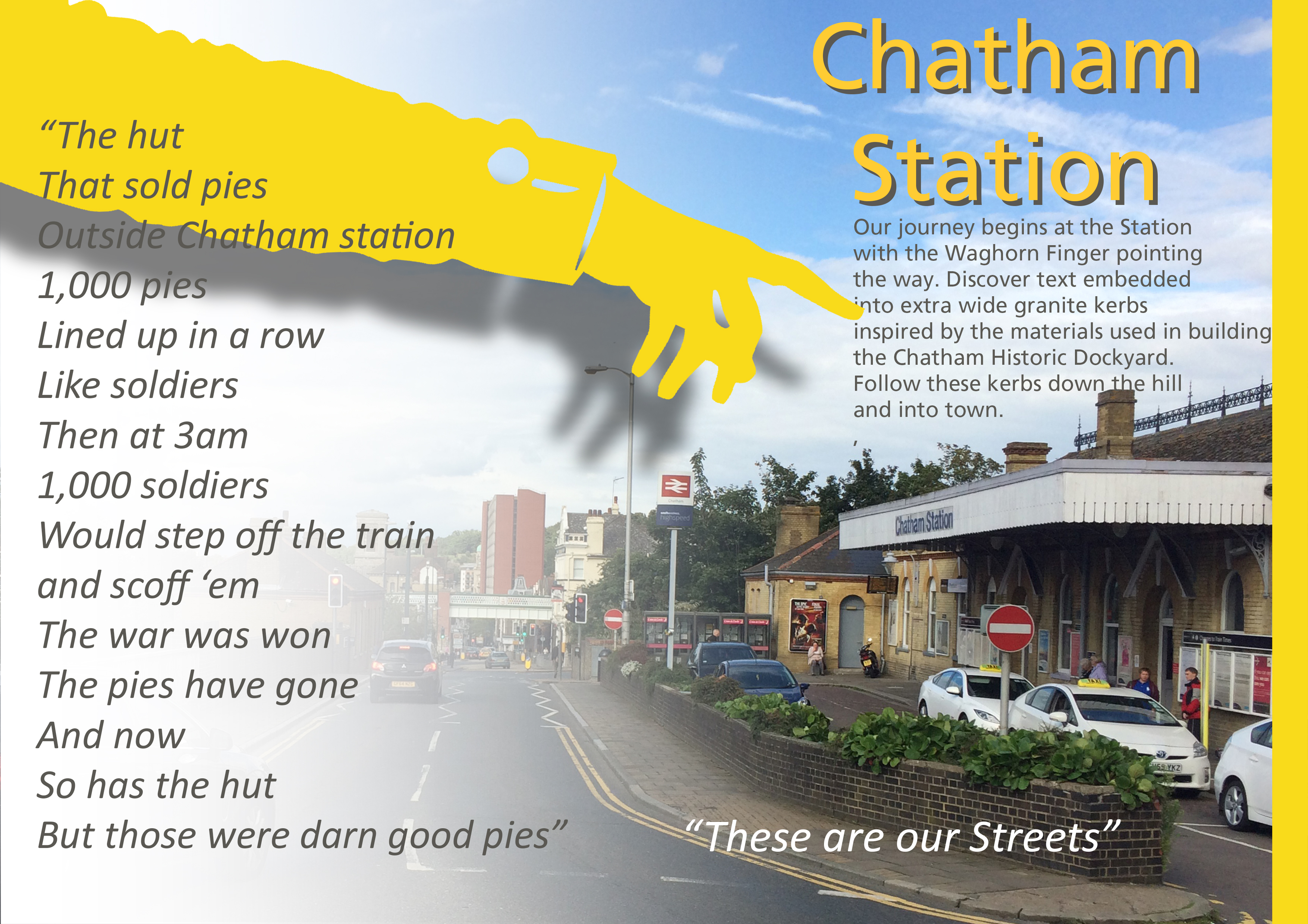
1000 Pies Lined up in a row like Soldiers…
Chatham Station and it’s approaches were always at the head of our scheme. Designs and public art have been prepared and approved, to become a part of the regeneration of the Station, which has just started on site. Click on this link to find out more.
Draft Magazine – Pages 6 & 7 V2 : THESE ARE OUR STREETS. Image: Christopher Tipping
Draft Magazine – Pages 6 & 7 V3 : THESE ARE OUR STREETS. Image: Christopher Tipping. Archive Photograph by Kind Permission of MALSC
Draft Magazine – Pages 8 & 9 V2 : THESE ARE OUR STREETS. Image: Christopher Tipping.
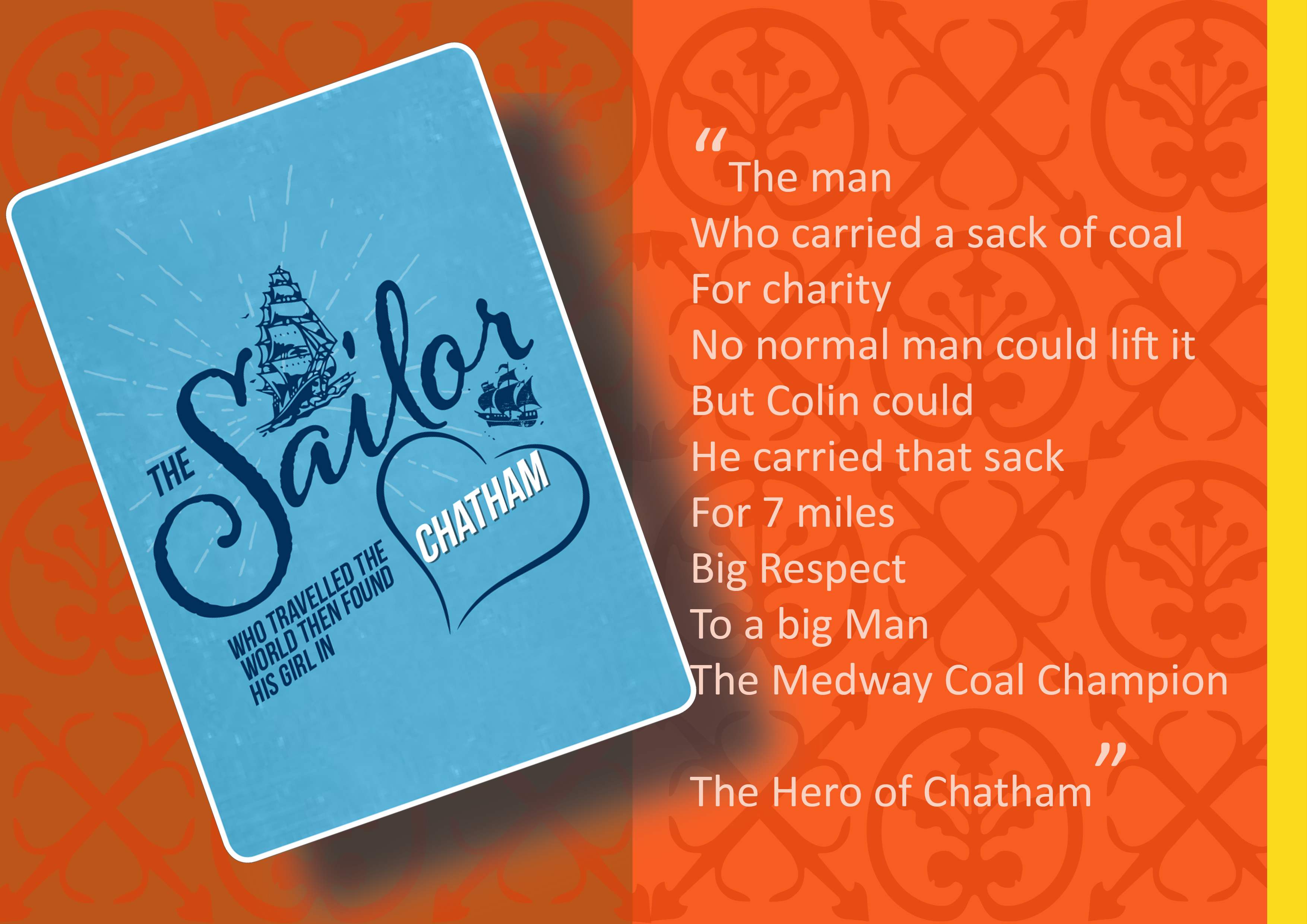
The Sailor who travelled the world…the found his girl in Chatham
Draft Magazine – Pages 10 & 11 V1 : THESE ARE OUR STREETS. Image: Christopher Tipping.
An imaginary tale…The Story of Tommy Johnson of Margate by Rob Young
Draft Magazine – Pages 12 & 13 V1 : THESE ARE OUR STREETS. Image: Christopher Tipping.
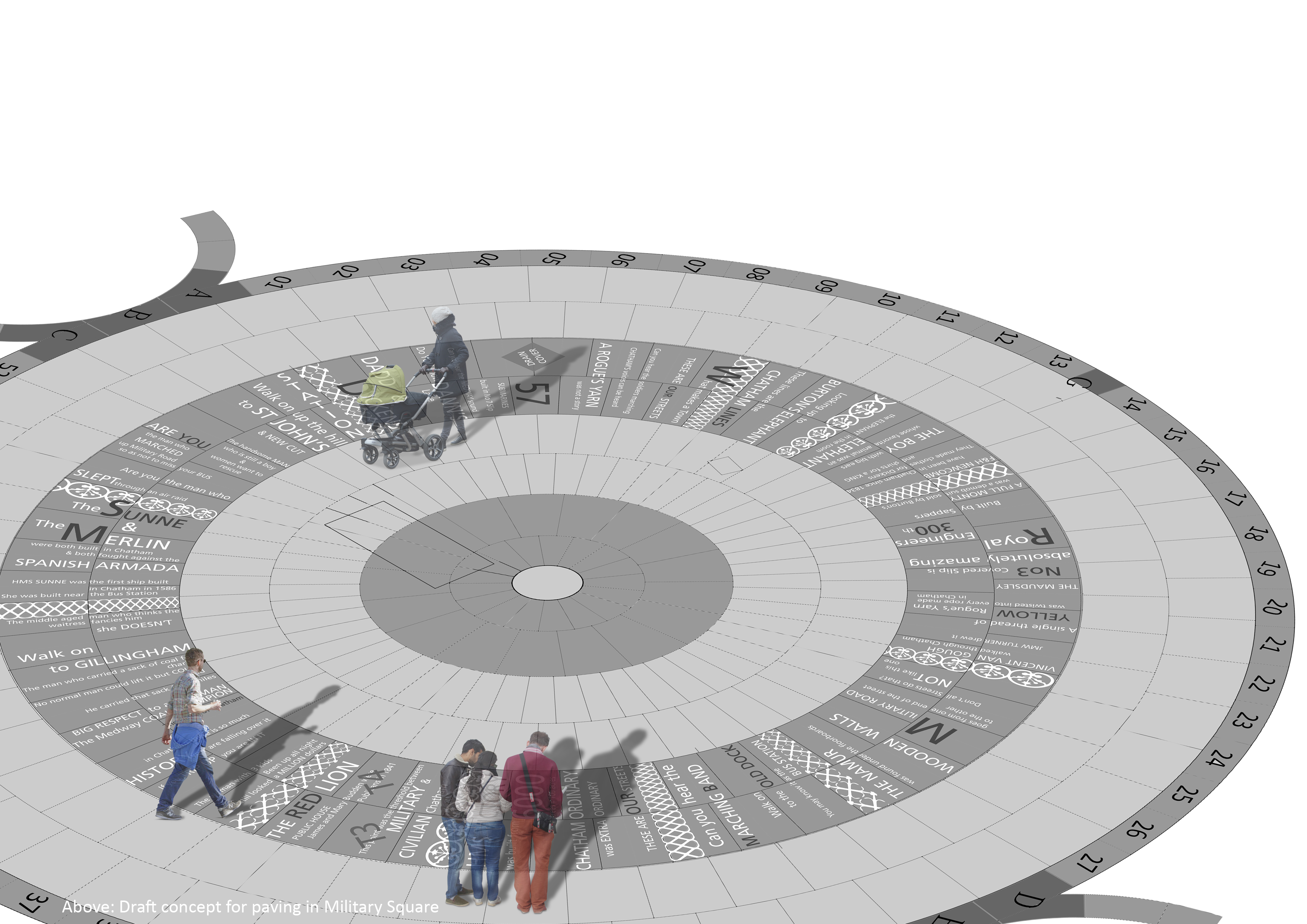
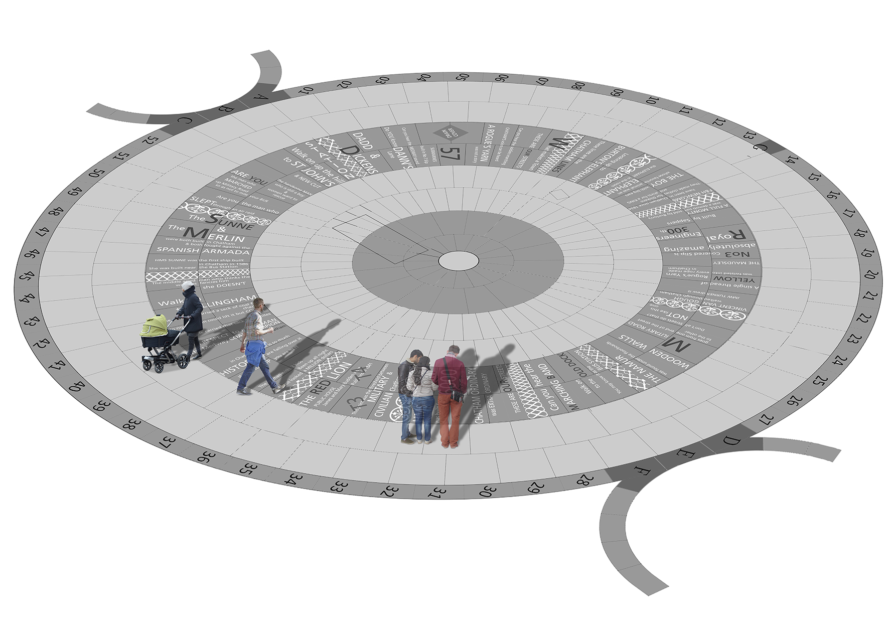
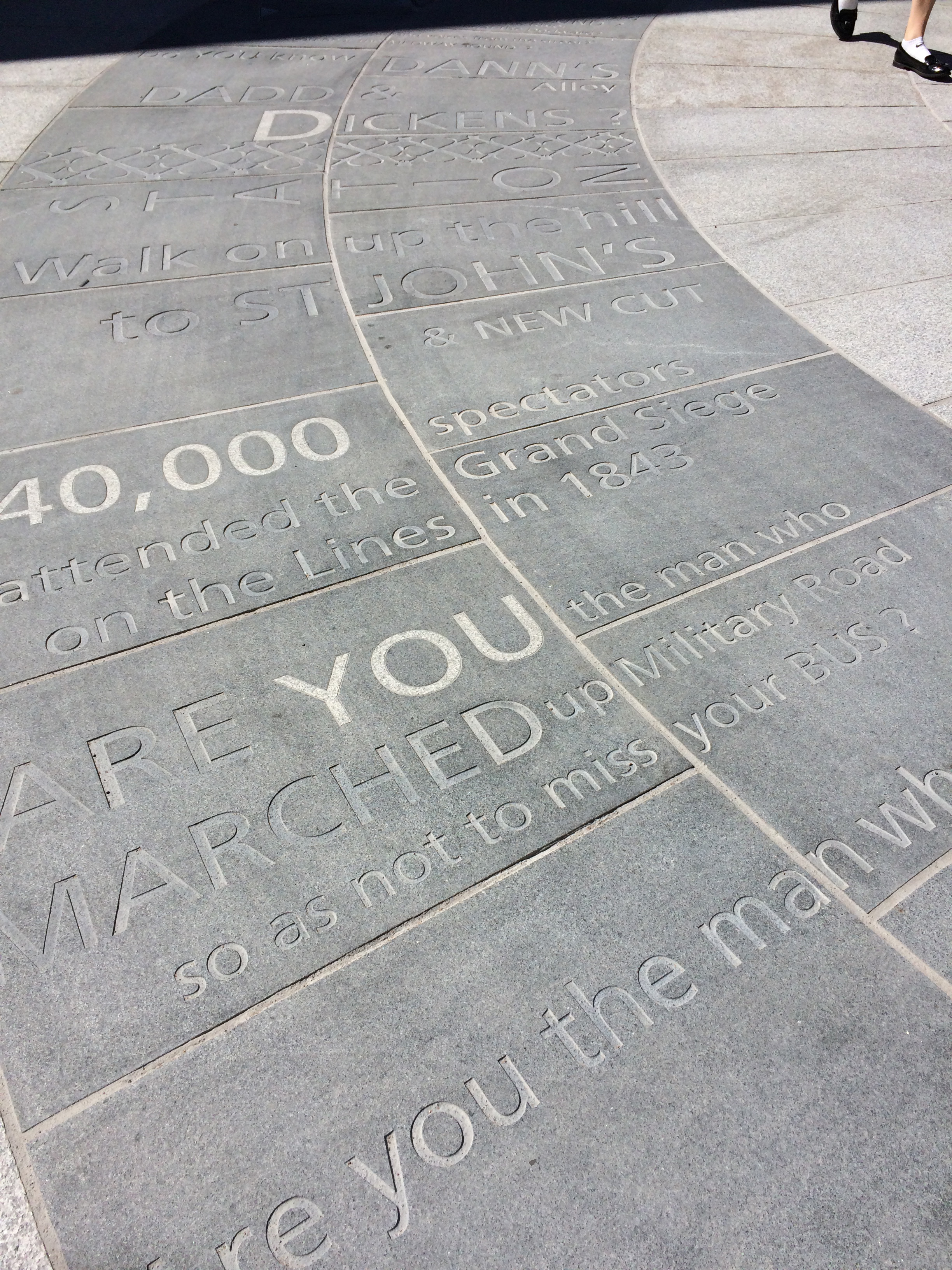
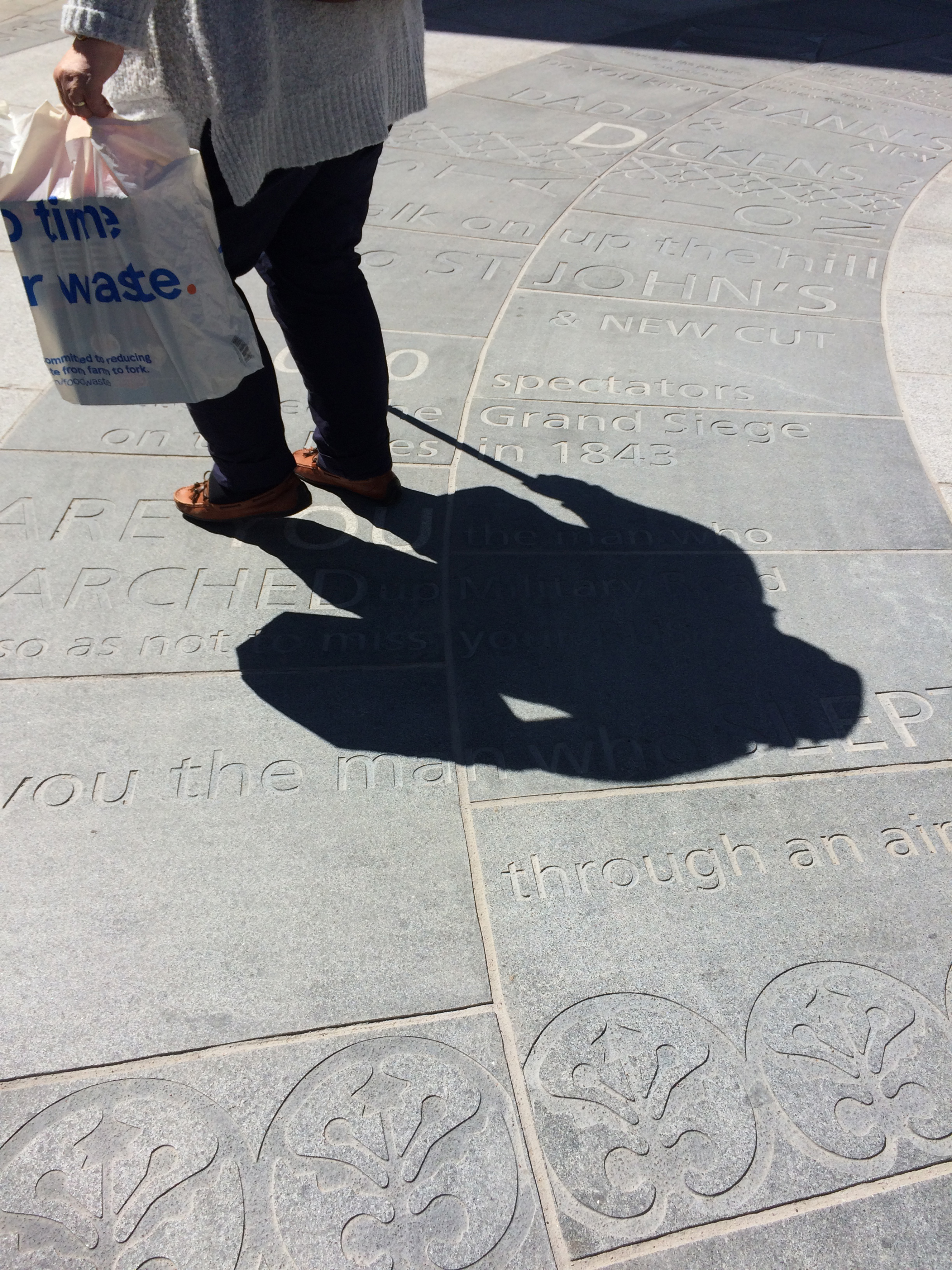
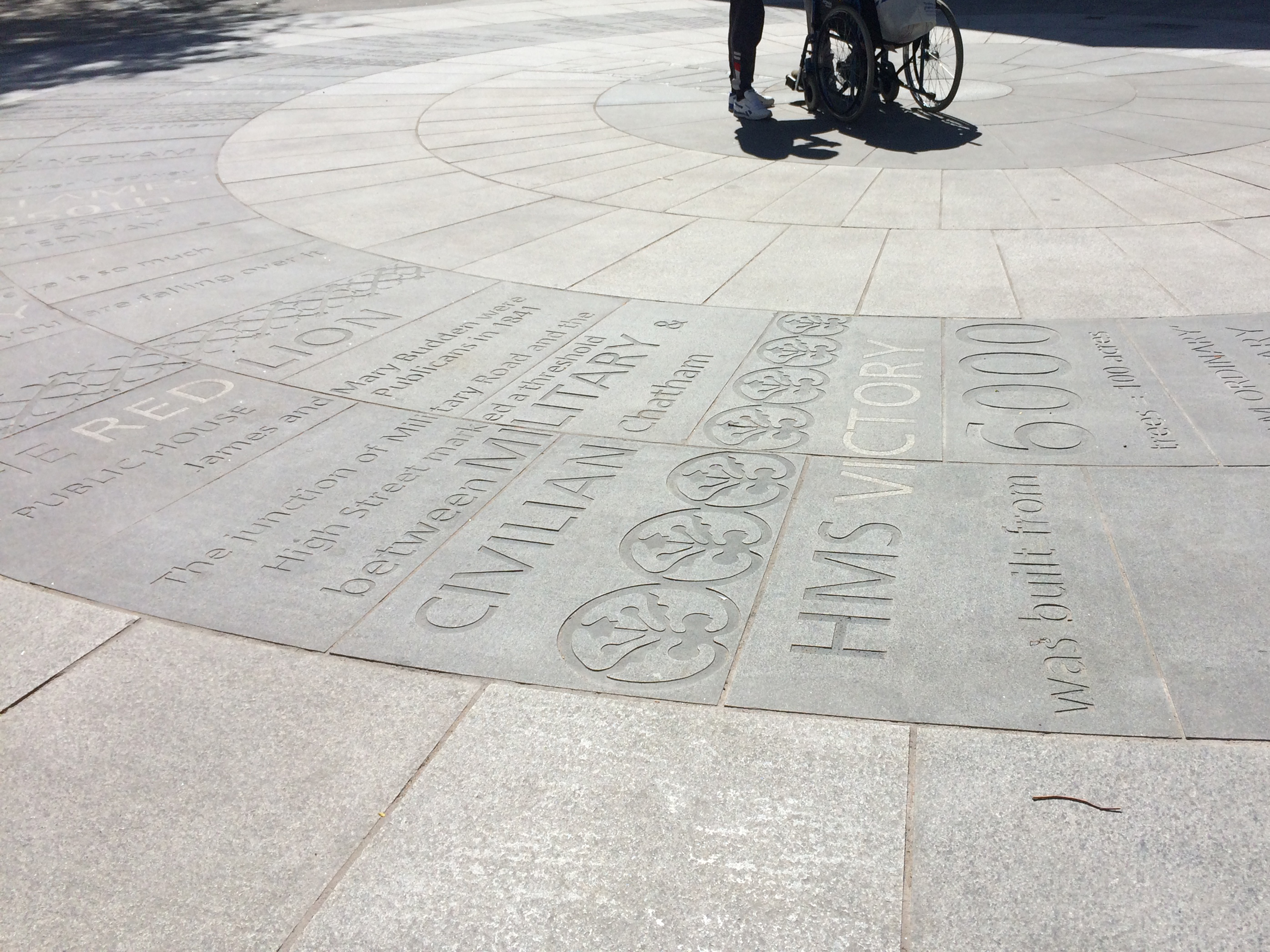
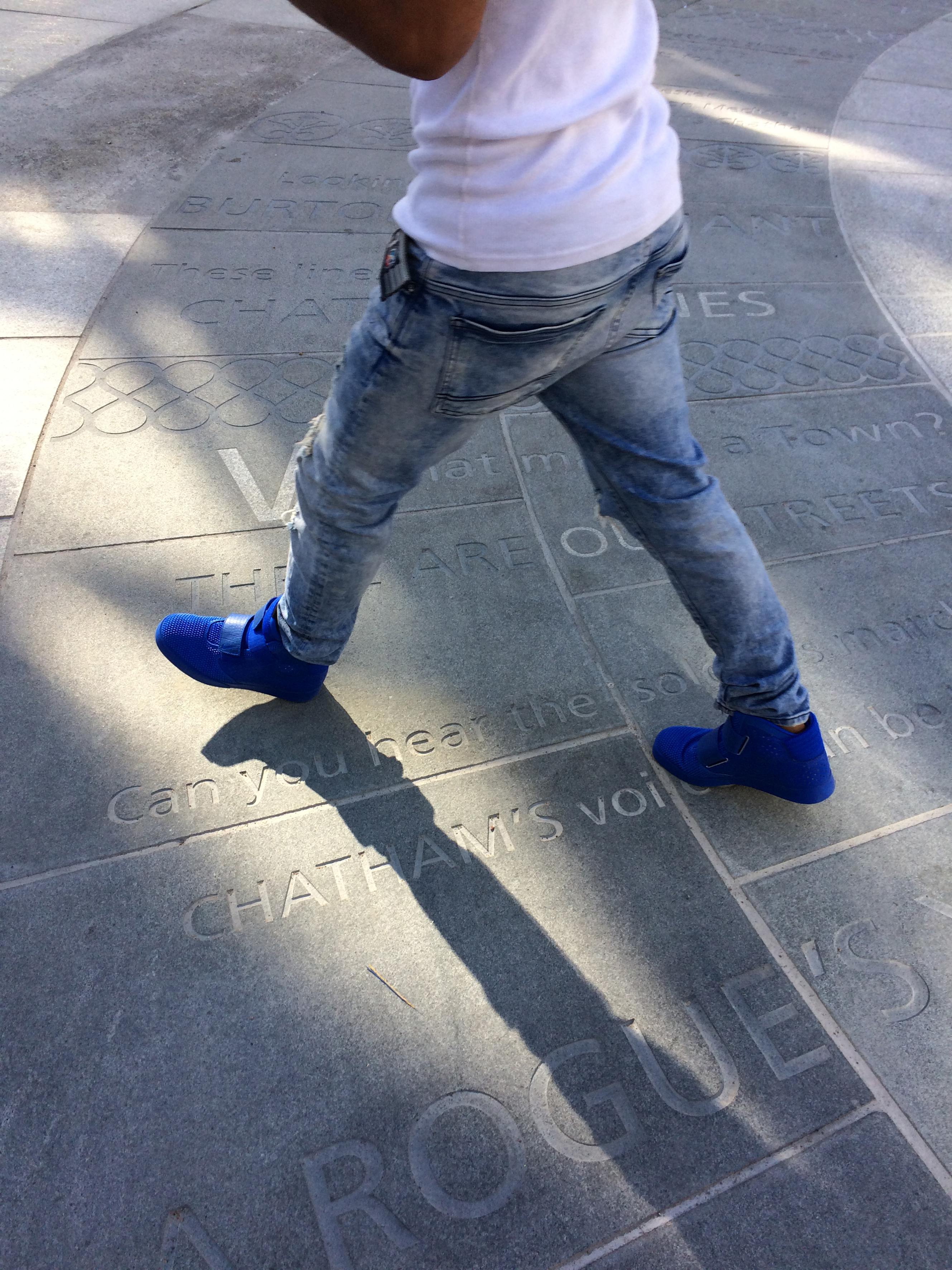
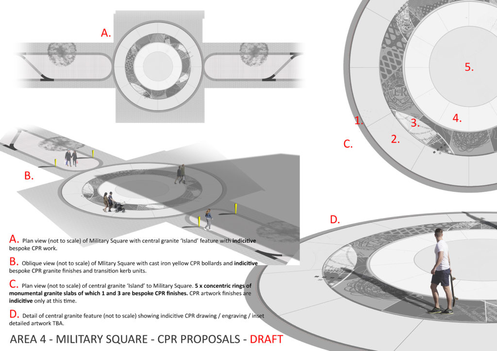
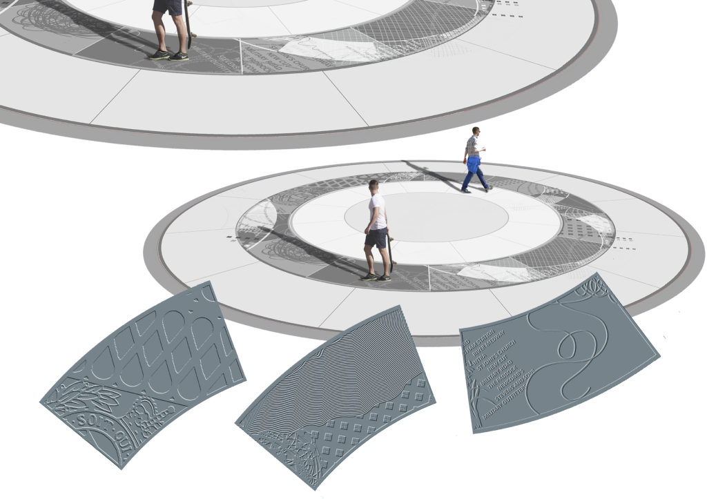
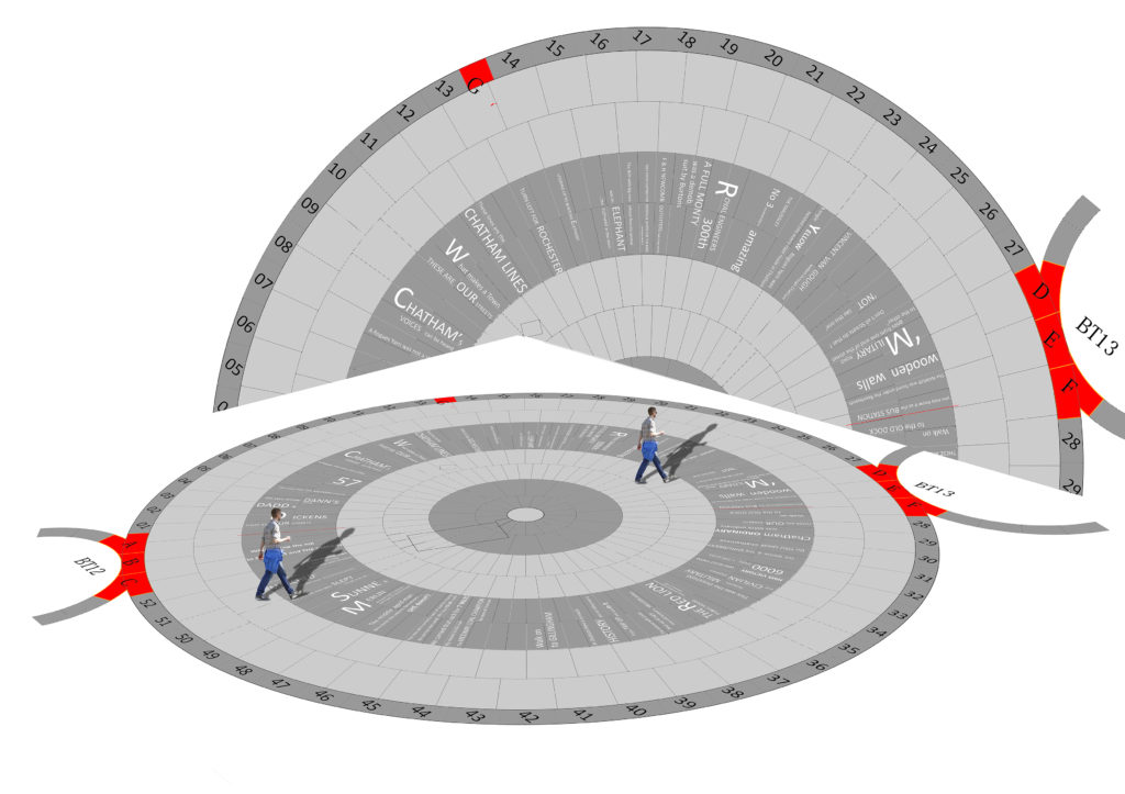
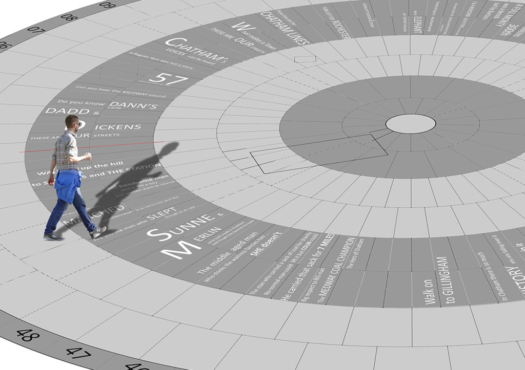
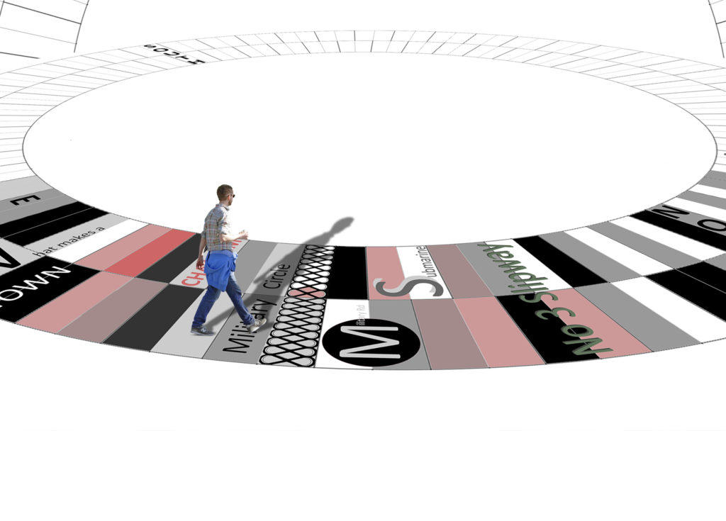
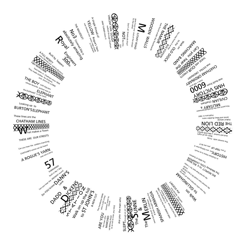
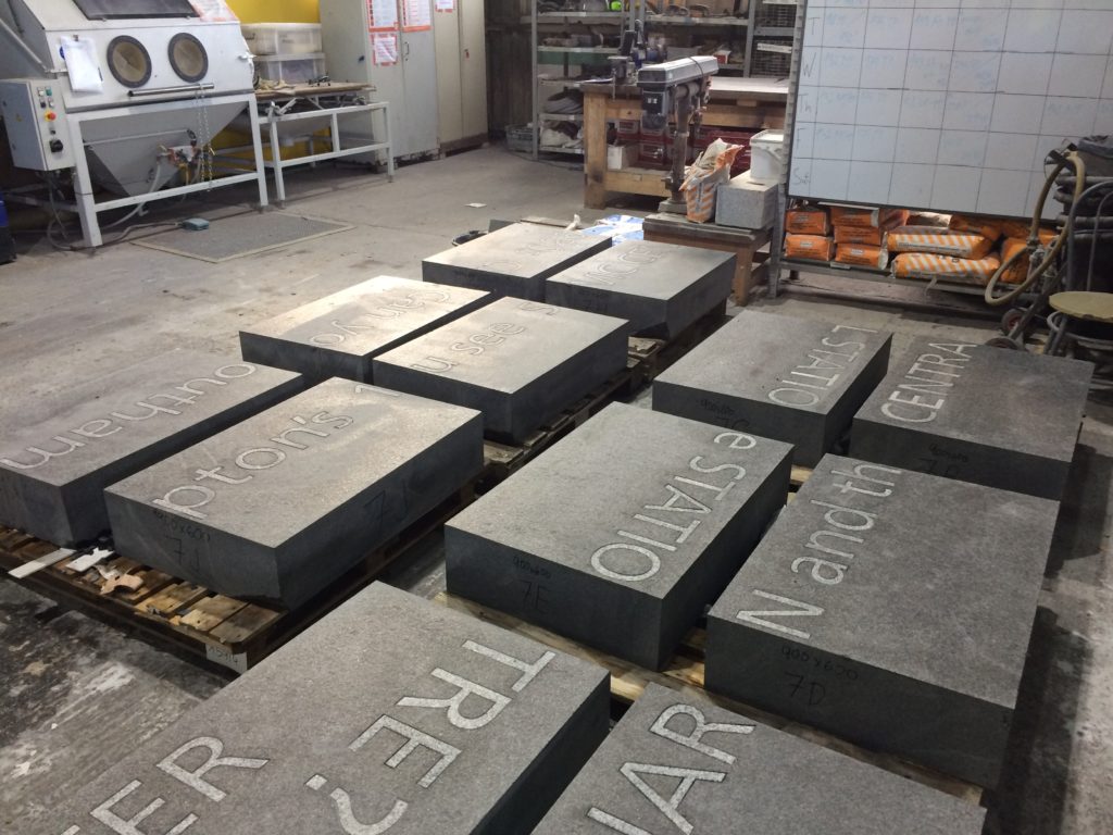
The regeneration and public realm works in Military Square, Chatham have very nearly been completed. This involves the installation of 400 bespoke radius-cut monolithic blocks of granite set into 17m diameter circle, putting a circle of words at the centre of a Military Square!
154 of the granite blocks have words, numbers & patterns sandblasted or inset into the surface. Just over 400 words are included –
Local school children & people working in local businesses were asked for their comments.
We listened to them & heard their stories. We listened to the sound of their lives.
There is an overwhelming sense of common ownership in this project.
These words are not ours. They belong to Chatham.
Military Square, Chatham. Image: Christopher TippingDraft Artwork for Military Square, Chatham. Image: Christopher TippingMilitary Square, Chatham. Image: Christopher TippingGranite blocks awaiting installation in Military Square, Chatham. Image: Christopher Tipping
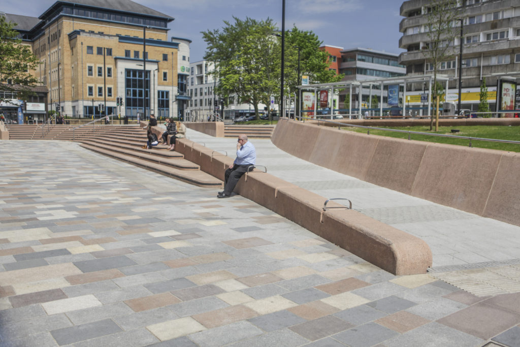
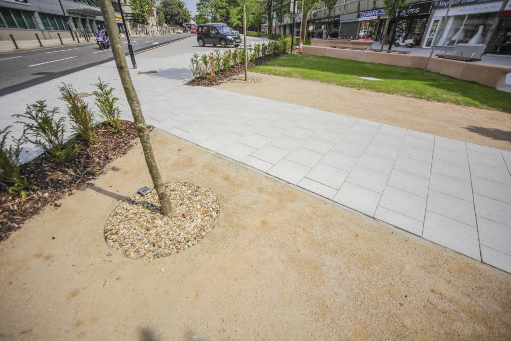
You may know that the aim of this public realm project was to upgrade the route from Chatham Station to the Waterfront. This includes pedestrian and cycle routes as well as crossing points, upgrading paving materials, improving steps and ramps, opening up the public realm and streamlining access and pedestrian permeability.
Francis Knight, Public Art Consultants, managed the Public Art Project. Our project collaborators and consultants to Medway Council were LDA Design and Project Centre.
We have worked within these parameters, using the language of public realm and materials, which are robust and stand the test of time. We have created a quiet ‘narrative’ thread – a story about Chatham– & more specifically about events and places along this route.
We wanted the streets to speak quietly, confidently & with good humour about Chatham…WHAT MAKES A TOWN? …THESE ARE OUR STREETS…part memorial, part living voice…but mostly a celebration of the rich heritage and community of Chatham.
As an artist and designer of public spaces, this project has been an opportunity to influence our surroundings in a way that ‘speaks’ of Chatham and its people. We mostly take our pavements for granted, but these spaces have often developed from historic pathways and tracks linking communities and towns across the wider region. They have a resonance and a ‘voice’, …and echo with history.
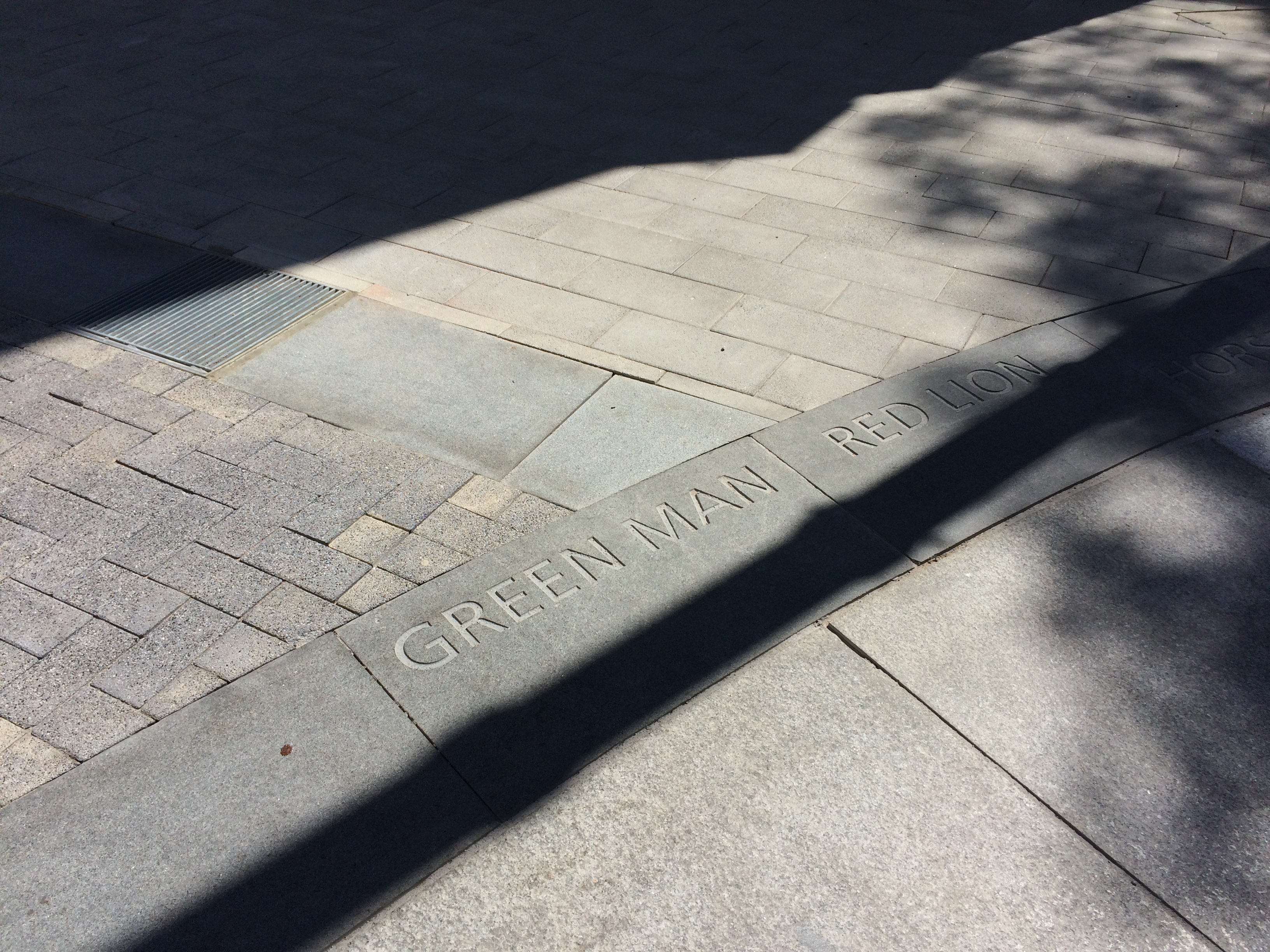
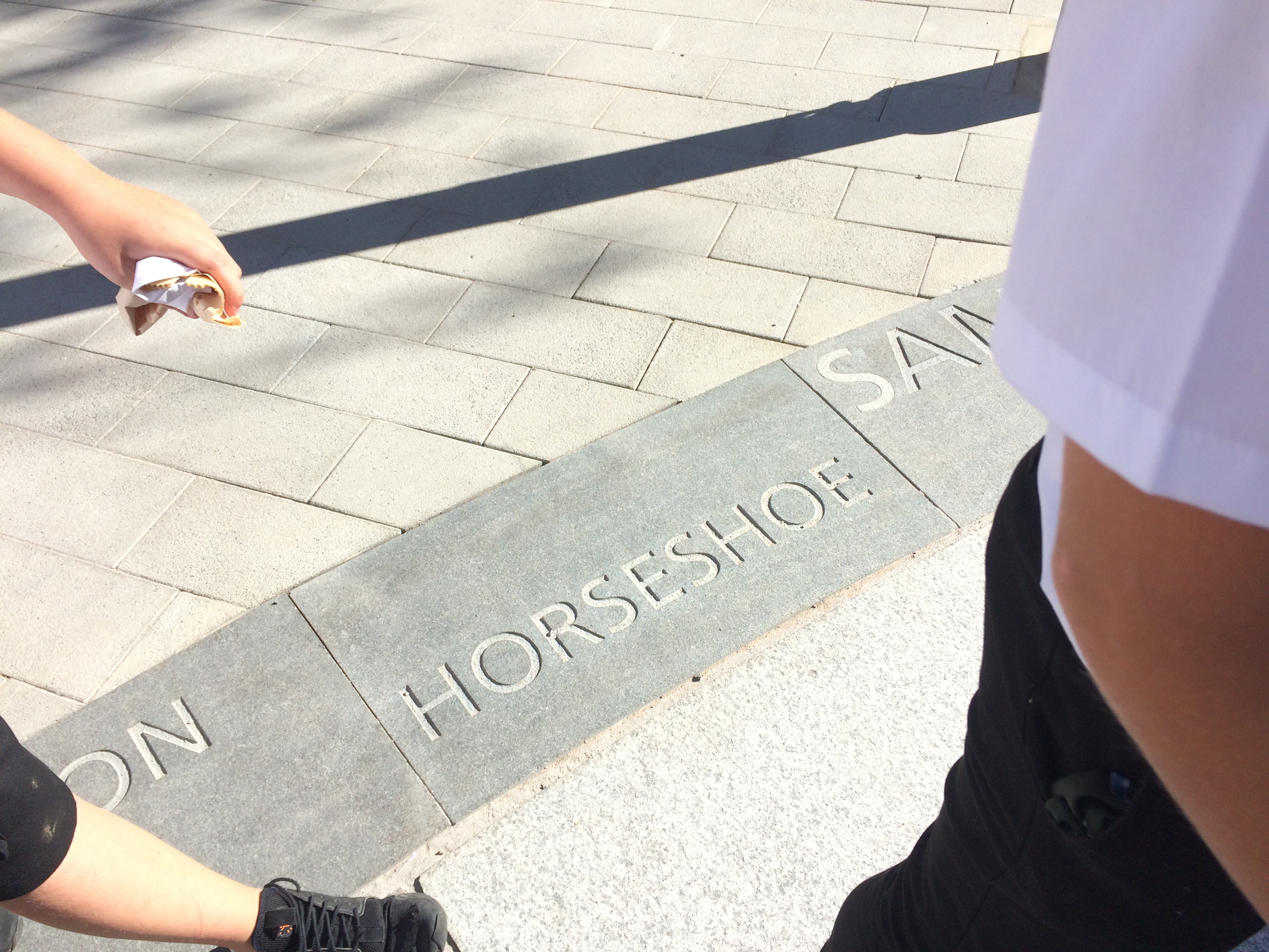
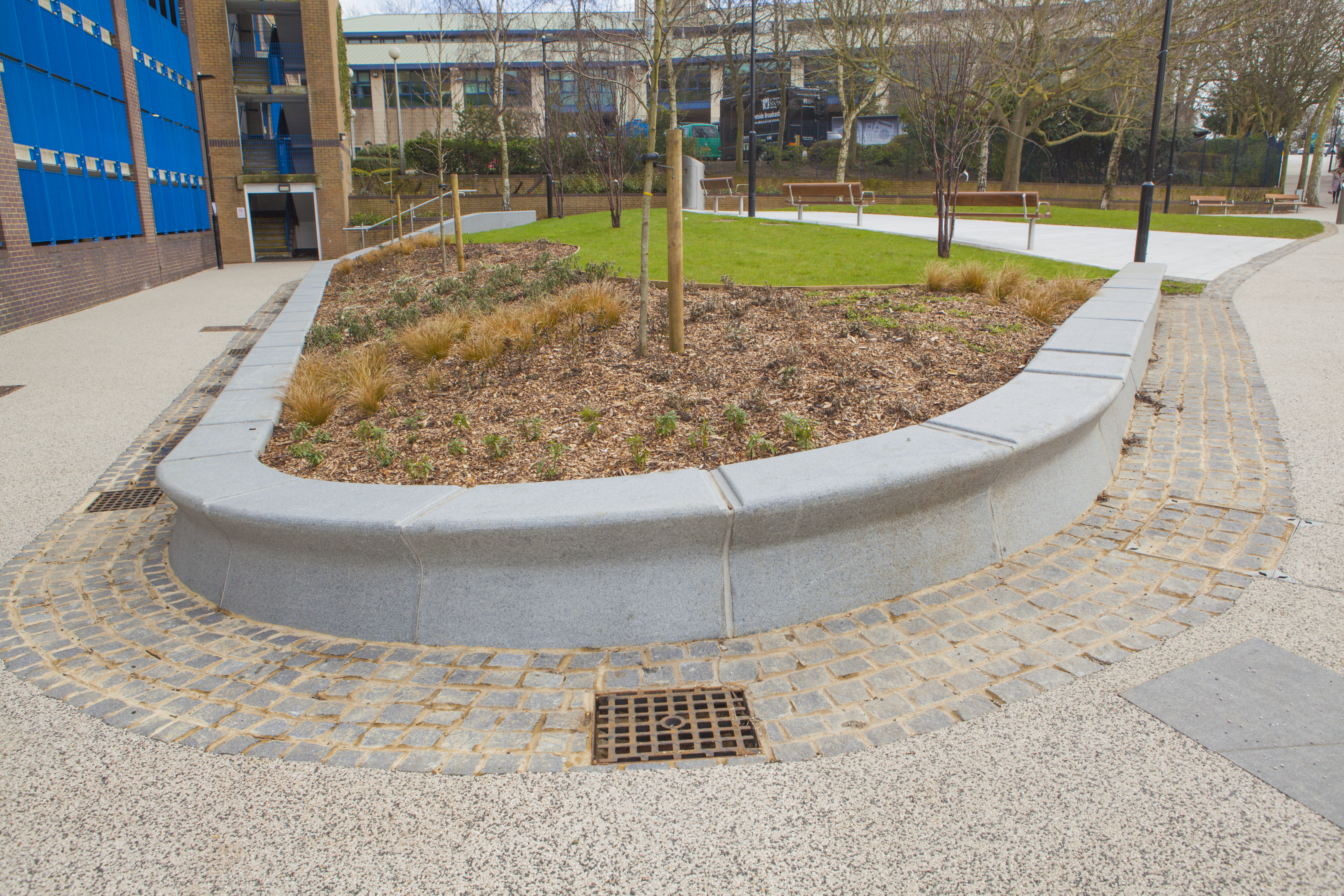
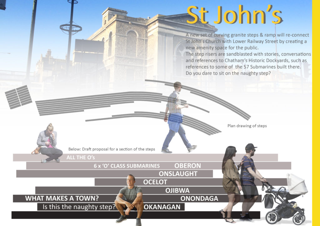
The route from the Station to the Waterfront takes us down Railways Street & Military Road – in doing so we pass several key places, such as New Cut (a former farmyard), St John’s (a Grade II Listed Waterloo Church) – Military Square, considered the Heart of the Town. At these important sites, we have made interventions to articulate the granite kerb in ways, which are expressive and of interest, whilst still maintaining functionality.
Military Square, Chatham. Image: Christopher TippingMilitary Square, Chatham. Image: Christopher TippingMilitary Square, Chatham. Image: Christopher TippingMilitary Square, Chatham. Image: Christopher TippingMilitary Square, Chatham. Image: Christopher TippingMilitary Square, Chatham. Image: Christopher TippingMilitary Square, Chatham. Image: Christopher TippingMilitary Square, Chatham. Image: Christopher Tipping
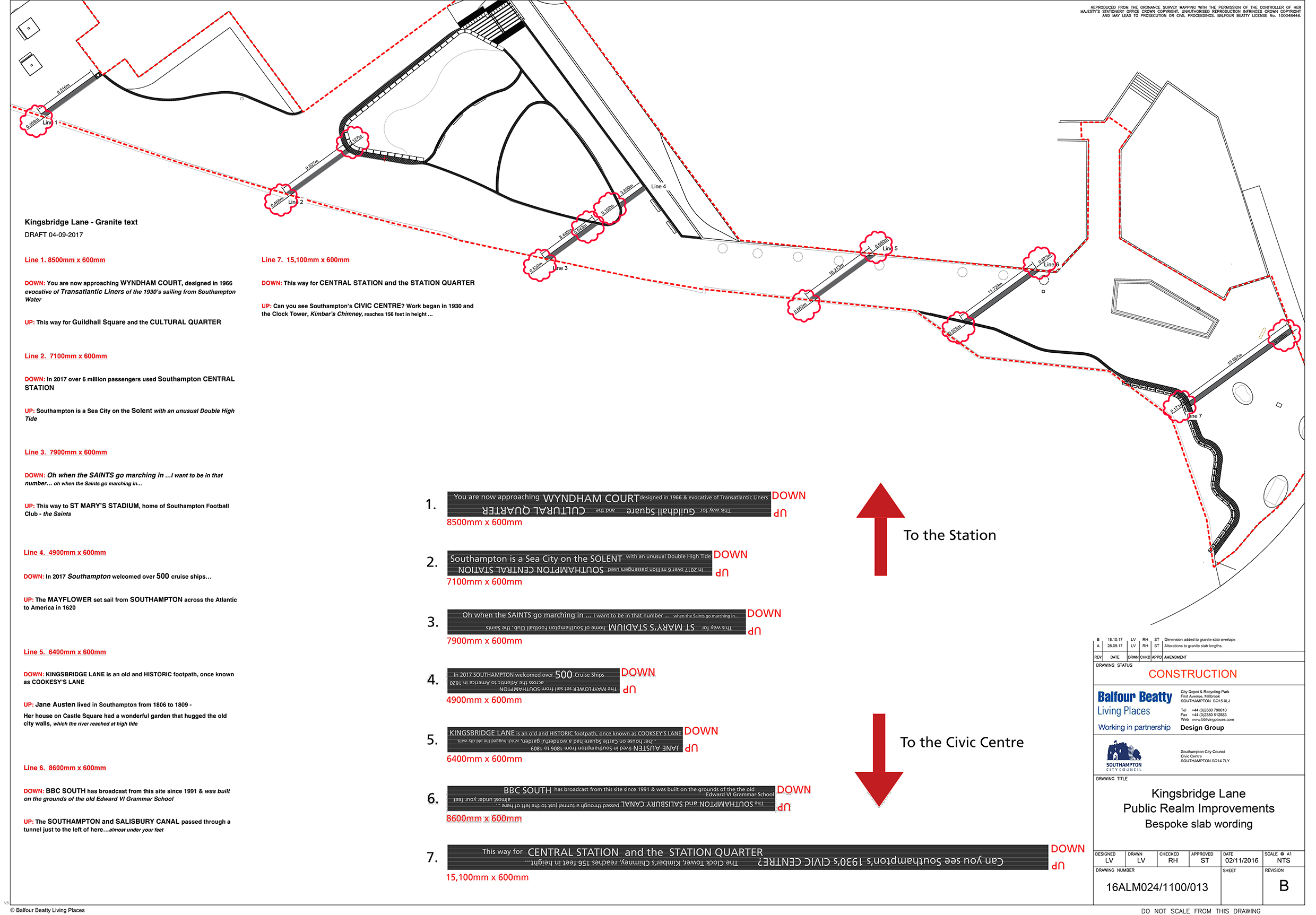
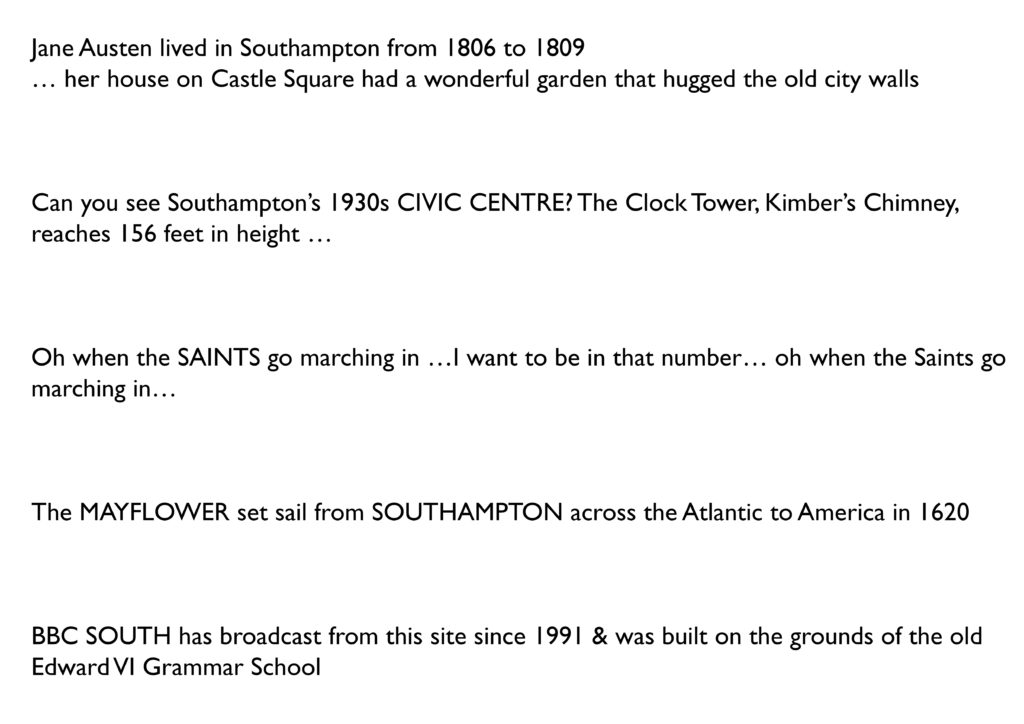
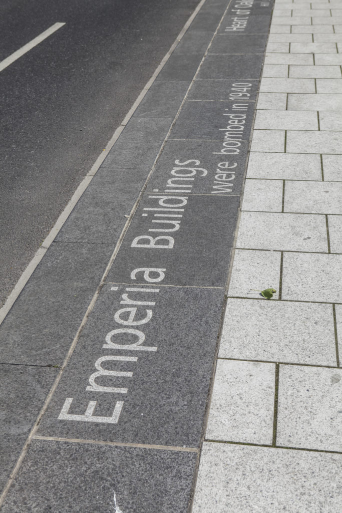
‘The SOUTHAMPTON and SALISBURY CANAL passed through a tunnel just to the left of here…almost under your feet’
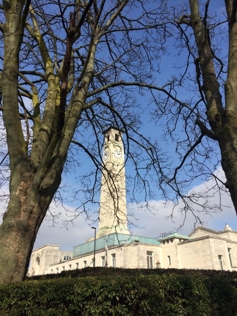
Kingsbridge Lane with Civic Centre and Clocktower. Image: Massie Wilson
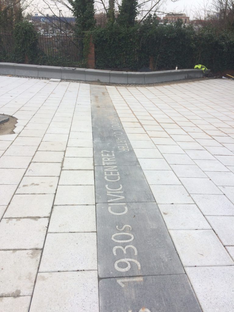
‘Can you see Southampton’s 1930s CIVIC CENTRE? The Clock Tower, Kimber’s Chimney, reaches 156 feet in height…’
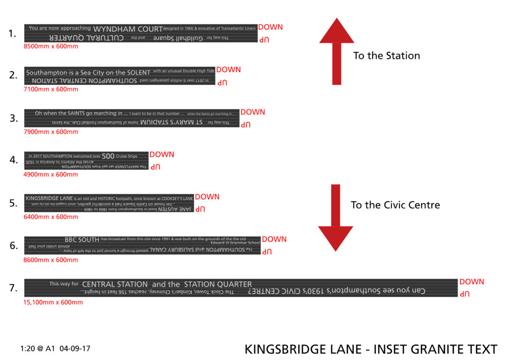
Text – white granite inset into contrasting black granite.
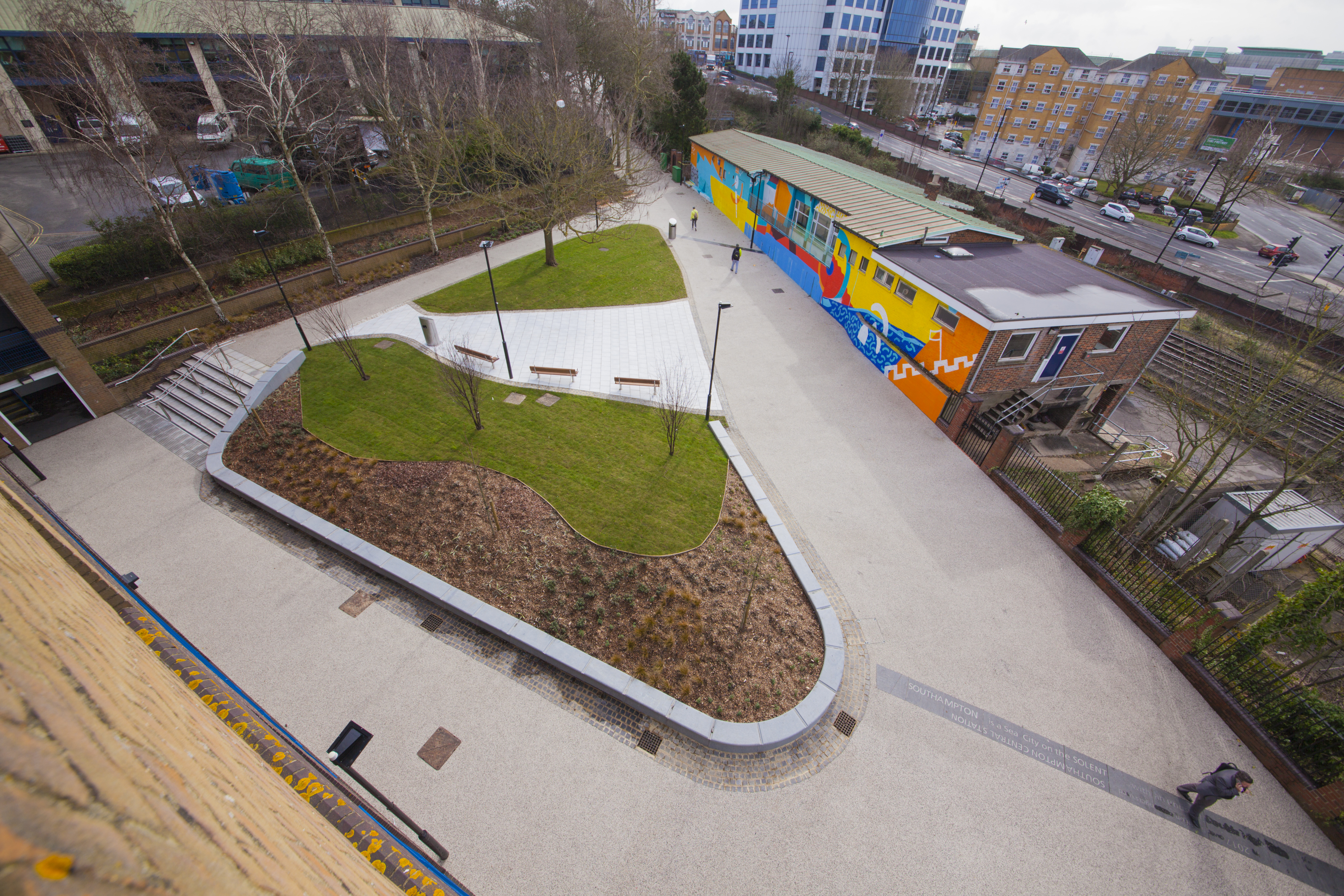
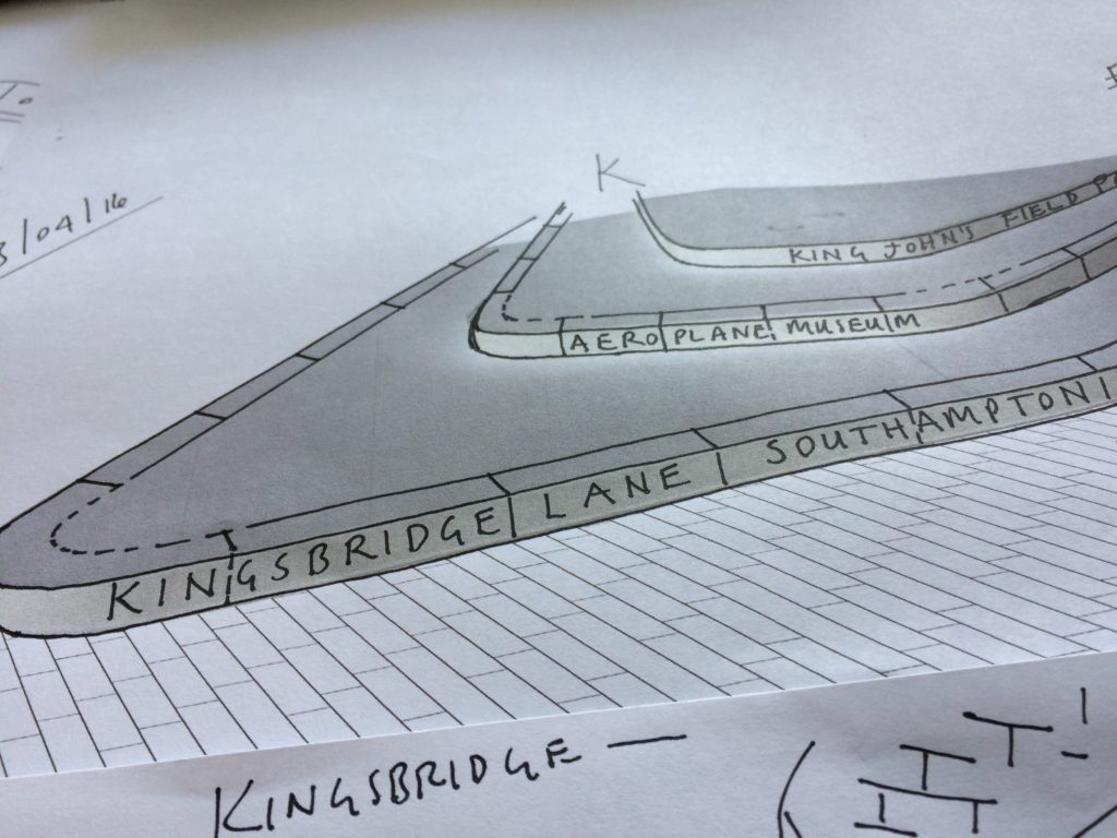
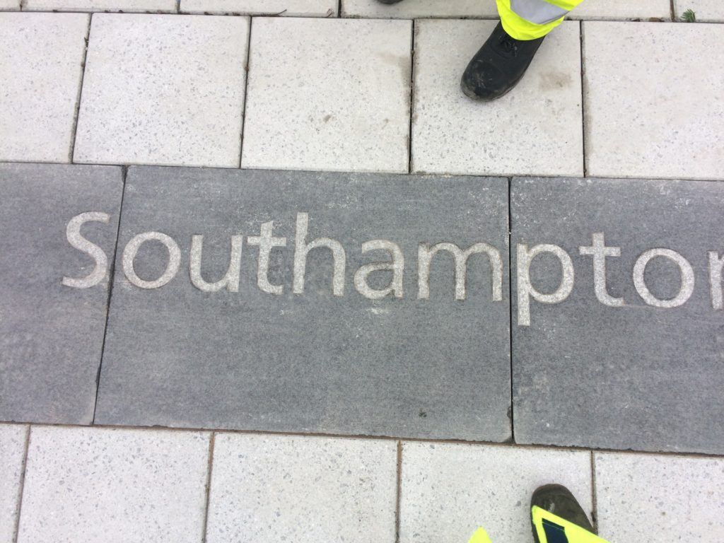
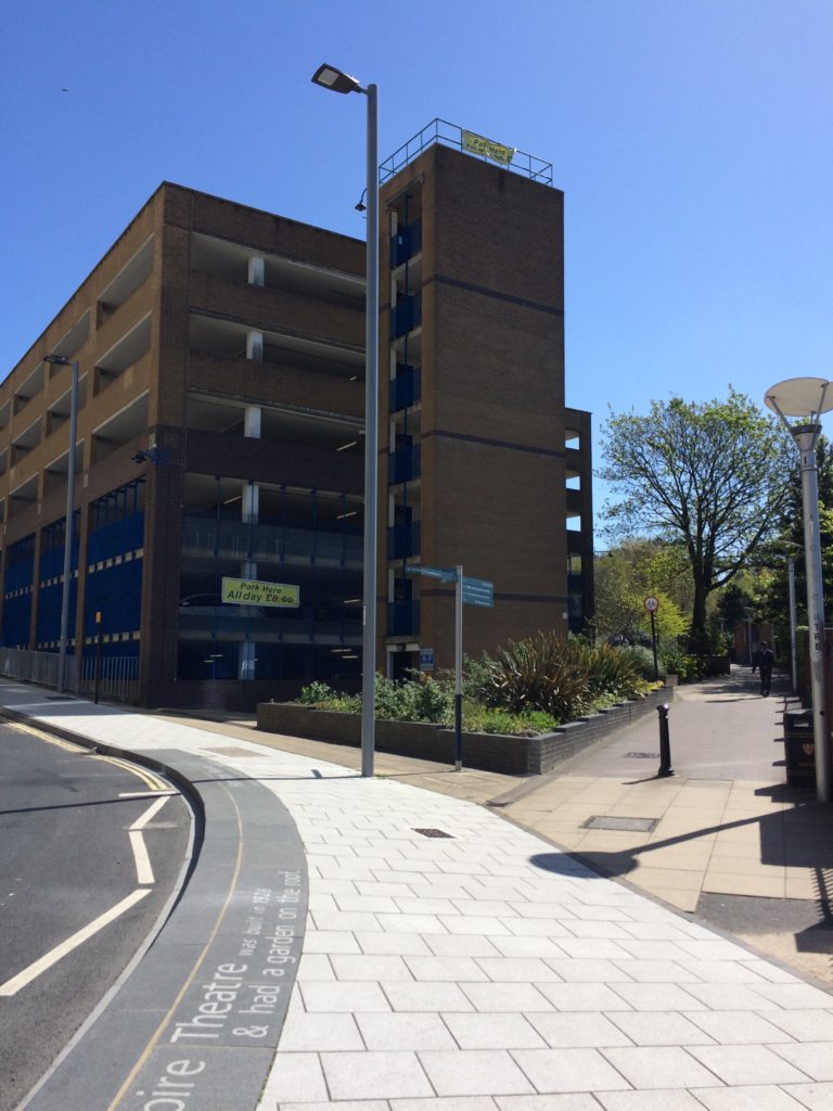
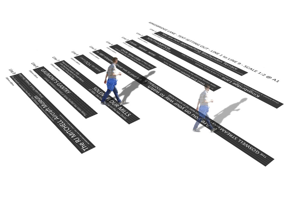
Kingsbridge Lane in Southampton is a historically important and longstanding pedestrian-only route with no vehicular access. This makes the site significant to Southampton. It is a long surviving link to the western route in and out of Southampton along the coastal strand, which formed the northern shore of the River Test Estuary until the early 20thCentury. The footpath runs along a narrow strip of land between the existing railway tunnel and the historic and long abandoned tunnel of the Southampton to Salisbury Canal, which ran along what is now Blechynden Terrace, linking Central Station to the Guildhall Square &Cultural Quarter. My role within this project was to develop a contextual response to the site, which would, hopefully, influence the landscape design and regenerative design process in collaboration Simon Taylor of Balfour Beatty Living Places , Southampton City Council and Hardscape.
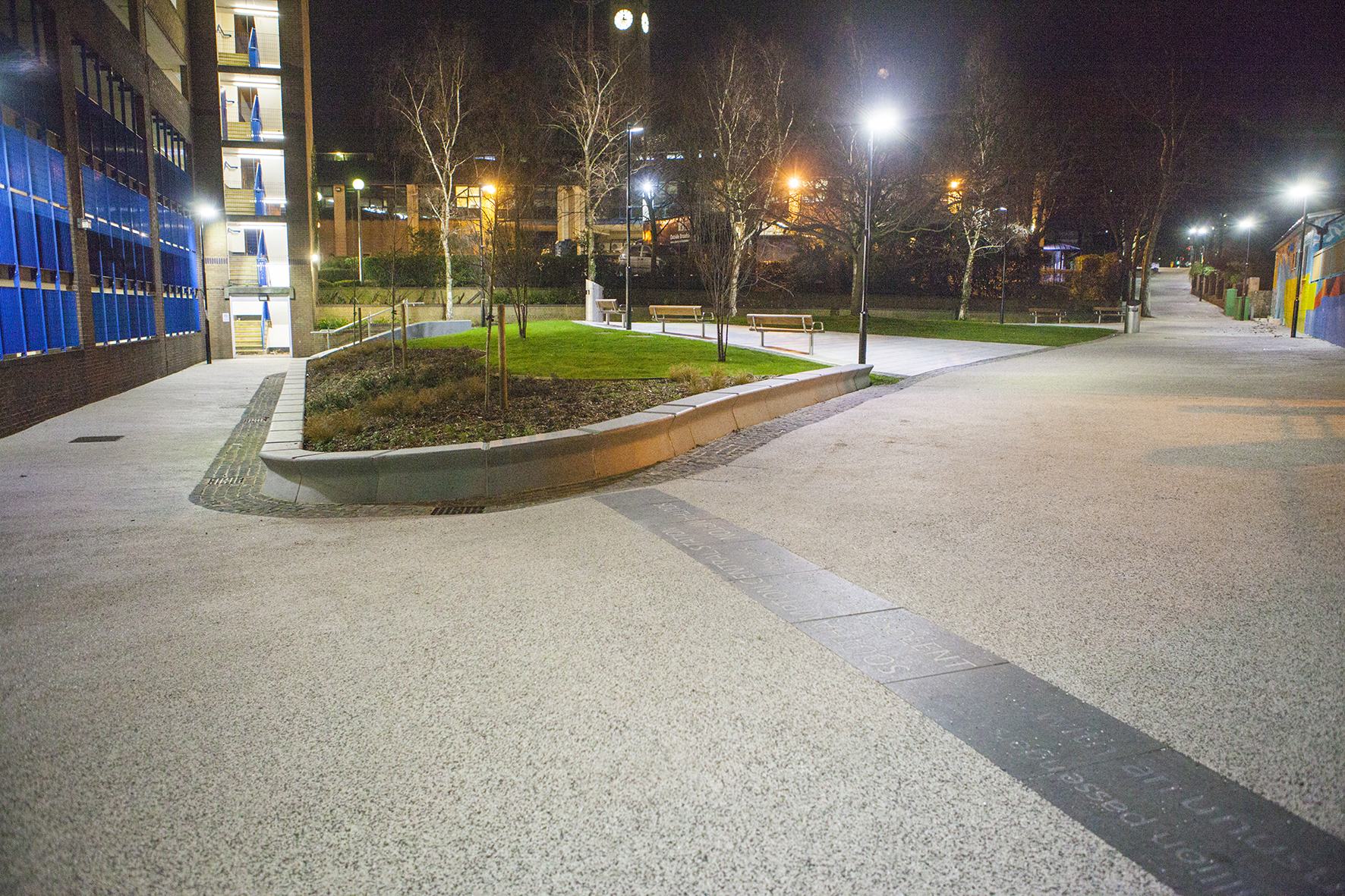
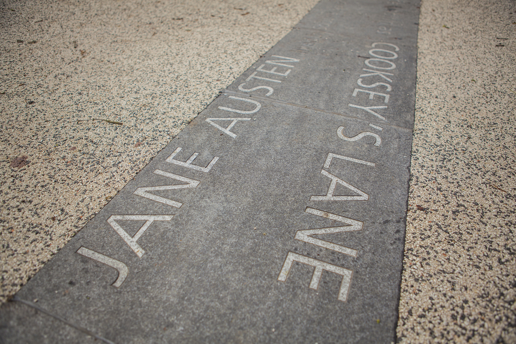
Kingsbridge Lane, Southampton. Image: Massie WilsonKingsbridge Lane, Southampton. 14 lines of text – Image: Balfour Beatty
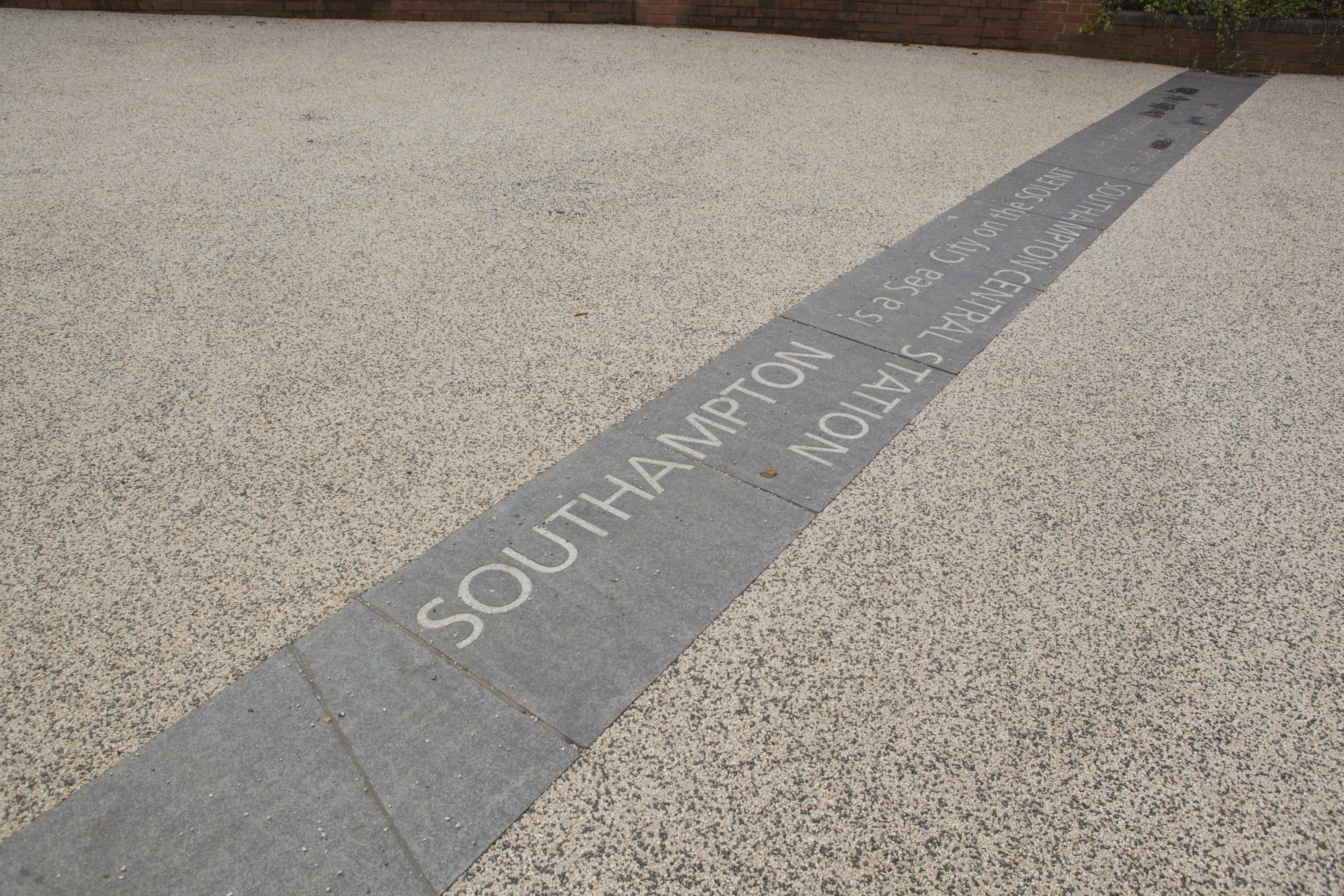
‘SOUTHAMPTON is a Sea City on the SOLENT …with and unusual Double High Tide’.
Text – white granite inset into contrasting black granite.
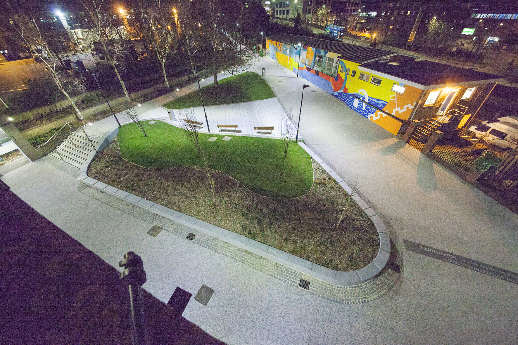
Aerial view of Kingsbridge Lane, Southampton. Image: Massie Wilson
‘Oh when the SAINTS go marching in …I want to be in that number… oh when the Saints go marching in…’
Nighttime aerial view of Kingsbridge Lane, Southampton. Image: Massie Wilson
‘In 2017 over 6 million passengers used Southampton CENTRAL STATION’
Kingsbridge Lane, Southampton. Nighttime view. Image: Massie Wilson
‘SOUTHAMPTON is a Sea City on the SOLENT …with and unusual Double High Tide’.
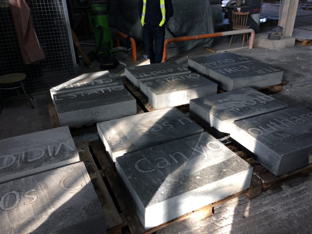
Basalt Slabs with inset text at Hardscape for Kingsbridge Lane, Southampton. Image: Christopher Tipping
Kingsbridge Lane, Southampton. Image: Massie Wilson
‘Jane Austen lived in Southampton from 1806 to 1809 … her house on Castle Square had a wonderful garden that hugged the old city walls’
Kingsbridge Lane, Southampton. Image: Massie Wilson
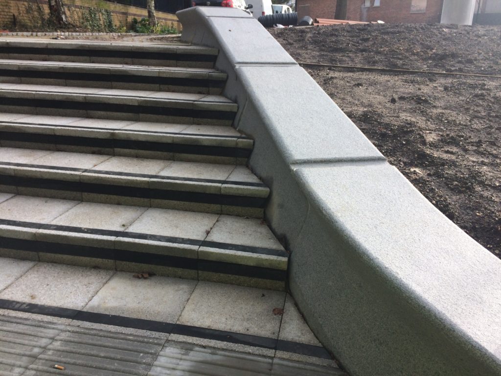
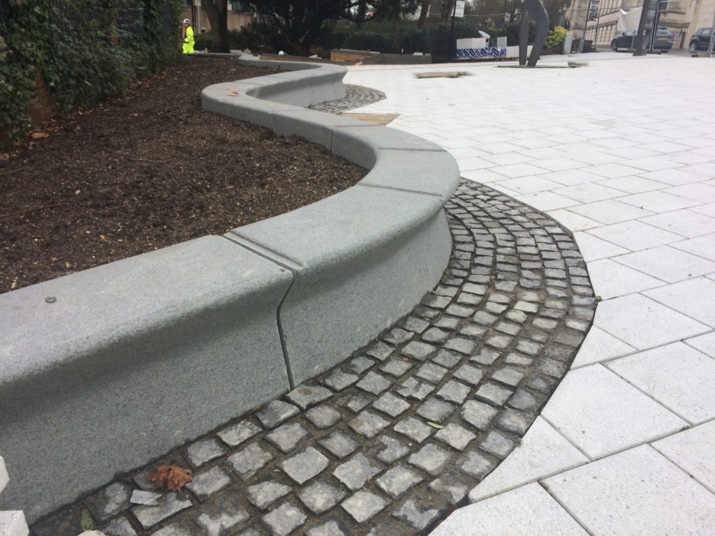
The granite seating and retaining walls by Hardscape are undercut along the front edge suggesting the movement of water throughout the site.
‘The MAYFLOWER set sail from SOUTHAMPTON across the Atlantic to America in 1620′
Aerial view of Kingsbridge Lane at the junction with Blechynden Terrace and West Park Rd, Southampton. Image: Massie Wilson
I haven’t updated this post for some time – actually since April 2017! Head down and just getting on with it …time flies. OK – I’ll now try to sum up what’s happened in the interim.
Following on from the initial research period, consultation & creative engagement phases of the project, a series of Creative Public Realm proposals were submitted for review. This work originated and was inspired by the positive & creative collaboration with our supporting artists in residence, Rob Young – Writer, Simon Williams – Filmmakerand Xtina Lamb – Printmaker. These collaborations proved to be highly creative as well as bringing a refreshing camaraderie and friendship to the work.
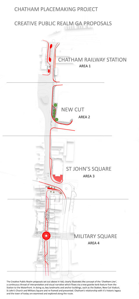
The proposals are presented here in the order in which the various sites are encountered along the route from Chatham Station down Railway Street to Military Road and the Waterfront. This is a visual account of how ideas developed and adopted into the scheme.
Chatham Station, although at the head of our scheme, will be the last Phase to be delivered on the ground & I will report on this work later in a separate post.
The sites where our work and interventions has been focussed are:
NEW CUT & NEW ROAD VIADUCT
ST JOHN’S SQUARE
LOWER RAILWAY STREET
MILITARY SQUARE
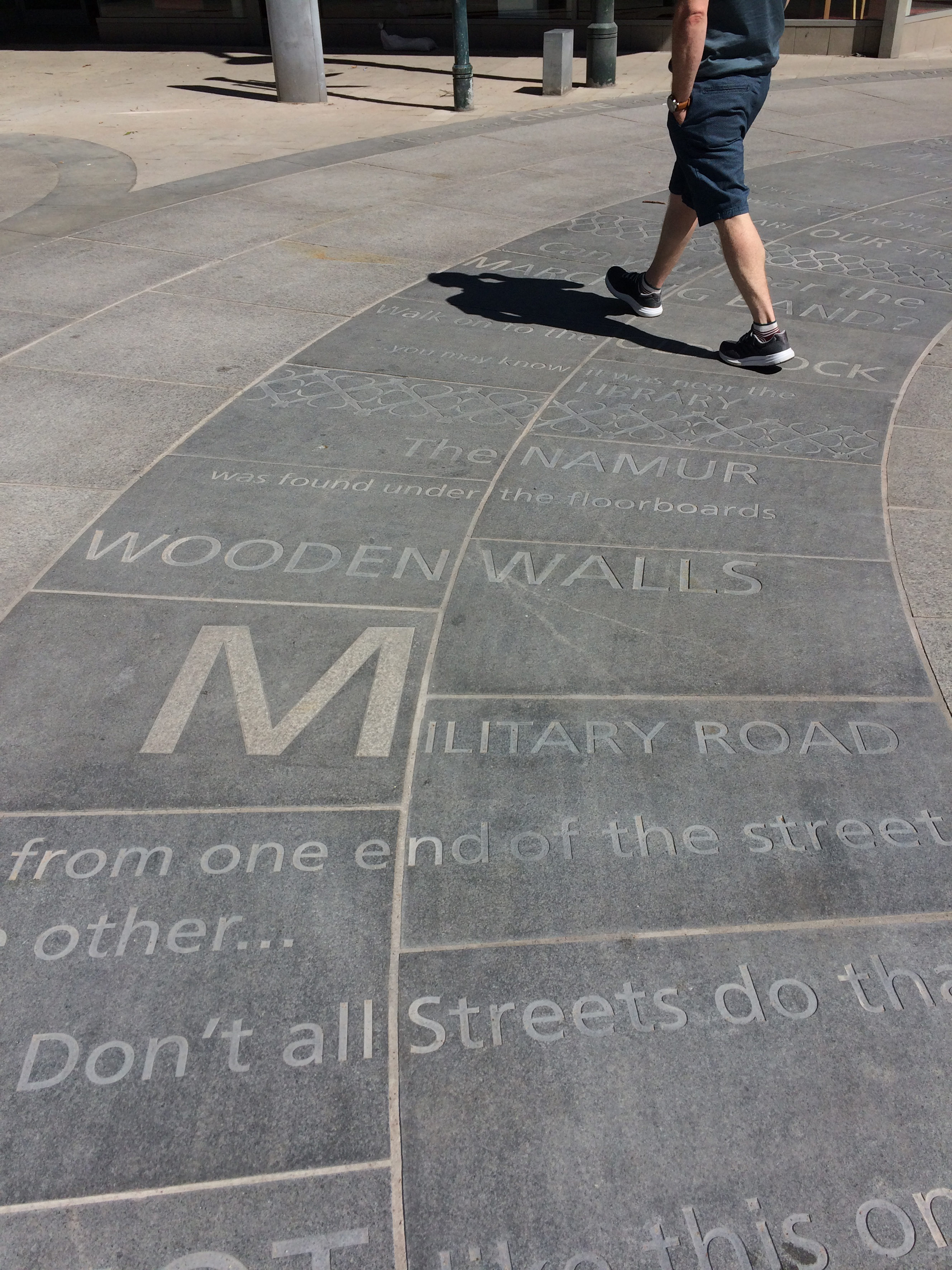
MILITARY ROAD
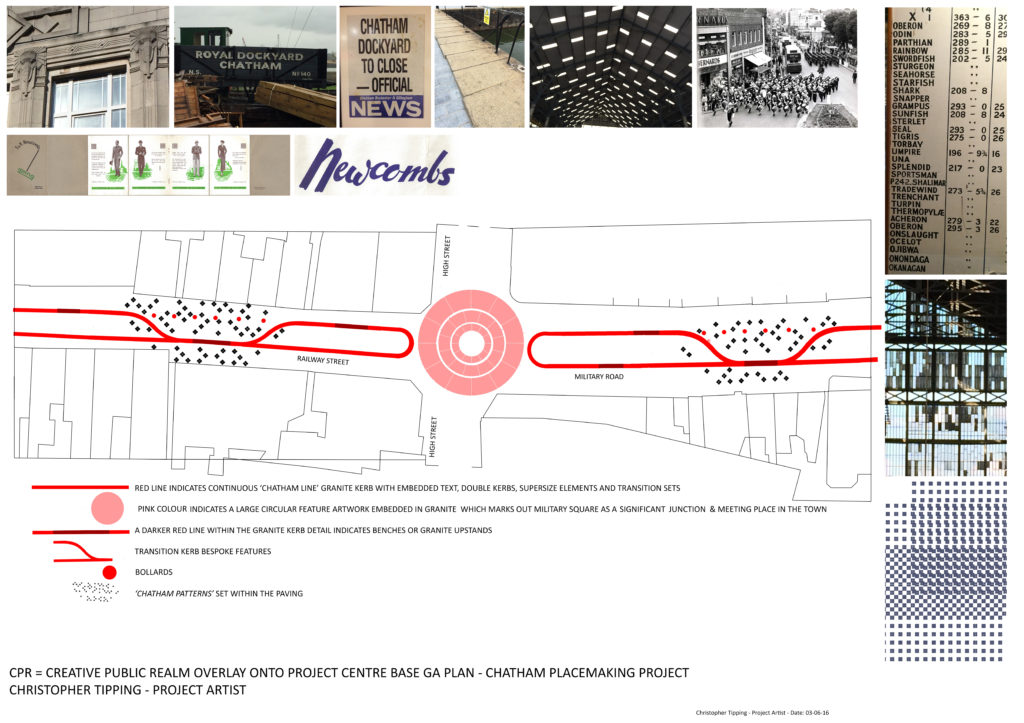
Chatham Placemaking Project. Route & Plan of Creative Public Realm. Image: Christopher Tipping
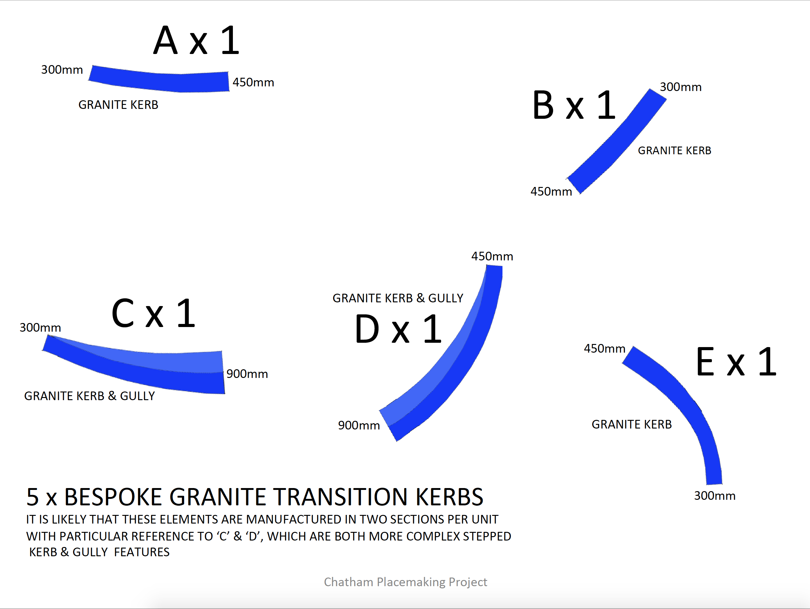
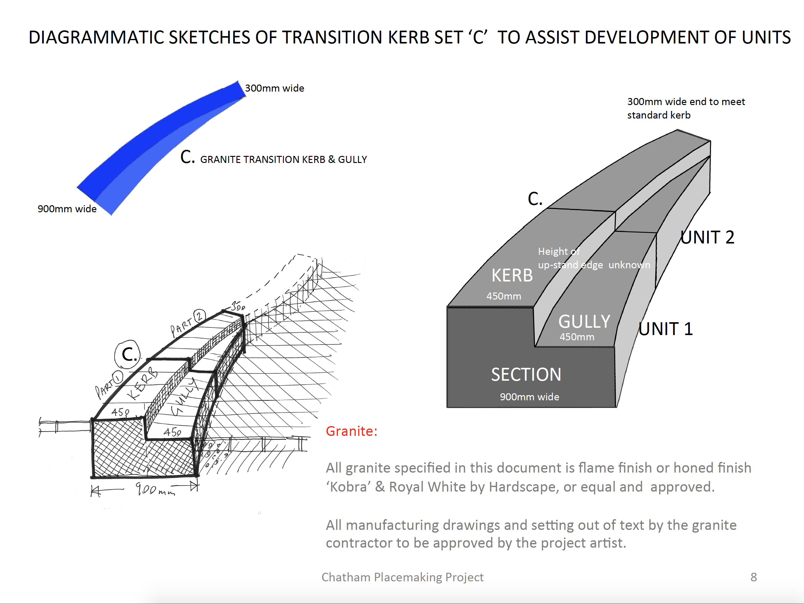
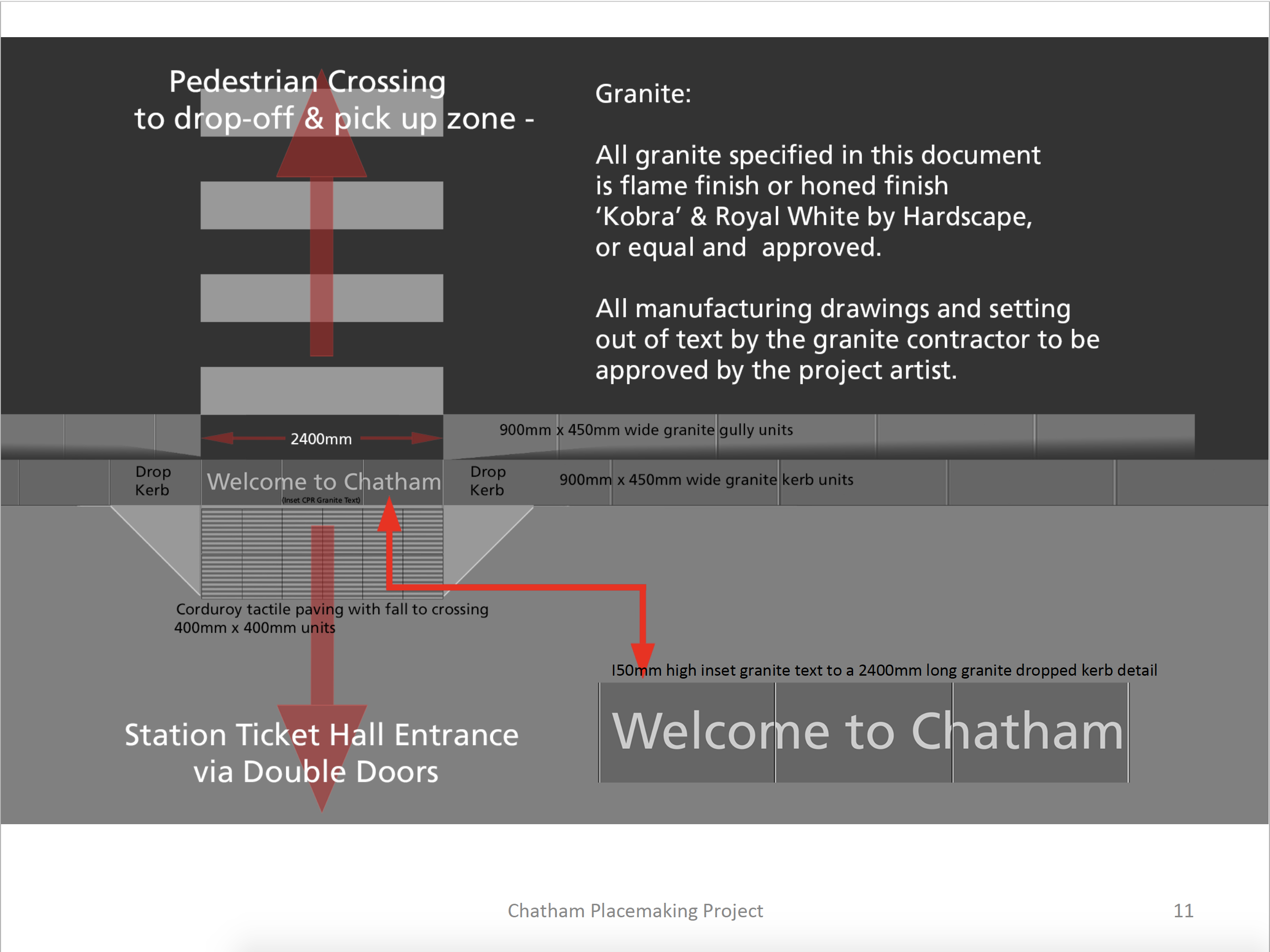
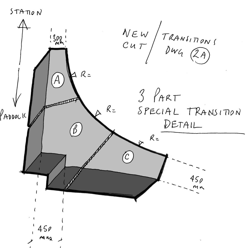
The Red Line indicates our project route & is titled the ‘Chatham Line’, after the Chatham Lines, the nearby defensive fortifications. The lines follow the historic granite kerb line & will be replaced in relevant sections by bespoke wide
granite kerbs and special transition granite units often with sandblasted or inset granite text. Text is based upon the surrounding local historic legacy & community engagement work & narrative developed by our writer in residence, Rob Young.
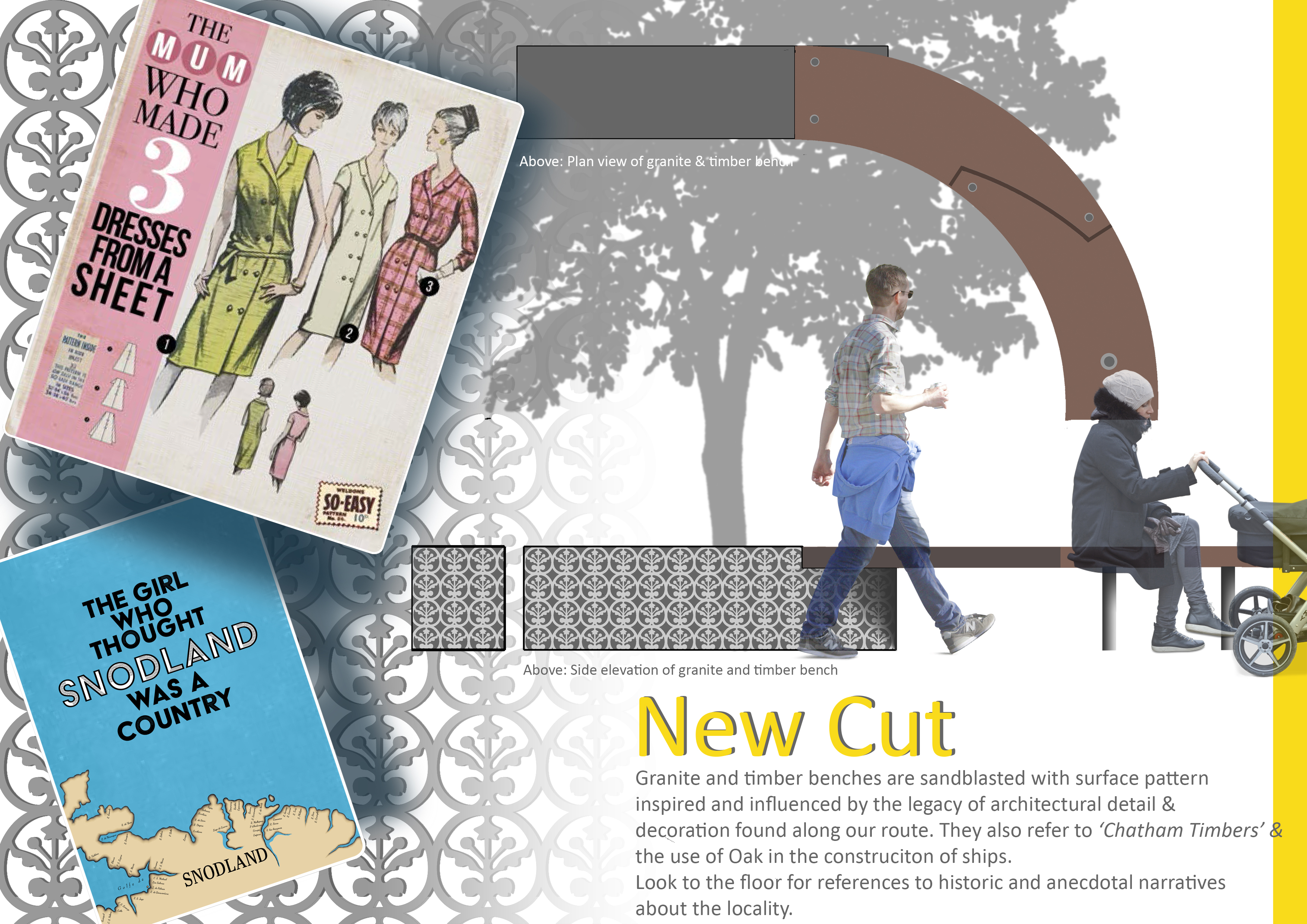
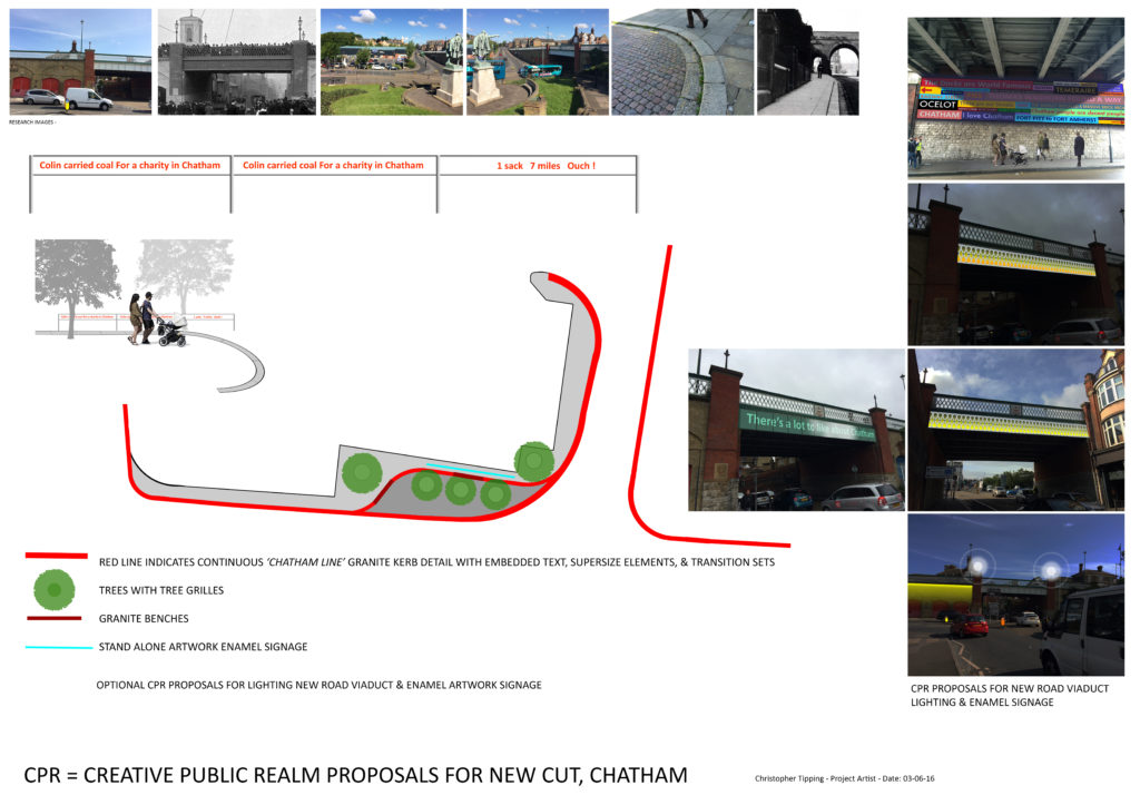
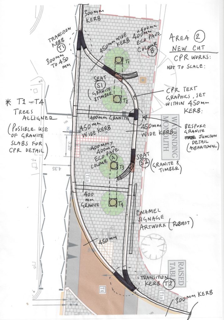
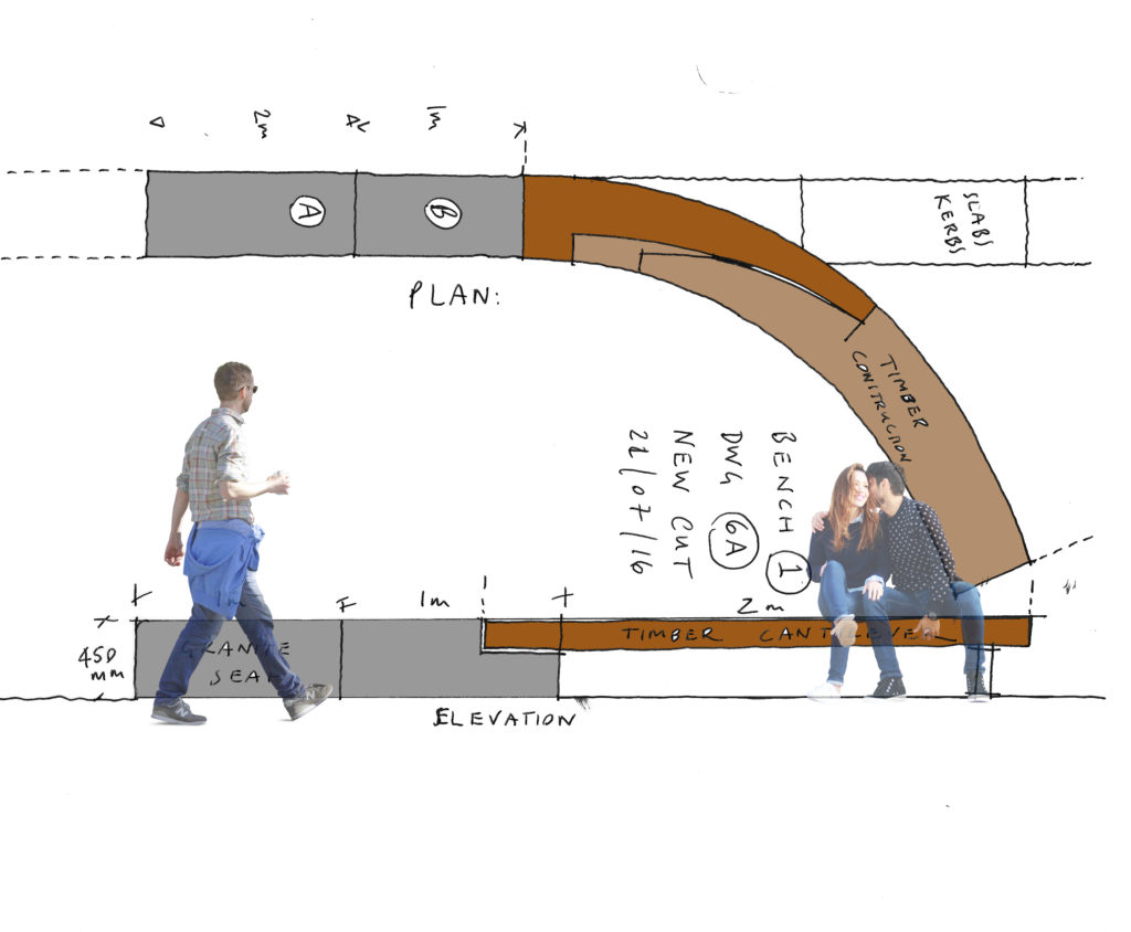
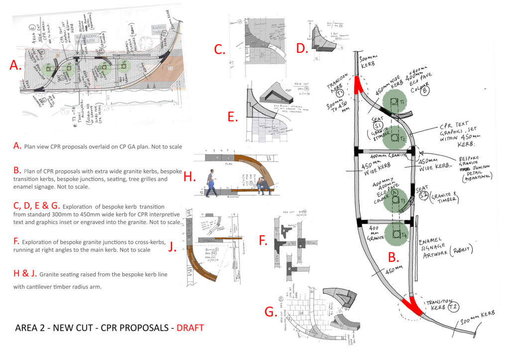
AREA 2 – NEW CUT
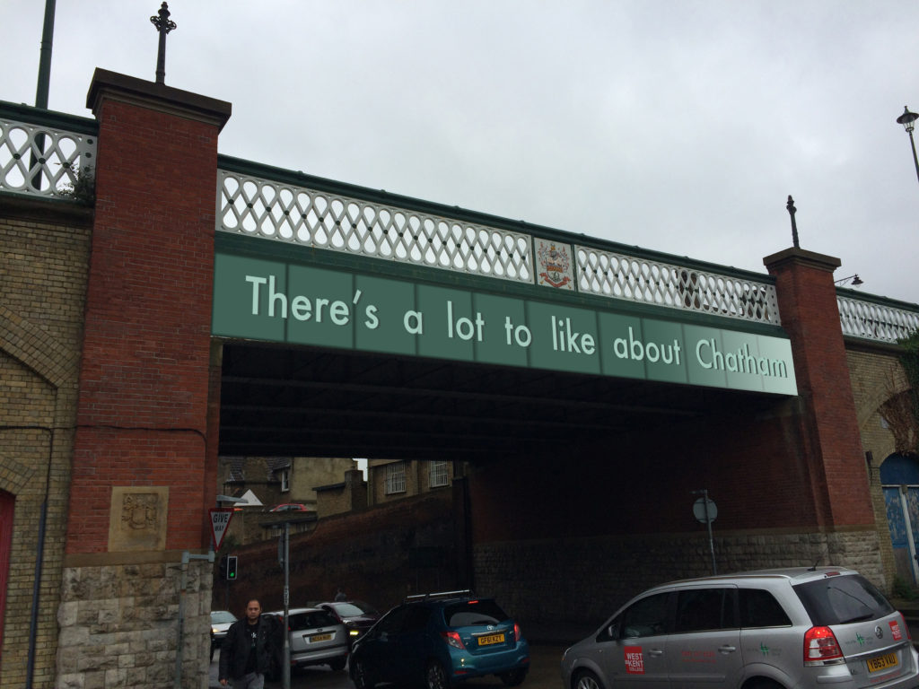
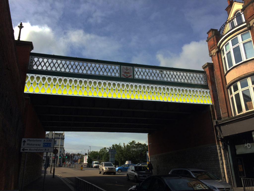
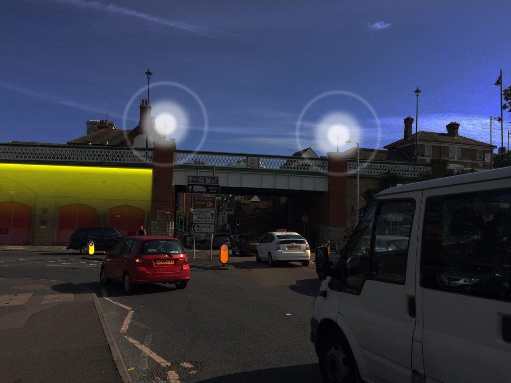
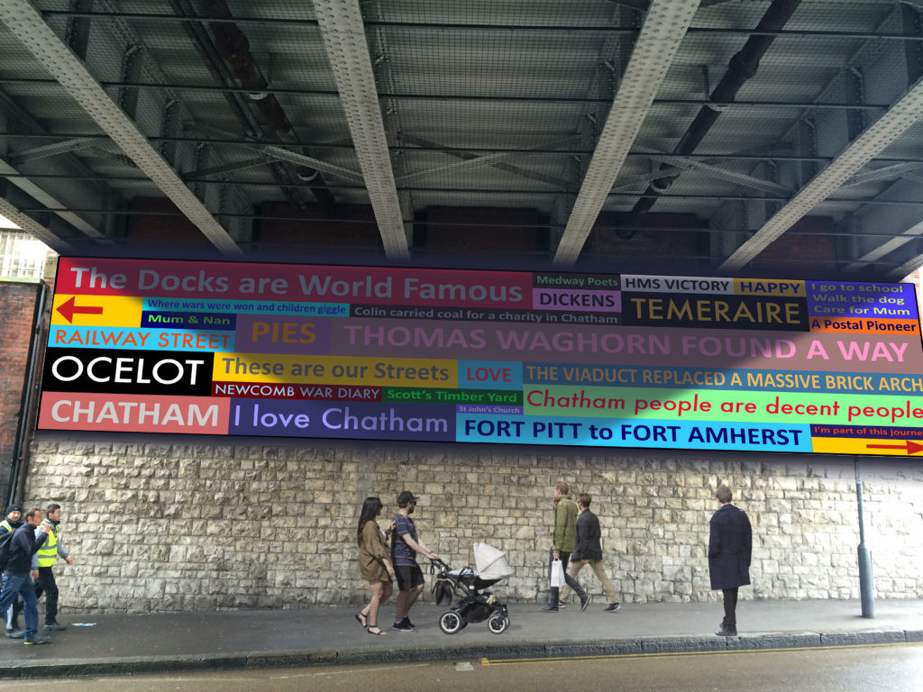
New Cut – Plan of Creative Public Realm. Image: Christopher TippingNew Cut – Sketches & Draft Plan of Creative Public Realm. Image: Christopher TippingNew Cut – Sketches & draft plan of bespoke granite kerb units. Creative Public Realm. Image: Christopher TippingNew Cut – Sketches & draft plan of bespoke granite kerb units. Creative Public Realm. Image: Christopher TippingNew Cut – Sketches & draft plan of bespoke granite & timber seating. Creative Public Realm. Image: Christopher TippingNew Cut – Sketches & draft plan of bespoke granite kerb units. Creative Public Realm. Image: Christopher TippingNew Cut – New Road Viaduct – Draft proposals for bespoke enamel panels below the balustrade, welcoming you to Chatham. Image: Christopher Tipping
As with most projects, not all ideas and proposals succeed.Budget limitations, critical rigour and often the subjective nature of the collaborative creative process all bring issues to bear in deciding what is destined to be built on site and what is left in the studio !
New Cut – New Road Viaduct – Draft proposals for bespoke enamel panels below the balustrade, welcoming you to Chatham. Image: Christopher TippingNew Cut & New Road Viaduct – Draft proposals for bespoke lighting scheme welcoming you to Chatham. Image: Christopher TippingNew Cut & New Road Viaduct – Draft proposals for bespoke enamel panels under the bridge, welcoming you to Chatham. Image: Christopher TippingSt John’s Square – Draft proposals for bespoke landscape interventions. Image: Christopher TippingSt John’s Square – Draft proposals for bespoke landscape interventions. Image: Christopher TippingSt John’s Square – Draft proposals for bespoke landscape interventions. Image: Christopher Tipping
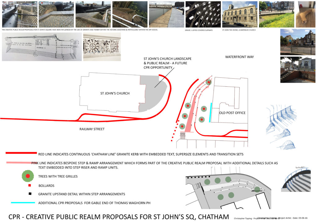
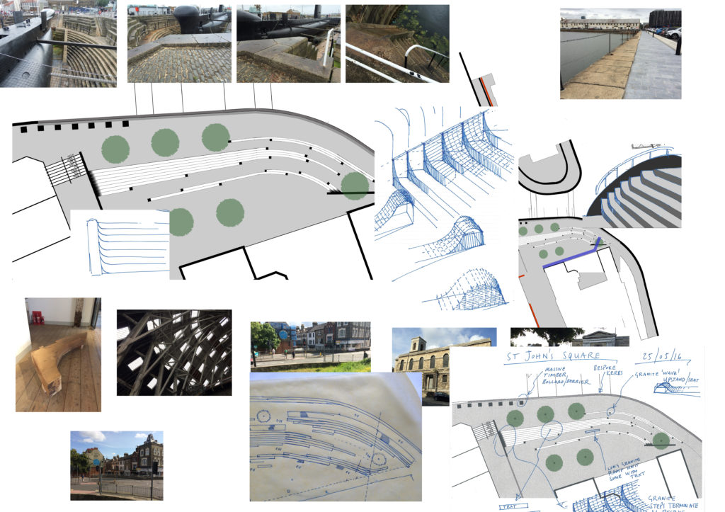
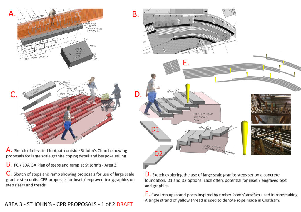
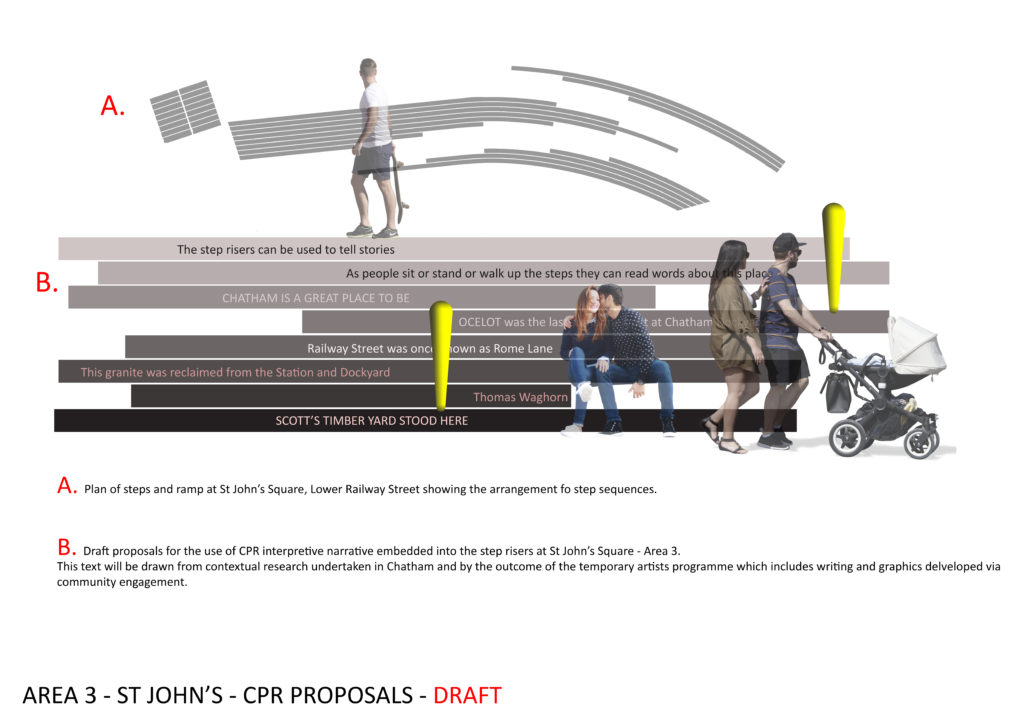
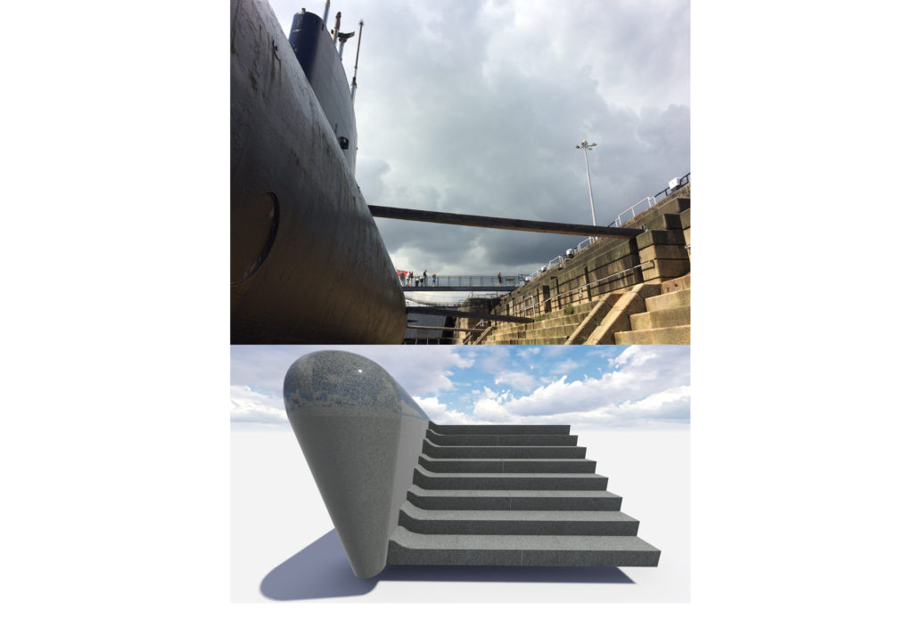
The approach to the materiality and scale of St John’s Square & elsewhere along our route, was influenced by the architectural & industrial heritage of the Historic Chatham Dockyard.
St John’s Square – Draft proposals for bespoke landscape interventions. Image: Christopher TippingSt John’s Square – Draft proposals for bespoke landscape interventions. Image: Christopher TippingSt John’s Square – Draft proposals for bespoke landscape interventions. Image: Christopher Tipping
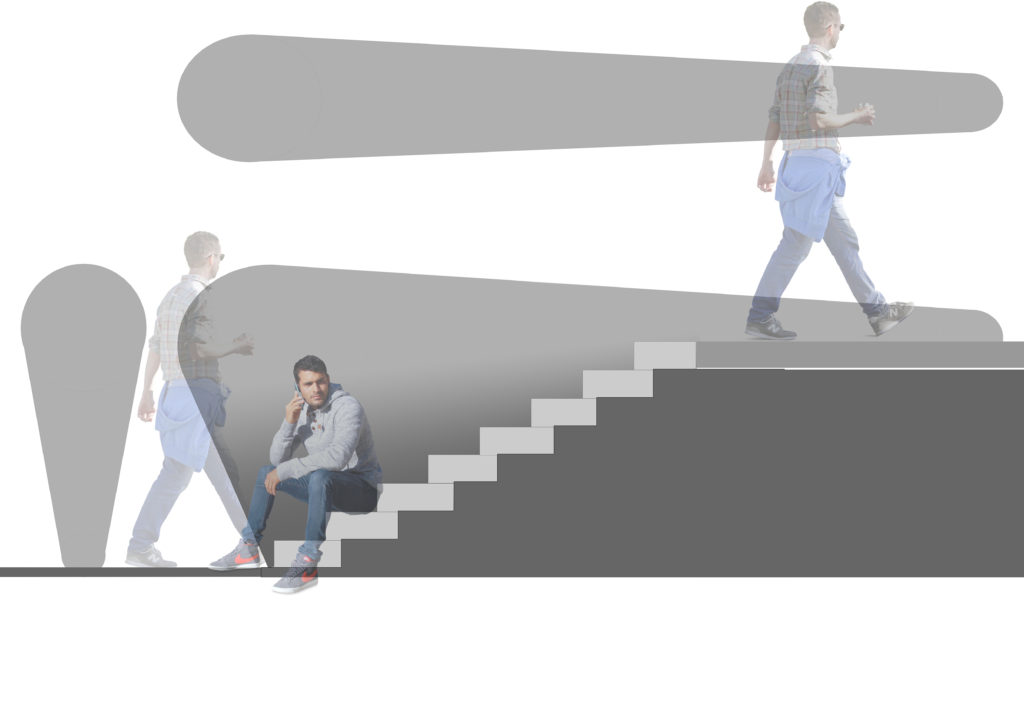
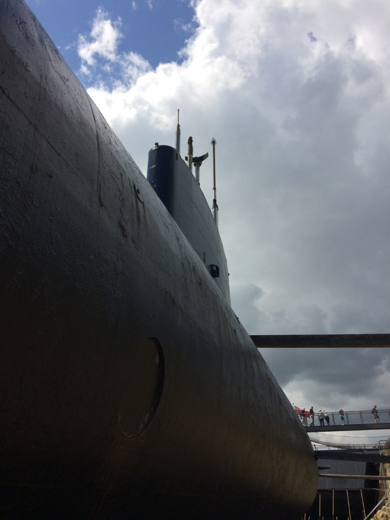
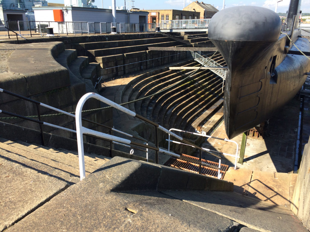
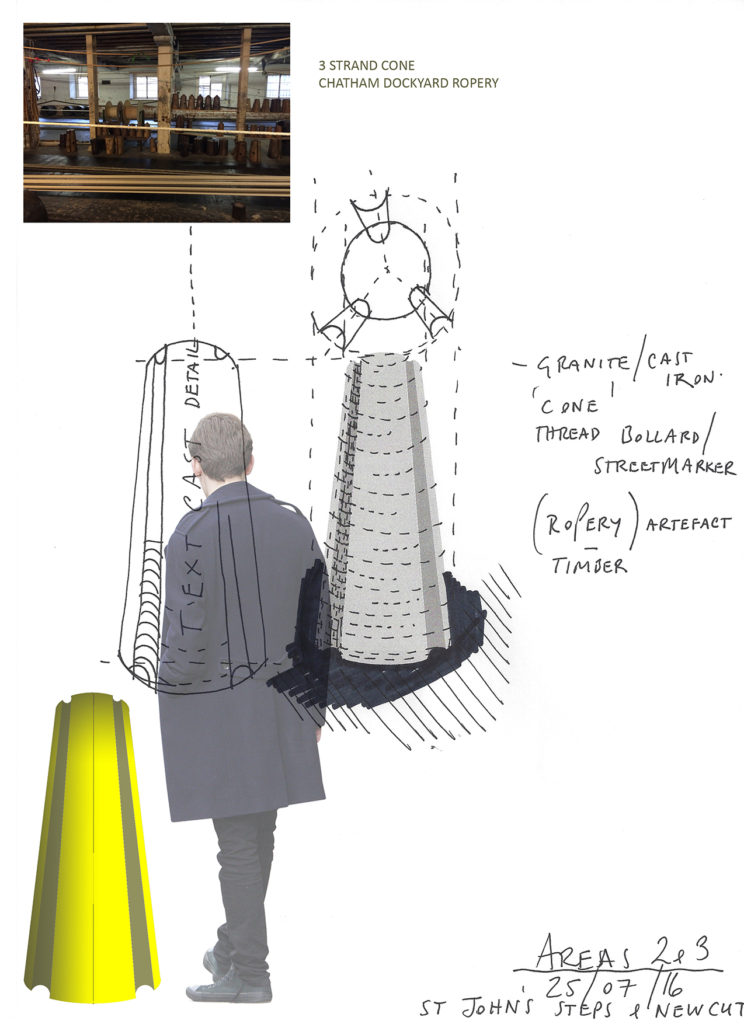
This monolithic detail seen above was titled ‘The Submarine’, inspired by HMS OCELOT on display at Chatham Historic Dockyard . This sculptural form was to act as a dividing feature separating two flights of steps at different levels.
I didn’t make it through the final evaluation process…
HMS OCELOT, Chatham Historic Dockyard. Image: Christopher TippingHMS OCELOT, Chatham Historic Dockyard. Image: Christopher TippingSt John’s Square – Draft proposals for bespoke landscape interventions. Image: Christopher Tipping & HardscapeSt John’s Square – Draft proposals for bespoke yellow enamel cast iron bollards & landscape interventions. Image: Christopher TippingSt John’s Square – Research Image of Ropery Artefacts. Draft proposals for bespoke yellow enamel cast iron bollards & landscape interventions. Image: Christopher Tipping
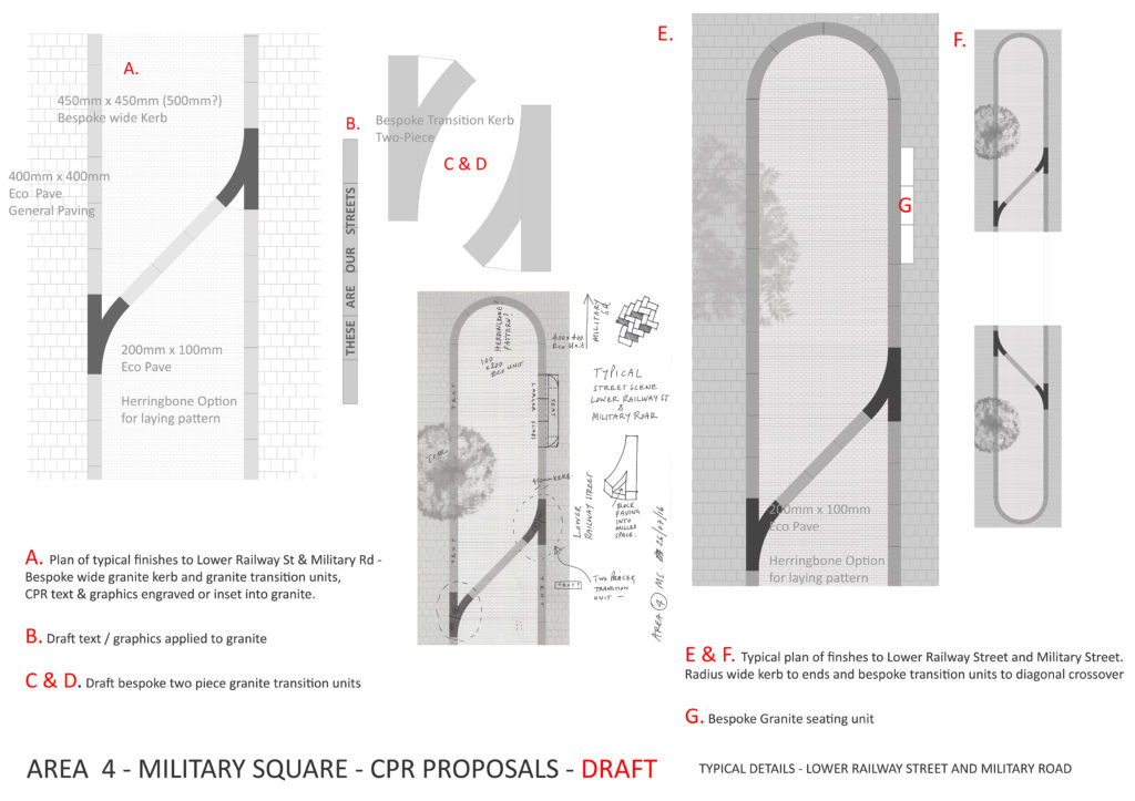
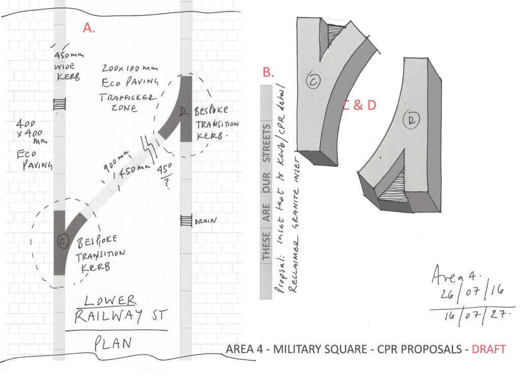
LOWER RAILWAY STREET & MILITARY SQUARE
Lower Railway Street & Military Square. Draft proposals for bespoke landscape interventions. Image: Christopher TippingLower Railway Street & Military Square. Draft proposals for bespoke landscape interventions. Image: Christopher TippingLower Railway Street & Military Square. Draft proposals for bespoke landscape interventions. Image: Christopher TippingLower Railway Street & Military Square. Draft proposals for bespoke landscape interventions. Image: Christopher TippingLower Railway Street & Military Square. Draft proposals for bespoke landscape interventions. Image: Christopher Tipping
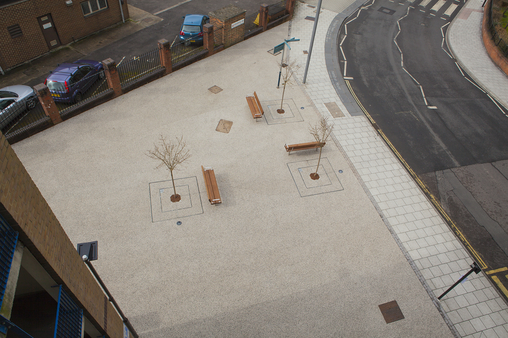
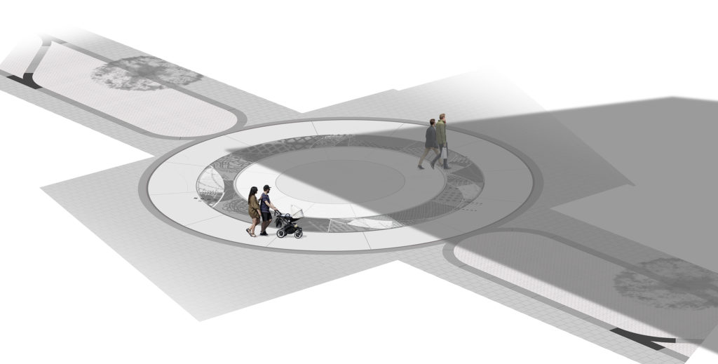
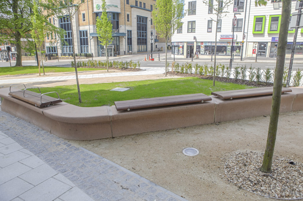
Military Square is a major pedestrian intersection in Chatham, at the crossroads between Railway Street, Military Road and the High Street.
Lower Railway Street & Military Square. Draft proposals for bespoke landscape interventions. Image: Christopher TippingLower Railway Street & Military Square. Draft proposals for bespoke landscape interventions. Image: Christopher TippingMilitary Square draft proposals for bespoke landscape interventions. Image: Christopher TippingMilitary Square draft proposals for bespoke landscape interventions. Image: Christopher TippingMilitary Square draft proposals for bespoke landscape interventions. Image: Christopher TippingMilitary Square draft proposals for bespoke landscape interventions. Image: Christopher Tipping
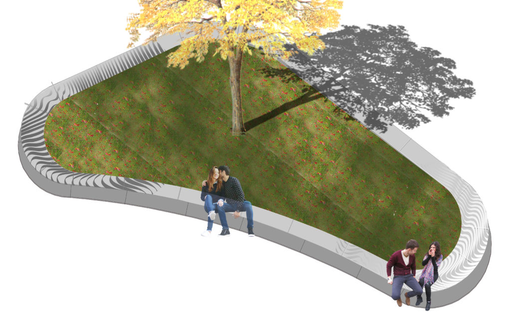
THE CIRCLE IN THE SQUARE
Military Square draft proposals for bespoke landscape interventions. Image: Christopher Tipping
Kingsbridge Lane in Southampton is a historically important and longstanding pedestrian-only route with no vehicular access. This makes the site significant to Southampton. It is a long surviving link to the western route in and out of Southampton along the coastal strand, which formed the northern shore of the River Test Estuary until the early 20th Century. The footpath runs along a narrow strip of land between the existing railway tunnel and the historic and long abandoned tunnel of the Southampton to Salisbury Canal, which ran along what is now Blechynden Terrace, linking Central Station to the Guildhall Square &Cultural Quarter. My role within this project was to develop a contextual response to the site, which would, hopefully, influence the landscape design and regenerative design process in collaboration Simon Taylor of Balfour Beatty Living Places , Southampton City Council and Hardscape.
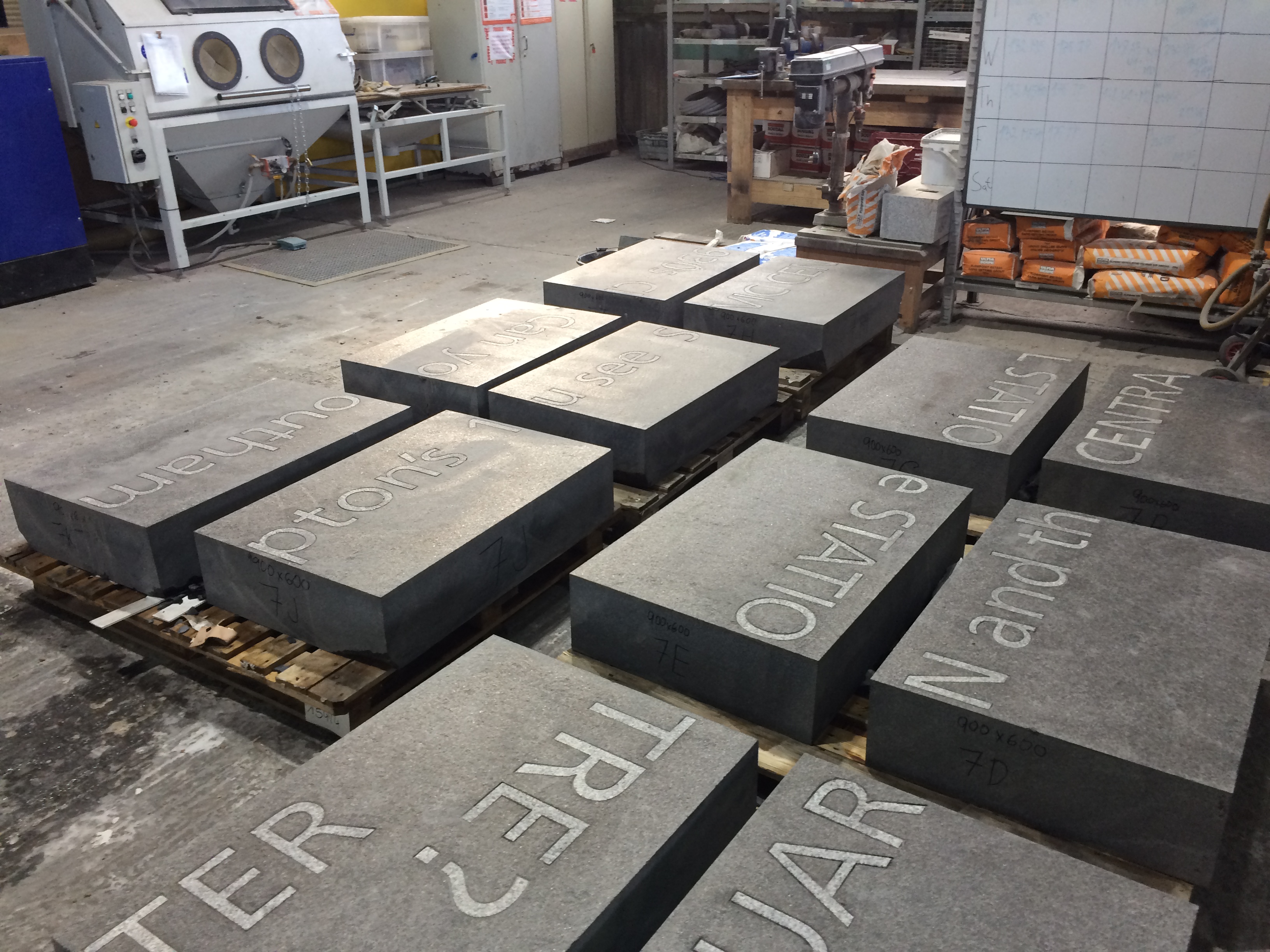
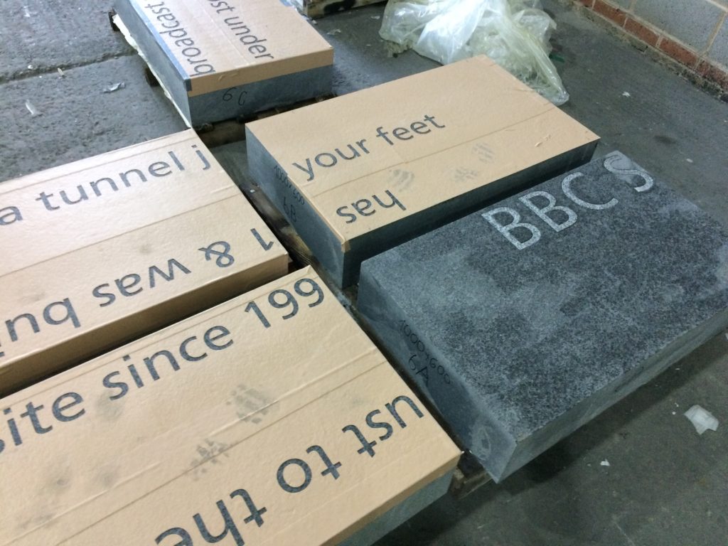
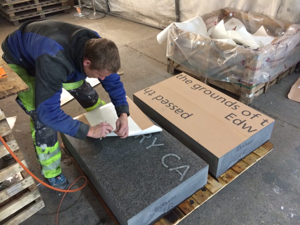
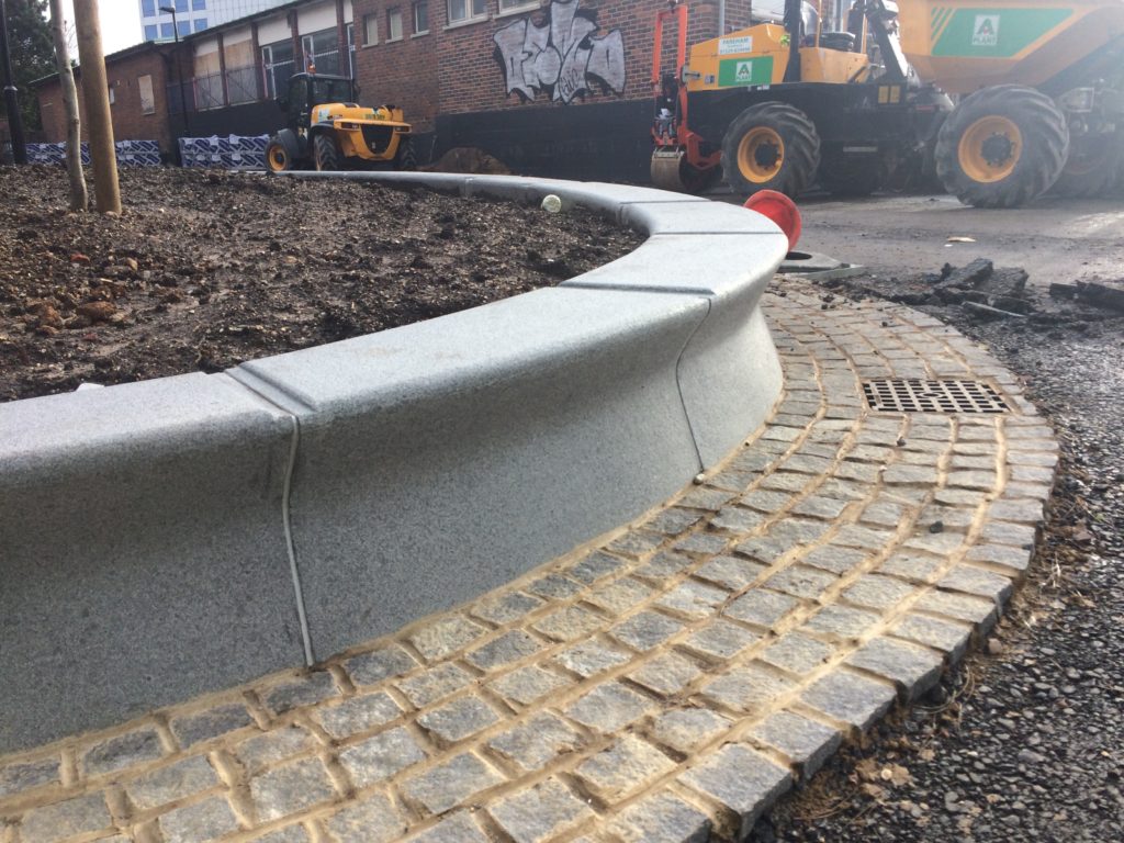
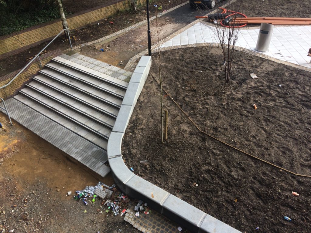
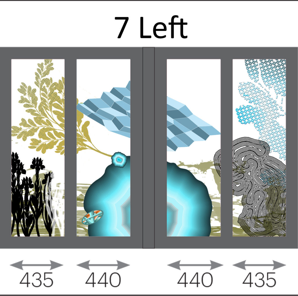
Contextual drafts – ‘BBC SOUTH has broadcast from this site since 1991 & was built on the grounds of the old Edward VI Grammar School’. Image: Christopher TippingBasalt Blocks with inset granite text set out during manufacture at Hardscape. Image: Christopher TippingBasalt Blocks awaiting sandblasting with text during manufacture at Hardscape. Image: Christopher TippingBasalt Blocks during sandblasting with text. Manufactured by Hardscape. Image: Christopher TippingBasalt Blocks with inset granite text set out during manufacture at Hardscape. Image: Christopher TippingGranite benches & retaining walls, Kingsbridge Lane, January 2018 during regeneration works on site. Image: Christopher TippingGranite benches, retaining walls and steps – Kingsbridge Lane, January 2018 during regeneration works on site. Image: Christopher TippingArtwork draft for granite benches and retaining walls. Image: Christopher TippingArtwork draft for granite benches, steps and retaining walls. Image: Christopher TippingGranite benches & retaining walls, Kingsbridge Lane, January 2018 during regeneration works on site. Image: Christopher TippingGranite benches & retaining walls, Kingsbridge Lane, January 2018 during regeneration works on site. Image: Christopher TippingFinal Text setting for Basalt Strips. Kingsbridge Lane, Southampton. Image: Christopher Tipping
Granite benches, retaining walls & Black Basalt slabs with inset and sandblasted contextual text – Kingsbridge Lane, January 2018 during regeneration works on site. Image: Christopher TippingBlack Basalt strips with inset and sandblasted contextual text, cross the footpath at intervals – Kingsbridge Lane, January 2018 during regeneration works on site. Image: Christopher Tipping
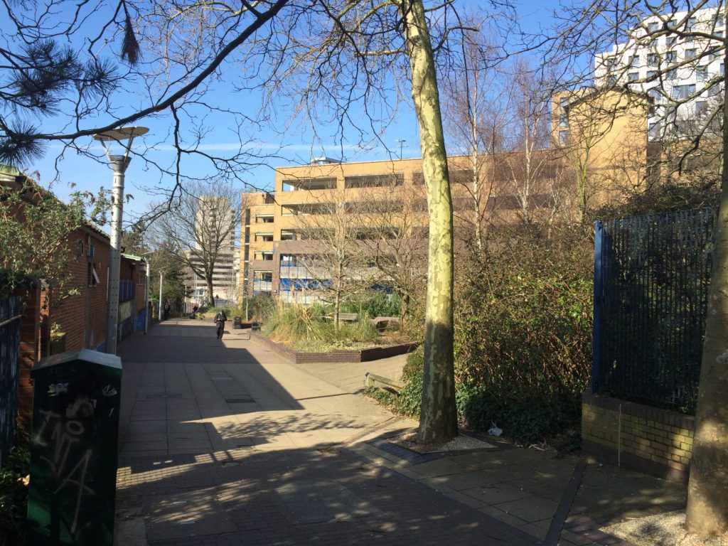
The footpath is busy, particularly at peak travel times, but is tired, with aged materials and and unkept vibe, even more striking now that the route connects the two recently completed ‘Quarters’, Cultural & Station – what is does have is brilliant a clear sight lines – with the Civic Centre Clocktower, Wyndham Court, Central Station and Southampton Docks all visible at points along the route.
The proposals for creative public realm interventions at Kingsbridge Lane are a direct response to the following:
Preservation of the historic legacy and contextual significance of the local area –
Topography – there is a 9m fall in height from the top of the route to the bottom –
Kingsbridge Lane as a primary pedestrian route today, linking Southampton Station Quarter to the Cultural Quarter, city centre & east to west pedestrian axis –
A practical need to screen existing Network Rail buildings and car park along the southern and northern boundaries of the site –
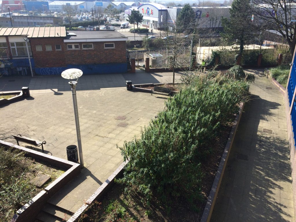
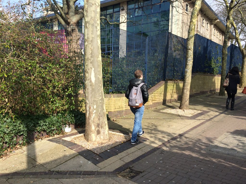
Entrance to Kingsbridge Lane is on the right hand side of this image from June 2016, prior to regeneration works starting. Image: Christopher TippingKingsbridge Lane March 2016 prior to regeneration. Image: Christopher TippingKingsbridge Lane March 2016 prior to regeneration. Image: Christopher TippingKingsbridge Lane March 2016 prior to regeneration. Image: Christopher TippingKingsbridge Lane March 2016 prior to regeneration. Image: Christopher TippingKingsbridge Lane March 2016 prior to regeneration. Image: Christopher Tipping
My work here is an extension of the ‘Canal Shore’ concepts and research underpinning the Station Quarter North Project completed a couple of years earlier in 2016, which I had been involved with since 2012. The text below set out the background of this work.
‘Inspiration, aspiration & delivery…
As project artist, I undertook a detailed investigation into the neighborhood’s social history, geography, ecology and culture to uncover hidden structures, which inform the area’s current form, identity & reputation. This site-specific & research-led activity assisted in driving the creative concept & rationale, which now underpins the general spatial layout, character and interpretation of the new proposals. I worked as part of an integrated design team including Engineers, Landscape Architects, Designers and specialist contractors. This collaborative process allowed me to work creatively, whilst being fully supported by the wider project team.
‘Southampton’s lost district: A landscape rediscovered’
An understanding of the site’s past physical condition drives the overall theme and character of the landscape & public realm interventions: a wooded valley, a meandering stream, the curve of the historic shoreline & the ill fated Southampton & Salisbury Canal. The primary human activities on the site over time, as evidenced by residential, industrial & cultural histories have been influential in drawing individual & collective ‘voices’ from the locality which will serve to imbue any outcomes with a distinctive & renewed sense of place.
This site, adjacent to the shoreline of the Test Estuary has always been a point of confluence. The main route West in & out of the city ran along the shoreline. In medieval times this route along the shore was known and ‘The Strand’. At a point marked by Achards Bridge, which crossed the Rollesbrook Stream to enter the River Test, the city boundary with Millbrook was established.
Today this point is almost exactly opposite the entrance to Southampton Station. Blechynden Terrace is considered to be built along the line of the filled in canal basin of the Southampton & Salisbury Canal. The historic shoreline and the highest point to which the tide rises was along the line of the road.
‘Canal Shore’ developed as a singular response to this research, which is supported by a broader influence, which has pervaded the whole site.
The artwork ‘Canal Shore’ is a consolidation of all that the site has to offer, both contextually and historically. In part it traced the line of the old shoreline & the only East to West route out of the city along the shingle beach from earliest times. It was the route of an ill-fated 19th Century canal. It is now a busy road and part of the transportation network of the city. Its route forms part of the perimeter of our site, so as a single element it has the capacity to help to unify the site and draw other more disparate elements together. The work represents the confluence of both historic and contemporary transportation routes within the city.
The location of the work dictates that it adds a tangible physical presence & value to the site. However, the materials and design are significant too. The black basalt kerb is deliberately large scale & incredibly robust, but has been engineered and designed with a particular aesthetic to blend well with its dual function. It considers traffic flow & movement through the site by allowing for transport access across its width, with elegant dropped kerb sets and large-scale corner quadrants. We have extended the width of the kerb to emphasize its importance as a marker of the historic shoreline of West Bay and the River Test Estuary, but also as a reference to the former Canal coping stone edge. Its function a physical kerb edge on the highway not only indicates that it is fit for purpose, but it deliberately aligns itself to the East to West axis of this transportation and pedestrian route within the City, extending and connecting to existing routes to the Cultural Quarter, QEII Mile and future Maritime Promenade’.
Chatham Placemaking Project – Left to Right – Project Artists: Xtina Lamb, Christopher Tipping, Simon Williams, Rob Young
A review of current and recently completed works –
I am an experienced Artist working in Public Realm, Urban Regeneration and Healthcare environments for Local Authorities, NHS Trusts and the Private Sector.
My projects exhibit contrasting variations in scale, budgets and delivery programmes. They illustrate how I can creatively collaborate within and successfully contribute to a variety of multi-disciplinary teams working in diverse locations and communities.
What underpins my approach to every project however, is a passion for contextually driven creative research and site analysis with which to inform, influence or drive a project forward. What actually delivers the project thereafter is an ability and a desire to collaborate from the outset, respectful of and creatively responsive to the contribution of all members of a client group.
I want to be involved in projects which create spaces and places which resonate with the people who will ultimately use them and which enhances their personal enjoyment and experience of it.
Click on the project titles for links to more detailed information.
Chatham Placemaking Project. Draft Magazine page for ‘A Circle of Words in a Military Square’.Chatham Placemaking Project. Draft Magazine page for ‘St John’s Steps & Crossing’. Artist: Christopher Tipping
Southampton Station Quarter North – Frobisher House Forecourt. Image: Wilson Massie. Project Artist: Christopher TippingSouthampton Station Quarter North – Station Forecourt. Image: Wilson Massie. Project Artist: Christopher Tipping
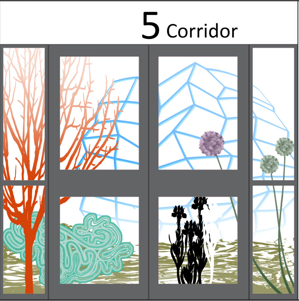
HARRISON PARK, ORCHARD PARK, HULL – Extra Care Housing Scheme – digitally printed glazing vinyl and wall mounted work – Status: Ongoing
Detail: Glazing Vinyl installation Harrison Park, Hall Rd, Hull Extra Care. Artist: Christopher TippingDetail: Glazing Vinyl installation Harrison Park, Hall Rd, Hull Extra Care. Artist: Christopher Tipping
Draft Artwork for Wenric Ward, Littlemore Mental Health Unit, Oxford. Artist: Christopher TippingDraft Artwork for Wenric Ward, Littlemore Mental Health Unit, Oxford. Artist: Christopher Tipping
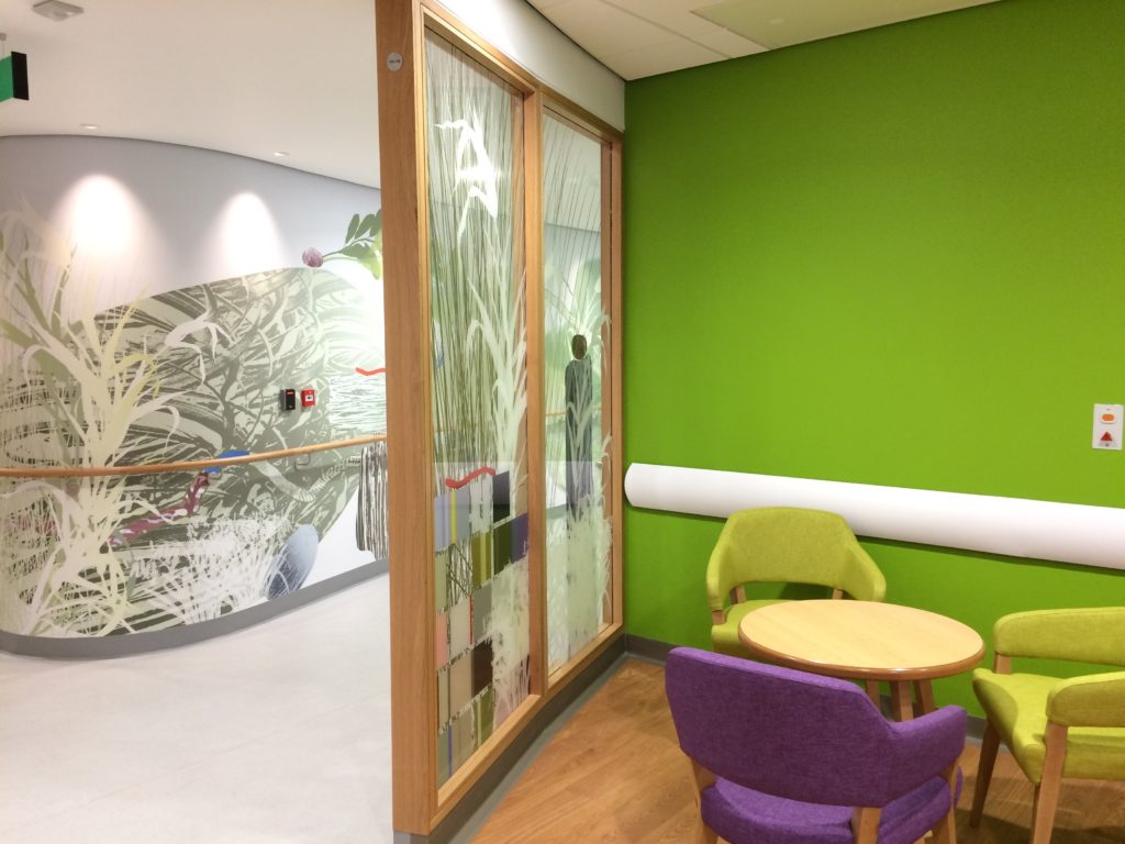
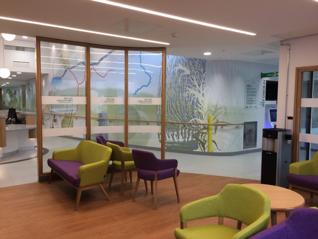
Interior of the New Macmillan Unit, showing a detail of the main corridor bespoke wall covering as seen through the laminated glazed screens. Project Artist: Christopher TippingInterior detail of the New Macmillan Unit at Tameside Hospital – Project Artist: Christopher Tipping
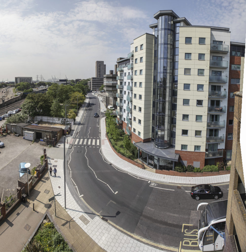
KINGSBRIDGE LANE, SOUTHAMPTON – Public Realm project currently in development. An extension of the Southampton Station Quarter North Project – Status: Ongoing
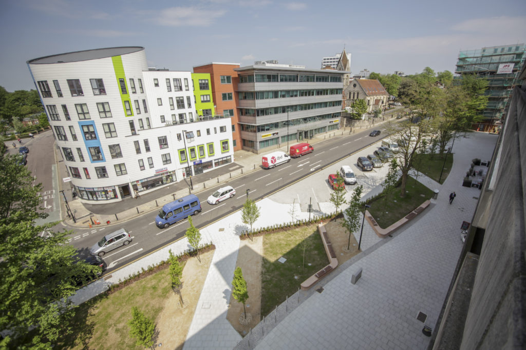
Southampton Station Quarter North was shortlisted for the 2016 Solent Design Awards, which were awarded in November 2016 – A much needed update on the project. Better late than never !
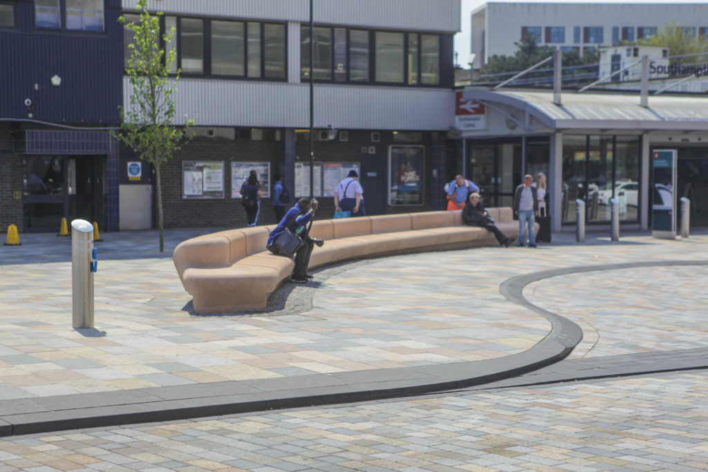
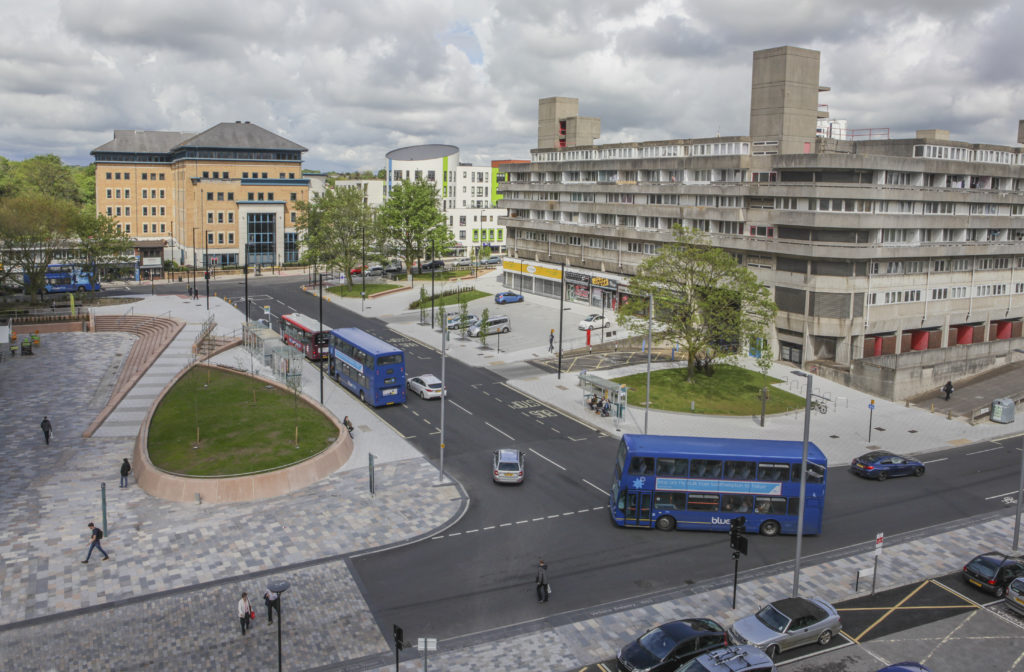
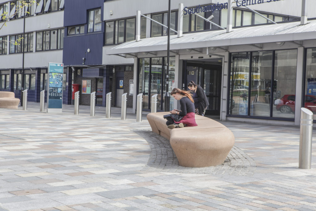
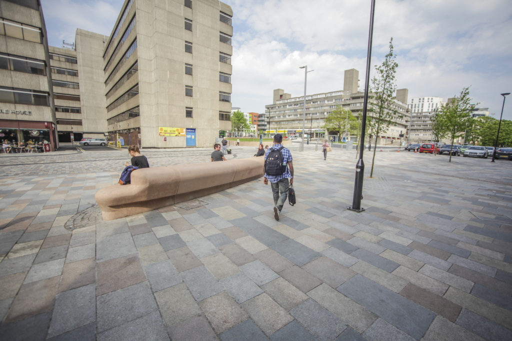
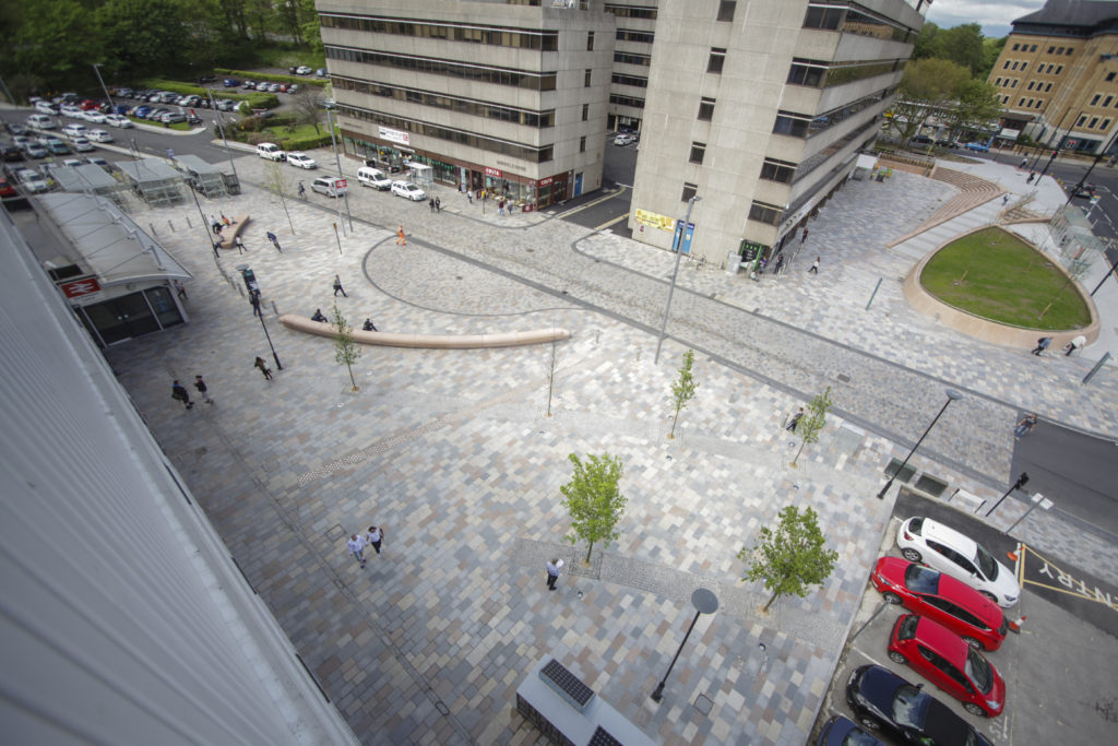
Southampton Station Quarter North – Public Realm. Image: Wilson Massie. Project Artist: Christopher Tipping
Although our project was not one of the winners… it was very encouraging that the collaborative approach which delivered the project and the role of our Champions Group, which endured throughout the build programme was recognised via the shortlist process.
‘The Solent Design Awards are all about the encouragement of quality place-making; schemes that create special places, lift communities, create richer experiences … not just iconic buildings, but also the places in-between’.
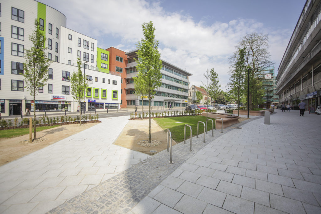
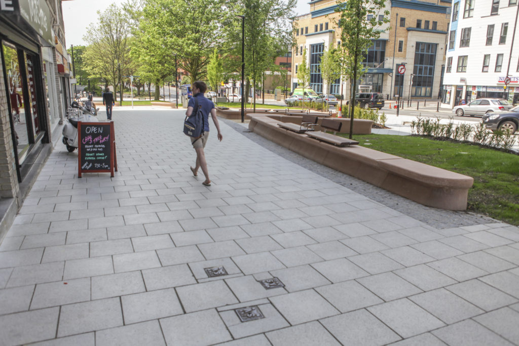
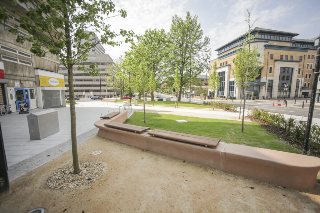
The following set of images from the site were produced by Wilson Massie of Balfour Beatty Living Places – thanks Wilson !
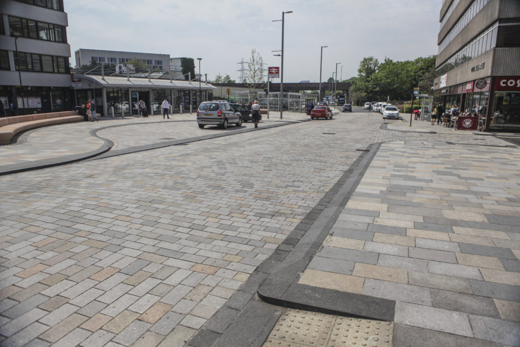
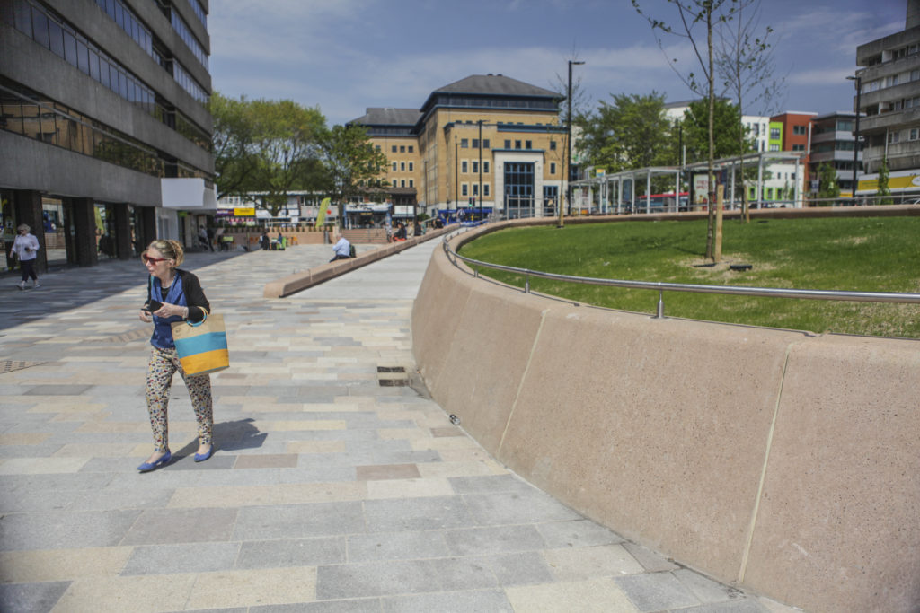
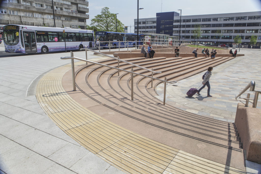
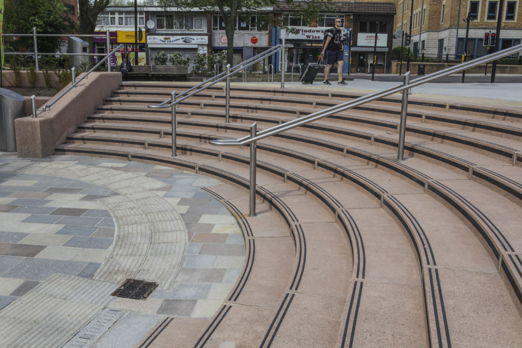
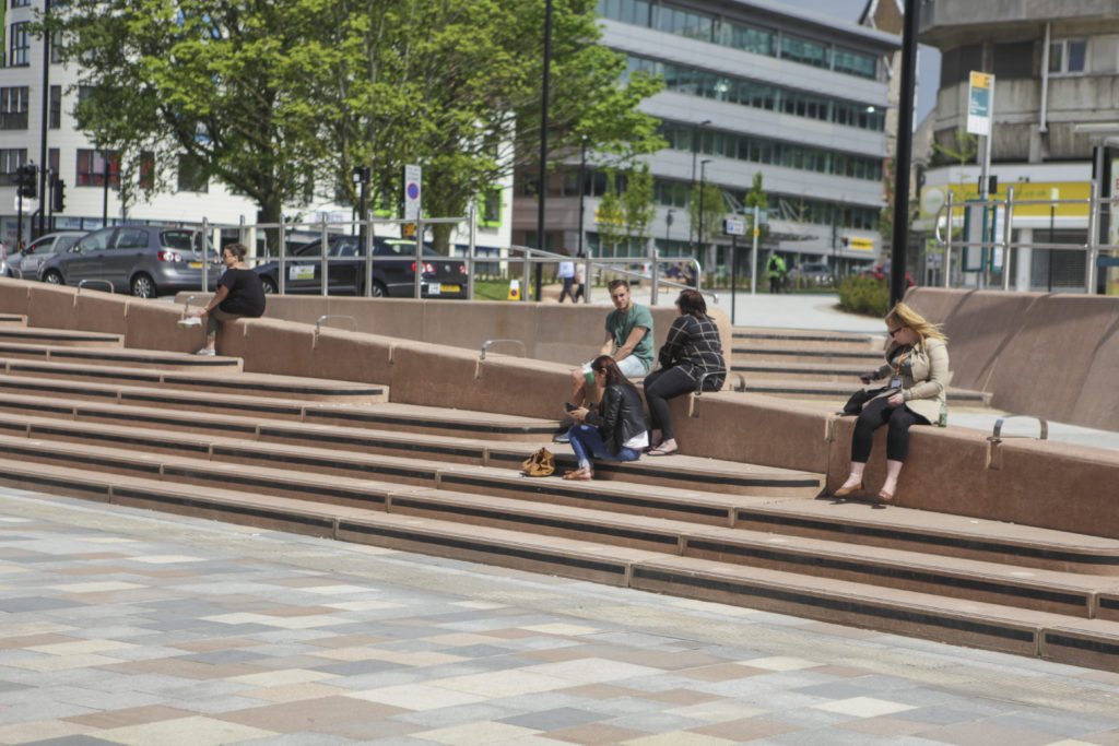
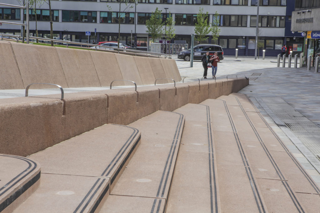
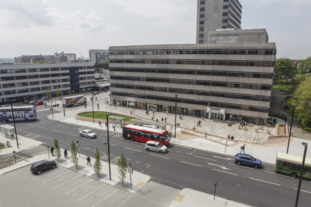
Southampton Station Quarter North – Station Forecourt. Image: Wilson Massie. Project Artist: Christopher TippingSouthampton Station Quarter North – Station Forecourt. Image: Wilson Massie. Project Artist: Christopher TippingSouthampton Station Quarter North – Station Forecourt. Image: Wilson Massie. Project Artist: Christopher TippingSouthampton Station Quarter North – Station Forecourt. Image: Wilson Massie. Project Artist: Christopher TippingSouthampton Station Quarter North – Station Forecourt, Southbrook Road. Image: Wilson Massie. Project Artist: Christopher TippingSouthampton Station Quarter North – Frobisher House Forecourt. Image: Wilson Massie. Project Artist: Christopher TippingSouthampton Station Quarter North – Frobisher House Forecourt. Image: Wilson Massie. Project Artist: Christopher TippingSouthampton Station Quarter North – Amphitheatre Steps, Frobisher House Forecourt. Image: Wilson Massie. Project Artist: Christopher TippingSouthampton Station Quarter North – Amphitheatre Steps, Frobisher House Forecourt. Image: Wilson Massie. Project Artist: Christopher TippingSouthampton Station Quarter North – Amphitheatre Steps, Frobisher House Forecourt. Image: Wilson Massie. Project Artist: Christopher TippingSouthampton Station Quarter North – Amphitheatre Steps, Frobisher House Forecourt. Image: Wilson Massie. Project Artist: Christopher TippingSouthampton Station Quarter North – Views from Wyndham Court. Image: Wilson Massie. Project Artist: Christopher TippingSouthampton Station Quarter North – View along Commercial Road from Wyndham Court. Image: Wilson Massie. Project Artist: Christopher TippingSouthampton Station Quarter North – View along Commercial Road from Wyndham Court. Image: Wilson Massie. Project Artist: Christopher TippingSouthampton Station Quarter North – View along Commercial Road from Wyndham Court. Image: Wilson Massie. Project Artist: Christopher TippingSouthampton Station Quarter North – View along Commercial Road from Wyndham Court. Image: Wilson Massie. Project Artist: Christopher TippingSouthampton Station Quarter North – View along Commercial Road from Wyndham Court. Image: Wilson Massie. Project Artist: Christopher TippingSouthampton Station Quarter North – View along Commercial Road. Image: Wilson Massie. Project Artist: Christopher TippingSouthampton Station Quarter North – View along Blechynden Terrace towards the Station. Image: Wilson Massie. Project Artist: Christopher Tipping
The artwork ‘Canal Shore’ runs for almost 200m along the South side of Blechynden Terrace. Bespoke extra wide Black Basalt kerbs are inset with white granite text referencing the site.
Quarter North – View of Basalt Kerb along Blechynden Terrace towards the Station. Image: Wilson Massie. Project Artist: Christopher Tipping
With thanks to Hardscapefor their excellent collaboration on the ‘Canal Shore’ artwork.