Draft Magazine – Playing Card Graphics by Paul Baker with text by Rob Young. THESE ARE OUR STREETS. Image: Christopher Tipping.
THESE ARE OUR STREETSPart Three…! We have always planned to create a magazine or booklet…some form of printed publication or other, with which to celebrate and record our progress, our ideas, the stuff that got away…but mostly our collaboration with each other and with the people along our route. We may still be able to deliver this a a hard-copy paper publication at some point in the future, as a way or marking the project – or as an online event.
The following images will show you part of our journey to create the draft and concepts for the work you can now see embedded into the pavements of Railway Street and Military Square. The content has been generated in collaboration with other artists and creatives, commissioned to deliver specific aspects of our work, but who directly and indirectly contributed so brilliantly to the outcome. FrancisKnight Public Art Consultants, Rob Young– Writer, Xtina Lamb– Printmaker, Simon Williams– Filmmaker & Paul Baker – Graphic Designer.
Draft Magazine – Pages 34 & 35 FINAL : THESE ARE OUR STREETS. Image: Christopher Tipping. Group Photograph by FrancisKnight. Chatham Patterns by Xtina Lamb
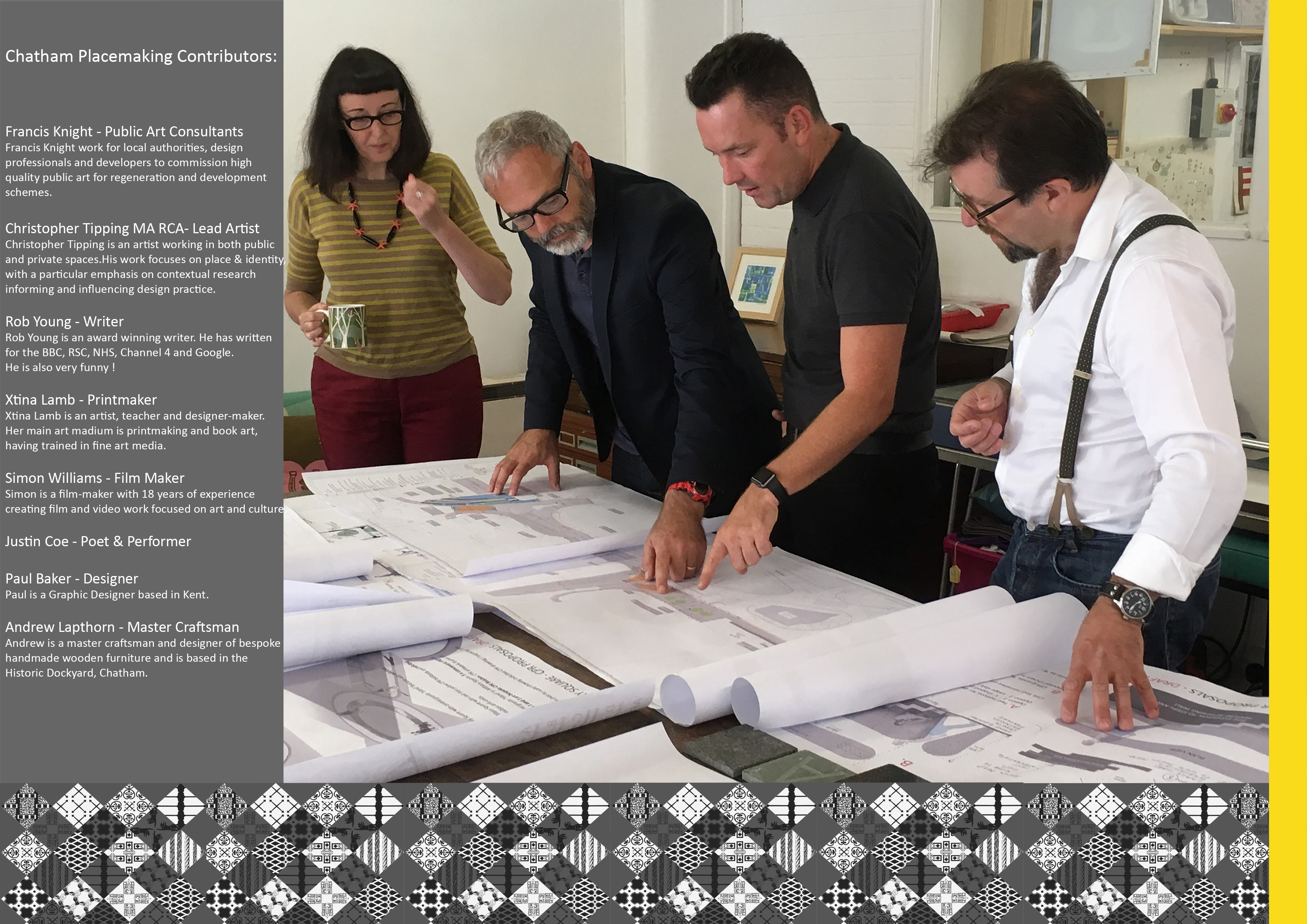
Above Image: From left to right – Xtina Lamb, Christopher Tipping, Simon Williams, Rob Young at a project meeting in Rochester with FrancisKnight, September 2016
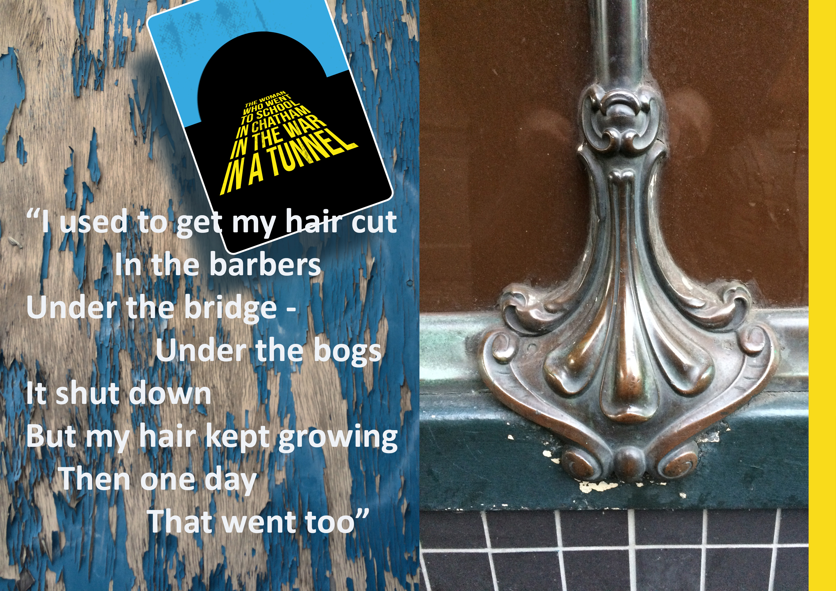
Draft Magazine – Playing Card Graphics by Paul Baker with text by Rob Young. THESE ARE OUR STREETS. Image: Christopher Tipping.Draft Magazine – Playing Card Graphics by Paul Baker with text by Rob Young. THESE ARE OUR STREETS. Image: Christopher Tipping.
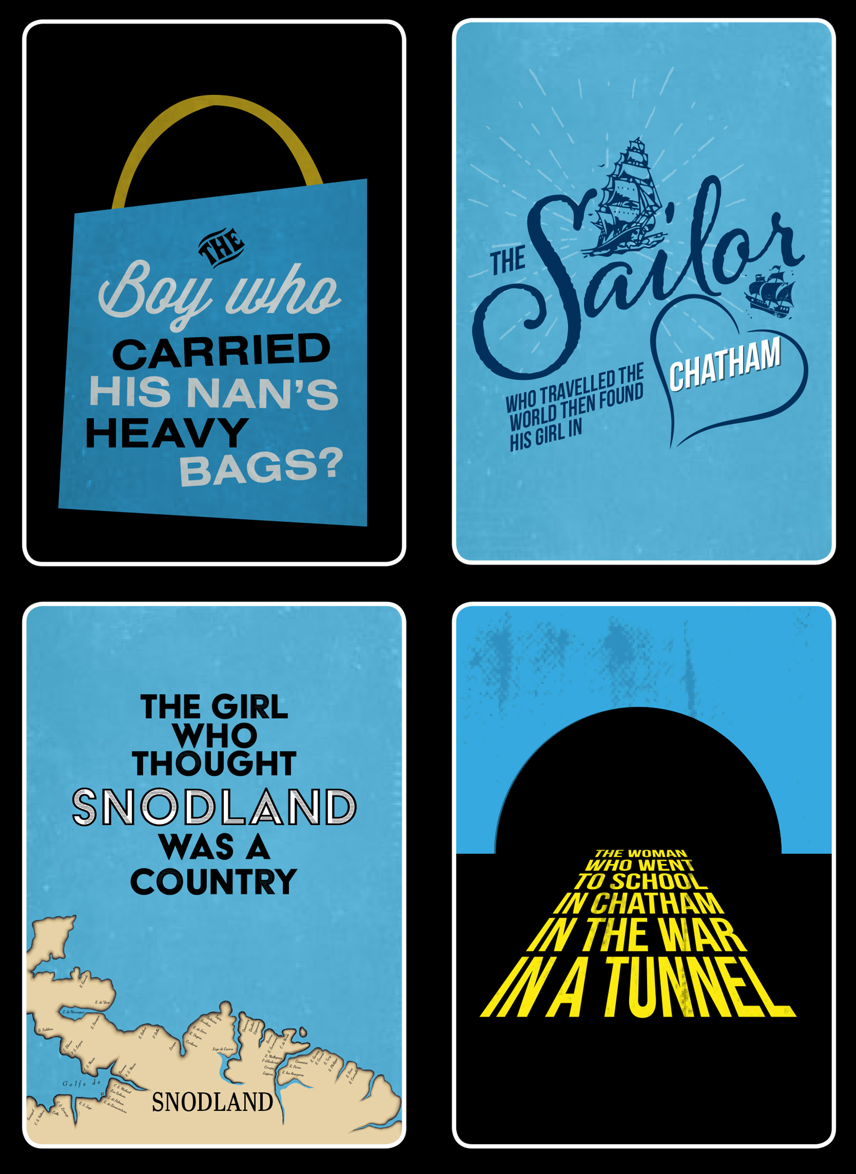
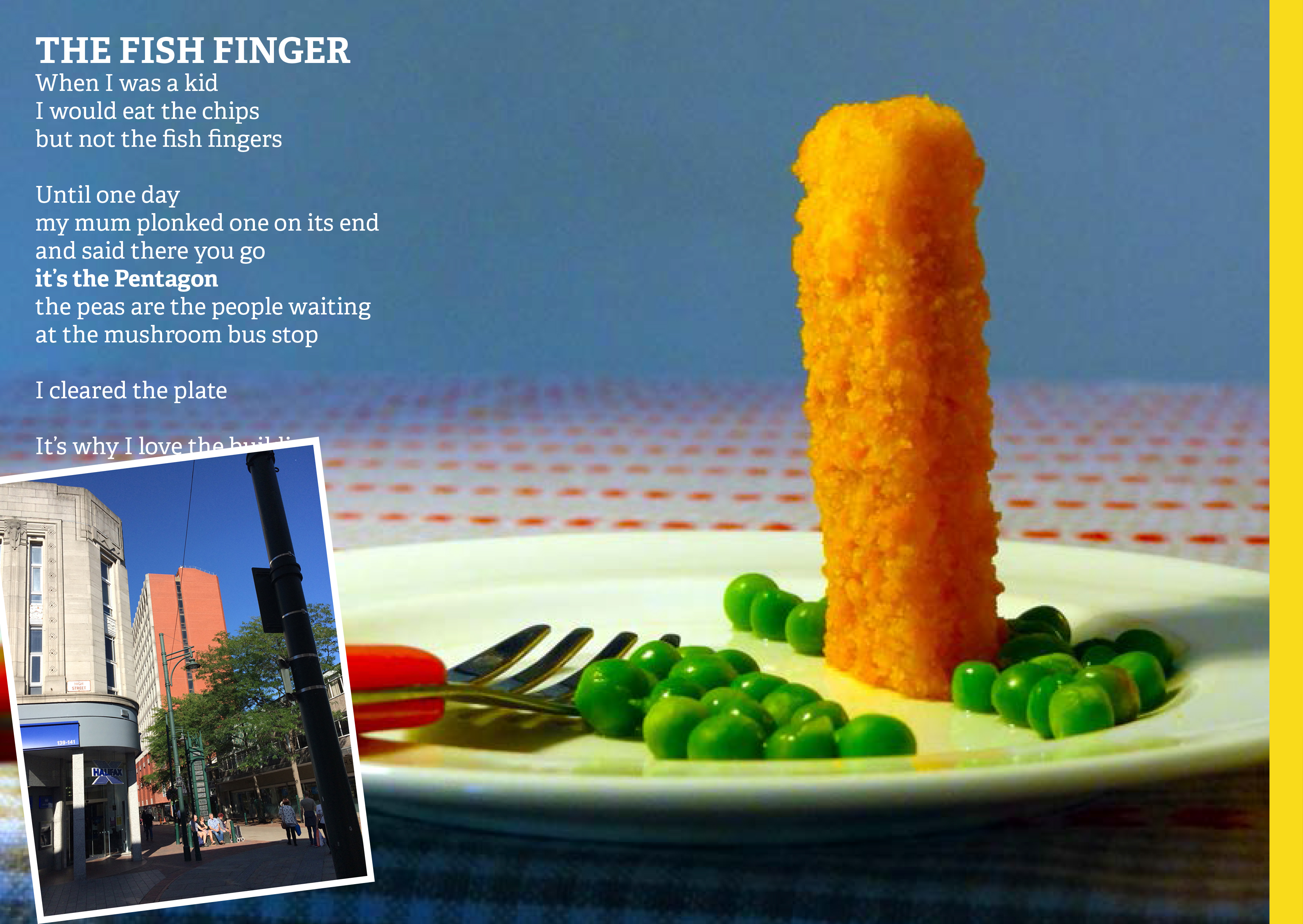
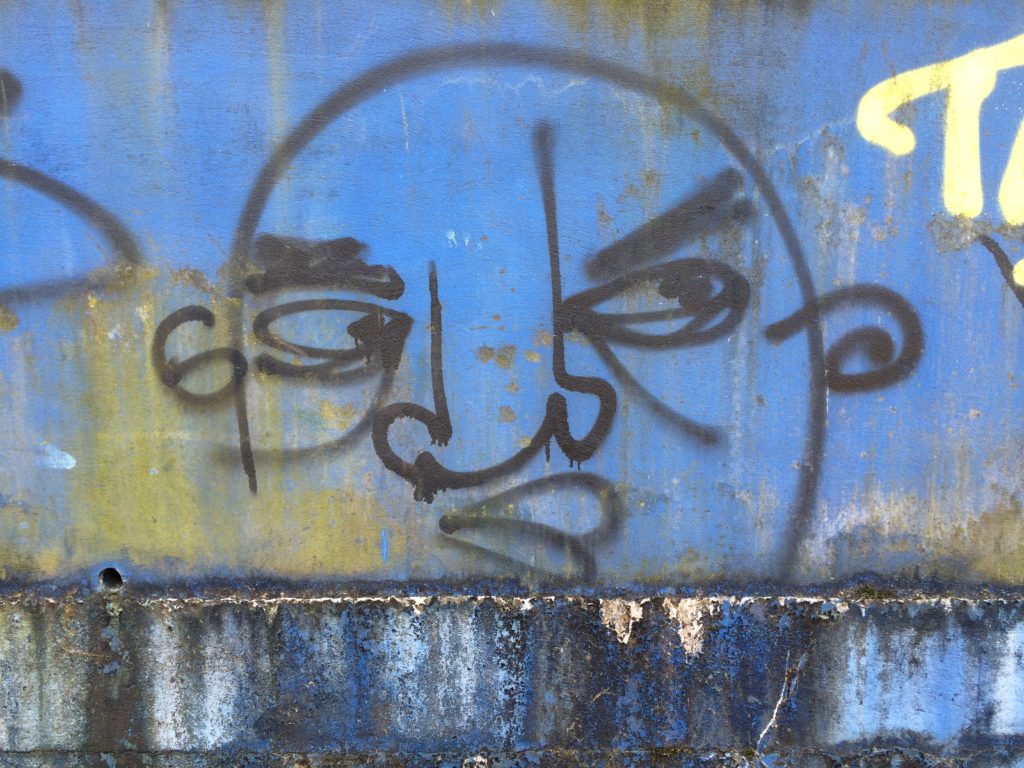
Graphic Designer Paul Baker with writer Rob Young devised these Playing Cards posters carrying anecdotal, conversational or overheard words on the streets of Chatham
Draft Magazine – Colour Key Page Icons. THESE ARE OUR STREETS. Image: Christopher Tipping.
Draft Magazine – Colour Key Page Icons. THESE ARE OUR STREETS. Image: Christopher Tipping.
Draft Magazine – Pages 24 & 25 V1 : THESE ARE OUR STREETS. Image: Christopher Tipping.Draft Magazine – Colour Key Page Icons. THESE ARE OUR STREETS. Image: Christopher Tipping.
Fictional Heroes of Chatham are a series of fictional stories about Chatham’s past by our project writer Rob Young developed in response to time spent walking and talking on the streets of Chatham.
The fictional story below is about a Chatham Hero, Davey Pitt, who worked on the New Cut Viaduct
Draft Magazine – Pages 26 & 27 V1 : THESE ARE OUR STREETS. Image: Christopher Tipping.
Draft Magazine – Pages 28 & 29 V1 : THESE ARE OUR STREETS. Image: Christopher Tipping.
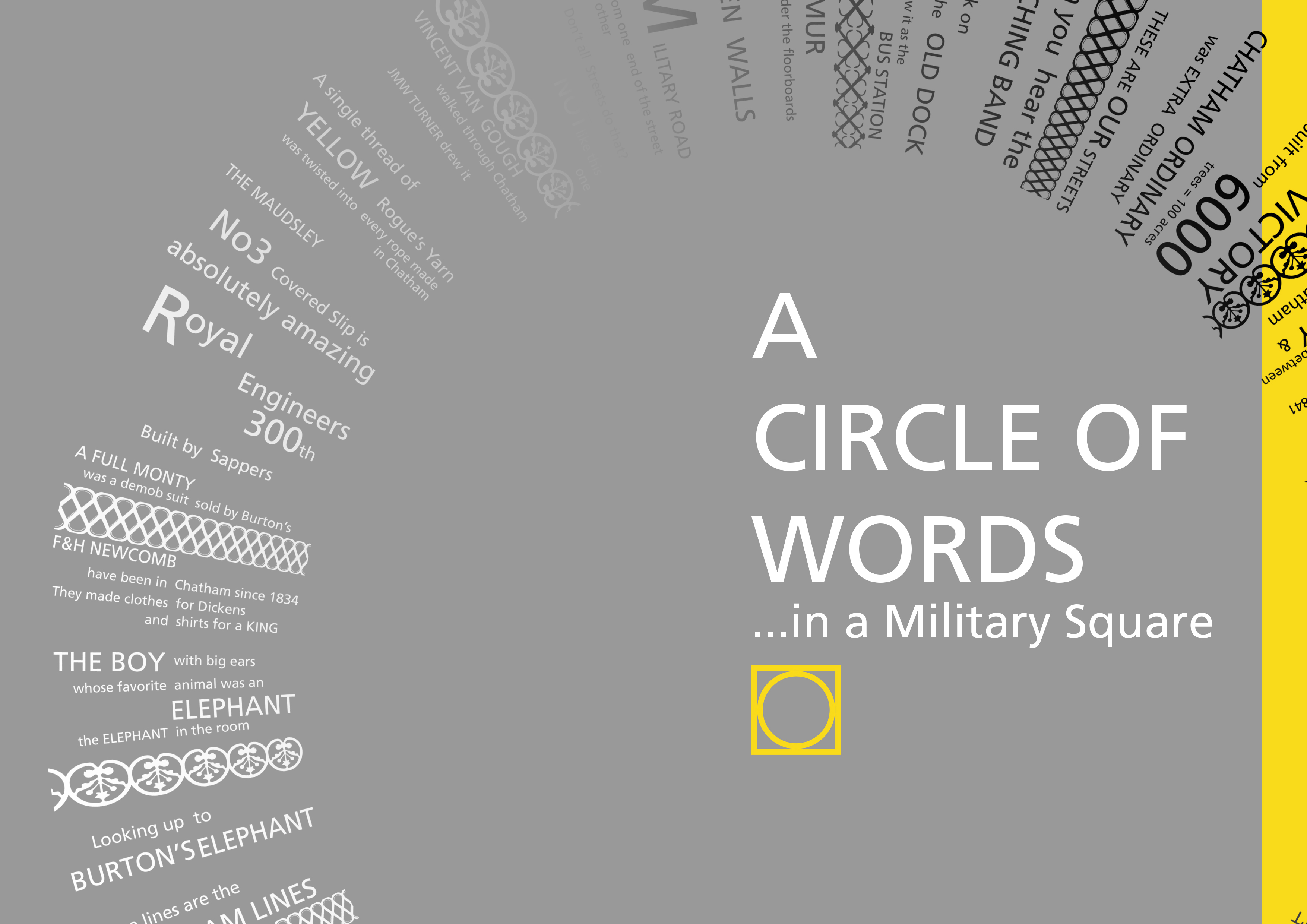
A CIRCLE OF WORDS IN A MILITARY SQUARE
Draft Magazine – Pages 24 & 25 V1A : THESE ARE OUR STREETS. Image: Christopher Tipping.
Draft Magazine – Pages 24 & 25 V3 : THESE ARE OUR STREETS. Image: Christopher Tipping.
Draft Magazine – Pages 30 & 31 V1 : THESE ARE OUR STREETS. Image: Christopher Tipping. Archive Photograph by kind permission of MALSC
Draft Magazine – Pages 30 & 31 V1 : THESE ARE OUR STREETS. Image: Christopher Tipping. Artwork & Text by Rob YoungDraft Magazine – Pages 34 & 35 FINAL : THESE ARE OUR STREETS. Image: Christopher Tipping. Group Photograph by FrancisKnight. Chatham Patterns by Xtina Lamb
THESE ARE OUR STREETS Part Two…CHATHAM UP ! We have always planned to create a magazine or booklet…some form of printed publication or other, with which to celebrate and record our progress, our ideas, the stuff that got away…but mostly our collaboration with each other and with the people along our route. We may still be able to deliver this a a hard-copy paper publication at some point in the future, as a way or marking the project – or as an online event.
The following images will show you part of our journey to create the draft and concepts for the work you can now see embedded into the pavements of Railway Street and Military Square. The content has been generated in collaboration with other artists and creatives, commissioned to deliver specific aspects of our work, but who directly and indirectly contributed so brilliantly to the outcome. FrancisKnight Public Art Consultants, Rob Young– Writer, Xtina Lamb– Printmaker, Simon Williams– Filmmaker & Paul Baker – Graphic Designer.
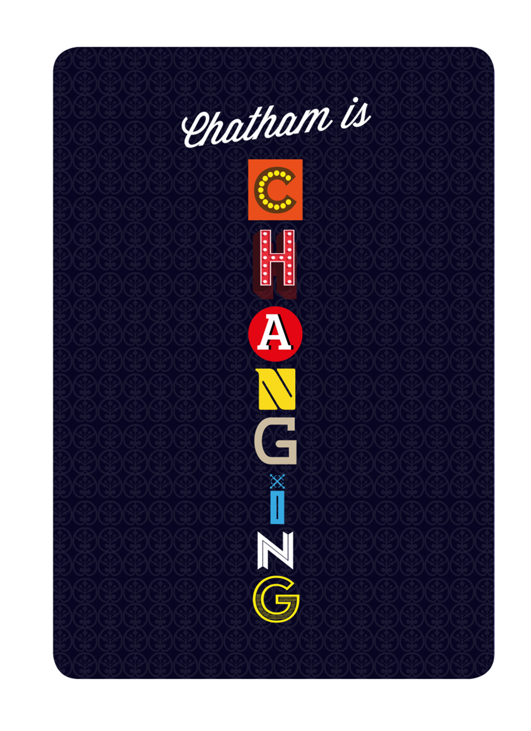
Draft Magazine – Optional Cover: CHATHAM UP. Image: Christopher Tipping
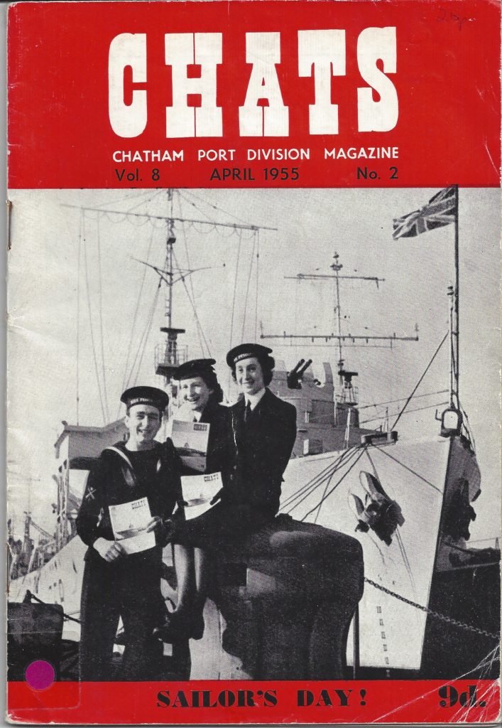
The yellow cover was the first logo and layout we created…the inspiration for this as well as the overall style and approach to the magazine concept came from looking at archive print magazines and periodicals at the Medway Archives and Local Studies Centre in Strood. We were drawn to copies of CHATS magazine – the Chatham Port Division Magazine from 1955.
The A5 size and very distinctive 1950’s advertising inside were just what we were looking for.
CHATS Magazine – The Chatham Port Division Magazine. Volume 8, April 1955 Volume . By Kind Permission of MALSC
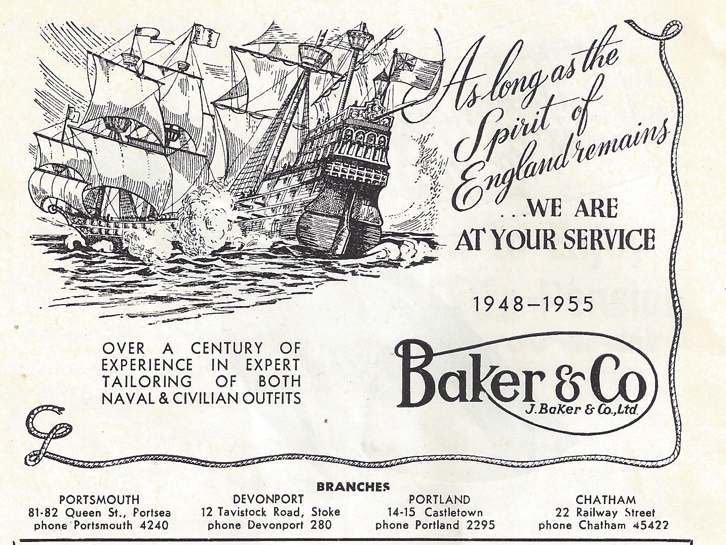
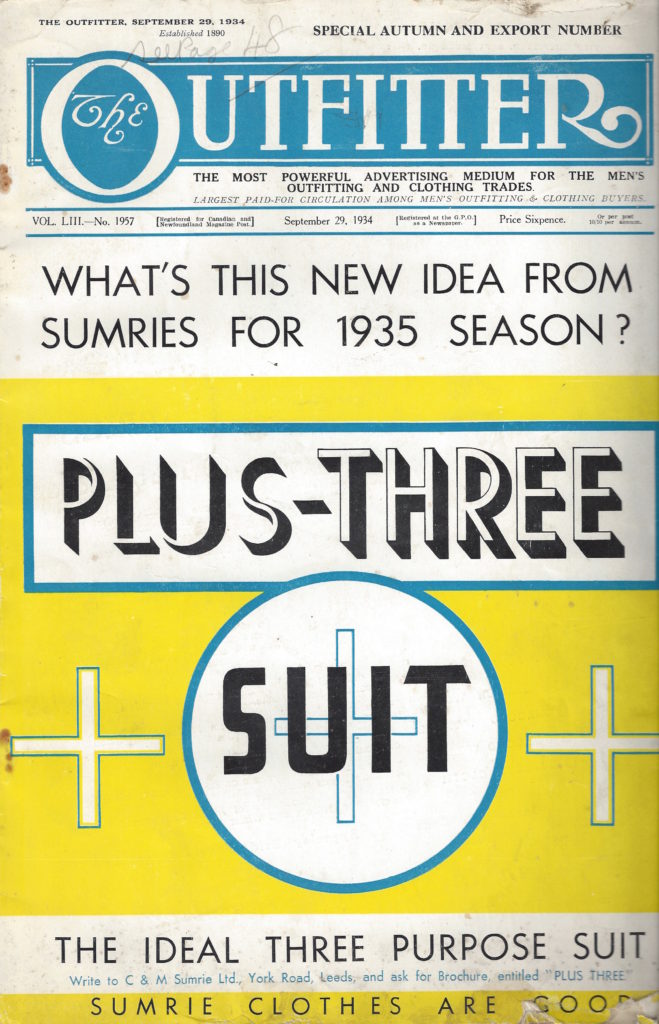
It can’t really be a surprise that such a massive military and naval presence in Chatham was serviced by local outfitters. What is interesting is that so many of these had businesses on Military Road and Railway Street. At the Medway Archives and Local Studies Centre, there is a collection of print magazines and periodicals. An amazing selection of adverts for military and civilian outfitters are contained within – almost all of them along our route of Railway Street and Military Road. I managed to find a copy to buy – Vol.8 April 1955 No. 2
Amongst some that I listed were –
“Over a century of experience in expert tailoring of both naval and civilian outfits”.
W.Cooper – ‘Cooperstyle’Regimental Blazers! 56 Military Road –
Gieves Ltd – 13 Military Road –
Unifit – 40 Military Road –
Baker & Co – 22 Railway Street – “As long as the Spirit of England Remains, we are at your service”.
A. Fleming & Co. Outfitters Ltd Contractors to the Admiralty– 15 Railway Street –
F & H Newcombe – Military, Naval and General Outfitters – Railway Street –
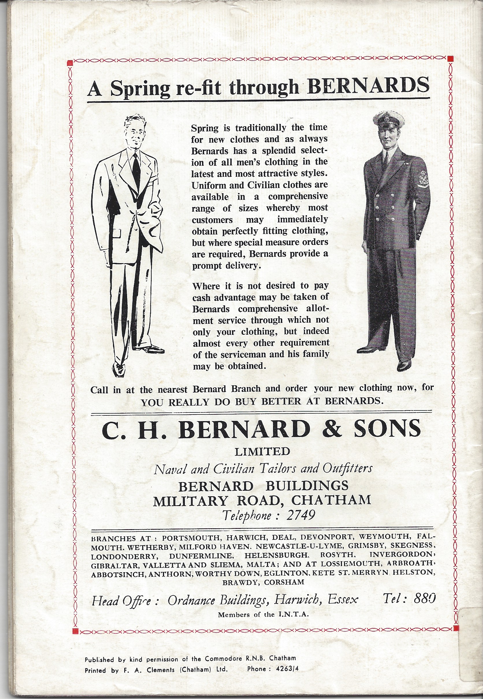
C.H Bernard & Sons – Bernard Buildings, Military Road
Military Outfitters, Baker & Co. 22 Railway Street, Chatham. CHATS Magazine. Collection of Christopher Tipping
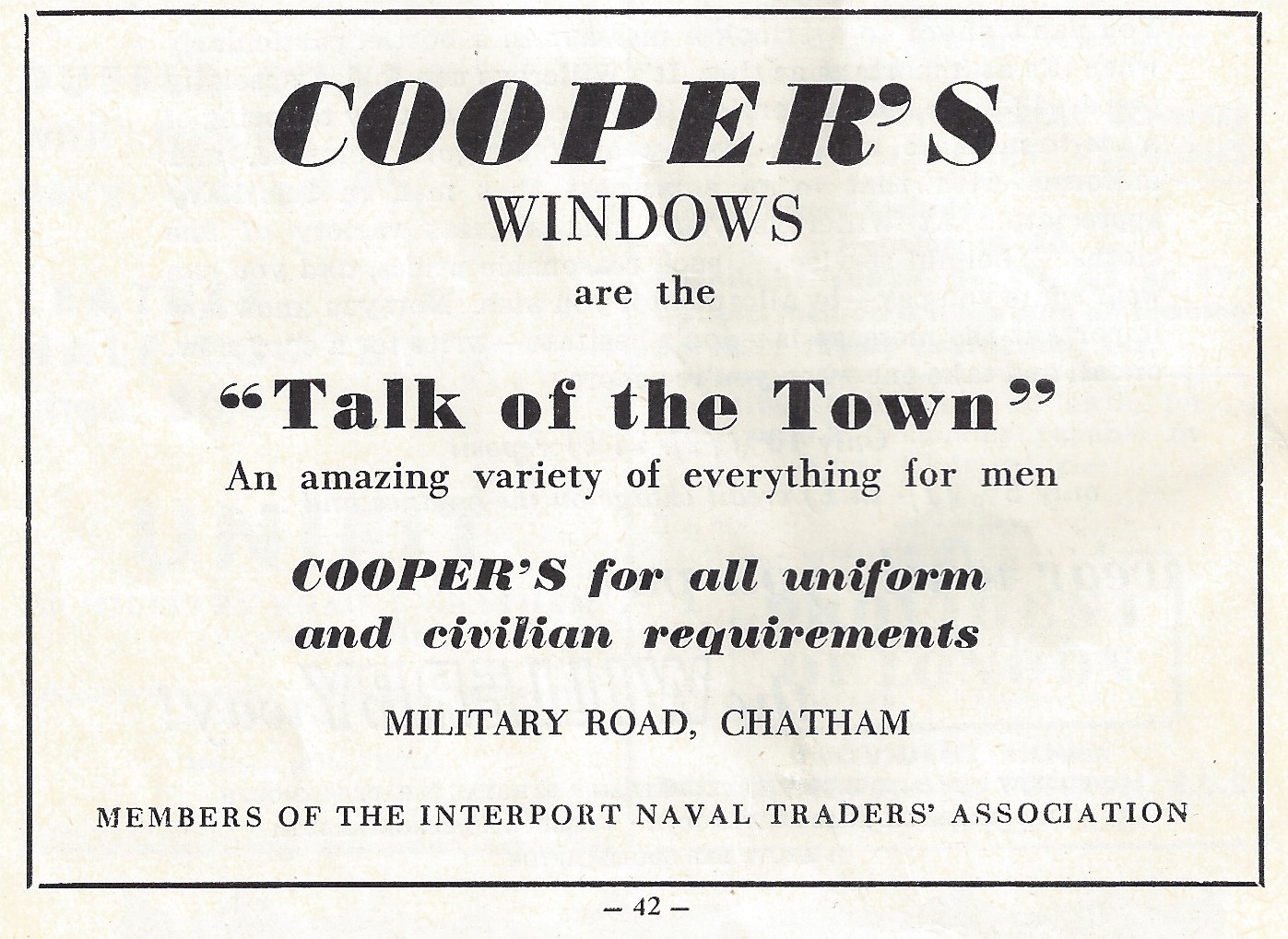
Coopers Windows are the Talk of the Town. CHATS Magazine Vol 8 April 1955 No 2. Collection of Christopher Tipping
C.H Bernard & Sons Naval & Civilian Tailors and Outfitters. CHATS Magazine. Collection of Christopher Tipping
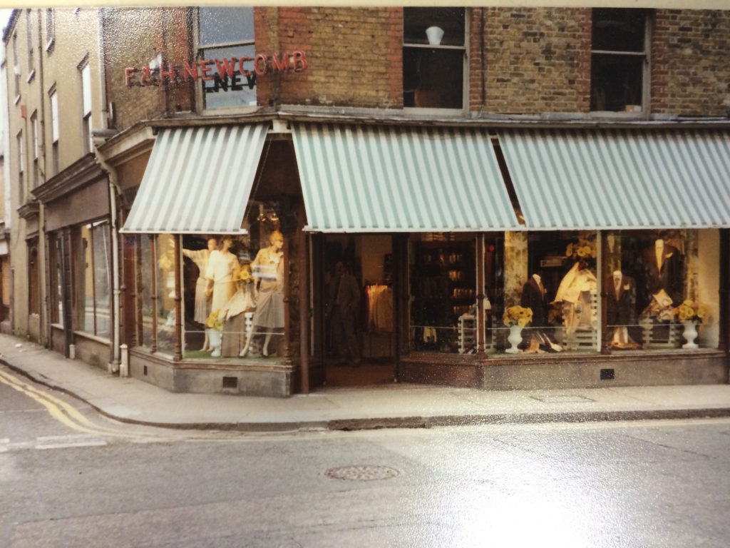
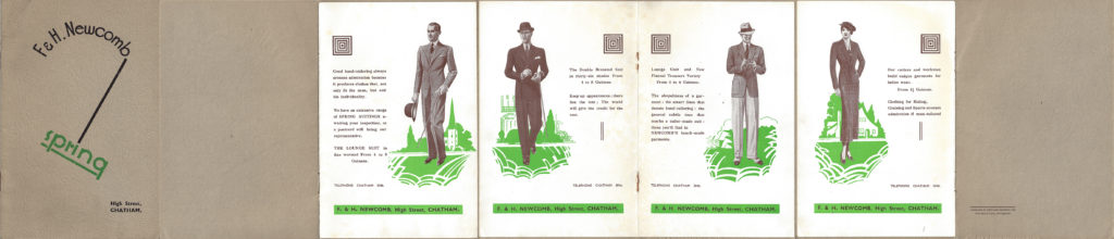
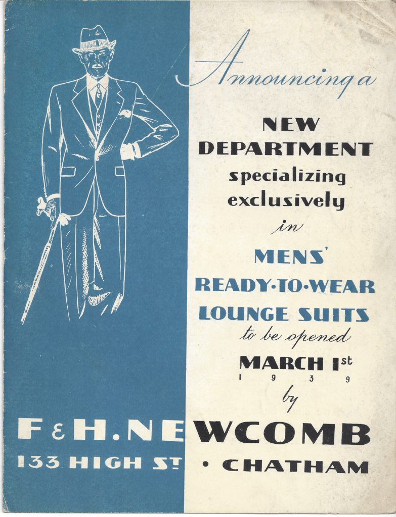
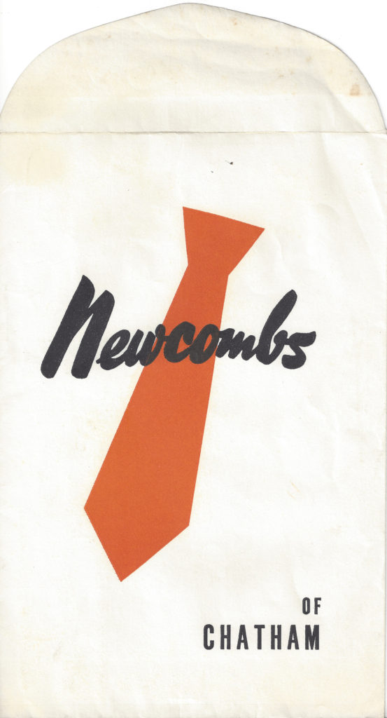
The other clear inspiration for me was the archive of Newcomb’s the tailors. They opened for business in 1854. After the original shop was demolished when the Sir John Hawkins flyover was built, the business moved along the High Street to the corner of Medway Street. Mr Gerald Newcomb is still trading as Penguins Dress Hire. Gerald is the 7th generation to run the firm and has himself been in the industry for 45 years.
‘The family has served the great and the good for almost 180 years. Figures such as Charles Dickens, Lord Kitchener, Lord Byron and Lord Tennyson have enjoyed the service we offer – our workrooms were a hive of activity as we created shirts for King Edward VII!’
This historic business fits into our Chatham Placemaking Project primarily because of its strong association with our route and the long association with style, craft and a strong sense of local community – Newcomb’s also had a Ladies Clothes Shop on Railway Street – the advertising for the business and associated images from their archives was inspirational.
F & H Newcomb had premises on the corner of High Street and Globe Lane and Ladies Shop on Railway Street. Image: F & H Newcomb ArchiveF & H Newcomb Print Advertising. Image: By kind permission of Gerald Newcomb, F & H Newcomb Archive
F & H Newcomb. Associated Trade Print Advertising. Image: By kind permission of Gerald Newcomb, F & H Newcomb Archive
F & H Newcomb. Associated Trade Print Magazine September 1934. Image: By kind permission of Gerald Newcomb, F & H Newcomb Archive
F & H Newcomb. Associated Trade Print Advertising. Image: By kind permission of Gerald Newcomb, F & H Newcomb ArchiveF & H Newcomb. Associated Trade Print Advertising. Image: By kind permission of Gerald Newcomb, F & H Newcomb Archive
…and so, back to our Magazine Pages…
Draft Magazine – Pages 14 & 15 V1 : THESE ARE OUR STREETS. Image: Christopher Tipping.
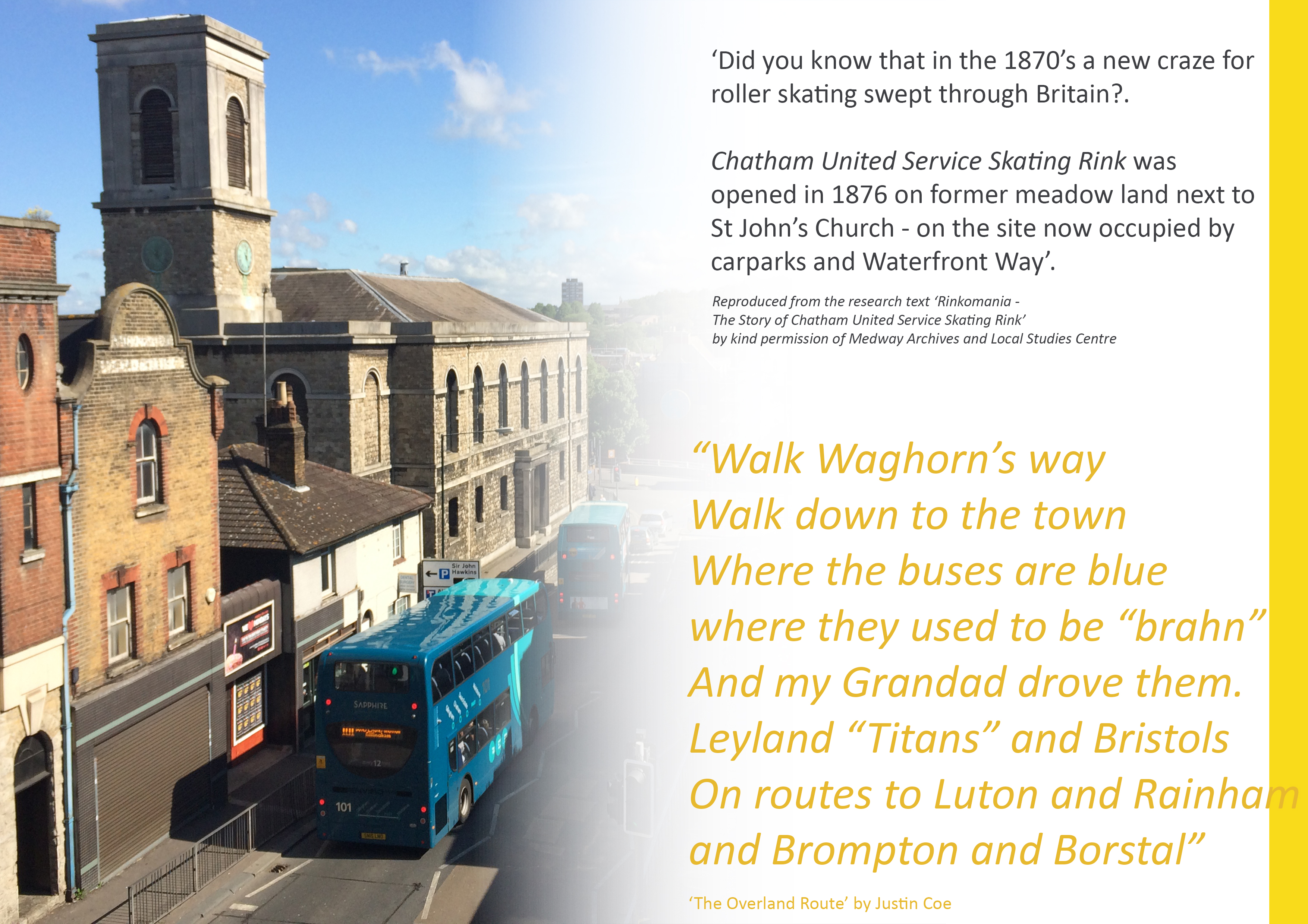
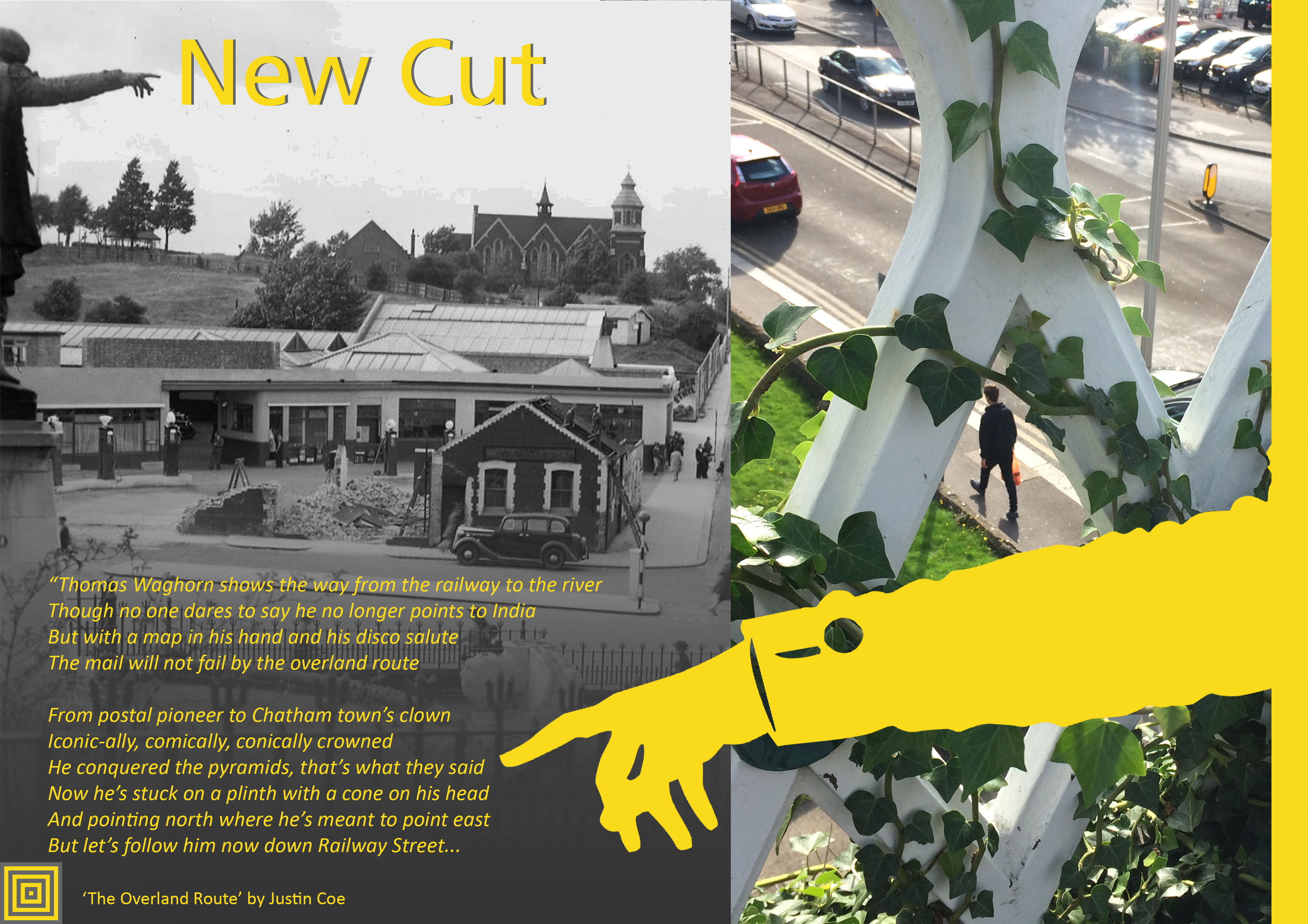
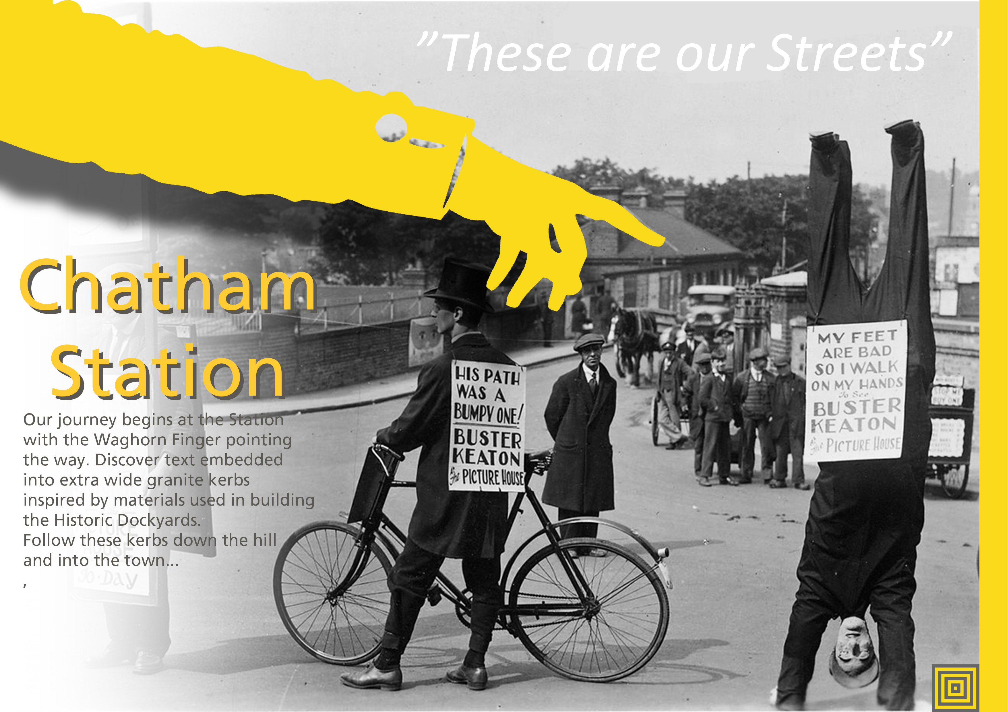
We love Thomas Waghorn…we also appointed a performance Poet, Justin Coe, to come up with a suitably witty and succinct take on our journey down Railway Street to the River, which he performed in the street in a lively film by Simon Williams. Click here for a link to the film. “The Overland Route c/o Thomas Waghorn’.
Draft Magazine – Page 15 Option V1 : THESE ARE OUR STREETS. Image: Christopher Tipping.
Draft Magazine – Page 15 Option V2 : THESE ARE OUR STREETS. Image: Christopher Tipping.
Draft Magazine – Pages 16 & 17 V1 : THESE ARE OUR STREETS. Image: Christopher Tipping.
Draft Magazine – Pages 18 & 19 V1 : THESE ARE OUR STREETS. Image: Christopher Tipping. Archive Image: Lady in Fur Coat on Military Road by Kind Permission of MALSC
Draft Magazine – Pages 20 & 21 V1 : THESE ARE OUR STREETS. Image: Christopher Tipping.
Draft Magazine – Pages 22 & 23 V1 : THESE ARE OUR STREETS. Image: Christopher Tipping.
Draft Magazine – Cover: THESE ARE OUR STREETS. Image: Christopher Tipping
We have always planned to create a magazine or booklet…some form of printed publication or other, with which to celebrate and record our progress, our ideas, the stuff that got away…but mostly our collaboration with each other and with the people along our route. We may still be able to deliver this a a hard-copy paper publication at some point in the future, as a way or marking the project – or as an online event.
The following images will take you with us on part of our journey to create the draft and concepts for the work you can now see embedded into the pavements of Railway Street and Military Square. The content has been generated in collaboration with other artists and creatives, commissioned to deliver specific aspects of our work, but who directly and indirectly contributed so brilliantly to the outcome. FrancisKnight Public Art Consultants, Rob Young– Writer, Xtina Lamb– Printmaker, Simon Williams– Filmmaker & Paul Baker – Graphic Designer.
There were many versions of these pages made, as we decided how best to represent what had been done. Here are just a few…
Draft Magazine – Page 1: THESE ARE OUR STREETS. Image: Christopher Tipping
“I’m not from Chatham, I’m just visiting…I come here a lot – Every Day !”.
The voices represented here are everyday voices of people in Chatham. Writer Rob Young sent time talking to small businesses and the people who worked in them along our route. He is a good listener with an exceptional ear for a ‘one liner’; a swagger, a forgotten hero, a heartfelt sentiment softly spoken. These overheard or anecdotal lines have been captured in stone set into the paving. Not all could be used. Many are reproduced here for the first time.
Draft Magazine – Pages 2 & 3: THESE ARE OUR STREETS. Image: Christopher Tipping
This was a draft layout for the information page – a bit of what we were planning. It is quire ambitious, but we actually achieved an enormous amount.
Draft Magazine – Pages 4 & 5: THESE ARE OUR STREETS. Image: Christopher Tipping
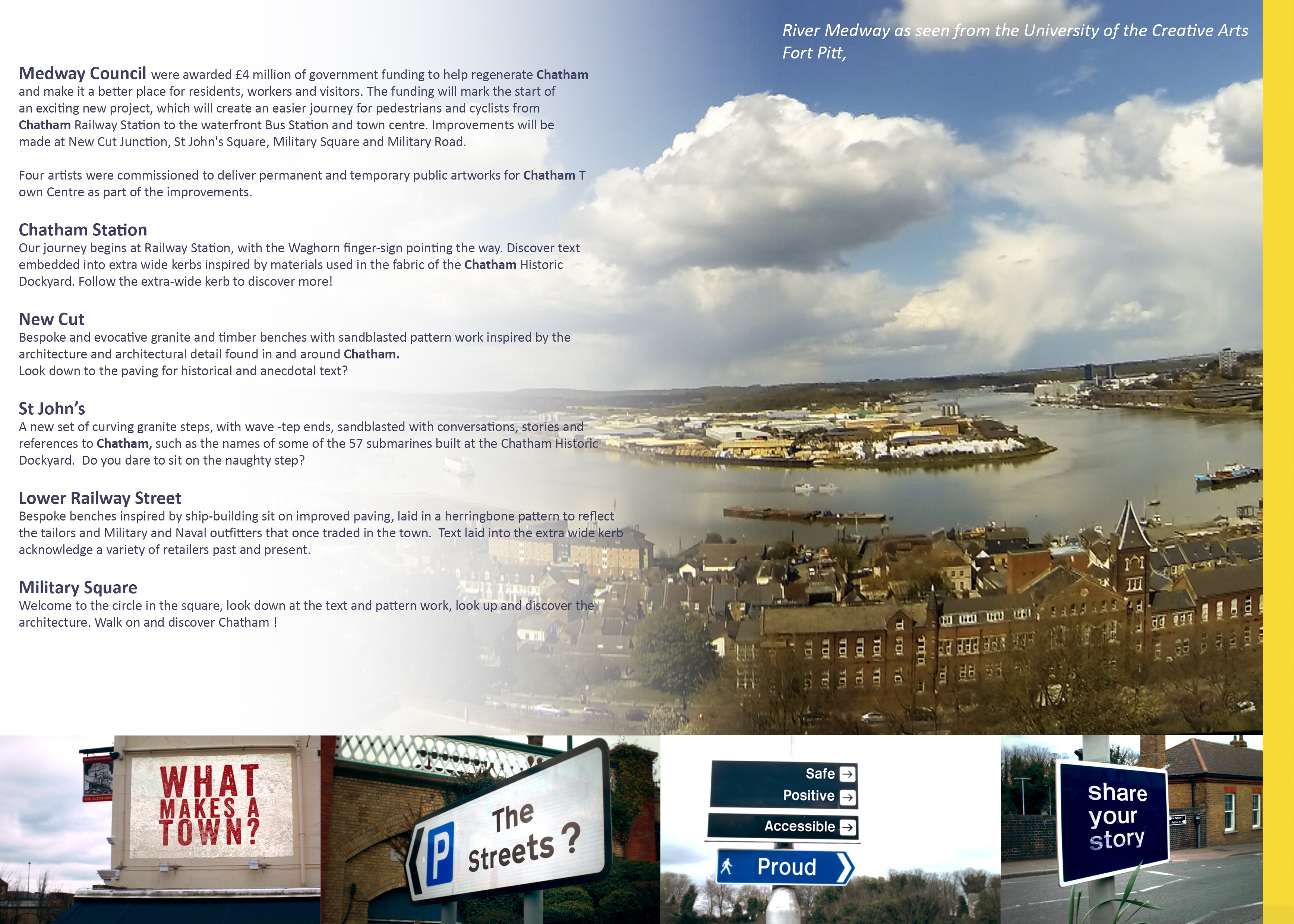
The fantastic panorama of the River Medway was taken by Filmmaker Simon Williams from the roof terrace of Fort Pitt, now the UCA RochesterCampus. The mock-up street signs were the outcome of a collaboration between Rob Young, Simon Williams and myself.
Draft Magazine – Pages 6 & 7: THESE ARE OUR STREETS. Image: Christopher Tipping
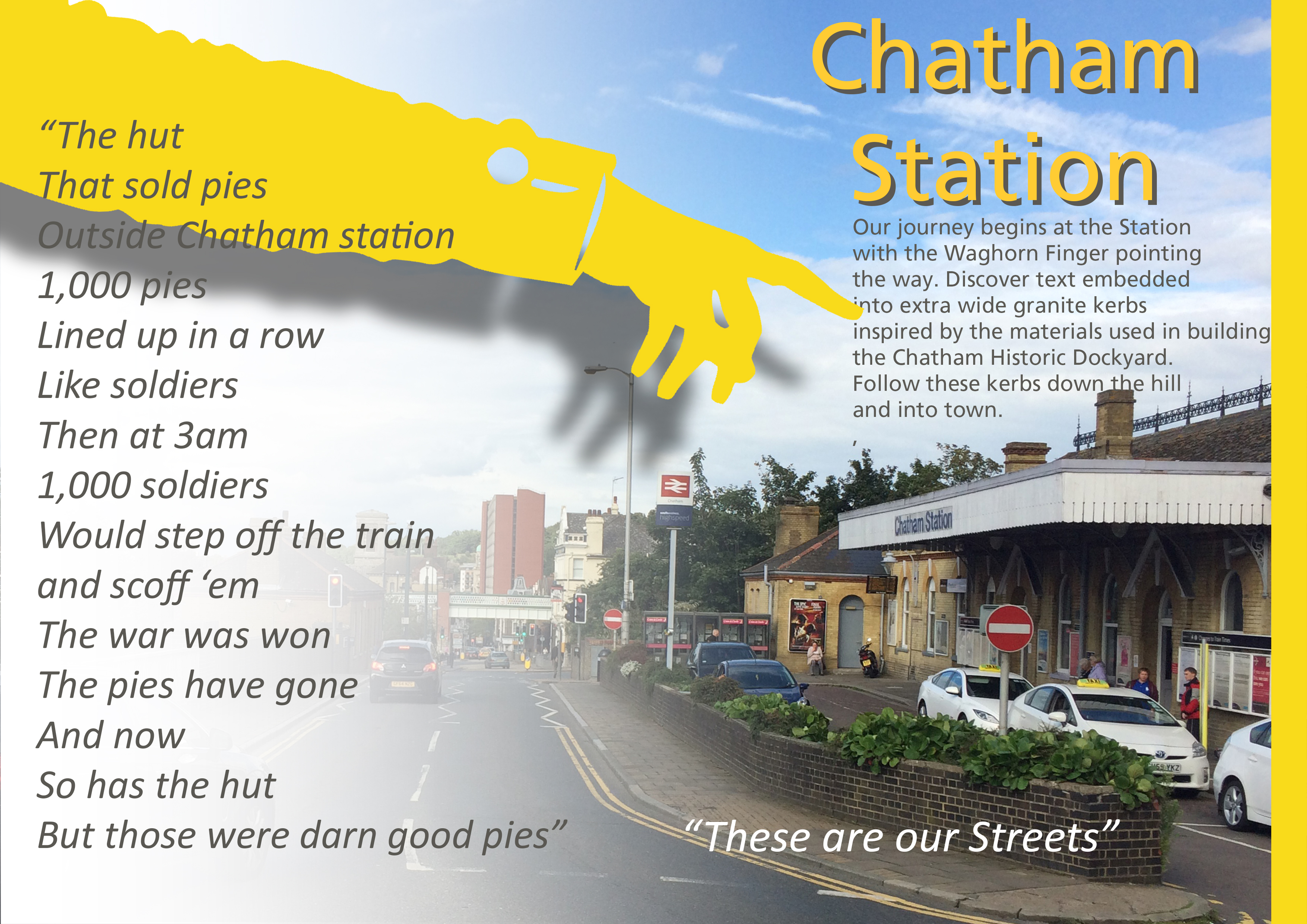
1000 Pies Lined up in a row like Soldiers…
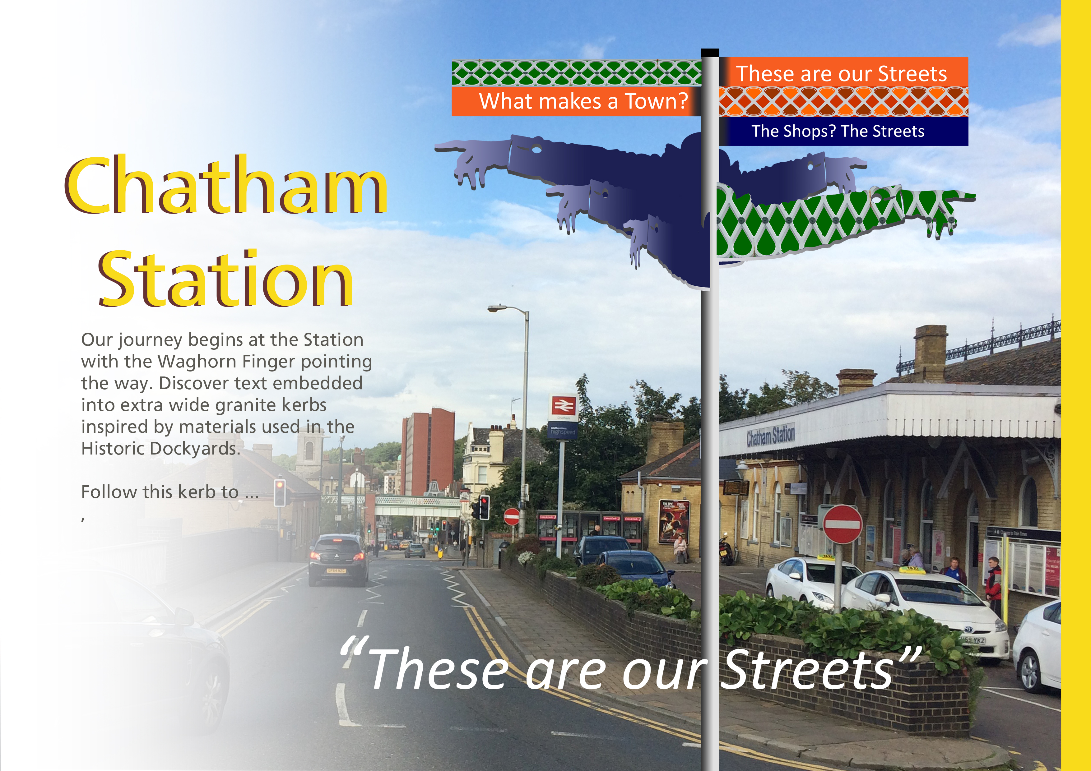
Chatham Station and it’s approaches were always at the head of our scheme. Designs and public art have been prepared and approved, to become a part of the regeneration of the Station, which has just started on site. Click on this link to find out more.
Draft Magazine – Pages 6 & 7 V2 : THESE ARE OUR STREETS. Image: Christopher Tipping
Draft Magazine – Pages 6 & 7 V3 : THESE ARE OUR STREETS. Image: Christopher Tipping. Archive Photograph by Kind Permission of MALSC
Draft Magazine – Pages 8 & 9 V2 : THESE ARE OUR STREETS. Image: Christopher Tipping.
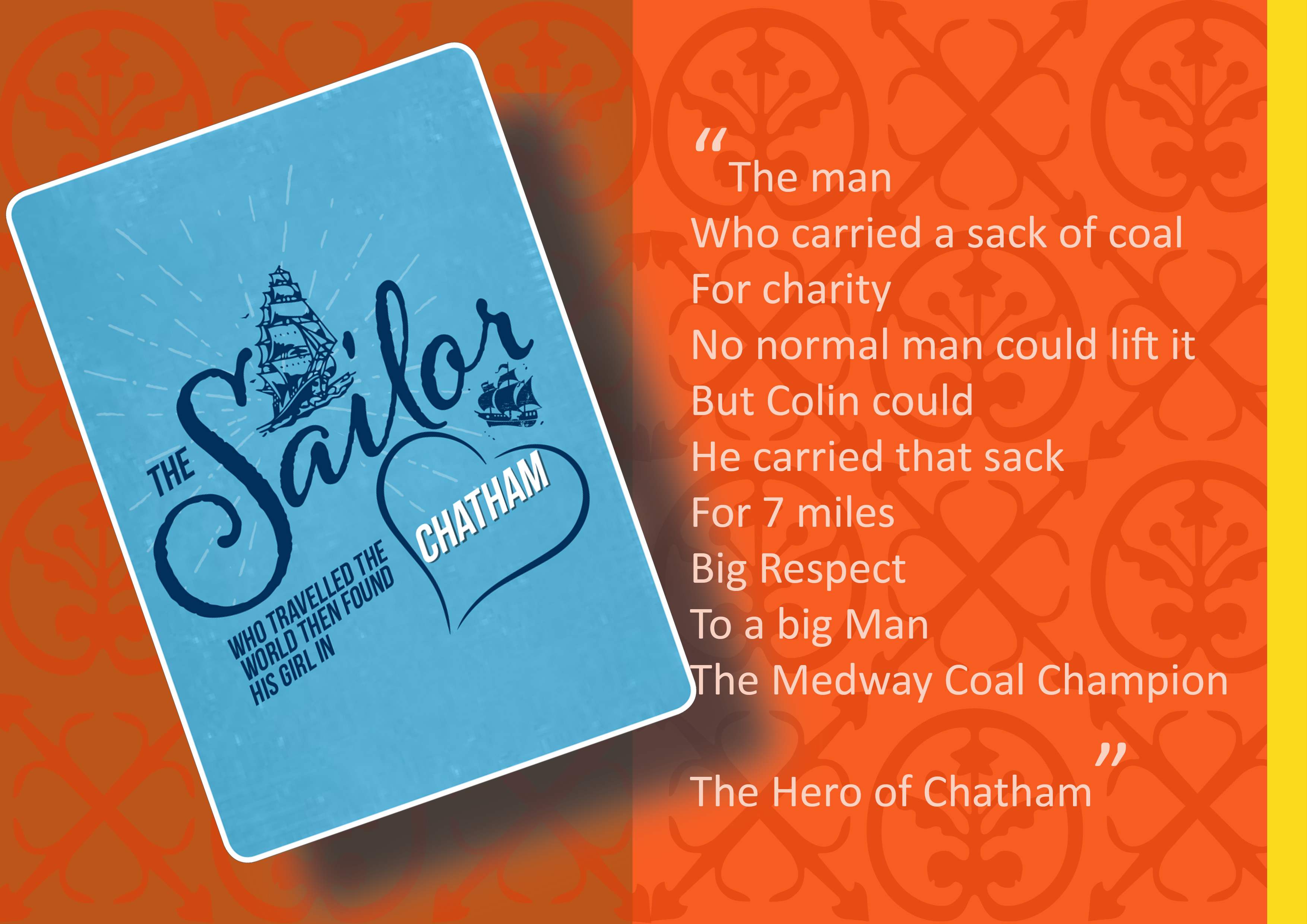
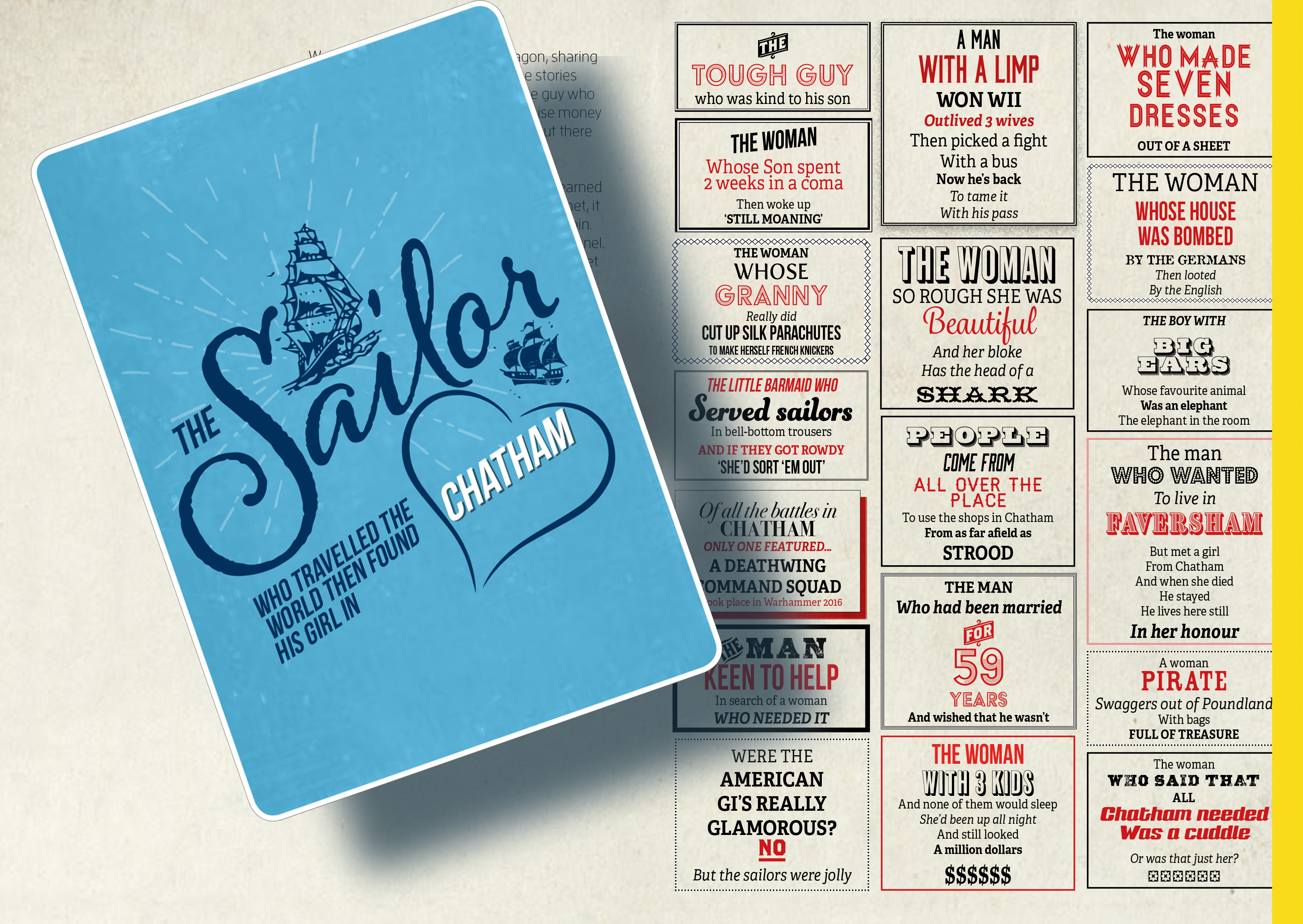
The Sailor who travelled the world…the found his girl in Chatham
Draft Magazine – Pages 10 & 11 V1 : THESE ARE OUR STREETS. Image: Christopher Tipping.
An imaginary tale…The Story of Tommy Johnson of Margate by Rob Young
Draft Magazine – Pages 12 & 13 V1 : THESE ARE OUR STREETS. Image: Christopher Tipping.
Draft designs for granite or cast iron paving slabs. Rochester Riverside. Image: Christopher Tipping
“A creek separates the marsh here from Cory’s Wharf – apparently into which the watermill discharged…” “The marsh was full of logs (a huge stack of wooden piles from Rochester Old Bridge) and was home to many rabbits – wild rabbits, grey, brown and black…” ‘It was said that the Foord Familystocked the marsh, with animals from their farm at Darland’. Stephen Hannington – Bygone Kent Magazine – Rochester’s Long Lost Common Part Two –
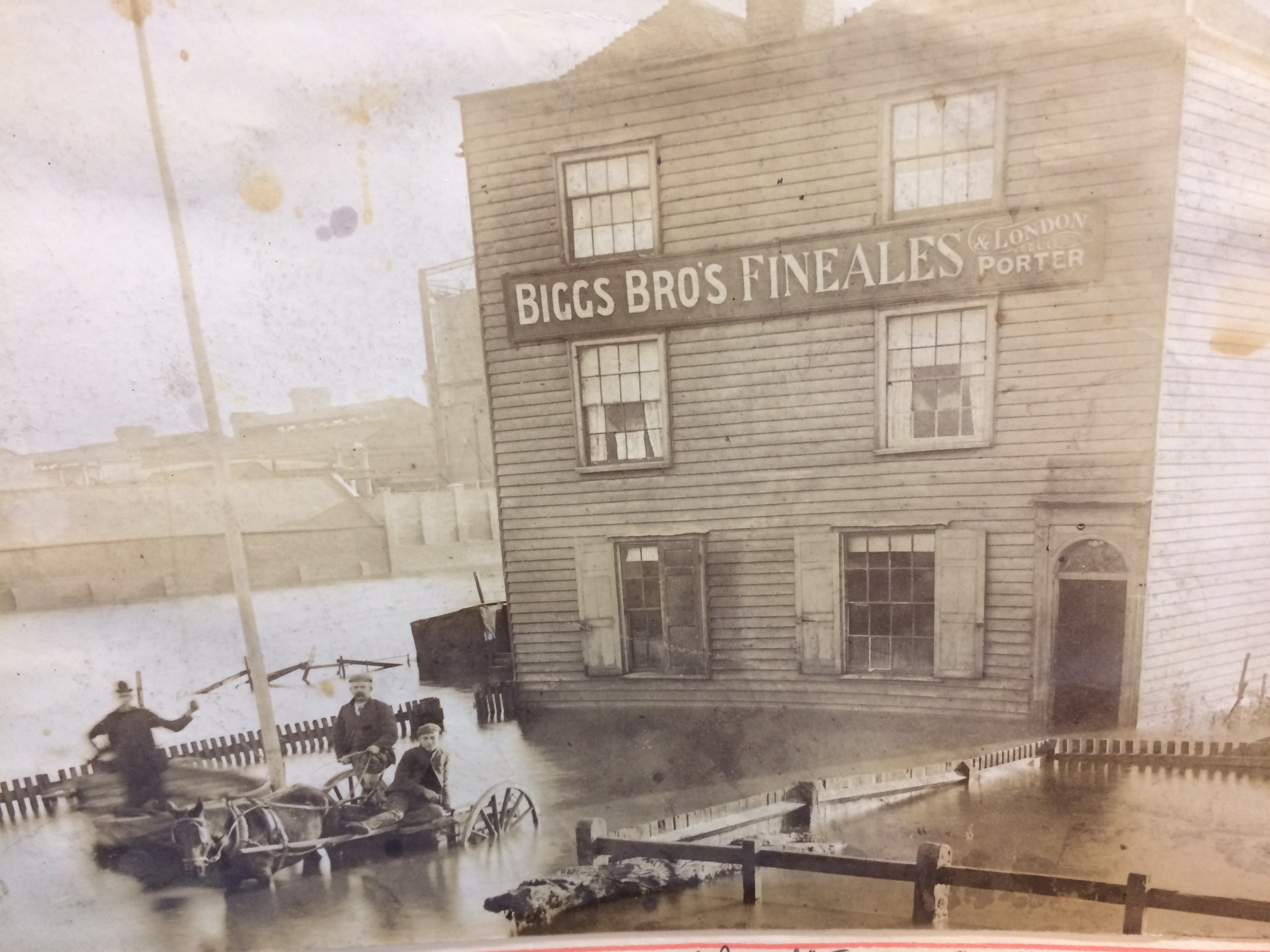
‘Floods of 1897 and 1928 inundated this area – the flooding in1897 was called The Great Flood and attributed to a record high tide on 29th November’. The image below shows the Homeward Bound Public House inundated by the flood waters. The Gas Holders of the Gasworks, can be seen in the background. The Gasworks, on Gas House Way was one of the earliest built in the UK in 1818. The area was known as Gas House Marshes. Image by kind permission of Medway Archives and Local Studies Centre.
The Homeward Bound Public House at Gas House Point inundated by the great flood of 1837. Image: By kind permission of MALSC
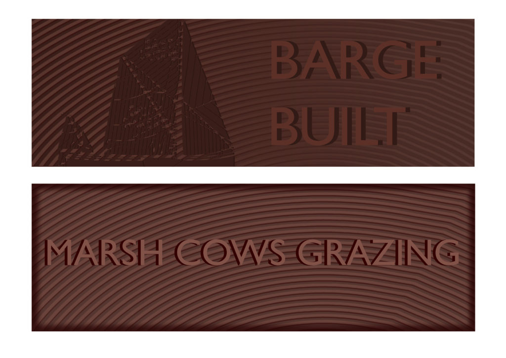
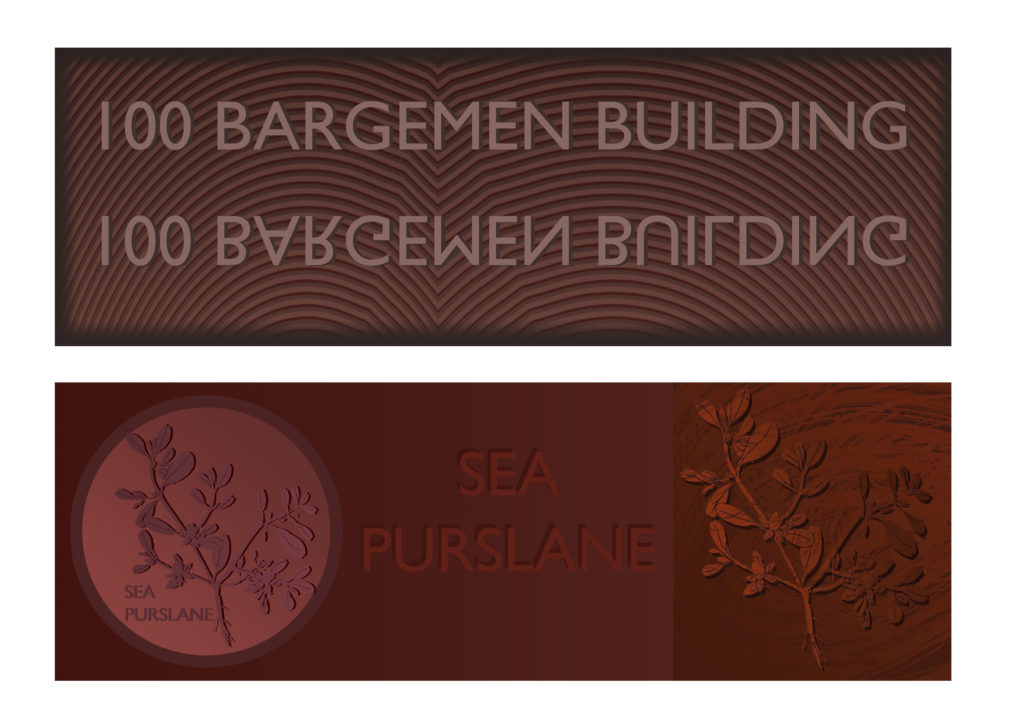
I thought I might post the artwork for all of the proposed granite and cast iron paving slab units. I can then add any historic anecdotes, images or information, which have caught my attention and may be of further interest. I’ll cover all these in this and the next two posts. 1 of 3
Draft designs for granite or cast iron paving slabs. Rochester Riverside. Image: Christopher Tipping
CAST IRON UNIT ‘BRICKIES‘ STACKIES STUMPIES’. You can also add MUDDIES to this list as well! All colloquial names for the trades associated with Medway Barges built in and operating out of the Rochester Riverside site. Brickies carried up to 40,000 bricks on the up river journey to London and came back laden with London’s rubbish. Stackies were piled high with Hay and Straw. Stumpies could take cement, lime, timber, clay, coal, bricks, hops and other commodities. Muddies are self explanatory…the carried clay and mud dug from the banks of the Medway Estuary and destined for local brickworks.
Draft designs for granite or cast iron paving slabs. Rochester Riverside. Image: Christopher Tipping
CAST IRON UNIT ‘GOLDEN SAMPHIRE’. ‘To the northwest the Medway Estuary consists of an extensive area of marshland, comprising of salt marsh and intertidal mudflats. The River remains tidal at this point and estuarine conditions would have dominated most of the site’s past.’ Ref: KCC HER 012. 2014 -371. Golden Samphire grows on estuary mudflats and salt march. It is rare and I have used it as it represents the efforts being made by the client team to build upon the heritage and legacy of the natural environment with it’s diverse flora and fauna.
Draft designs for granite or cast iron paving slabs. Rochester Riverside. Image: Christopher Tipping
GRANITE UNIT ‘BLUE BOAR CREEK’. “Blue Boar Wharf was our playground”. Edwin Harris
Blue Boar Creek is the one of the more distinctively named and well remembered places on our site. It also gave name to Blue Boar Lane, Blue Boar Hard, Blue Boar Lower Yard, Blue Boar Upper Yard, Blue Boar Lane Foundry and Blue Boar Pier. ‘Blue Boar Hard Pier: November 26th 1886′ as seen at the Medway Archives is set of beautiful, hand painted drawings of plans for a new Pier by draughtsman William Hoelking. Some details are referred to as ‘DOLPHINS’ & ‘DUMMY’. MALSC Ref: Plan 1 of 4 (002) MP/B/30/1 (1 of 4).
Blue Boar Hard Pier: November 26th 1886. Image: By kind permission of MALSC. Ref: Plan 1 of 4 (002) MP/B/30/1 (1 of 4).Blue Boar Hard Pier: November 26th 1886. Image: By kind permission of MALSC. Ref: Plan 1 of 4 (002) MP/B/30/1 (1 of 4).
William BanksCity Surveyor has also signed this document. William was born in about 1850 at Edmonton. He married Anne Mary Everett in June 1876 at Islington. In 1891, he and his family were living at at 10 Albany Road, Rochester, William was by then aged 40 and a surveyor for the city of Rochester.
‘What is now left of Blue Boar Creek and the river beyond at Limehouse Reach, lies deathly silent. Coal is not longer unloaded from colliers at Cory’s Wharf. So too is the Pier, once festooned with skiffs and rowing boats, where formerly small boys with rod and line and a jar of worms could fish away the school holidays’. John K. Austin from his publication ‘Yesterday’s Medway’. Johns has been involved with this project from the outset, having been consulted by the project Architects BPTW on his local knowledge as a historian, author, teacher and artist.
Draft designs for granite or cast iron paving slabs. Rochester Riverside. Image: Christopher Tipping
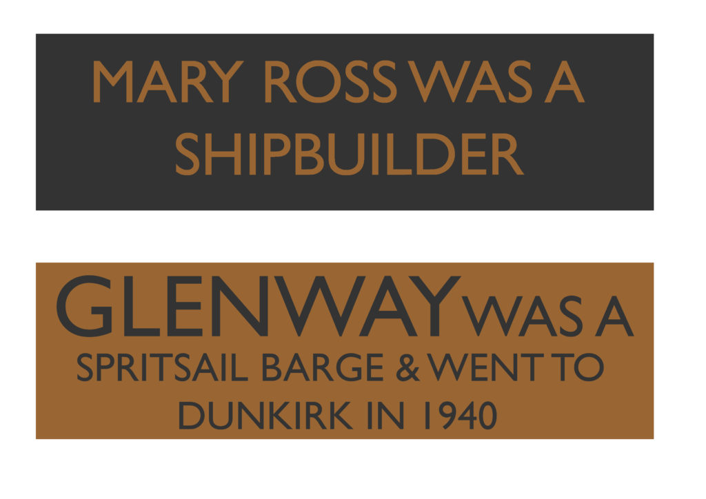
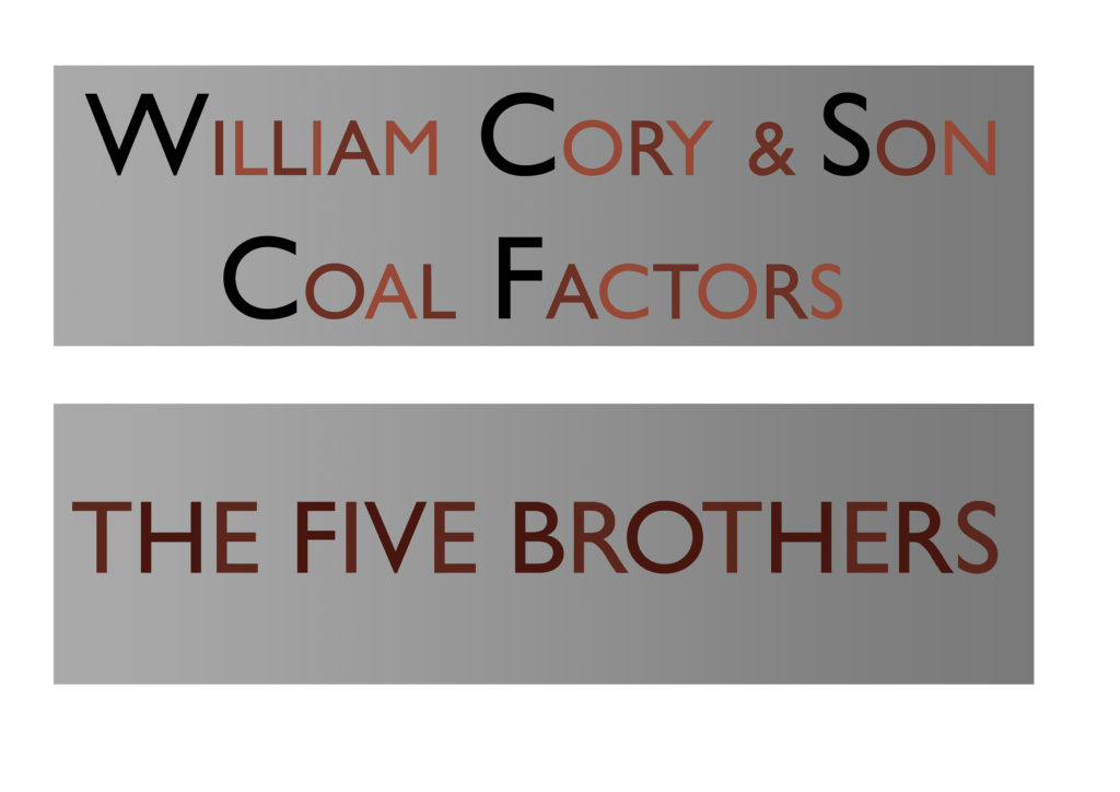
GRANITE UNIT ‘THE FIVE BROTHERS’ William Higham had a Barge Building business on Blue Boar Hard. He was born in 1838 in Lewes Sussex. On 27th October 1864 he married Fanny Elizabeth Blake in Strood. By 1881 they had 9 children and lived in a private house on Victoria Street, Rochester. William employed 11 men and 7 boys. THE FIVE BROTHERS was the last barge built at this yard alongside DOROTHY in 1901.
Draft designs for granite or cast iron paving slabs. Rochester Riverside. Image: Christopher Tipping
GRANITE UNIT ‘PERENNIAL GLASSWORT’. ‘The Medway Estuary is believed to be the most important area in North kent for wintering wildfowl in numbers of international significance. The saltmarsh serves as a roosting area for waders at high tide. Several scarce plant species include: golden samphire, perennial glasswort and one-flowered glasswort. The estuary is one of the best places in Britain for the study of glassworts. The grazing marsh has breeding and wintering birds of interest; the former include lapwing, redshank, pochard, mallard and gadwall, while in winter large flocks of may wildfowl and wader species are present.’ Ref: Environmental Stresses and Resource Use in Coastal Urban and Peri Urban Regions. DPSIR Approach to SECOA’s 17 Case Studies.
Draft designs for granite or cast iron paving slabs. Rochester Riverside. Image: Christopher Tipping
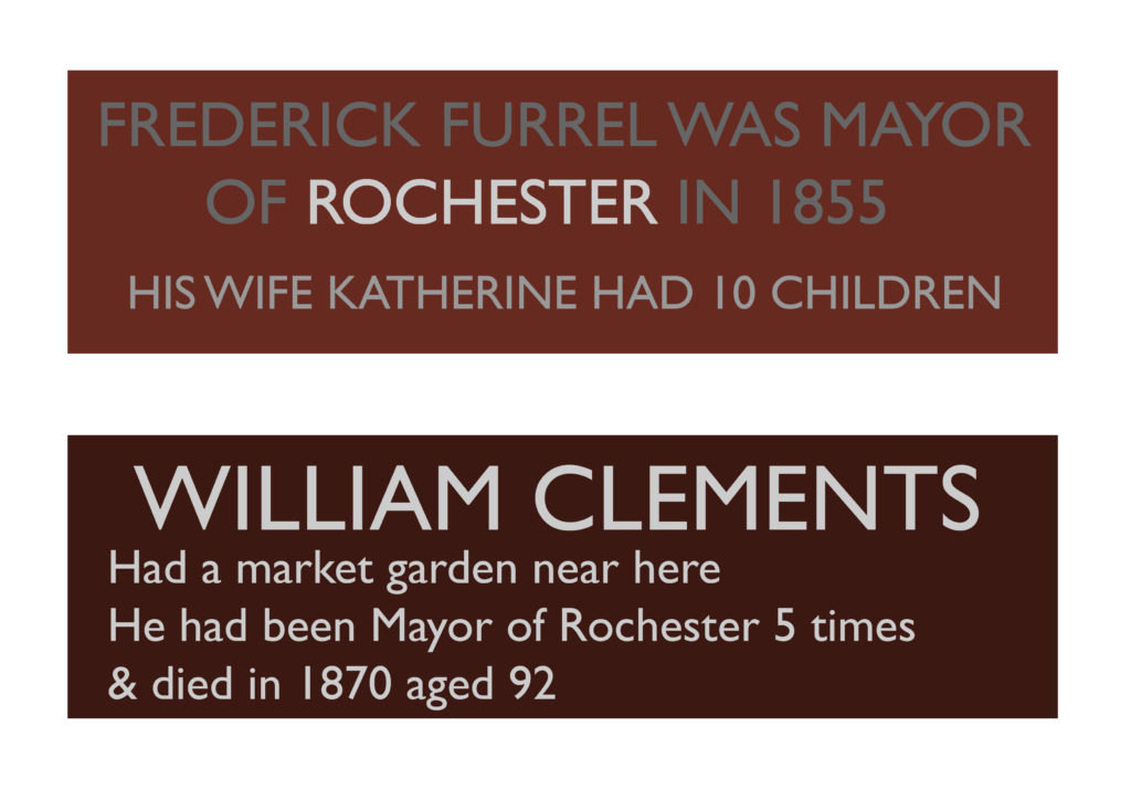
GRANITE UNIT ‘COAL: METER HEAVER WHIPPER’. Colloquial names for trades employed in the Coal business.Frederick Furrell was born in 1807 and died in 1877. Frederick Furrell & Son were Coal Merchants based at Furrell’s Wharf, a He was also an Alderman & Shipowner. He had ten children with his wife Katherine who he had married on February 25th 1832 at St Margaret’s Church in Rochester. Fred was Mayor of Rochester in 1855. Furrell’s Wharf was a 30m length of post and plank revetment of Oak and Elm Posts, most likely made from re-used ships timbers was in use in 1865 making it one of the oldest sites for industry on Rochester Riverside. It was accessed via Furrell’s Road.
His name also lived on as ‘Furrells Pond’, “where children swam and skated in Icy weather – The site flooded during exceptionally high tides” . Edwin Harris
Furrells Wharf was also the destination of many travelling shows, menageries and circuses – such as Wombwells Wild Beasts & Edmonds Menagerie – George Sangers Circus, Pinder’s Circus, Middletons’ Marionettes.
Coal was a major industry at Rochester, with several businesses engaged, most notable William Cory & Son of Fenchurch Street London were registered in 1896 after taking over he business of coal factors, merchants and Lightermen of William Cory & Son of Rochester at Rochester Coal Wharf.
Draft designs for granite or cast iron paving slabs. Rochester Riverside. Image: Christopher Tipping
Brickies, Stackies and Stumpies refer to Thames Sailing Barges (aka Medway Barges or Rochester Sailing Barges or Spritsail Barges), which were built at Rochester and more specifically to the the trades they carried out. Brickies carried up to 40,000 bricks on the up river journey to London and came back laden with London’s rubbish. Huge mounds of glass bottles recorded on the Rochester Riverside site, north of Blue Boar Creek, are a result of this domestic waste being brought up the Medway from the capital.Stackies were piled high with Hay and Straw. Stumpies could take cement, lime, timber, clay, coal, bricks, hops and other commodities.
“Russet Brown & Ochre Sails with Various devices Emblazoned” Edgar J Marsh. ‘Spritsail Barges of the Thames and Medway’. 1948
Draft design for a granite paving slab. Rochester Riverside. Image: Christopher Tipping
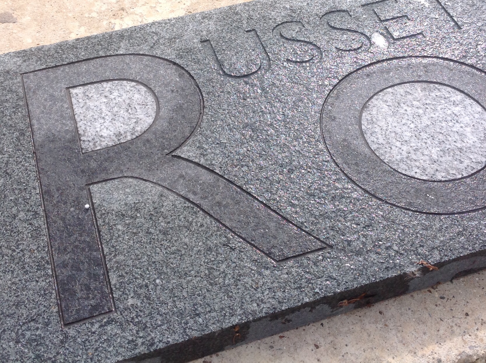
Sample granite paving slab with water jet cut granite inlay and sandblasted text. Rochester Riverside. Image: Christopher Tipping
The granite units will be manufactured in collaboration with Hardscape.
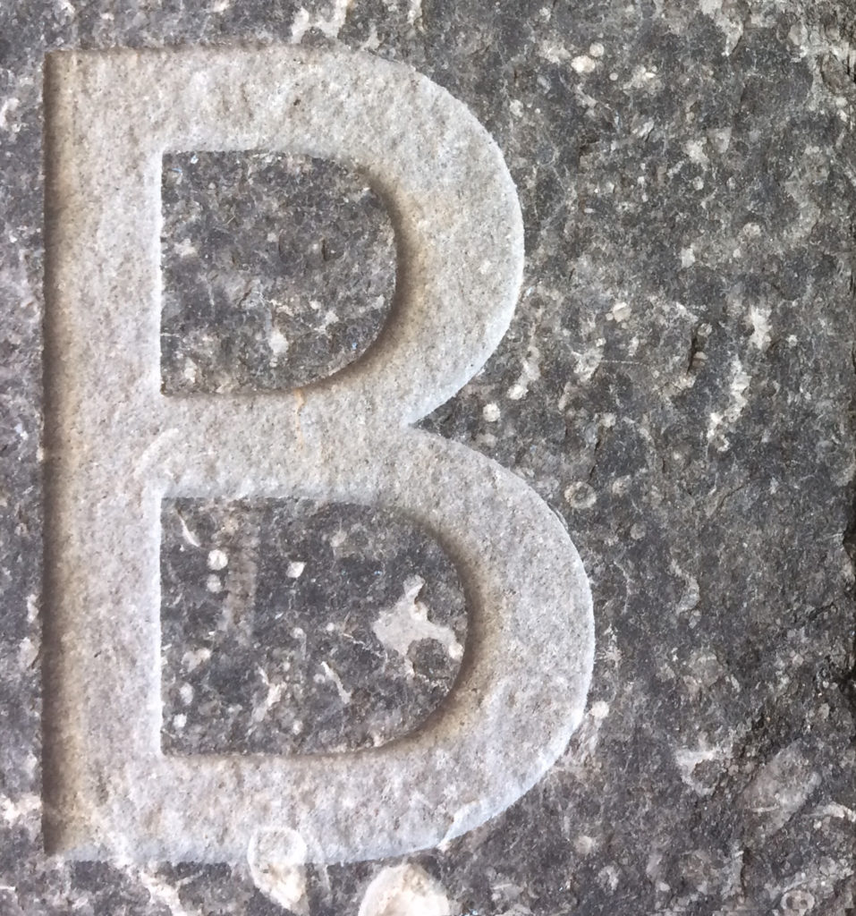
Granite square tile with a sandblasted letter B. Rochester Riverside. Image: Christopher Tipping
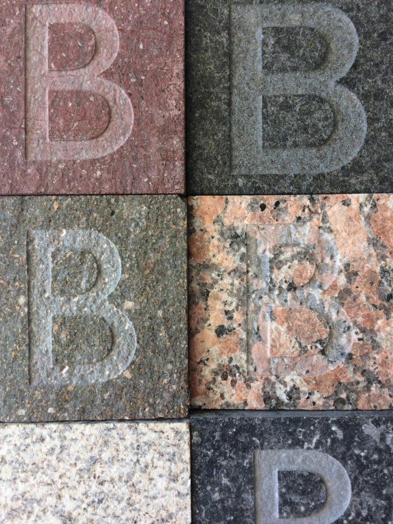
Sample coloured granite squares with sandblasted letters. Rochester Riverside. Image: Christopher Tipping
Sample coloured granite squares with sandblasted letters. Rochester Riverside. Image: Christopher Tipping
Detail of sample granite paving slab with water jet cut granite inlay and sandblasted text. Rochester Riverside. Image: Christopher Tipping
I am proposing to make 24 artwork units in either cast iron or granite, with inlaid & sandblasted detail. The units will be embedded into paving within or adjacent to the threshold entrances to all Apartment blocks and to the footpaths of all the central and riverside designated housing. I want these works with their accompanying text and drawings to be seen each day as people cross the thresholds between the public realm and the private home. This site was an industrious place for hundreds of years, providing and creating the wealth upon which Rochester grew into a powerful and beautiful cathedral city. It’s wealth however, is not only in the grand and the elevated. The everyday, the matter of fact, the local and colloquial have all contributed over time to this place leaving a rich social and community-led legacy through the people whose livelihoods were centred on this fascinating site next to the River Medway. Shipbuilding, Sailmaking, Gasworks, Railways, Livestock Market, Transport, Fishing, Metal and Aggregate Trades and Market Gardening have all at various times left an indelible and tangible mark on this place, as have the domestic residences, pubs, shops and small businesses such as:
Henry Allen – Dealer in Building Materials
Jane Weaver – Milliner
Joseph Anderson – Clay Pipe Maker
George Millar – Wheelwright and Coach Builder
Ebenezer Baird – Tailor
…all of Rochester Common.
Detail of cast iron paving slab with low relief pattern and text. Rochester Riverside. Image: Christopher Tipping
The images above shows a single panel manufactured by Hargreaves Foundry immediately after casting, when the surface is a gun-metal colour and then after a couple of weeks outside, where the colour is more akin to Corten steel.
The actual finish will be almost black, as the cast iron will eventually be treated with nitric acid to prevent further weathering.
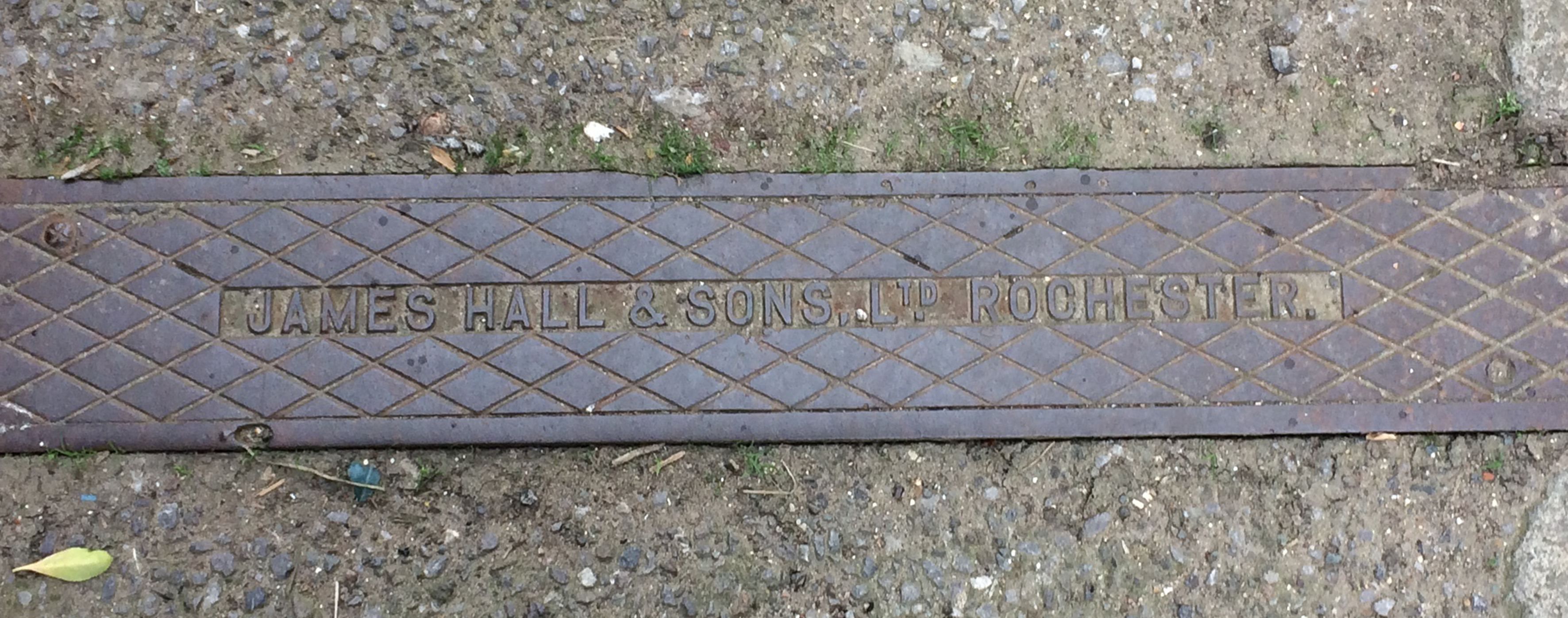
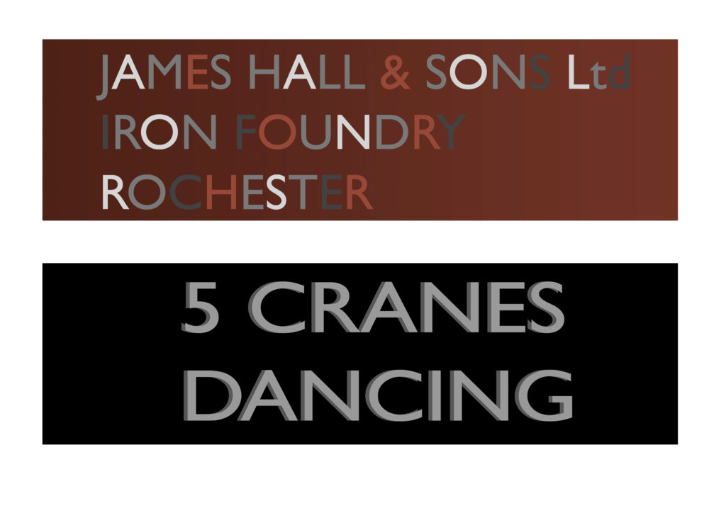
There was an Iron Foundry on the site up to the 19th Century. HALLS IRON FOUNDRY was founded in 1785 and worked form premises adjacent to Cory’s Creek on Blue Boar Lane. In the 1918 Directory of Manufacturers in England, James Hall & Son Ltd are listed as trading as T/A Hall’s Foundry. Tel. Chatham 169.
Cast Iron items such a pavement drains can still be see bearing the makers name in the streets surrounding the site.
James Hall & Son Cast Ltd. Rochester. Image: Christopher TippingDraft design for a cast iron paving slab. Rochester Riverside. Image: Christopher Tipping
BELVEDERE was the name of a Locomotive (a sentinel geared vertical boilered tank engine) that worked at William Cory’s Coal Yardand Cory’s Wharf. She was built by Sentinel (Shrewsbury) in 1945 & worked at Cory’s Wharf from 1950 to 1957 & is now at the Northampton Ironstone Museum. Belvedere was one of four Locomotives working in the yard – Thalia, Telemon and Greenwich being the others.
Detail of cnc milled model board for cast iron slab showing low relief pattern and text. Rochester Riverside. Image: Christopher Tipping
The original models for the cast iron units are being manufactured by Arthur Jackson & Co Ltdin Brighouse, West Yorkshire.
Plan of Rochester Riverside Phases 1 & 2, showing proposed sites for artwork as red or blue dots. Image: Christopher Tipping
I had researched the whole Rochester Riverside site and so have an enormous resource of material to draw upon. For the first two Phases of delivery however, we are focussing on site specific references relevant to the locality.
The following images show some of the draft artwork we may have to work with for the delivery of future Phases.
Draft designs for granite or cast iron paving slabs. Rochester Riverside. Image: Christopher Tipping
The Ross family were Shipbuilders working out of Acorn Yard on Rochester Riverside. Following the death of her husband Charles Ross in 1808 leaving her a widow with seven children, Mary Rosstook on the running of the yard. This was highly unusual for a woman at this time.
These are the ships built by Mary Ross following the death of her husband Charles.
Tanais: 1813 / 38 Guns / built of Fir / broken up 1819
HMS Fury: 1814 / Bomb Vessel / Lost 1825
HMS Fury was launched in 1814 and was one of Captain Parry’s two ‘Discovery Ships surveying for the Hudson Bay Company. Fury was converted to an Arctic exploration ship. Commander William Edward Parry commissioned her in December 1820 She then made two journeys to the Arctic, both in company with her sister ship, Hecla. Her second Arctic voyage ended in disaster. She was damaged by ice while overwintering and was abandoned on 25 August 1825, at what has since been called Fury Beach on Somerset Island on the Canadian Arctic Archipelago.
Draft designs for granite or cast iron paving slabs. Rochester Riverside. Image: Christopher Tipping
William Higham had a Barge Building business on Blue Boar Hard. He was born in 1838 in Lewes Sussex. On 27th October 1864 he married Fanny Elizabeth Blake in Strood, nr, Rochester. By 1881 they had 9 children and they lived in a private house on Victoria Street, Rochester. William employed 11 men and 7 boys. THE FIVE BROTHERS was the last Barge built at this yard alongside DOROTHY in 1901.
Draft designs for granite or cast iron paving slabs. Rochester Riverside. Image: Christopher Tipping
Frederick Furrell was born in 1807 and died in 1877. Frederick Furrell & Son were Coal Merchants. He was also an Alderman & Shipowner. He had ten children with his wife Katherine who he had married on February 25th 1832 at St Margaret’s Church in Rochester. Fred was Mayor of Rochester in 1855. Furrell’s Wharf – a 30m length of post and plank revetment of Oak and Elm Posts, most likely made from re-used ships timbers was in use in 1865 making it one of the oldest sites for industry on Rochester Riverside. It was accessed via Furrell’s Road.
His name also lived on as ‘Furrells Pond’, “where children swam and skated in Icy weather – The site flooded during exceptionally high tides” . Edwin Harris
Furrells Wharf was also the destination of many travelling shows, menageries and circuses – such as Wombwells Wild Beasts & Edmonds Menagerie – George Sangers Circus, Pinder’s Circus, Middletons’ Marionettes.
Draft designs for granite or cast iron paving slabs. Rochester Riverside. Image: Christopher TippingDraft designs for cast iron paving slabs. Rochester Riverside. Image: Christopher TippingDraft designs for cast iron paving slabs. Rochester Riverside. Image: Christopher Tipping
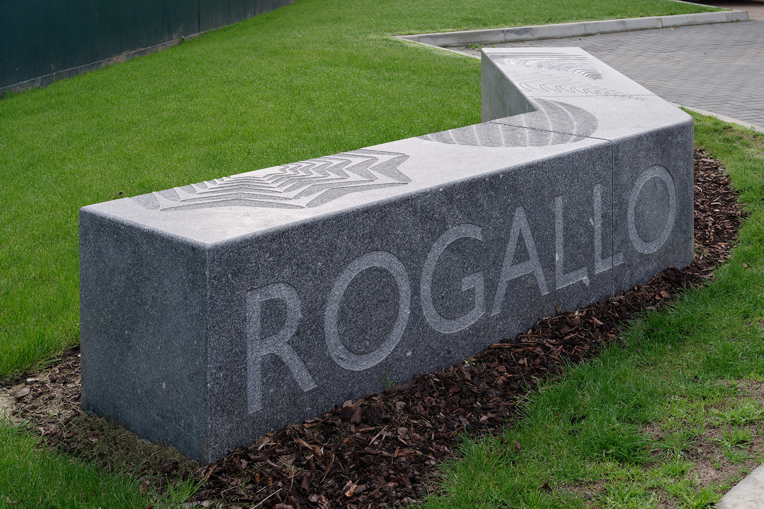
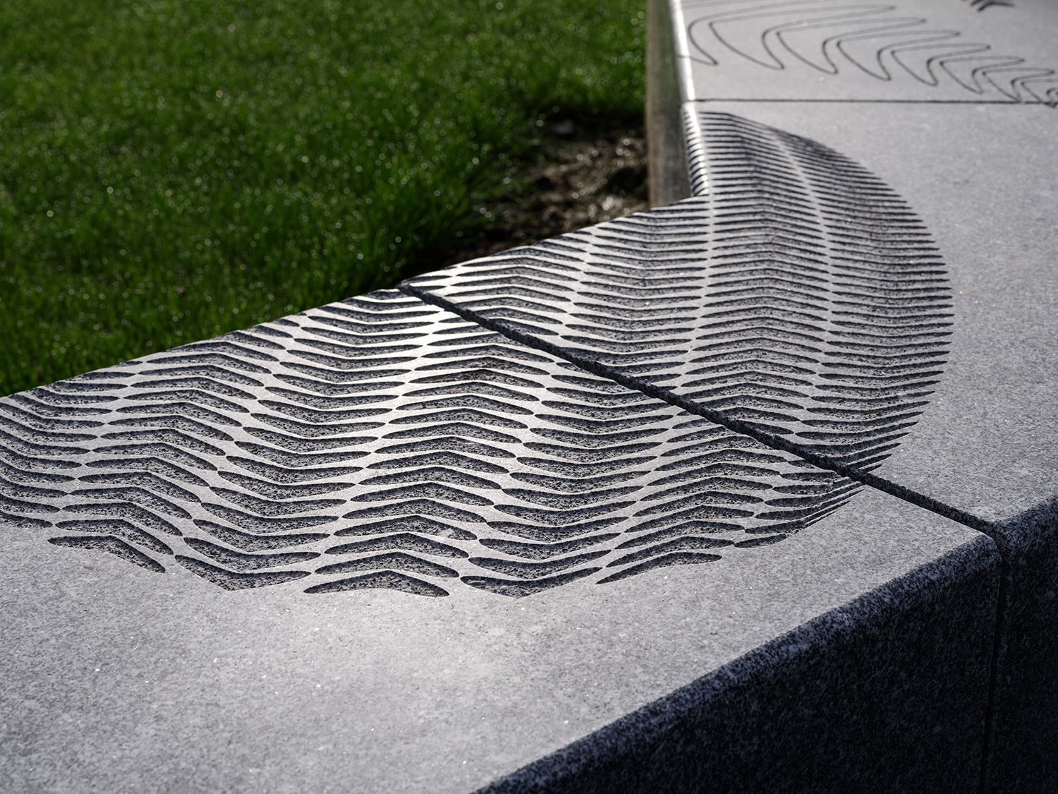
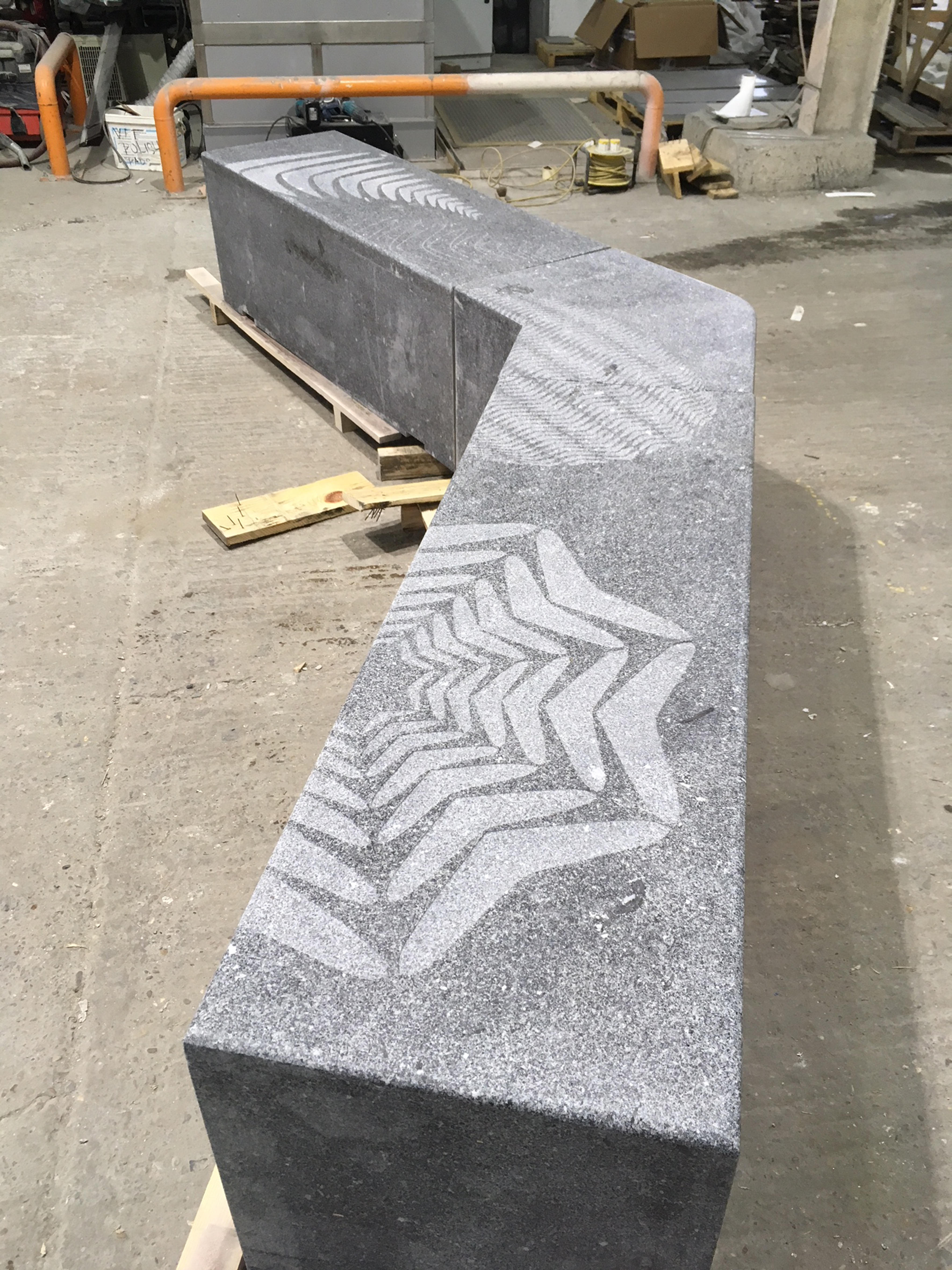
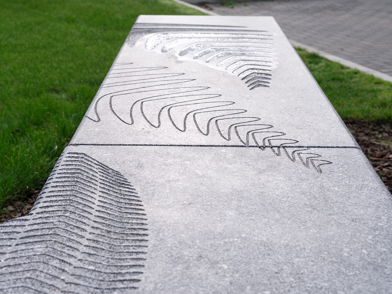
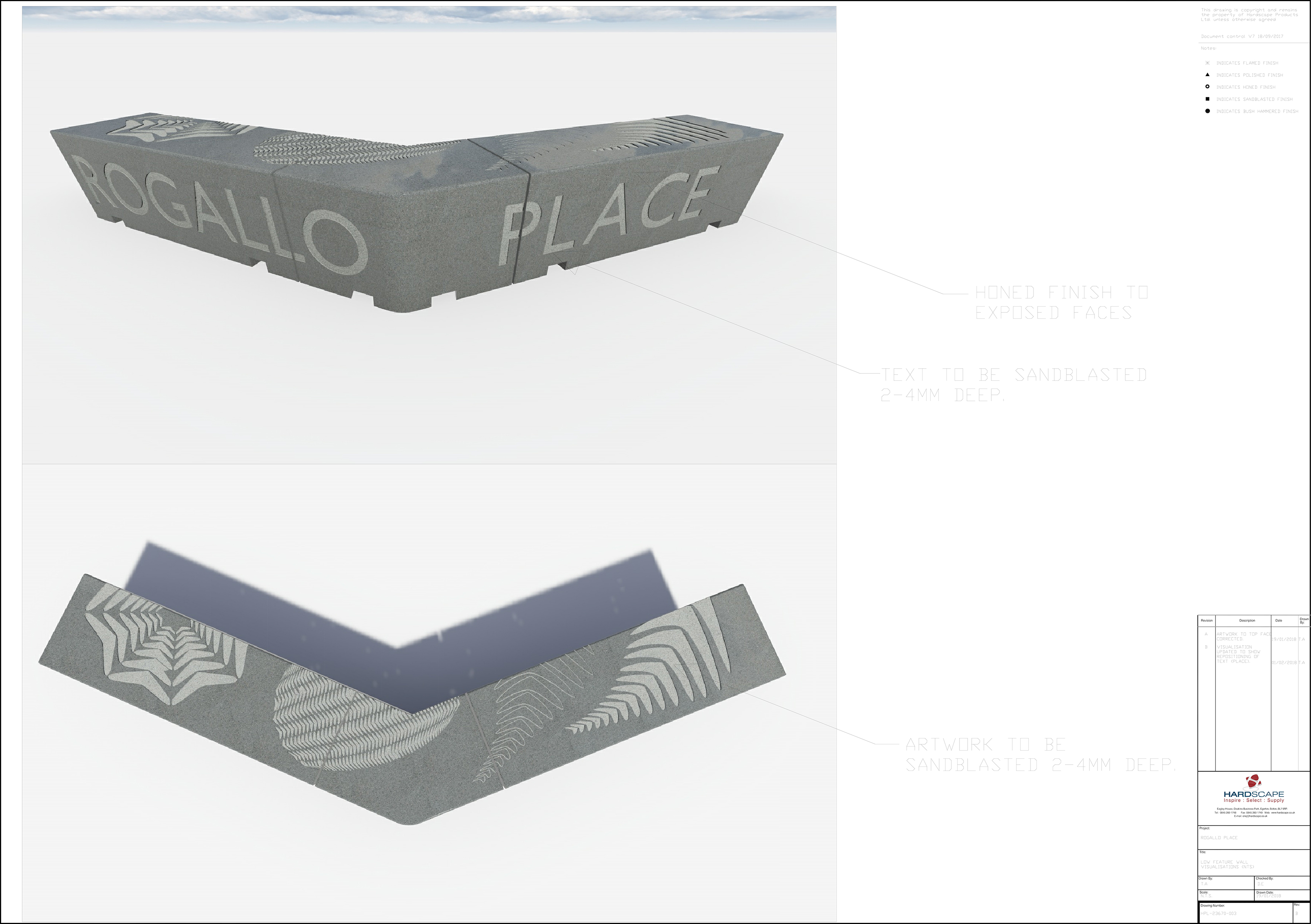
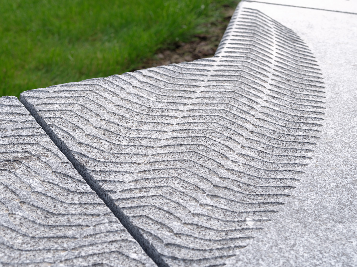
Rogallo Place Granite Bench by Artist Christopher Tipping. Image: Richard Gooding
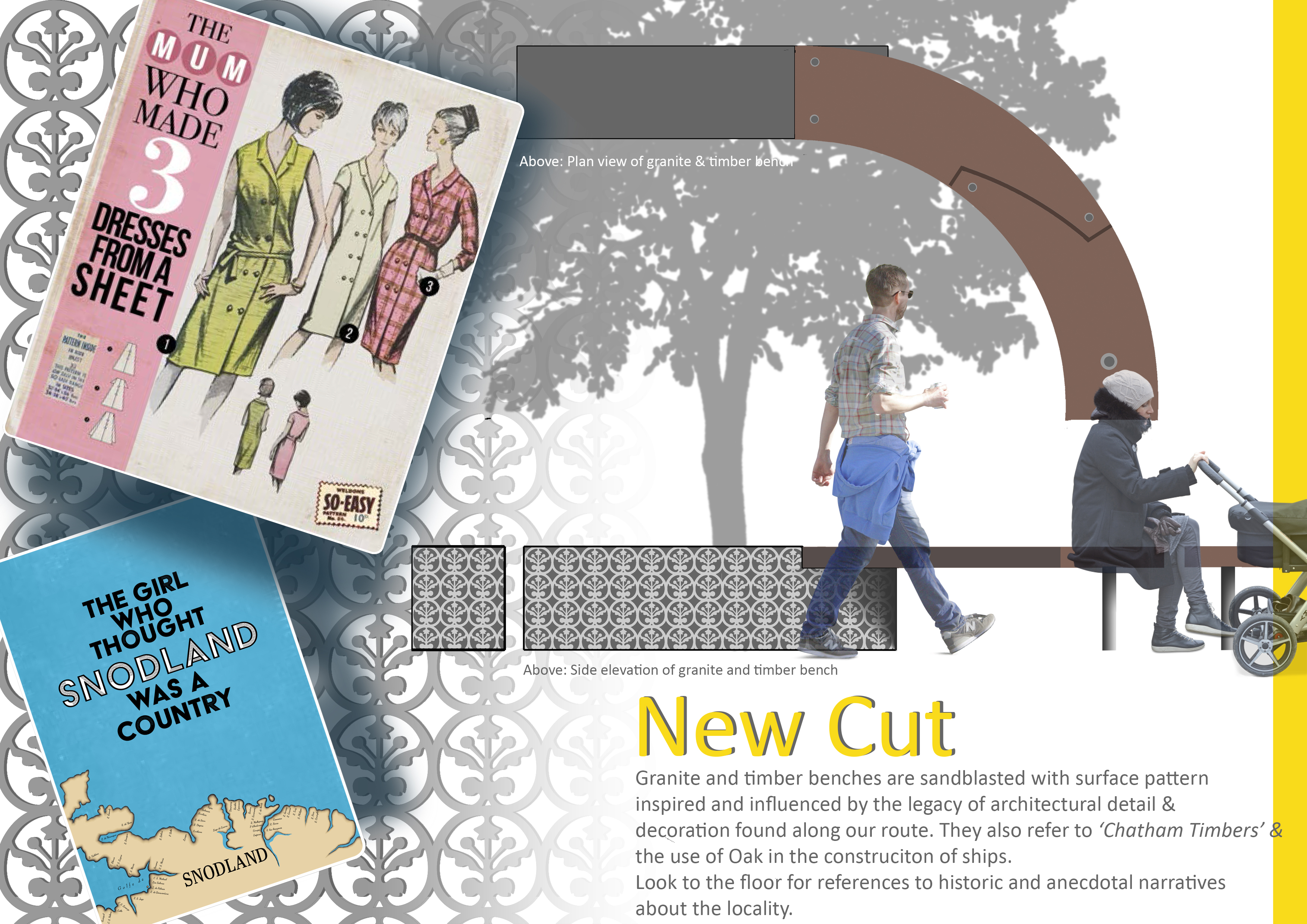
A simple monolithic granite bench was also commissioned for Rogallo Place by Optivo Homes. A beautiful honed finish is sandblasted with the name of the building alongside detailed motifs reflecting the glazing vinyls of the building’s interior.
The bench was manufactured and supplied in collaboration withHardscape,as ever, great to work with.
Rogallo Place Granite Bench by Artist Christopher Tipping. Image: Richard GoodingRogallo Place Granite Bench by Artist Christopher Tipping. Image: Richard GoodingRogallo Place Granite Bench by Artist Christopher Tipping. Image: Hardscape
The image above was taken during production at Hardscape’s Facility at Long Marston, near Stratford Upon Avon.
Rogallo Place Granite Bench by Artist Christopher Tipping. Image: HardscapeRogallo Place Granite Bench by Artist Christopher Tipping. Image: Richard GoodingRogallo Place Granite Bench Drawings by Hardscape for Artist Christopher Tipping. Image: HardscapeRogallo Place Granite Bench by Artist Christopher Tipping. Image: Richard GoodingRogallo Place Granite Bench by Artist Christopher Tipping. Image: Richard GoodingRogallo Place Granite Bench by Artist Christopher Tipping. Image: Francis Knight Art Consultants
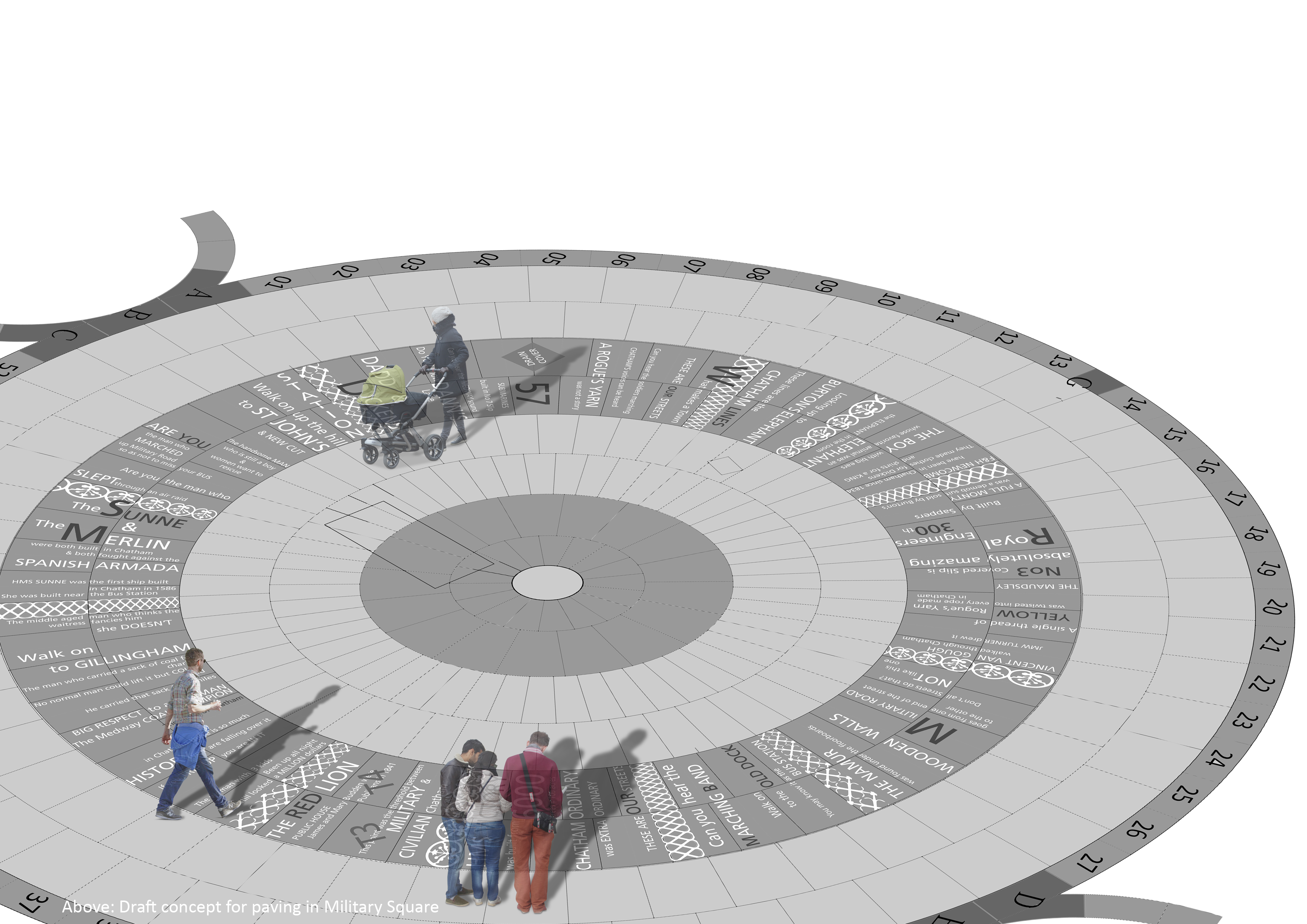
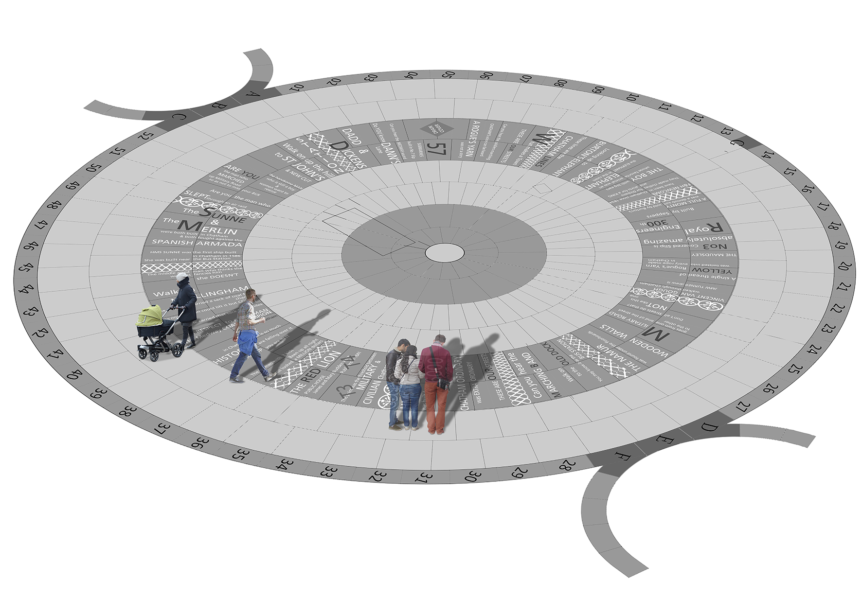
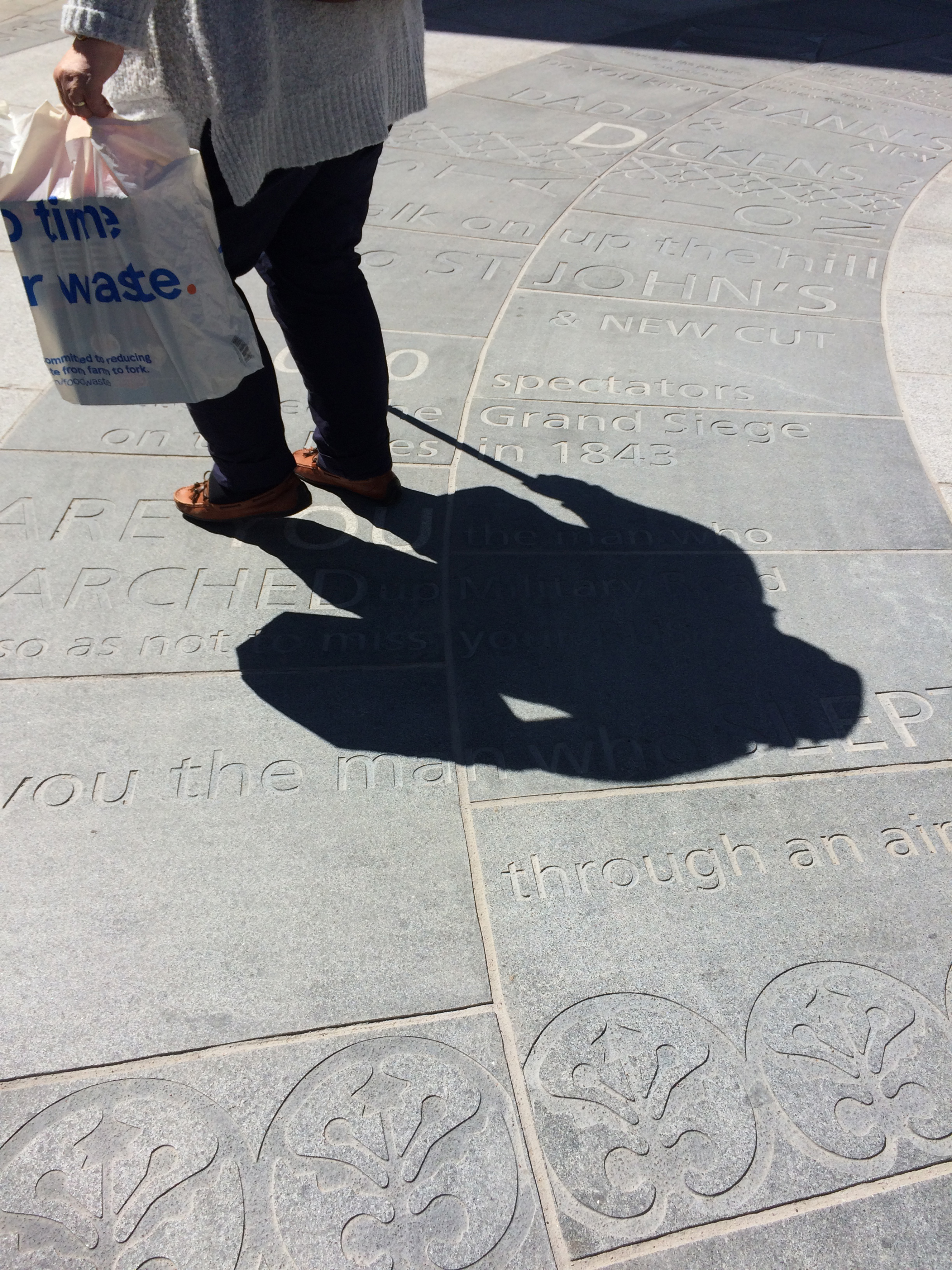
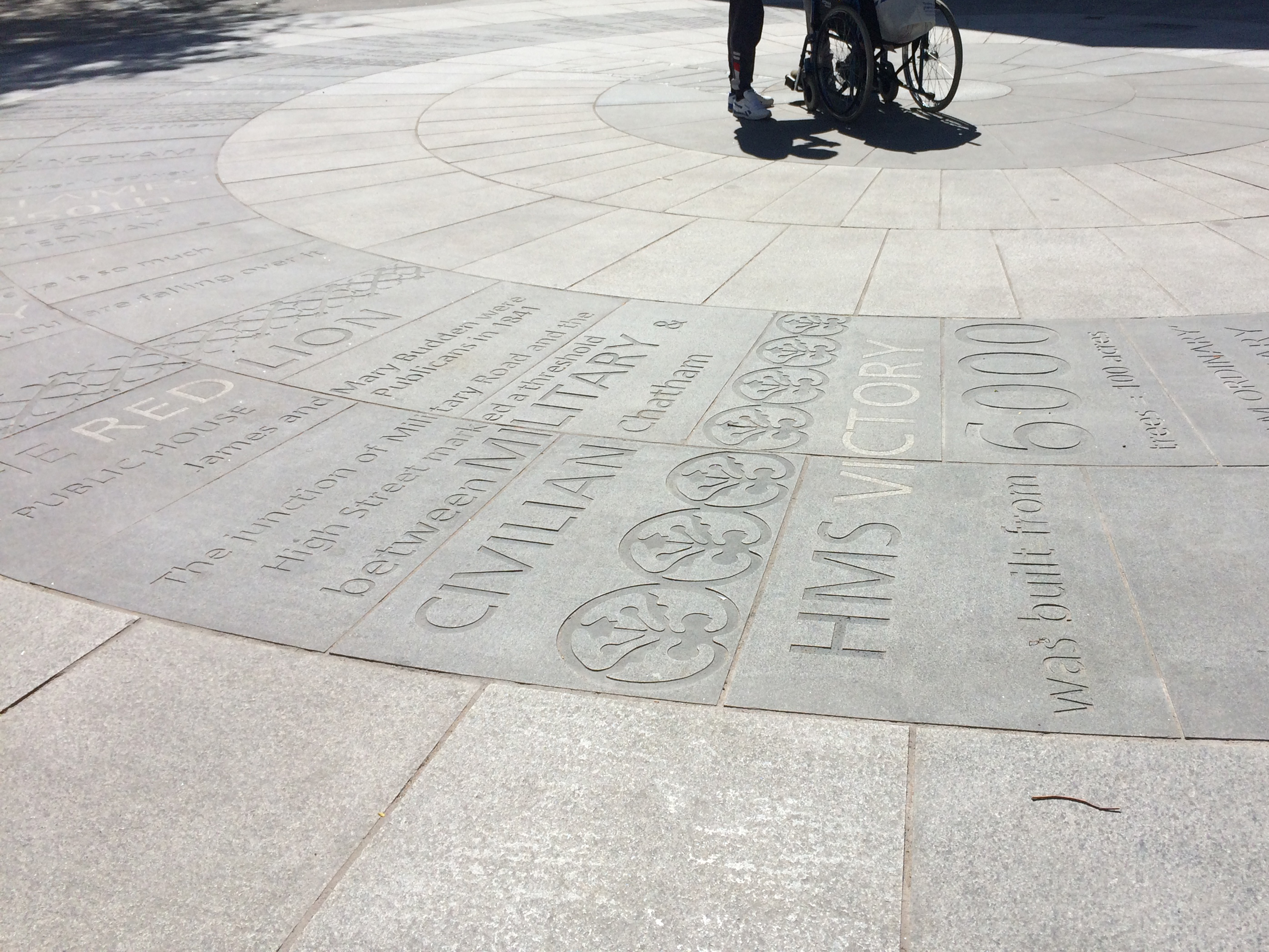
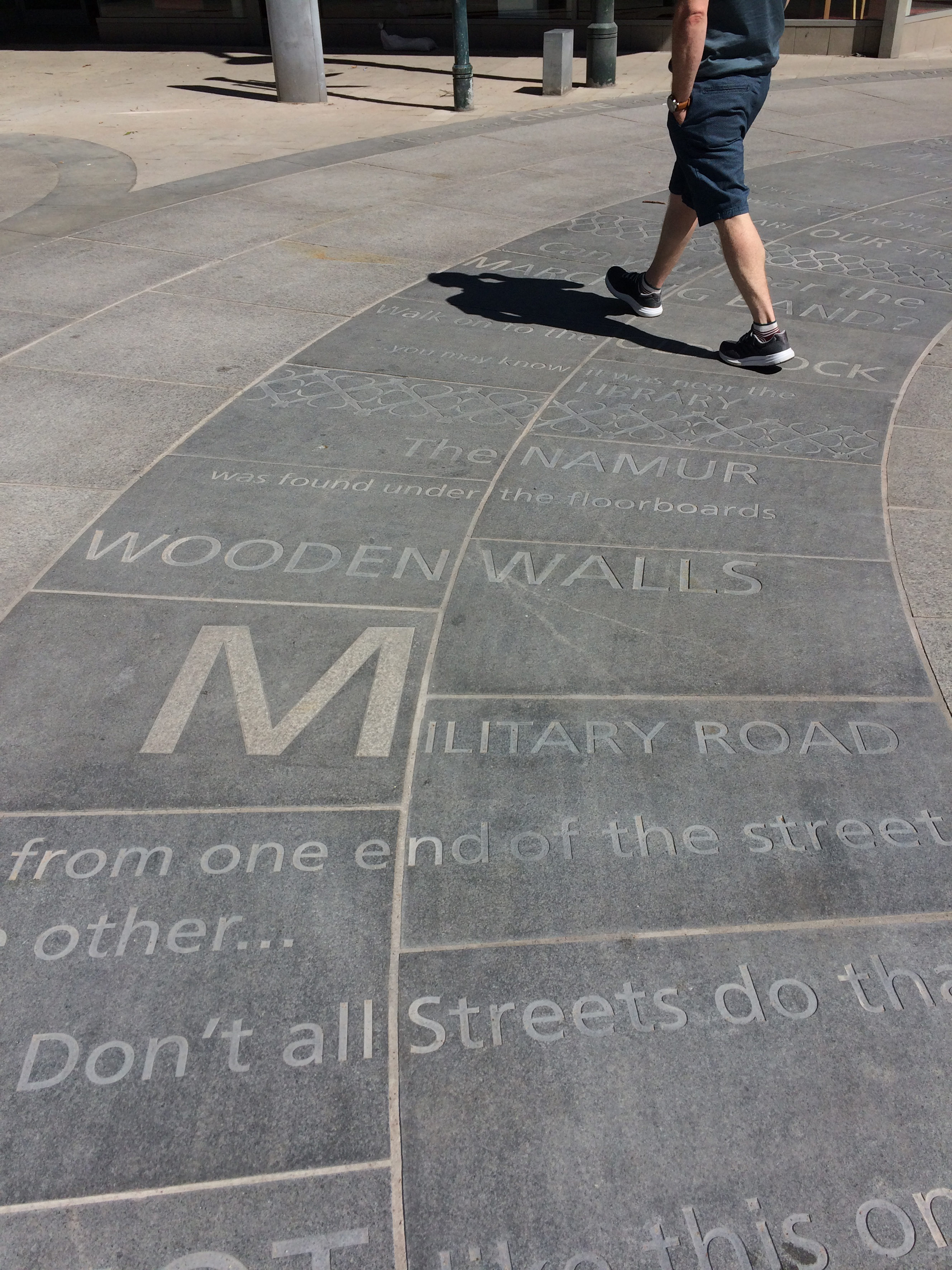
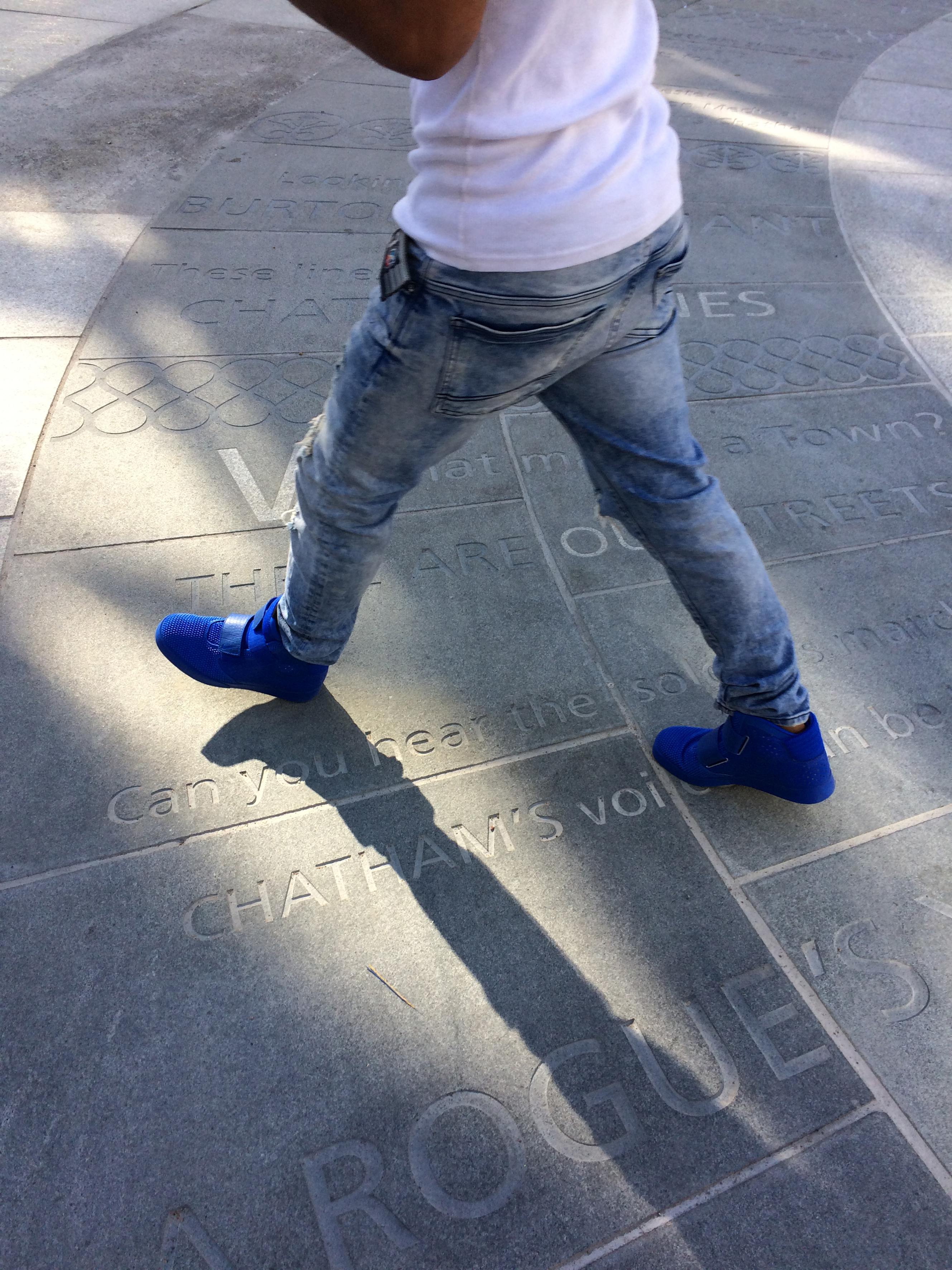
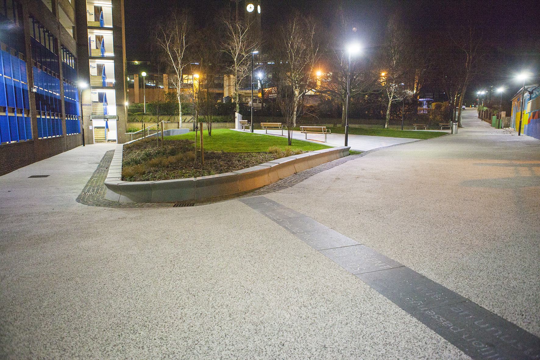
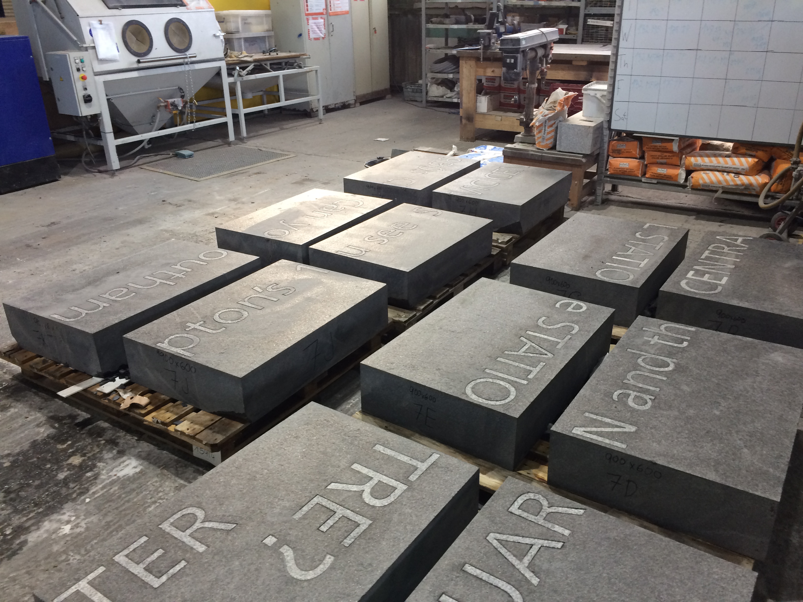
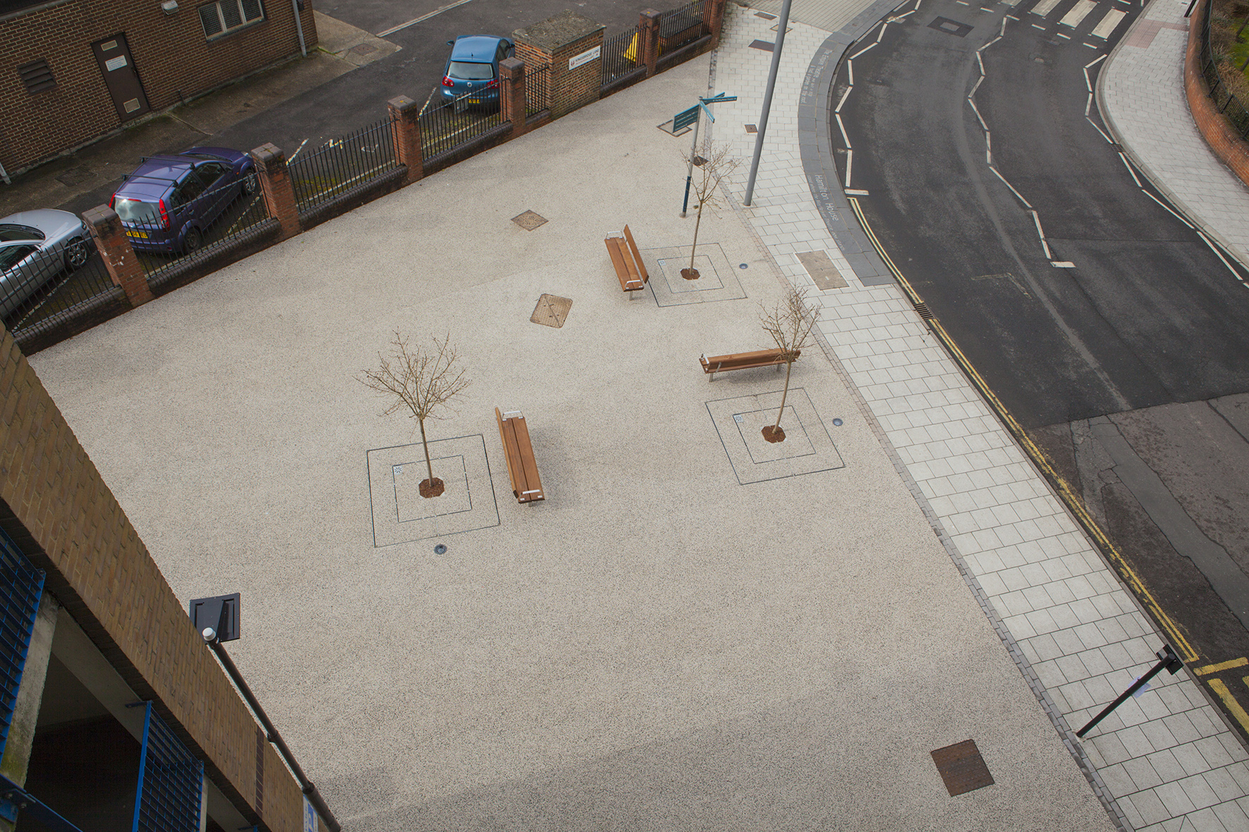
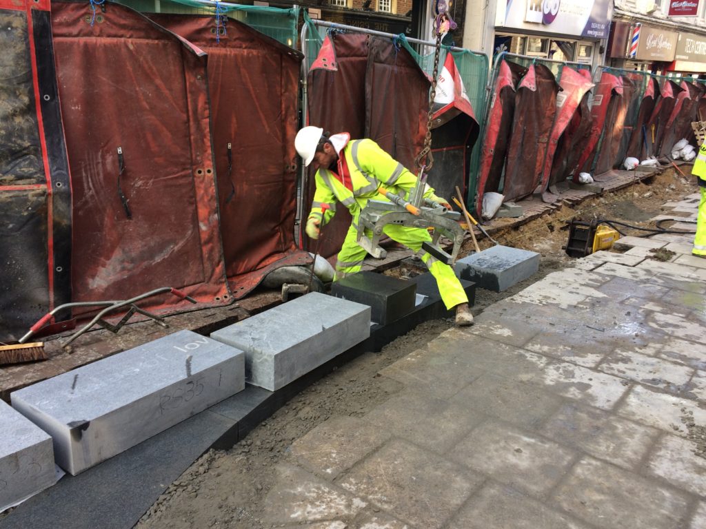
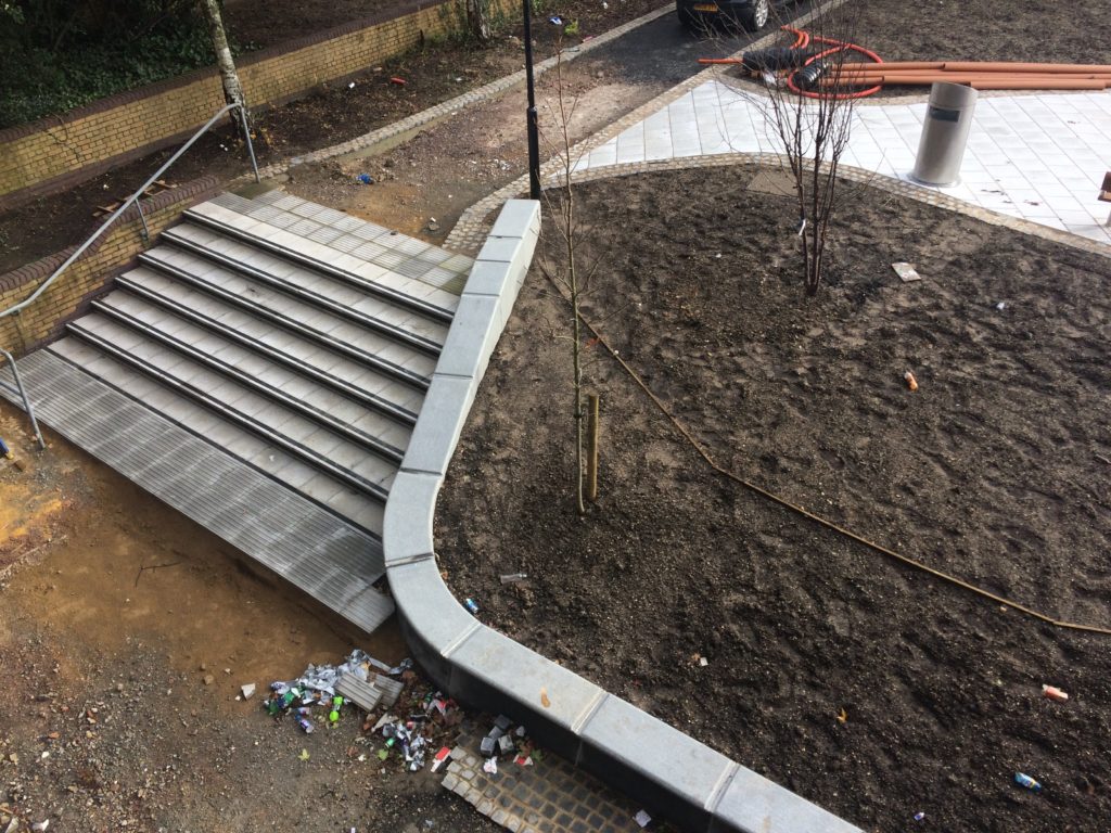
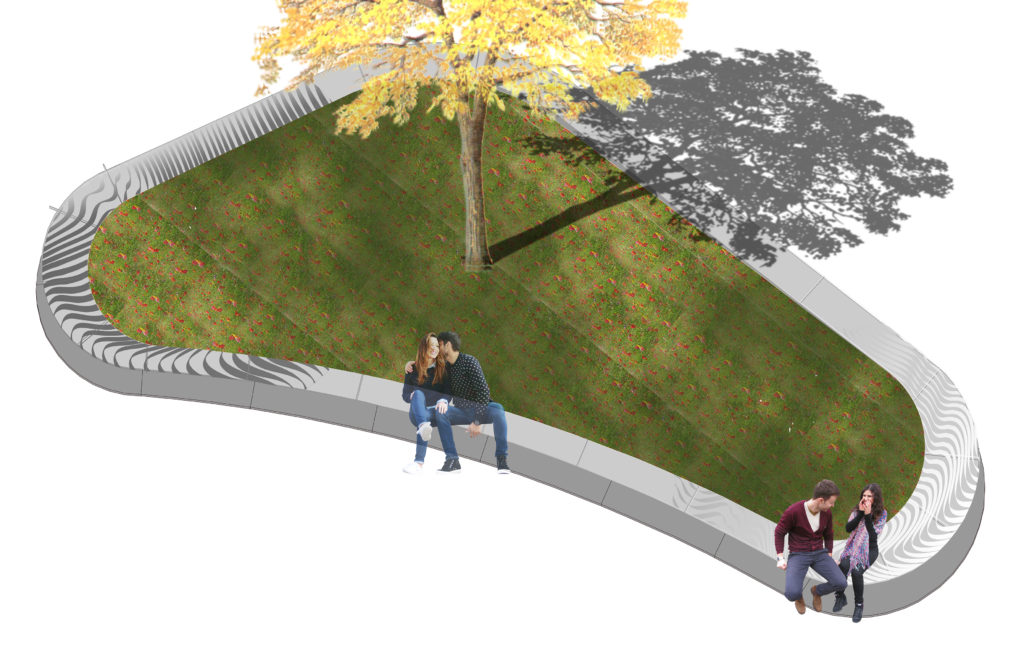
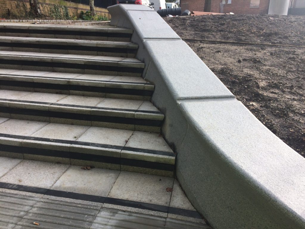
The regeneration and public realm works in Military Square, Chatham have very nearly been completed. This involves the installation of 400 bespoke radius-cut monolithic blocks of granite set into 17m diameter circle, putting a circle of words at the centre of a Military Square!
154 of the granite blocks have words, numbers & patterns sandblasted or inset into the surface. Just over 400 words are included –
Local school children & people working in local businesses were asked for their comments.
We listened to them & heard their stories. We listened to the sound of their lives.
There is an overwhelming sense of common ownership in this project.
These words are not ours. They belong to Chatham.
Military Square, Chatham. Image: Christopher TippingDraft Artwork for Military Square, Chatham. Image: Christopher TippingMilitary Square, Chatham. Image: Christopher TippingGranite blocks awaiting installation in Military Square, Chatham. Image: Christopher Tipping
You may know that the aim of this public realm project was to upgrade the route from Chatham Station to the Waterfront. This includes pedestrian and cycle routes as well as crossing points, upgrading paving materials, improving steps and ramps, opening up the public realm and streamlining access and pedestrian permeability.
Francis Knight, Public Art Consultants, managed the Public Art Project. Our project collaborators and consultants to Medway Council were LDA Design and Project Centre.
We have worked within these parameters, using the language of public realm and materials, which are robust and stand the test of time. We have created a quiet ‘narrative’ thread – a story about Chatham– & more specifically about events and places along this route.
We wanted the streets to speak quietly, confidently & with good humour about Chatham…WHAT MAKES A TOWN? …THESE ARE OUR STREETS…part memorial, part living voice…but mostly a celebration of the rich heritage and community of Chatham.
As an artist and designer of public spaces, this project has been an opportunity to influence our surroundings in a way that ‘speaks’ of Chatham and its people. We mostly take our pavements for granted, but these spaces have often developed from historic pathways and tracks linking communities and towns across the wider region. They have a resonance and a ‘voice’, …and echo with history.
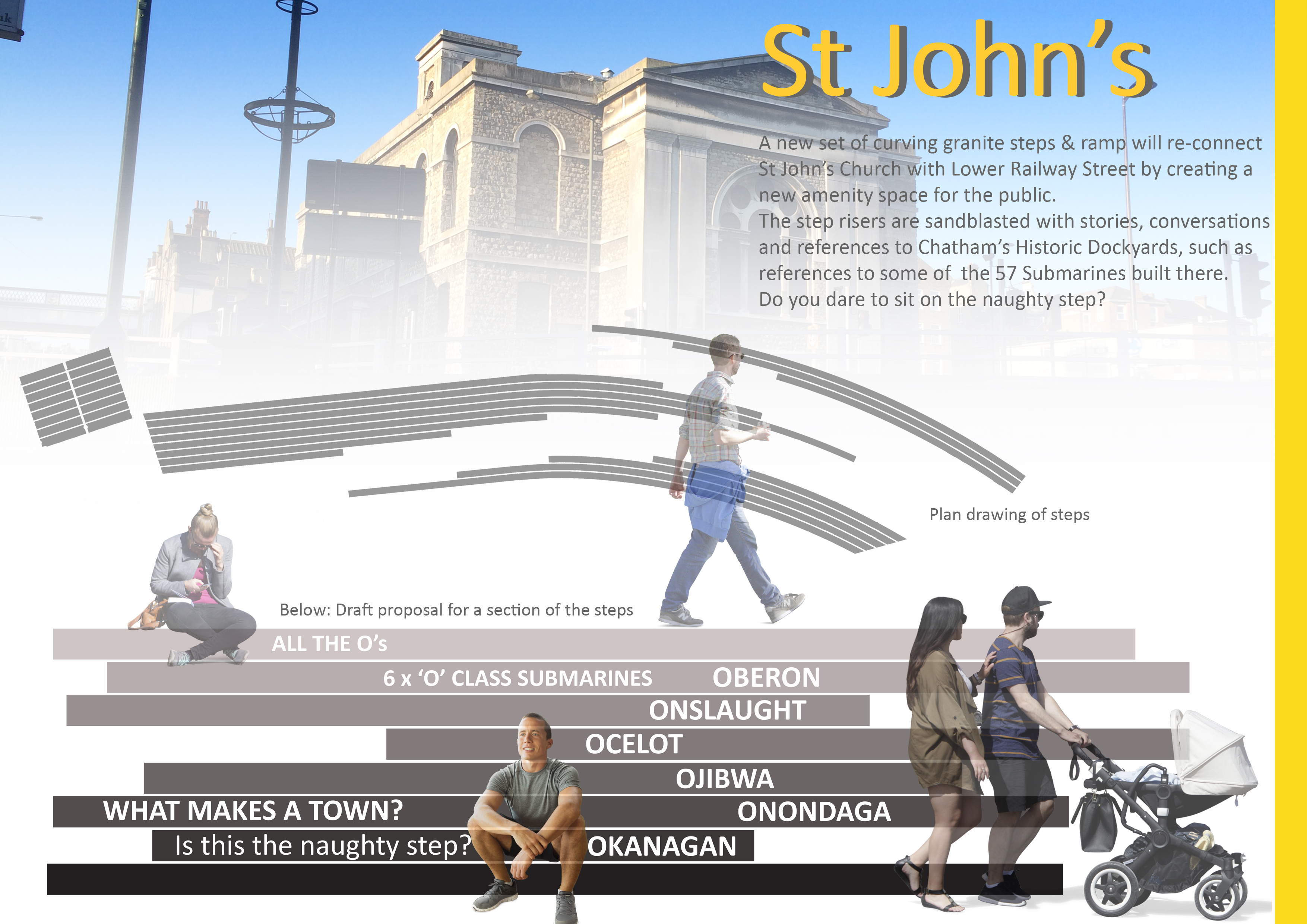
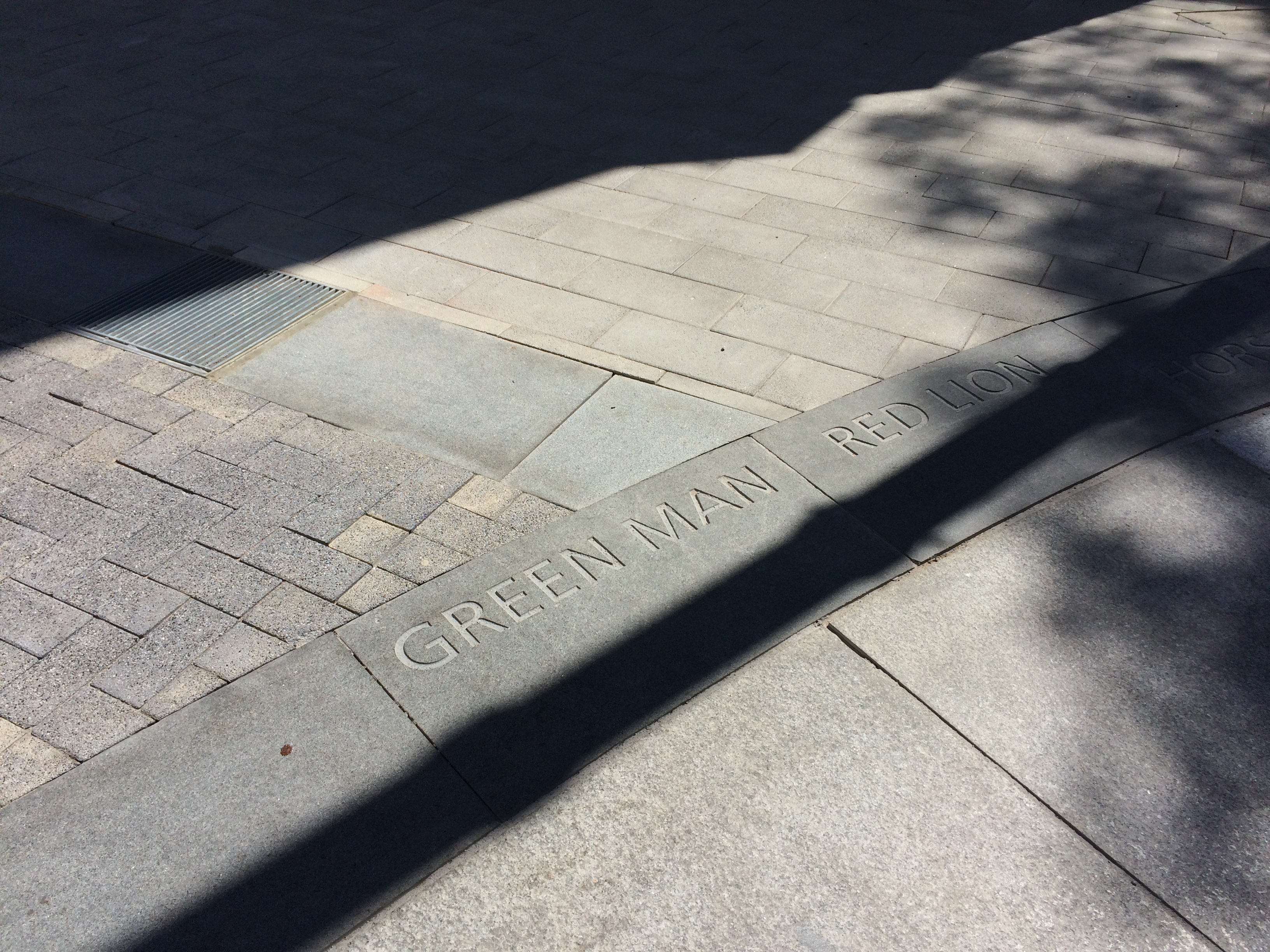
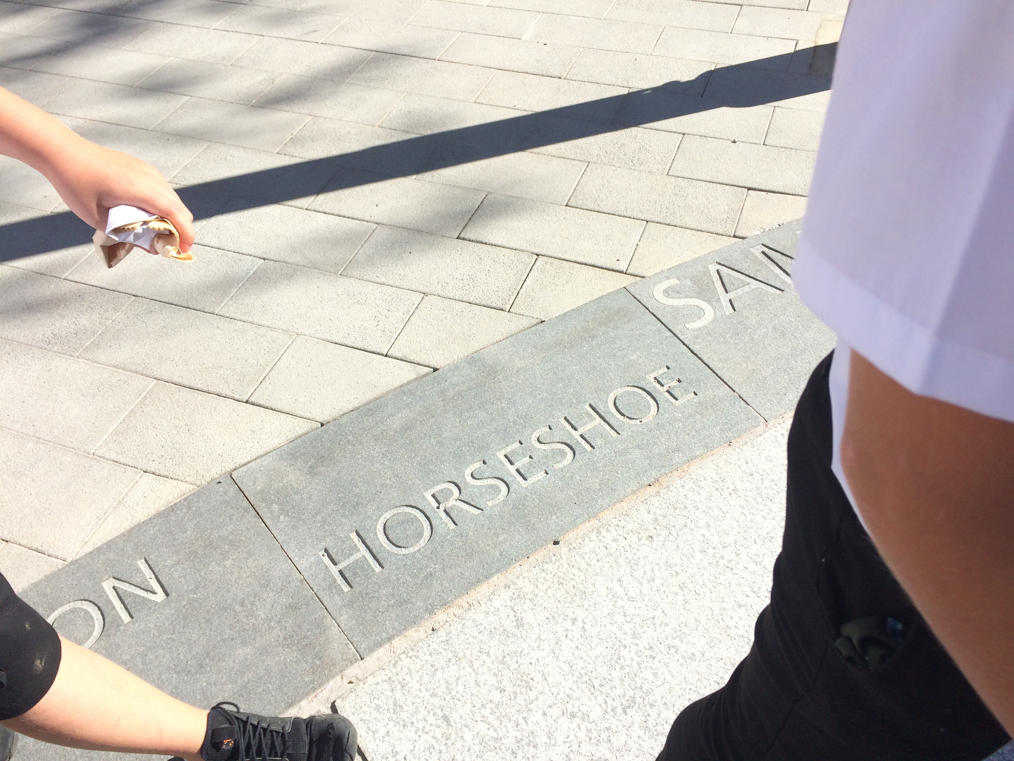
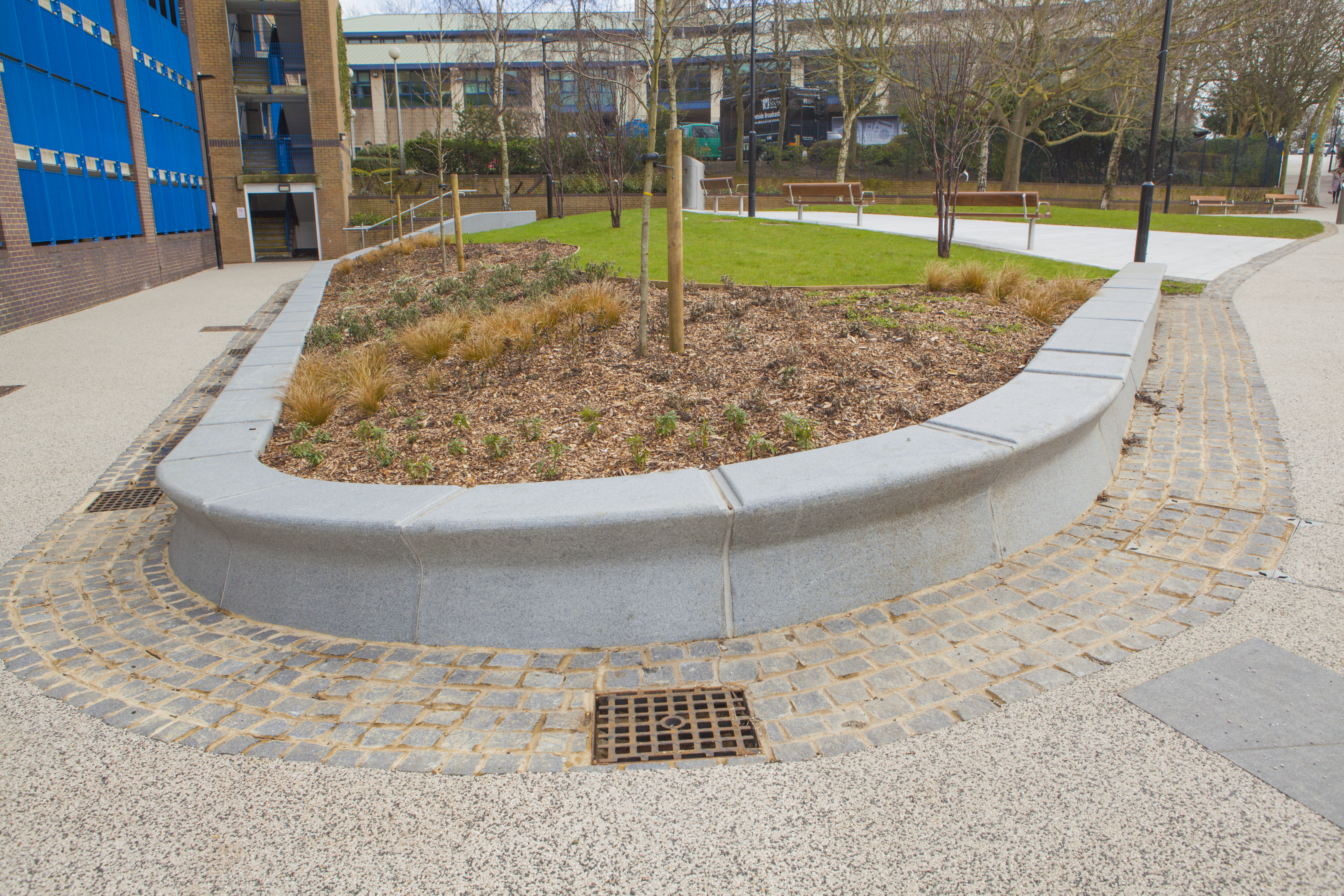
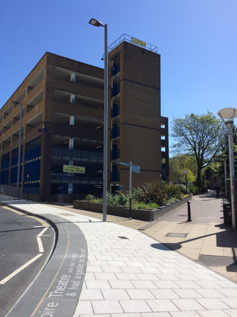
The route from the Station to the Waterfront takes us down Railways Street & Military Road – in doing so we pass several key places, such as New Cut (a former farmyard), St John’s (a Grade II Listed Waterloo Church) – Military Square, considered the Heart of the Town. At these important sites, we have made interventions to articulate the granite kerb in ways, which are expressive and of interest, whilst still maintaining functionality.
Military Square, Chatham. Image: Christopher TippingMilitary Square, Chatham. Image: Christopher TippingMilitary Square, Chatham. Image: Christopher TippingMilitary Square, Chatham. Image: Christopher TippingMilitary Square, Chatham. Image: Christopher TippingMilitary Square, Chatham. Image: Christopher TippingMilitary Square, Chatham. Image: Christopher TippingMilitary Square, Chatham. Image: Christopher Tipping
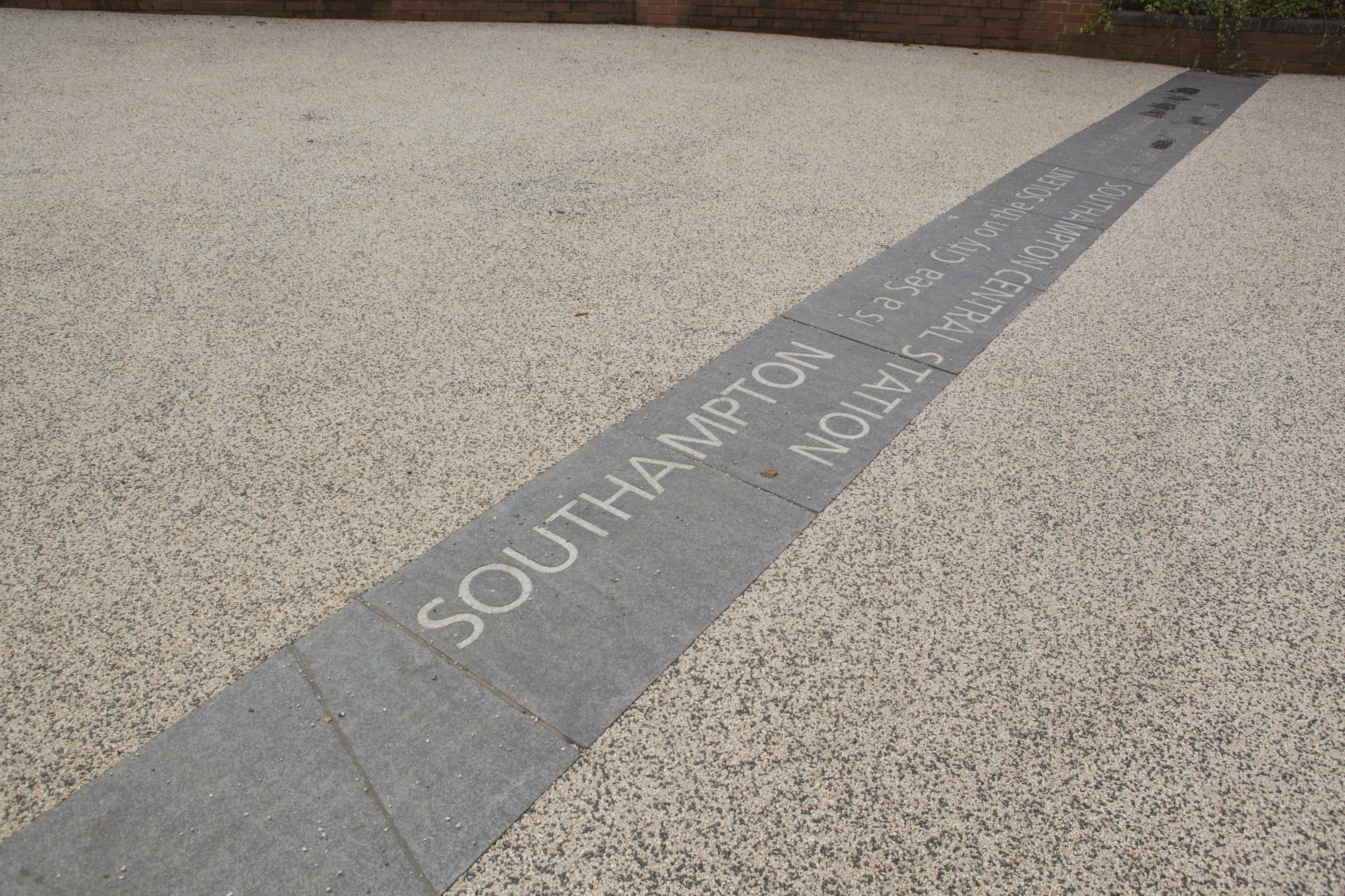
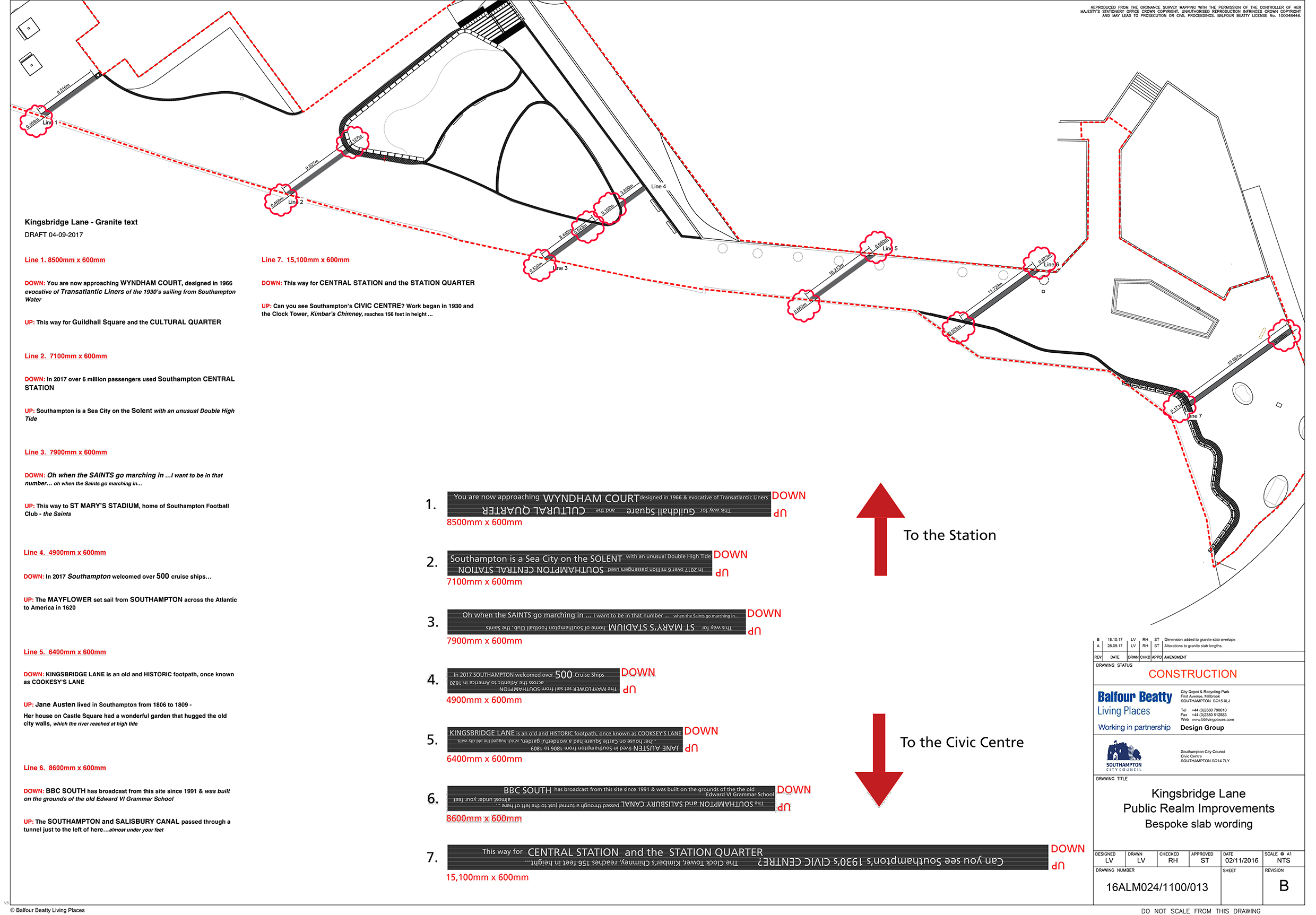
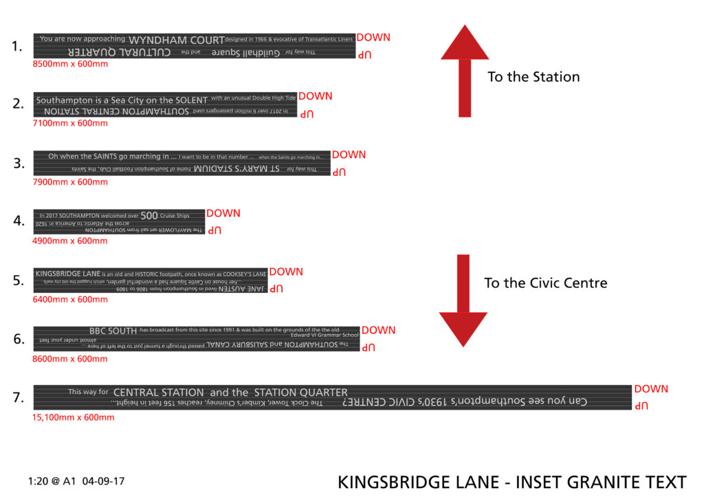
‘The SOUTHAMPTON and SALISBURY CANAL passed through a tunnel just to the left of here…almost under your feet’
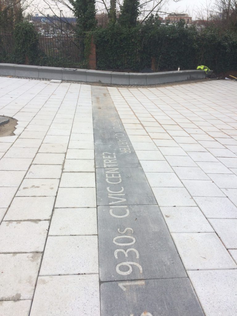
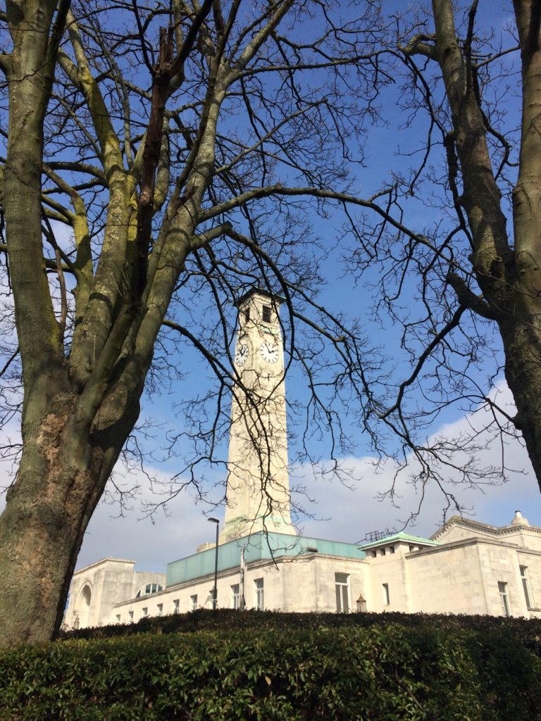
Kingsbridge Lane with Civic Centre and Clocktower. Image: Massie Wilson
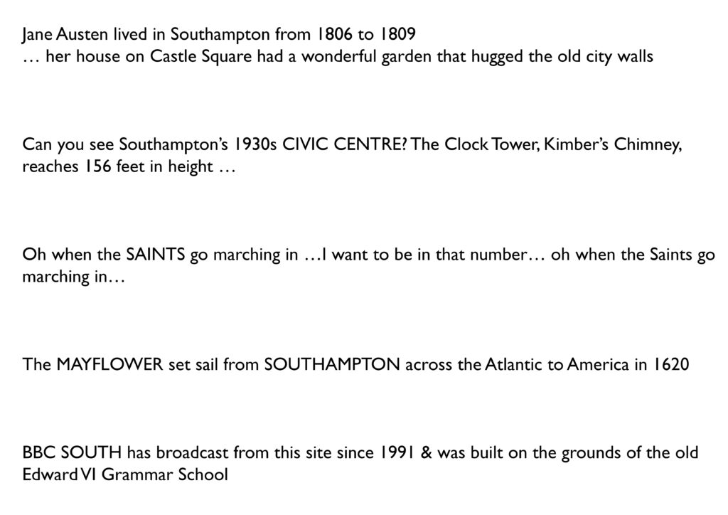
‘Can you see Southampton’s 1930s CIVIC CENTRE? The Clock Tower, Kimber’s Chimney, reaches 156 feet in height…’
Text – white granite inset into contrasting black granite.
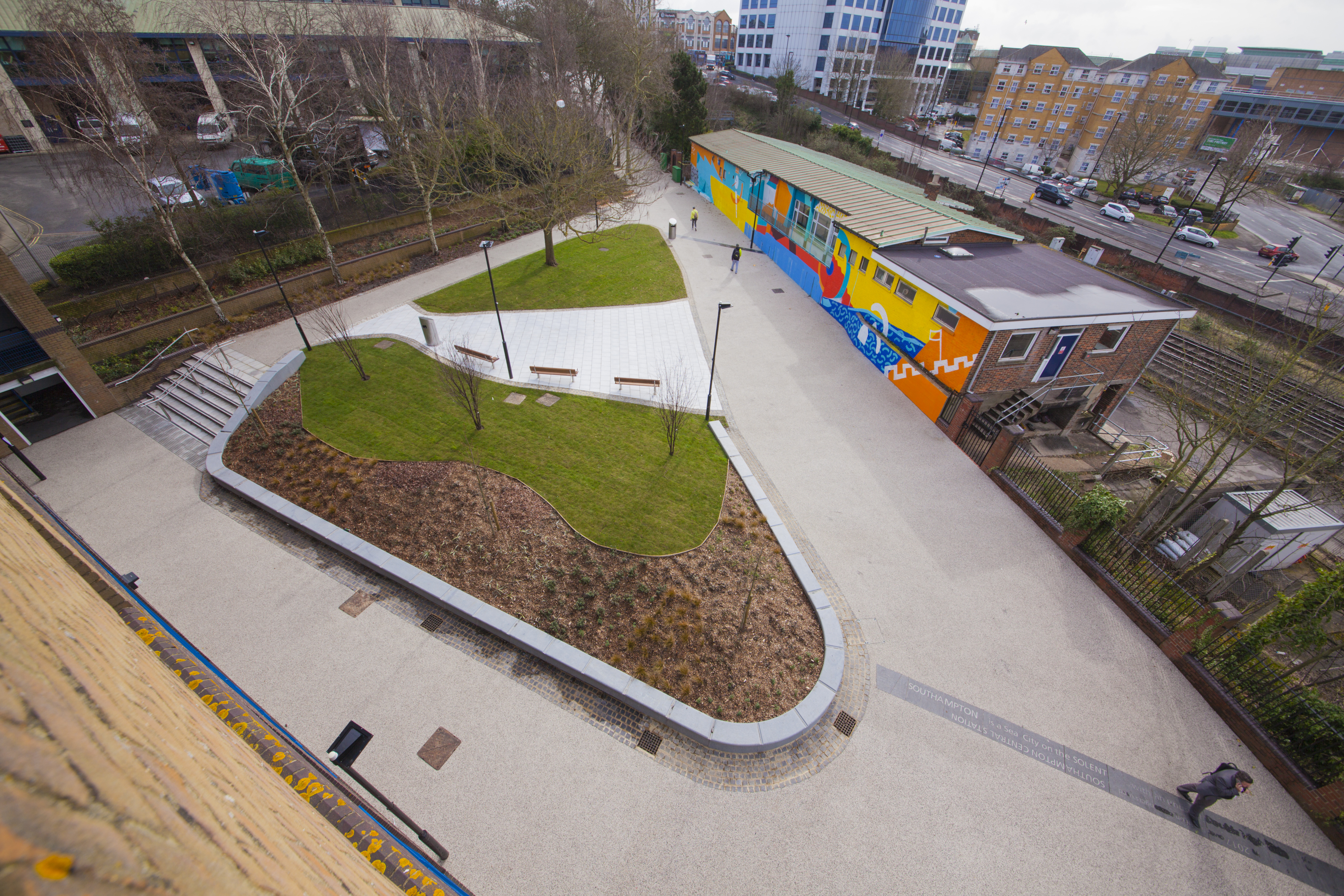
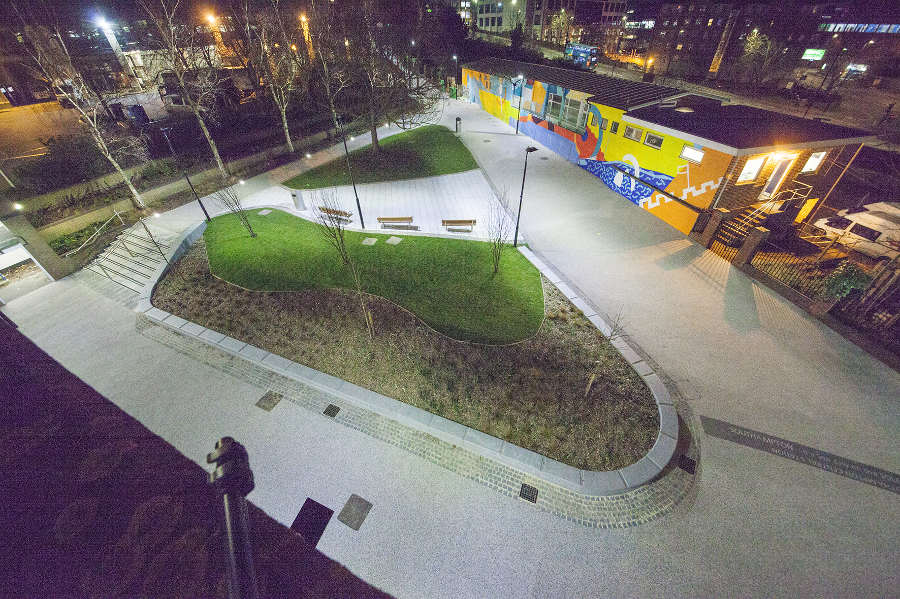
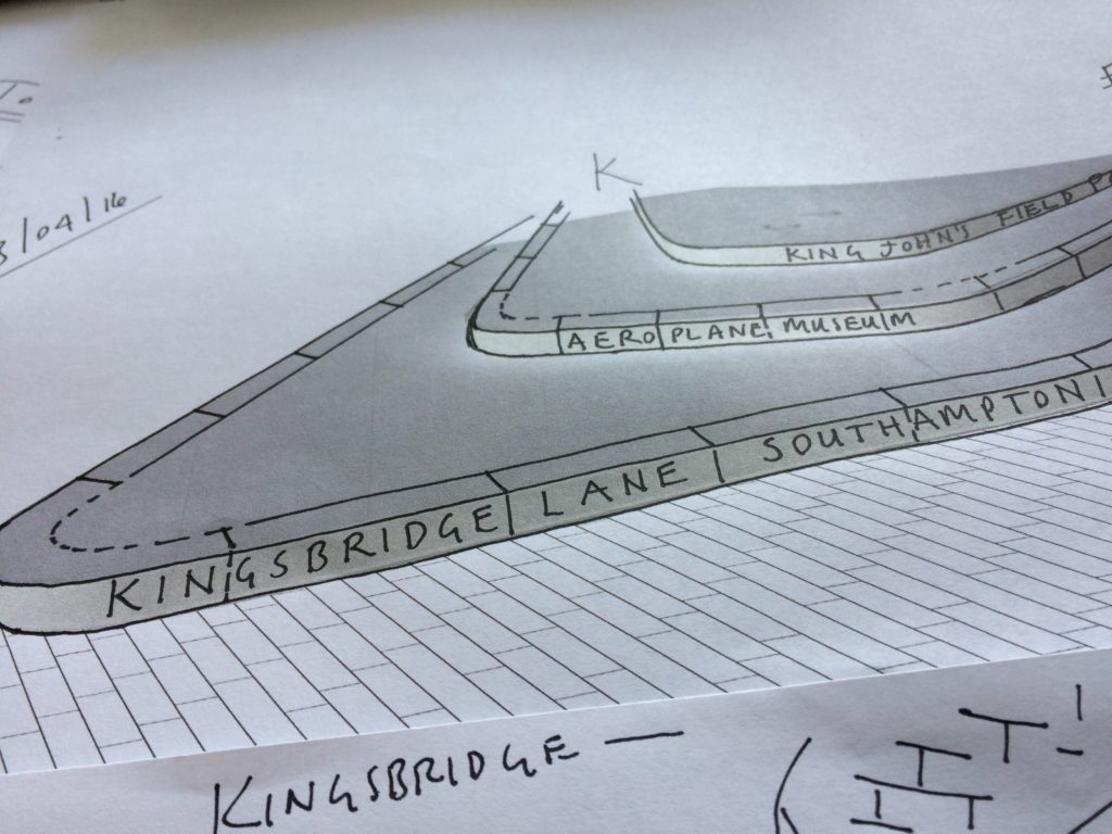
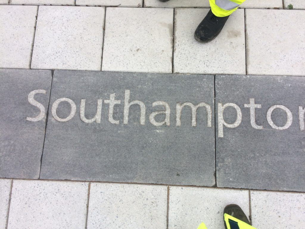
Kingsbridge Lane in Southampton is a historically important and longstanding pedestrian-only route with no vehicular access. This makes the site significant to Southampton. It is a long surviving link to the western route in and out of Southampton along the coastal strand, which formed the northern shore of the River Test Estuary until the early 20thCentury. The footpath runs along a narrow strip of land between the existing railway tunnel and the historic and long abandoned tunnel of the Southampton to Salisbury Canal, which ran along what is now Blechynden Terrace, linking Central Station to the Guildhall Square &Cultural Quarter. My role within this project was to develop a contextual response to the site, which would, hopefully, influence the landscape design and regenerative design process in collaboration Simon Taylor of Balfour Beatty Living Places , Southampton City Council and Hardscape.
Kingsbridge Lane, Southampton. Image: Massie WilsonKingsbridge Lane, Southampton. 14 lines of text – Image: Balfour Beatty
‘SOUTHAMPTON is a Sea City on the SOLENT …with and unusual Double High Tide’.
Text – white granite inset into contrasting black granite.
Aerial view of Kingsbridge Lane, Southampton. Image: Massie Wilson
‘Oh when the SAINTS go marching in …I want to be in that number… oh when the Saints go marching in…’
Nighttime aerial view of Kingsbridge Lane, Southampton. Image: Massie Wilson
‘In 2017 over 6 million passengers used Southampton CENTRAL STATION’
Kingsbridge Lane, Southampton. Nighttime view. Image: Massie Wilson
‘SOUTHAMPTON is a Sea City on the SOLENT …with and unusual Double High Tide’.
Basalt Slabs with inset text at Hardscape for Kingsbridge Lane, Southampton. Image: Christopher Tipping
Kingsbridge Lane, Southampton. Image: Massie Wilson
‘Jane Austen lived in Southampton from 1806 to 1809 … her house on Castle Square had a wonderful garden that hugged the old city walls’
Kingsbridge Lane, Southampton. Image: Massie Wilson
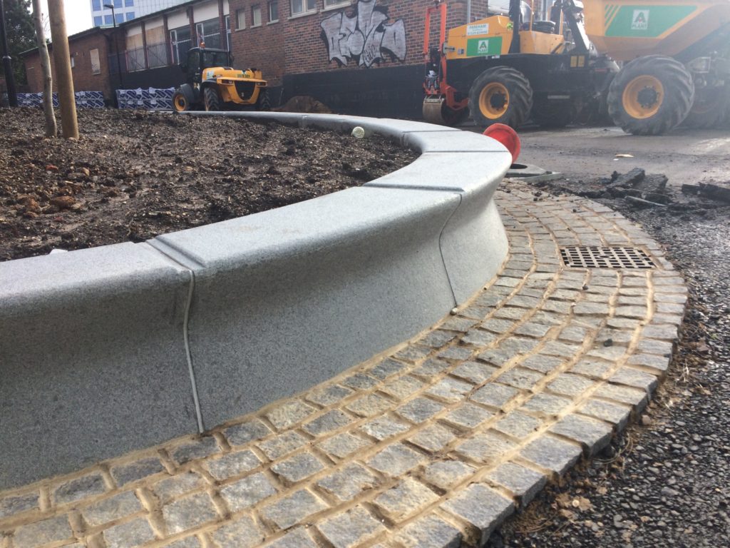
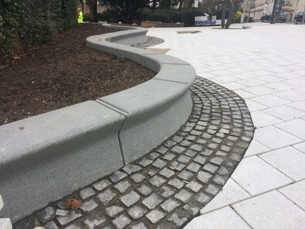
The granite seating and retaining walls by Hardscape are undercut along the front edge suggesting the movement of water throughout the site.
‘The MAYFLOWER set sail from SOUTHAMPTON across the Atlantic to America in 1620′
Aerial view of Kingsbridge Lane at the junction with Blechynden Terrace and West Park Rd, Southampton. Image: Massie Wilson
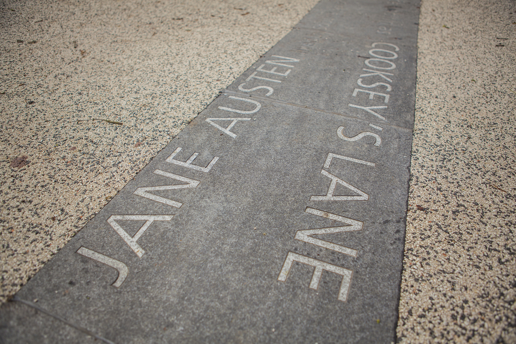
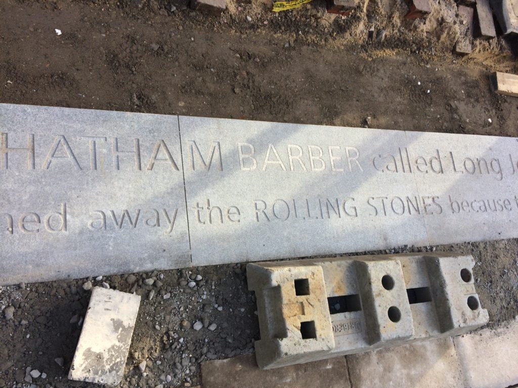
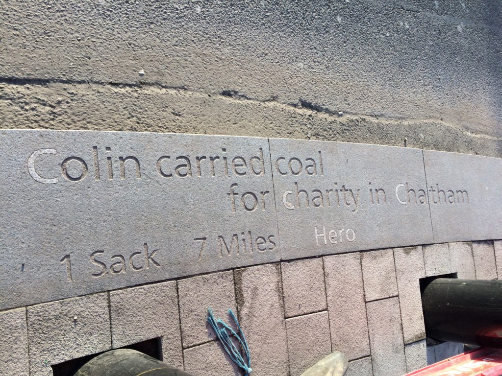
You may have seen some of our work embedded into the streetscape along Railway Street. Large scale granite kerbs contain words sandblasted or inlaid into the surface. You may wonder what these words mean, or how they relate to you. Here is a short explanation of how they came about.
We often talk about words having weight – of text being ‘set in stone’… or ’engraved in stone’…suggesting gravitas, importance, longevity, …we all like a funny ‘one liner’…colloquial, local…distinct Chatham voices…
Well, here in Chatham your words really are being set in stone…for all to read…for years to come –
Chatham Placemaking Project. “A Chatham Barber called Long John…”. Image: Christopher TippingChatham Placemaking Project. “Colin carried coal…”. Image: Christopher Tipping. Words: Rob Young
You may know that the aim of this public realm project was to upgrade the route from Chatham Station to the Waterfront. This includes pedestrian and cycle routes as well as crossing points, upgrading paving materials, improving steps and ramps, opening up the public realm and streamlining access and pedestrian permeability. This work was driven by Francis Knight, Public Art Consultants & our project collaborators and consultants to Medway Council, LDA Design and Project Centre.
We have worked within these parameters, using the language of public realm and materials, which are robust and stand the test of time. We have created a quiet ‘narrative’ thread – a story about Chatham– & more specifically about events and places along this route.
We wanted the streets to speak quietly, confidently & with good humour about Chatham…WHAT MAKES A TOWN ?…THESE ARE OUR STREETS…part memorial, part living voice…but mostly a celebration of the rich heritage and community of Chatham.
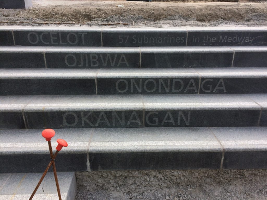
Chatham Placemaking Project. 57 Submarines. Image: Christopher Tipping.
As an artist and designer of public spaces, this project has been an opportunity to influence our surroundings in a way that ‘speaks’ of Chatham and its people. We mostly take our pavements for granted, but these spaces have often developed from historic pathways and tracks linking communities and towns across the wider region. They have a resonance and a ‘voice’, …and echo with history.
The route from the Station to the Waterfront takes us down Railways Street & Military Road – in doing so we pass several key places, such as New Cut ( a former farmyard), St John’s ( a Grade II Listed Waterloo Church) – Military Square, considered the Heart of the Town. At these important sites, we have made interventions to articulate the granite kerb in ways which are expressive and of interest, whilst still maintaining functionality.
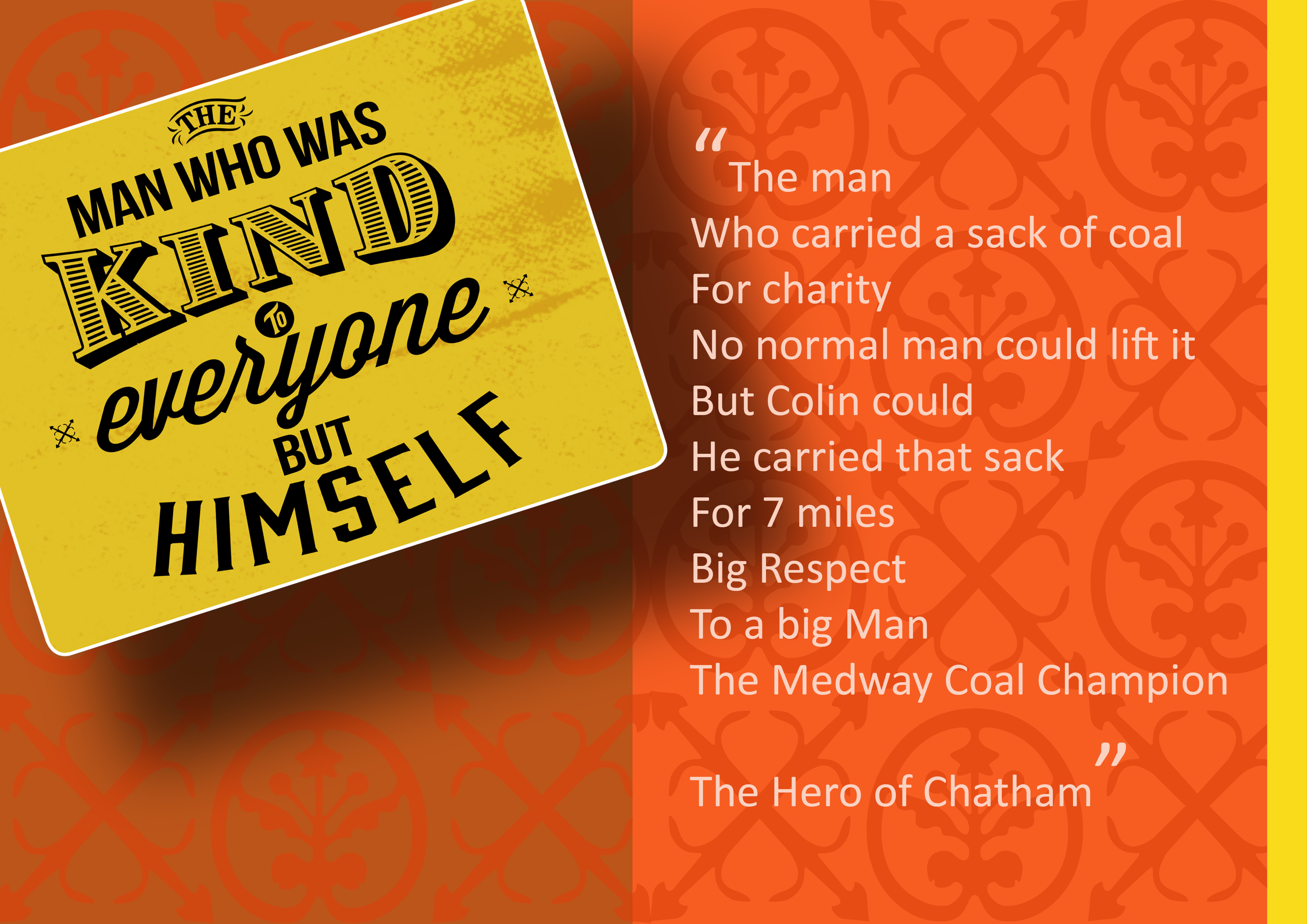
We were keen to hear and to record everyday voices …words spoken by ordinary people – such as ‘the girl who cried when she lost her phone and then cried again when she found it’... ‘the lovey barmaid’ …or ‘Colin, the man who carried coal for charity’…these are the voices of people on the street, passers by, people shopping & passing the time of day. We engaged with people directly in conversation, we overheard the conversations of others, we wrote down and recorded stories and anecdotes we were told.
I was very fortunate to collaborate with other artists on this project. Filmmaker Simon Williams succinctly and with an understated eye for visual language and movement, cleverly framed our project parameters and vision in a series of short films, whilst printmaker Xtina Lamb rendered our architectural vision into graphic patterns & motifs used throughout the scheme. Both artists also live in Chatham, bringing their individual & unique perspectives to play. However, it was the award winning writer Rob Young, who contributed significantly to the embedded text. An astute, profound and funny wordsmith with an ability to engage anyone and everyone, turning their words into poetry along the way.
“The knitter. Whose name is Pearl.
The woman. Who uses the word ‘like?’ As like, punctuation?
The woman. Who said sorry. When you’re the one who pushed in.
The woman. Who draws breath. Then monologues. For an hour.
The waiter. Who had a fling. With a Bride. At her wedding.
The girl. Who cried. All day. When she lost her phone. Then cried again. When she found it.
The boy. Whose Mum. Made him take back the sweets. That he stole.
The man. Who says, I’m mad, me. Who isn’t mad, at all. Just lonely”. Rob Young 2016
Justin Coe, a poet and writer also contributed, animatedly performing his work directly to camera, whilst walking the route in a film by Simon Williams.
Film still image of Poet & Writer Justin Coe performing his work on Military Road, Chatham. Image: Simon Williams
“On his way to his first day of school on Rome Lane
(The name of this road – before the trains came)
And while we’re walking with Dickens – observe the new Church
They’ve called it St Johns. And it will soon be the first
Public building in Chatham lit by electricity!…
Though all the lights went out here by the end of last century…” Justin Coe 2016
Local school children & people working in local businesses were asked for their comments. We listened to them & heard their stories. We listened to the sound of their lives. There is an overwhelming sense of common ownership in this project. These words are not ours. They belong to Chatham.
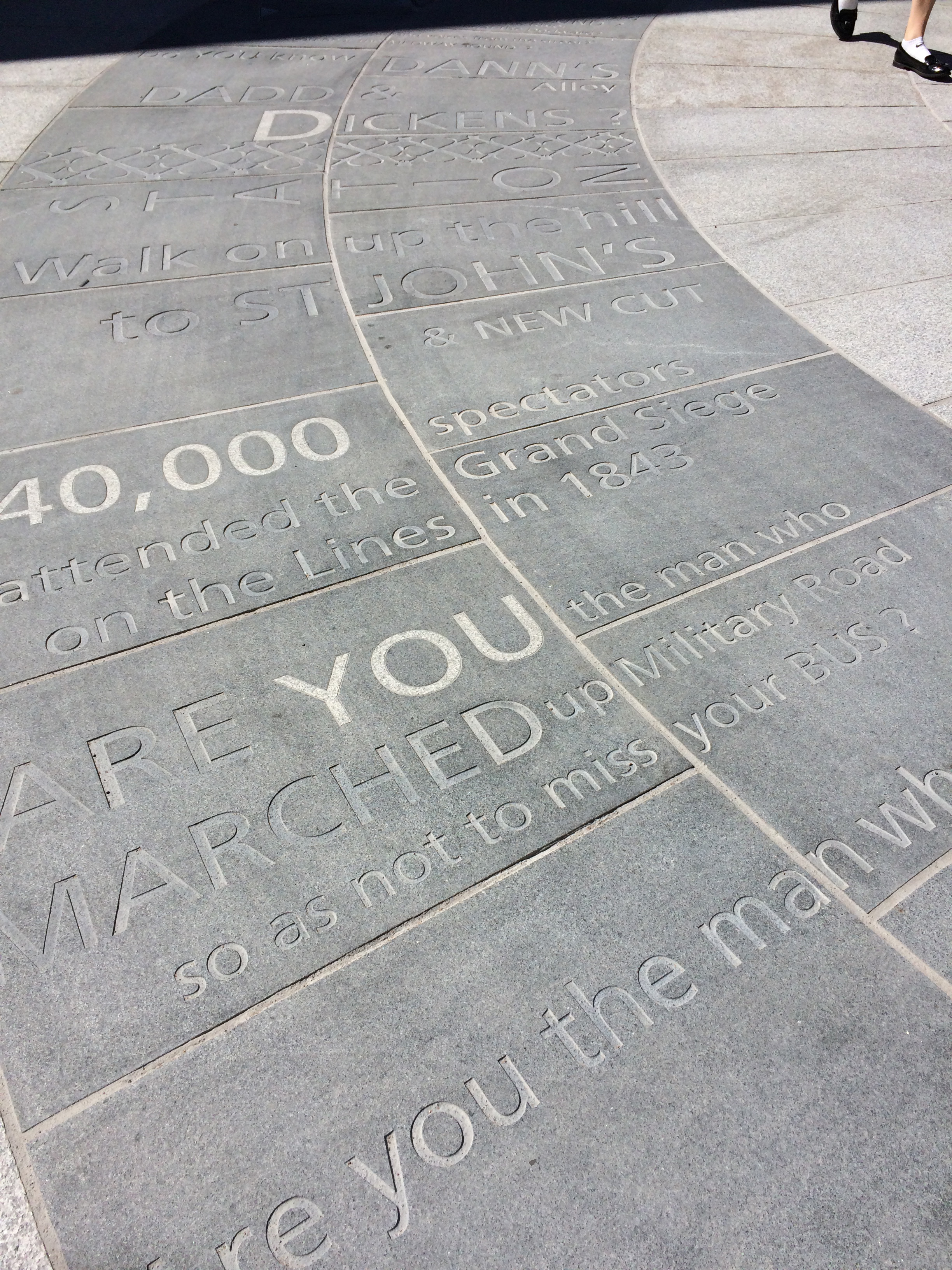
We referenced times past by collaborating with MALSC (Medway Archives and Local Studies Centre) and other local agencies in searching for site specific text, such as the words of famous visitors & local Luminaries such as Charles Dickens, reminiscing about ‘soldiers marching through the town in regimented rows …’
The oversized granite kerbs we have used here become a metaphor for the continuity of the local community – kerbs being critical in holding roads and pavements in place – they are physically important in maintaining the fabric of our environment –they could almost be described as ‘defensive structures’ maintaining the integrity and safety of our public spaces …reminiscent of the Chatham Lines – the historic defensive structures, forts and earthworks, which offered protection to the people of Medway & especially the Chatham Dockyard …
The granite kerb acts as a threshold between various states …of the pedestrian…and the driver, or moving fast or slow – perceptions of safety & danger…often the original granite kerb is often the only thing left in place when pavements and roads have been re-placed or modernised throughout recent history…the kerb maintains the parameters of how public spaces were managed and maintained. These lines of granite are also ‘our other Chatham Lines…’
More of the kerbstone lies buried beneath the surface than on top of it… and so it is also a rather poignant link between the past and the present…where times and events past lie buried beneath out feet –
Chatham Placemaking Project – granite kerbs being installed on Railway Street. Image: Christopher Tipping
Our work in Chatham set out to find and hear voices and words which quietly & evocatively create a sense of place associated with each of our stopping points on the route from the Station to the Paddock… the power of these voices is amplified by the weight and mass of the monolithic granite.
Left in place, these words will still be here in a hundred years from now…
Kingsbridge Lane in Southampton is a historically important and longstanding pedestrian-only route with no vehicular access. This makes the site significant to Southampton. It is a long surviving link to the western route in and out of Southampton along the coastal strand, which formed the northern shore of the River Test Estuary until the early 20th Century. The footpath runs along a narrow strip of land between the existing railway tunnel and the historic and long abandoned tunnel of the Southampton to Salisbury Canal, which ran along what is now Blechynden Terrace, linking Central Station to the Guildhall Square &Cultural Quarter. My role within this project was to develop a contextual response to the site, which would, hopefully, influence the landscape design and regenerative design process in collaboration Simon Taylor of Balfour Beatty Living Places , Southampton City Council and Hardscape.
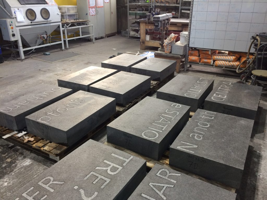
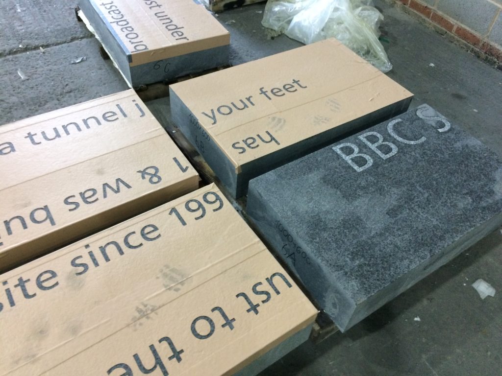
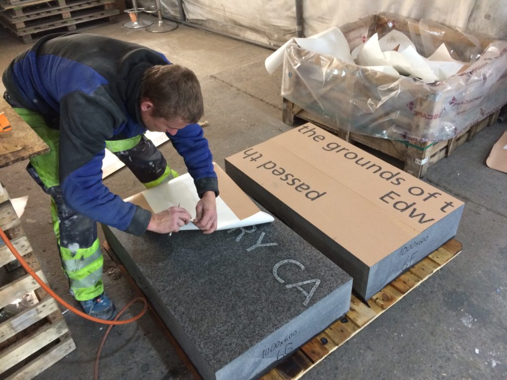
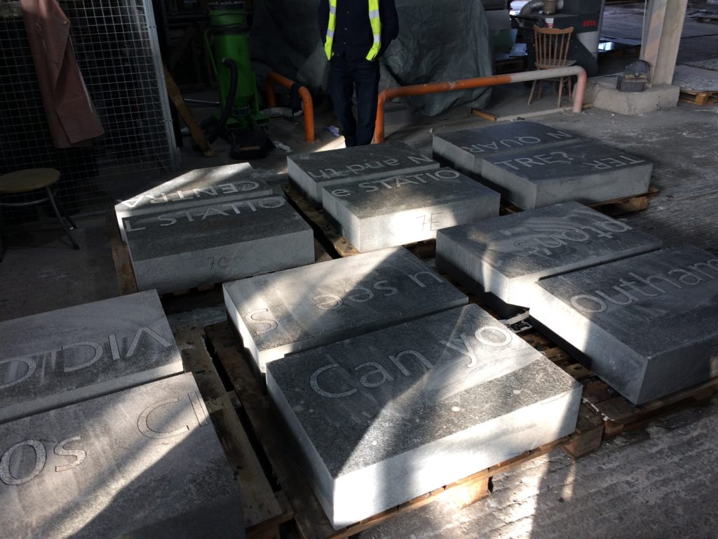
Contextual drafts – ‘BBC SOUTH has broadcast from this site since 1991 & was built on the grounds of the old Edward VI Grammar School’. Image: Christopher TippingBasalt Blocks with inset granite text set out during manufacture at Hardscape. Image: Christopher TippingBasalt Blocks awaiting sandblasting with text during manufacture at Hardscape. Image: Christopher TippingBasalt Blocks during sandblasting with text. Manufactured by Hardscape. Image: Christopher TippingBasalt Blocks with inset granite text set out during manufacture at Hardscape. Image: Christopher TippingGranite benches & retaining walls, Kingsbridge Lane, January 2018 during regeneration works on site. Image: Christopher TippingGranite benches, retaining walls and steps – Kingsbridge Lane, January 2018 during regeneration works on site. Image: Christopher TippingArtwork draft for granite benches and retaining walls. Image: Christopher TippingArtwork draft for granite benches, steps and retaining walls. Image: Christopher TippingGranite benches & retaining walls, Kingsbridge Lane, January 2018 during regeneration works on site. Image: Christopher TippingGranite benches & retaining walls, Kingsbridge Lane, January 2018 during regeneration works on site. Image: Christopher TippingFinal Text setting for Basalt Strips. Kingsbridge Lane, Southampton. Image: Christopher Tipping
Granite benches, retaining walls & Black Basalt slabs with inset and sandblasted contextual text – Kingsbridge Lane, January 2018 during regeneration works on site. Image: Christopher TippingBlack Basalt strips with inset and sandblasted contextual text, cross the footpath at intervals – Kingsbridge Lane, January 2018 during regeneration works on site. Image: Christopher Tipping
The footpath is busy, particularly at peak travel times, but is tired, with aged materials and and unkept vibe, even more striking now that the route connects the two recently completed ‘Quarters’, Cultural & Station – what is does have is brilliant a clear sight lines – with the Civic Centre Clocktower, Wyndham Court, Central Station and Southampton Docks all visible at points along the route.
The proposals for creative public realm interventions at Kingsbridge Lane are a direct response to the following:
Preservation of the historic legacy and contextual significance of the local area –
Topography – there is a 9m fall in height from the top of the route to the bottom –
Kingsbridge Lane as a primary pedestrian route today, linking Southampton Station Quarter to the Cultural Quarter, city centre & east to west pedestrian axis –
A practical need to screen existing Network Rail buildings and car park along the southern and northern boundaries of the site –
Entrance to Kingsbridge Lane is on the right hand side of this image from June 2016, prior to regeneration works starting. Image: Christopher TippingKingsbridge Lane March 2016 prior to regeneration. Image: Christopher TippingKingsbridge Lane March 2016 prior to regeneration. Image: Christopher TippingKingsbridge Lane March 2016 prior to regeneration. Image: Christopher TippingKingsbridge Lane March 2016 prior to regeneration. Image: Christopher TippingKingsbridge Lane March 2016 prior to regeneration. Image: Christopher Tipping
My work here is an extension of the ‘Canal Shore’ concepts and research underpinning the Station Quarter North Project completed a couple of years earlier in 2016, which I had been involved with since 2012. The text below set out the background of this work.
‘Inspiration, aspiration & delivery…
As project artist, I undertook a detailed investigation into the neighborhood’s social history, geography, ecology and culture to uncover hidden structures, which inform the area’s current form, identity & reputation. This site-specific & research-led activity assisted in driving the creative concept & rationale, which now underpins the general spatial layout, character and interpretation of the new proposals. I worked as part of an integrated design team including Engineers, Landscape Architects, Designers and specialist contractors. This collaborative process allowed me to work creatively, whilst being fully supported by the wider project team.
‘Southampton’s lost district: A landscape rediscovered’
An understanding of the site’s past physical condition drives the overall theme and character of the landscape & public realm interventions: a wooded valley, a meandering stream, the curve of the historic shoreline & the ill fated Southampton & Salisbury Canal. The primary human activities on the site over time, as evidenced by residential, industrial & cultural histories have been influential in drawing individual & collective ‘voices’ from the locality which will serve to imbue any outcomes with a distinctive & renewed sense of place.
This site, adjacent to the shoreline of the Test Estuary has always been a point of confluence. The main route West in & out of the city ran along the shoreline. In medieval times this route along the shore was known and ‘The Strand’. At a point marked by Achards Bridge, which crossed the Rollesbrook Stream to enter the River Test, the city boundary with Millbrook was established.
Today this point is almost exactly opposite the entrance to Southampton Station. Blechynden Terrace is considered to be built along the line of the filled in canal basin of the Southampton & Salisbury Canal. The historic shoreline and the highest point to which the tide rises was along the line of the road.
‘Canal Shore’ developed as a singular response to this research, which is supported by a broader influence, which has pervaded the whole site.
The artwork ‘Canal Shore’ is a consolidation of all that the site has to offer, both contextually and historically. In part it traced the line of the old shoreline & the only East to West route out of the city along the shingle beach from earliest times. It was the route of an ill-fated 19th Century canal. It is now a busy road and part of the transportation network of the city. Its route forms part of the perimeter of our site, so as a single element it has the capacity to help to unify the site and draw other more disparate elements together. The work represents the confluence of both historic and contemporary transportation routes within the city.
The location of the work dictates that it adds a tangible physical presence & value to the site. However, the materials and design are significant too. The black basalt kerb is deliberately large scale & incredibly robust, but has been engineered and designed with a particular aesthetic to blend well with its dual function. It considers traffic flow & movement through the site by allowing for transport access across its width, with elegant dropped kerb sets and large-scale corner quadrants. We have extended the width of the kerb to emphasize its importance as a marker of the historic shoreline of West Bay and the River Test Estuary, but also as a reference to the former Canal coping stone edge. Its function a physical kerb edge on the highway not only indicates that it is fit for purpose, but it deliberately aligns itself to the East to West axis of this transportation and pedestrian route within the City, extending and connecting to existing routes to the Cultural Quarter, QEII Mile and future Maritime Promenade’.