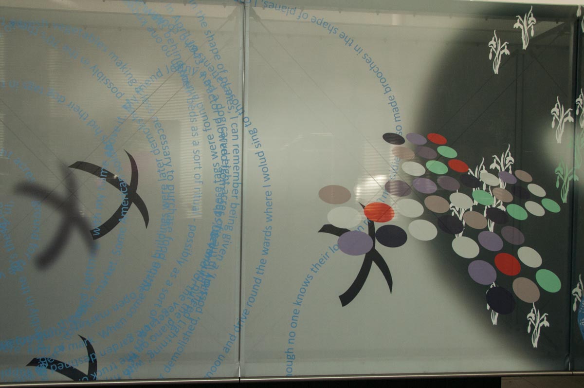
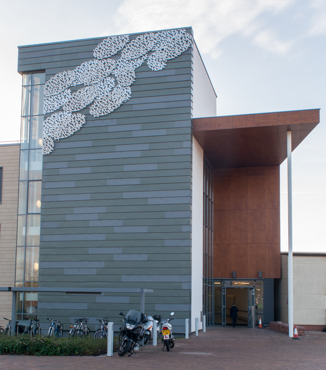
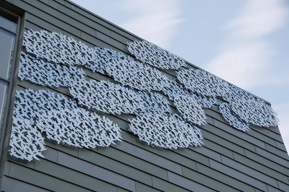
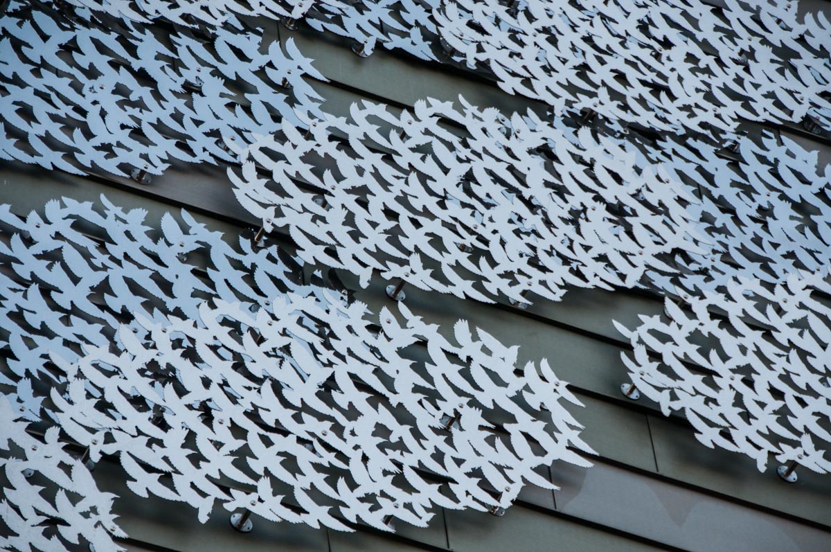
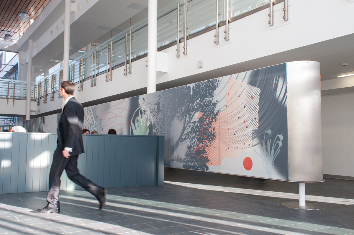
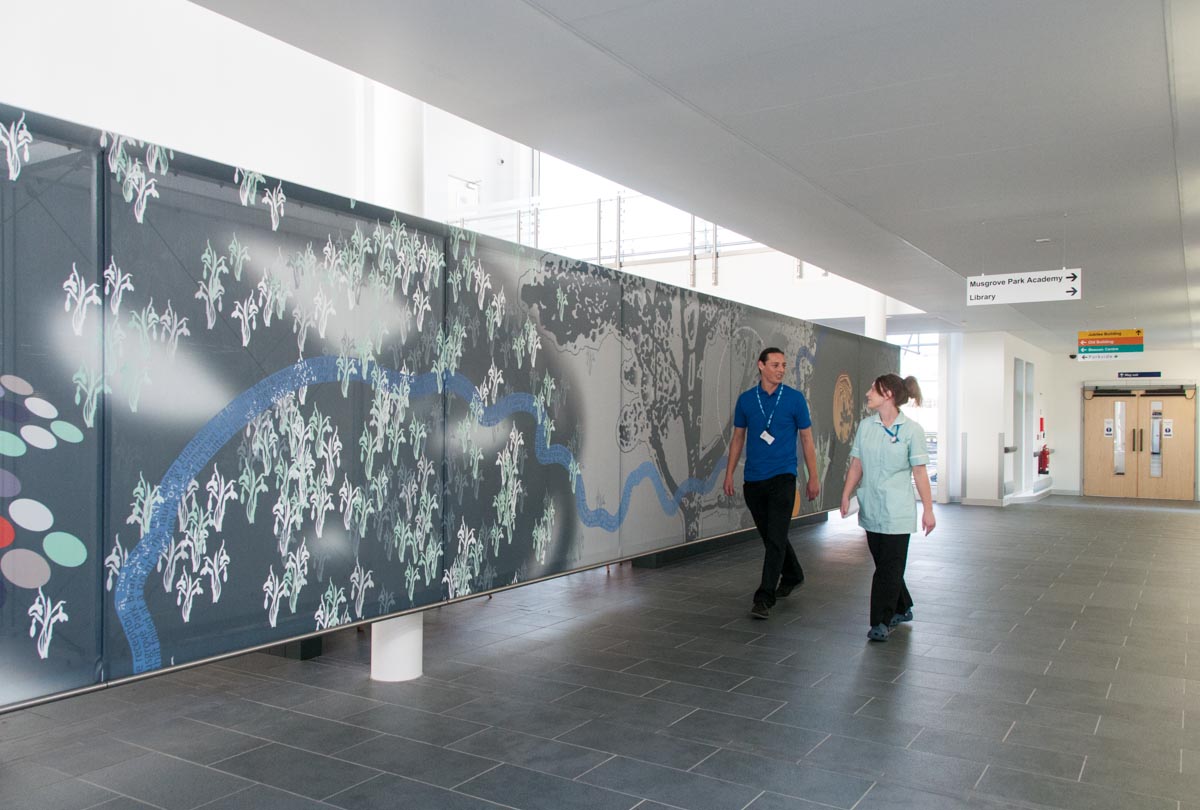
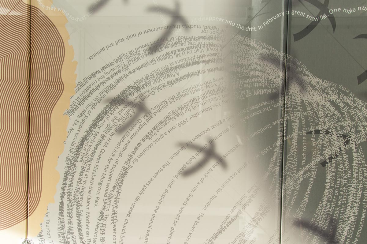
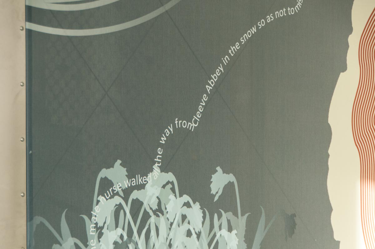
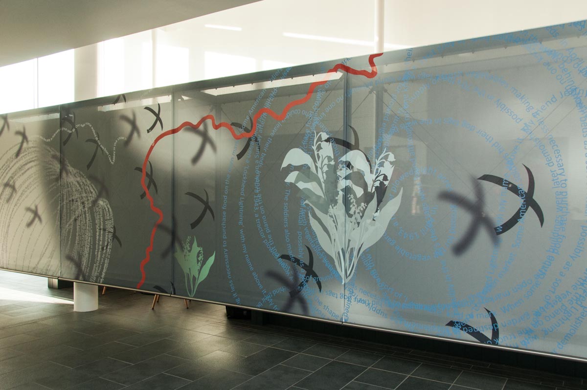
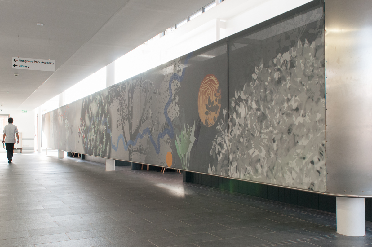
Detail: ’70 Years On…’ – Central Concourse Tensile Artwork, Jubilee Building, Musgrove Park Hospital. Image: Art for Life, Corbin O’Grady Studio‘Murmuration’, Jubilee Building, Musgrove Park Hospital. Image: Art for Life, Corbin O’Grady Studio
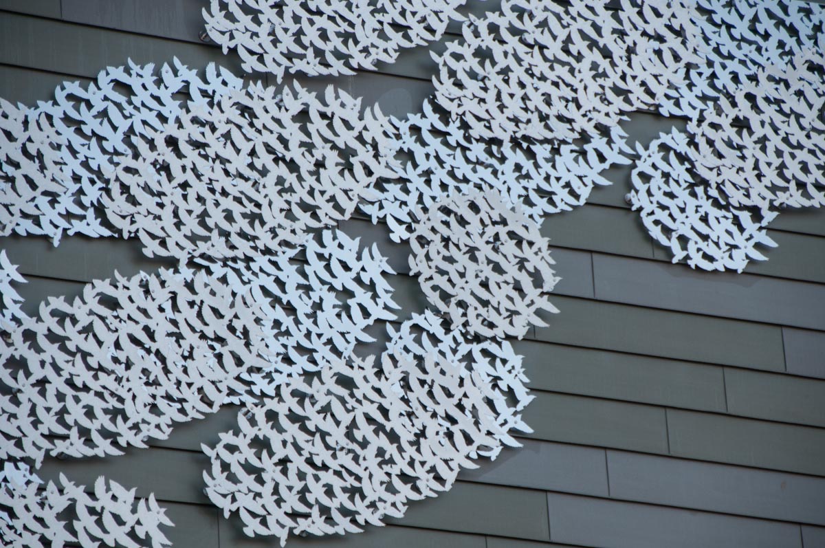
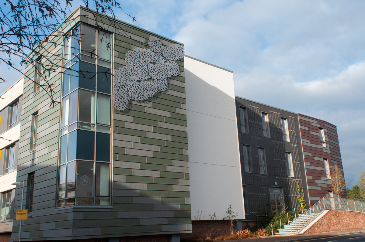
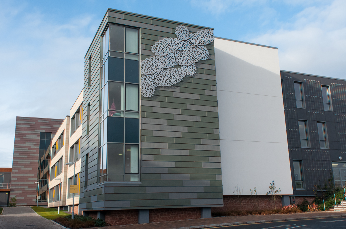
Laser-cut stainless steel panels – affixed to the building elevation.
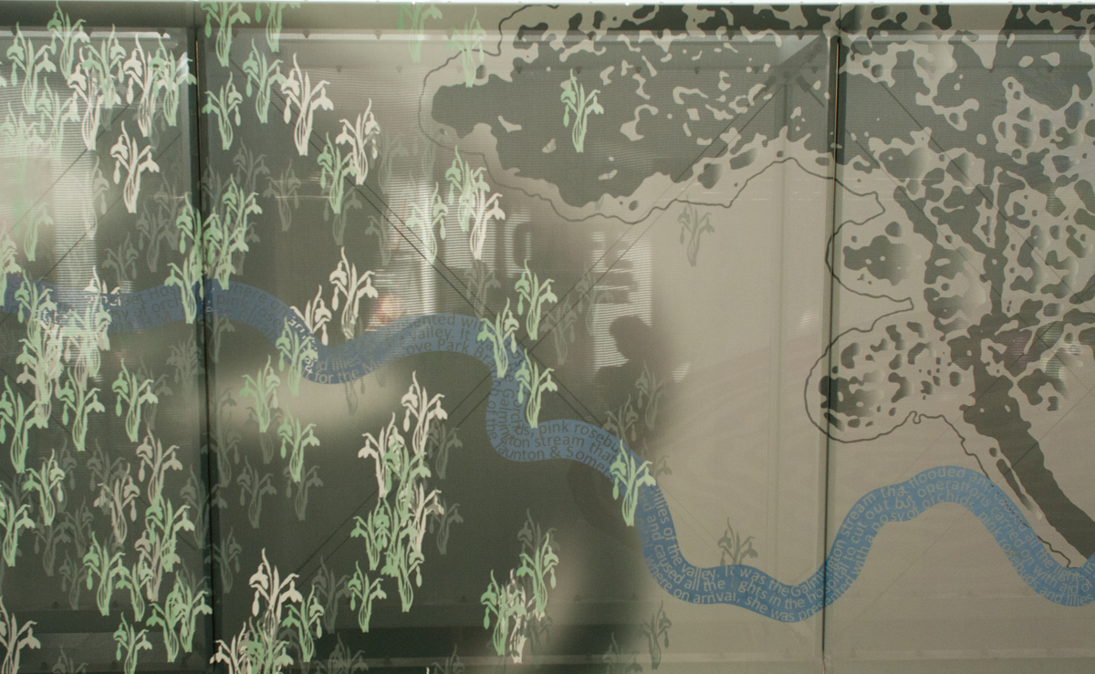
Detail: ‘Murmuration’, Jubilee Building, Musgrove Park Hospital. Image: Art for Life, Corbin O’Grady StudioDetail: ‘Murmuration’, Jubilee Building, Musgrove Park Hospital. Image: Art for Life, Corbin O’Grady StudioDetail: ‘Murmuration’, Jubilee Building, Musgrove Park Hospital. Image: Art for Life, Corbin O’Grady StudioDetail: ‘Murmuration’, Jubilee Building, Musgrove Park Hospital. Image: Art for Life, Corbin O’Grady StudioDetail: ‘Murmuration’, Jubilee Building, Musgrove Park Hospital. Image: Art for Life, Corbin O’Grady StudioDetail: ’70 Years On…’ – Central Concourse Tensile Artwork, Jubilee Building, Musgrove Park Hospital. Image: Art for Life, Corbin O’Grady StudioDetail: ’70 Years On…’ – Central Concourse Tensile Artwork, Jubilee Building, Musgrove Park Hospital. Image: Art for Life, Corbin O’Grady StudioDetail: ’70 Years On…’ – Central Concourse Tensile Artwork, Jubilee Building, Musgrove Park Hospital. Image: Art for Life, Corbin O’Grady StudioDetail: ’70 Years On…’ – Central Concourse Tensile Artwork, Jubilee Building, Musgrove Park Hospital. Image: Art for Life, Corbin O’Grady StudioDetail: ’70 Years On…’ – Central Concourse Tensile Artwork, Jubilee Building, Musgrove Park Hospital. Image: Art for Life, Corbin O’Grady StudioDetail: ’70 Years On…’ – Central Concourse Tensile Artwork, Jubilee Building, Musgrove Park Hospital. Image: Art for Life, Corbin O’Grady StudioDetail: ’70 Years On…’ – Central Concourse Tensile Artwork, Jubilee Building, Musgrove Park Hospital. Image: Art for Life, Corbin O’Grady Studio
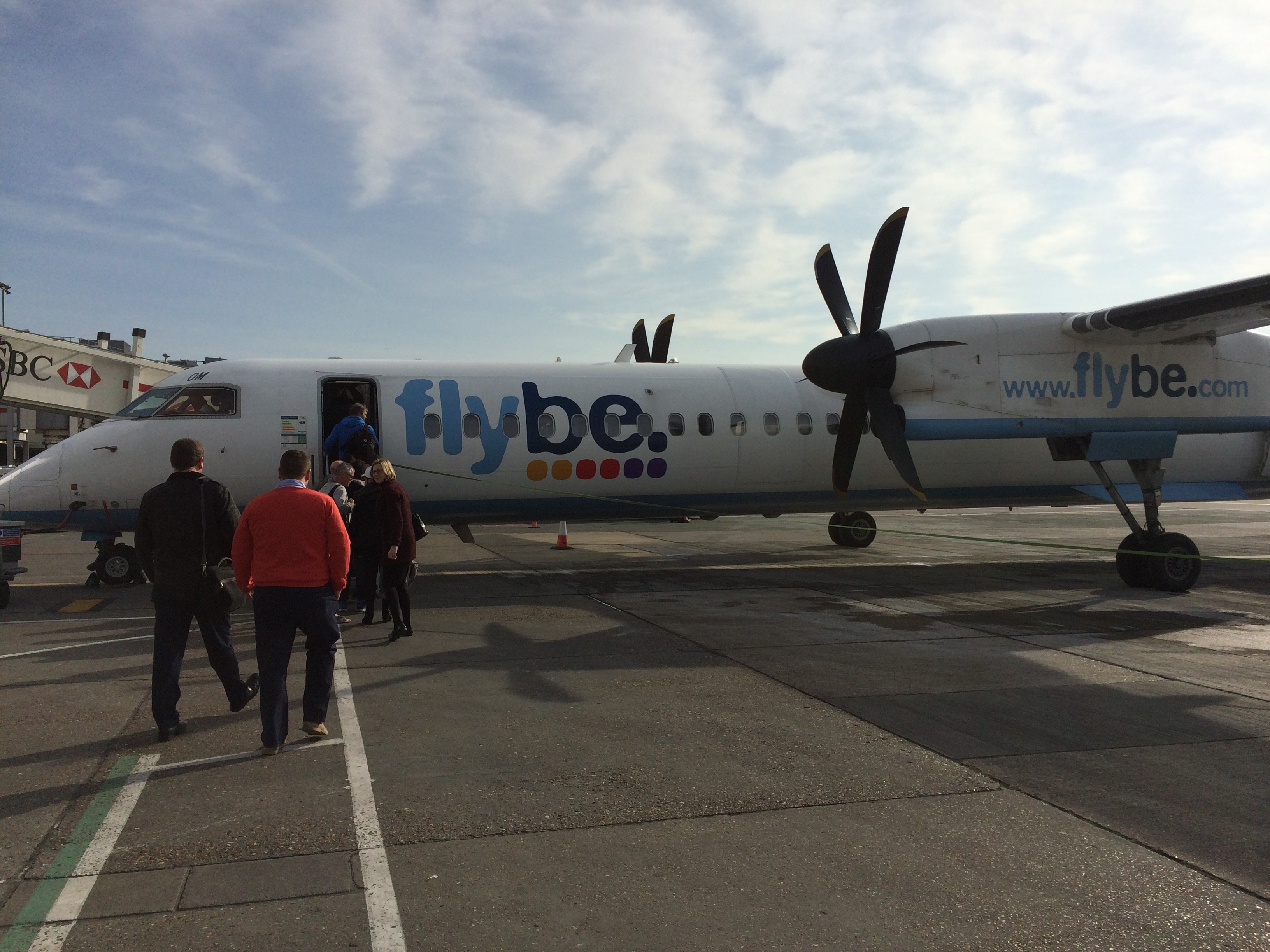
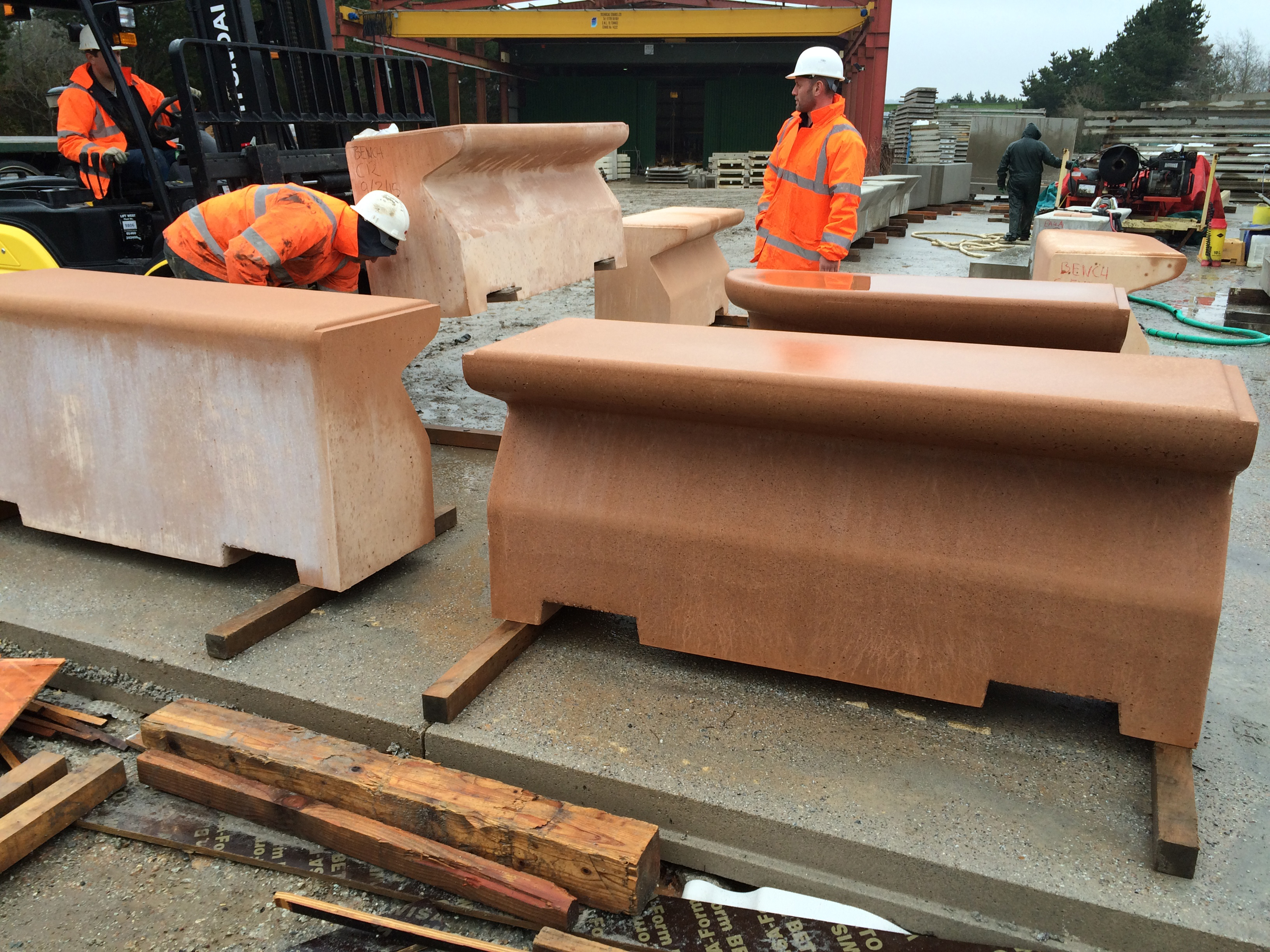
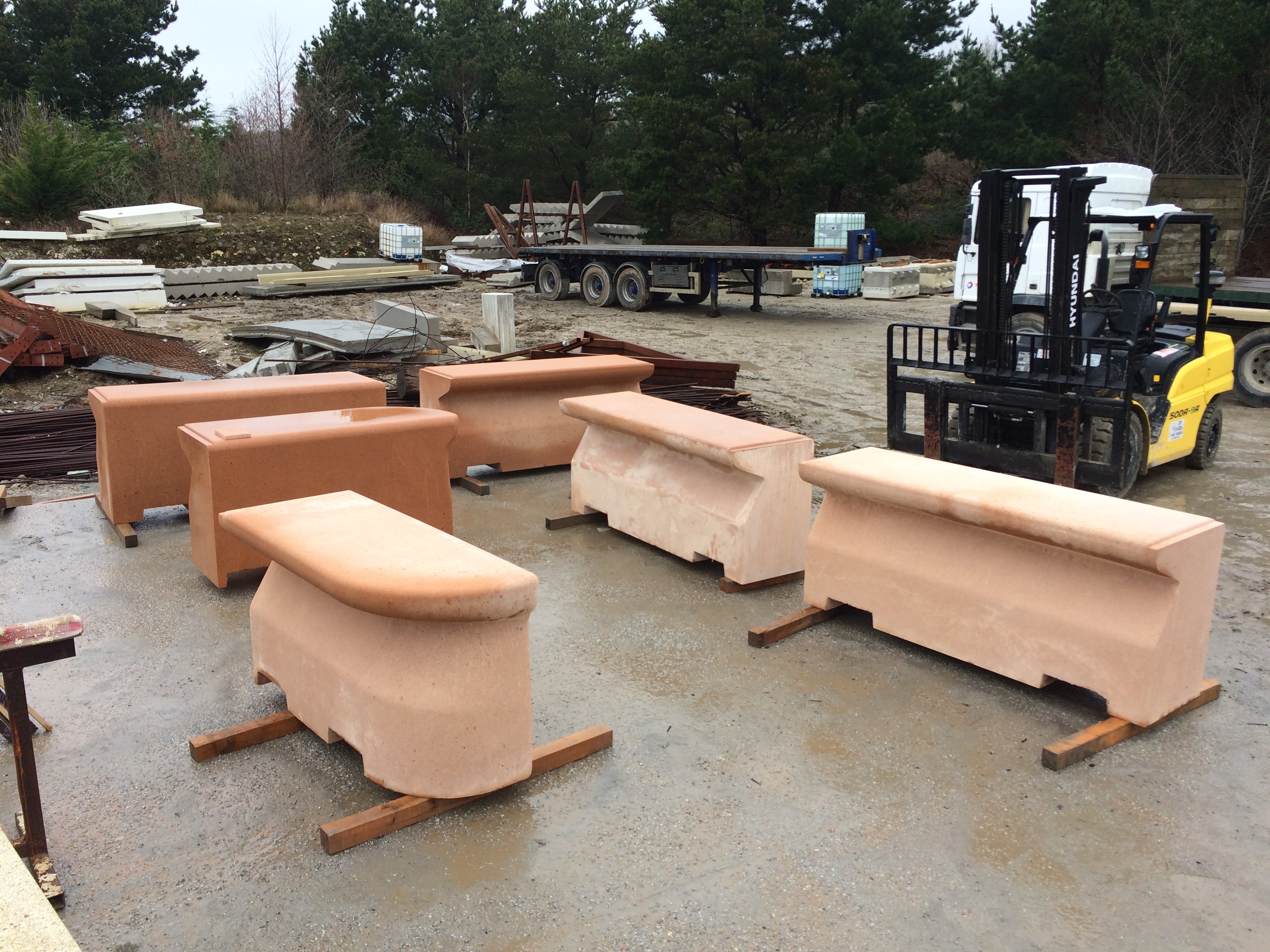
On Thursday 12th March I flew down to Newquay to visit CCP Ltd – Cornish Concrete Products – to review production on the first set of bespoke benches for Southampton Station Quarter. I was meeting up with Simon Taylor, Urban Design Manager –Southampton Highways Partnership, Balfour Beatty Living Places, who is the Design Manager for the Station Quarter project. Simon met me at Newquay Airport & we drove down to Bissoe to CCP’s manufacturing plant.
Gatwick Airport to Newquay with Flybe – around 55mins – not bad !
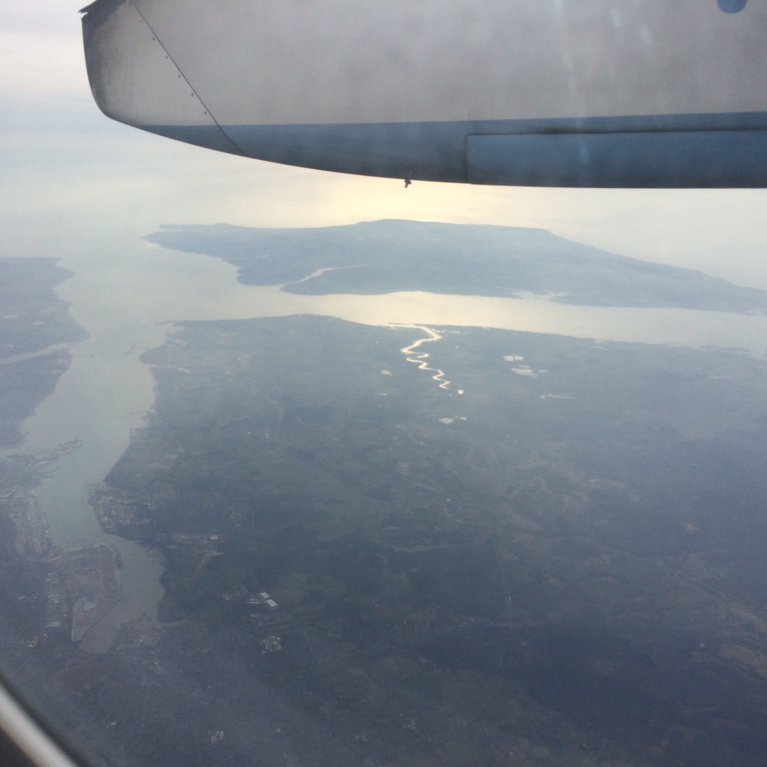
I left Ramsgate on High Speed 1 for London, St Pancras, then by Tube to Victoria to pick up the Gatwick Express & Gatwick to Newquay by Twin Prop and from there by car to Bissoe – easy ! A great day – but one delay along the way could have been a disaster – fortunately it was brilliant.
Great views of Southampton and the Isle of Wight on the flight down. Image: Christopher Tipping
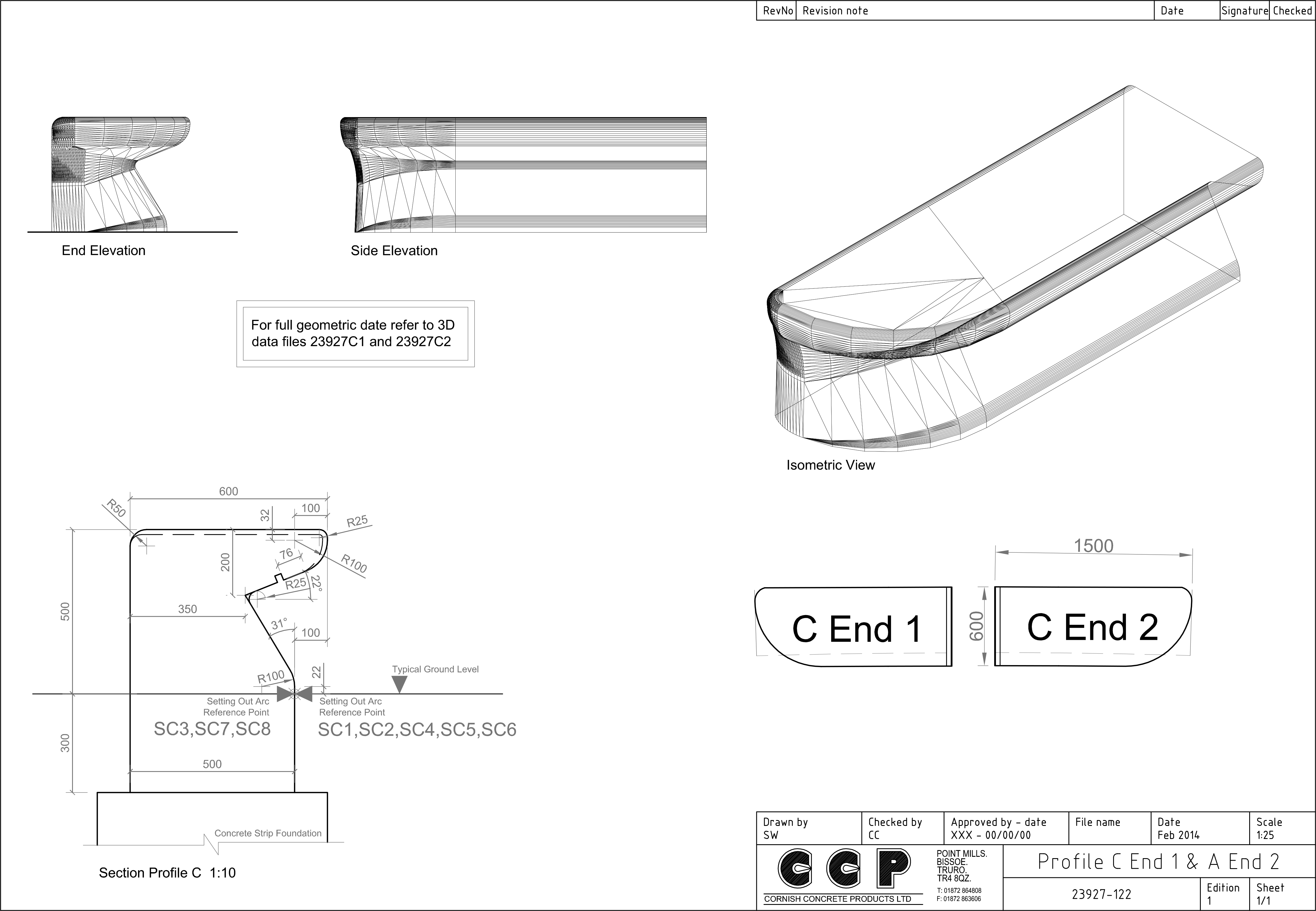
The units below are the first to be manufactured and are, as such the sample test for the project. We will be looking to iron out any issues presenting at this stage and develop a methodology for ensuring quality control through the production period. The Type C unit – is only one of several bespoke profiles being developed – with each profile there are accompanying bespoke ends and specials to be made.
Southampton Station Quarter – Visit to Cornish Concrete Products Ltd to review manufacture of Type C bench Units.
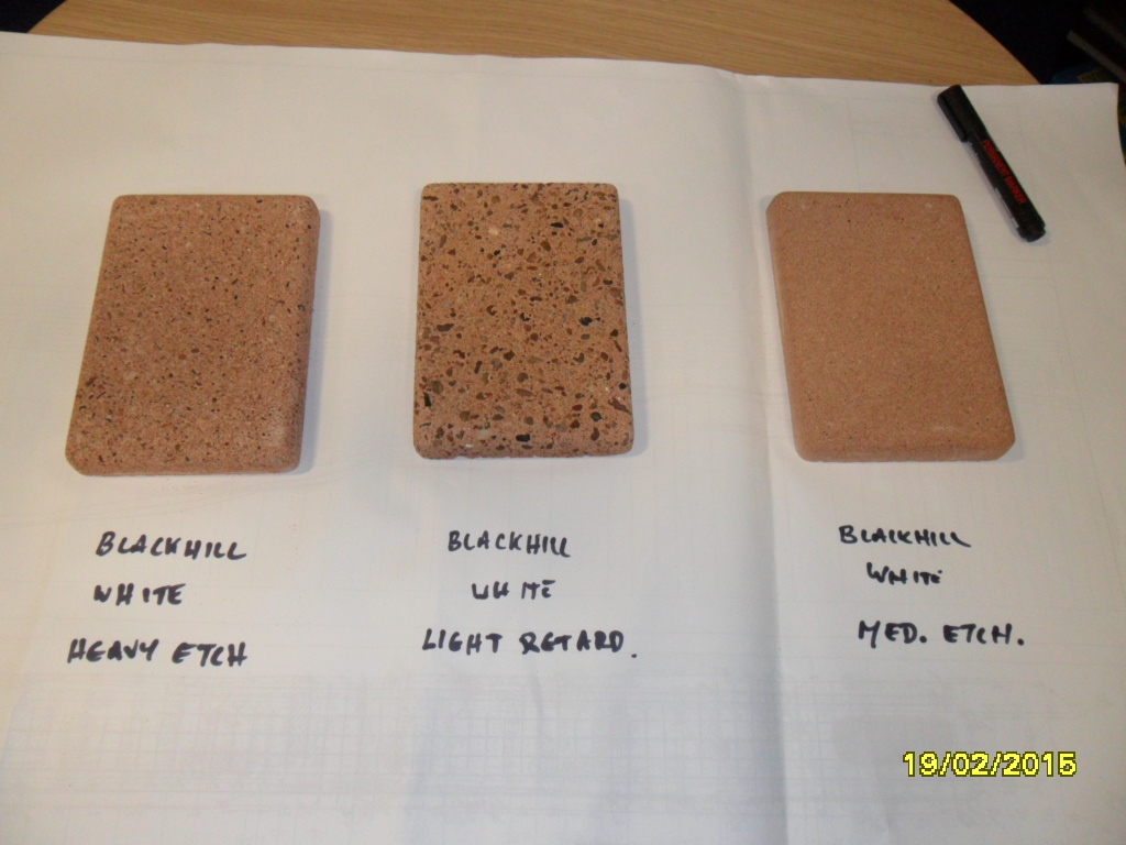
This is a single unit, part of a six unit seating set for the landscape works. The seating forms part of the interpretation and public art created for the project. The units as seen here have yet to have the etching treatment to expose the surface aggregates, so appear quite light in colour. The finished colour and aggregate mix reflect the multi blend granite paving used throughout the site and is informed by the geology of the site – alluvial gravels – which were at one time quarried nearby in the area now occupied by the Civic Centre. These gravels would have formed the beach of the River Test Estuary, which was – until 175 years ago – to be found where Blechynden Terrace now stands.
Southampton Station Quarter – concrete samples developed with Cornish Concrete Products Ltd for bespoke landscape works. Image: Matt Dyer, Balfour Beatty Services.
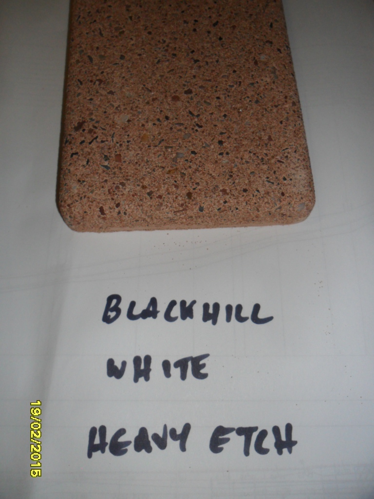
We have selected the Blackhill Aggregate – White Cement – Heavy Etch sample to work with –
Southampton Station Quarter – preferred sample developed with Cornish Concrete Products Ltd for bespoke landscape works. Image: Matt Dyer, Balfour Beatty ServicesSouthampton Station Quarter – Visit to Cornish Concrete Products Ltd to review manufacture of Type C bench Units.Southampton Station Quarter – Visit to Cornish Concrete Products Ltd to review manufacture of Type C bench Units. Bespoke return end unit, showing inverted fibreglass mould.Southampton Station Quarter – Visit to Cornish Concrete Products Ltd to review manufacture of Type C bench Units.Southampton Station Quarter – Visit to Cornish Concrete Products Ltd to review manufacture of Type C bench Units.
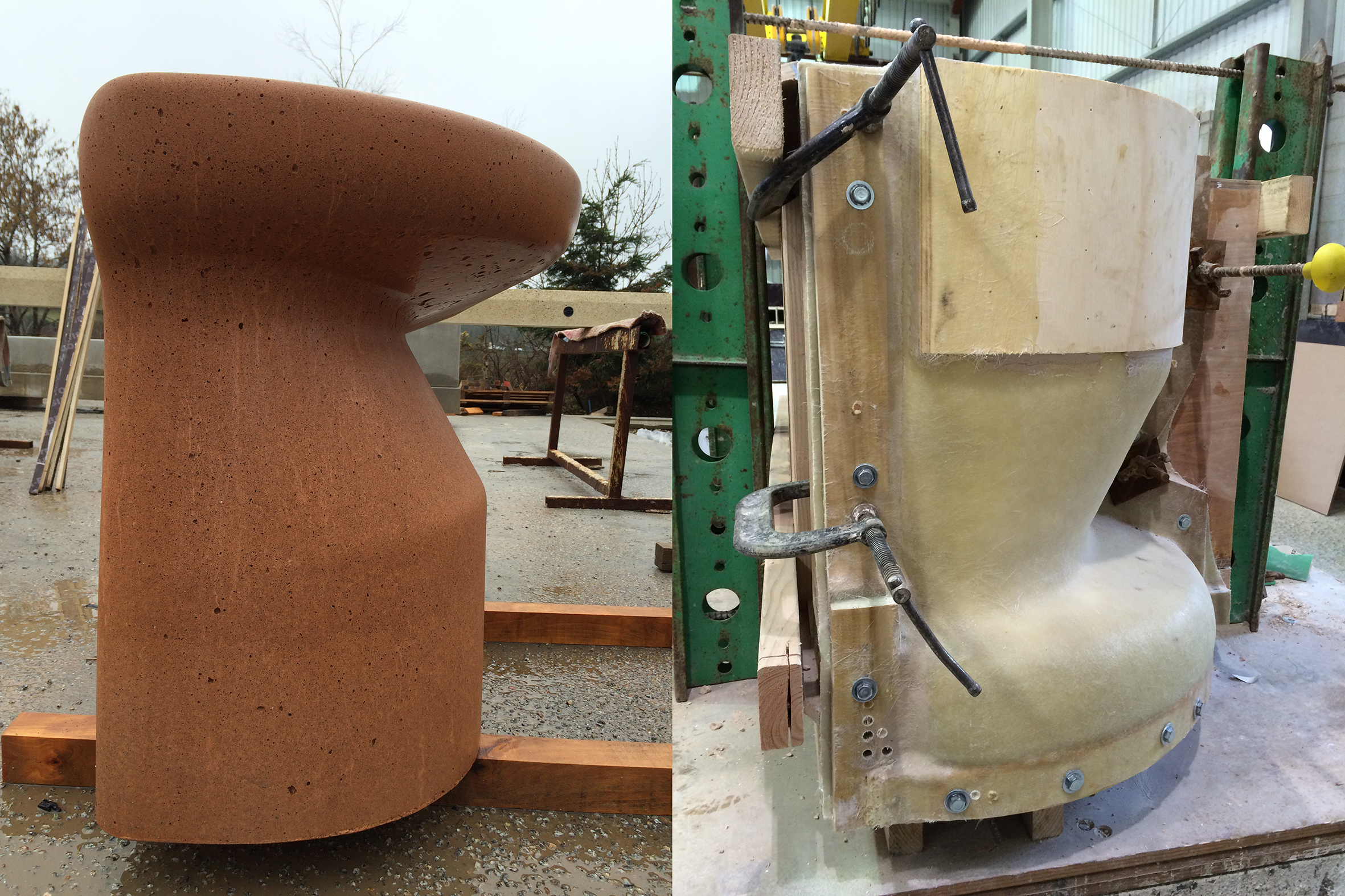
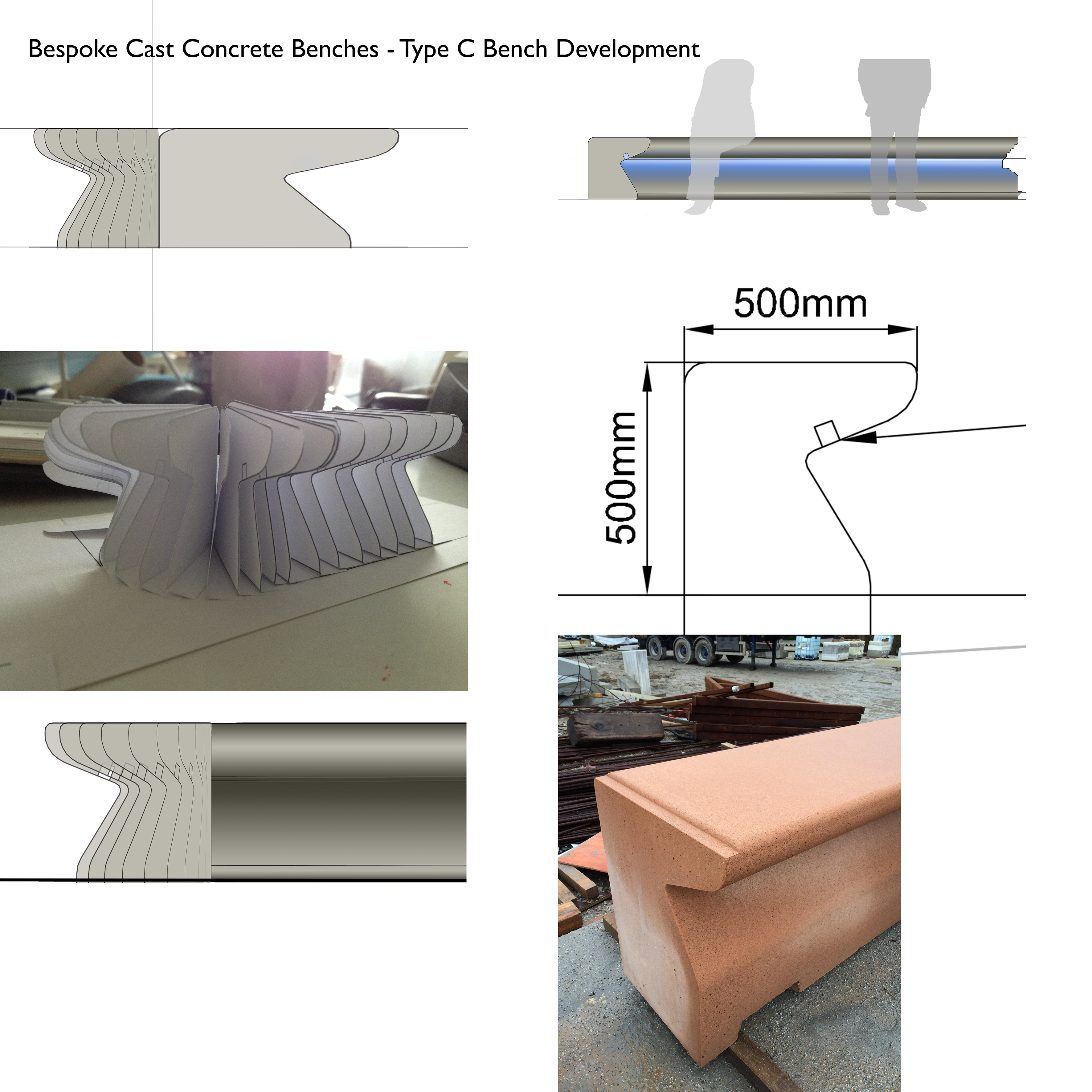
The composite image below, illustrate the evolution of the Type C Bench. The basic section is added to with bespoke and varying ‘ends’, with some units being further cast with lighting recesses.
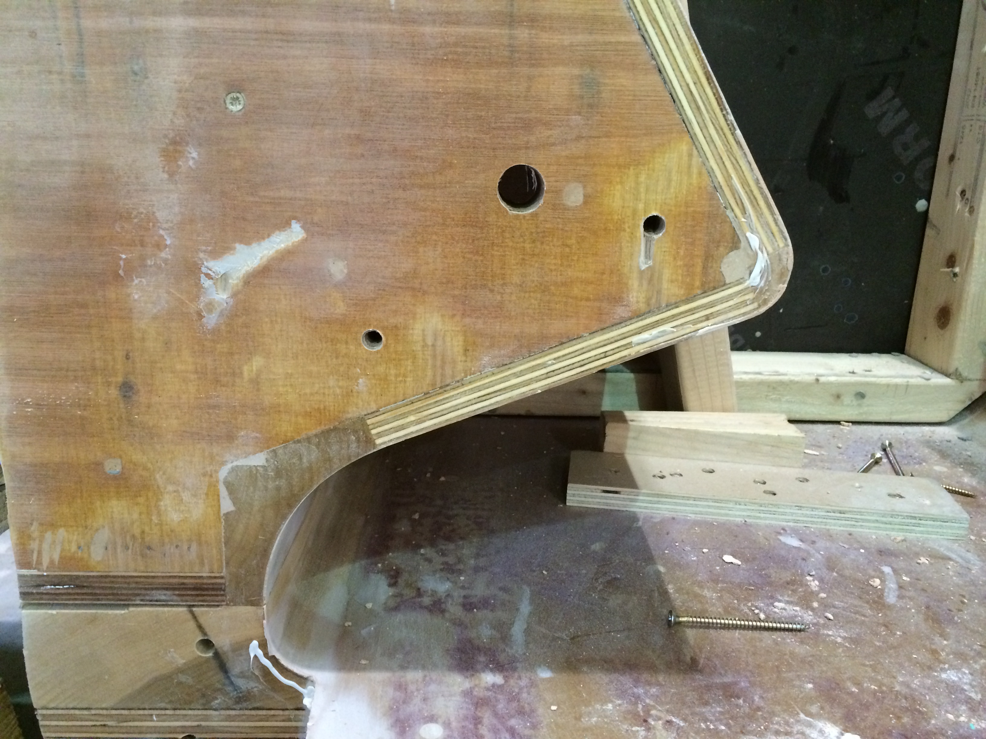
Type C Bespoke Cast Concrete Bench for Southampton Station Quarter. Drawings by CCP LtdSouthampton Station Quarter, Type C Cast Concrete Bench development. Image: Christopher TippingBespoke timber mould for the Type C bench fabricated by CCP Ltd. Image: Christopher TippingBespoke timber mould for the Type C bench fabricated by CCP Ltd. Image: Christopher Tipping
I particularly like to see the timber joinery and craftsmanship which goes into the moulds. No-one else really sees this – and the general public generally have no idea of the work that goes on behind the scenes to achieve the objects they see in the public realm.
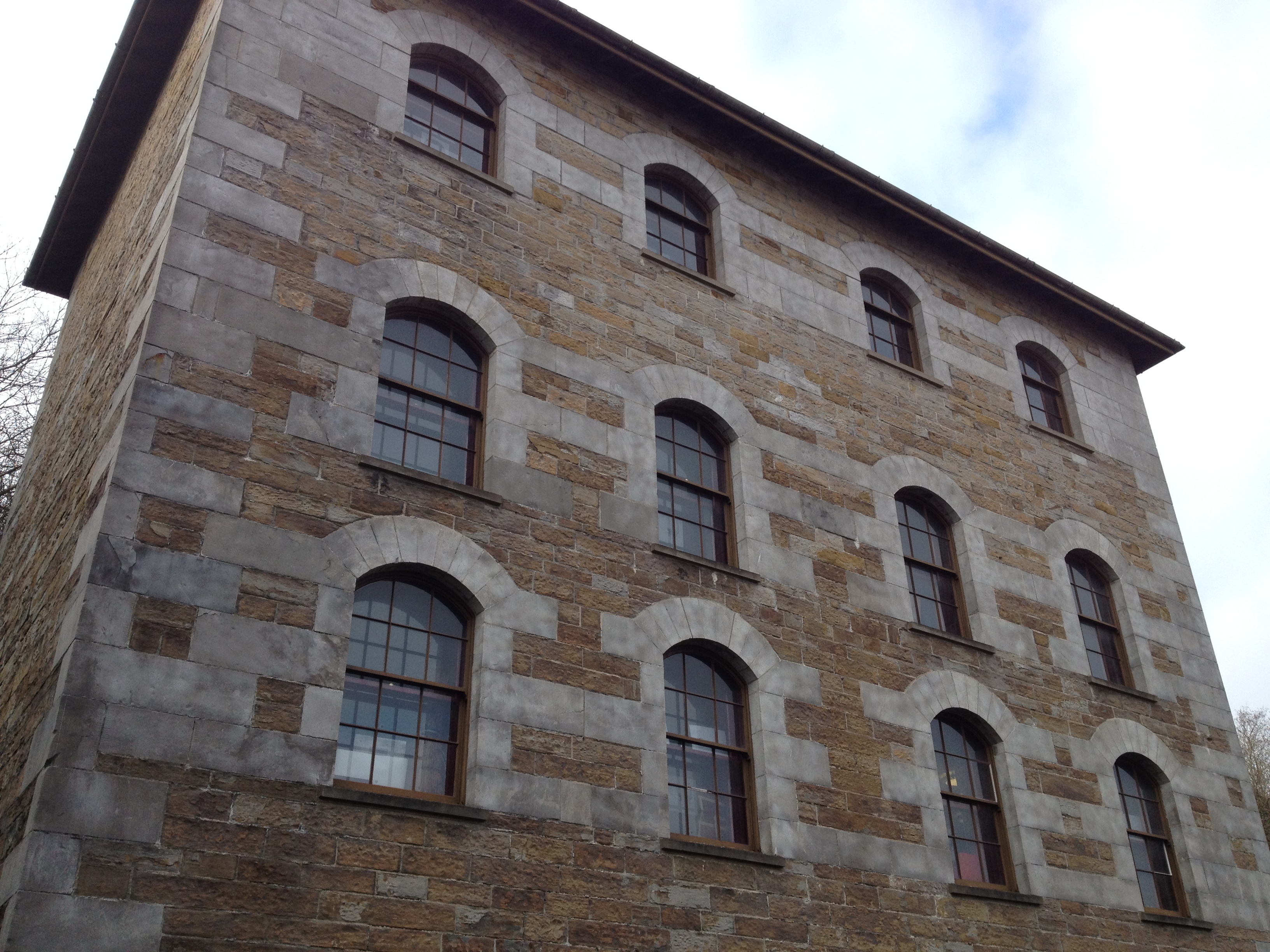
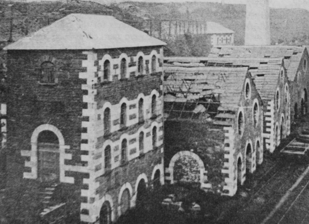
The Engine House was one of a pair of Engine Houses on the Ynysfach Ironworks site. ‘The Glamorgan-Gwent Archaeological Trust Ltd undertook investigations at Merthyr Tydfil College, on the site of the former Ynysfach Ironworks, which began in August 2011 and were completed by January 2012. Archaeologists from the Trust excavated and recorded structures belonging to the former ironworks, which had survived unexpectedly well, buried underneath the college buildings’.
To see the amazing animated 3D reconstruction of the site. produced as part of the interpretation for the project, press on this link. A permanent exhibition of this project can be seen at The College, Merthyr Tydfil, which is built upon this site.
The restored Ynysfach Engine House, Merthyr Tydfil. Image: Christopher Tipping
I met withSteve Brewer & Ceinwen Statter , members of the Merthyr Tydfil Historical Society, who operate out of the recently restored Engine House of the former Ynysfach Iron Works. Mary Owen – Author of book on the New Rectory of Merthyr Tydfil, was mentioned as someone who may have some insight on Swan Street history. Clive Thomas, the author of a history of Cae-Draw School, was also mentioned. The Merthyr Tydfil Historical Society also publish the Merthyr Historian, which is a 26 Volume history of the town from every source possible. Published from 1976 to the present, it has some engaging and surprising stories, records & contributory essays and images from many individuals. A great resource document ! A set of these publications is available in the Merthyr Tydfil Library.
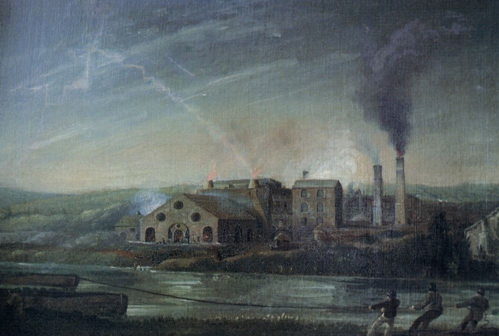
Ynysfach Ironworks by Penry Williams, 1819. http://www.alangeorge.co.uk/
The site of the former Ironworks is now mostly occupied by The College, Merthyr Tydfil,the original ironworks being demolished and lost before and during the 1960’s.
The ruins of Ynysfach Iron Works prior to demolition. http://www.alangeorge.co.uk/
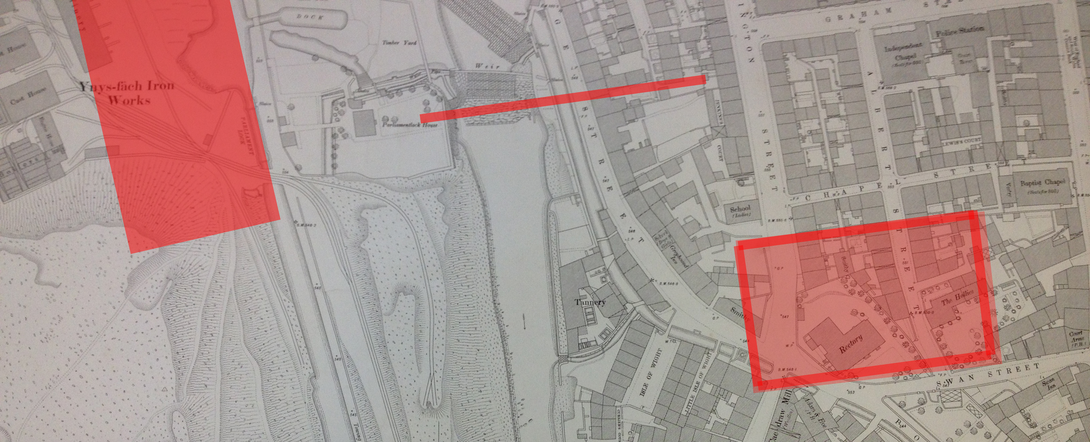
We discussed the site specific history of the new Bus Station site on Swan Street and references to a building called ‘The Rectory’, which is show on old OS Maps, but is not referred to in any written text I can find. Alan and his colleagues are assisting in researching this. The wider area around Swan Street is also rich in history and community, which needs to be addressed in this contextual study.
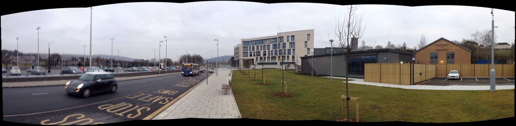
The College Merthyr Tydfil as seen from the new Rover Taff Gyratory Link Road. Image: Christopher TippingThe College Merthy Tydfil. Image: Christopher Tipping
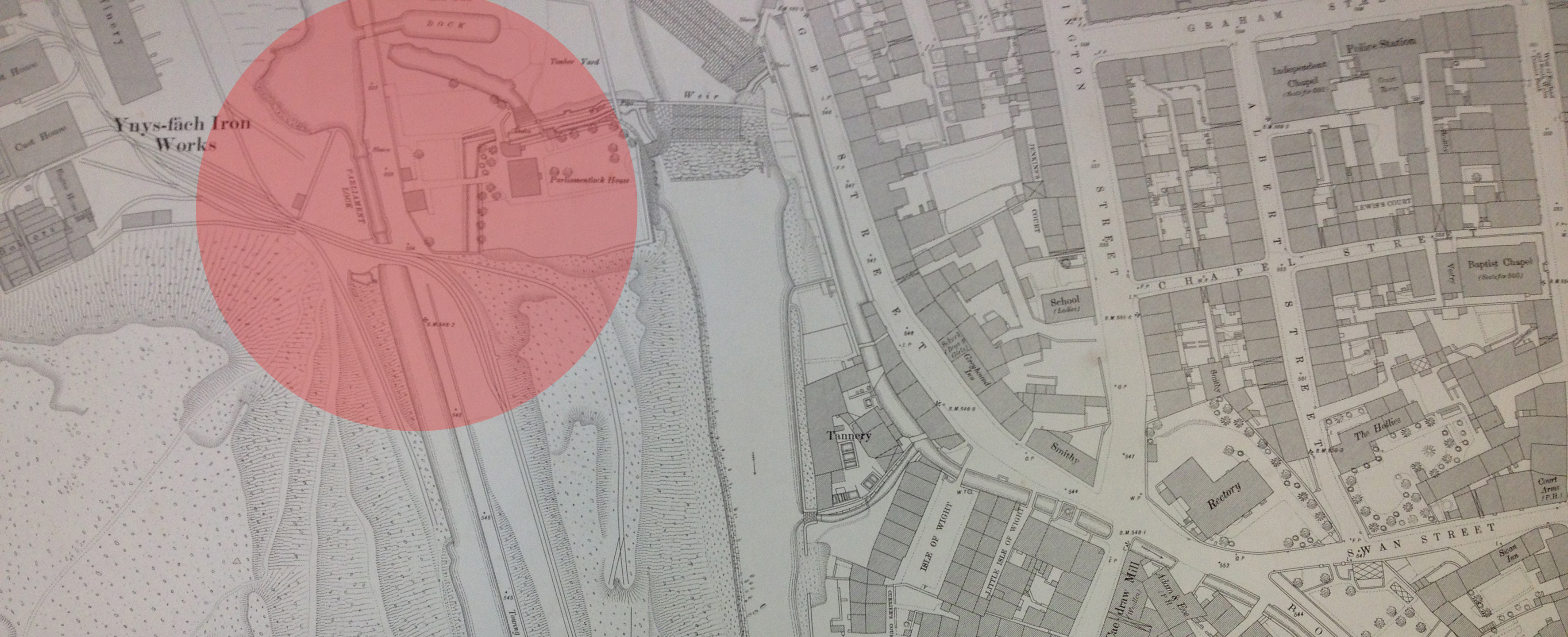
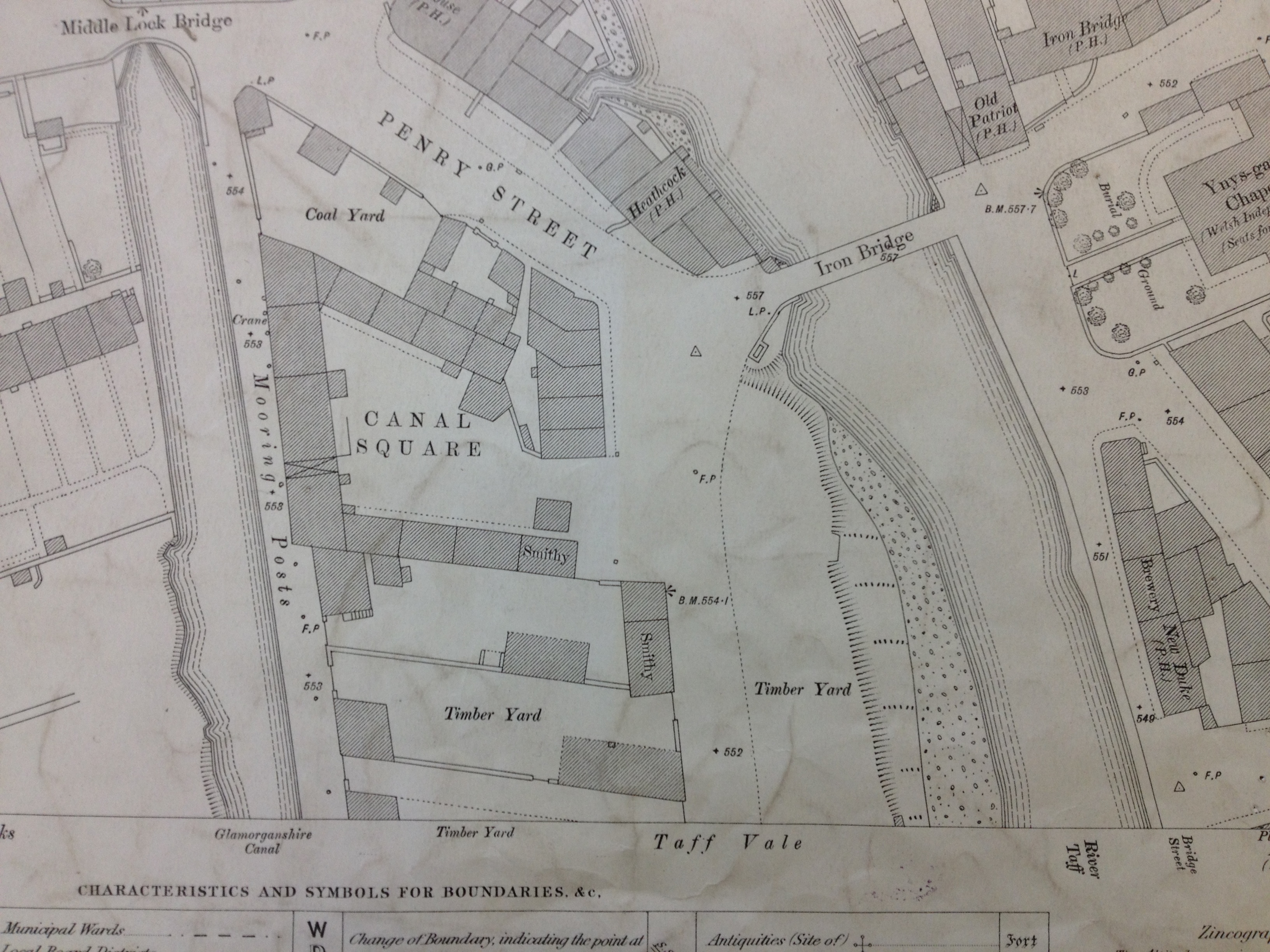
The new College site – although first developed in the 1960’s – is historically relevant to the Link Bridge project, as not only was this the site of the Ynysfach Ironworks, part of the Cyfarthfa Ironworks, but the public realm and highway in front of the College and in-between it and the River Taff, was the site of the Glamorganshire Canal. There was a Lock Gate here, called Parliament Lock. An Archaeological Report was made by the Glamorgan-Gwent Archaeological Trust(Contracts Division) to support the Archaeological Watching Brief on Parliament Lock during pipe laying works in October 1995. The Report was prepared for Ove Arup & Partners who carried out the works.The report is really interesting. – click on Parliament Lock, above –
The Glamorganshire Canal and Parliament Lock, Merthyr Tydfil. Image: http://www.alangeorge.co.uk/
Parliament Lock Gate and House is in the bottom right foreground of this image of the Glamorganshire Canal. The bridge, seen at the middle far right of this image, is the Ynysgau Iron Bridge across the River Taff, built in 1799 by Watkin George for the Cyfarthfa Ironworks.
Glamorganshire Canal & Parliament Lock. Detail of OS Public Health Map of 1875 – showing the weirs crossing the Taff. The Canal & Lock are highlighted. Reproduced from the 1876 Ordnance Survey Map. Collection of Merthyr Tydfil CBC Libraries.
The dominant theme in this project is transport & transport links. Fluid and effective connectivity for cars, trains, buses and pedestrians alike. My role is specifically to try to ‘influence’ the design process being delivered by the teams involved in the Bus Station & Link Bridge. Creative Influence can be brought via research into the heritage and legacy of the town. Contextual research can also look at the practicalities of what a Bus Station or a shared pedestrian and cyclist Footbridge require to function. I can also investigate the aspiration and hope for the future which both of these elements of the town’s infrastructure could bring. All these threads of influence can combine to create a visual and conceptual aesthetic to use as a tool to aid the design and engineering process.
Social history in Merthyr Tydfil has shaped and re-shaped this landscape over a few hundred years perhaps more than natural history did since the last Ice Age. If you look at old OS Maps of Merthyr Tydfil from around 1840 to 1960, patterns of use and development begin to emerge. Transport leads the way, starting with the management of water: rivers, streams, ponds, canals, reservoirs, culverts & aqueducts. Railways, roads, embankments, cuttings, tunnels & spoil heaps all enable the efficient delivery & transportation of goods and materials, whilst also removing & storing waste products. All this happened in a fairly small locality, geographically speaking. This had a fundamental impact on the landscape. Maps show this impact in patterns and textures to evoke a man-made industrial environment. Even the The architecture of industry – buildings, factories, furnaces is also rich in patterns and repeating systems.
I am very grateful for the permission of Merthyr Tydfil CBC Librariesto allow me to photograph the maps in their collection. As these maps are also over 50 years old, the Ordnance Surveyrequest only that the following information is added to each image: ‘Reproduced from the (add date) Ordnance Survey map’.
These are my annotations upon an OS Map of Merthyr Tydfil of 1876. Reproduced from the 1876 Ordnance Survey Map. Collection of Merthyr Tydfil CBC Libraries.
The annotated detail of the 1876 OS Map of Merthyr Tydfil Town Centre, shows the present day approximate positions of the following: Left to Right –
The College at Merthyr Tydfil
The current pedestrian footbridge
The proposed site of the new Bus Station on Swan Street
Detail of OS Public Health Map of 1875 – showing the weirs crossing the Taff. The Glamorganshire Canal can be seen to the left. Reproduced from the 1875 Ordnance Survey Map. Collection of Merthyr Tydfil CBC Libraries.
The image above showing the weirs on the River Taff is the exact site of the current pedestrian footbridge link form the College at Merthyr Tydfil, to the St Tydfil Shopping Centre.
Detail of OS Public Health Map of 1875 – showing the original Iron Bridge at Ynysgau crossing the Taff. The Glamorganshire Canal can be seen to the left. Reproduced from the 1875 Ordnance Survey Map. Collection of Merthyr Tydfil CBC Libraries.
The Ynysgau Iron Bridge of 1799 is just a few hundred yards upstream from the weirs in the previous image. The Glamorganshire Canal is clearly seen on the left.
Detail of OS Public Health Map of 1875 – showing the large Rectory building on Swan Street, Cae-Draw, top right. The River Taff is on the left of the image. Reproduced from the 1875 Ordnance Survey Map. Collection of Merthyr Tydfil CBC Libraries.
The Buildings on Swan Street in the above image – including the large Rectory and the adjacent property called The Hollies, were demolished at some point during the 1960’s to make way for new developments and roads. The Hollies Medical Centre and the Police Station – both built on this site, are now being demolished to make way for the new Bus Station.
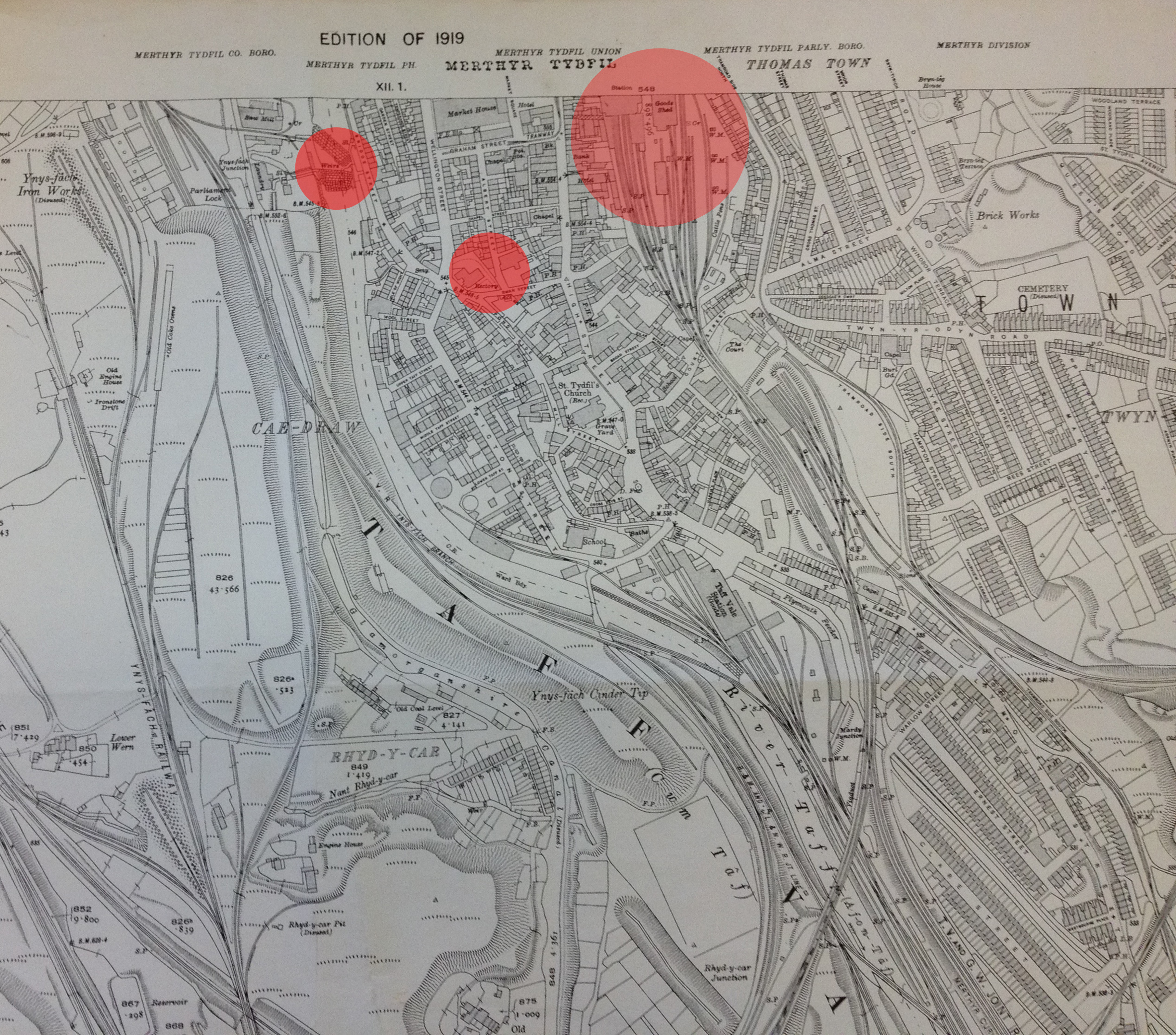
Reproduced from the 1919 Ordnance Survey Map of Merthyr Tydfil and surrounding areas. Collection of Merthyr Tydfil CBC Libraries.
The above detail from an OS map of 1919, has been annotated by me to show the positions of the existing pedestrian footbridge (left), the site for the new Bus Station (middle) and the site of the old Merthyr Tydfil Train Station (right). The train Station was built on the site of the current Tesco Store in the centre of town. The original station building was by I.K.Brunel.
A detail from an OS map of Merthyr Tydfil and Cyfarthfa Iron Works. Reproduced from the 1865 Ordnance Survey Map. Collection of Merthyr Tydfil CBC.
I very much like the interconnectivity between the Ironworks – in pink – and the railway tracks and River Taff. The word that keeps coming to mind is ‘Confluence’, – describing the point at which two bodies of water meet. In this case – the dynamic interchange of the man-made and the the natural – albeit controlled – forces of water.
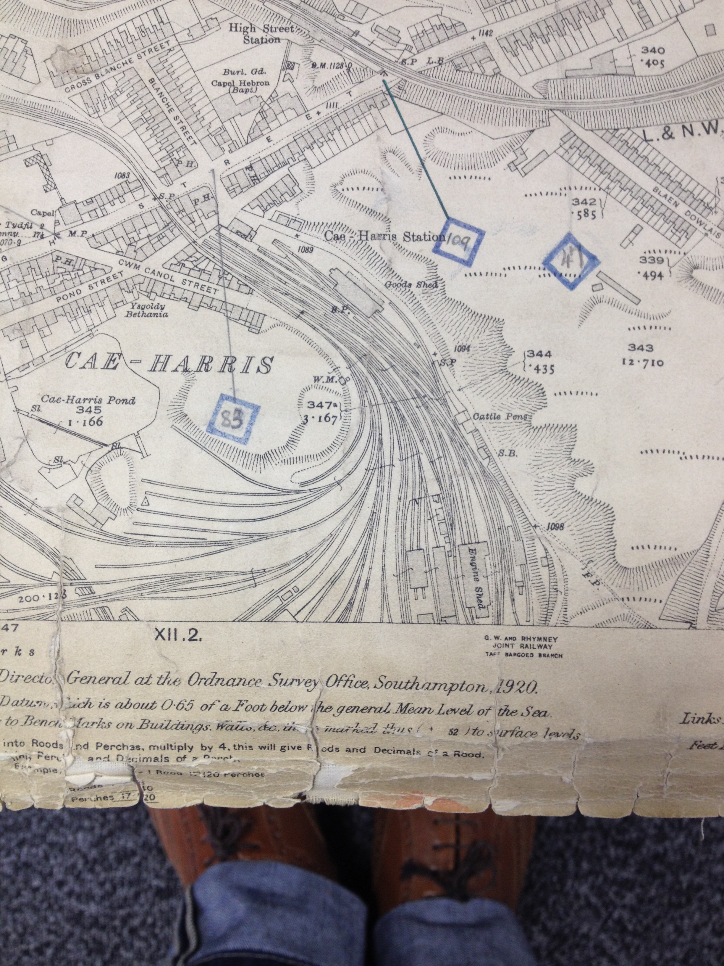
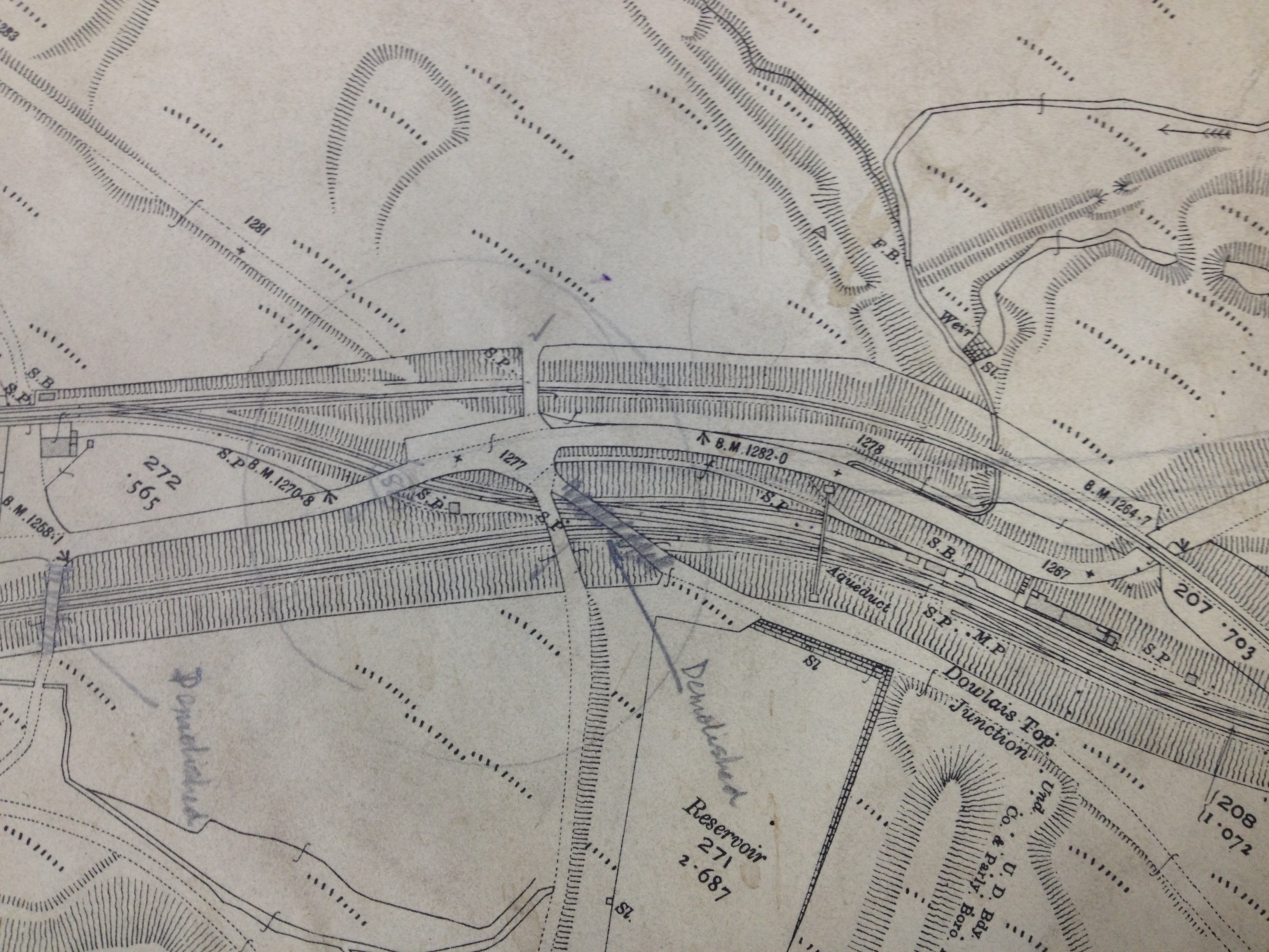
Railway tracks at Cae-Harris, Dowlais. Reproduced from the 1920 Ordnance Survey Map. Collection: Merthyr Tydfil CBC
The branching patterns of rail tracks are fluid and respond to the local topography.
Detail: Railway tracks & cuttings at Dowlais Top, Merthyr Tydfil Reproduced from the 1920 Ordnance Survey Map. Collection: Merthyr Tydfil CBC
The above detail is from the 1920 OS Map above, shows rail lines in cuttings with embankments and raised trackways and crossing points.
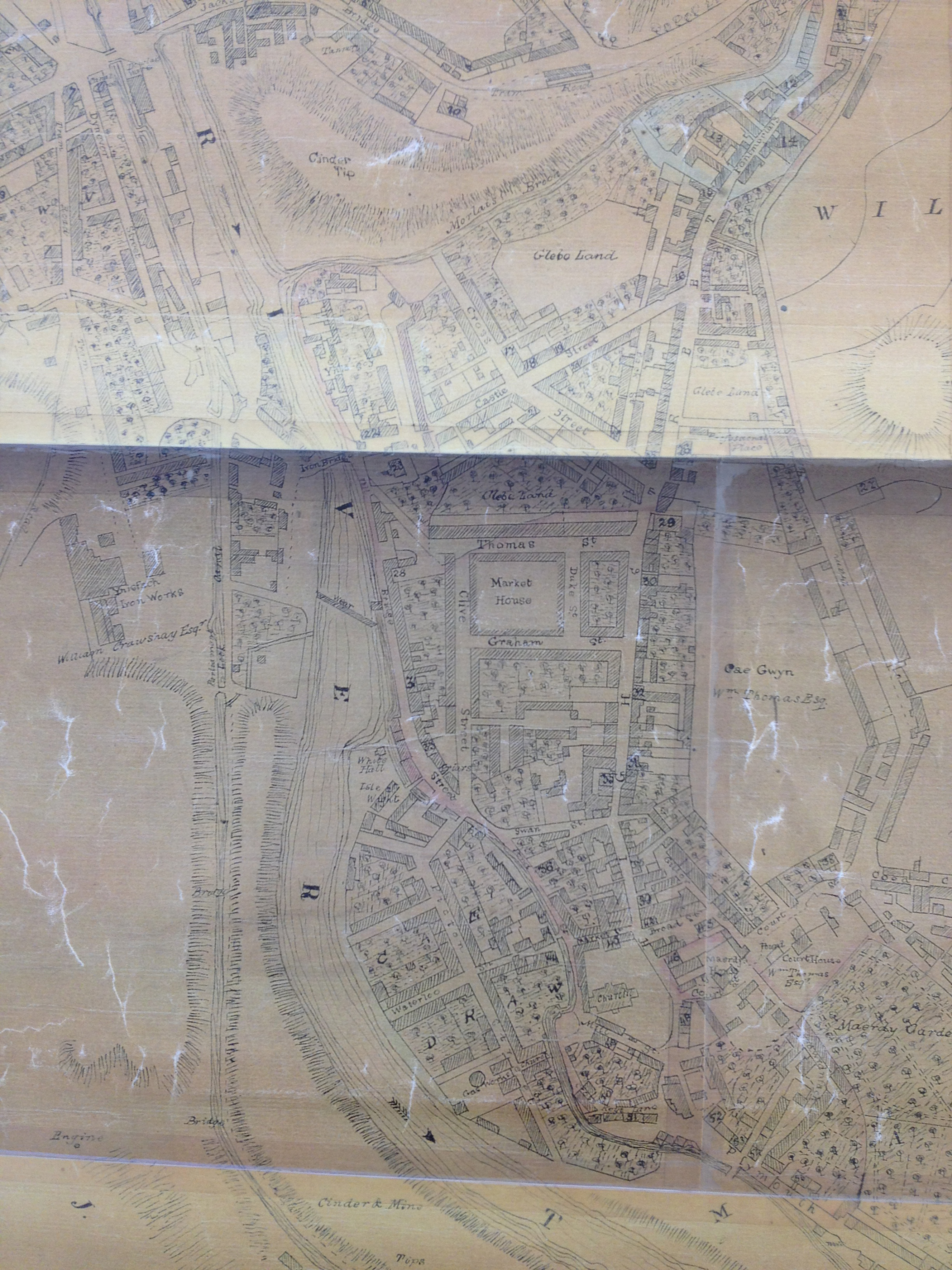
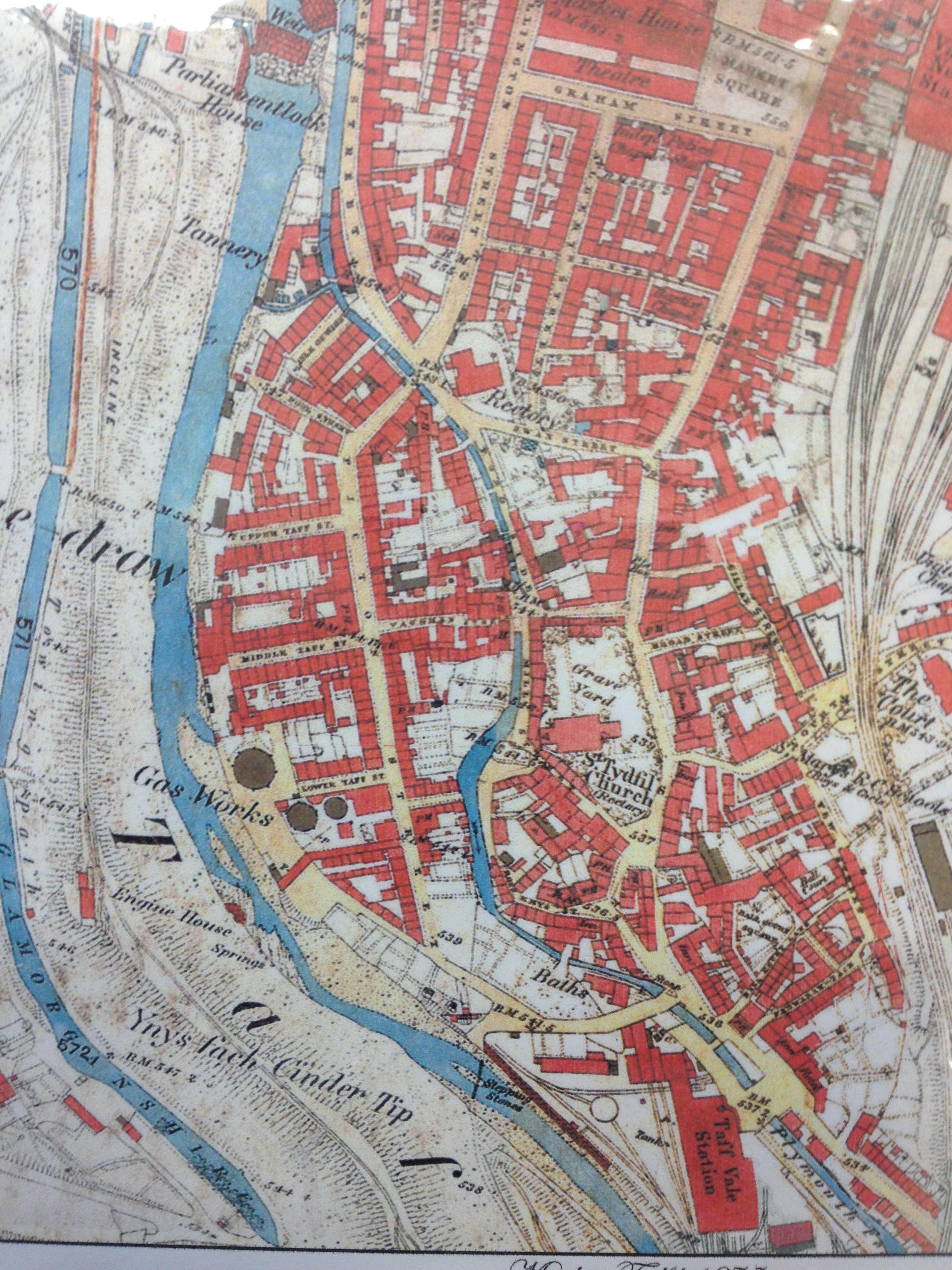
A detail from an OS map of Merthyr Tydfil Town Centre. Reproduced from the 1836 Ordnance Survey Map. Collection of Merthyr Tydfil CBC Libraries.
This lovely map clearly shows the positions of the Iron Bridge of 1799 & the weir on the River Taff. The pedestrian footbridge of 1970 crosses immediately downstream of the weir linking the College – on the site of the former Ynysfach Iron works, to the St Tydfil Shopping Centre – which was built upon the site of the old Market Square– seen on this map. Swan Street is also clearly marked – a couple of streets below the Market Buildings. This is the site for the new Bus Station. The Old Station was at the top of the map on the site known as Glebeland– originally land belonging to the Church.
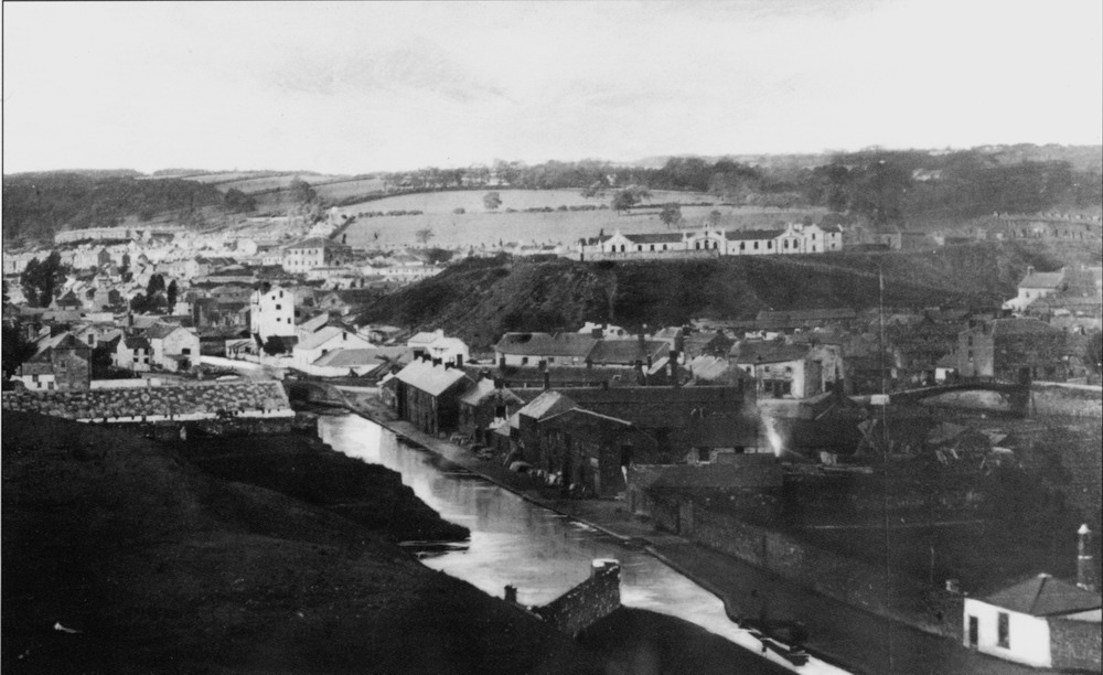
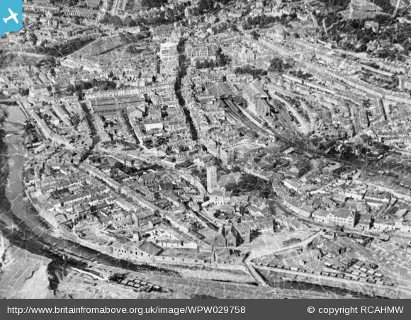
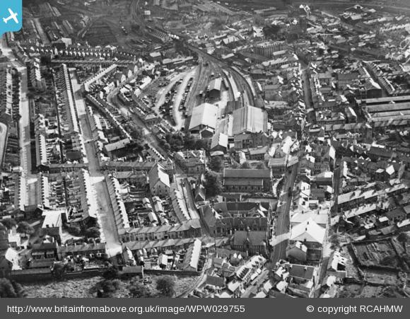
These images of Old Merthyr Tydfil come from the website Britain From Above– they really serve to show how dense the footprint of the town was in 1929. This pattern of community within the town centre remained pretty much unchanged until the 1950’s.
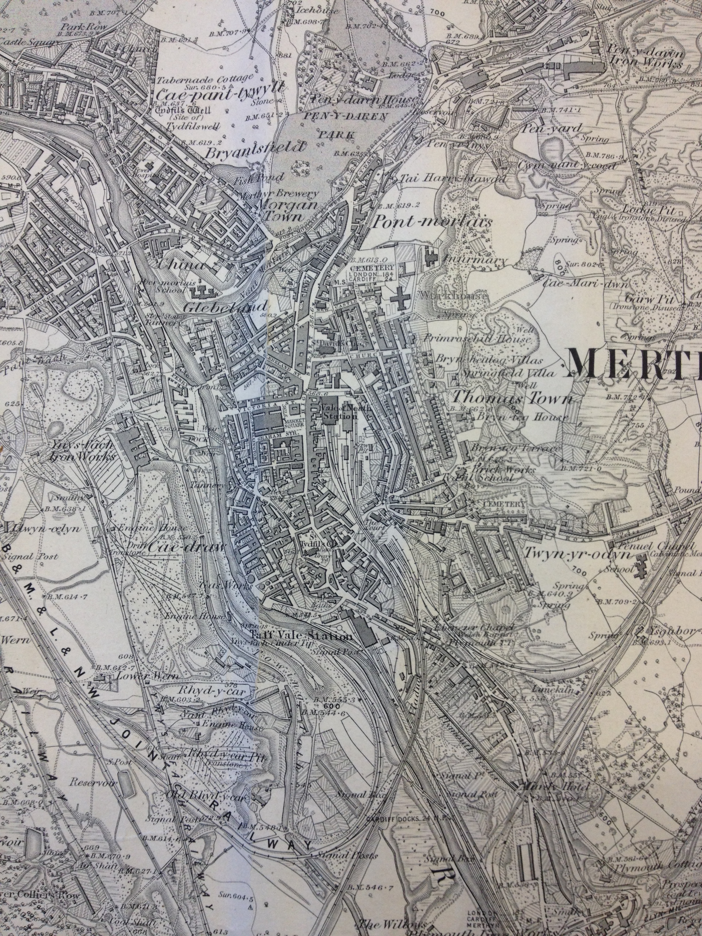
Detail of OS Public Health Map of 1851 – showing Cyfarthfa Iron works. Reproduced from the 1851 Ordnance Survey Map. Collection of Merthyr Tydfil CBC Libraries.Detail of OS Public Health Map of 1851 – showing Ynysfach Iron Works. The Glamorganshire Canal can be seen to the right. Reproduced from the 1851 Ordnance Survey Map. Collection of Merthyr Tydfil CBC Libraries.Merthyr Tydfil Map. Reproduced from the 1875 Ordnance Survey Map. Collection of Merthyr Tydfil CBC Libraries.Reproduced from the 1885 Ordnance Survey Map of Merthyr Tydfil and surrounding areas. Collection of Merthyr Tydfil CBC Libraries.
This 1885 OS Map of Merthyr Tydfil and surrounding areas is richly – almost decoratively detailed with the patterns of industrial development.
Railways in particular, dominate the landscape with curvilinear arcs branching and dovetailing into one another. The scene at the time must have been frenetic and constantly moving. What the map cannot easily show is the variation in topography and the ways in which the rail tracks were over-sailing one another in cuttings, over bridges and on raised embankments.
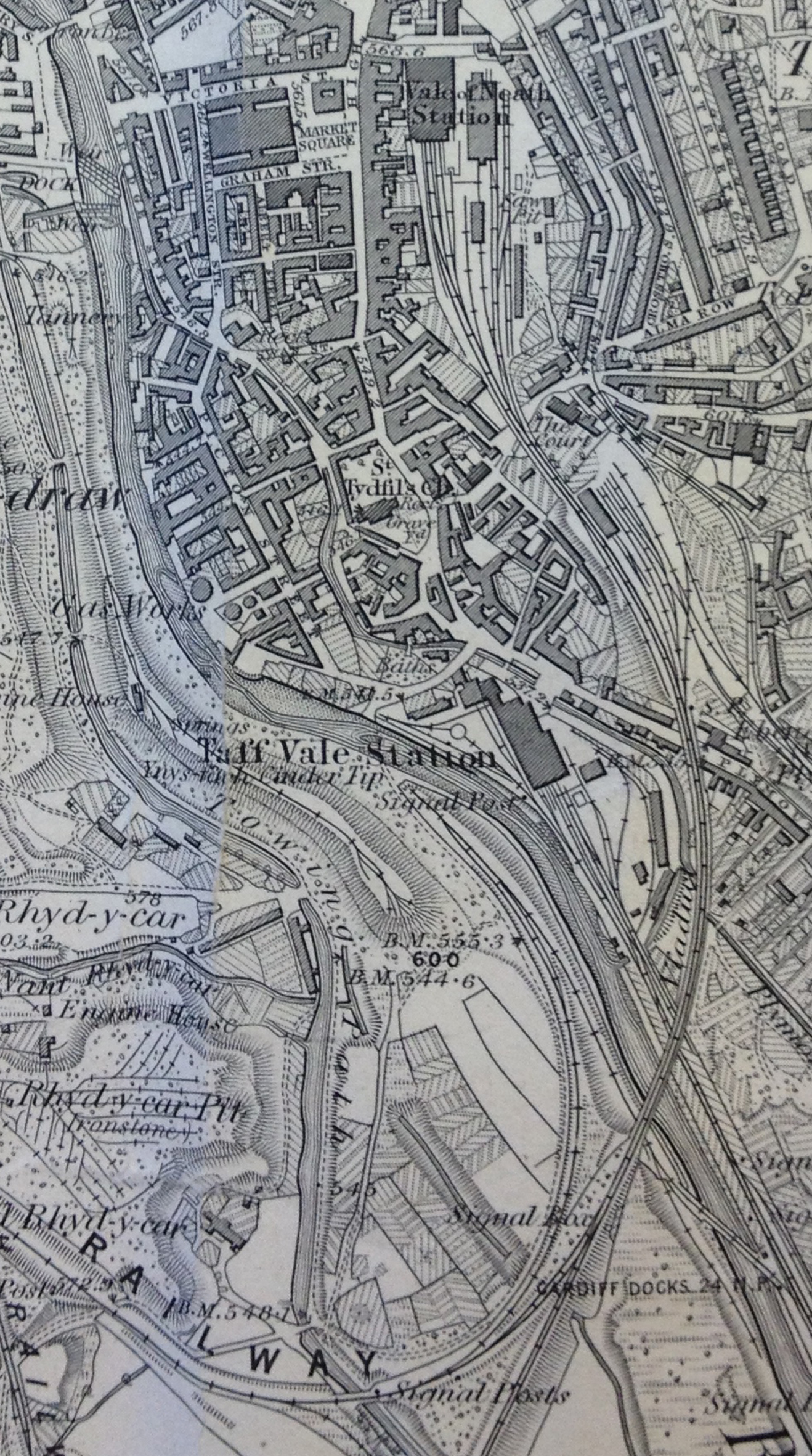
Detail. Reproduced from the 1885 Ordnance Survey Map of Merthyr Tydfil and surrounding areas. Collection of Merthyr Tydfil CBC Libraries.
The detail above illustrates the complexity of transportation & landscape management and how it interweaves in the landscape. Train Stations and Sidings, various roads and trackways, River Taff, Glamorganshire Canal with towing path, reservoirs, cinder tips, working quarries, disused workings. Sitting tightly in the midst of it all is the dense footprint of the Town Centre.
I have now made two visits to Merthyr Tydfil & am preparing to go up again this week for two days to meet with the project team and Capita, who will be delivering the Bus Station. Capita recently completed the The River Taff Central Link and Bridge – a new road system that connects Merthyr Learning Quarterat the existing Penry Street Bridge, through Avenue De Clichy, across the new road bridge located south of Swan Street, and via the new road in front of the College. The new bridge is a major landmark for the town.
The town centre is fascinating & has some wonderful architecture. Just remember to look up above the shop fronts to see the architectural detail! Key anchor buildings are still extant & a good deal of regeneration is breathing new life into these buildings and by default, back into the town centre. The RedHouse, an arts and cultural centre – in the former Town Hall – is a singular example of great regeneration practice & takes in the adjoining Penderyn Square – “As part of the Heritage Quarter development, a new civic square outside the renovated Old Town Hall will be a key focal point for the cultural identity of Merthyr Tydfil. The square will be a vibrant environment that will host events across the year celebrating the heritage of the town”.
I have done a lot of walking and am talking to whoever I can to enlighten me on the legacy and heritage of the town, but also about its aspiration and spirit for the future.
I have also been asked to contribute to a feasibility study commissioned by Merthyr Tydfil CBC, to look into replacing the existing footbridge link from the College, to St Tydfil’s Shopping Centre with a new footbridge which also extends to the site of the new Bus Station on Swan Street. The project is being delivered by Mott MacDonald & Knight Architects. This pedestrian connectivity is a critical element in unifying the accessibility of trains, buses and pedestrian routes in the town. It serves also to improve and build upon the visual impact a new footbridge may have as a landmark attraction and destination along the Taff Trail, bringing more tourists and visitors to the town centre.
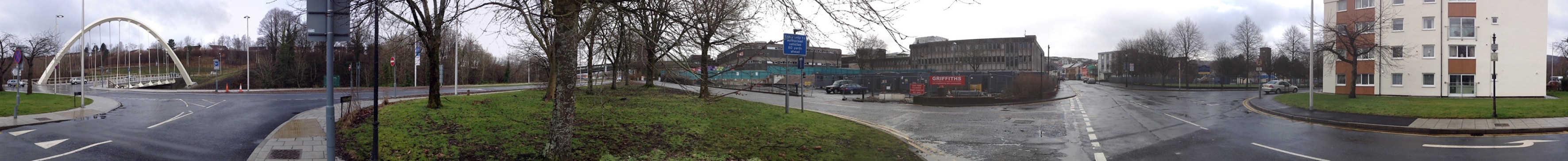
The site of the new Bus Station on Swan Street. Image: Christoher Tipping
This site, on the corner of Swan Street and Avenue de Clichy was until recently, the home of the Hollies Health Centre, which has now moved to state of the art new facilities in the Keir Hardie Health Park at Cyfarthfa. The old buildings have now been demolished. The old Police Station – right & centre of picture, is also in process of demolition to make way for the Bus Station. The back of the St Tydfil’s Shopping Centre can be see on the left of this image.
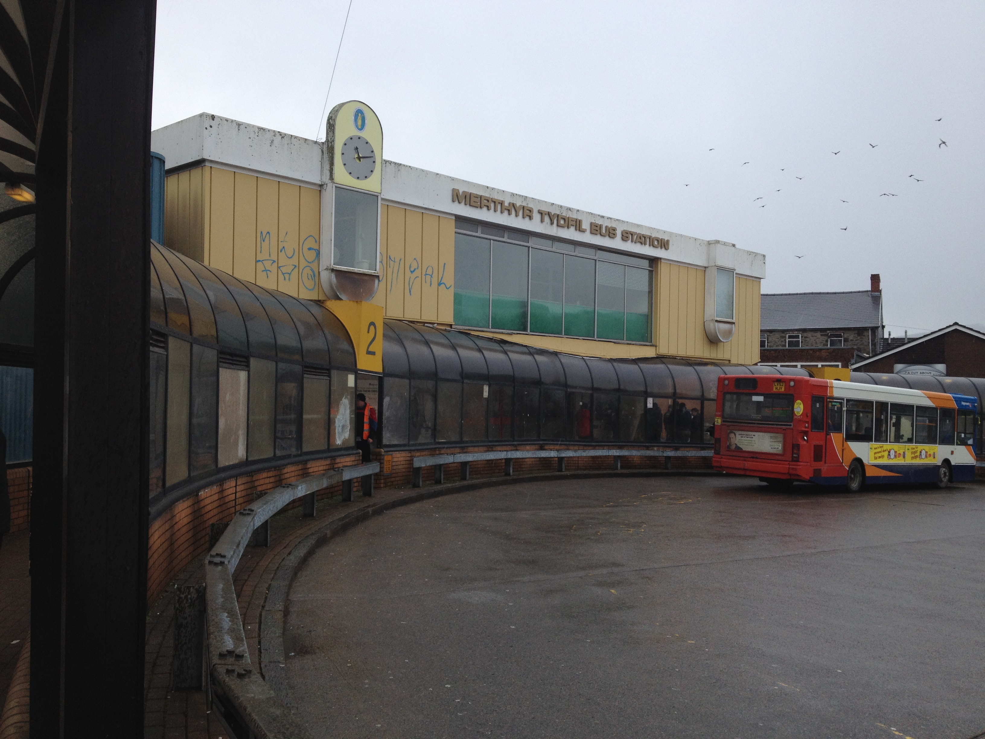
The new Bus Station site as seen from the new River Taff Road bridge. Image: Christopher Tipping360 Panoramic image of the Swan Street site. Residential flats and two schools lie to the south of the site & a sensitive response is imperative. Image: Christopher TippingThe current Bus Station off Castle Street. Image: Christopher Tipping
This image looks grim, but to be fair, the weather on the day was dreadful ! If you turned around, the views out to the surrounding hills are great, even on a horrible day. Castle Street now leads onto the new River Taff Central Link Road at one end and the Redhouse at the other – both, great examples of the power of regeneration schemes in the town to make credible changes.
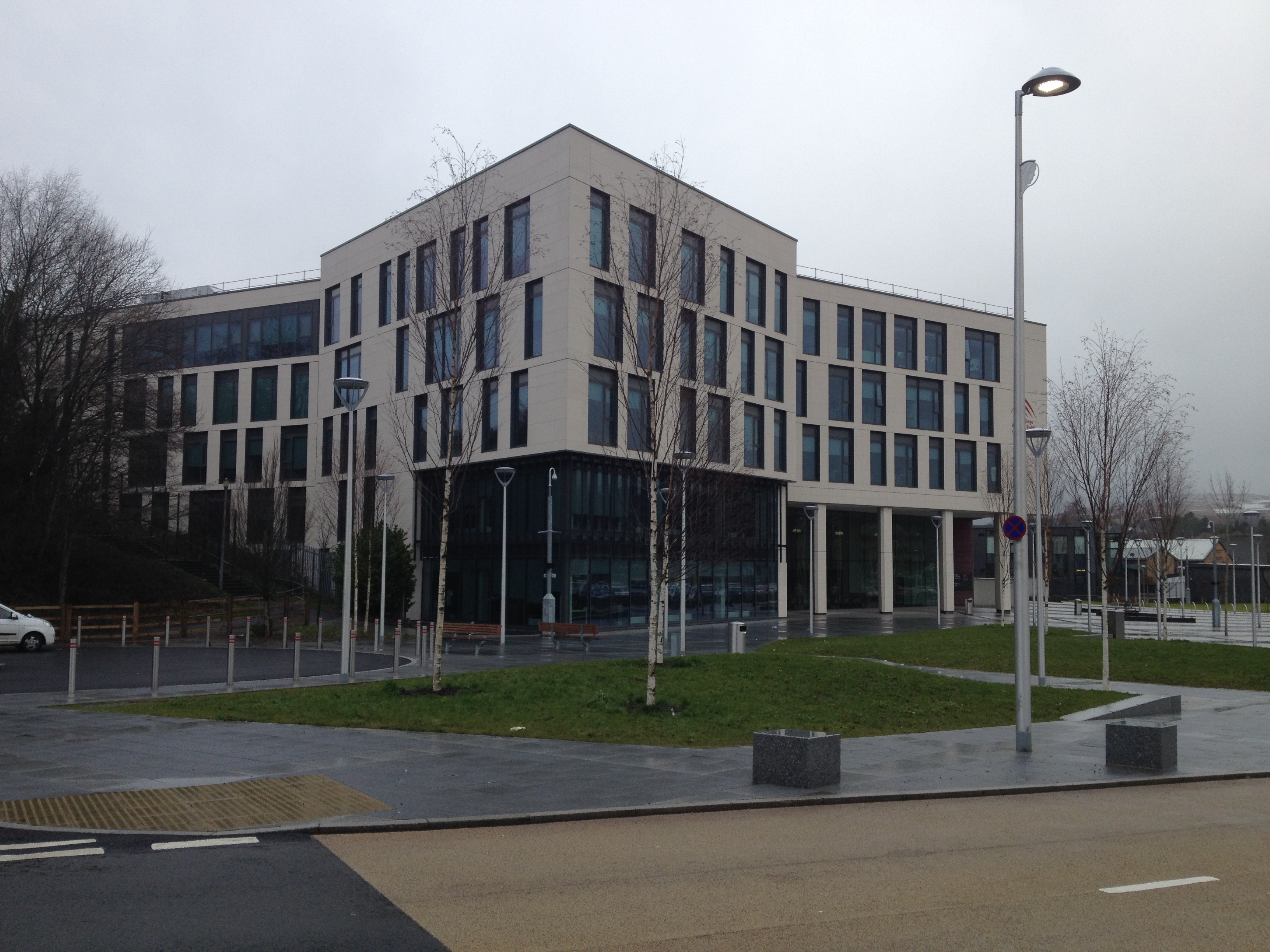
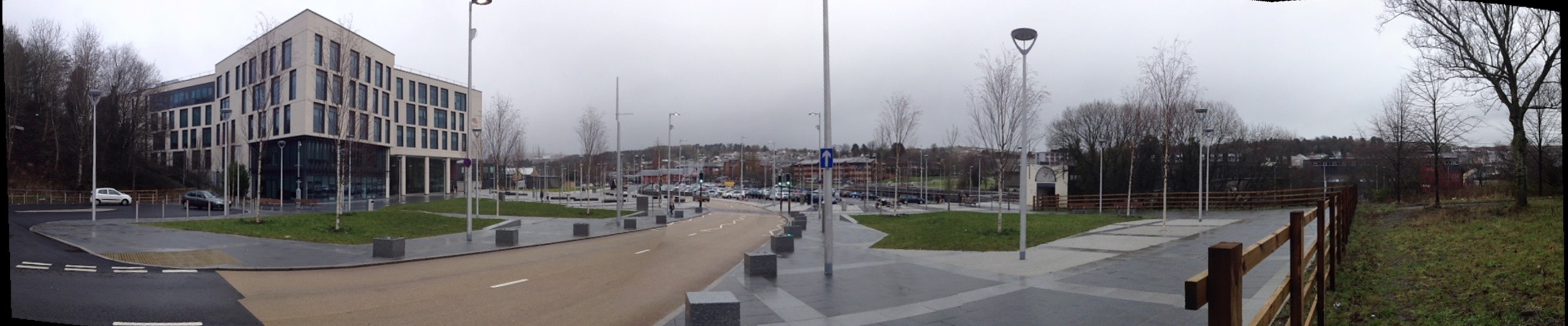
The College, Merthyr Tydfil, which opened on September 2nd 2013. Image: Christopher TippingPanoramic image of the College at Merthyr Tydfil showing the new road and extensive public realm. The River Taff footbridge is at the far right of this image. Image: Christopher Tipping
This area was the site of the former Ynysfach Ironworks, owned and run by the Crawshay Family of Cyfarthfa Ironworks. The new road seen running through the site above almost follows the path of the former Glamorganshire Canal,which was fully opennd in 1794 and declined progressively between 1898 & 1951. Much of the Canal route is now buried beneath the A470 Cardiff to Merthyr Tydfil Truck Rd.
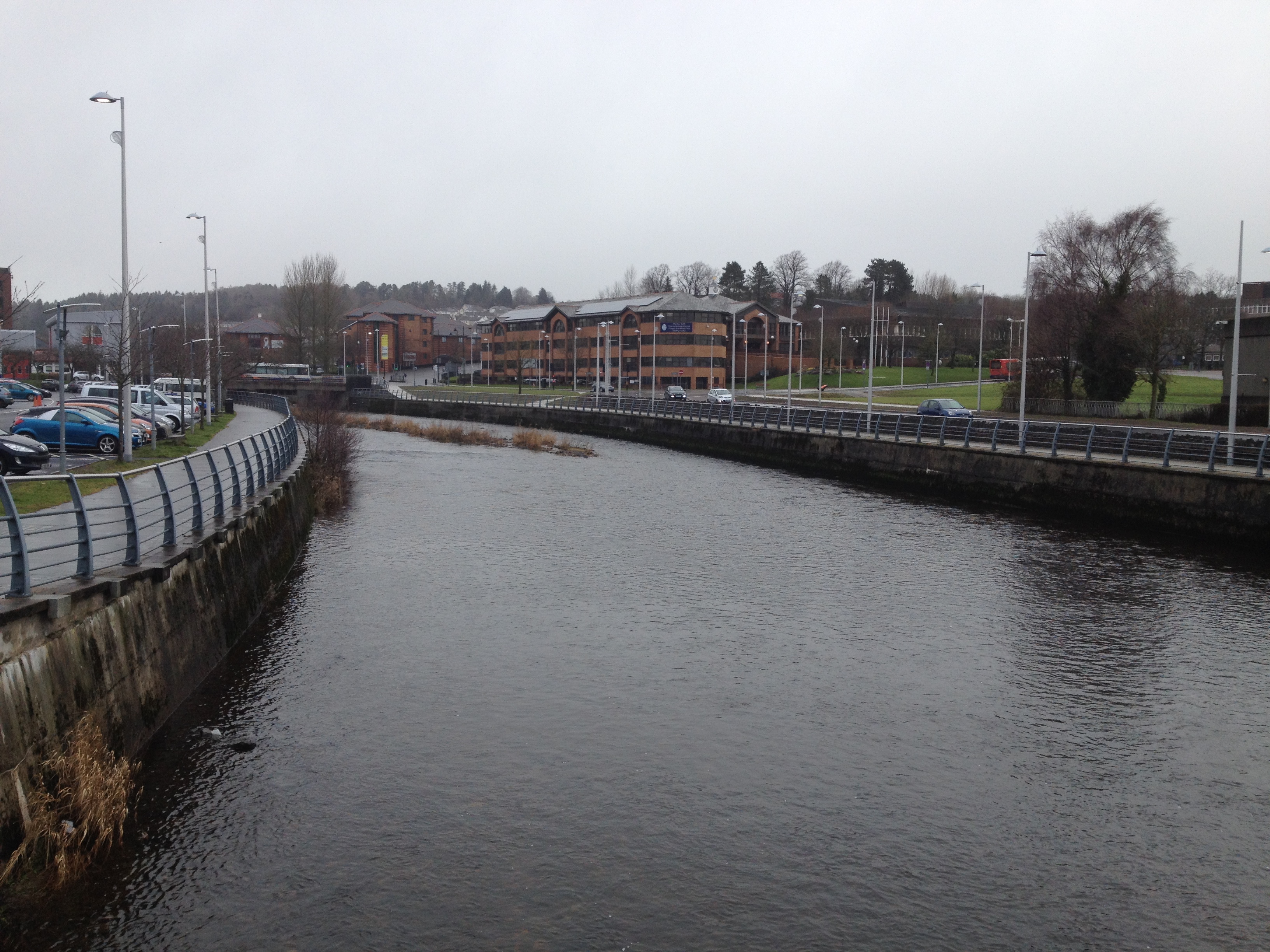
The view upstream from the River Taff Footbridge. towards the Civic Centre. Image: Christopher Tipping
Where the River Taff meanders to the left in the above image and turns the corner, was the site of the Ynysgau Iron Bridge, one of the first Cast Iron Bridges built anywhere in the world, started in 1799 & completed in 1800. The bridge was designed and built by Watkins George, a brilliant engineer working for Richard Crawshay of CyfarthfaIronworks, known as the Iron King. The bridge was constructed for the workforce to cross the Taff to reach the Ironworks. It was dismantled in 1963 and is now stored by Merthyr Tydfil CBC.
Sections and details of the Ynysgau Iron Bridge, dismantled in 1963 and now stored by Merthyr Tydfil CBC. Image: Christopher Tipping
Communications and advances in transport were critical factors behind the expansion of Iron production during the Industrial Revolution. Natural water supplies found in the Taff and its tributaries & streams provided the source of power, but this had to be managed and controlled. Innovation and technological advances were the powerhouses.
Merthyr Tydfil may no longer claim to be the Iron Capitol of the world, but transport and innovation continues to be the catalyst for change in the area.
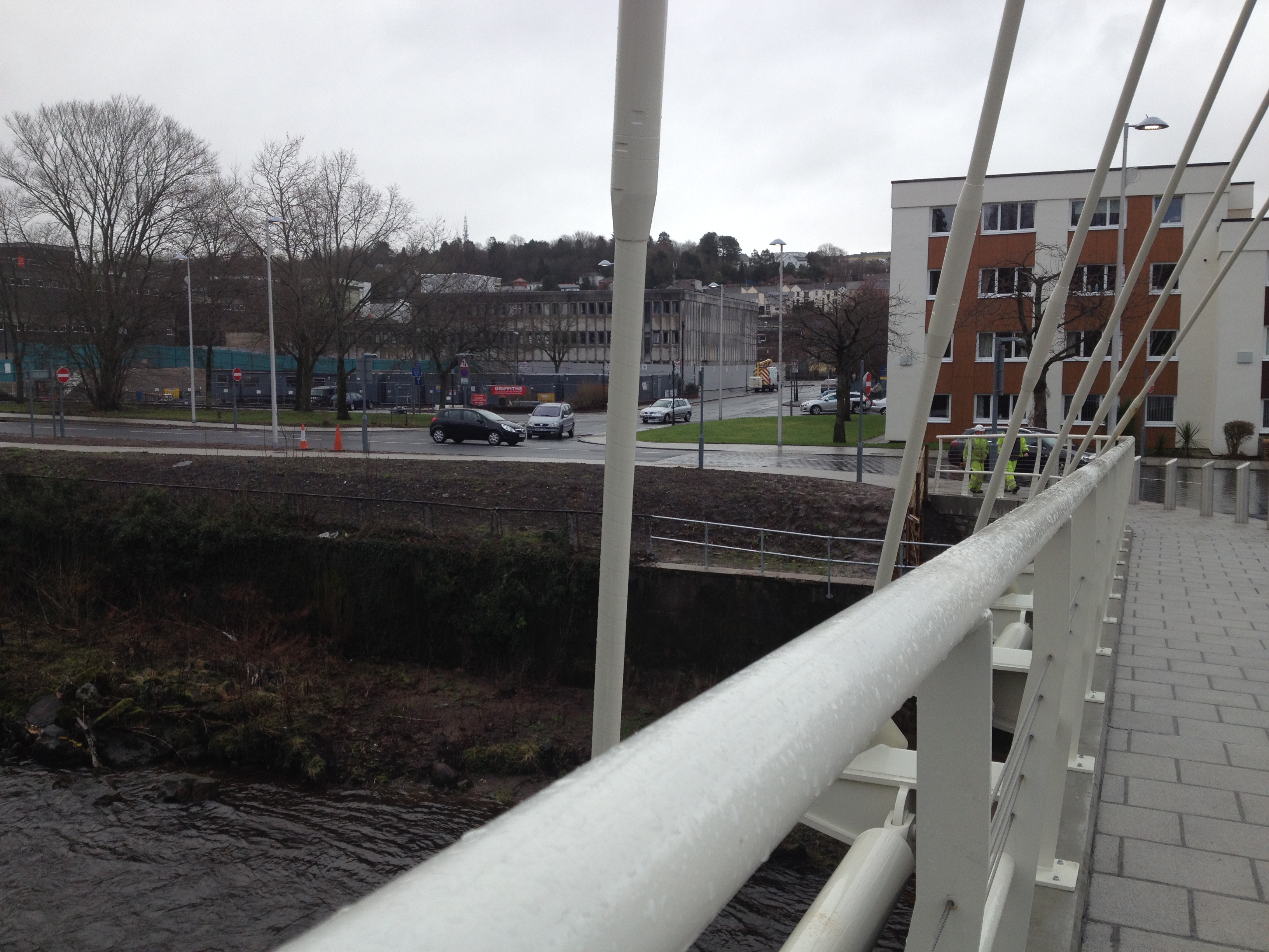
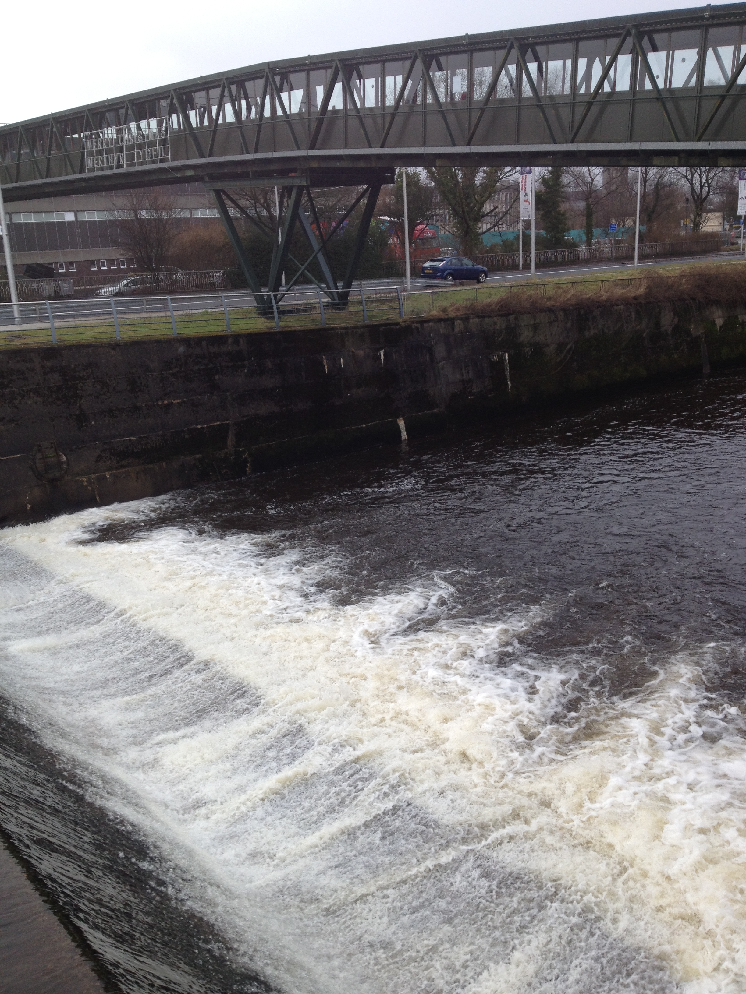
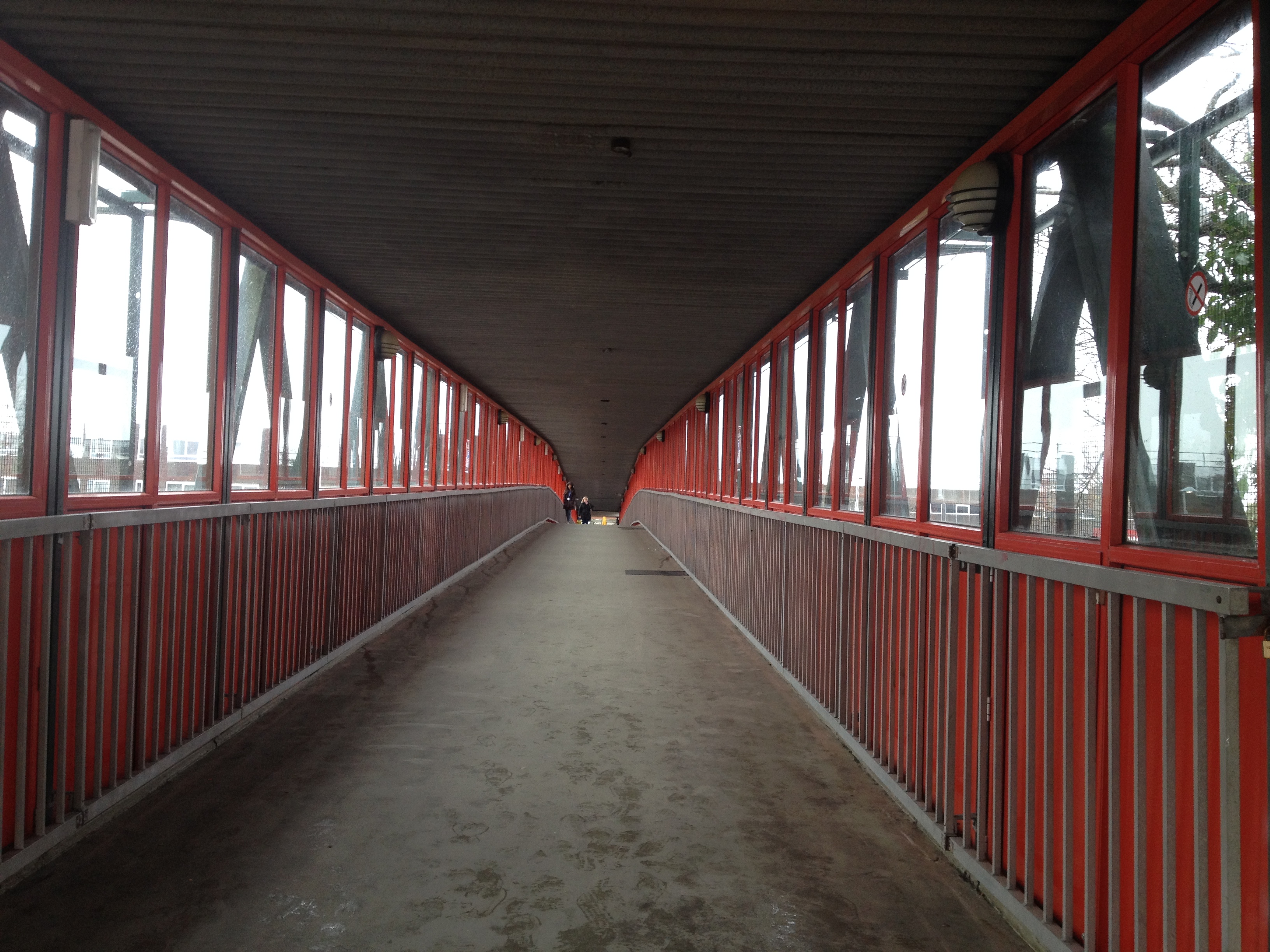
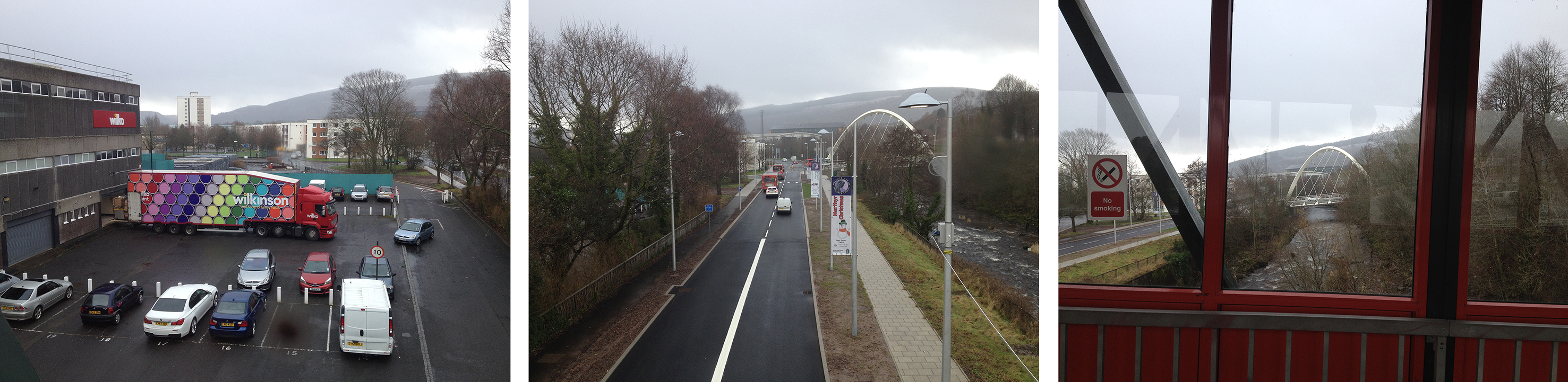
The River Taff footbridge crosses just below the weir from the College to St Tydfils Shopping Centre. Image: Christopher TippingThe footbridge was built in the early 1970’s but wasn’t always covered. The bridge spans not only the River Taff, but the Avenue de Clichy & Wilkinson’s Carpark . Image: Christopher TippingLooking downstream from the footbridge the views change between retail carpark, highway and river. Image: Christopher Tipping
This distinct zoning of views as one crosses the bridge could also change considerable during the year. It’s a great feature from where to see the town – its downfall being that it isn’t particularly good to look at ! A new footbridge would have the potential to exploit this fact too and make the most of the opportunities presented.
Film Credit: Wilson Massie for Balfour Beatty Living Places and Southampton City Council
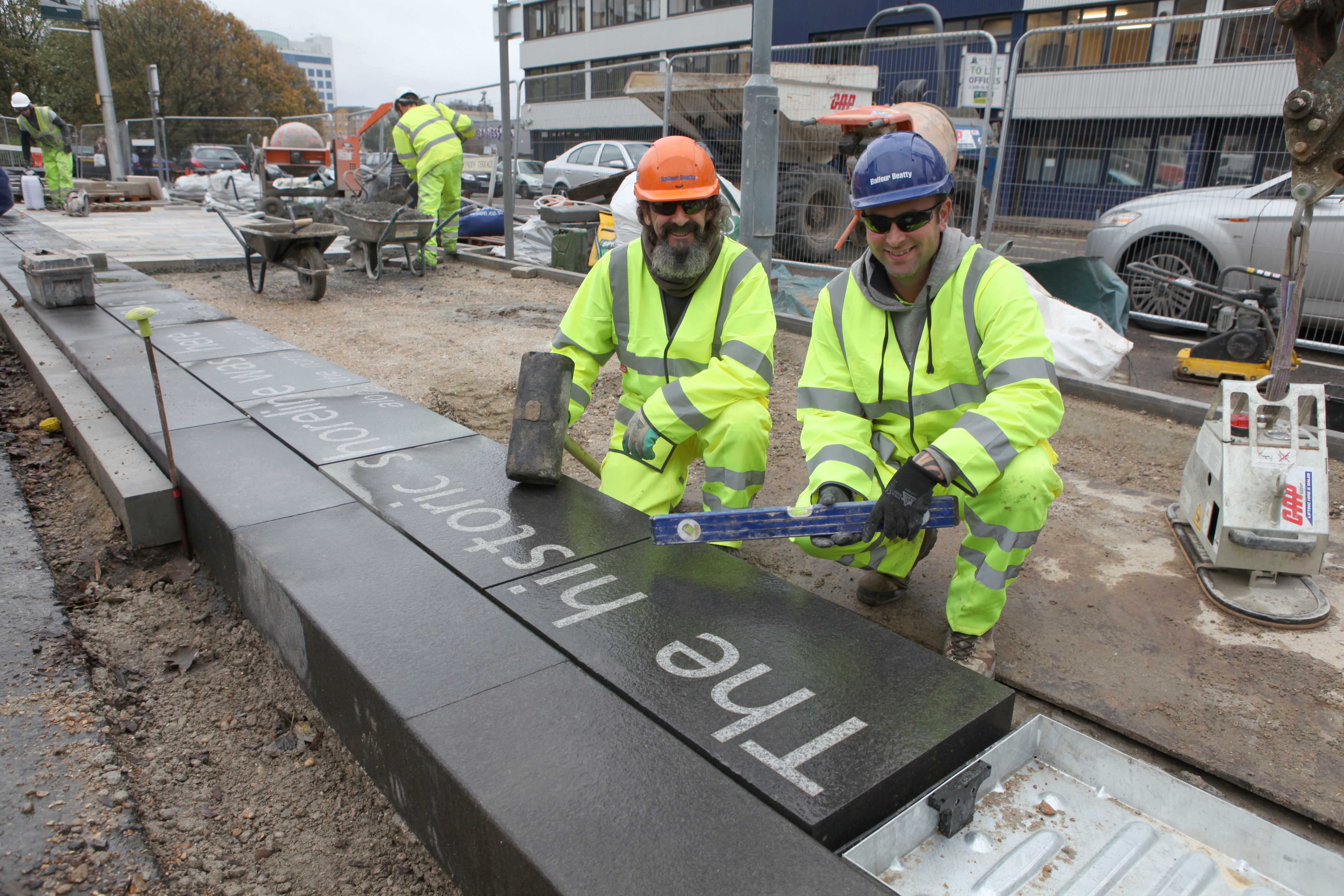
These were the brilliant guys on the ground who installed the Canal Shore works – Martin Miller & Jay Geary of Balfour Beatty. Image: Wilson Massie, Balfour Beatty Living Places
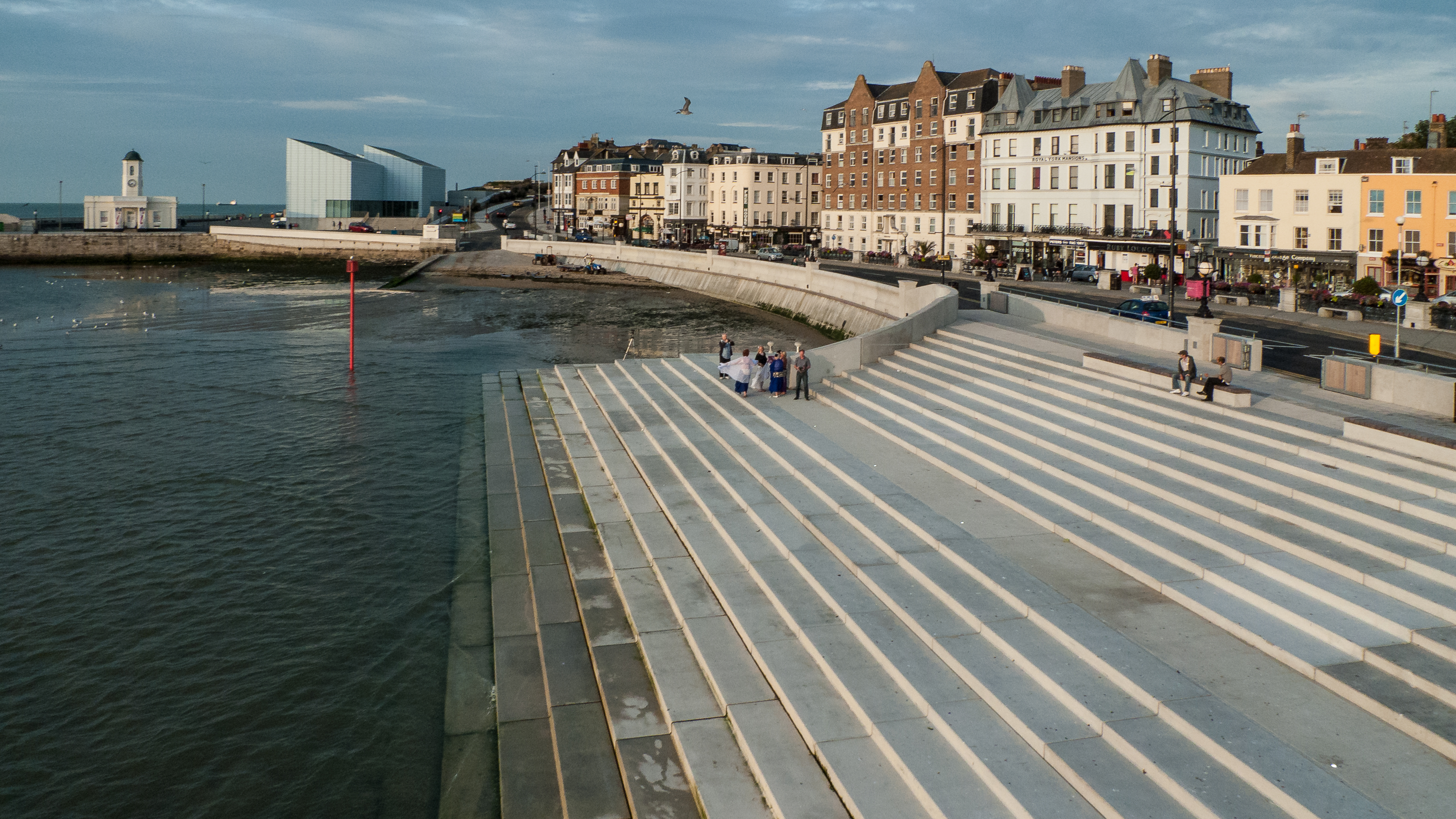
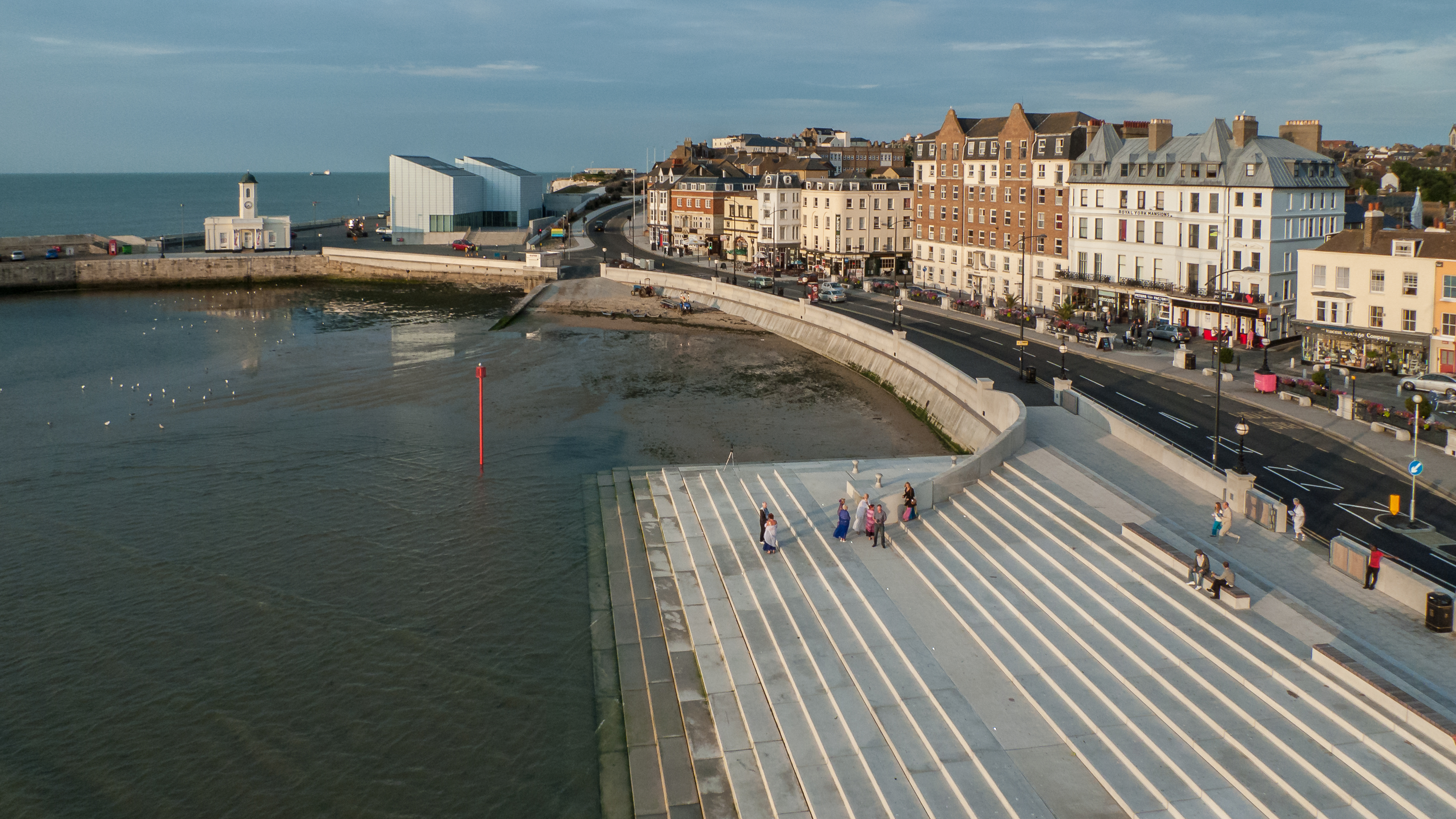
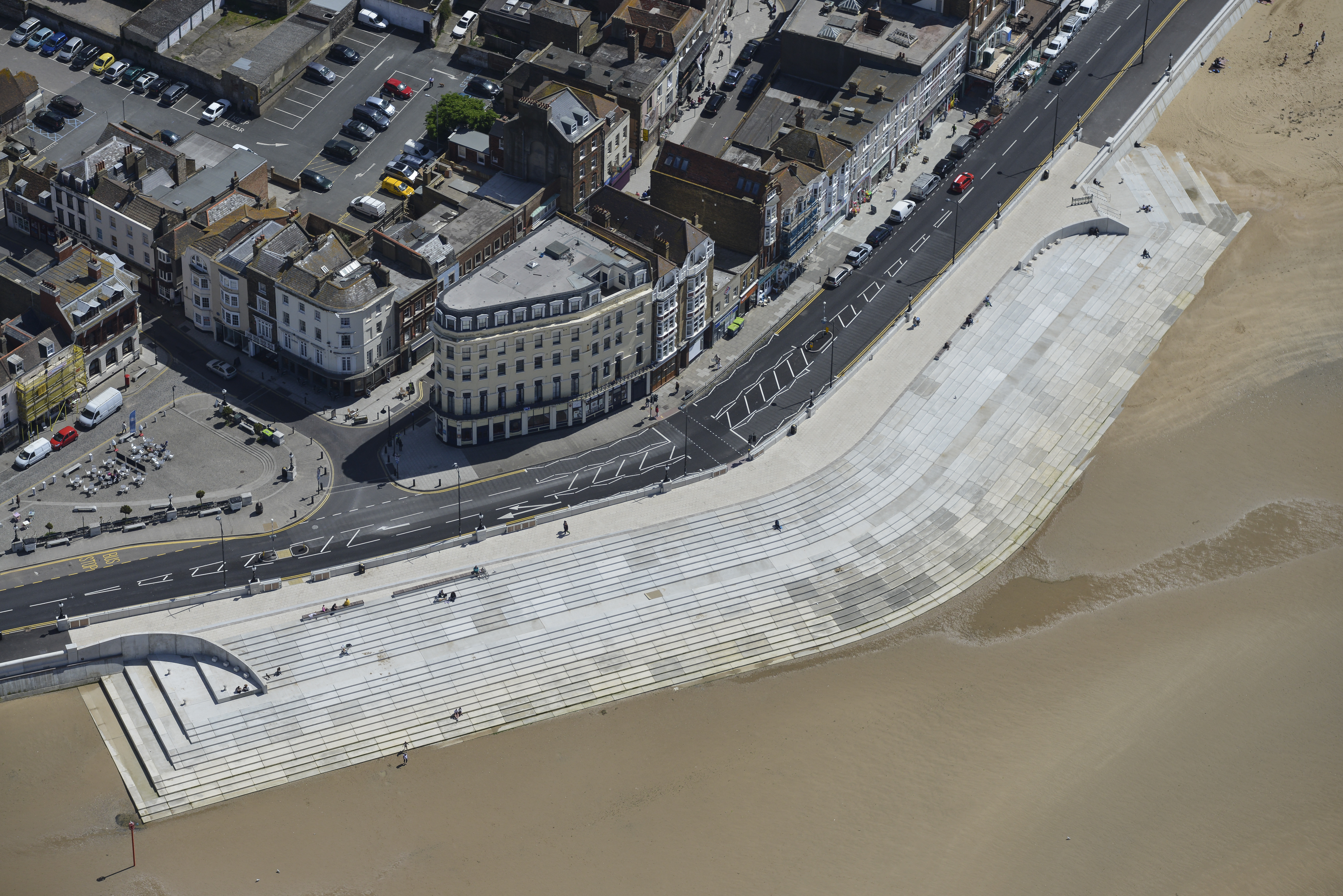
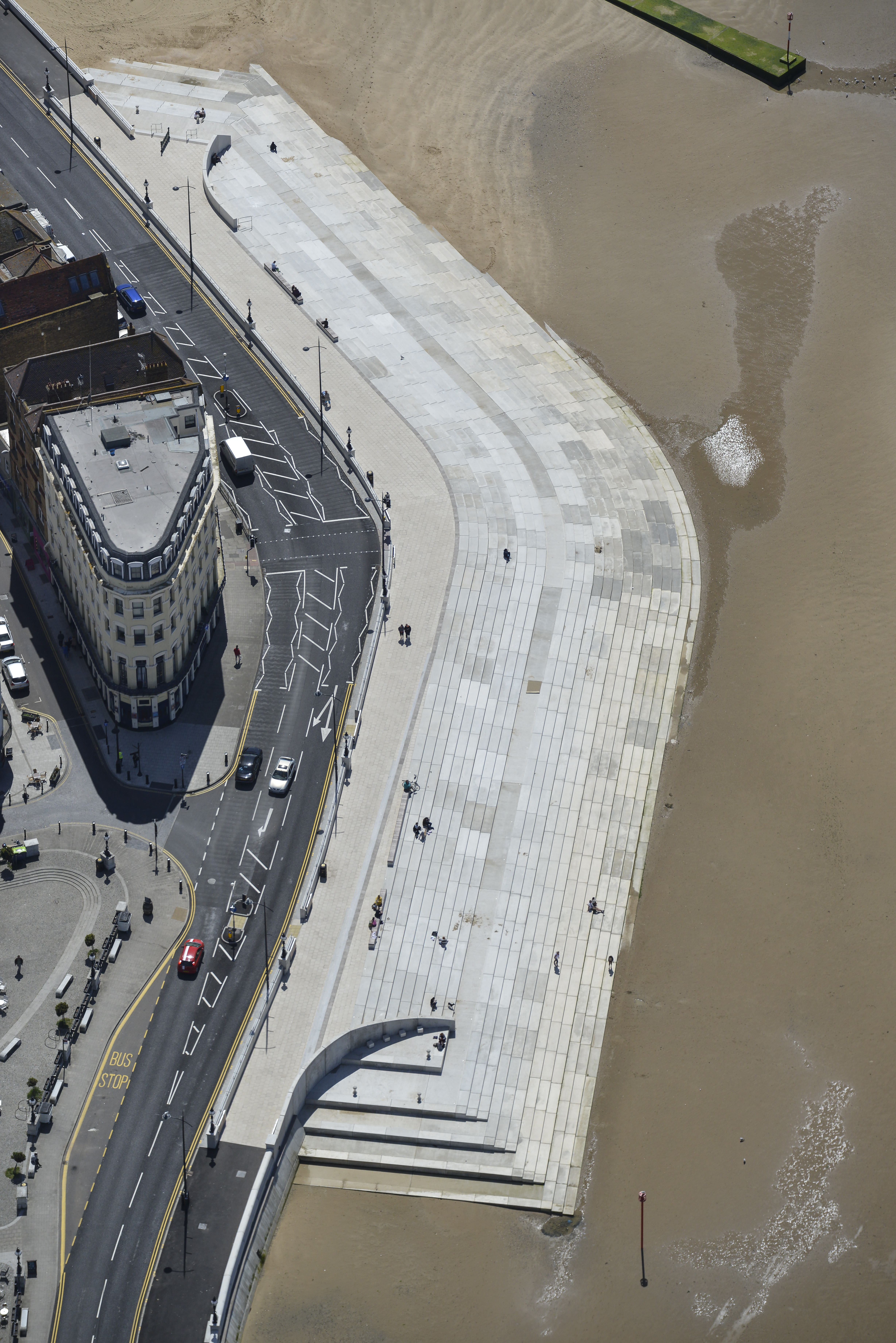
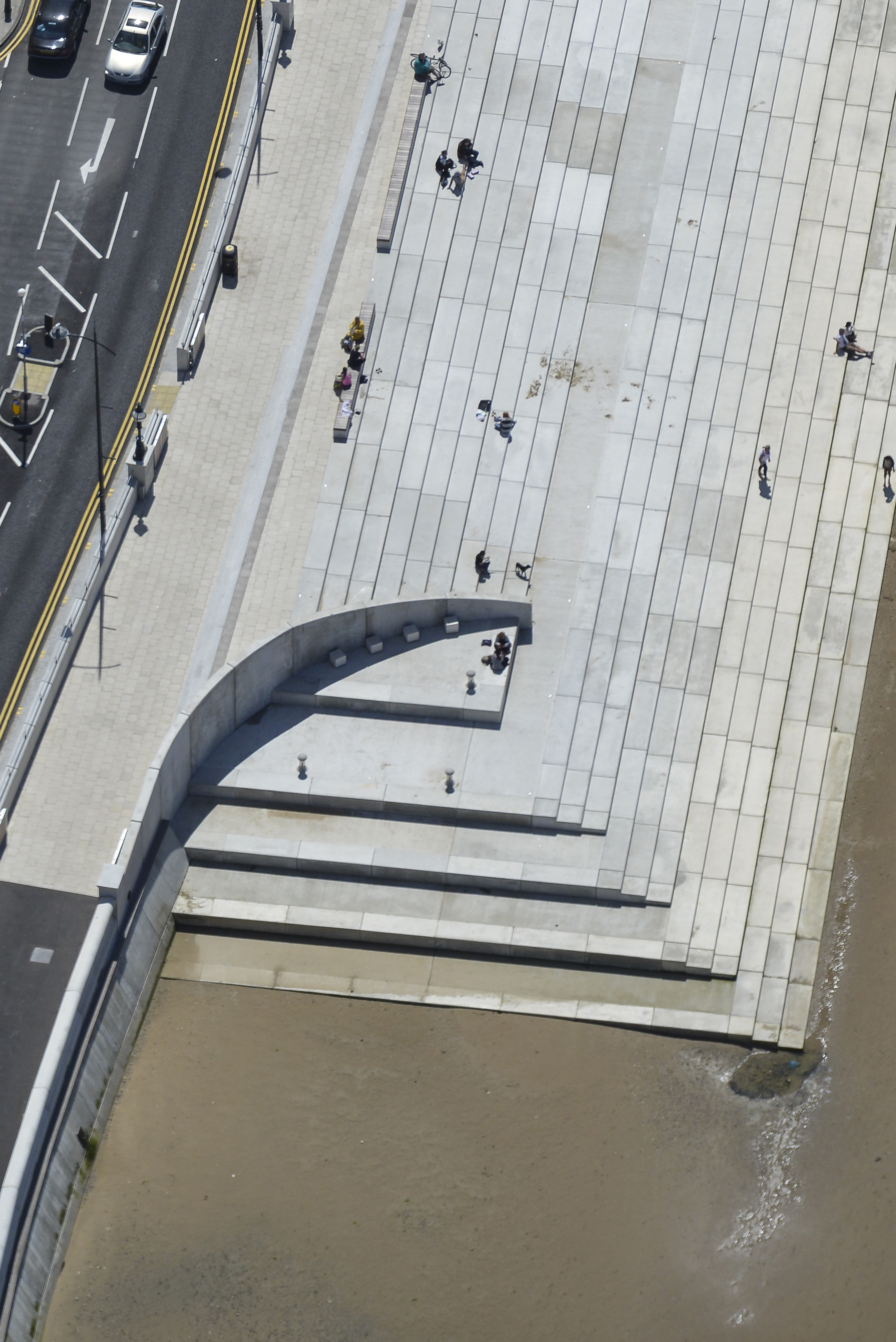
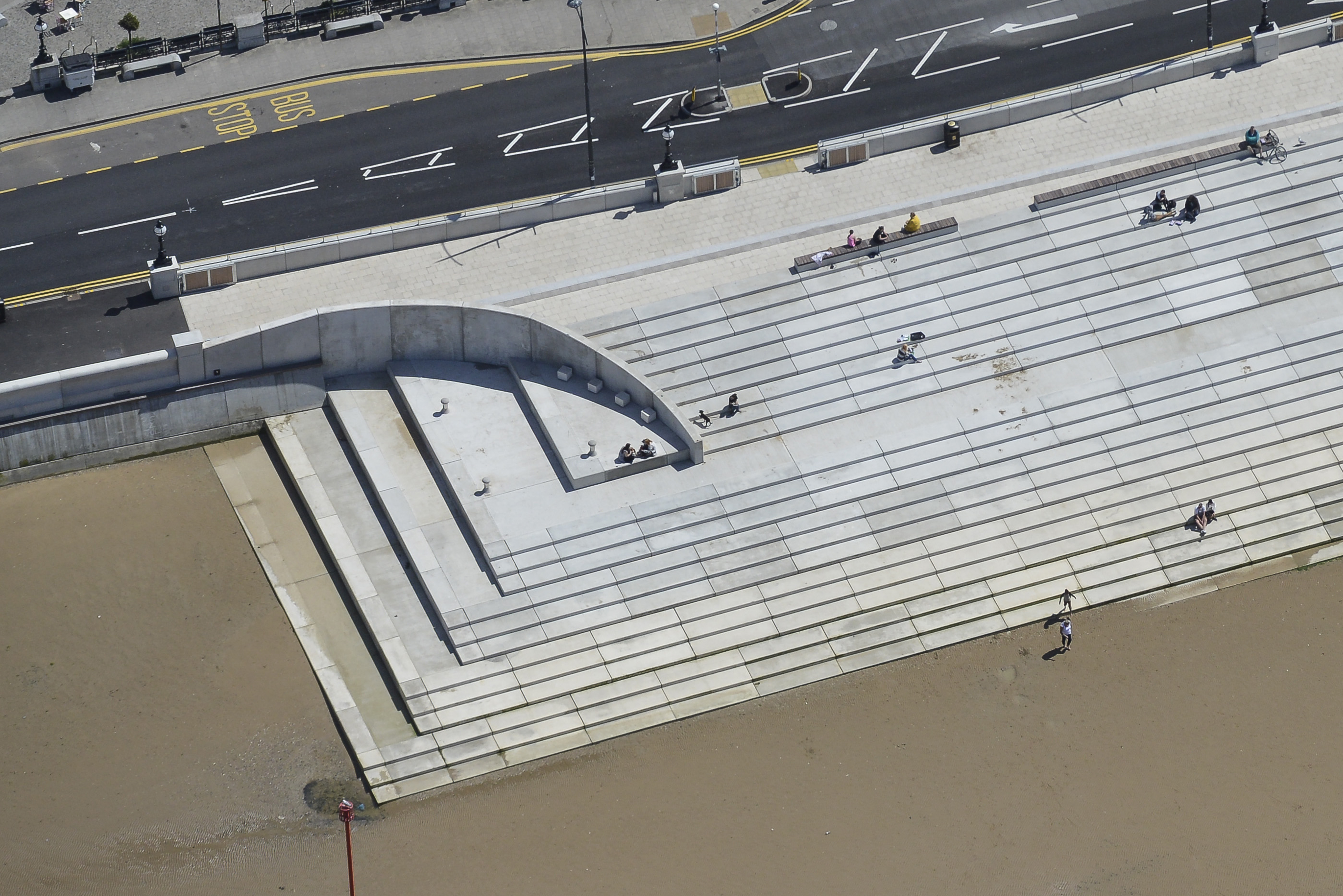
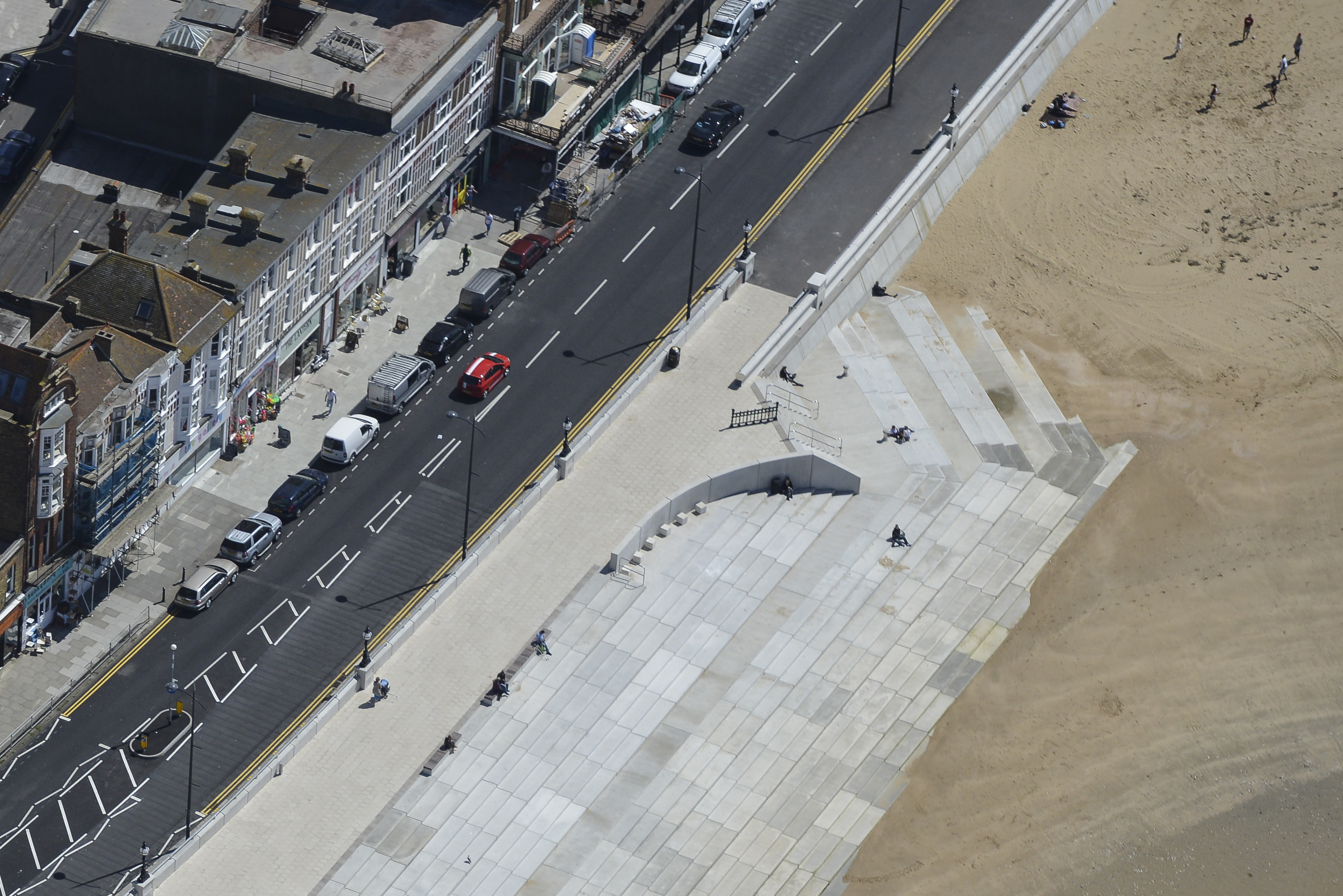
I recently saw some new aerial images of Margate Steps at low tide taken by the project contractors Breheny –
Breheny have very kindly allowed me to publish them on my blog. Notwithstanding its success as an example of coastal engineering within an urban setting, these images of the project really show to good effect the scale and impact of the project. As a public realm & additional amenity space which the step revetment provided for the town, the project was also successful as demonstrated by the awards it has won.
I was commissioned as the project Artist by MACH – Margate Art & Cultural Heritage, Thanet District Council & the Environment Agency. My role was to supply an interpretive & contextual backdrop developed with which to influence the design process & inform the structure, detailing & interpretation of this major sea defence works. The total budget for the project was £6m.