Tag Archives: Historic Chatham

Chatham Creative Scope – ongoing

It’s a while since I last posted on the project. My creative scope has now been submitted and contains a number of research-led works, including:

Site visits to Chatham, for the purposes of research and site analysis.

A review of local landmarks and key buildings, places and organisations –

Meetings with archivists –

A personal blog –

Pinterest Board of research images and aspirations –

A text based creative analysis made as a contribution to the Masterplan document being prepared by LDA

‘Another Chatham Line…’ – an illustrated creative scope pdf document –

Concept and diagrammatic drawings to accompany and illustrate the creative scope and concept approach –

The work submitted will be added into the supporting documents or as an appendix to the work. We will now be looking towards a public consultation exercise, which is scheduled for early December 2015.

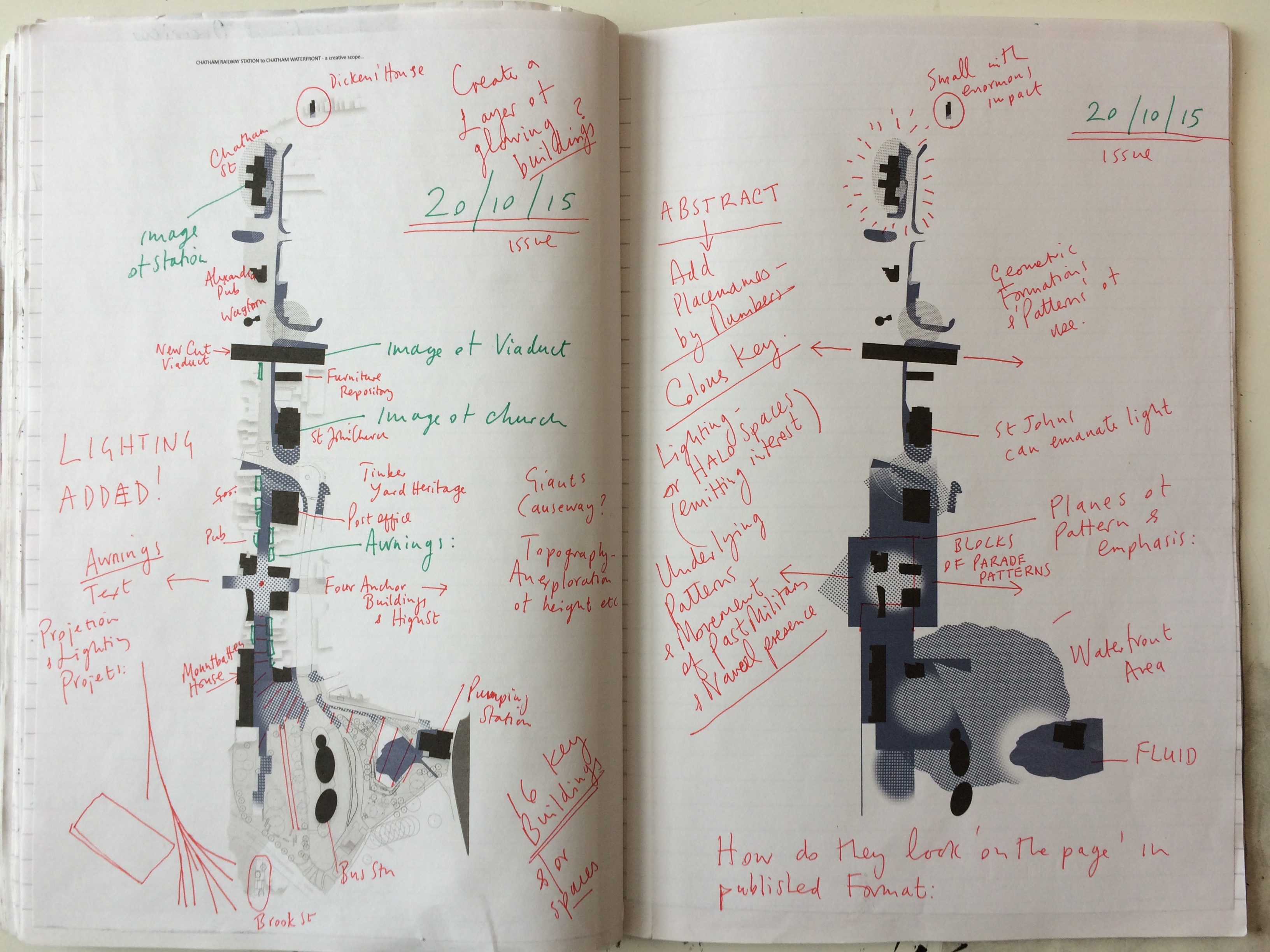
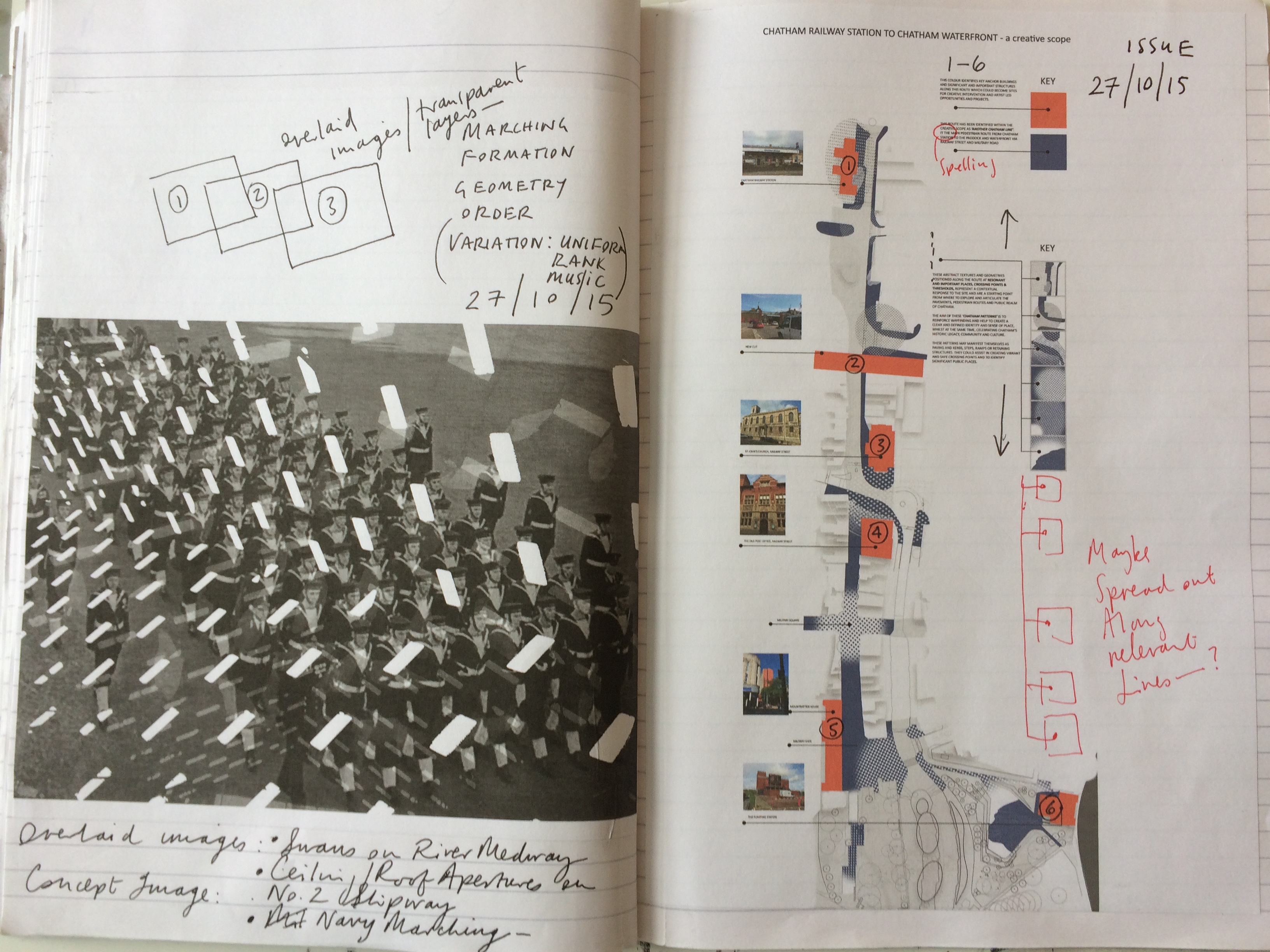
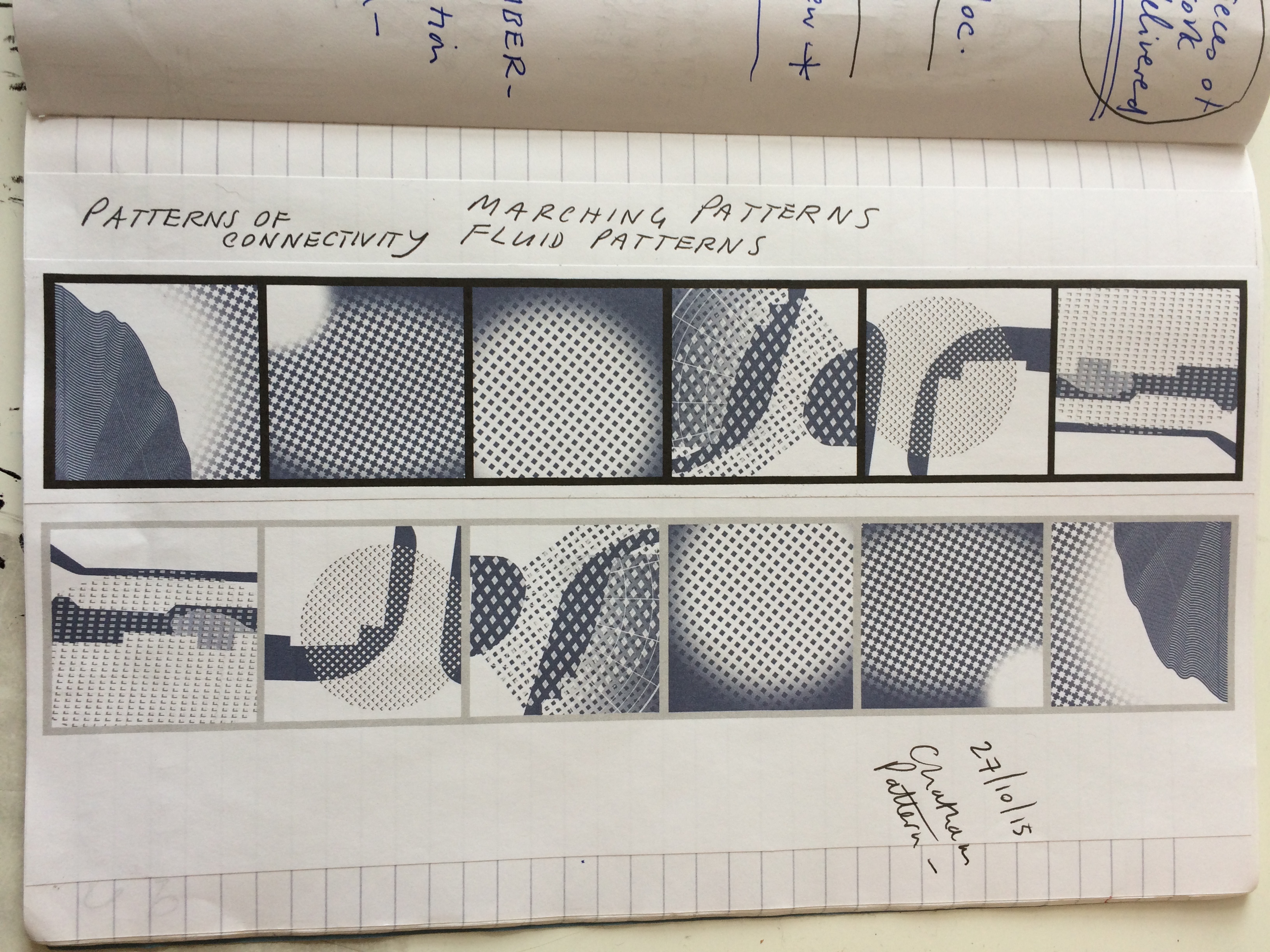
The following images are from draft artworks I have produced, exploring the idea of a thematic pedestrian route from Chatham Station to the Waterfront and The Paddock.

Chatham Creative Scope - artist sketchbook drafts. Image: Christopher Tipping
Chatham Creative Scope – artist sketchbook drafts. Image: Christopher Tipping
Chatham Creative Scope - artist sketchbook drafts. Image: Christopher Tipping
Chatham Creative Scope – artist sketchbook drafts. Image: Christopher Tipping
Chatham Creative Scope - artist sketchbook drafts. Image: Christopher Tipping
Chatham Creative Scope – artist sketchbook drafts. Image: Christopher Tipping
Chatham Creative Scope - artist sketchbook drafts. Image: Christopher Tipping
Chatham Creative Scope – artist sketchbook drafts. Image: Christopher Tipping
Chatham Creative Scope - artist sketchbook drafts. Image: Christopher Tipping
Chatham Creative Scope – artist sketchbook drafts. Image: Christopher Tipping


Medway Archives & Local Studies Centre

Thursday 3rd September 2015 – Medway Archives & Local Studies Centre, Stood. 

I had an appointment to meet the archivist at MALSC to review their photographic collection – particularly in regard to Railway Street and Military Street. I took a number of digital images from old photographs, but will require permission to post them on the blog. Hopefully, I can do this in due course.

Old OS Maps of the area were of particular interest as these obviously mapped out – some in great detail – large areas of the site where building had been lost during ‘development’ and / or razed to the ground by fire or neglect. Again – watch this space as i hope to post these images too.

Of particular interest were the OS 1848 Board of Health Map and the 1843 Tithe Map.