Tag Archives: industrial heritage

‘Under the Shadow of the Crane’ ROCHESTER RIVERSIDE – PHASE 3 (2) CRANE POINT

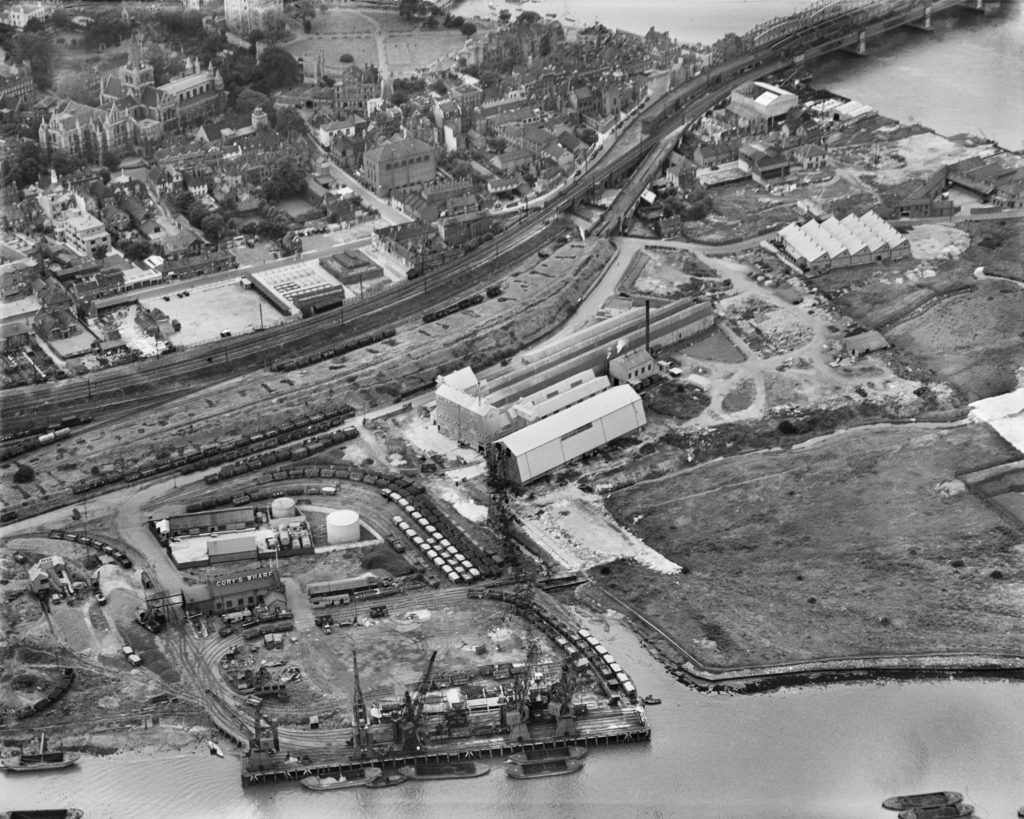
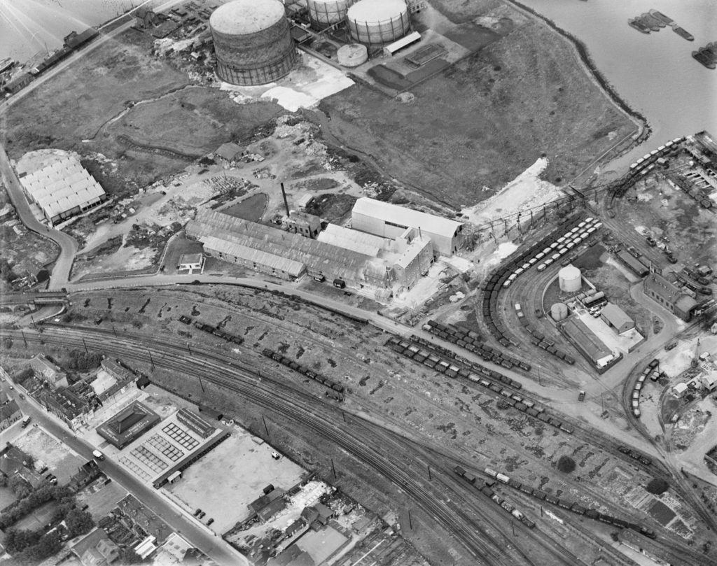
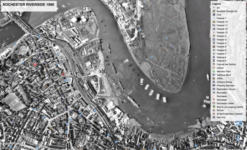
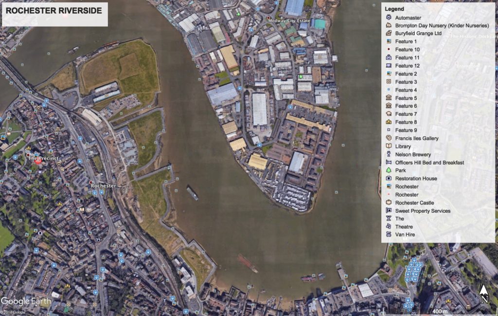
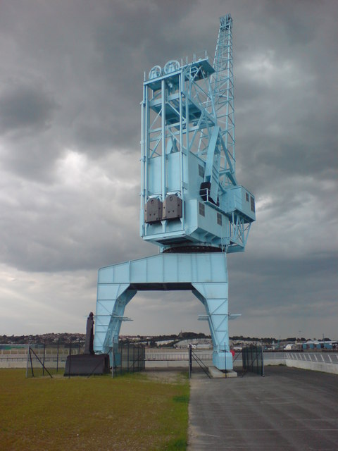
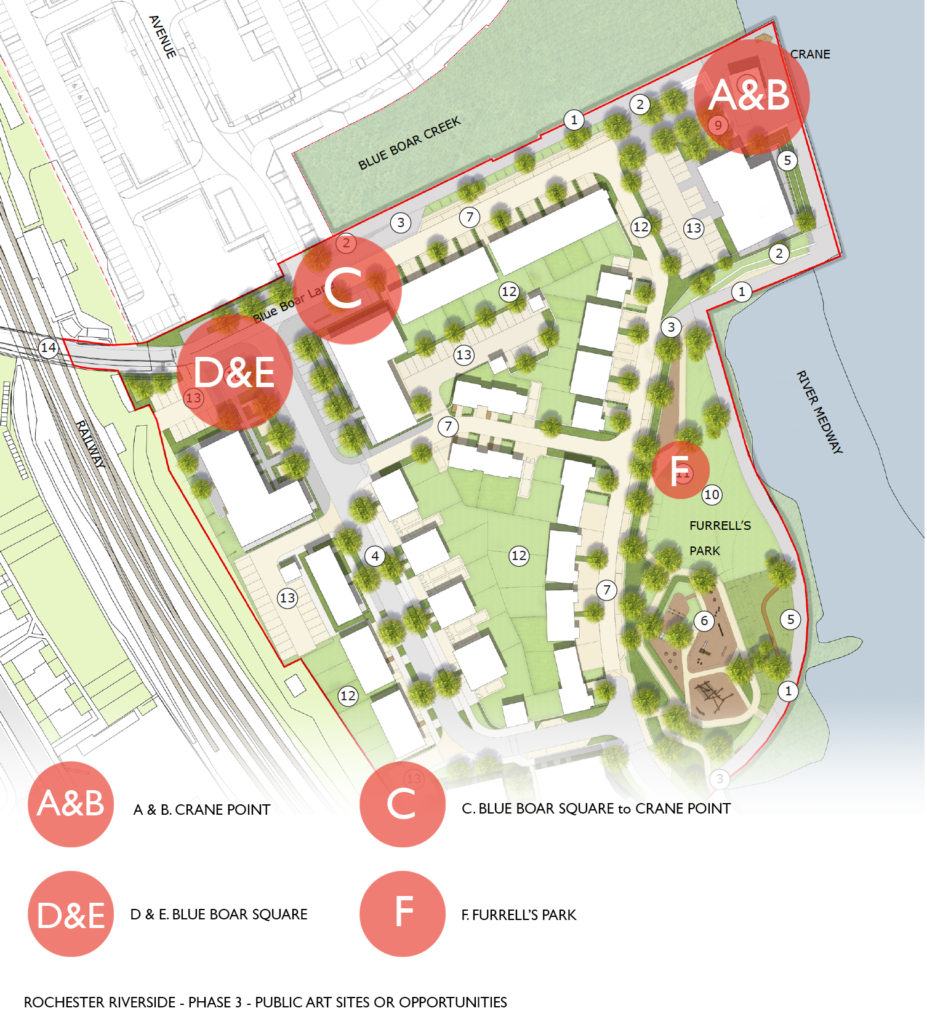
Part 2. ‘Under the Shadow of the Crane’ is actually a reference to the whole of Rochester Riverside, as for much of its post 20th Century history, it was dominated and defined by tall cranes, loading and offloading from the various wharfs. However, a single 200tonne crane was retained & moved to this new position at Blue Boar Hard as a landmark and heritage beacon. Our journey for Phase 3 starts here.

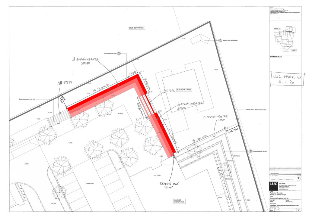
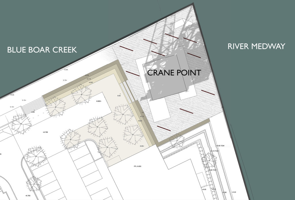
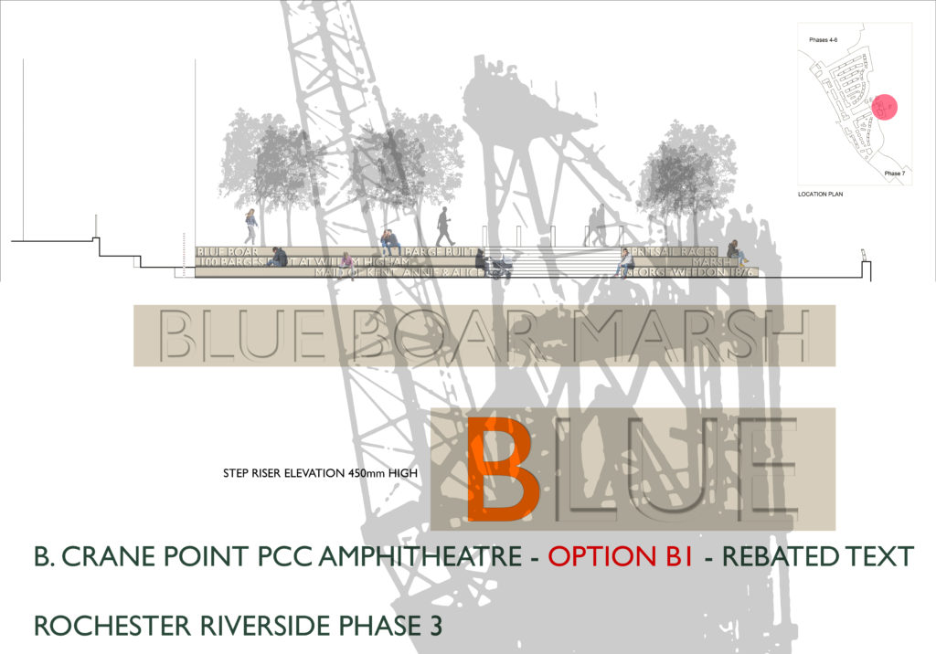
Crane Point is the name for the public realm and viewing point under the shadow of the crane. The landscape has been designed by LUC as an Amphitheatre with precast concrete stepped seating and concrete paving extending around and beneath the crane. A large Apartment block is being built adjacent to the public space, which will look out over the crane and the River Medway.

This plan of the concept development masterplanning stage for the Phase 3 development at Blue Boar Wharf, Rochester Riverside shows opportunities for possible Public Art intervention within the site. Image: Christopher Tipping

Children swam from here…Blue Boar Wharf was our playground…

A forlorn Blue Boar Pier as it was in 1970, from a viewpoint looking out over the River towards the Chatham Dockyard. Image: By permission of MALSC
Artwork for the precast concrete Amphitheatre at Crane Point, Rochester Riverside Phase 3 Public Art Proposals. Image: Christopher Tipping

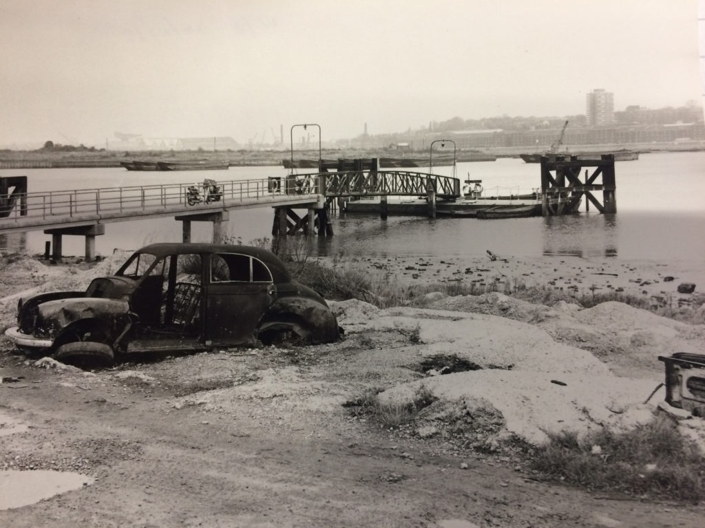
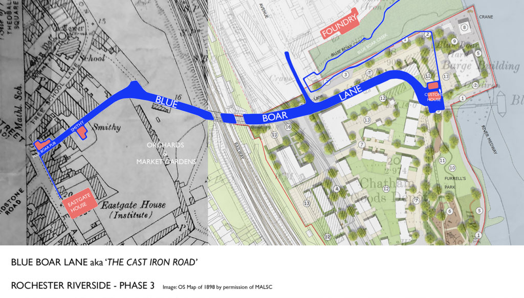
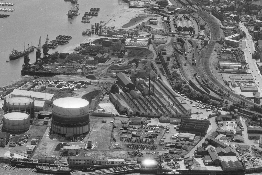
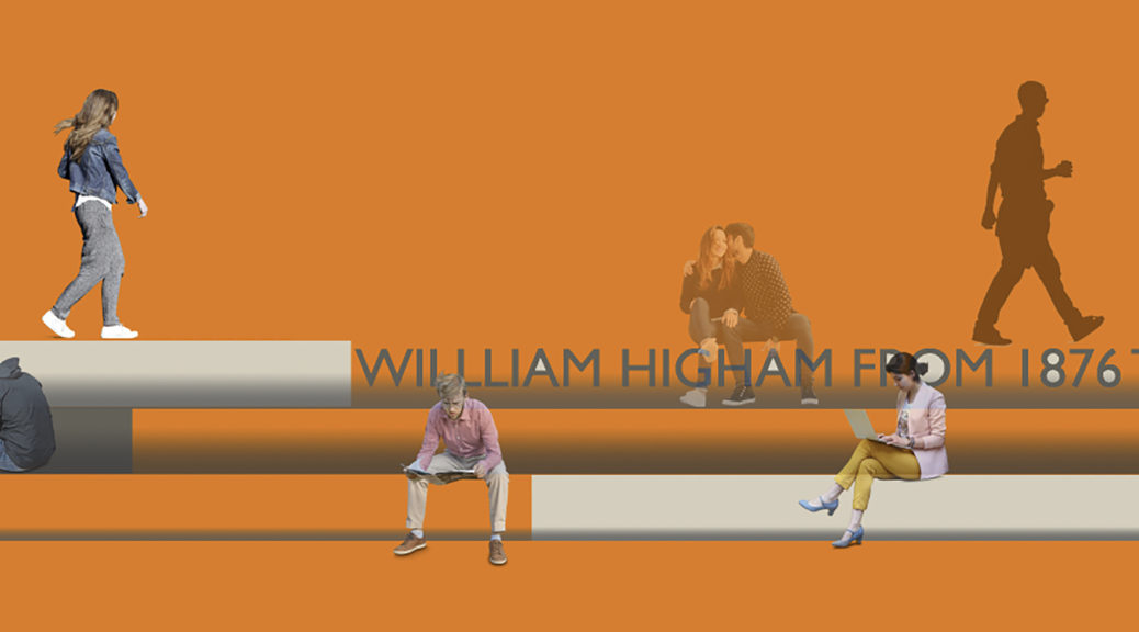
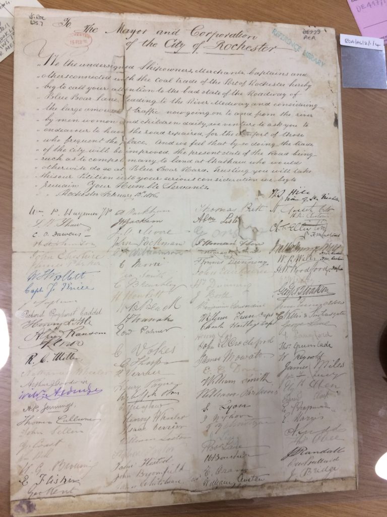
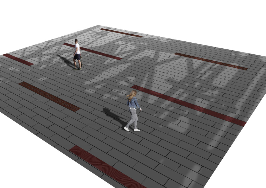
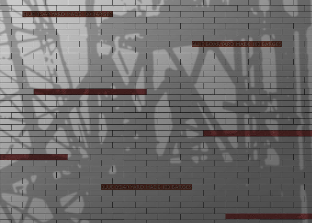
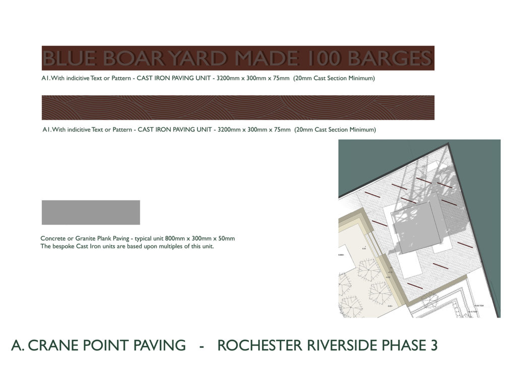
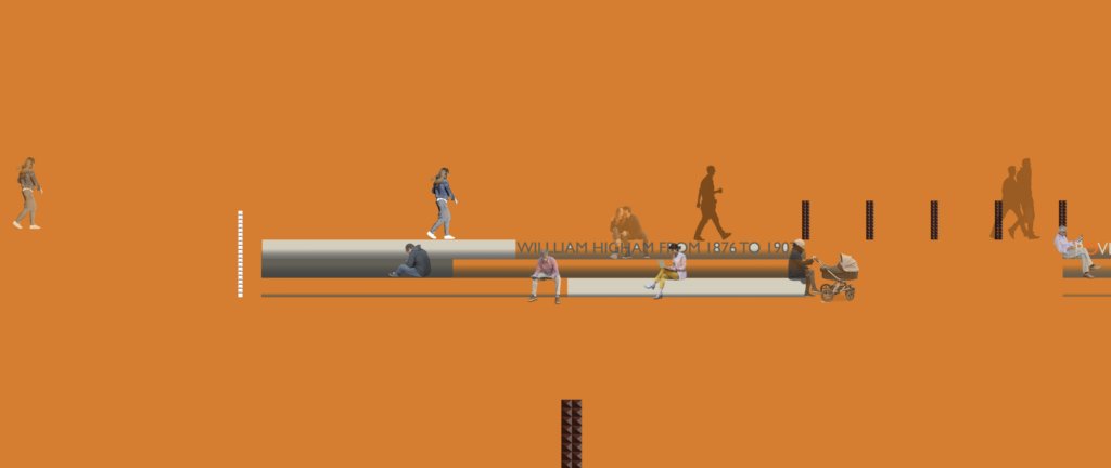
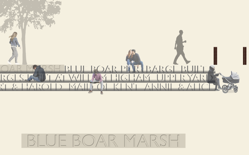
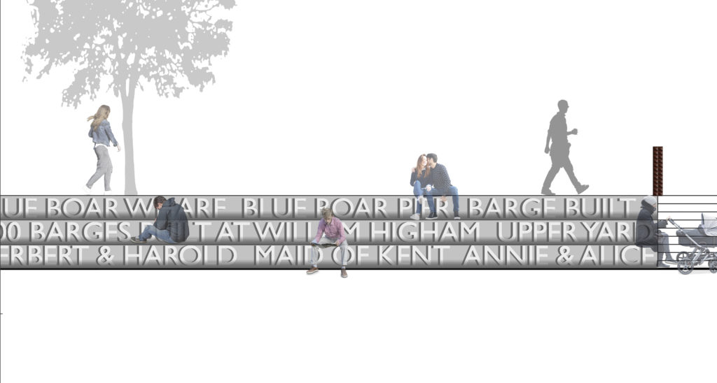
Crane Point – or Blue Boar Hard as it was called in its former life, is the end point of Blue Boar Lane, terminating with a Pier. It starts at its junction with Rochester High Street and the Blue Boar Public House (now demolished), leading under the railway tracks towards the river. At one time, the road split in two, with one track leading to the other side of Blue Boar Creek to James Hall & Son, Iron Foundry. Examples of their work can still be seen embedded into the pavements around Furrell’s Road. To the South of Blue Boar Creek, Blue Boar Wharf provided the river frontage for Barge Building. Up to 100 Medway Spritsail Barges were built here by William Higham. William lived on Victoria Street in Rochester and his wife had 9 children.

Plan of Crane Point draft artwork. Image: Christopher Tipping

William Higham was also notable as a signatory to a fascinating document signed by 251 individuals connected to the Coal Trade Port of Rochester trading from Rochester Riverside on February 10th 1876 petitioning the Mayor and Corporation of the City of Rochester to review the state of the roadway of Blue Boar Lane, which was in such a poor condition it was compelling commerce to land at Chatham and not Blue Boar Hard.

“ We the undersigned Ship Owners, Merchants, Captains and others connected with the coal trade of the Port of Rochester hereby beg to call your attention to the bad state of the roadway of Blue Boar Lane leading to the River Medway and considering the large amount of traffic now going to and from the River…the present state of the road being such as to compel many to land at Chatham who would otherwise do so at Blue Boar Hard…” MALSC

A document signed by 251 important people associated with Rochester Riverside petitioning for improvements to the condition of Blue Boar Lane to save their trade. By permission MALSC
Draft artwork for paving with Cast Iron detailing at Crane Point. Image: Christopher Tipping
Plan of draft artwork for paving to Crane Point with inset cast iron interpretation units. Image: Christopher Tipping
Plan of draft artwork for cast iron paving unit at Crane Point. Image: Christopher Tipping
Draft artwork for cast iron paving units with text and pattern as interpretation. Image: Christopher Tipping
Crane Point PCC Amphitheatre – draft artwork for rebated text into the concrete step riser. Artwork: Christopher Tipping
Crane Point PCC Amphitheatre – draft concept artwork showing rebated text cast into the concrete step riser. Artwork: Christopher Tipping

Rather a lot of variations on a theme are drawn up – this is a process of discovery after all. I am often looking for something elusive. I don’t always know what I am chasing after or trying to uncover. Much of this work proves unsuitable to produce, or doesn’t fit the client brief (or budget) but nothing really ever goes to waste. Ideas unused are tucked away for another time.

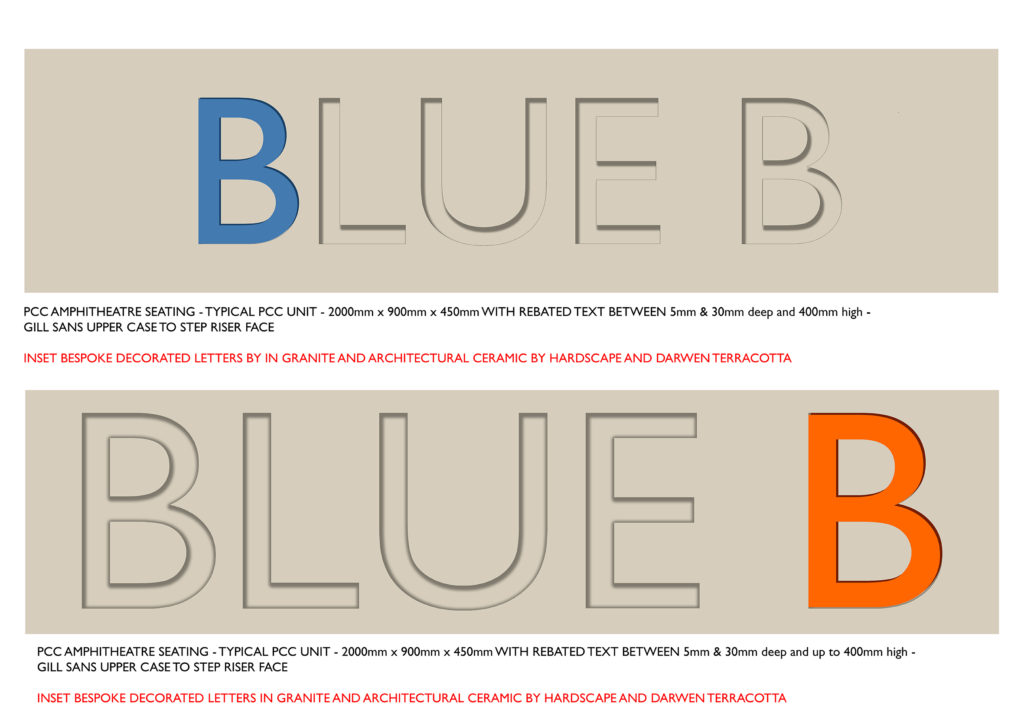
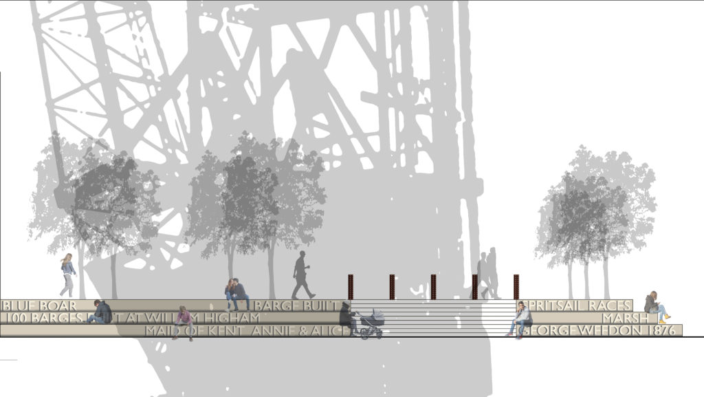
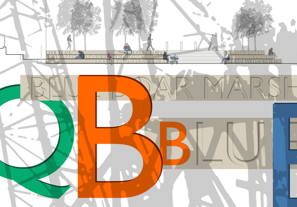
The rebated letters within the cast concrete stepped units very from 5mm to 30mm deep. This allows for some expression and emphasis to be placed on certain anchor words, important for the interpretation on site. The large coloured letters are proposals for bespoke, highly detailed individual letters made of granite, enamelled steel or architectural glazed faience. These will be inset and bonded into several of the 30mm rebated capital letters, inspired by historiated initials of Illuminated Manuscripts in the Library of Rochester Cathedral.

Crane Point – PCC Amphitheatre – draft concept artwork exploring ideas for rebated text cast into the concrete step riser. Artwork: Christopher Tipping
Crane Point – PCC Amphitheatre – draft concept artworks showing bespoke letters inset into the concrete step riser. Artwork: Christopher Tipping
Crane Point – PCC Amphitheatre – draft concept artwork showing rebated text cast into the concrete step riser. Artwork: Christopher Tipping

mmmm

Crane Point – PCC Amphitheatre – draft concept artwork showing rebated text cast into the concrete step riser. Artwork: Christopher Tipping
Crane Point – Plan of PCC Amphitheatre – draft concept artwork showing the areas of rebated text cast into the concrete step risers. Artwork: Christopher Tipping. Plan Drawing: LUC

‘Under the shadow of the crane’ Rochester Riverside – Phase 3 (Post1)

In December 2019, I began research and concept development of Phase 3 Public Art proposals for Rochester Riverside. Commissioned by FrancisKnight Art Consultants for client Countryside Properties and The Hyde Group.

This plan of the concept development masterplanning stage for the Phase 3 development at Blue Boar Wharf, Rochester Riverside shows opportunities for possible Public Art intervention within the site. Image: Christopher Tipping
The 1898 OS Map overlaid with the new concept development proposals for Phase 3 on the Blue Boar Wharf Site. Image of 1898 Map by permission MALSC

I have had access to some amazing aerial images from Britain From Above. The following black and white images are so evocative and detailed, they tell a fascinating story of our site’s industrial and social history, nothing much of which survives today, except the large crane.

Rochester Riverside 1965 Aerial Image: By Permission – Britain From Above.
Limehouse Reach, River Medway, looking towards Chatham. Rochester Riverside 1965 Aerial Image: With Permission – Britain From Above.

The above image from 1965 shows the Gasworks, Limehouse Wharf, Acorn Wharf (Shipbuildng) Acorn House, RMC Aggregates and Ready Made Concrete, Cory’s Wharf (Coal), Chatham Goods Yard (Railways), Blue Boar Wharf, Furrell’s Wharf – almost all the way to Chatham Intra. So much to be inspired by…

I am collaborating with LUC and BPTW who are leading on the architecture, masterplanning and landscape design.

I am continuing to develop the work I created for Phases 1 & 2 as the site has endless riches to be inspired by. My problem is knowing where to stop the research. Each stone unturned has golden threads to follow. Contextually, we are now on the site of Blue Boar Wharf, in its heyday a major Barge Building site, with two Yards, Upper and Lower occupied by two businesses – William Higham, ran the Upper Yard, where he built 100 Barges between 1876 and 1901 & George Weedon the proprietor of the Lower Yard.

Cory’s Coal Wharf and Gyproc Products as seen looking towards Rochester Cathedral. Rochester Riverside 1936. Aerial Image: With Permission – Britain From Above.

Above: Gyproc Products (Plasterboard), started production on the Rochester Riverside site in 1933, just 3 years prior to this images from 1936 (the large white shed in the centre of the picture). Cory’s Wharf, with its ‘5 Cranes Dancing’, is in the foreground.

Cory’s Coal Wharf, Gyproc Products and the Cattle Market. Rochester Riverside 1936. Aerial Image: With Permission – Britain From Above.

Above: The coming of the railways in the 1840’s effectively separated the town from its salt marsh grazing pastures and community centred around The Common. The Cattle & Livestock Market – seen bottom left in this image from 1936 has rooftop graphics – advertising its products – probably for the benefit of train passengers, as the track was raised on an earthen bank and brick viaduct. ‘Thorley’s Food for Cattle’, & ‘Thorley’s Food for all Stock’.

Cory’s Coal Wharf and Gyproc Products as seen looking towards Rochester Cathedral. Rochester Riverside 1936. Aerial Image: With Permission – Britain From Above.

Above: This Postcard must be a very early image of the site, as there appears to be no industrial development of the Riverside site.

This Google Earth Image from 1960 shows the site in its Industrial heyday.
This Google Earth Image from 2017 shows the site stripped of its industry and prepared for development as a new residential community in Rochester.
One of two 200tonne Cranes was retained on site. This is not its original position, but nonetheless, it speaks loudly of the industrial heritage of the site. Image: Crane on Rochester Riverside cc-by-sa/2.0 – © Danny P Robinson – geograph.org.uk/p/843730

There is a great short film on You Tube called the Medway Dock Crane, which show the Blue Boar Wharf site and the whole of Rochester Riverside, prior to development by Countryside as seen from a drone. Click on the above link to view.