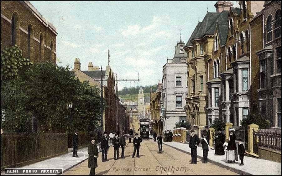
Railway Street, Chatham has been home to some longstanding businesses. One of them was Scott’s Timber Yard, established in 1864 and owned by Roy and Keith Scott.
The business had been bought out from the brothers on retirement by Sandell, Smythe and Drayson of Maidstone (Travis Perkins). The buildings on Railway Street burned down in the early 1980’s I understand. The Sir John Hawkins Flyovermade use of the site. Railway Street was cleaved in two. More details about the business and a lovely image of the Railway Street facade can be seen on the Kent History Forum site (click this link). Scott’s also had an entrance on the High Street. Local maps show the enormous footprint of the business behind the facades. Many local people I have talked to remember the business. It would be brilliant to hear more stories about it.
Medway Archives and Local Studies Centre have a wonderful series of GOAD maps, which contain the most detailed plans and annotations of building along Railway Street and Military Road. Each building is described via a detailed key reference. Scott’s Timber Yard is drawn is great detail and the scale of it’s site becomes very clear. The maps were produced originally for fire insurance purposes – hence the level of detail.
“Over a century of experience in expert tailoring of both naval and civilian outfits”.
It can’t really be a surprise that such a massive military and naval presence in Chatham was serviced by local outfitters. What is interesting is that so many of these had businesses on Military Road and Railway Street.
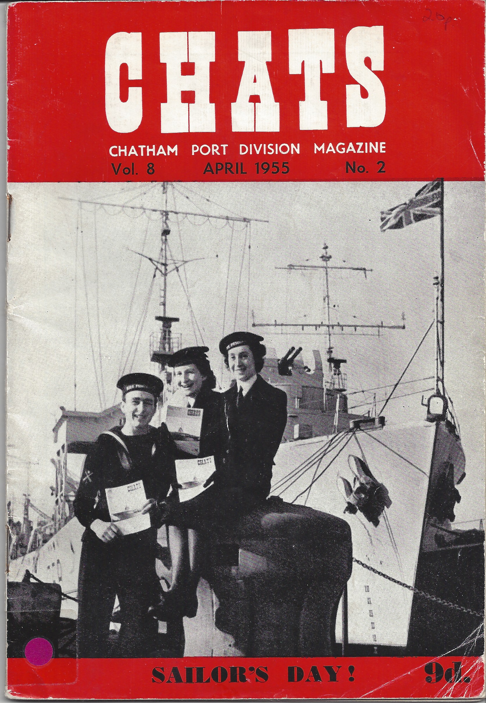
At the Medway Archives and Local Studies Centre, there is a collection of print magazines and periodicals. One of these is called CHATS – a magazine for the personnel of Chatham Port Division. An amazing selection of adverts for military and civilian outfitters are contained within – almost all of them along our route. I managed to find a copy to buy – Vol.8 April 1955 No. 2
CHATS – Chatham Port Division Magazine Vol. 8 April 1955 No.2. Collection of Christopher Tipping
Amongst some that I listed were –
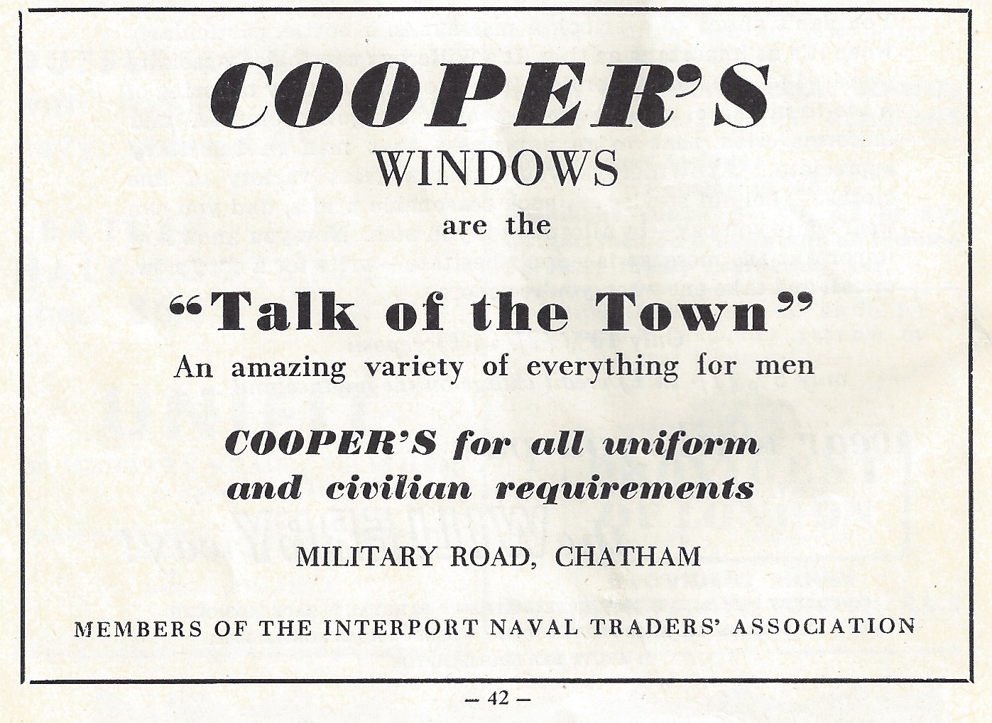
W.Cooper – ‘Cooperstyle’Regimental Blazers! 56 Military Road –
Gieves Ltd – 13 Military Road –
Unifit – 40 Military Road –
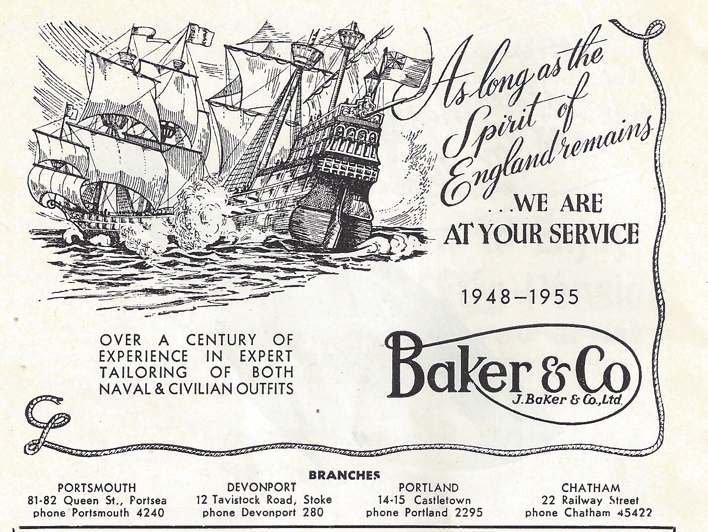
Baker & Co – 22 Railway Street – “As long as the Spirit of England Remains, we are at your service”.
A. Fleming & Co. Outfitters Ltd Contractors to the Admiralty– 15 Railway Street –
F & H Newcombe – Military, Naval and General Outfitters – Railway Street –
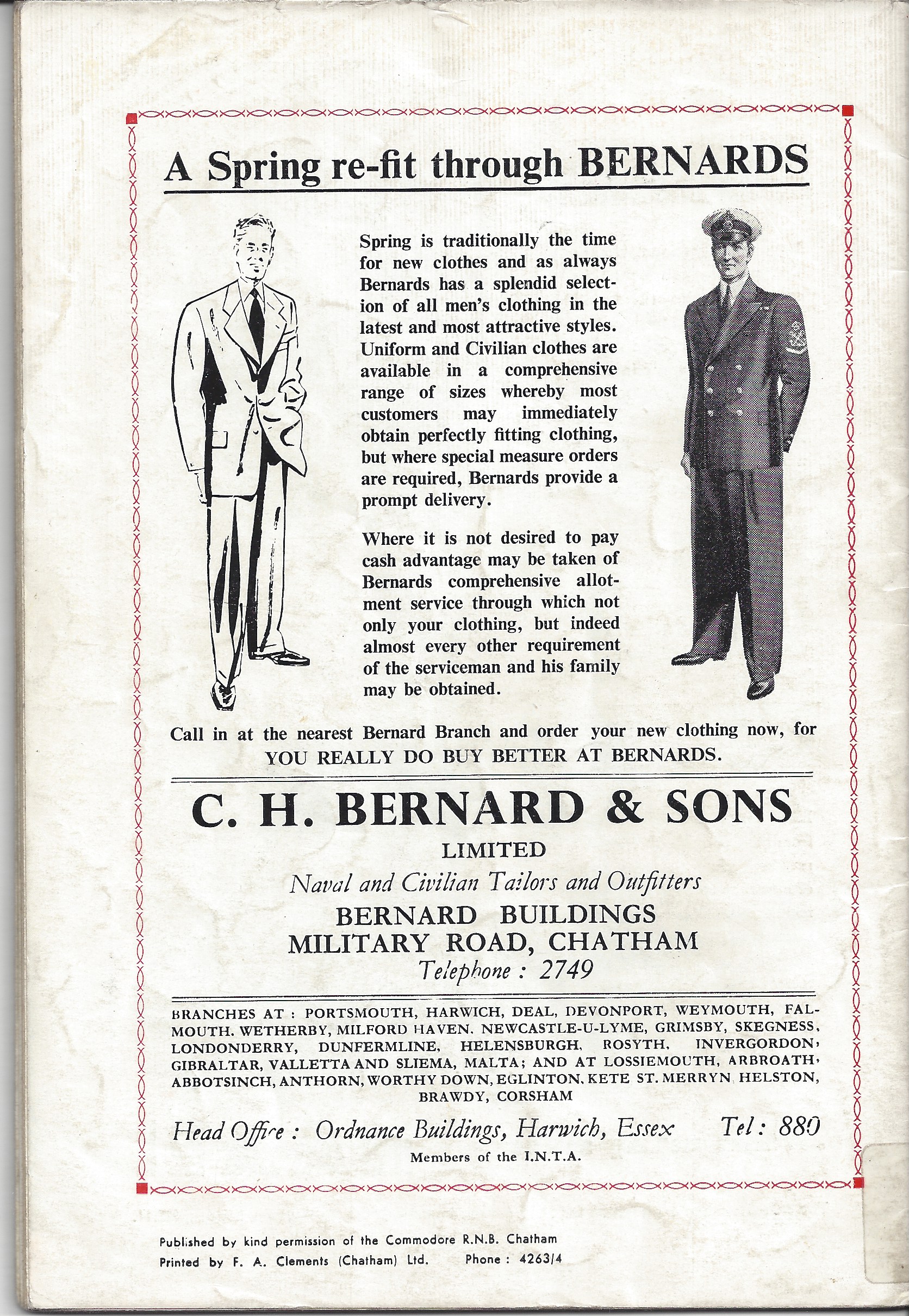
C.H Bernard & Sons – Bernard Buildings, Military Road –
Military Outfitters, Baker & Co. 22 Railway Street, Chatham. CHATS Magazine. Collection of Christopher TippingCoopers Windows are the Talk of the Town. CHATS Magazine Vol 8 April 1955 No 2. Collection fo Christopher TippingC.H Bernard & Sons Naval & Civilian Tailors and Outfitters. CHATS Magazine. Collection of Christopher Tipping
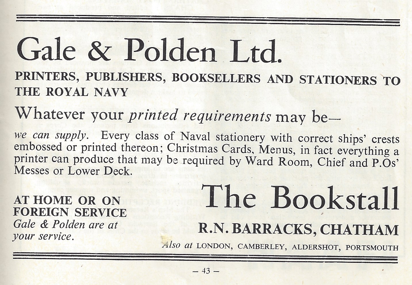
Also of interest was this advert for Gale & Polden Ltd. Printers, Publishers, Booksellers and Stationers to the Royal Navy – 121 High Street, Chatham.
Gale & Polden Ltd. Printers RN Barracks, Chatham. CHATS Magazine, Collection of Christopher Tipping
Printed materials are something of great interest to the project. Watch this space –
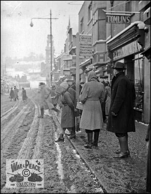
Actually, the images I have recently received permission to use from the collection of Rex Cadman, also feature in the Kent Photo Archive and I am grateful to Roy Moore for putting me in contact with him via his colleague Roger Smoothy. The War & Peace Collection contains a number of relevant images of our route in Chatham.
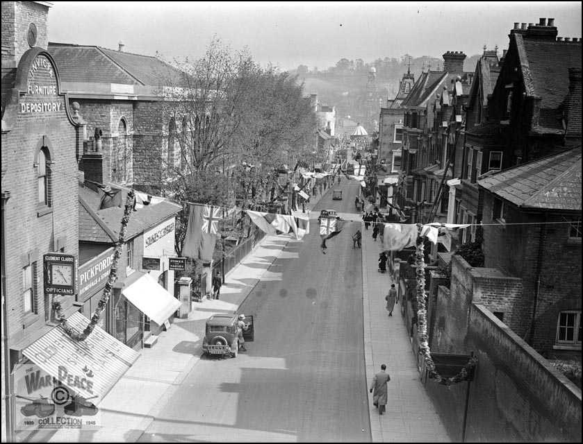
Railway Street from New Cut Viaduct circa 1955. Collection of Rex Cadman. by Permission of Rex Cadman and Kent Photo Archive.Railway Street from New Cut Viaduct date unknown. Collection of Rex Cadman. by Permission of Rex Cadman and Kent Photo Archive.
I love this image of Railway Street, with its celebratory flags, bunting and street decorations. I have no idea what the celebration is – but clearly a big event in the calendar for the town. Notice the fairground at the bottom of Military Street on The Paddock site. On the left can be seen the Invicta Furniture Depository and below it the clock and striped awning of the Opticians – I can make out the name Clements – will check this out via Kelly’s Street Directory.
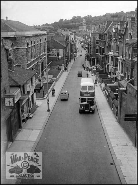
Bus Stop on Military Road Chatham. Collection of Rex Cadman. By permission of Rex Cadman and Kent Photo Archive.
All of the properties in the image above were demolished to build the Pentagon Shopping Centre and Mountbatten House.
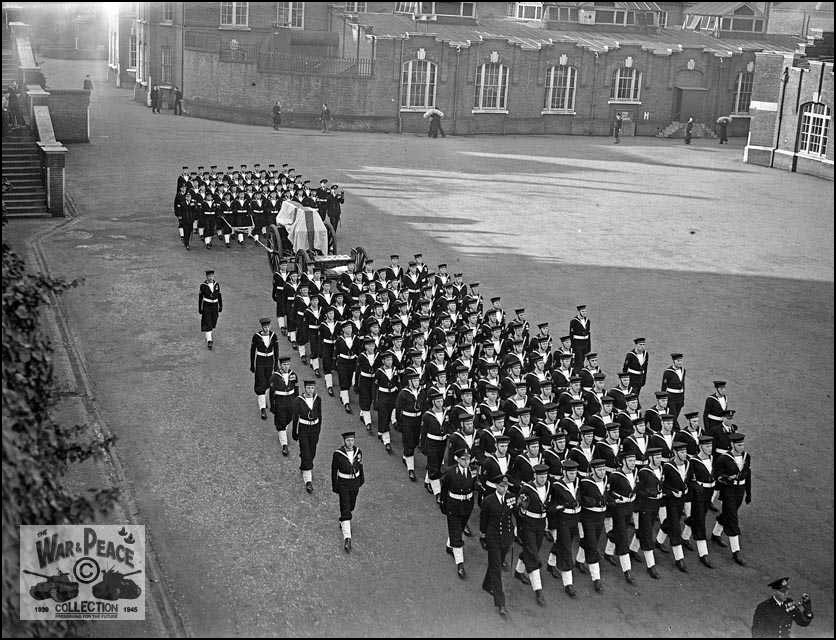
Naval Ratings rehearsing for the King George VI’s Funeral. HMS Pembroke, Chatham, Feb. 1952. Collection of Rex Cadman. By permission of Rex Cadman and Kent Photo Archive.
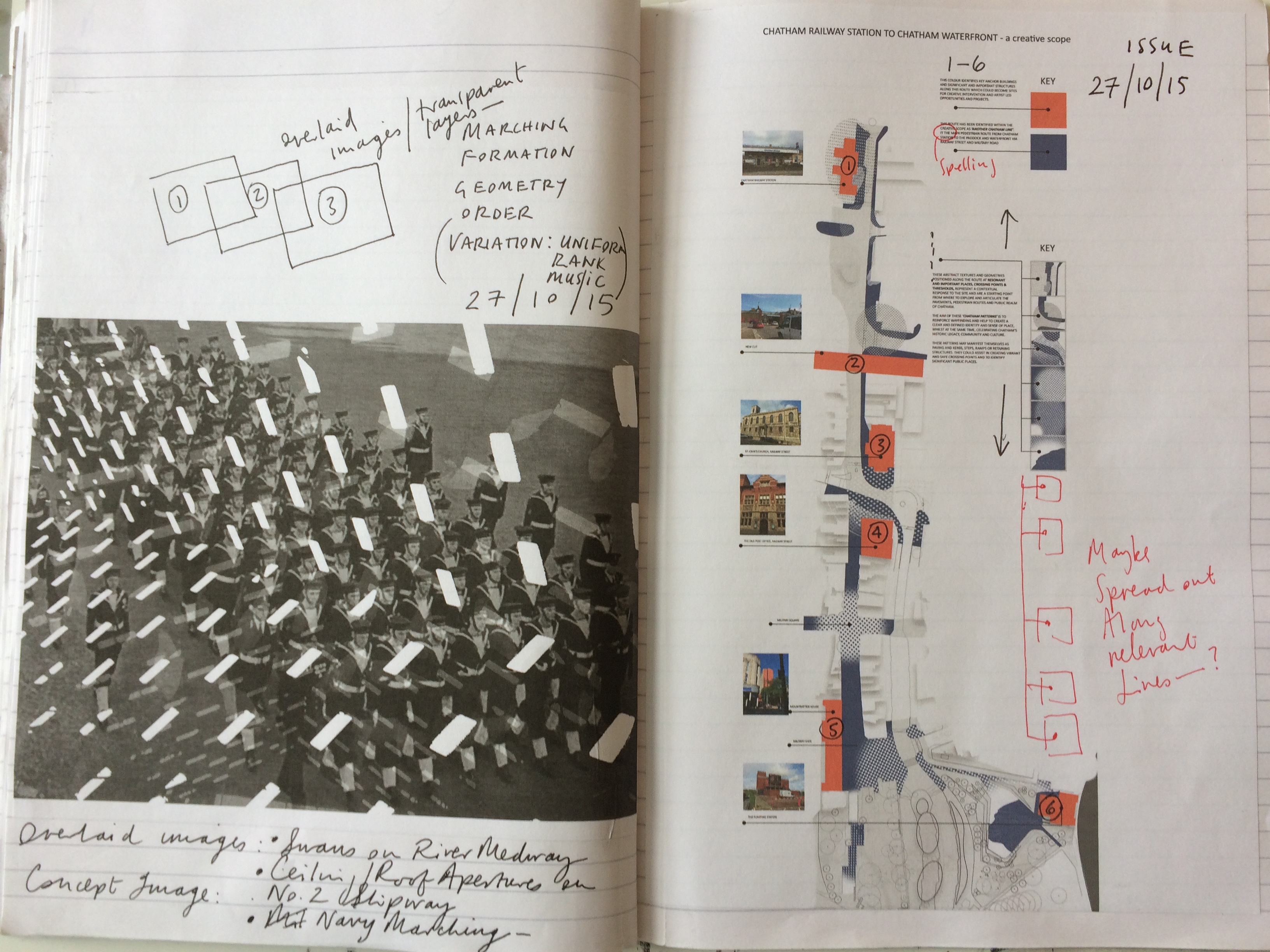
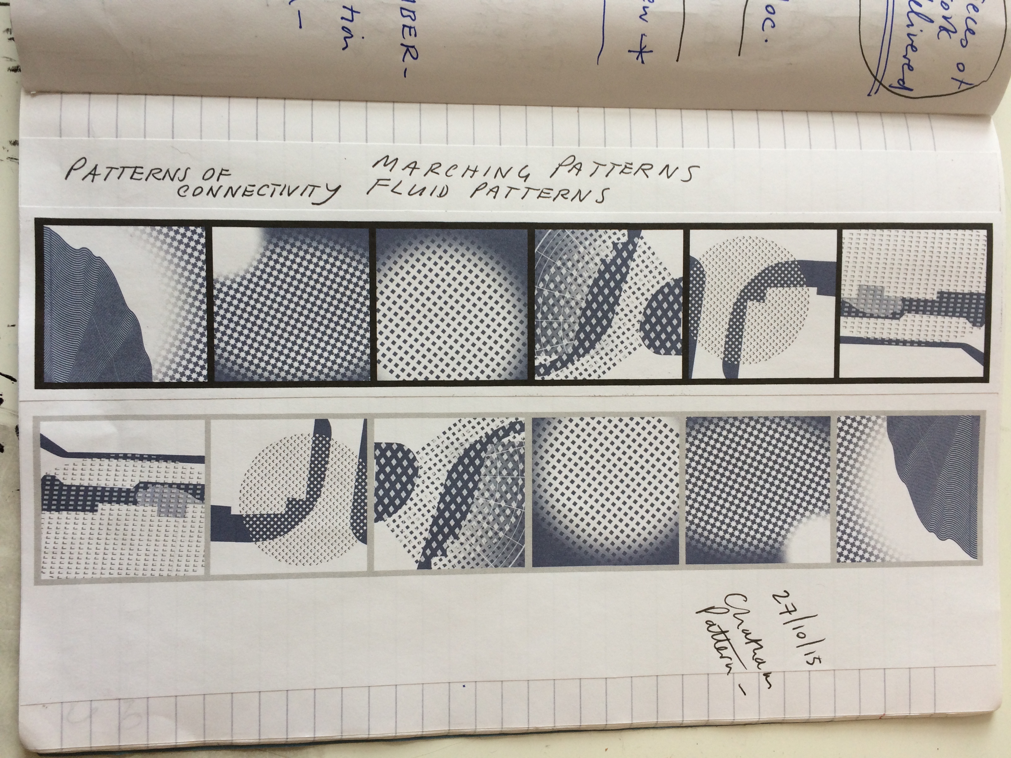
The underlying symmetry, formation, visual contrast and rhythm in this image has been an important influencing factor in the development of the ‘Chatham Patterns’ concept. Similar events and parades must have played out within the streets and public spaces of Chatham so many times, that the evidence is within the very fabric of place.
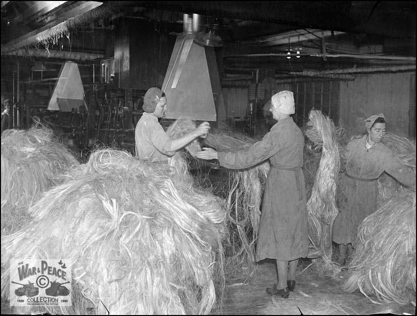
The Hatchelling House at the Ropery, Chatham Dockyards circa 1950’s. Collection of Rex Cadman. By permission of Rex Cadman and Kent Photo Archive.
I have been corresponding with Roy Moore for some time now. He has been an invaluable contact at The Kent Photo Archive.
He has allowed me to use some archive images of Chatham from his own collection and some contemporary images of his too.
Here are a few of these –
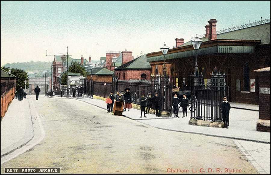
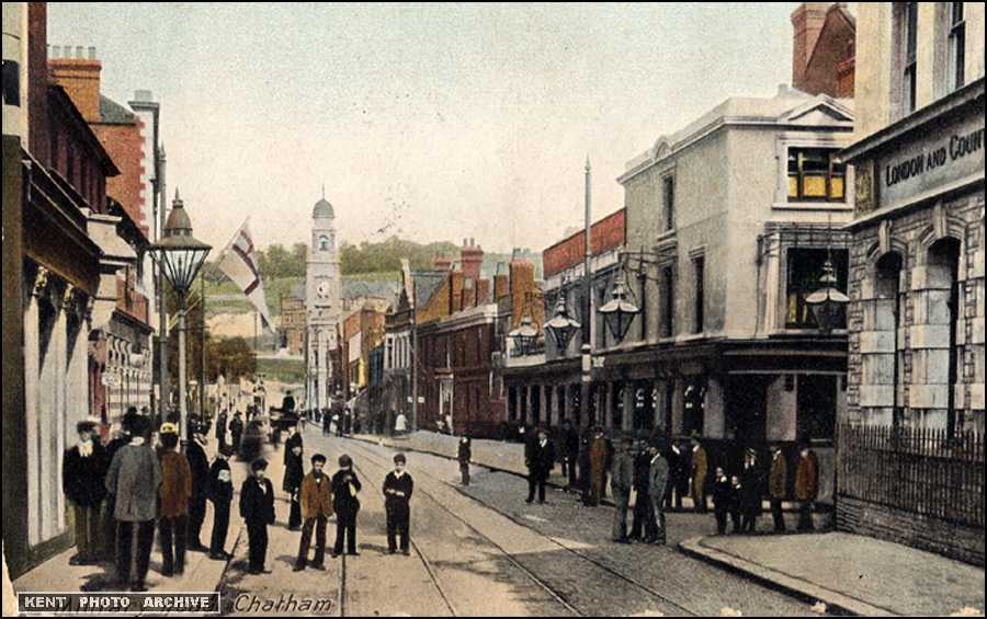
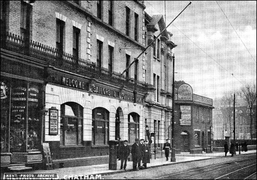
Chatham Railway Station date unknown. Image by permission of Kent Photo Archive. Collection of Roy MooreRailway Street, Chatham looking towards the Brook Theatre (formerly the Town Hall). Image by permission of Kent Photo Archive. Collection of Roy Moore.Railway Street, Chatham. Image by permission of Kent Photo Archive. Copyright Roy Moore.Railway Street, High Street, Military Road, Chatham, looking towards the Brook Theatre. By permission of Kent Photo Archive. Collection of Roy MooreSailors and Soldiers Welcome Home Establishment on Military Road, Chatham. By permission of Kent Photo Archive. Collection of Roy Moore.
It is said that this ‘Temperance’ establishment, built in 1877 providing accommodation and entertainment for Sailors and Soldiers, was built to help them avoid the ‘temptations’ available elsewhere in the Town.
It’s a while since I last posted on the project. My creative scope has now been submitted and contains a number of research-led works, including:
Site visits to Chatham, for the purposes of research and site analysis.
A review of local landmarks and key buildings, places and organisations –
Meetings with archivists –
A personal blog –
Pinterest Board of research images and aspirations –
A text based creative analysis made as a contribution to the Masterplan document being prepared by LDA
‘Another Chatham Line…’ – an illustrated creative scope pdf document –
Concept and diagrammatic drawings to accompany and illustrate the creative scope and concept approach –
The work submitted will be added into the supporting documents or as an appendix to the work. We will now be looking towards a public consultation exercise, which is scheduled for early December 2015.
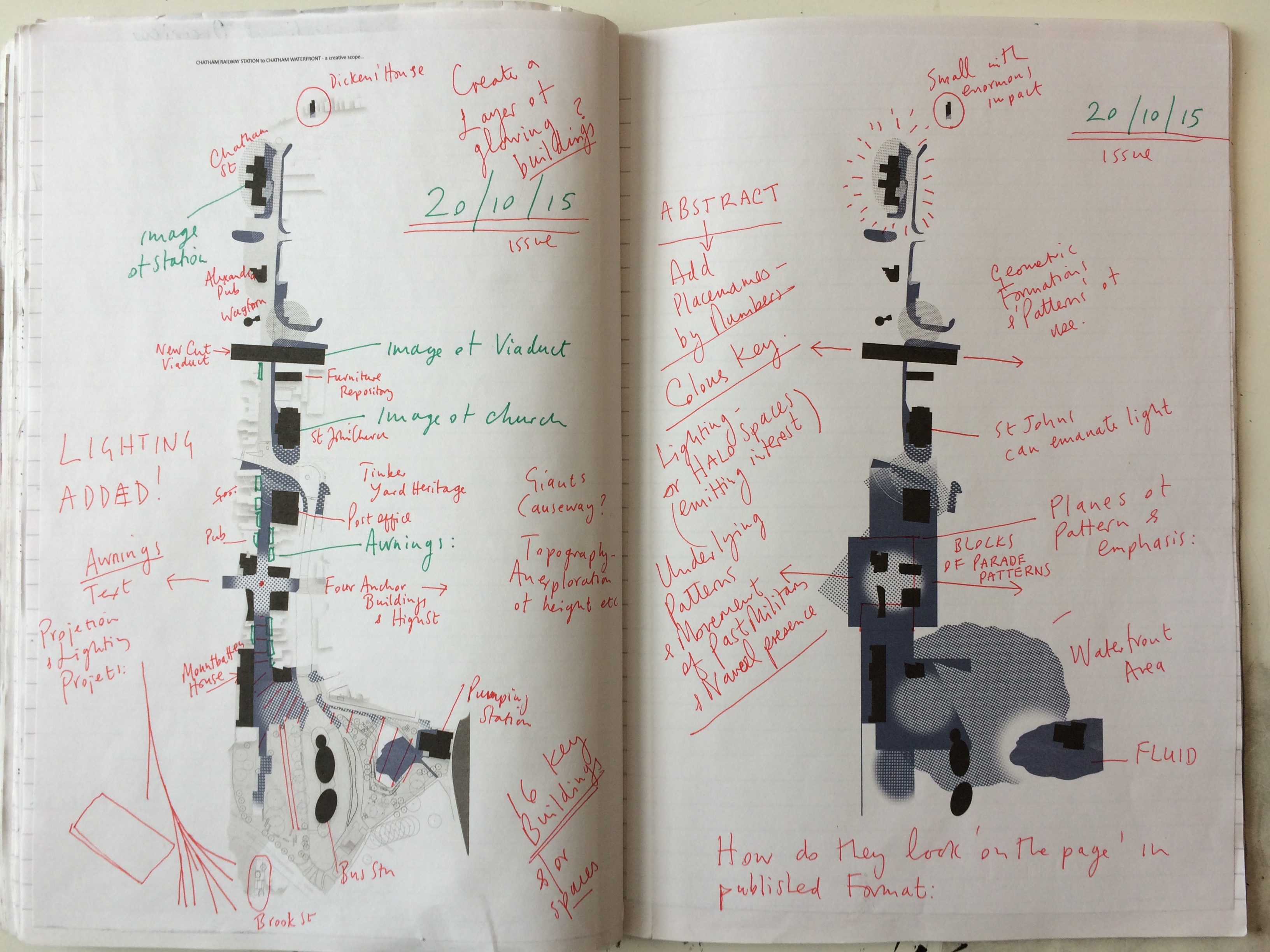
The following images are from draft artworks I have produced, exploring the idea of a thematic pedestrian route from Chatham Station to the Waterfront and The Paddock.
Chatham Creative Scope – artist sketchbook drafts. Image: Christopher TippingChatham Creative Scope – artist sketchbook drafts. Image: Christopher TippingChatham Creative Scope – artist sketchbook drafts. Image: Christopher TippingChatham Creative Scope – artist sketchbook drafts. Image: Christopher TippingChatham Creative Scope – artist sketchbook drafts. Image: Christopher Tipping
I had an appointment to meet the archivist at MALSC to review their photographic collection – particularly in regard to Railway Street and Military Street. I took a number of digital images from old photographs, but will require permission to post them on the blog. Hopefully, I can do this in due course.
Old OS Maps of the area were of particular interest as these obviously mapped out – some in great detail – large areas of the site where building had been lost during ‘development’ and / or razed to the ground by fire or neglect. Again – watch this space as i hope to post these images too.
Of particular interest were the OS 1848 Board of Health Map and the 1843 Tithe Map.
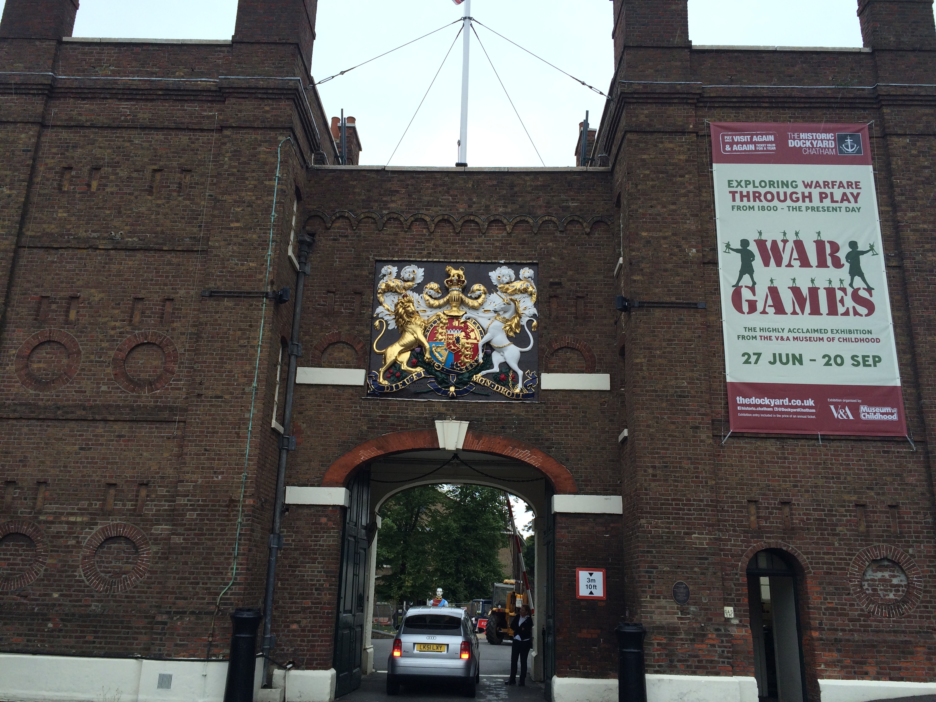
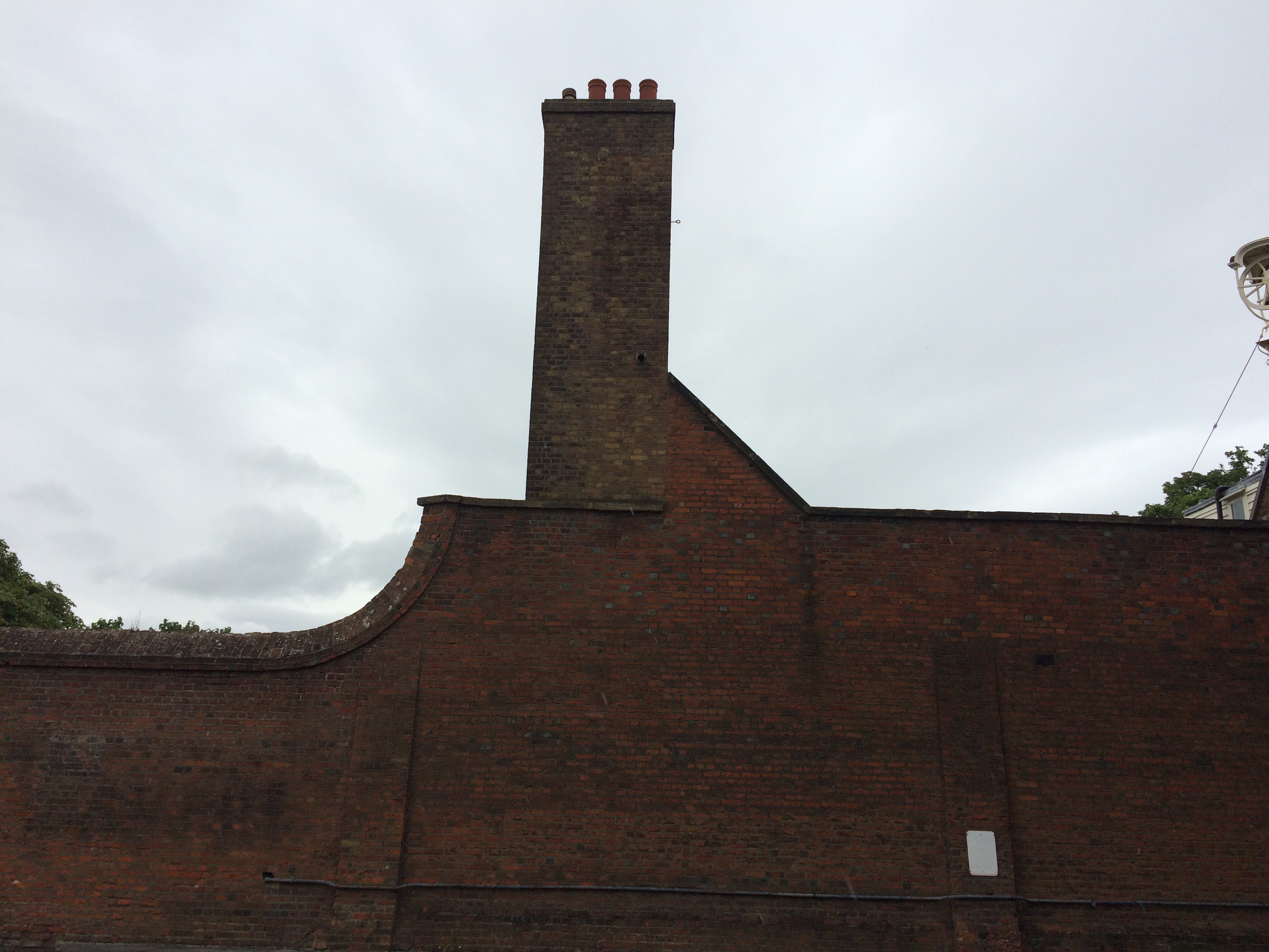
A long day of walking streets in Chatham, trying to understand how it all works – I finally made my way along Dock Rd, past Medway Councilbuildings at Gun Wharfand St Mary’s Church, where Pepys and Dickens both worshipped; past Fort Amherst – to The Historic Dockyard.
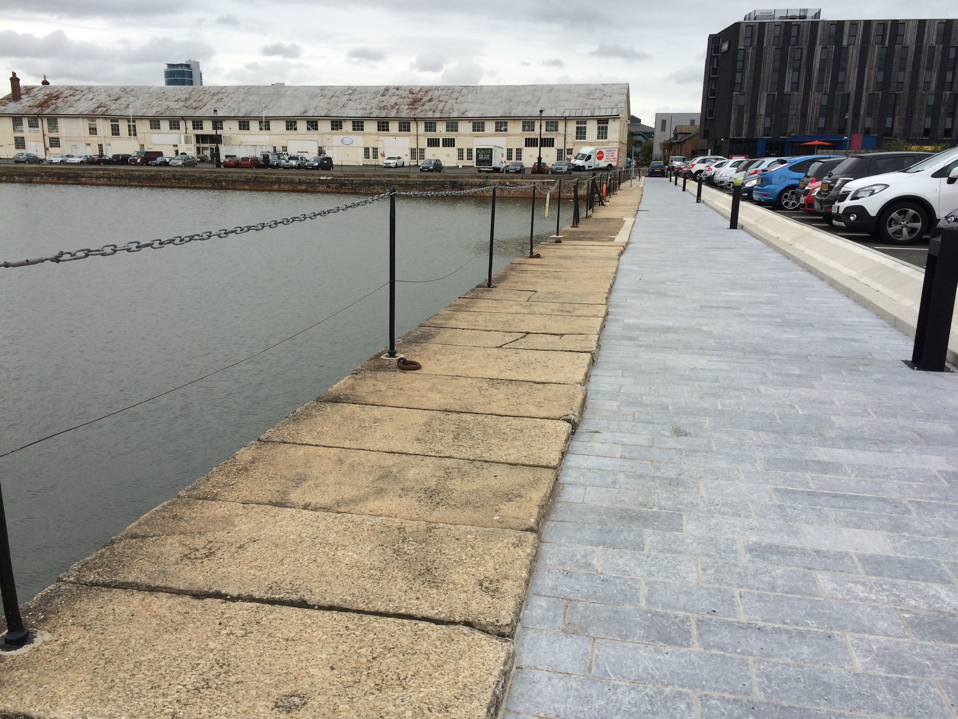
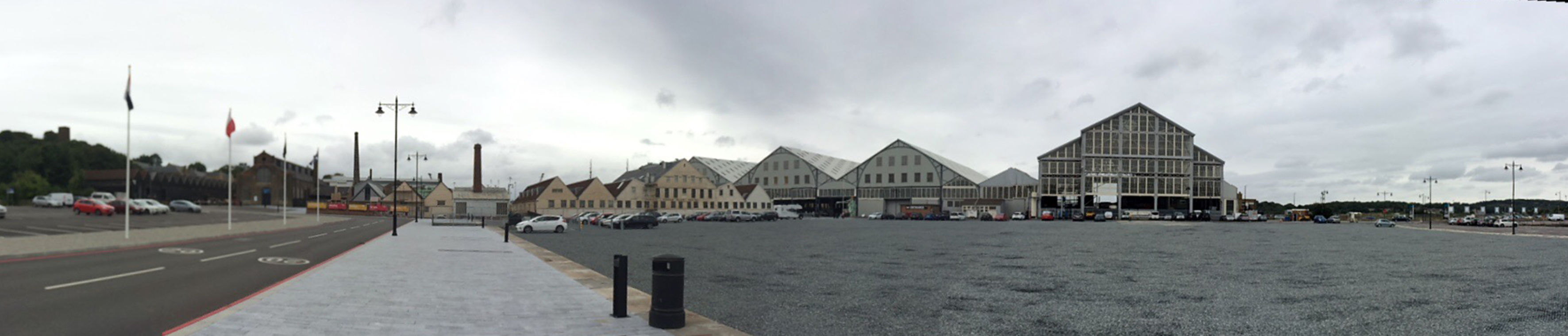
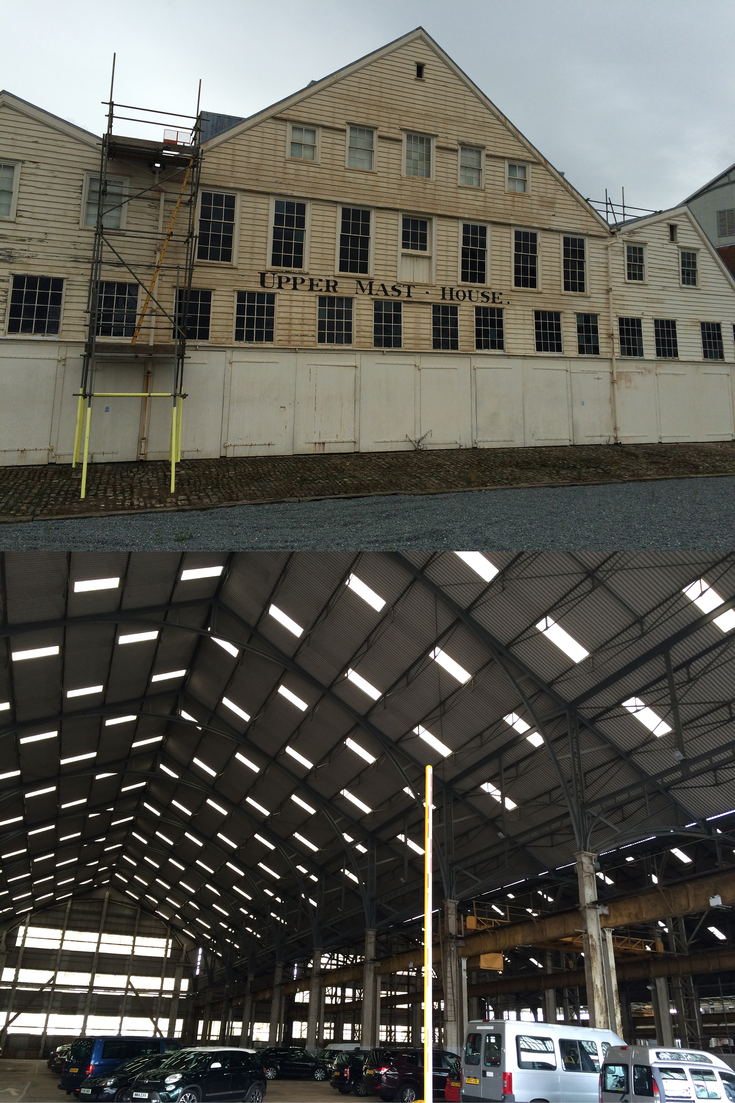
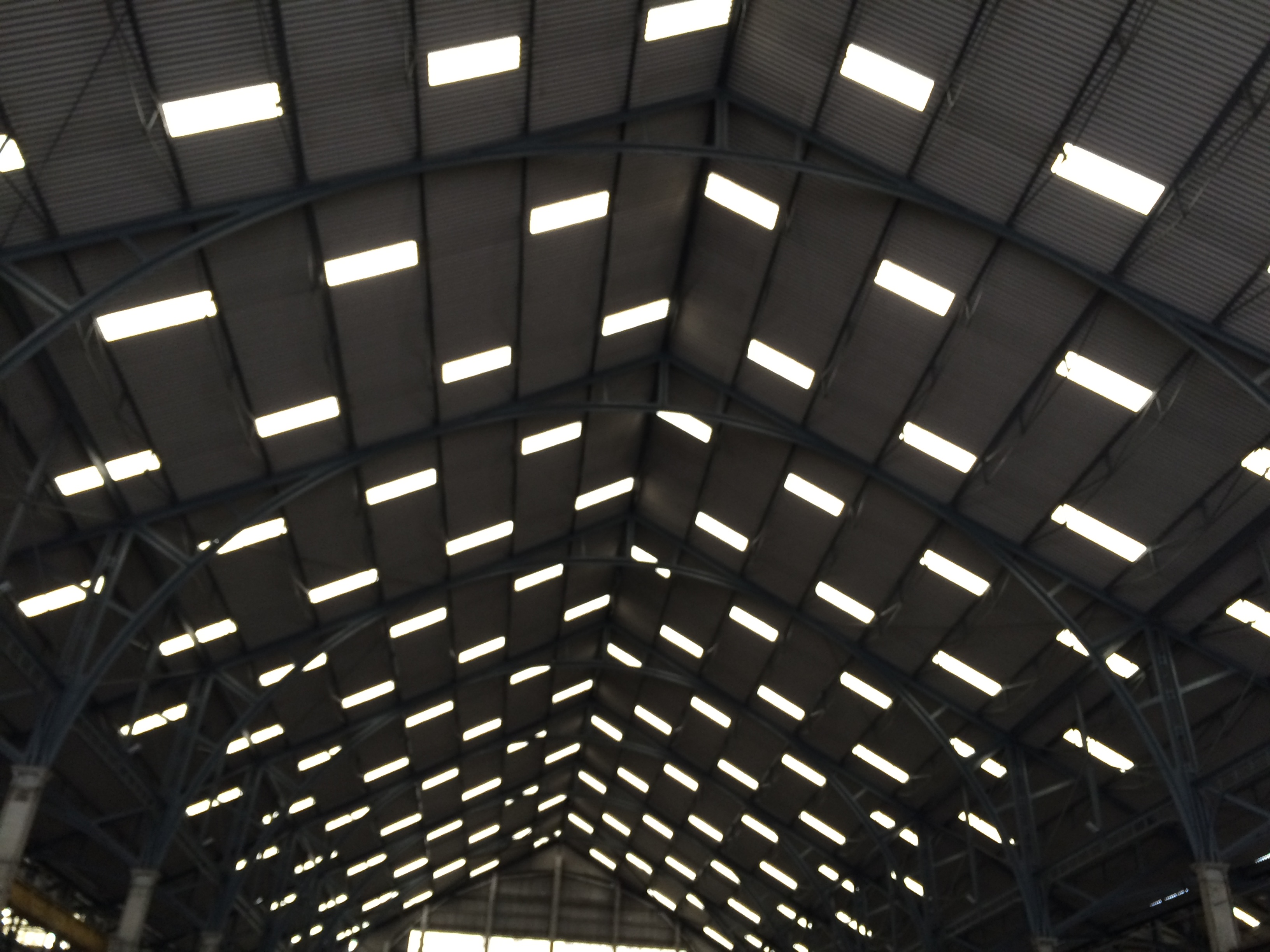
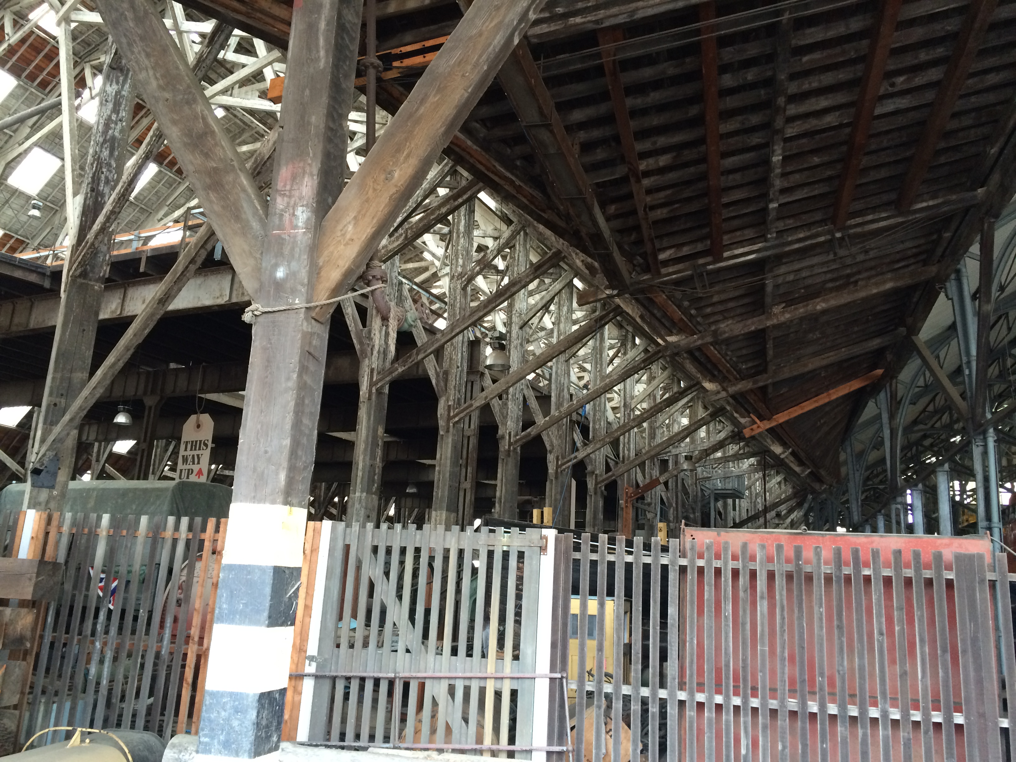
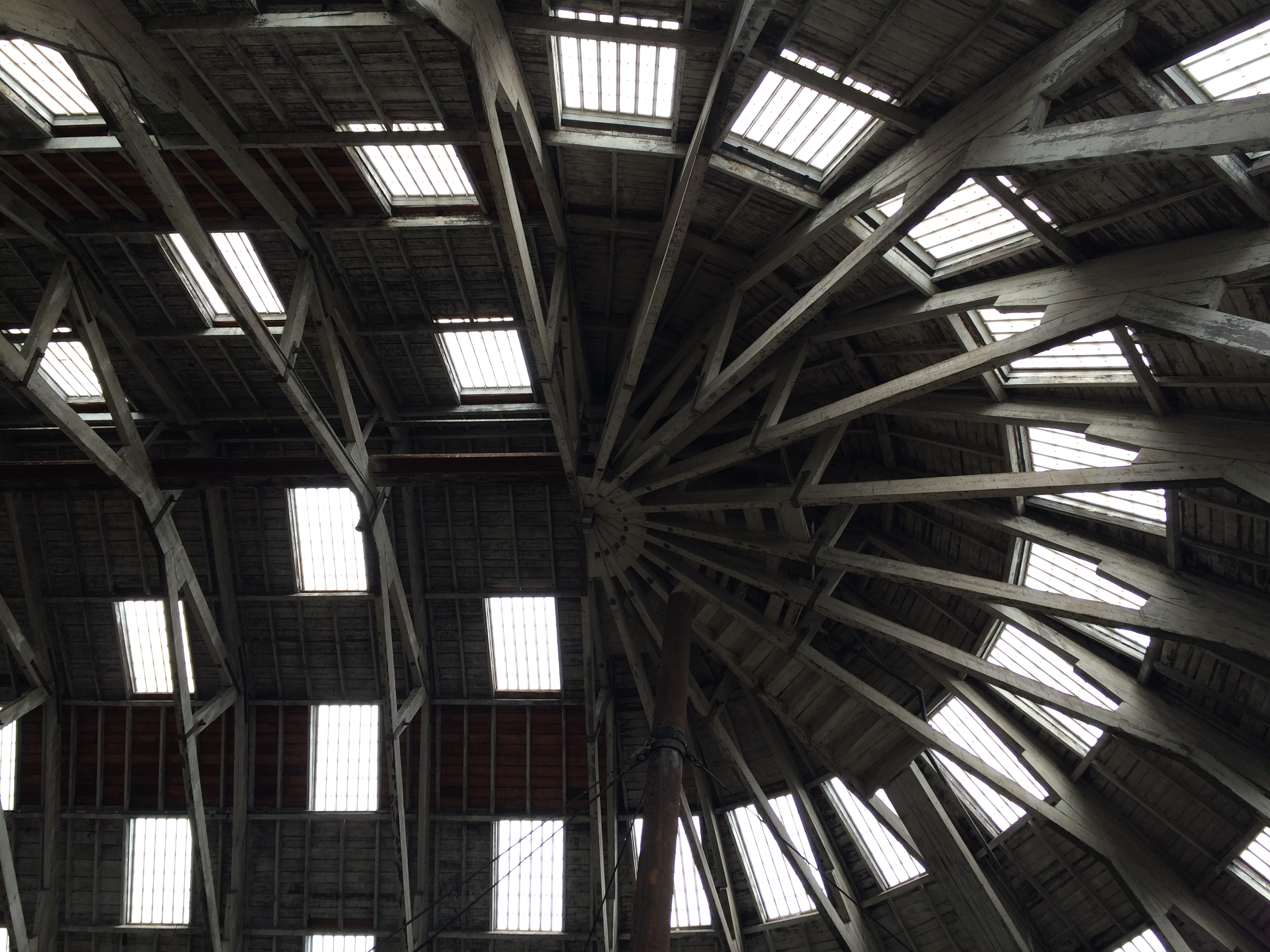
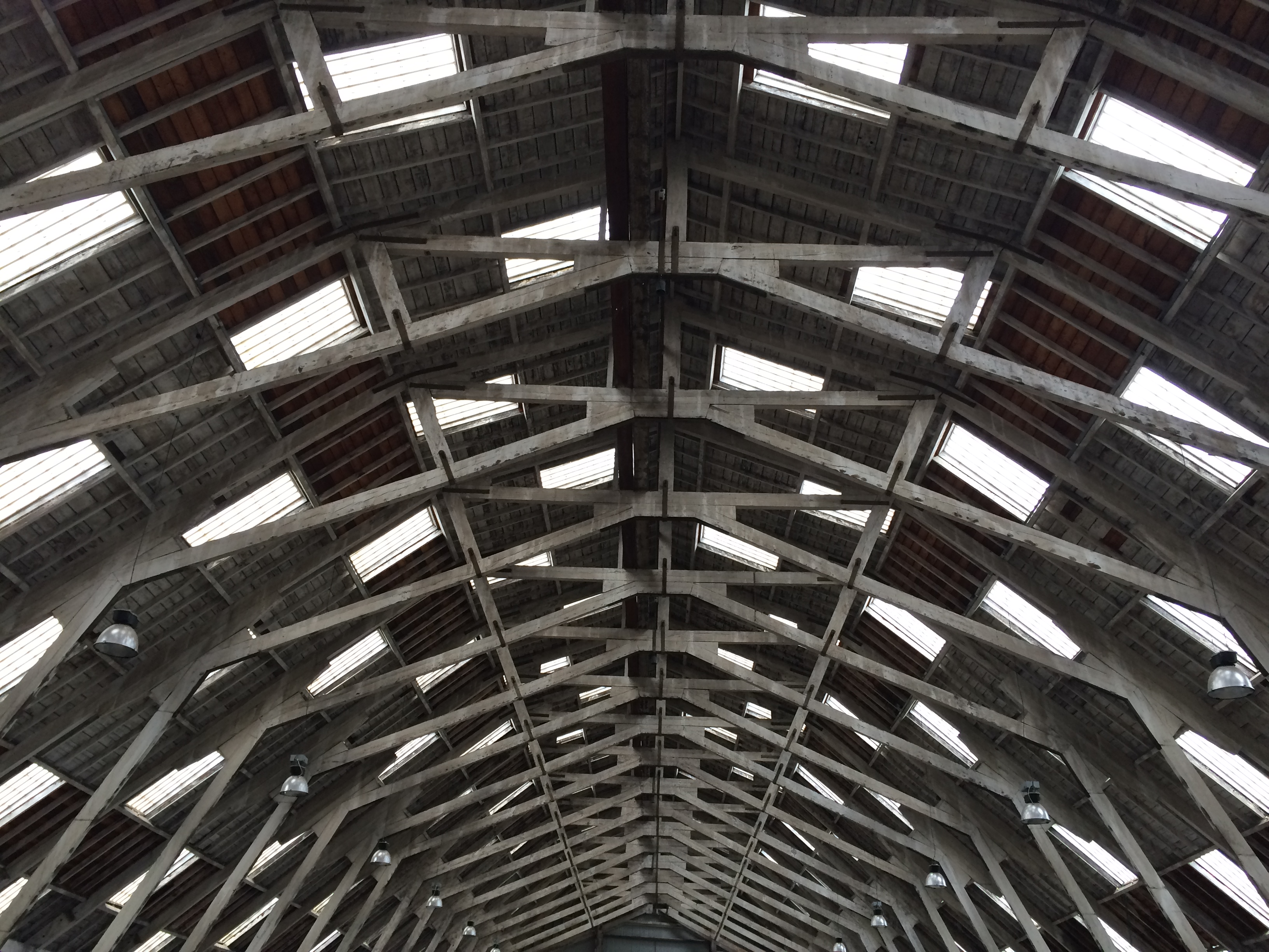
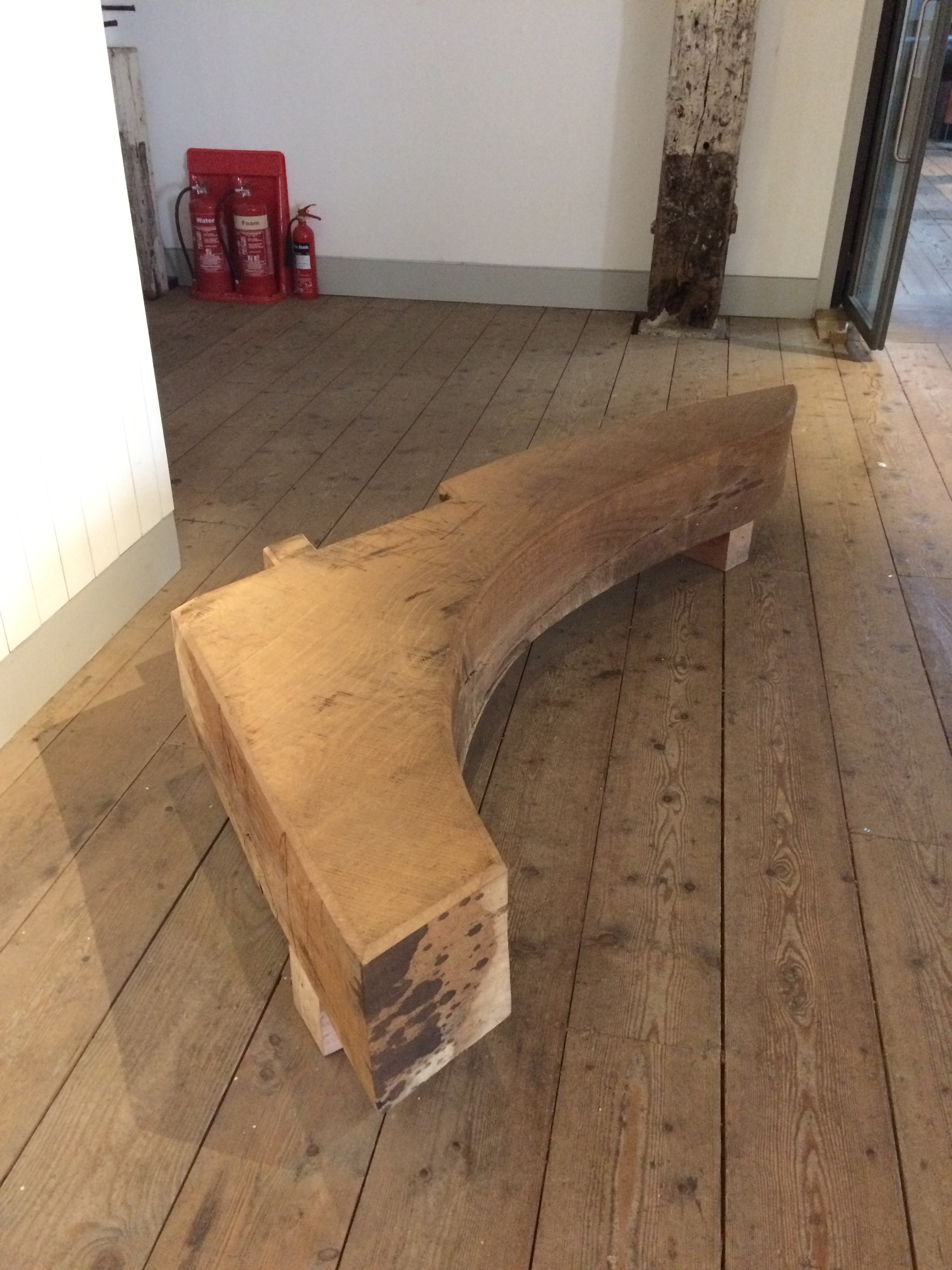
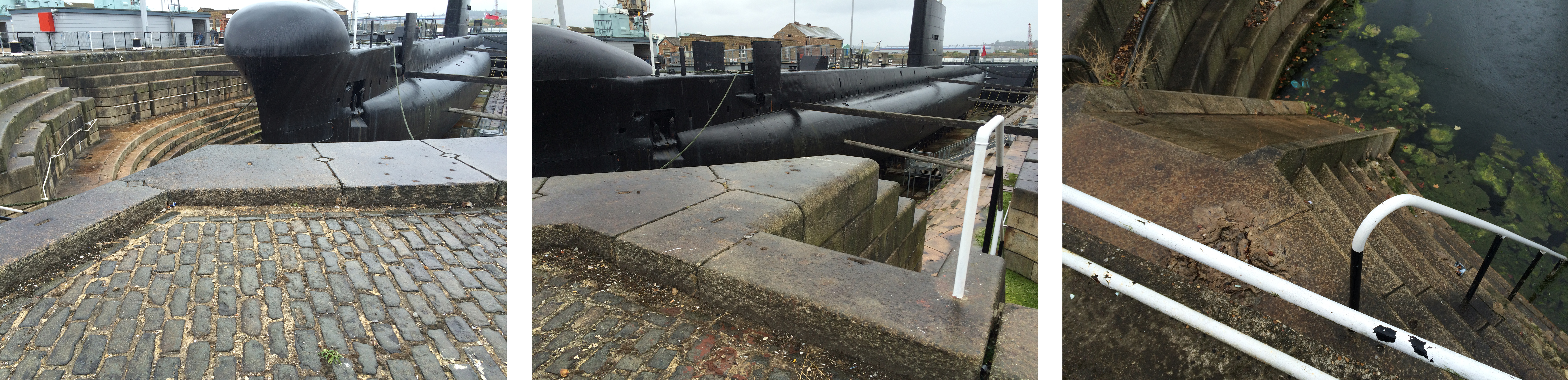
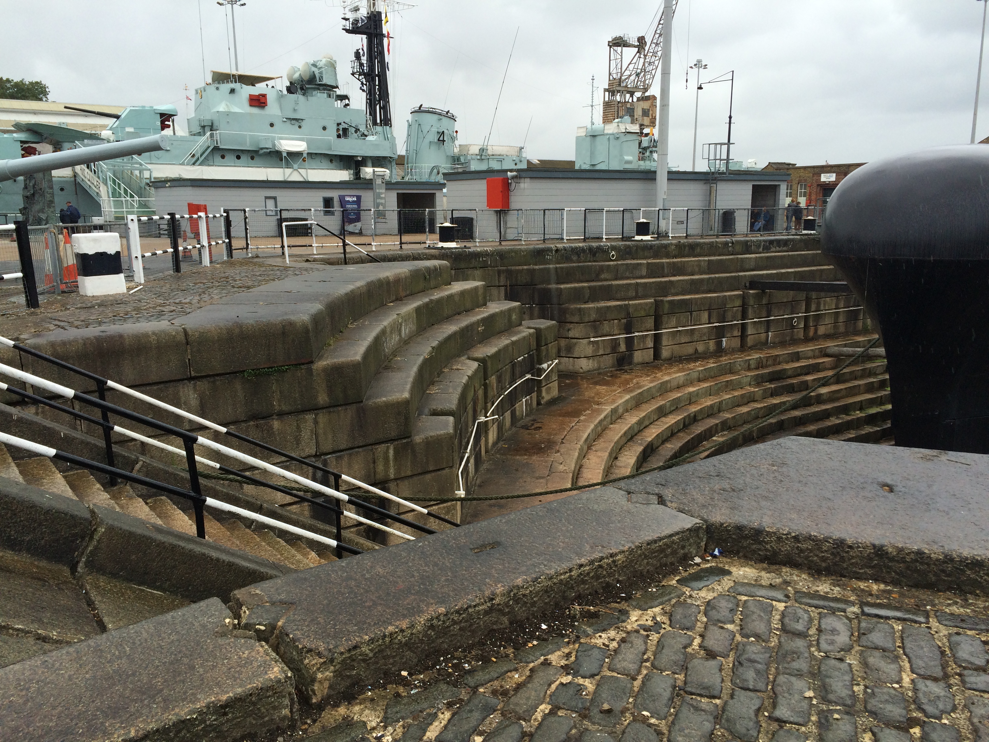
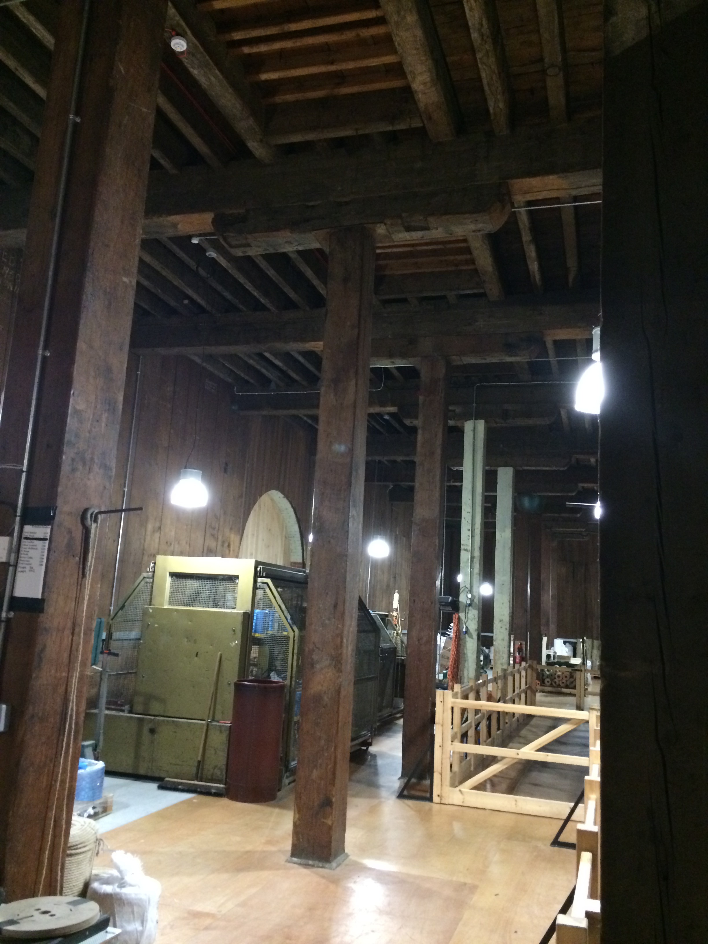
Historic Dockyards, Chatham – Georgian brickwork of the main gateway entrance. Image:Christopher TippingHistoric Dockyards, Chatham – The imposing and very long brick perimeter wall along Dock Road. Image:Christopher TippingHistoric Dockyards, Chatham – The imposing and very long brick perimeter wall along Dock Road. Image:Christopher TippingHistoric Dockyards, Chatham – the massive extant granite coping stones along the edge of Mast Dock. Image:Christopher TippingHistoric Dockyards, Chatham – The scale of the original Dockyard architecture is so impressive. Image:Christopher TippingHistoric Dockyards, Chatham – The geometry and pattern within the buildings are evident in structure and light. Image:Christopher TippingHistoric Dockyards, Chatham – The internal roof of the slipway buildings is really something to behold ! Image:Christopher TippingHistoric Dockyards, Chatham – The massive structural timbers of the No 2 Slipway building. Image:Christopher TippingHistoric Dockyards, Chatham – the roof apertures & timbers of the No 2 Slipway building create wonderful geometry and rhythms. Image:Christopher TippingHistoric Dockyards, Chatham – the roof apertures & timbers of the No 2 Slipway building create wonderful geometry and rhythms. Image:Christopher TippingHistoric Dockyards, Chatham – the early oak timbers were part of what were revered as ‘Chatham Timbers’ – Impressive forms with considerable interpretive merit. Image:Christopher TippingHistoric Dockyards, Chatham – the massive bespoke granite forms which make up the dry docks are particularly impressive. Image:Christopher Tipping
Historic Dockyards, Chatham – the massive bespoke granite forms which make up the dry docks are particularly impressive. Image:Christopher Tipping
Material use within the Historic Dockyards is often massive in form, frugal in detail and places enormous emphasis on function and being ‘fit for purpose’. This robust, economic and honest use of material and form is influential and informative and should be used as a template and contextual influence within the regeneration of the Town Centre of Chatham.
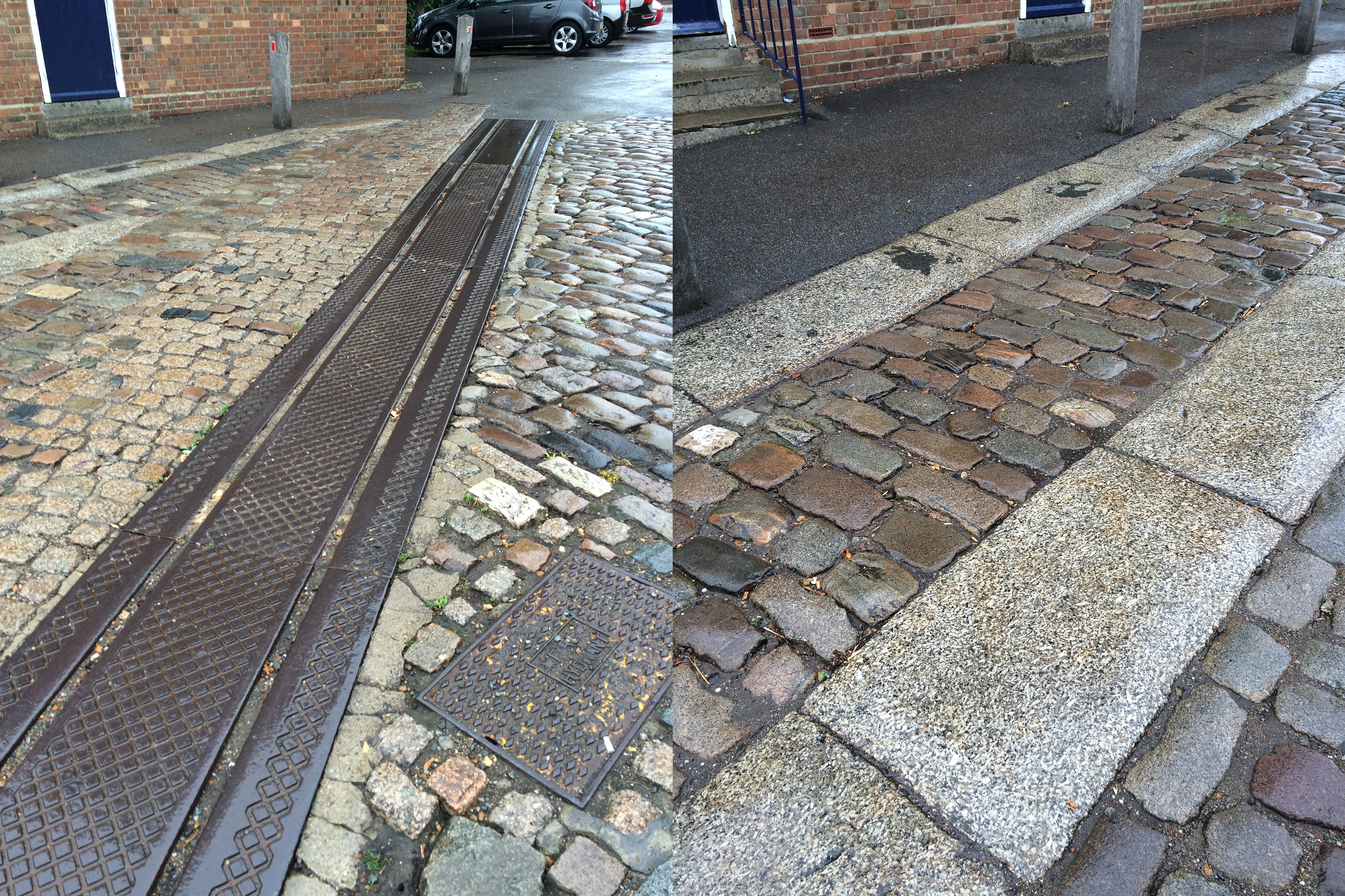
Historic Dockyards, Chatham – the bespoke granite paving forms and trackways which criss cross the site conjure up the legacy of movement and industrious activity of the dockyard. Image:Christopher Tipping
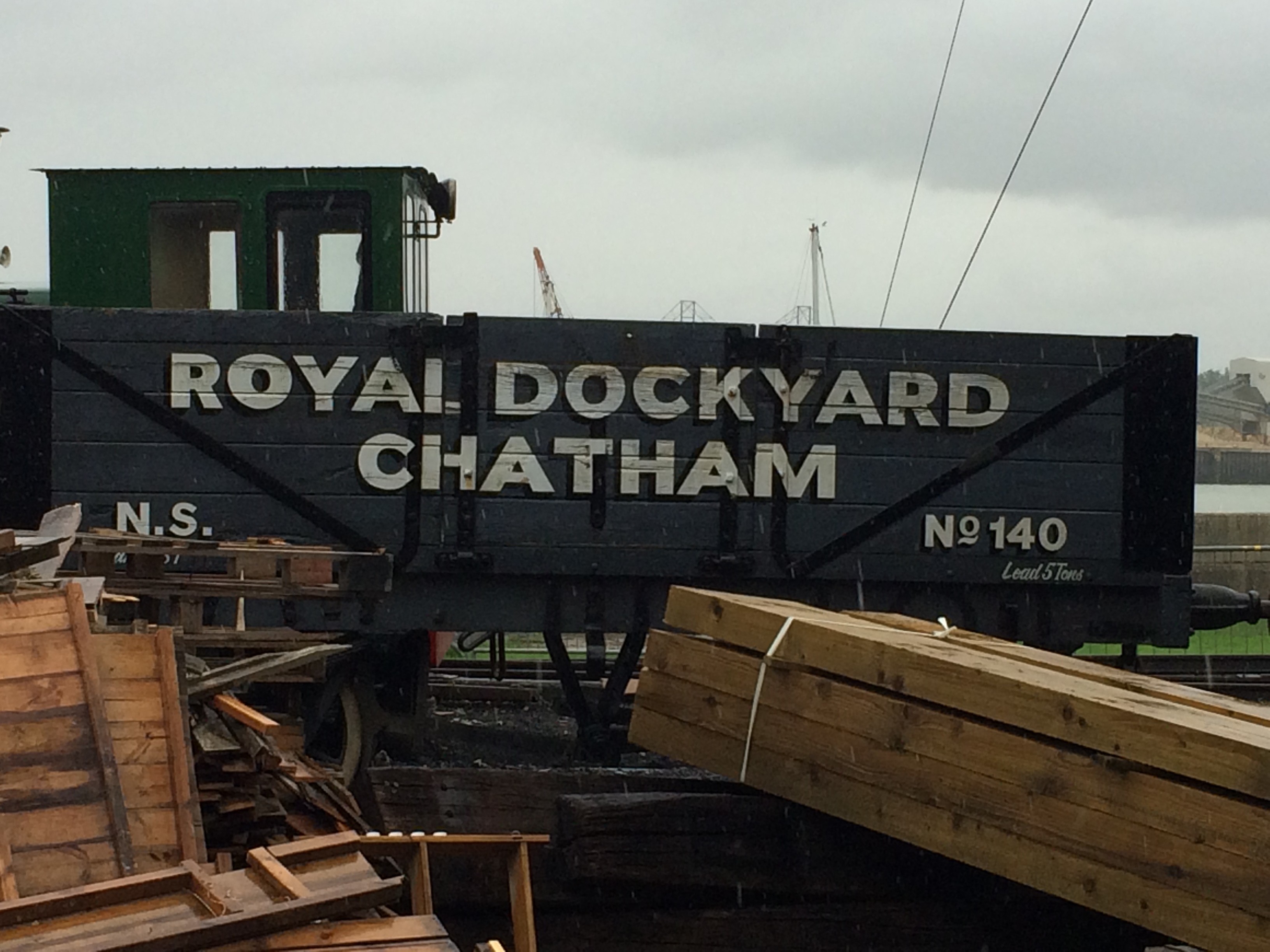
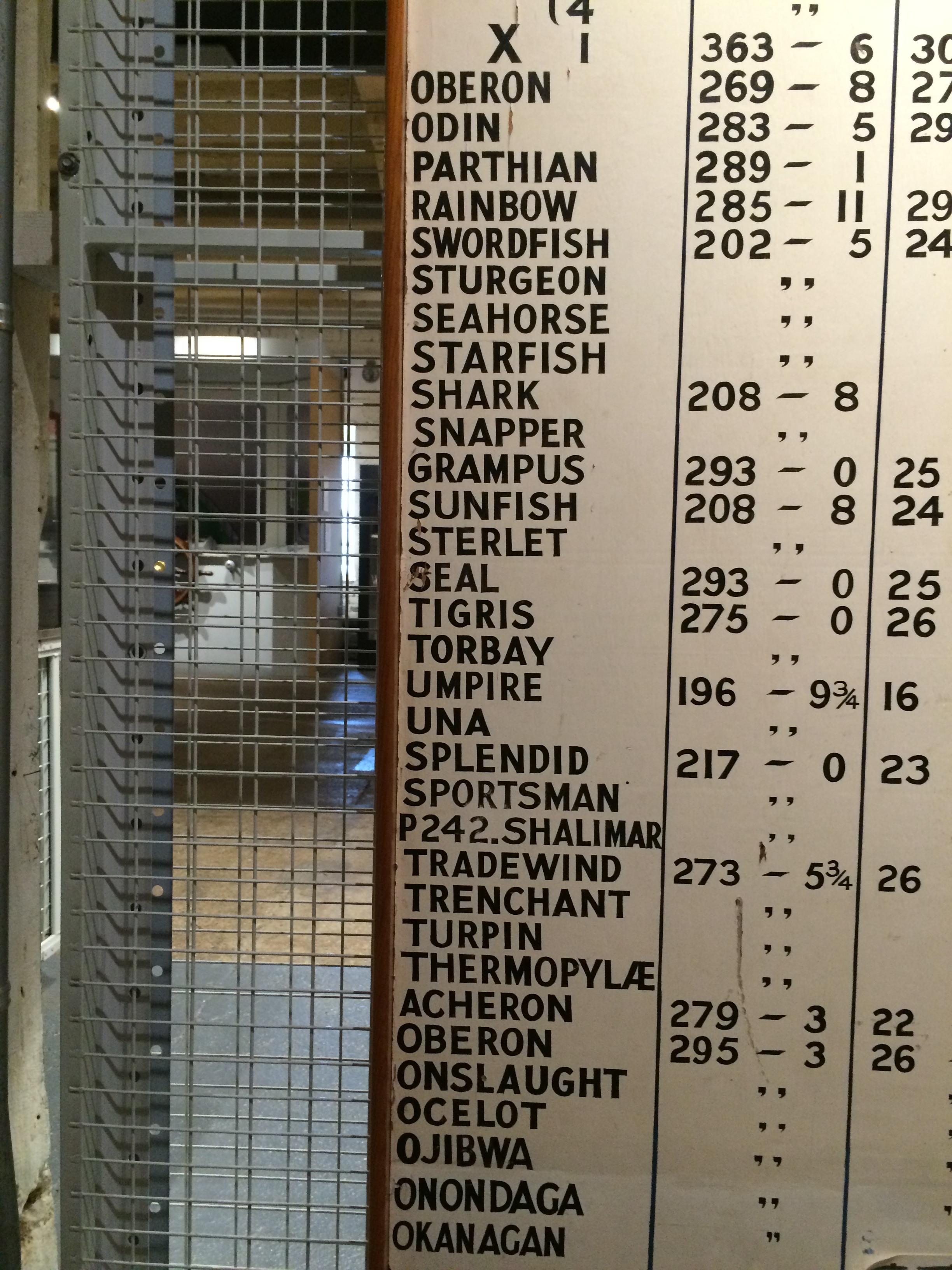
Historic Dockyards, Chatham – Dockyard Trains with great text – Image:Christopher TippingHistoric Dockyards, Chatham – List of submarines built in Chatham Docks. Image:Christopher TippingHistoric Dockyards, Chatham – the interiors of some of the buildings on site are immensely evocative and full of abstract forms. Image:Christopher TippingHistoric Dockyards, Chatham – the interiors of some of the buildings on site are immensely evocative and full of abstract forms. Image:Christopher TippingHistoric Dockyards, Chatham – the interiors of some of the buildings on site are immensely evocative and full of abstract forms. Image:Christopher TippingHistoric Dockyards, Chatham – the interiors of some of the buildings on site are immensely evocative and full of abstract forms. Image:Christopher Tipping
In early August this year I was commissioned by FrancisKnight Art Consultants and Medway Council to identify and scope creative public realm opportunities within the strategic Chatham Placemaking Project, which is being delivered by LDA Design.
“FrancisKnight have been appointed to work with LDA DESIGN and Medway Council on the Chatham Placemaking Project and in particular producing a creative public realm strategy to enhance the proposals and to add a sense of place and purpose to the spaces.
At the heart of the Thames Gateway, only 30 miles from central London, Medway is the largest conurbation between the capital and continental Europe. A modern place with green spaces and a superb quality of life, close to breathtaking countryside, the area has a young and culturally diverse population.
Chatham is located at the heart of Medway, with a population of 264,900 people living in the urban area in 2013. The area is world famous for its historic naval dockyard, and has also been a strategic centre for trade”.
This is a short term consultancy for me, which focuses particularly on the pedestrian route between Chatham Railway Station and The Waterfront, Chatham, via Railway Street and Military Road. This route leads on towards the Historic Dockyard Chatham – which is the subject of a World Heritage Bid –
I had up till this point never been to Chatham! I know of Chatham via Dickens and Pepys – as well as having looked at the Historic Dockyards online ! I have passed through the Medway Townsmany times on the train between Ramsgate and London, which does not really help frame a complete & honest image of the town.
This is a small sample of the visual record I made of my first visit in response to the project brief –
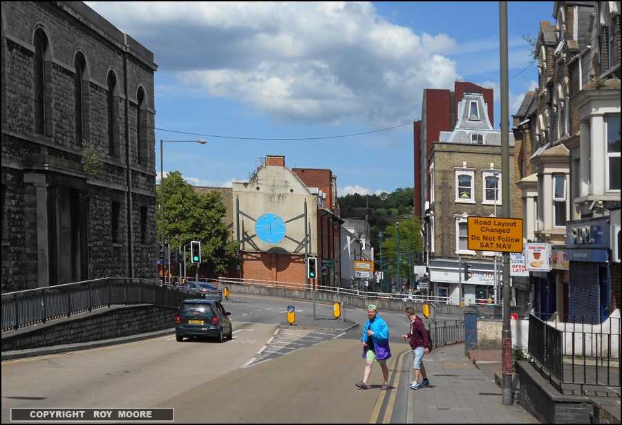
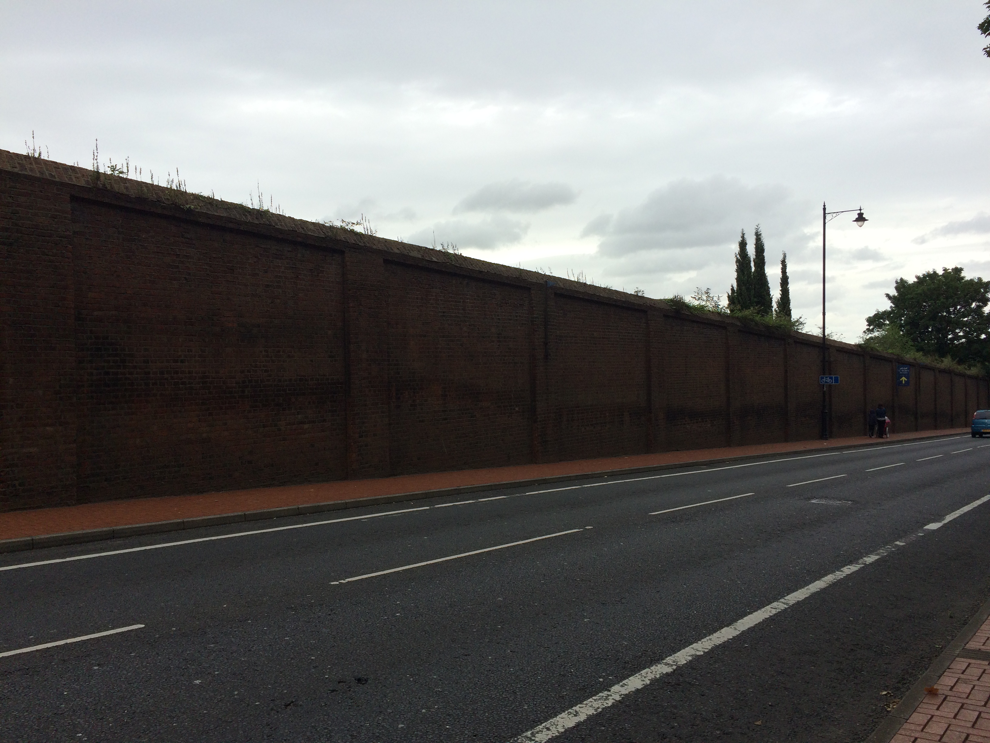
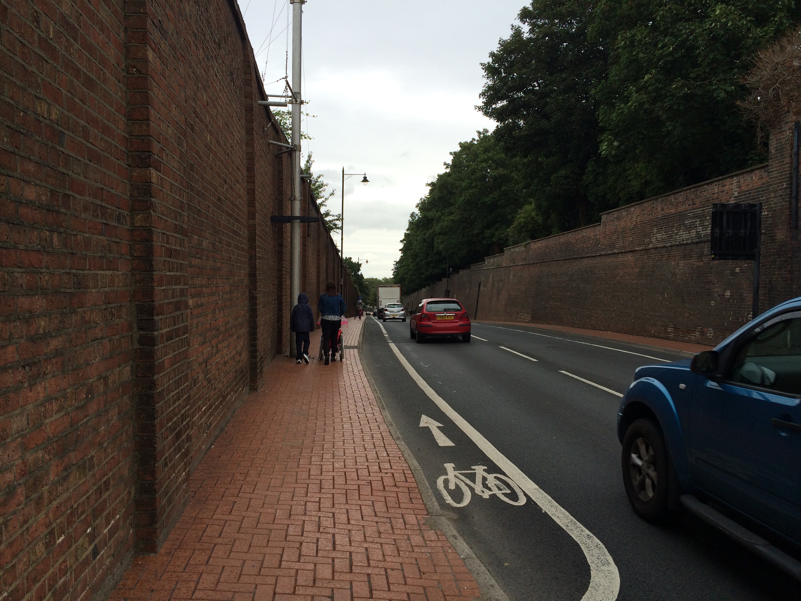
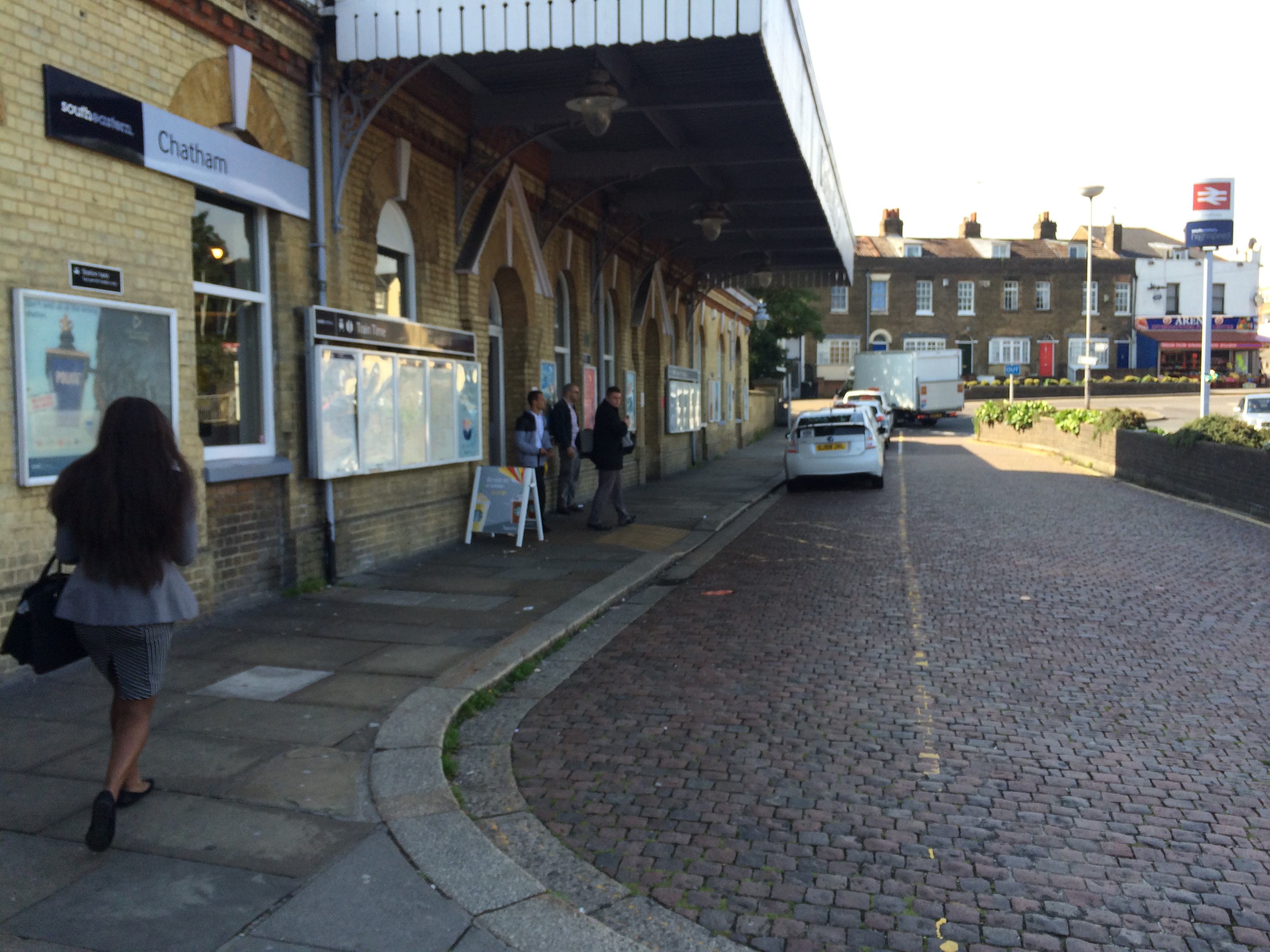
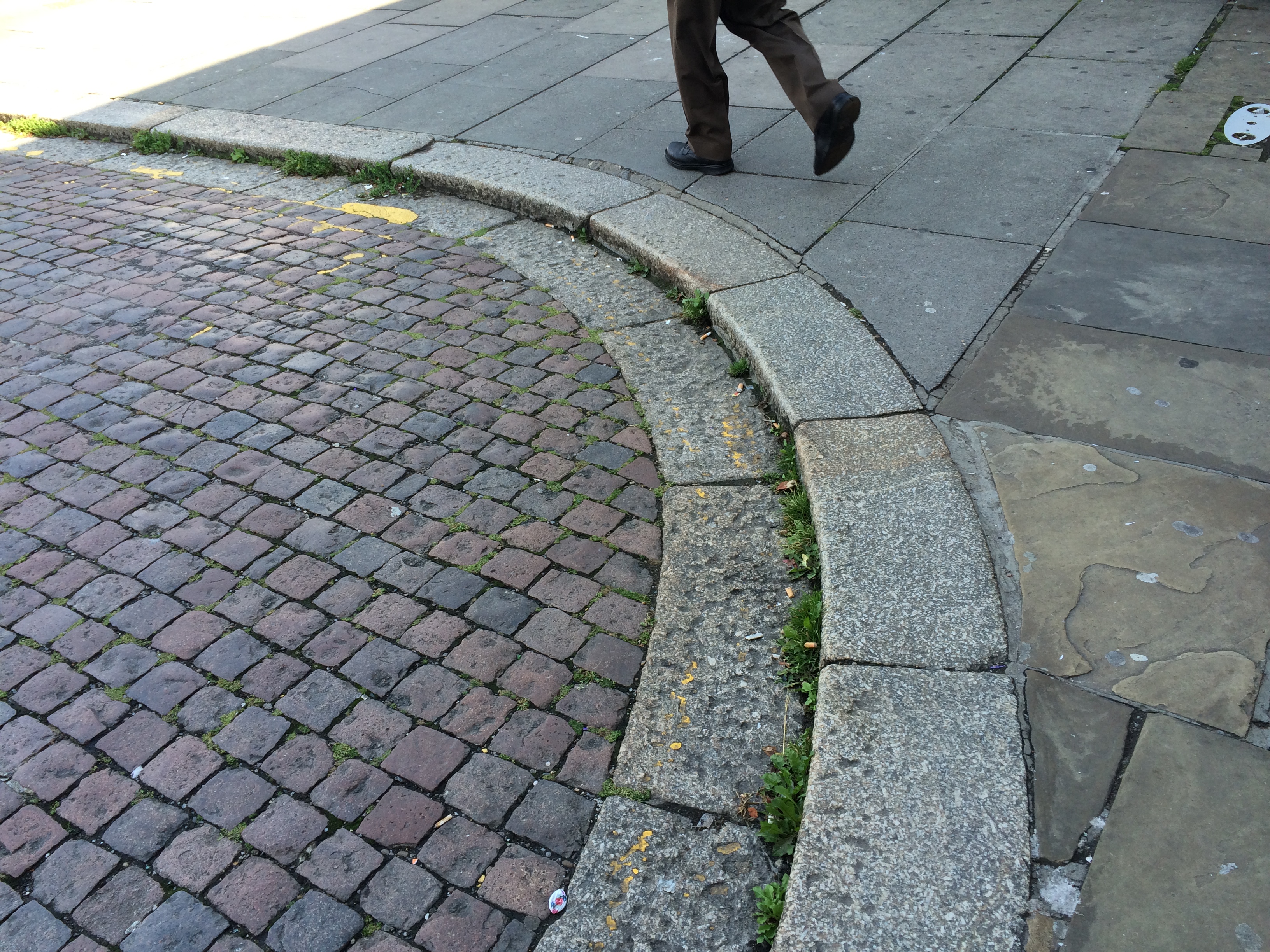
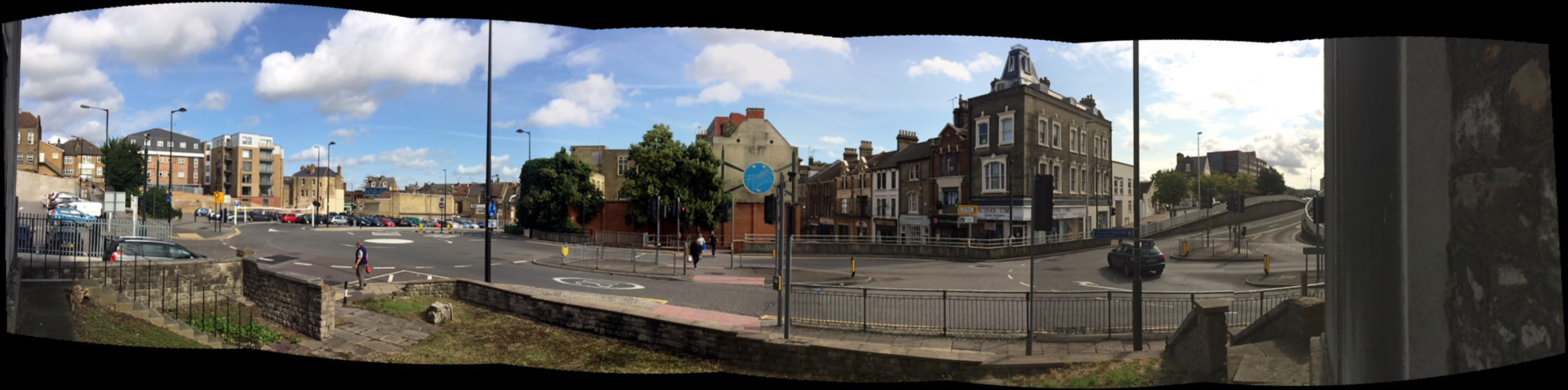
As you leave the Station and turn left, this leads you, via Railway Street towards the Town Centre and The Waterfront – however this route is a difficult one to navigate – if you know the town, then various landmarks map this out for you, but for a visitor, the experience is confusing and not for the faint hearted. The first 100m of this route, the car is certainly King – much to the detriment (& risk) of the pedestrian!
Railway Street, Chatham, Kent. The same view – Image:Christopher TippingRailway Street, Chatham, Kent. Image:Christopher Tipping
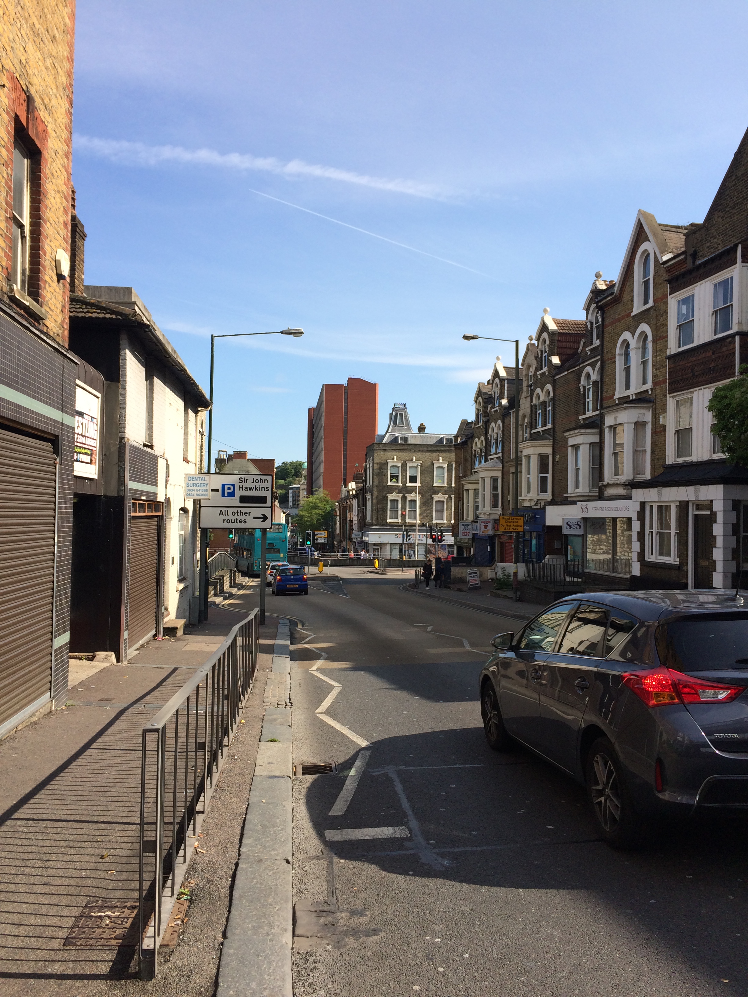
This view looks down Railway Street towards the Town Centre with the red brick edifice of Mountbatten House dominating the centre view.
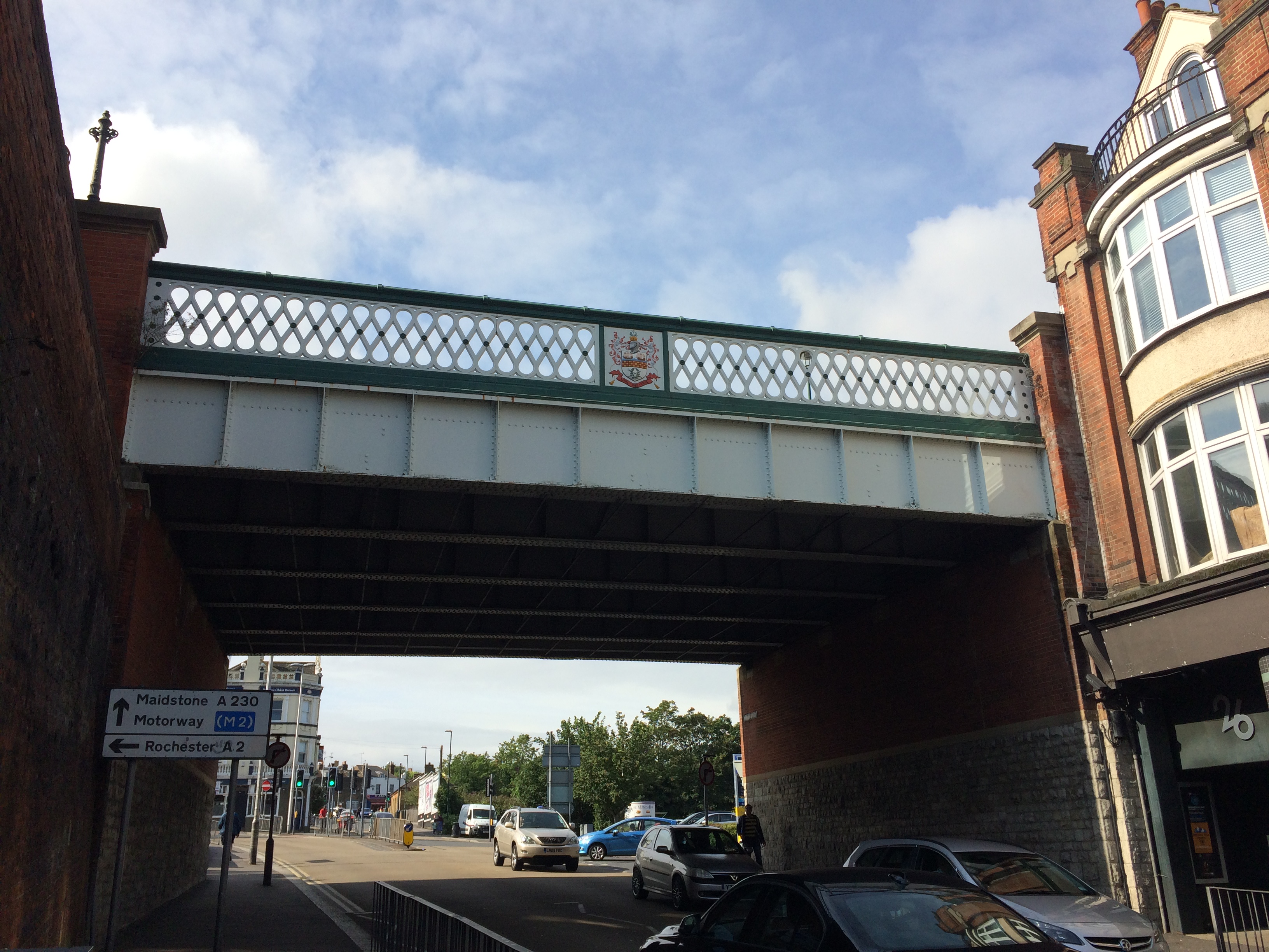
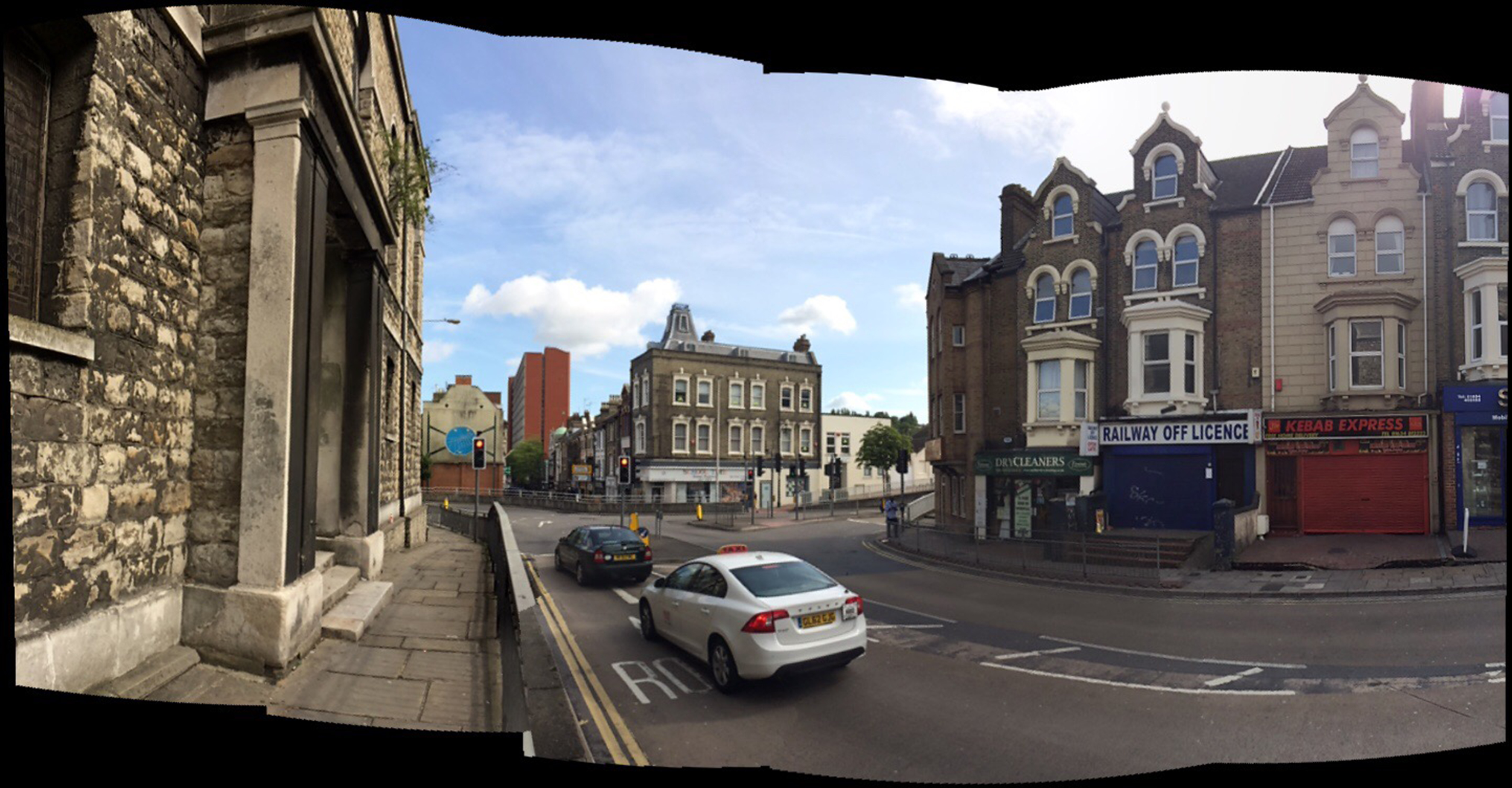
Railway Street, Chatham, Kent. Looking up towards the Train Station through the Viaduct, which replaced the original Old Viaduct of 1794, which was referred to as a ‘defensive’ gateway. Image:Christopher TippingSt John the Divine Church, Railway Street. Built in 1820/21 & closed in 1998. Image:Christopher Tipping
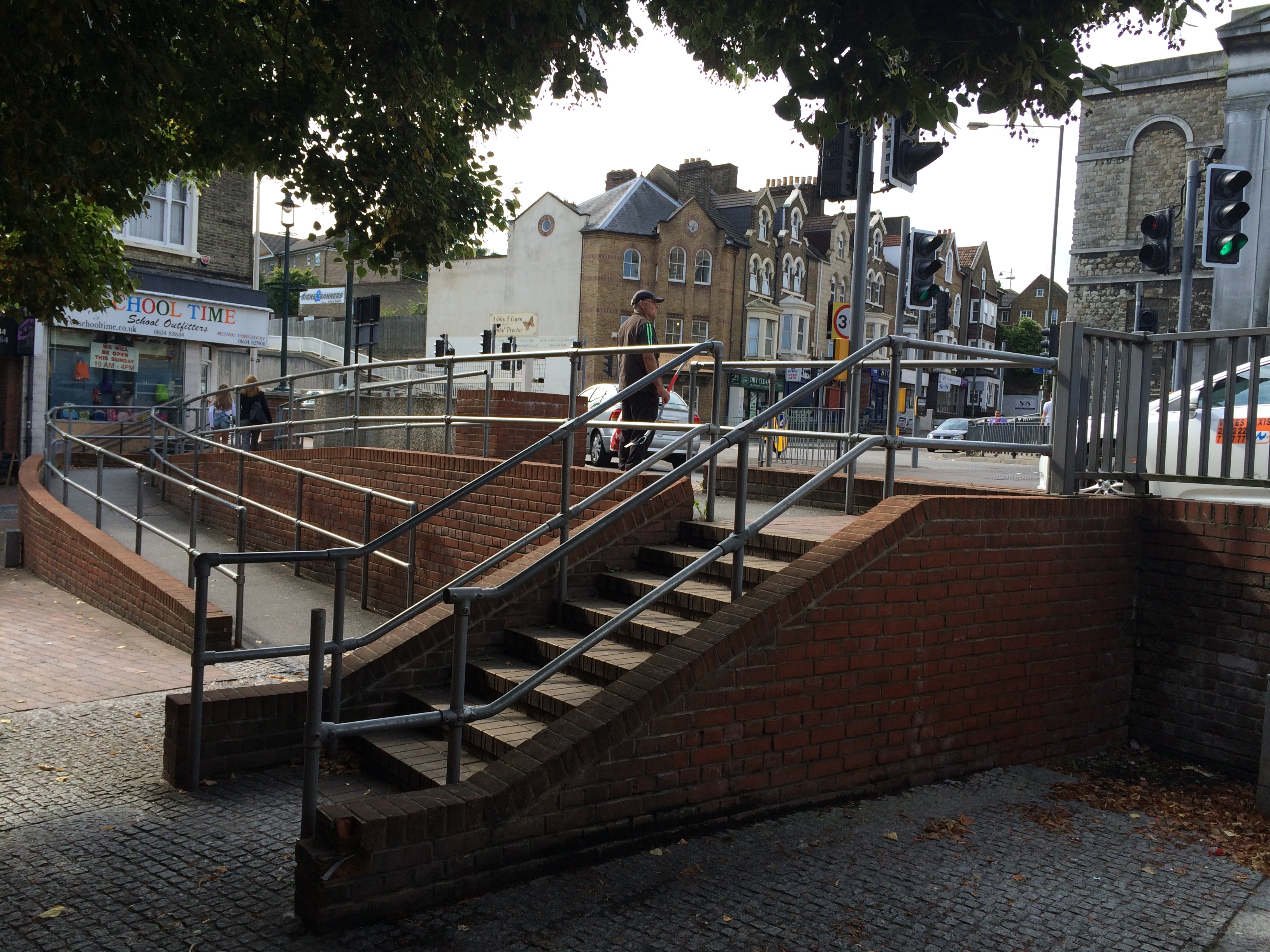
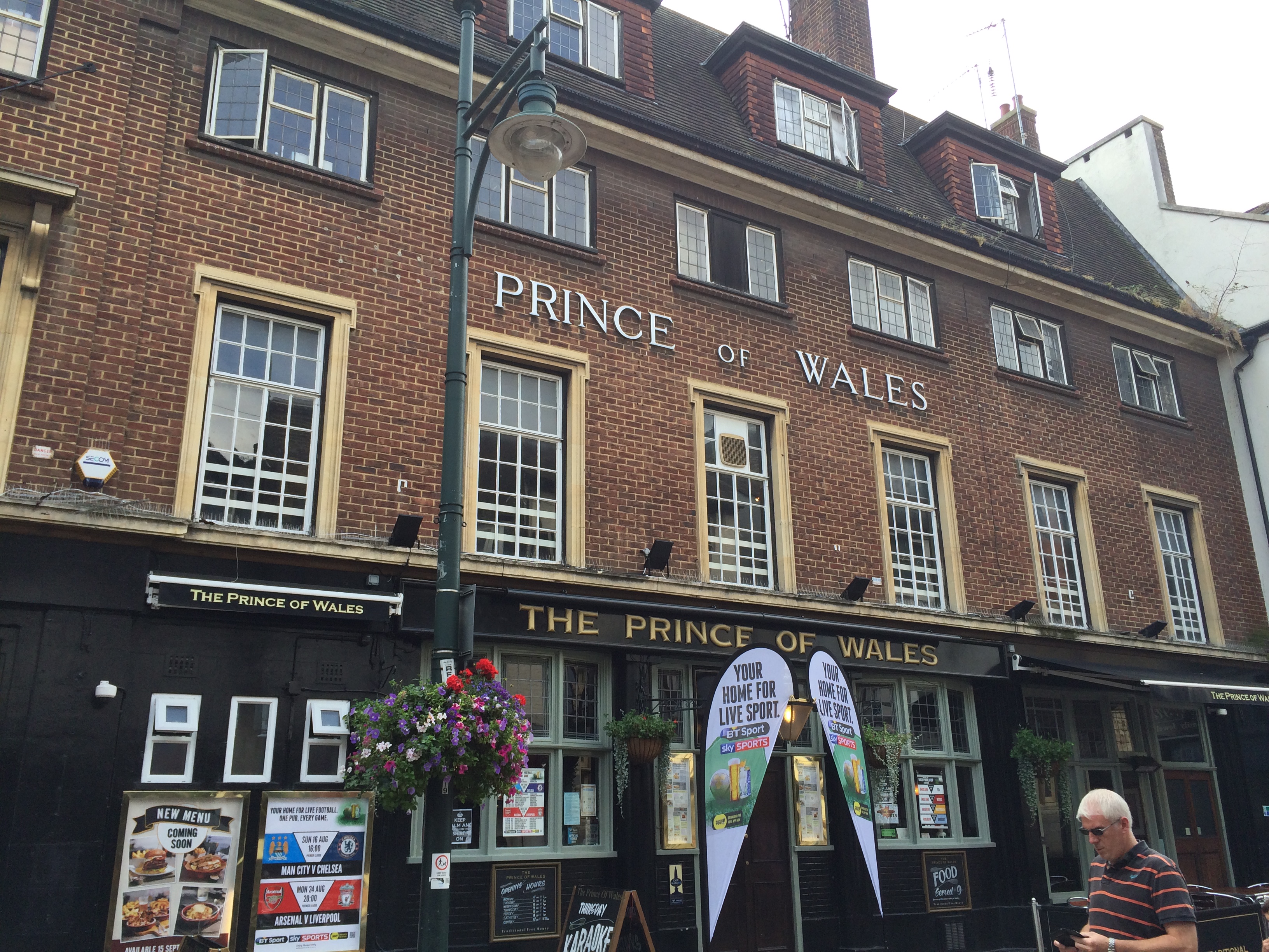
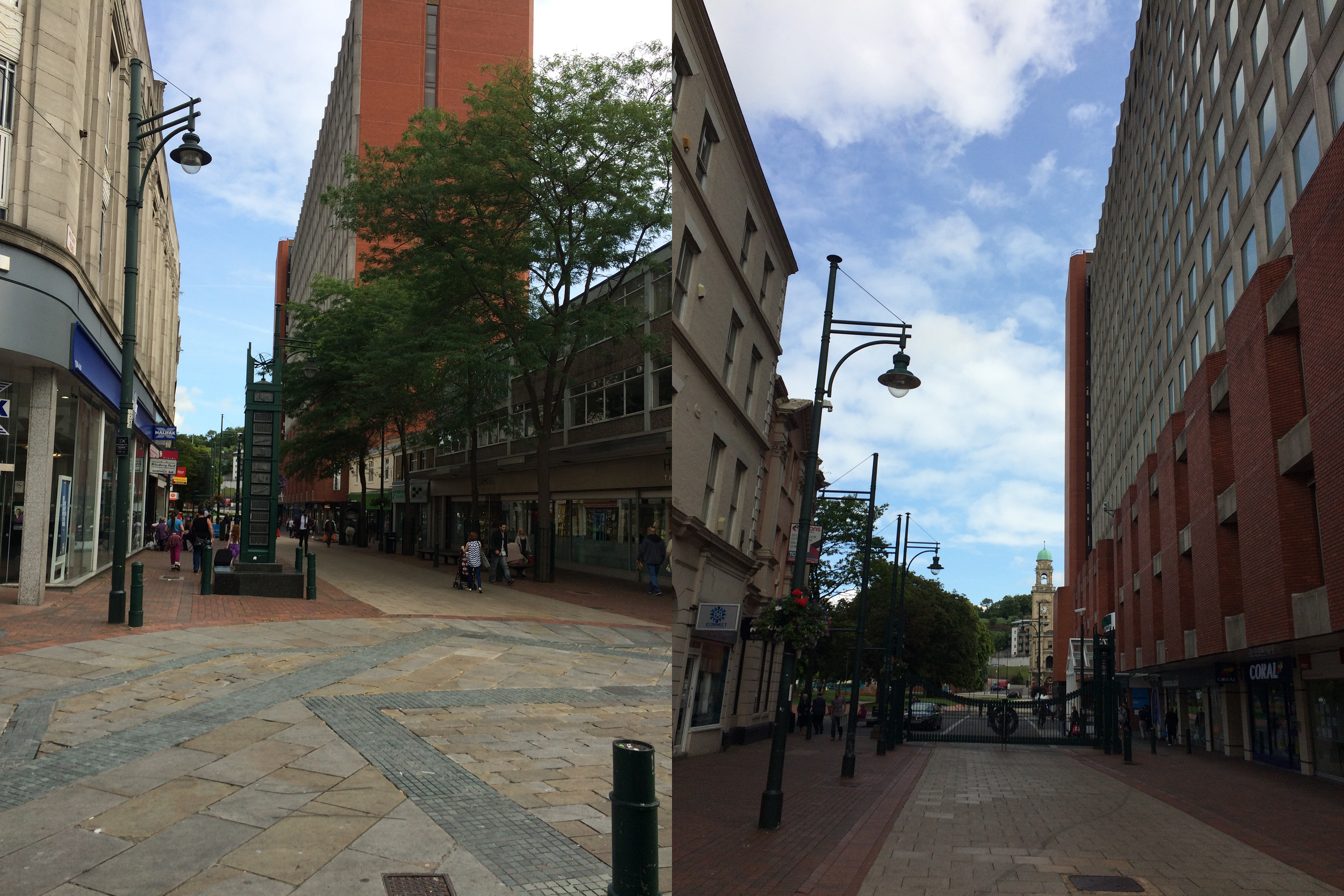
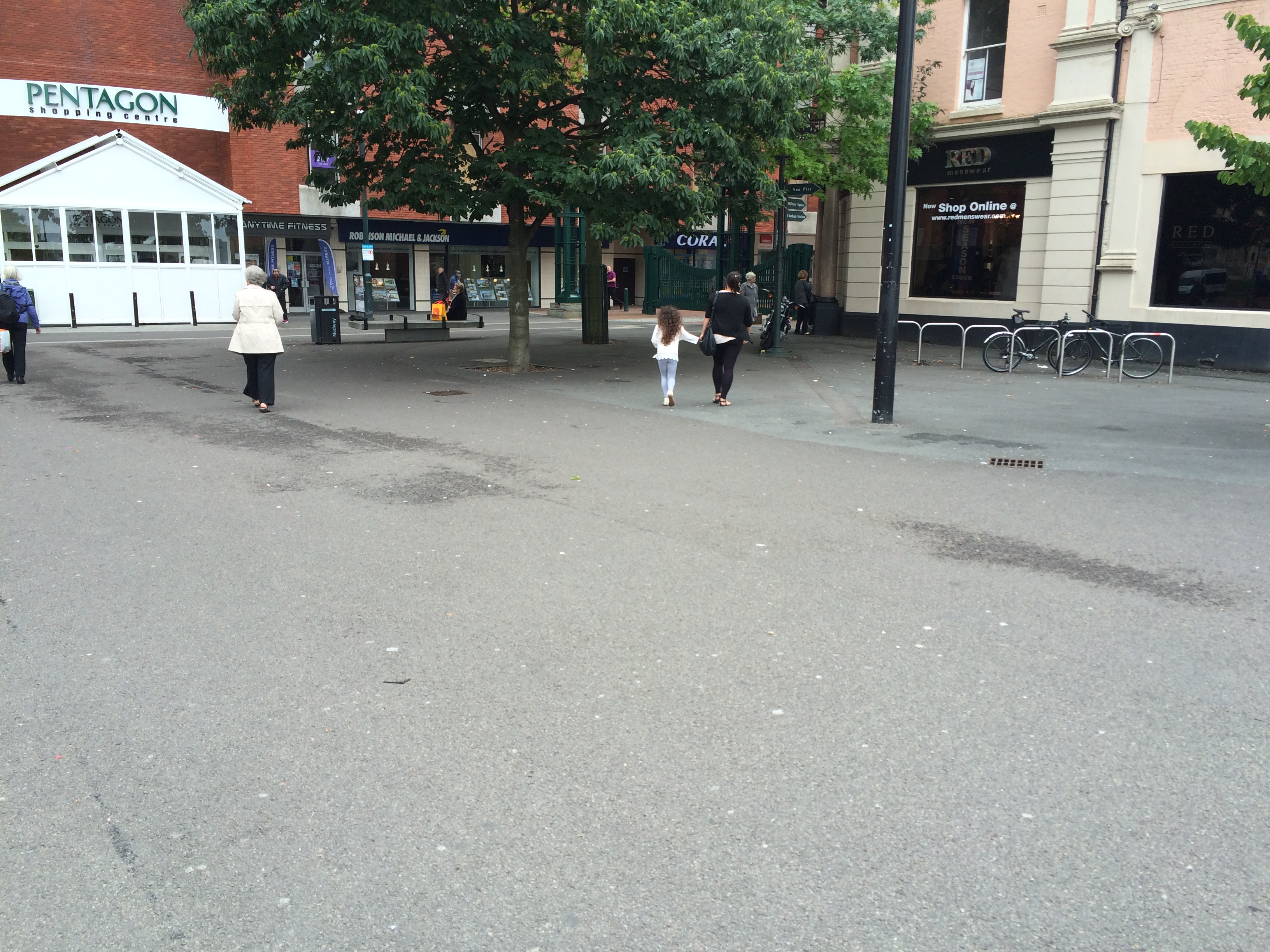
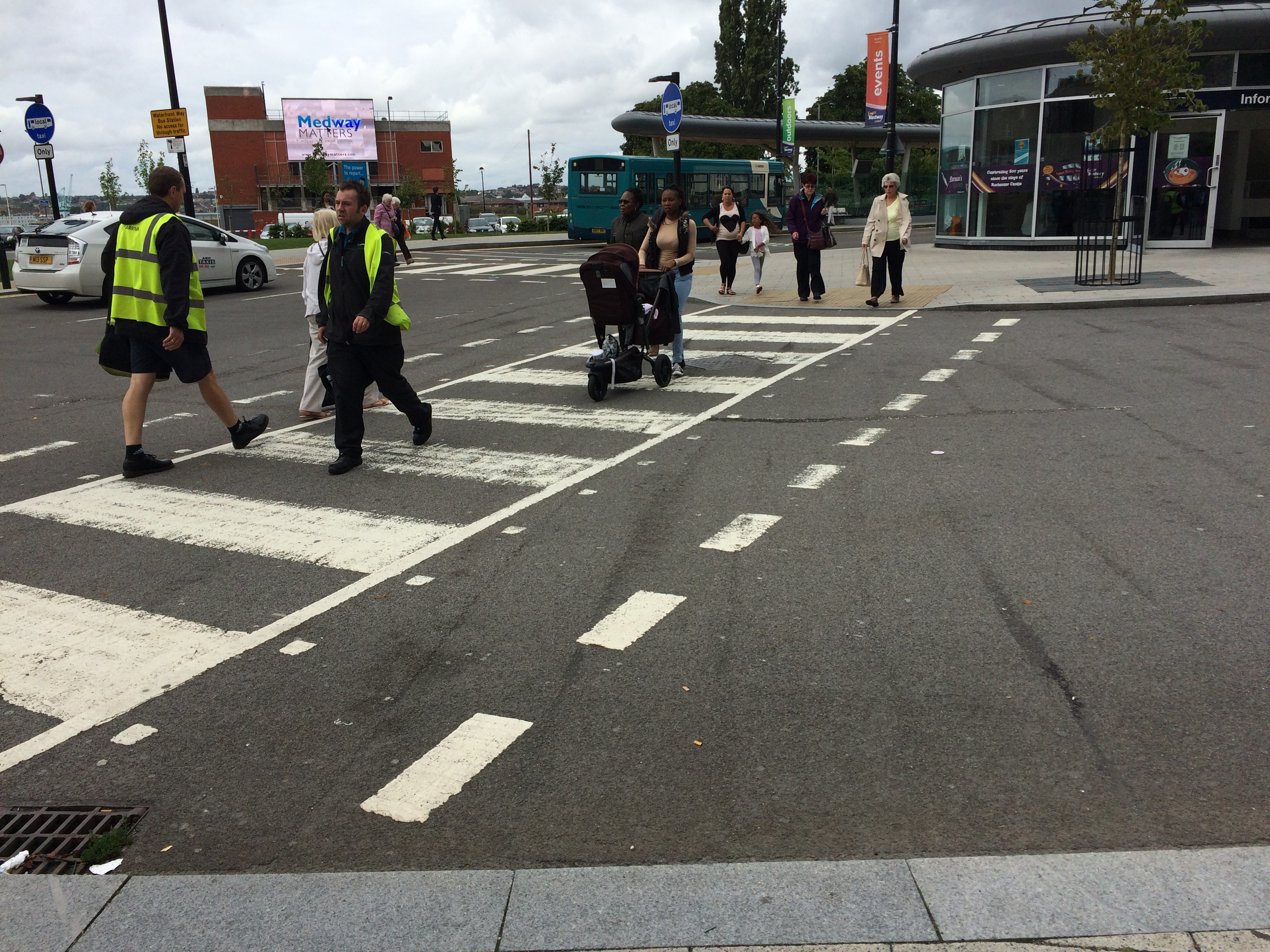
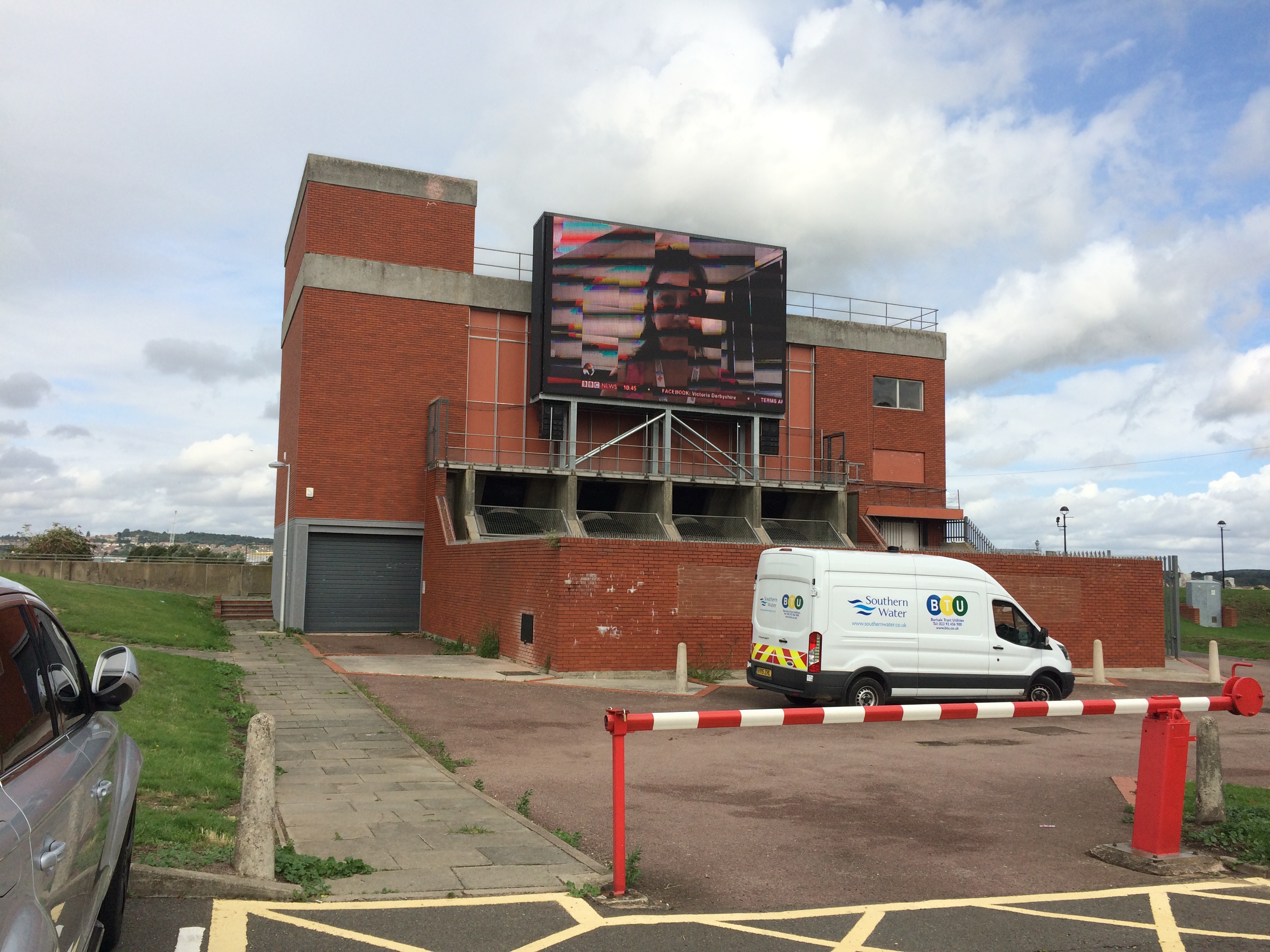
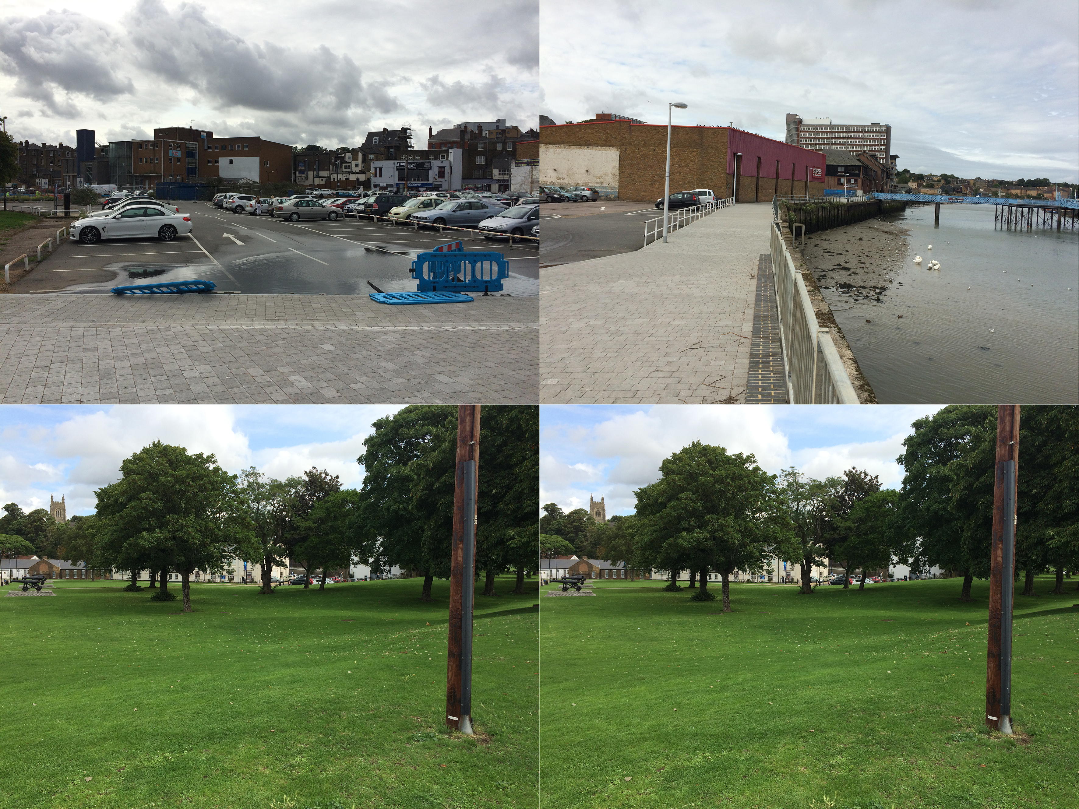
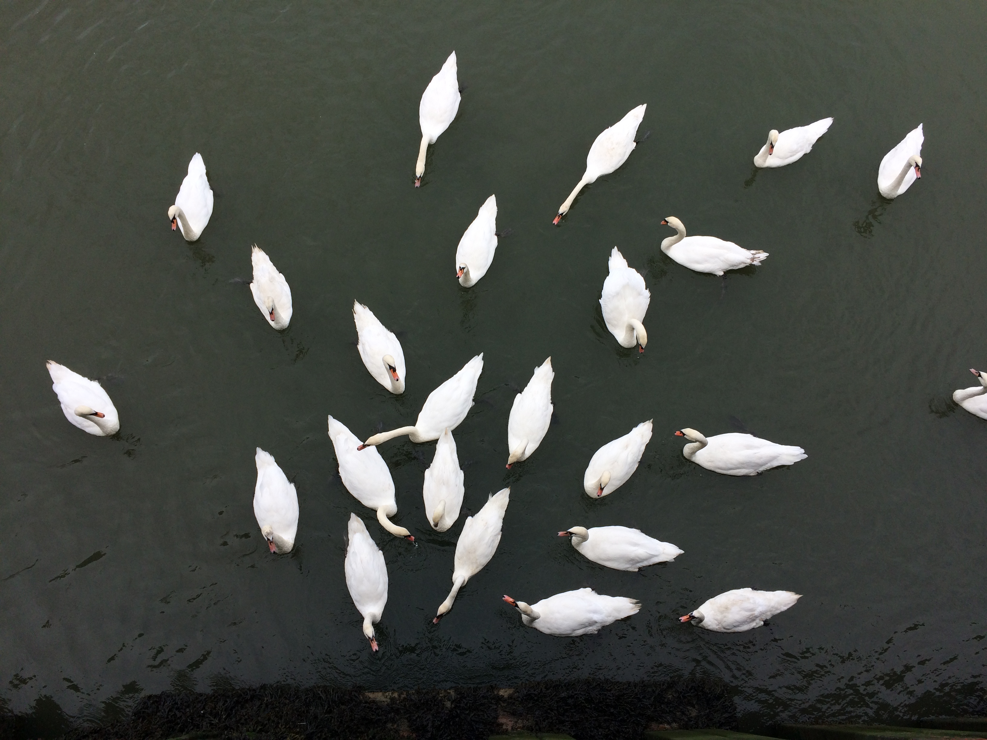
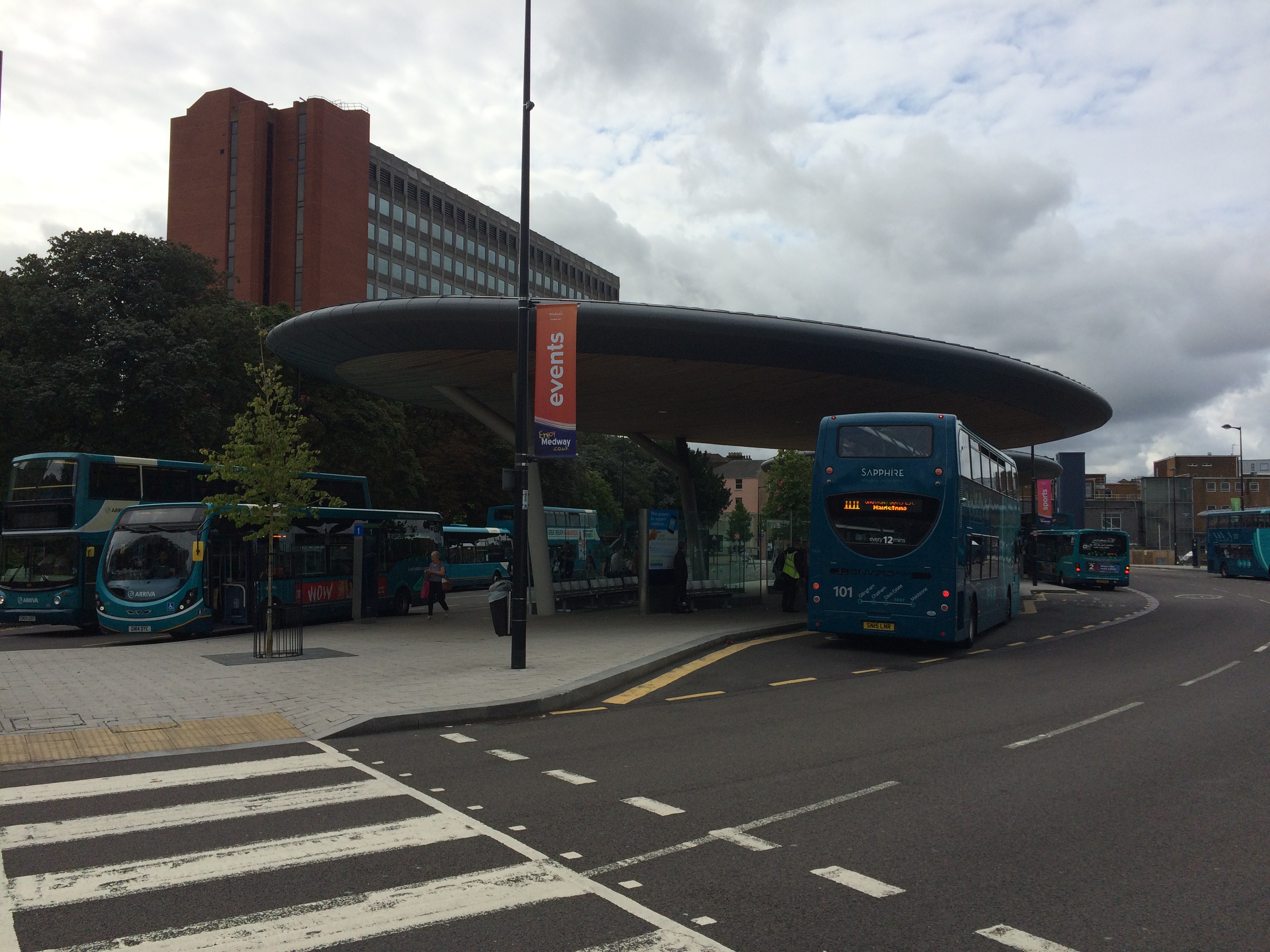
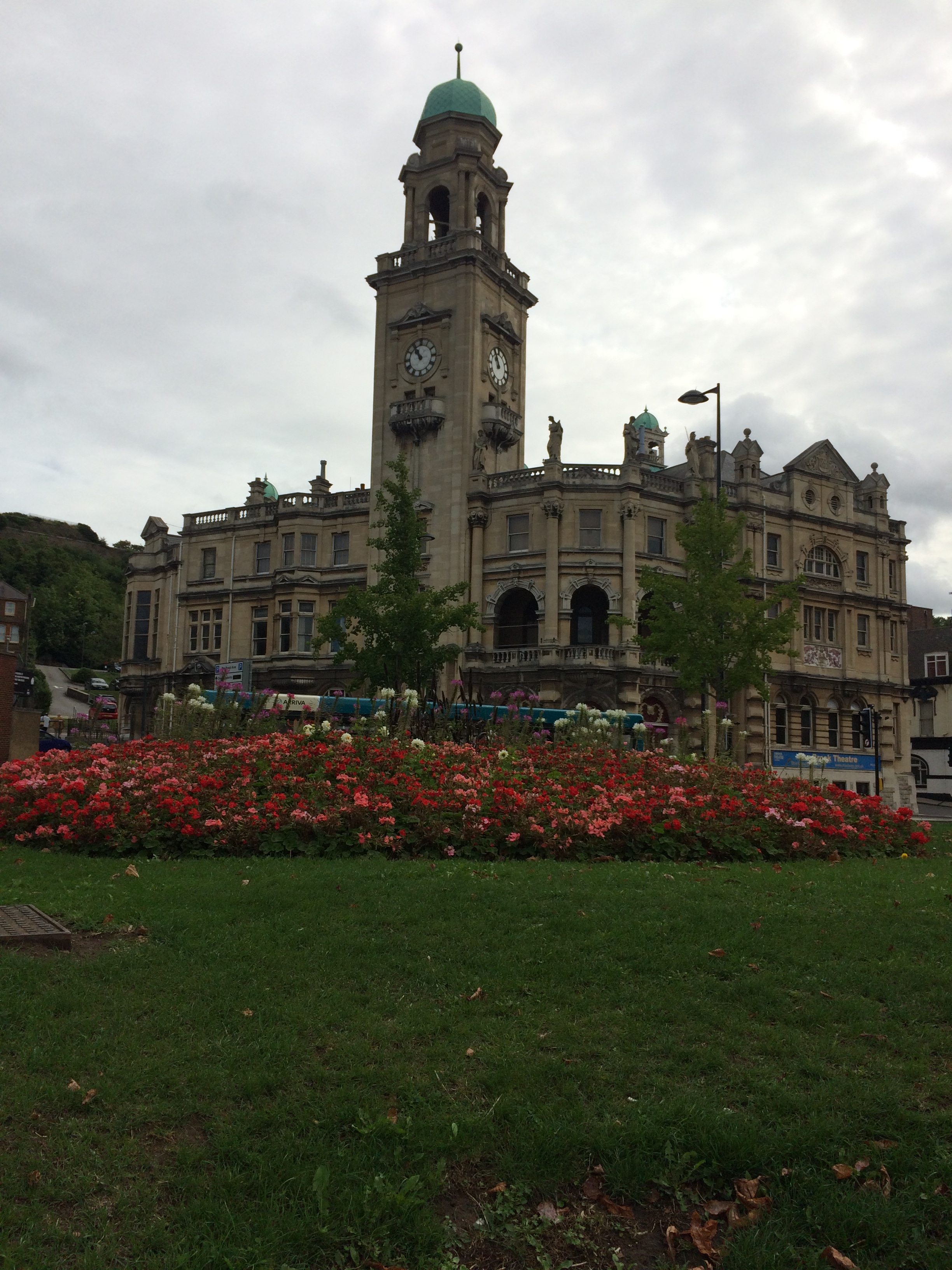
Railway Steet was split into two sections with Waterfront Way connecting to the A2. This created issues with pedestrian flow and connectivity. Image:Christopher TippingRailway Street, Chatham, looking towards the Town Centre from St John’s Church. Image:Christopher TippingRailway Street, Chatham, looking towards the Town Centre from St John’s Church. Image:Christopher TippingA variety of great buildings still extant on Railway Street. Image:Christopher TippingThe ‘Prince of Wales’ Public House on the lower part of Railway Street, Chatham. Image:Christopher TippingTwo views along Military Road, Chatham, which is dominated by the red brick office block on the right hand side – Mountbatten House and the Pentagon Shopping Centre. At the far end of the long view is the beautiful Brook Theatre, the former Town Hall. Image:Christopher TippingA wide view at the lower end of Military Road looking towards the Brook Theatre and the New Bus Station. Image:Christopher TippingA wide view at the lower end of Military Road looking towards the new Bus Station and Waterfront. Image:Christopher TippingWalking from the Bus Station towards The Pentagon Shopping Centre and Military Road, Chatham. Image:Christopher TippingThe main pedestrian crossing point towards the Bus Station & Pumping Station. Image:Christopher TippingChatham Waterfront Pumping Station and Big Screen, Chatham. Image:Christopher TippingThe Pumping Station appears to divide two distinct landscapes along the river frontage. Top – looking left of the Pumping Station. Bottom – looking right of the Pumping Station. Image:Christopher TppingThe local population on the river below the Pumping Station. Image:Christopher TippingThe local population sit on railings along the waterfront, Chatham. Image:Christopher TippingThe new Bus Station looking towards Mountbatten House. Image:Christopher TippingThe Paddock, which is green space between the Bus Station, Mountbatten House and the Pentagon Shopping Centre. Image:Christopher TippingBrook Theatre, Chatham, the former Chatham Town Hall. Image:Christopher Tipping