In researching this project I have engaged with many individuals, institutions and stakeholders in order to decipher the history of our site. I am immensely grateful to all those who contributed.
The purpose of taking this approach to research is twofold.
Firstly it fosters a sense of common ownership around the project. People have given their information and experience freely in order to see these improvement be made.
Secondly, the collaborative exchange of information has enriched the debate around the design outcomes, This can only be a positive step forward. The project now on the ground is all the better for this.
Thanks to all who have contributed thus far. The following is not an exclusive list – & I am adding to it all the time !
The following set of images – all credited – have been used to inform and influence the design process. They formed a brilliant & illuminating part of the contextual research, which has influenced the design process throughout the project – & which is quite frankly – ongoing …the research never stops !
‘The Walls of Southampton’ an engraving by WH Bartlett 1809 – 1854. The work was made as an illustration for the book ‘The Ports, Harbours, Watering Places and Coast Scenery of Great Britain’. 1842, by William Finden, Edward Francis Finden & William Henry Bartlett
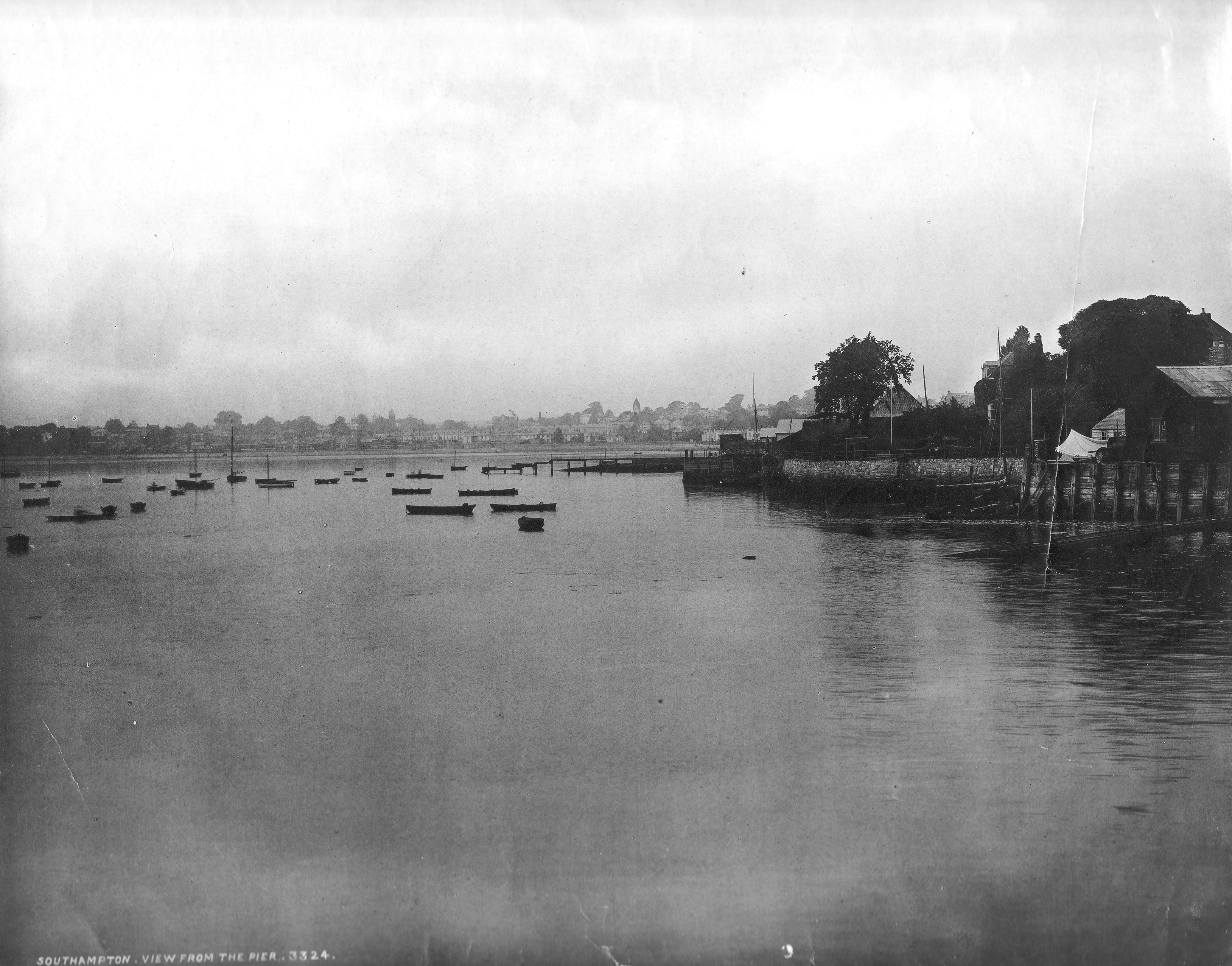
Sailing near the walls of Southampton and the West Quay area on a stormy day in late Victorian times. The embayment (West Bay) is an old meander of the River Test, flooded by the rising sea levels of the Holocene (current epoch) following the last ice age. This image is a wide angle view from near the present site of Southampton Central Station and looks out towards Town Quay – the site of the West Quay Shopping Centre & John Lewis. Ian West & Tonya West 2008
The image ties in wonderfully well with a description of a great storm in West Bay in 1893
An extract from the Parish of St Peters Church, Commercial Road. Magazine No 5 January 1894 by Rev H C Percival
“We have had our share of the late terrific storm, as well as much of the sunshine of Christmas. It is not often that St Peters Parish and people see the usually placid Southampton water assume the appearance of the Bay of Biscay. But on Tuesday the 12th December (1893), we actually had a wreck on the shore in this parish and waves did much damage along the Western Shore. Our Church too suffered much more damage than is generally known. When the gale was at its height, about 3pm, some slates were carried a distance of about 3o yards and hurled with terrific force through one of the small stained windows of the Chancel. The iron guard outside was beat like thin wire and the lead & glass of the window were driven in and the window was smashed into thousands of fragments…one of our beautiful churchyard evergreen Oaks has been sadly damaged and now presents a very one sided appearance. In front of our school, slates were sticking in the ground, as though some giant from the opposite side of Commercial Road had been playing quoits all the afternoon”.
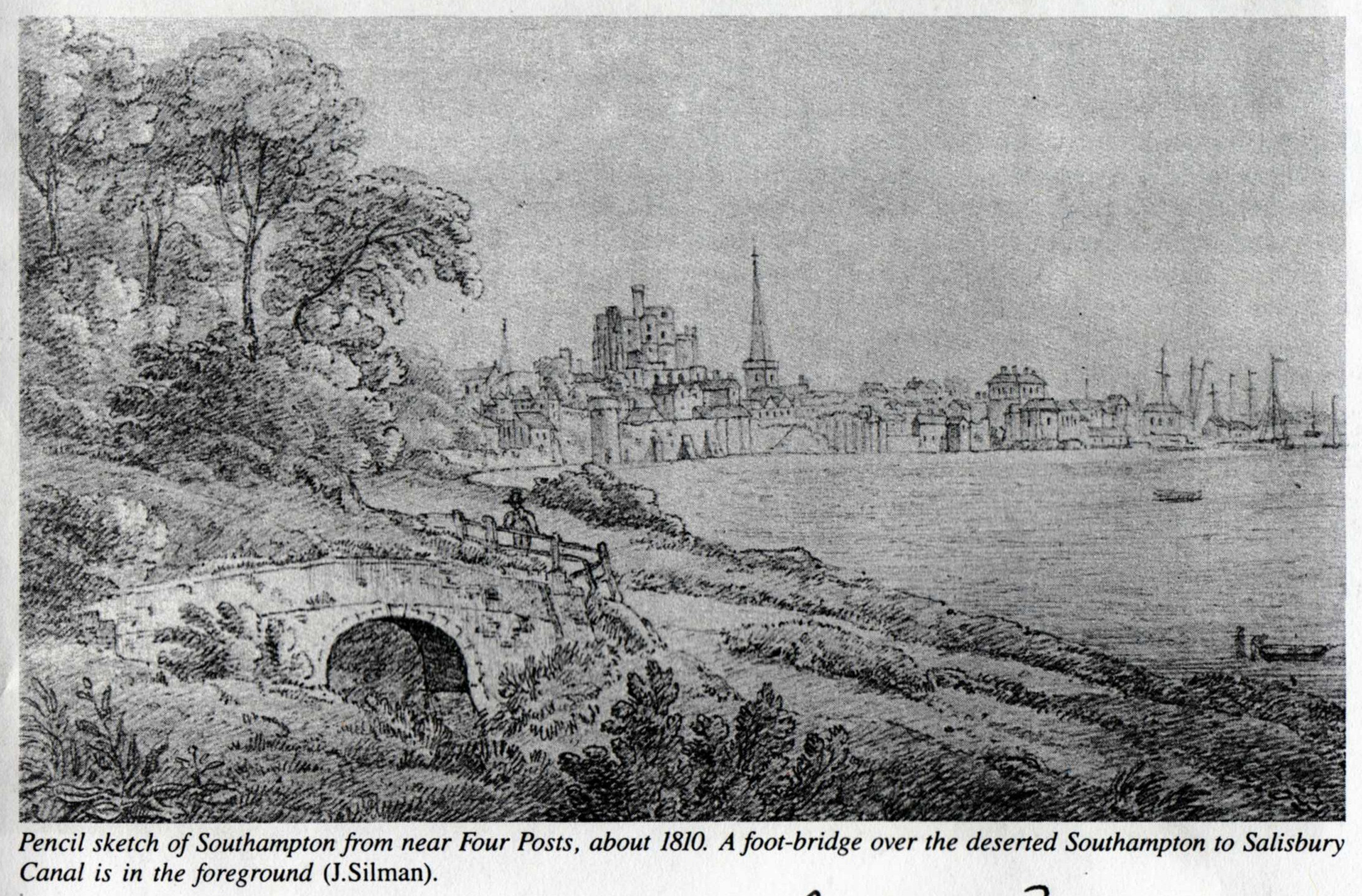
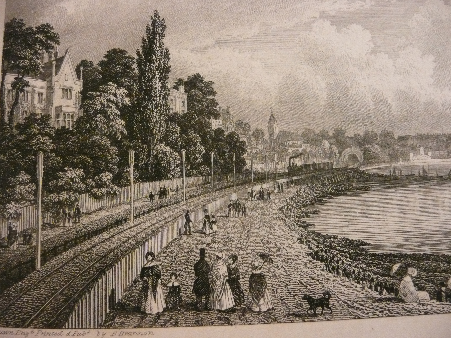
This view of around 1810 looking out over West Bay towards the City walls is thought to be almost on the site of the present day Costa Coffee shop opposite the Station Main Entrance. Image: Collection of John SilmanA view east towards the city with St Peters Church in the background. This drawing by Philip Brannon shows the shoreline around Blechynden at some point soon after the coming of the railway in 1847. The image was accompanied by the words…”a stroll along the beach was enhanced by a glimpse of a steam engine, where the line passed close to the shore”. St Peters Church on Commercial Rd was completed in 1842. Image by permission of Southampton City Council Local Studies and Maritime Collection.
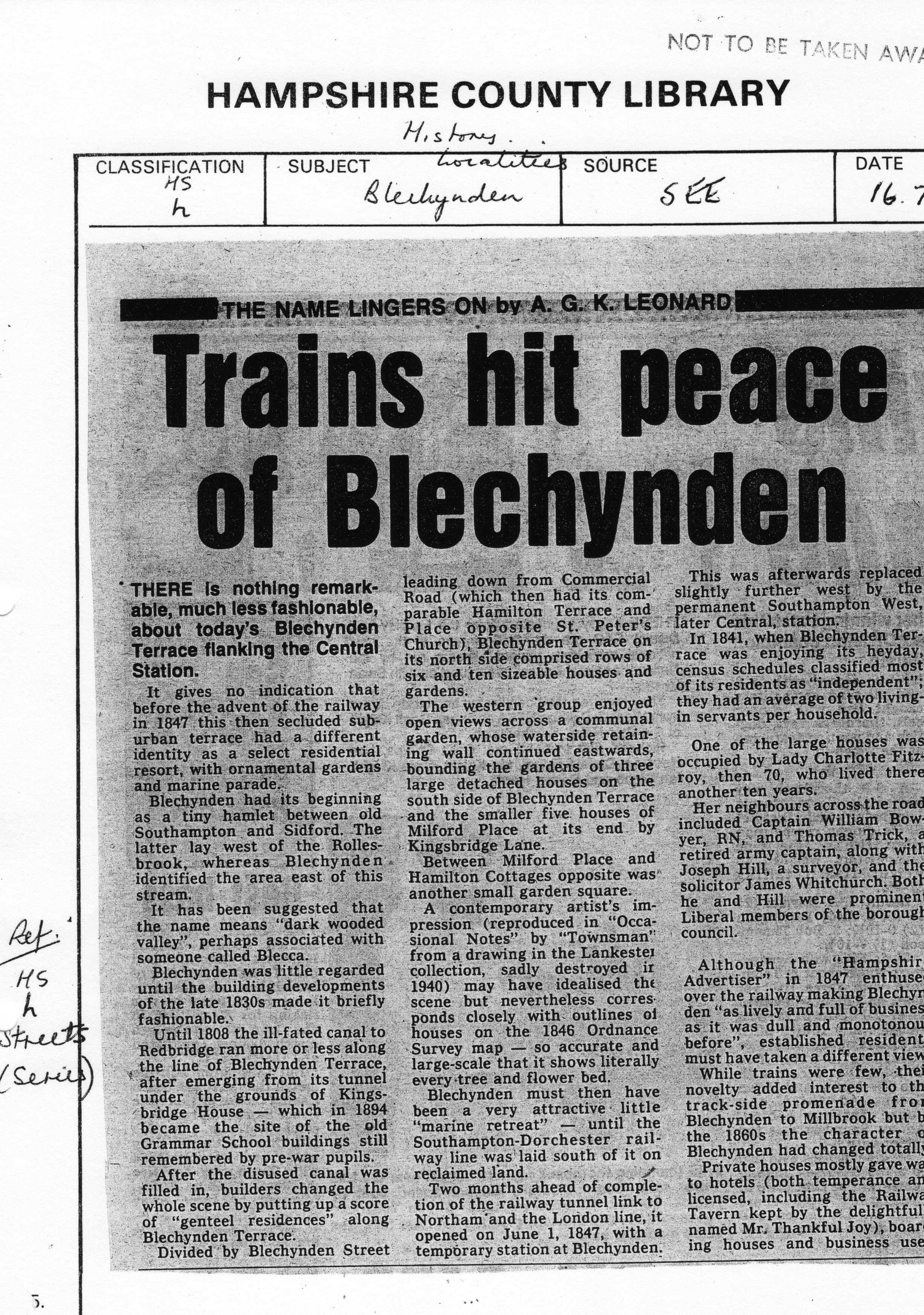
A reference to Blechynden before the coming of the railways. Newspaper cutting image by permission of Southampton City Council Local Studies and Maritime CollectionA reference to the area known as Blechynden before the coming of the railways. Newspaper cutting image by permission of Southampton City Council Local Studies and Maritime CollectionA view towards Millbrook from the bridge over the railway tunnel dated around 1880. The original Blechynden or West Station in Southampton can be seen on the right. Image: Bert Moody Collection / Cope Collection
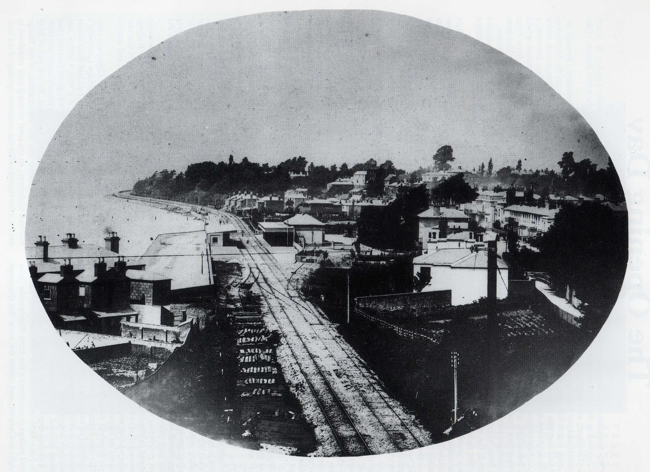
This image of the down side of the track during high tide in 1890 shows just how close the train passed to the shoreline and the waters edge. Weymouth Terrace can be seen in the background. The footbridge is still in use today ! Image: Bert Moody Collection.
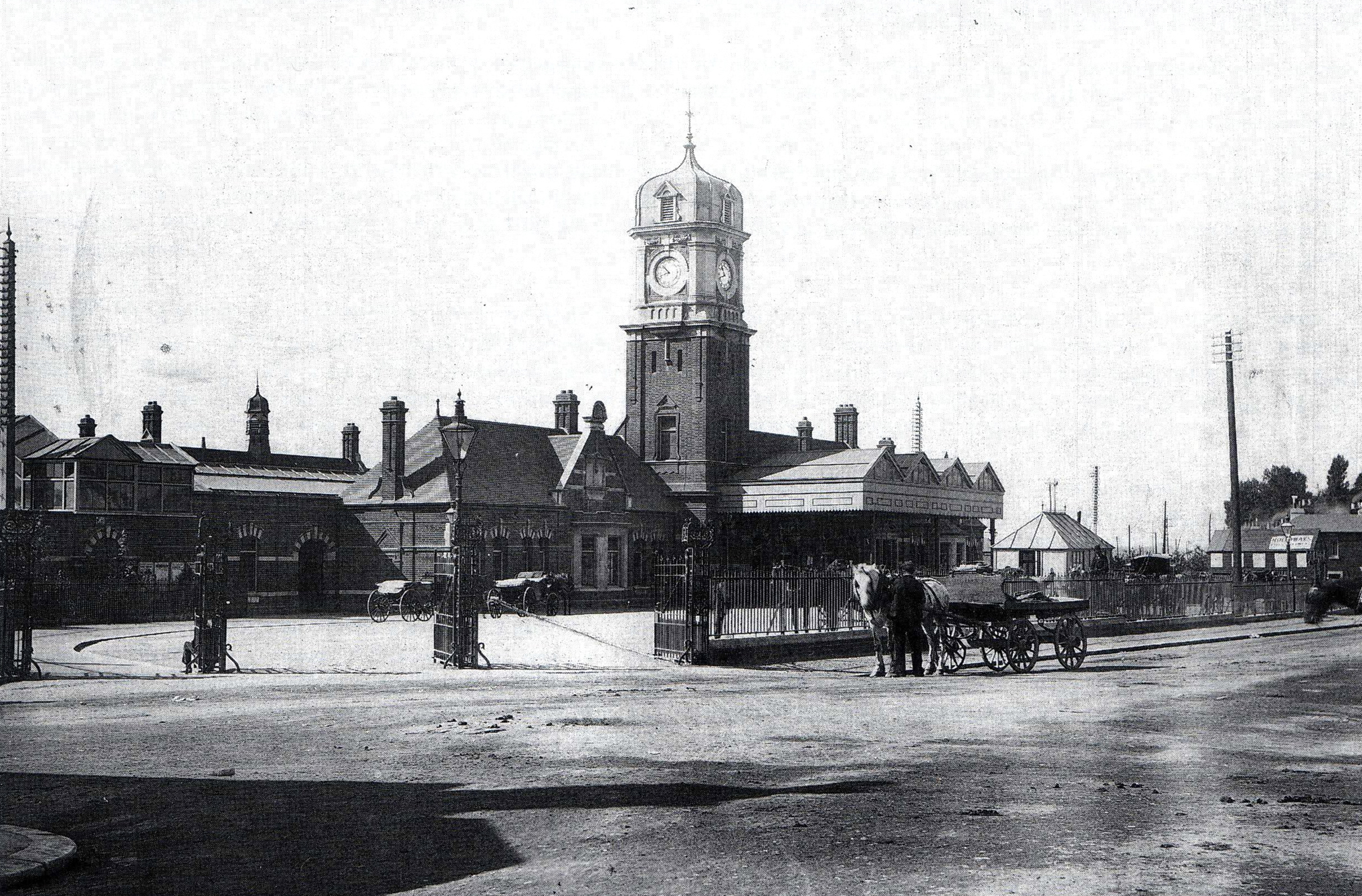
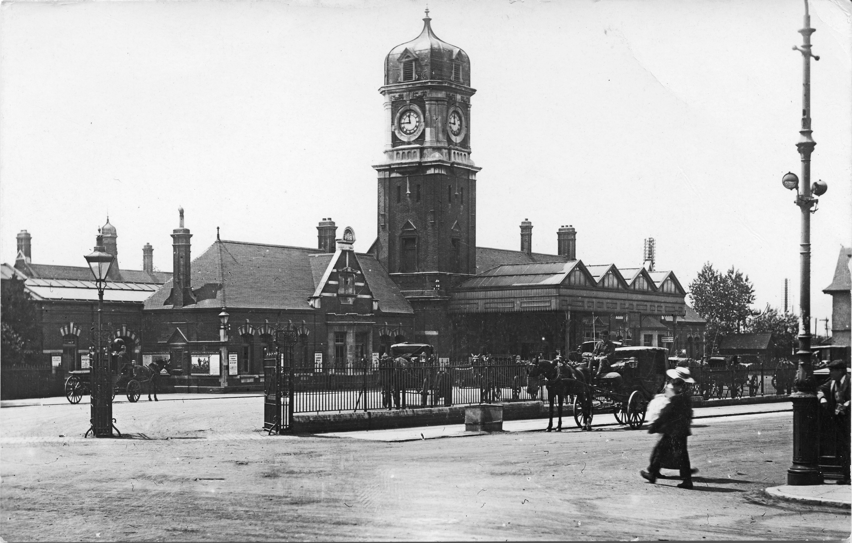
This was the new Southampton West Station opened on 1st November 1895. It had an 82 foot clock tower & had been built upon nursery gardens. Image: Bert Moody Collection
‘In the 1890’s Southampton Corporation sold an area of land for the construction of the new station. The land involved was partly field & partly shoreline and was therefore subject to tidal flooding’. ‘The new station was opened on 1st November 1895. The clock tower had been a landmark long before the Civic Centre was built in 1931. It was damaged by bombing in WWII and finally demolished to make way for the new station and Overline House in 1966/67.
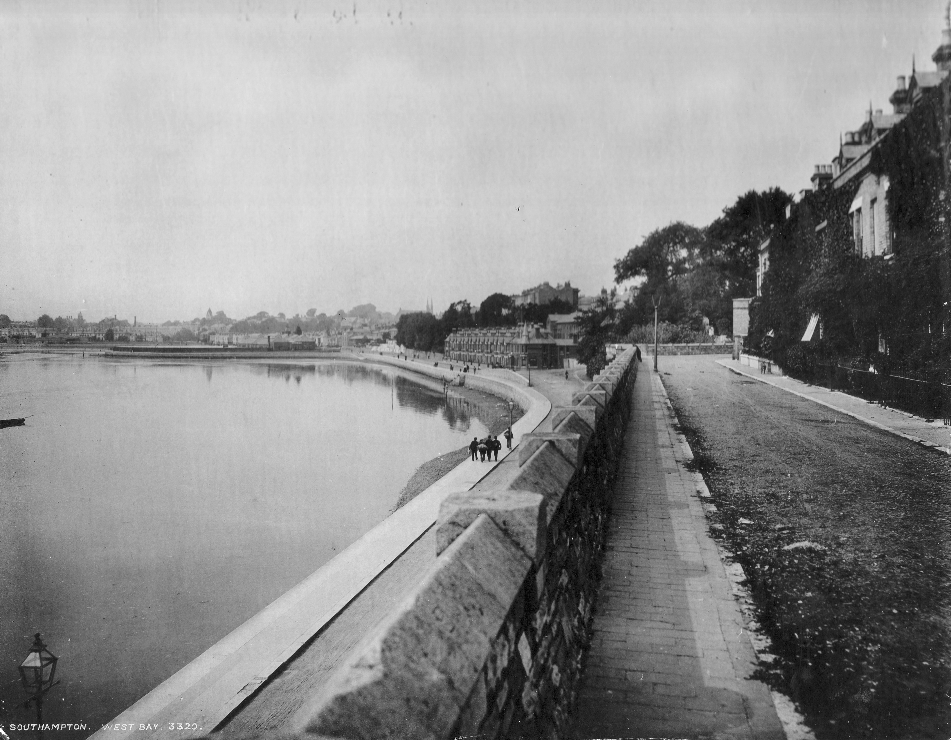
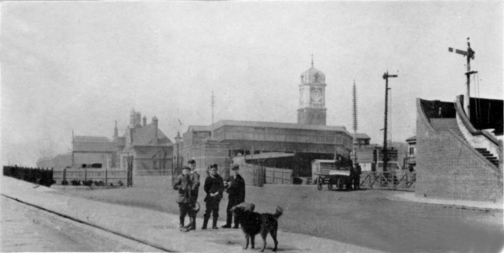
This image of the old station south side – down side – is now adjacent to the A3024 Western Esplanade road. It was once next to the water’s edge. The sea wall is in the foreground. Date unknown – post 1895 – Image: Bert Moody Collection.Looking from Town Quay across West Bay towards Blechynden circa 1890’s / 1900. Image by kind permission of Southampton Daily EchoWest Bay, Southampton, taken from the city walls between 1895 – 1912 looking towards Blechynden. St Peter’s Church can be see on the horizon. The waters edge is clearly defined by coping stone and paving detail. Image by kind permission of the Southampton Daily Echo.
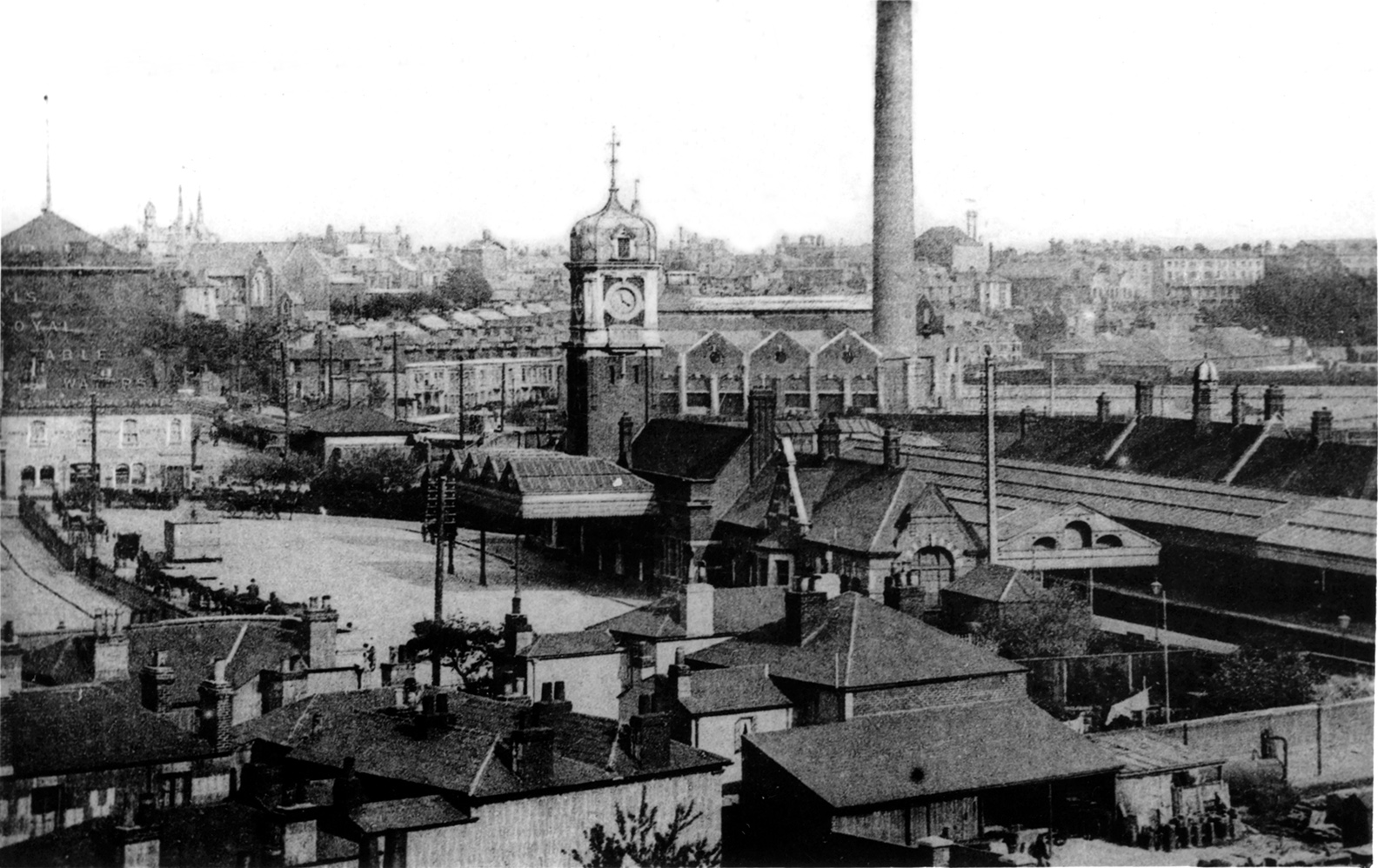
This post-1910 image taken from Weymouth Terrace, looks towards Blechynden with the station clocktower clearly visible. To the right of this is the large brick built Emperia Building of around 1905. This first housed a mineral water factory IDRIS & Co, but by 1913 the building was used by BAT, British American Tobacco. This operation closed in 1921 & the building was destroyed by bombing in 1940. Parts of the building are still clearly visible today. Image: Bert Moody CollectionThis photograph of 1909 is a view from the water’s edge towards the down side line of Southampton Station. Image: John Alsop Collection
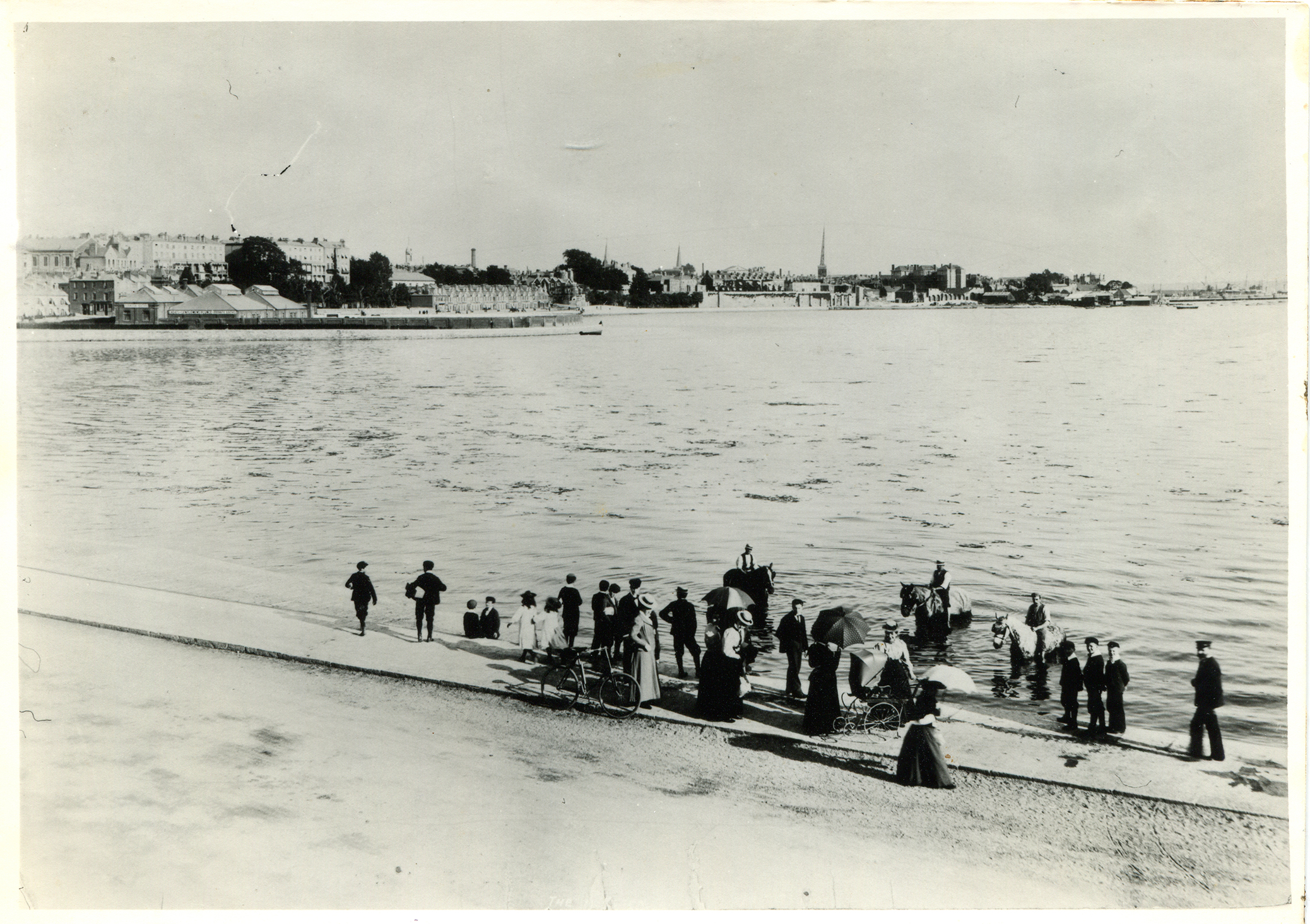
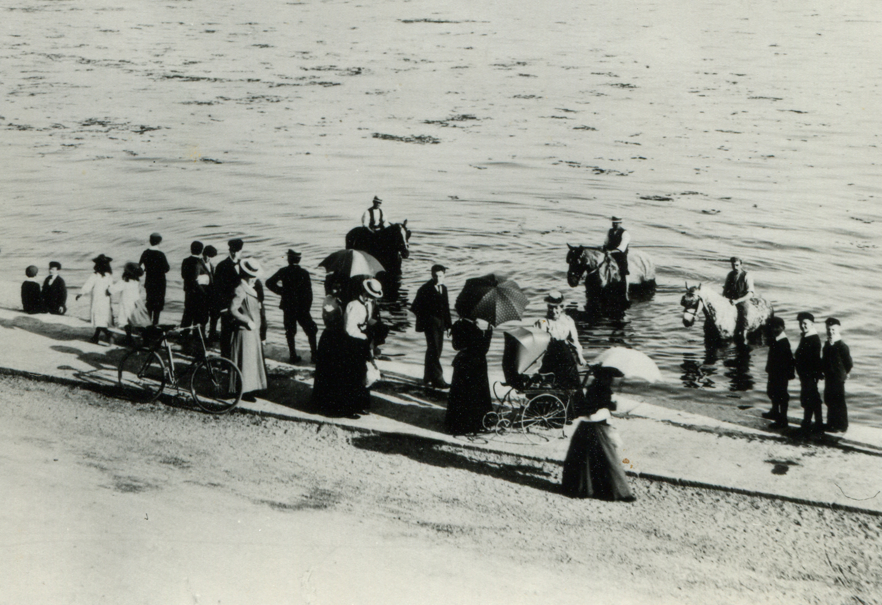
This wonderfully intimate image of 1910, shows people and horses enjoying the waters edge just outside the station. Views are across West Bay to the city walls and Town Quay. Image by kind permission of Southampton Daily EchoDetail: This image of 1910, shows people and horses enjoying the waters edge just outside the station. Views are across West Bay to the city walls and Town Quay. Image by kind permission of Southampton Daily Echo
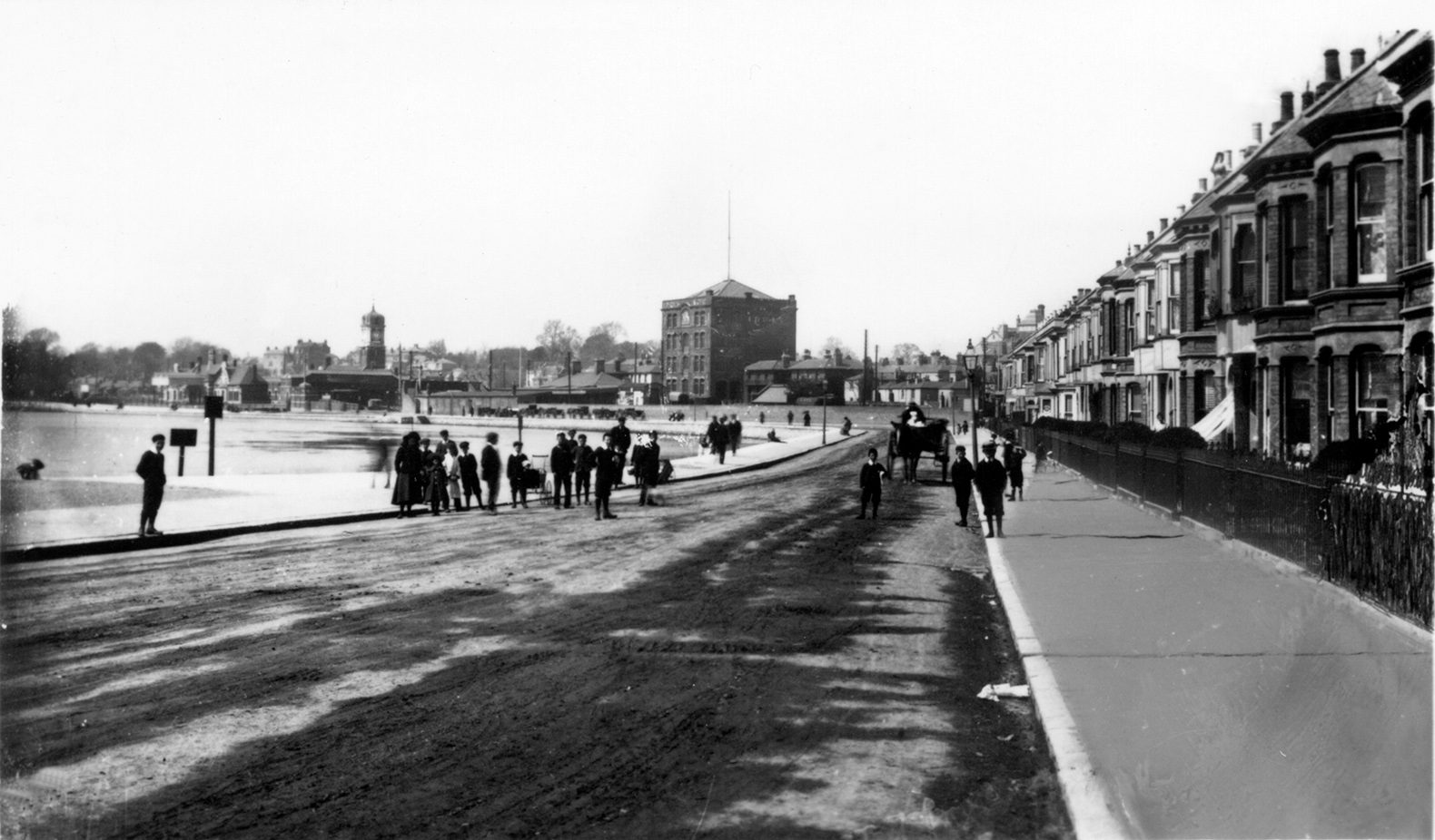
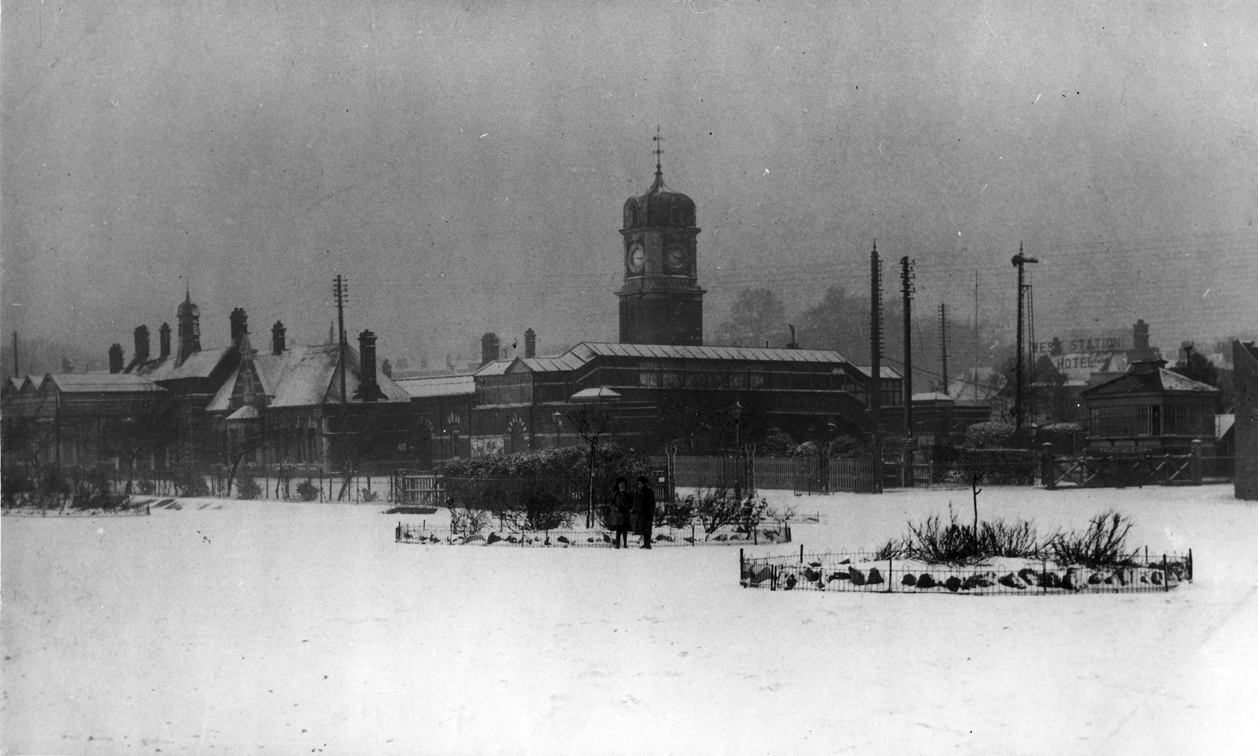
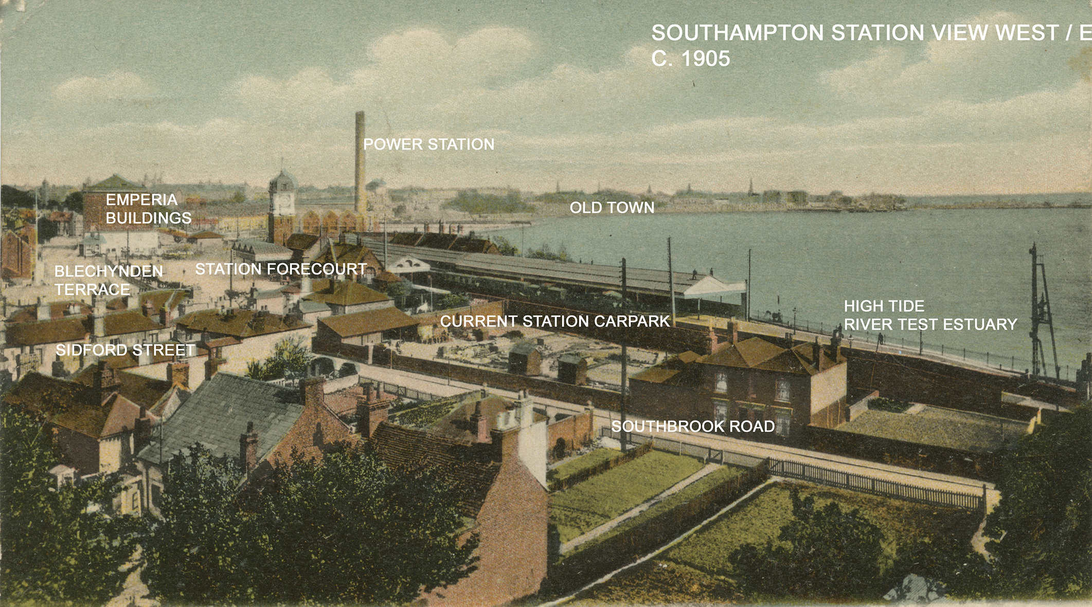
A cold and somewhat bleak image of Southampton West Station date unknown, but probably around 1910. To the right can just been seen the signage for the West Station Hotel on Blechynden Terrace. Image by kind permission of Southampton Daily Echo.An Edwardian view of Southampton West Station taken between 1901 & 1910. Horse drawn carriages await passengers. Image: John Alsop CollectionA colour tinted postcard view of Southampton Station at high tide in 1905. I have added the place names . Note the tall brick chimney of the Power Station, built in 1903 & demolished in the 1970’s. Image: John Alsop Collection
A more detailed black & white image, probably taken from the same postcard image as above – in 1905, showing the Station Concourse and environs including Emperia Buildings & the Power Station. Image: Bert Moody Collection
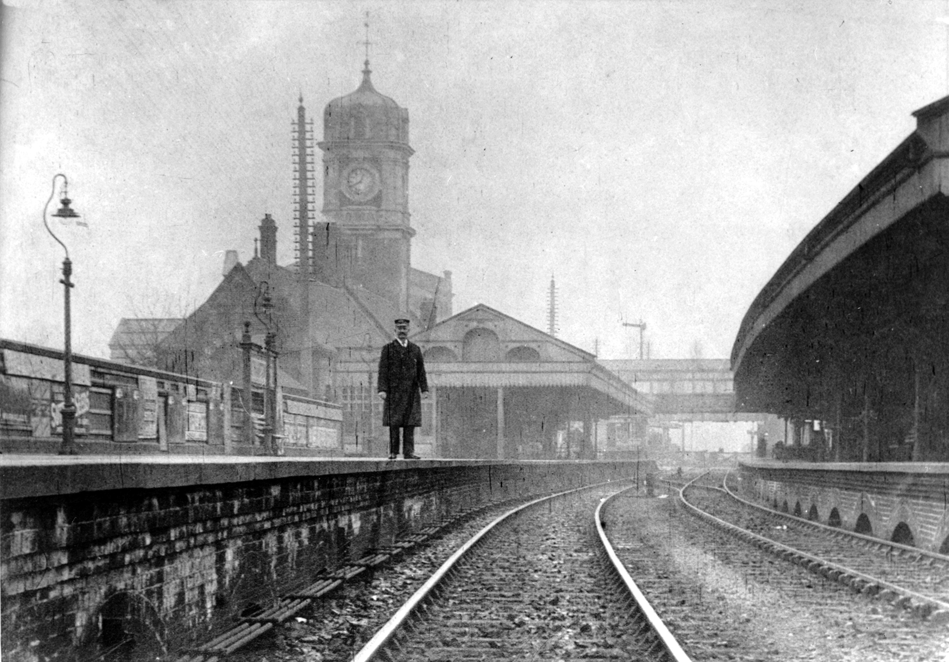
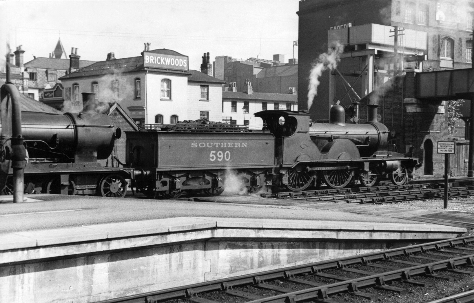
A Postcard image from 1911 of a Station guard or Station Master standing on the up line at Southampton Station. Image: Bert Moody CollectionThis image of Southampton Station south side taken from the water’s edge is actually taken from a newspaper cutting, date unknown, but around the turn of the century. The steps and bridge crossing on the far right of the image are still in use today. Image: Bert Moody Collection.Steam train passing through from 1936. The spire of St Peters Church is just visible on the left & the footbridge, still in use today to cross the tracks is on the far right. Image: Bert Moody Collection
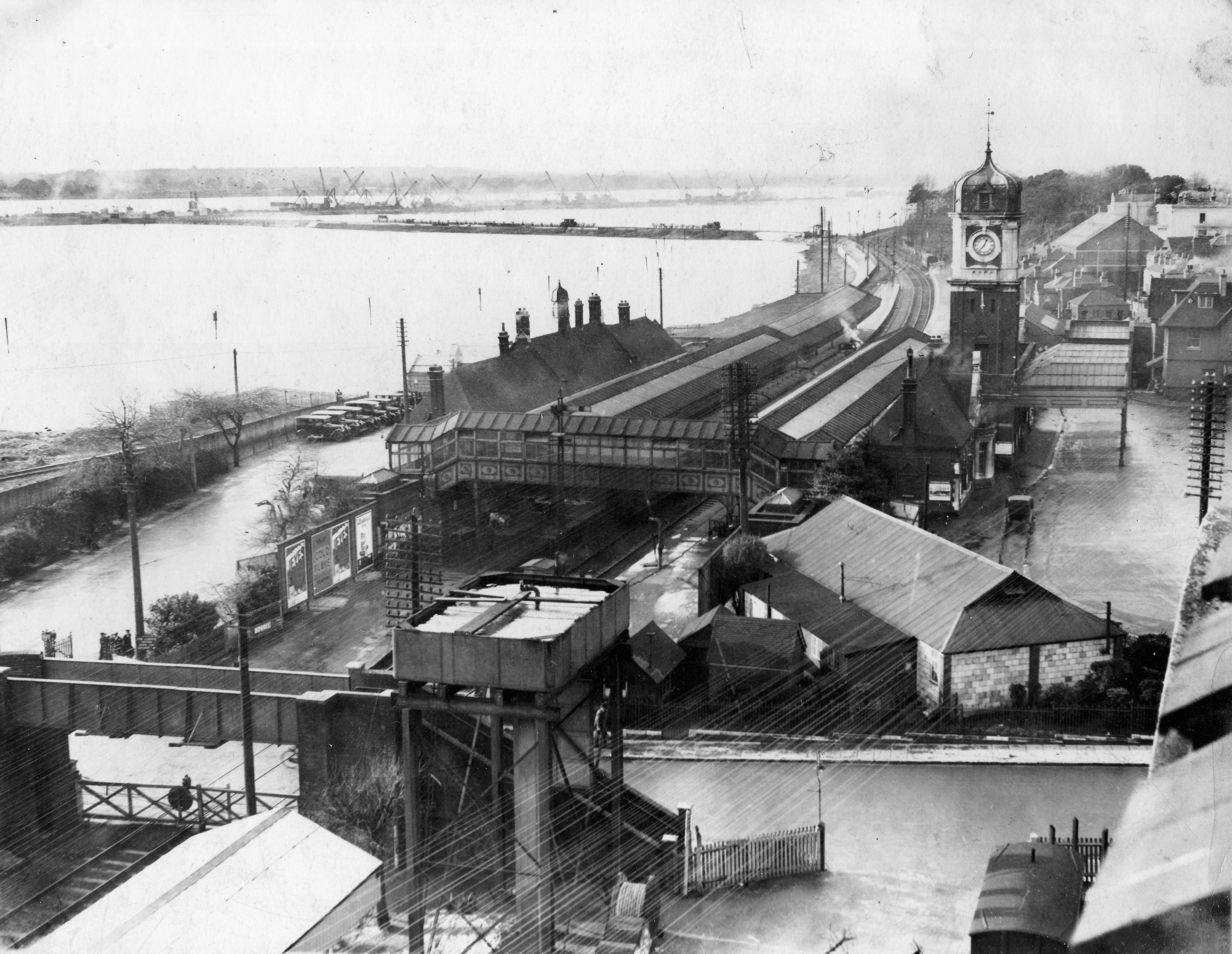
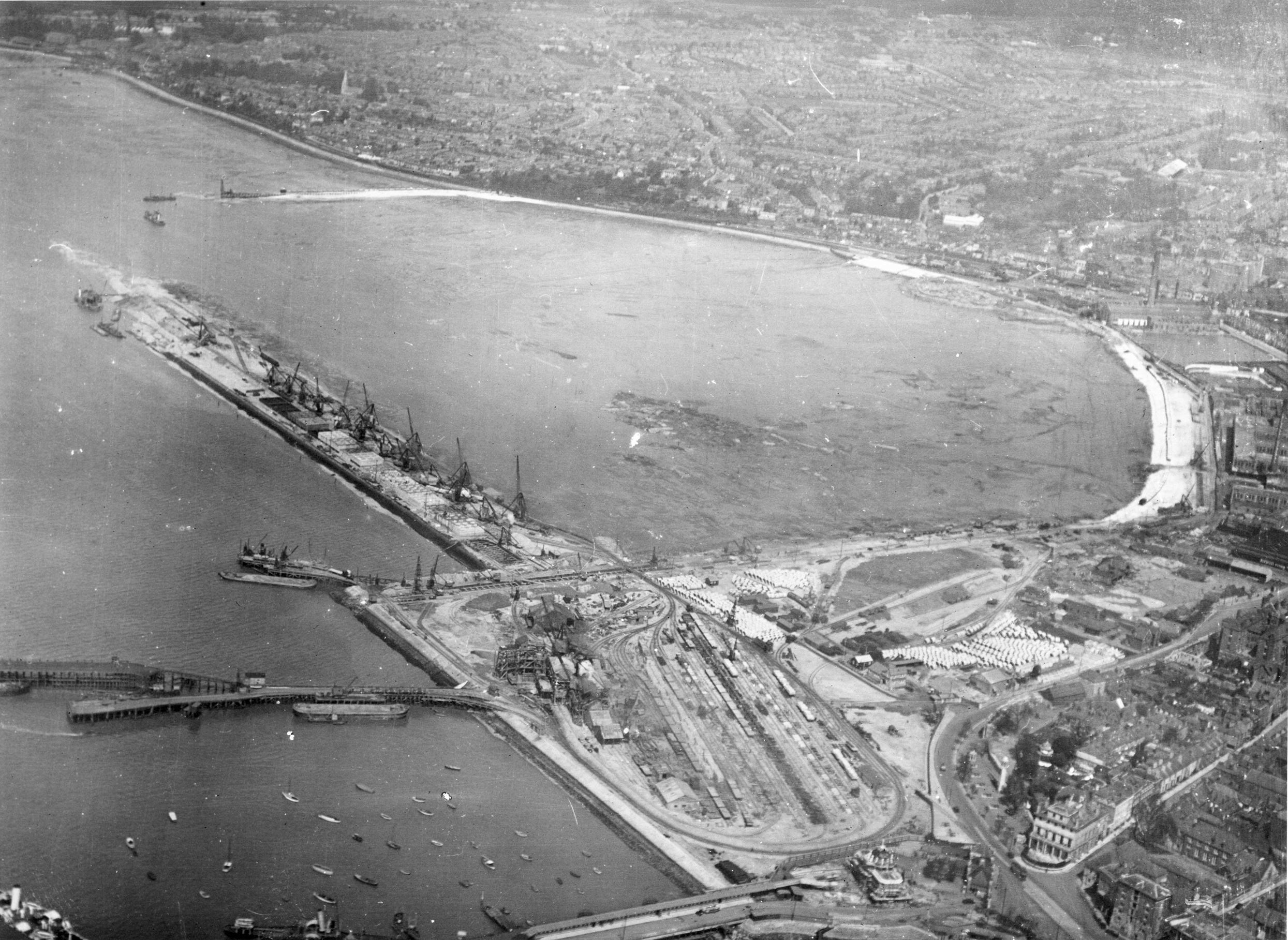
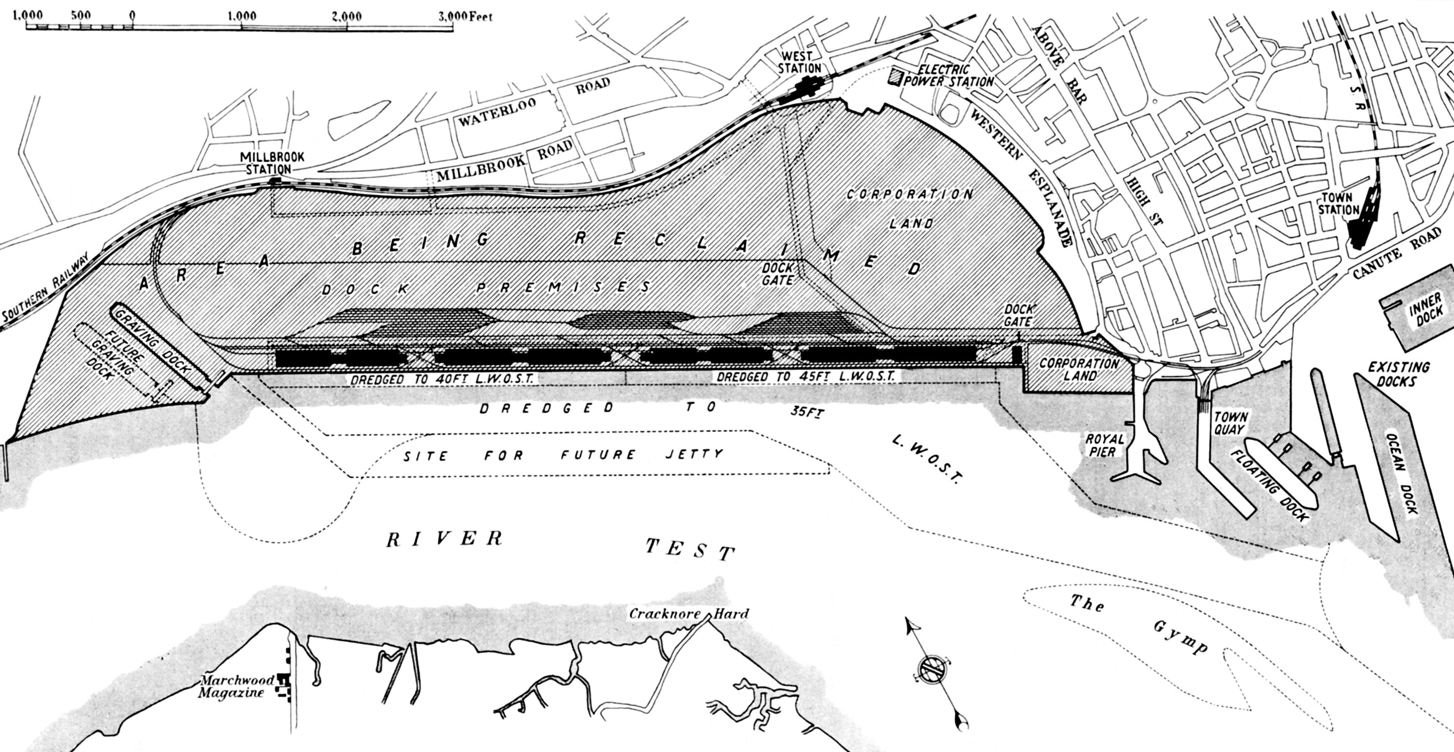
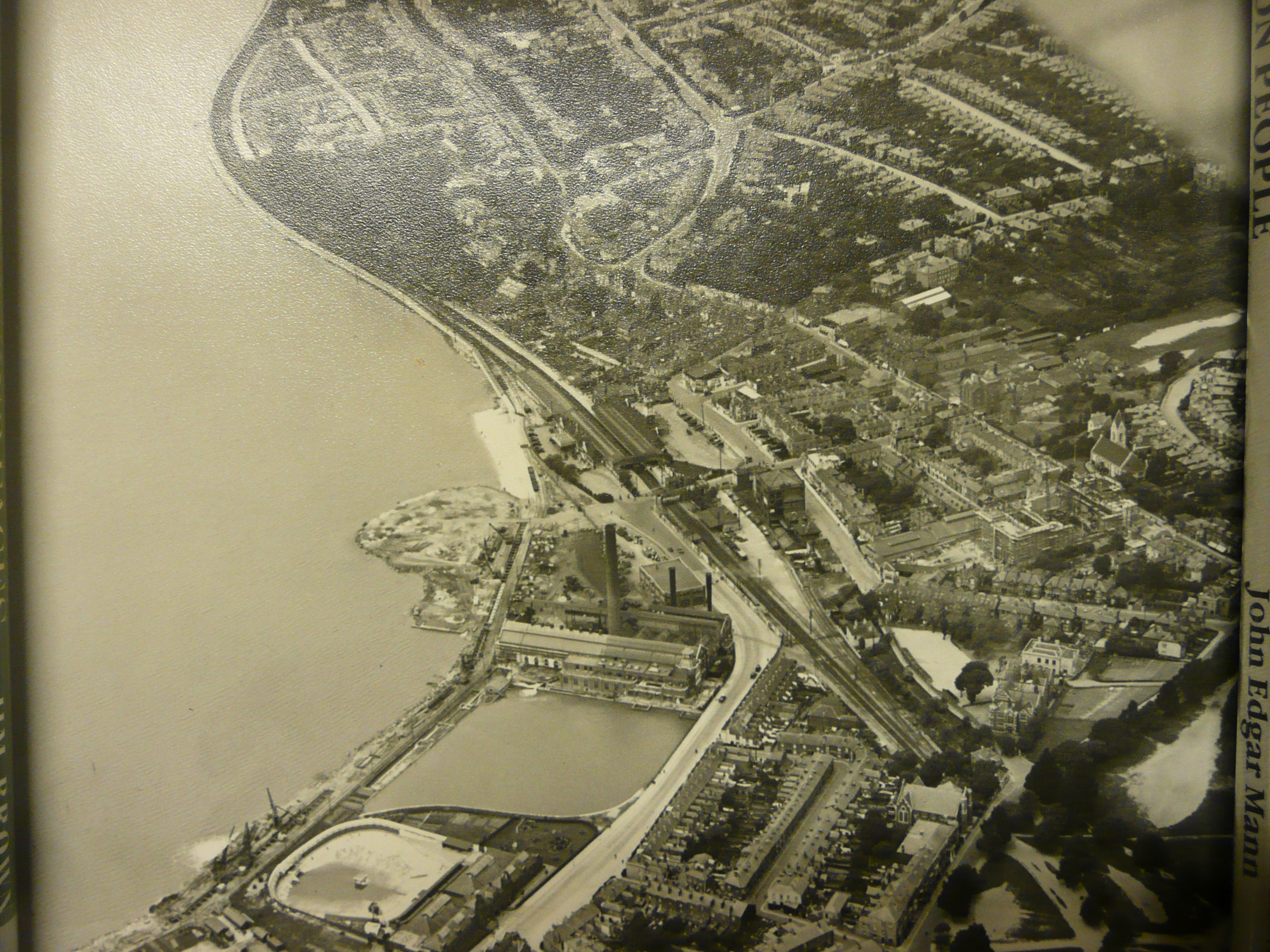
An aerial view of Southampton Station looking down track towards Millbrook, probably taken from the Emperia Building on Blechynden Terrace in 1931. The reclamation of West Bay had already begun as you can see top left , for the expansion of the Western Docks. Image: Bert Moody Collection / Southampton Daily EchoThis aerial view across West Bay looking towards Millbrook & Southampton Station, shows the extent of the reclamation works underway during the construction & expansion of the Western Docks in 1929. Image: Dave Marden Collection – Associated British PortsThis is a map & plan of proposed and future dock expansion in West Bay which occurred through the 1930’s. Image: Dave Marden Collection – Associated British Ports1928 saw the building of the Mayflower Theatre – known as The Empire Theatre. The Power Station of 1903 and the Lido from 1854 had begun the reclamation of land from West Bay, which was then taken to another level entirely by the docks expansion of the 1930’s. Southampton Station can be see in the centre of this image. Image: SCC Local & Maritime Aerial Collection.This image of 1928 from the Local & Maritime Aerial Collection of Southampton City Council, has been annotated by me to show the key buildings of our project area which is bounded by a red line.
A. St Peters Church, Commercial Road. Built 1845
B. Victoria Brewery, Commercial Road founded between 1863 & 1871 by Andrew Barlow, a business man & philanthropist who died in 1904 aged 84, the richest man to be buried in Southampton Cemetery!
C. Southampton Station of 1895
D. Emperia Building – Warehouses. Built around 1905, bombed out in 1940
E. Empire Theatre – now the Mayflower, built 1928
F. Power Station, built 1903
G. Kingsbridge Grammar School on Kingsbridge Lane
H. Blechynden Terrace & the Station forecourt
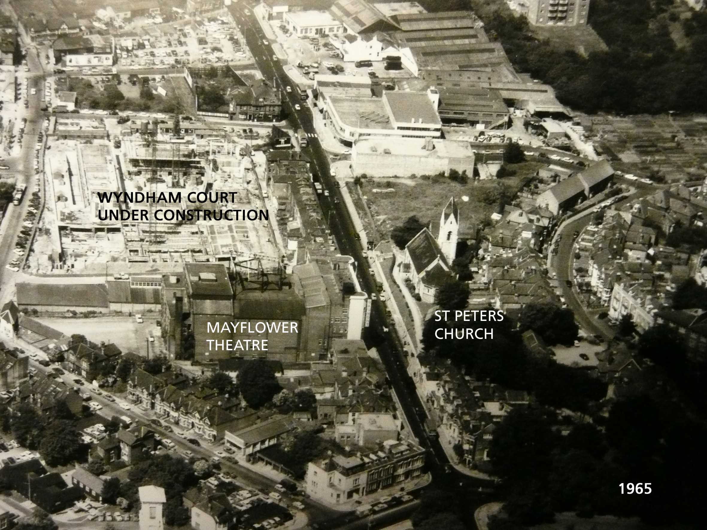
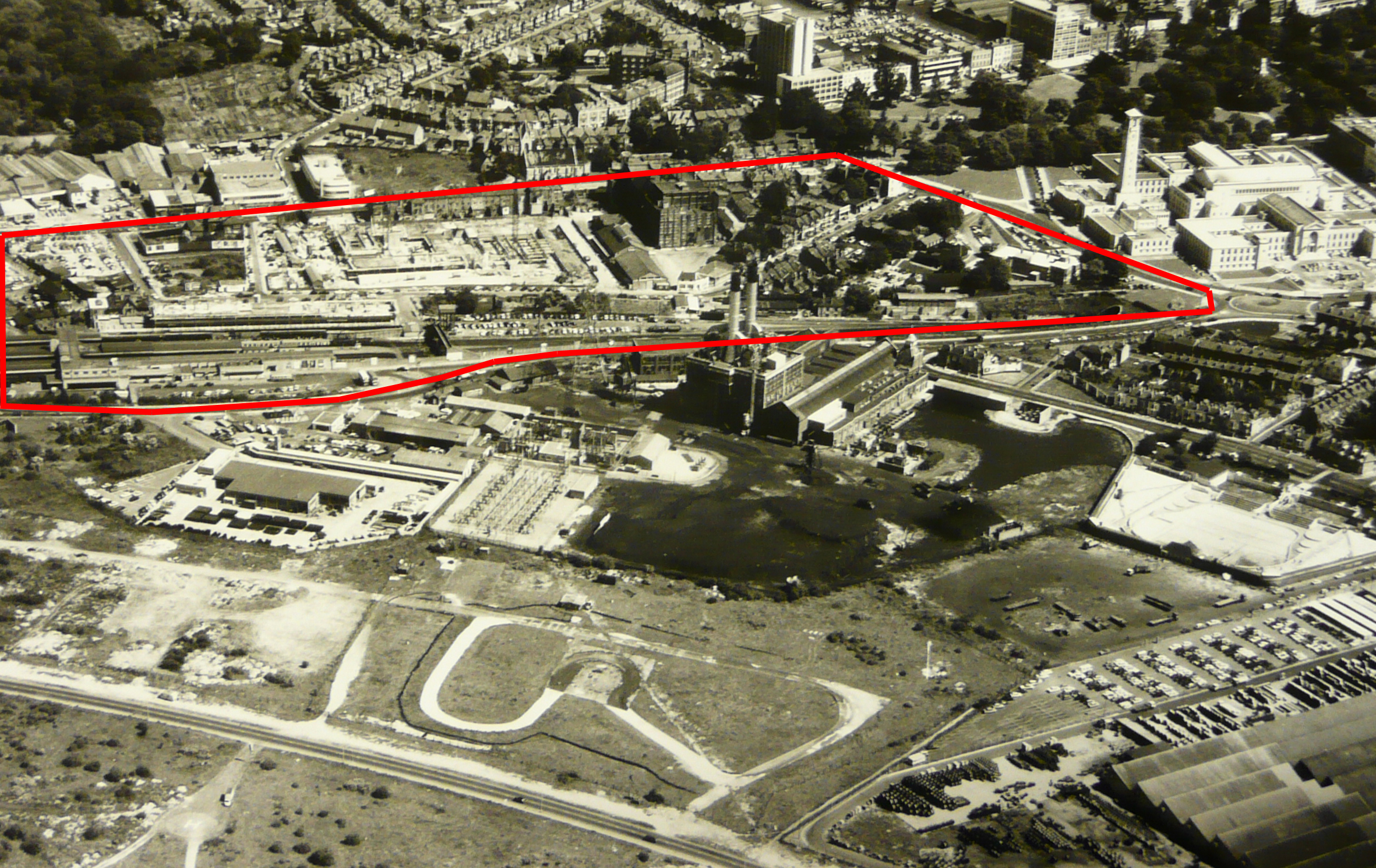
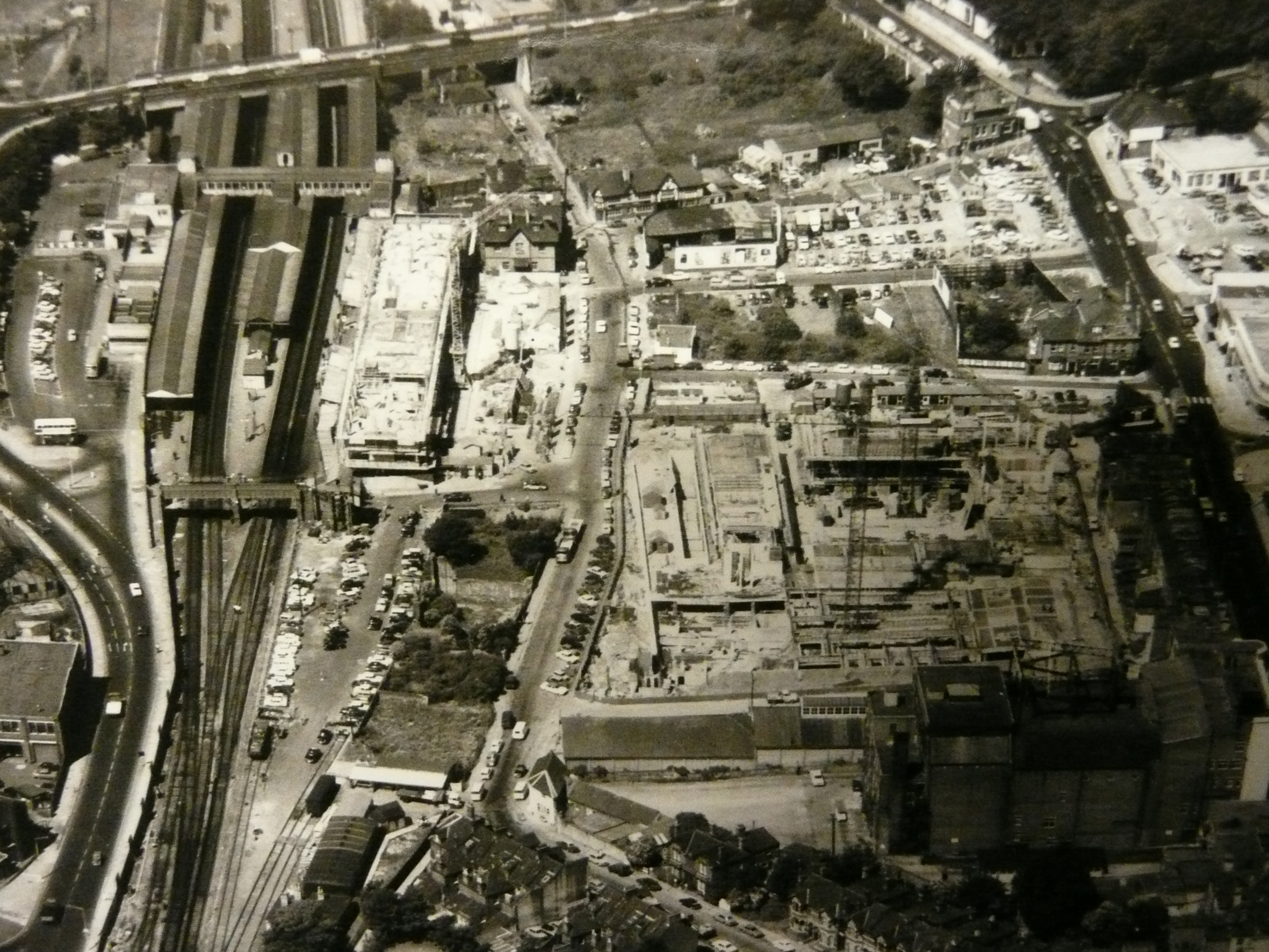
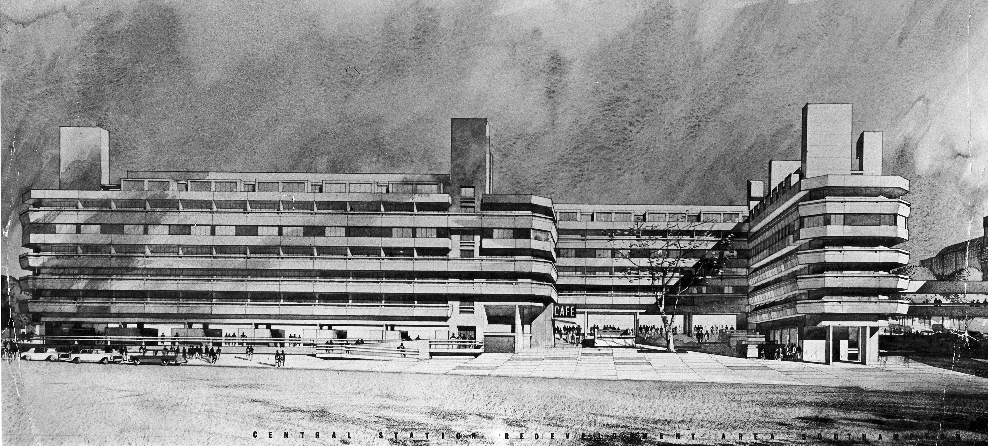
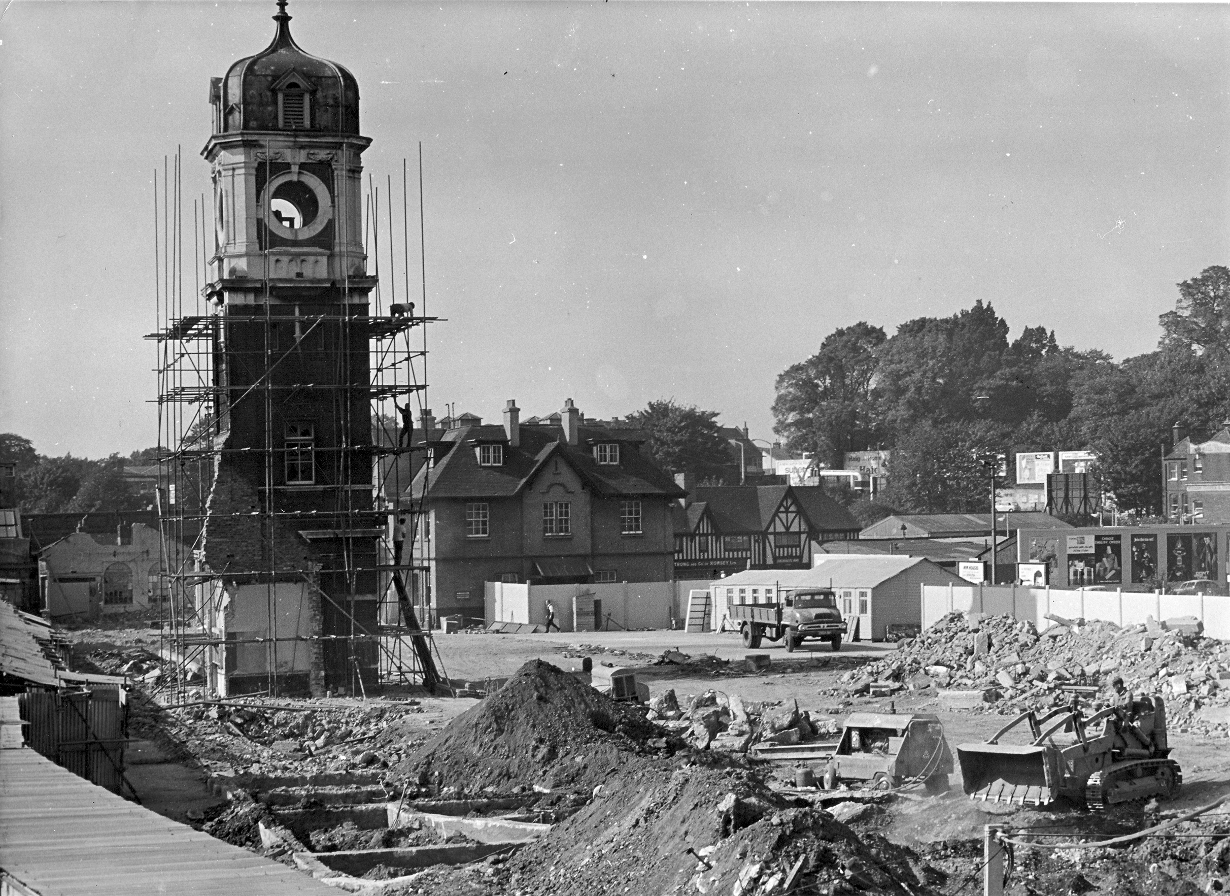
Cropped & annotated image of Commercial Road, Southampton in 1965. SCC Local Studies and Maritime Aerial Collection. Commercial Rd with Wyndham Court under construction.Cropped image of 1967. Looking north – this images gives a perfect west to east aerial view across the project site which is outlined in red – showing the construction of Overline House & Wyndham Court, between the railway line and Commercial Rd. The Civic Centre is at the top right hand side. SCC Local Studies and Maritime Aerial Collection.Cropped Image of 1967 showing the construction of Overline House and Wyndham Court. Blechynden Terrace runs vertically through the centre of this image, with Commercial Rd at the far right. Image: SCC Local Studies & Maritime Aerial Collection.Architects visualisation drawing for Wyndham Court, circa 1966. Image by kind permission of Southampton Daily EchoSouthampton Station Clocktower of 1895 during the final days of its demolition in 1966 to make way for Overline House. Image by kind permission of Southampton Daily EchoLooking towards Southampton Station, circa 1966 – probably taken from the Mayflower Theatre. Hill Street is the road on the right hand side – the street was completely demolished & is now under Wyndham Court. Image by kind permission of Southampton Daily Echo
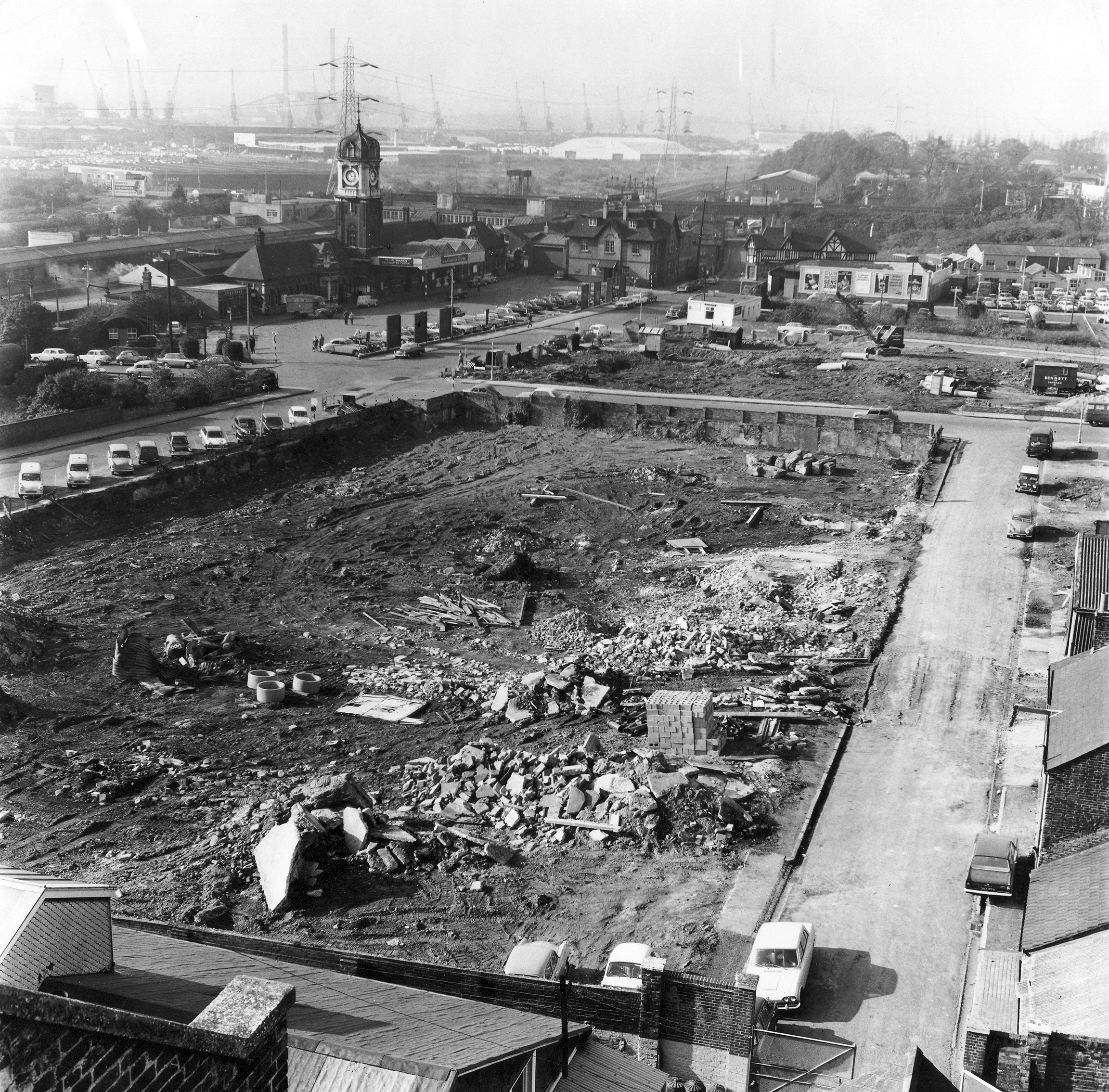
An aerial image of the site around the Station, looking east towards the Civic Centre at top of image. The image was probably for planning purposes and shows the future phased redevelopment of the land between Commercial Road and south of the railway lines. Easy to see how much of this site was bombed out during WWII. These sites were left untouched until the mid sixties, when the site was redeveloped. Image by kind permission of Southampton Daily Echo
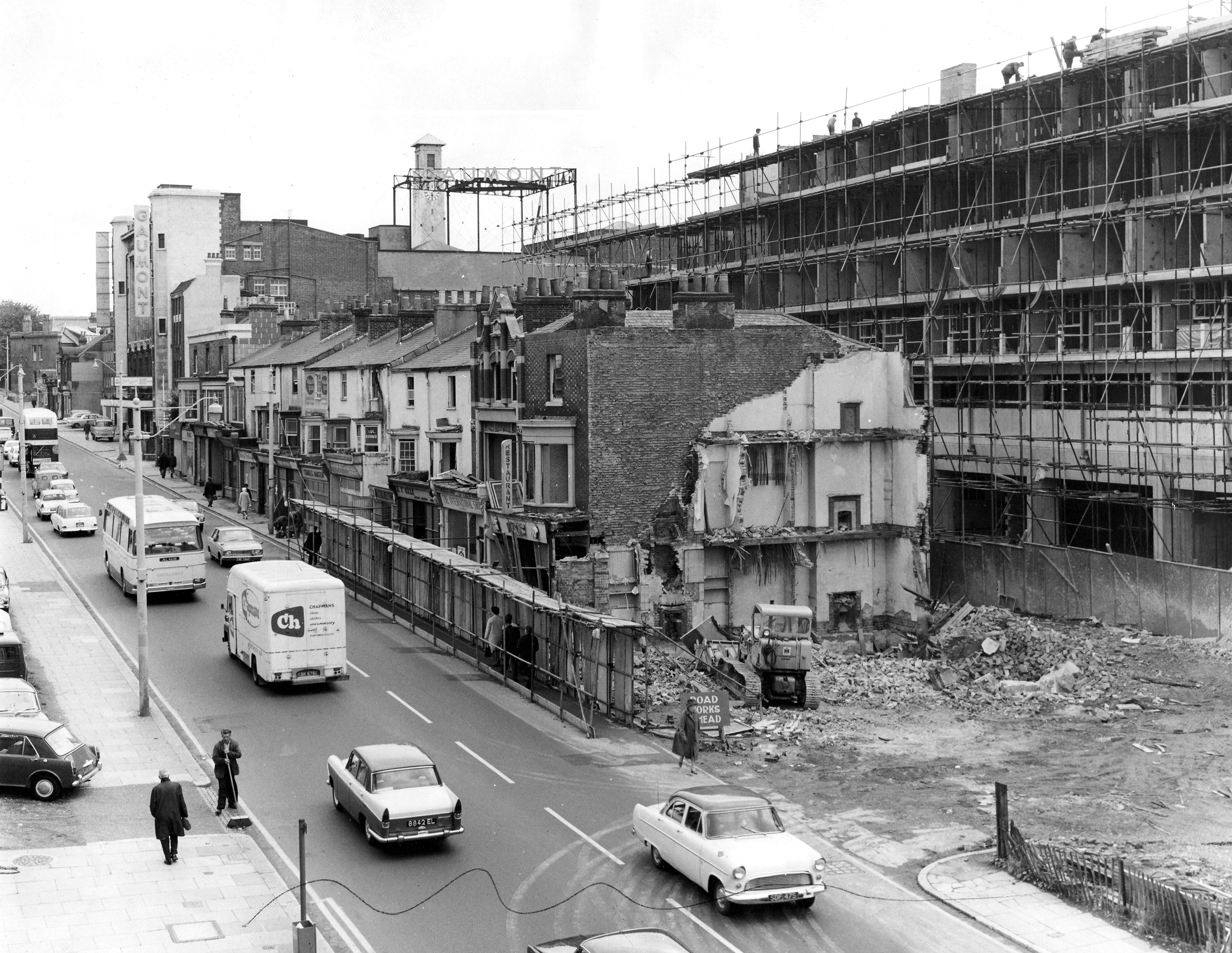
This image, looking east up Commercial Road, Southampton, towards the Mayflower (Gaumont) Theatre and Civic Centre, during the construction of Wyndham Court – circa 1967 / 1968. Image by kind permission of Southampton Daily Echo
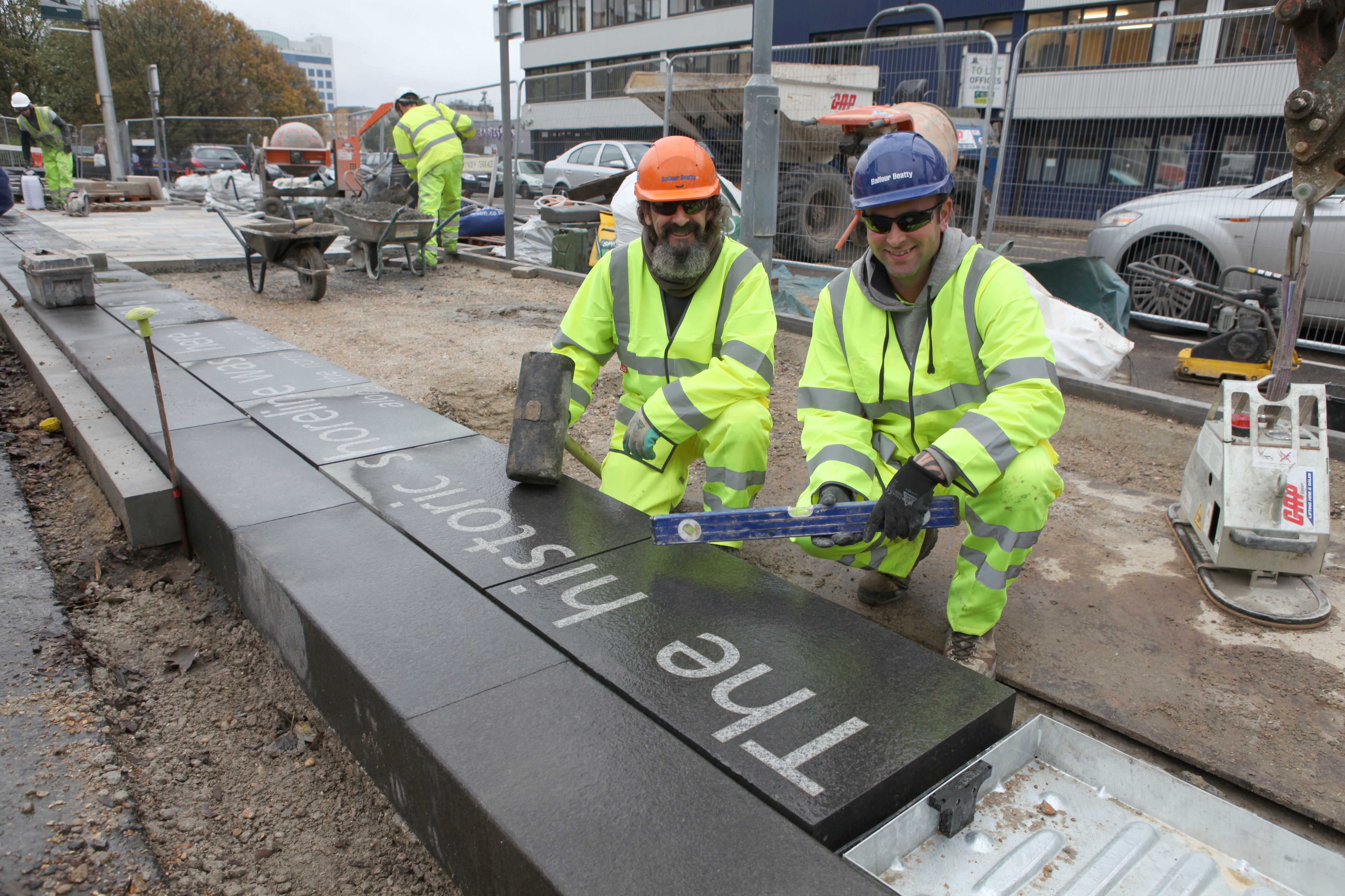
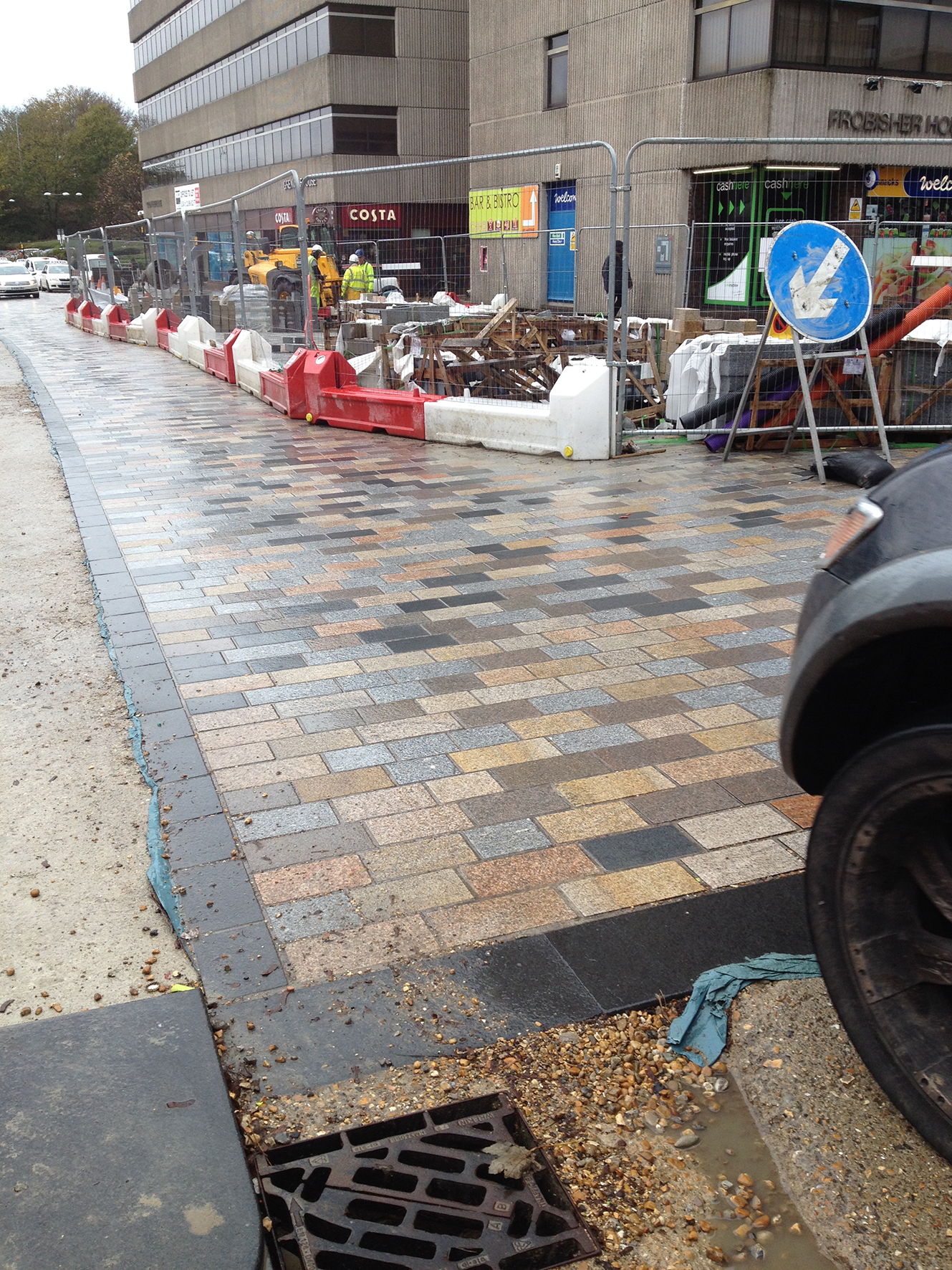
Thursday 13th November 2014saw the last black basalt slab installed on Blechynden Terrace to complete the ‘Canal Shore’artwork installation.
Left to right – Martin Miller and Jay Geary of Balfour Beatty, who have together installed all the 205 linear metres of the kerb edge artwork – which was manufactured and inlaid with text by Hardscape – along Blechynden Terrace and the forecourt of Central Station.
These were the brilliant guys on the ground who installed the Canal Shore works – Martin Miller & Jay Geary of Balfour Beatty. Image: Wilson Massie
This almost – but not quite – completes the Phase 1 works for the Southampton Station Quarter North project being delivered by Balfour Beatty Living Places for Southampton City Council. This project is one of seven ‘Very Important Projects’ (VIP’S) & part of its City Centre Master Plan which will see one of Southampton’s most important gateways transformed into ‘an exciting arrival experience fit for a major city.’
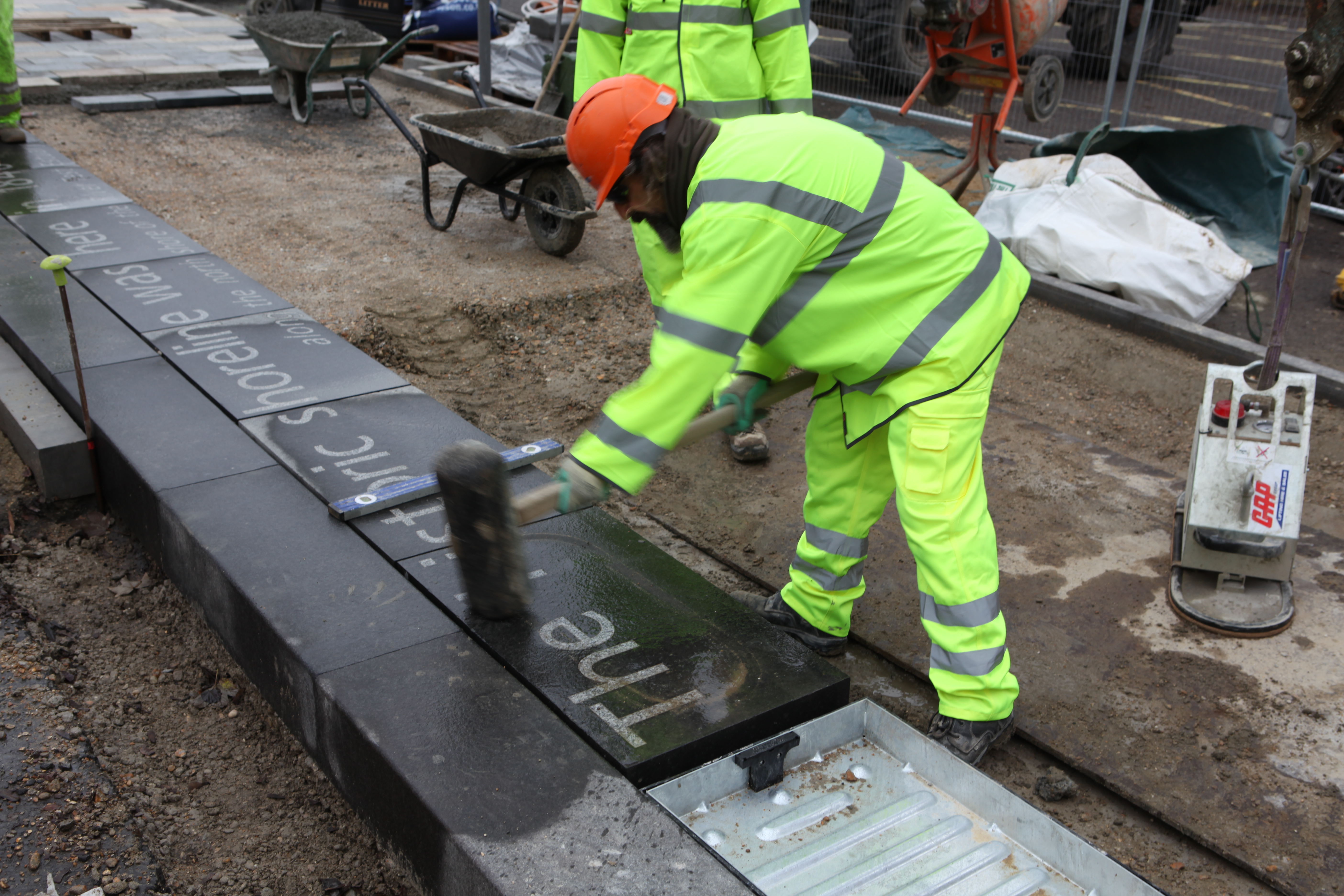
Some more images of works in progress:
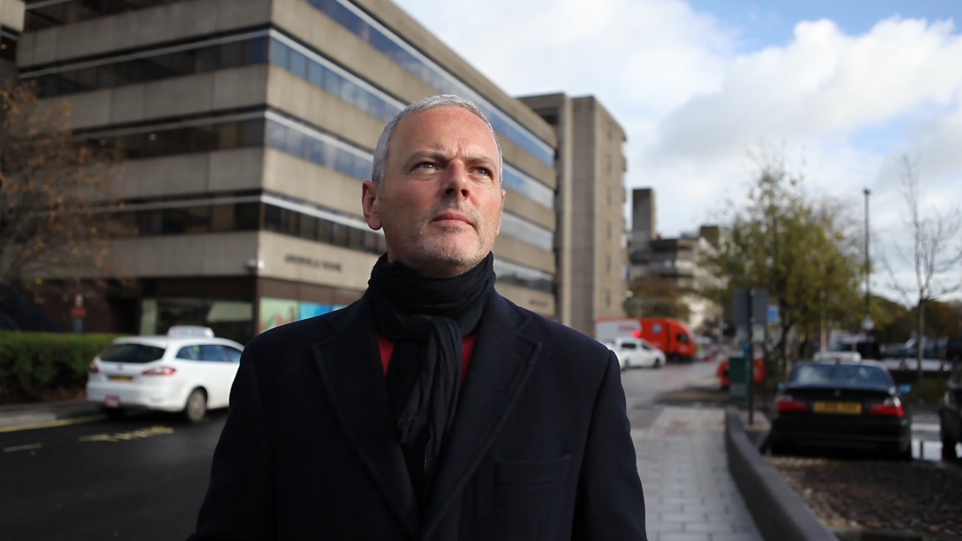
Image: Wilson Massie for Southampton Station Quarter NorthImage: Wilson Massie for Southampton Station Quarter NorthChristopher Tipping, project artist on site –
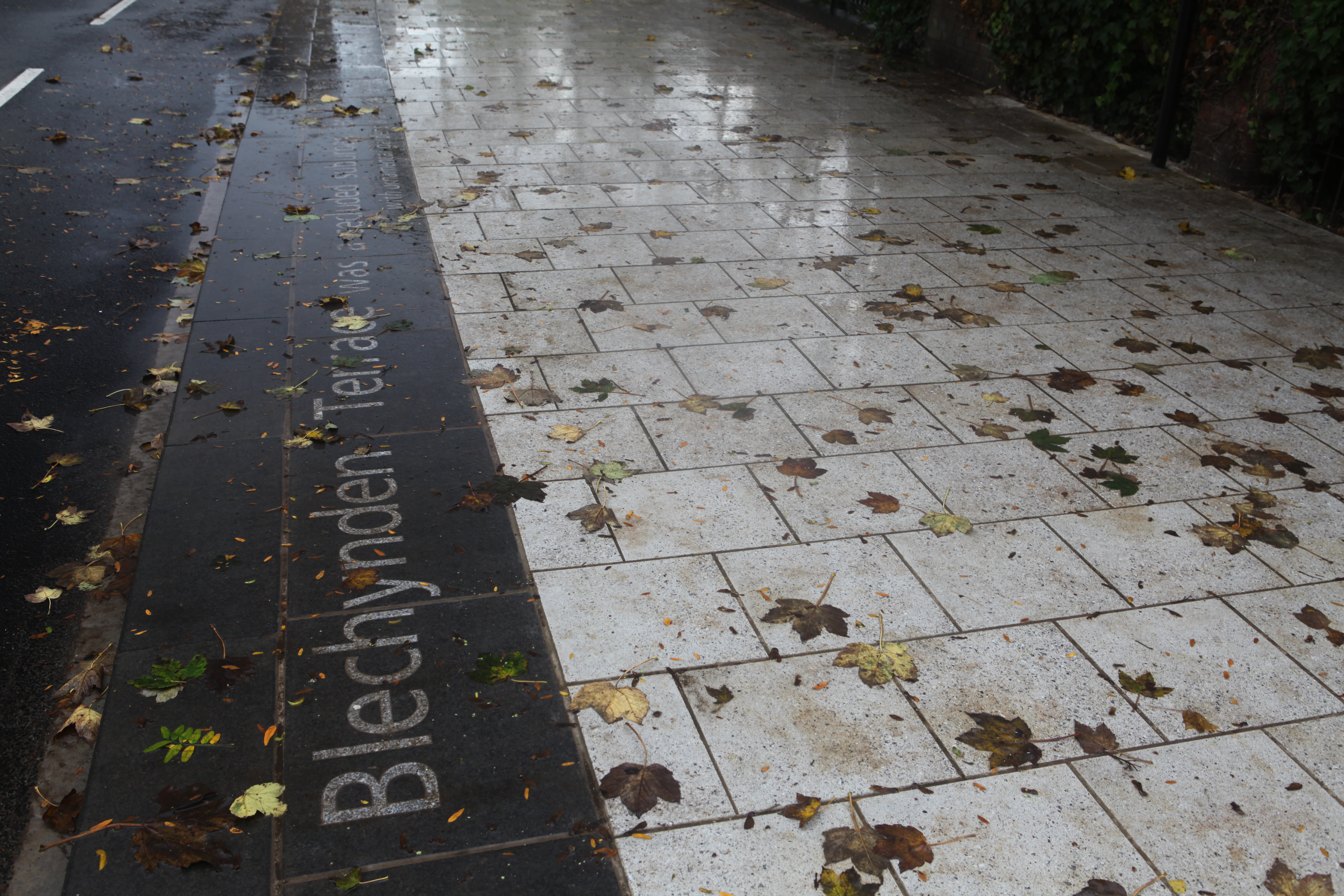
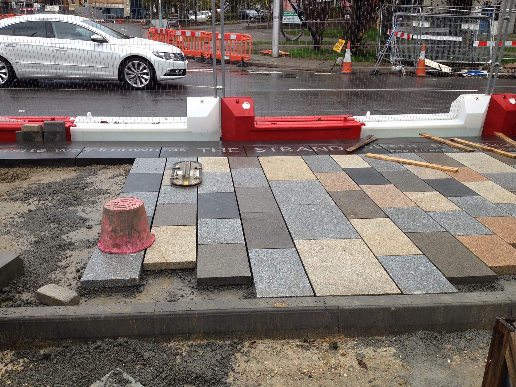
The text just visible along the kerb edge reads: ‘this route was known as THE STRAND, ‘strata super Strondham’, …the street by the shore…’ Christopher Tipping
The site, adjacent to the shoreline of the Test Estuary has always been a point of confluence. The main route West in & out of the city ran along the shoreline and was known as The Strand. At a point marked by Achards Bridge, which replaced an ancient ford across the Rollesbrook Stream which enters the River Test at this point, the city boundary with Millbrook was established.
Today this site is near to the entrance to Southampton Central Station. You may cross the Rollesbrook Stream yourself each time you visit the station. The station is the gateway to the city & a critical hub & interchange.
The individual lines of texts are to be set out adjacent to the carriageway on the south side of Blechynden Terrace at site specific points along the ‘Canal Shore’ feature kerb line, & reveal in their expression something of the history and use of the local area. It is not a linear ‘narrative’ and has no specific start or finish. It will engage with people as and when they encounter the words. Some words and phrases have their origin in fact and are ‘on the record’, whilst some is anecdotal and ‘remembered’.
The black basalt has inset light grey granite. When wet – as today was – the contracts is at it’s greatest.
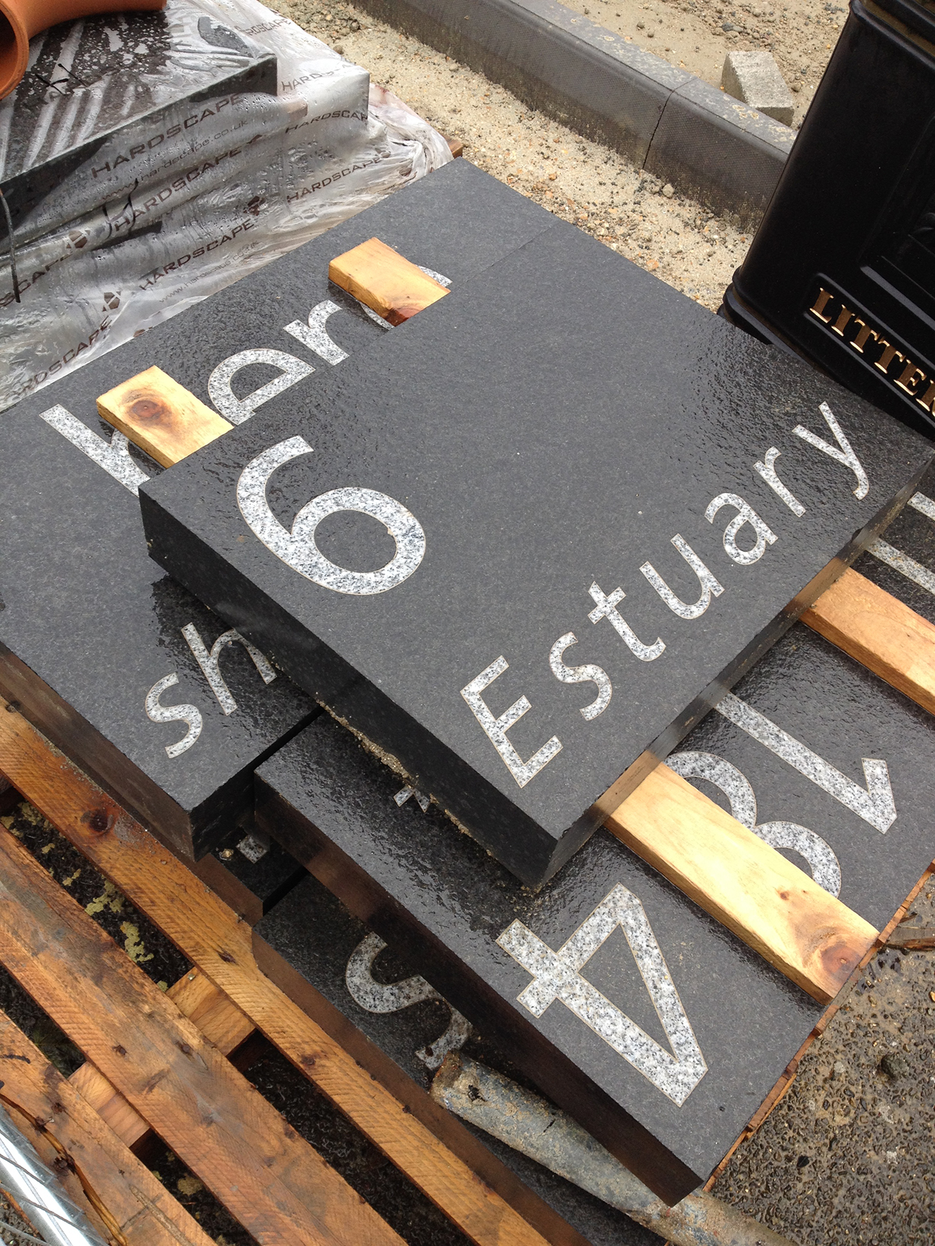
The text on these slabs is part of the following line – ‘The historic shoreline was here in 1846…the north shore of the River Test Estuary’
The 1846 Large Folio Royal Engineers Map held in the Southampton City Council Archive, is wonderfully accurate & detailed. It shows the planned route out over the mudflats of the unfinished ‘Dorchester Railway’. The shoreline was at this time still north of this point, with the high water mark reaching to what is now, the southern footpath of Blechynden Terrace & Southbrook Road. The historic curve of the Bay here is thought to be a meander of the ancient Solent River system. SCC Libraries & Archive
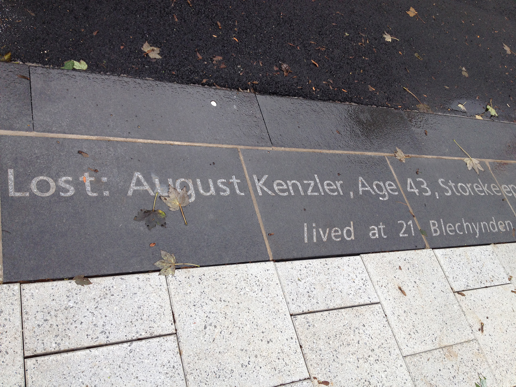
‘Lost: August Kenzler, Age 43, Storekeeper on the RMS Titanic lived at 21 Blechynden Terrace’
August Kenzler was lost when the Titanic struck an iceberg on its maiden voyage. He was one of seven crewmen (from more than 720 from Southampton) who lived in the area bounded by our project.
John Henry Stagg – Steward – 1st Class – Lost – 66 Commercial Road
August Kenzler – Storekeeper – Age 43 – Lost – 21 (12) Blechynden Terrace
Michael Stafford – Greaser – Age 37 – No 4 Southbrook Road
Walter Edward Saunders – Trimmer – Age 25 – No1 Suffolk Sq (off Southbrook Road)
Long – Trimmer – Age 28 – No 19 Sidford Street –
William Logan Gwinn – Age 37 – No 4 Commercial Road