Chatham Maps


Details from OS 1864 & OS 1932 Maps of Chatham - by permission of Medway Archives and Local Studies Centre. Chatham Placemaking Project. Image: Christopher Tipping
Details from OS 1864 & OS 1932 Maps of Chatham – by permission of Medway Archives and Local Studies Centre. Chatham Placemaking Project. Image: Christopher Tipping

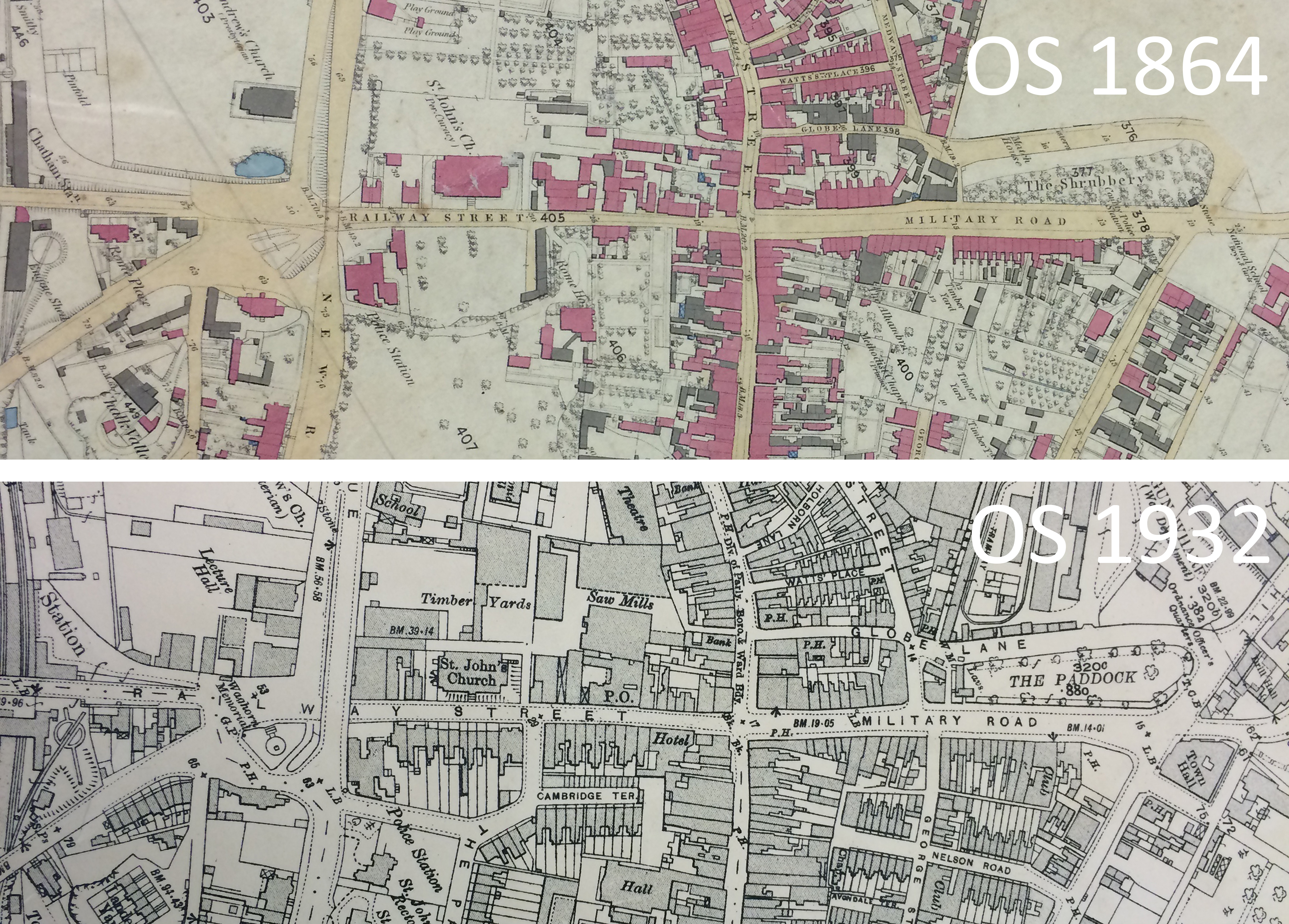
The two OS Maps above show developments along the project route over 68 years between 1864 and 1932. The maps can be read left to right – from Chatham Station, along Railway Street, Military Road and The Paddock. Of particular interest is the area just above St John’s Church. In 1864 this appears to have been private gardens or grounds, with trees or orchards planted. BY 1932 this had all been consumed by timber Yards and Sawmills. This was the site of Scott’s Timber Yard.

Leave a Reply

Your email address will not be published. Required fields are marked *

This site uses Akismet to reduce spam. Learn how your comment data is processed.