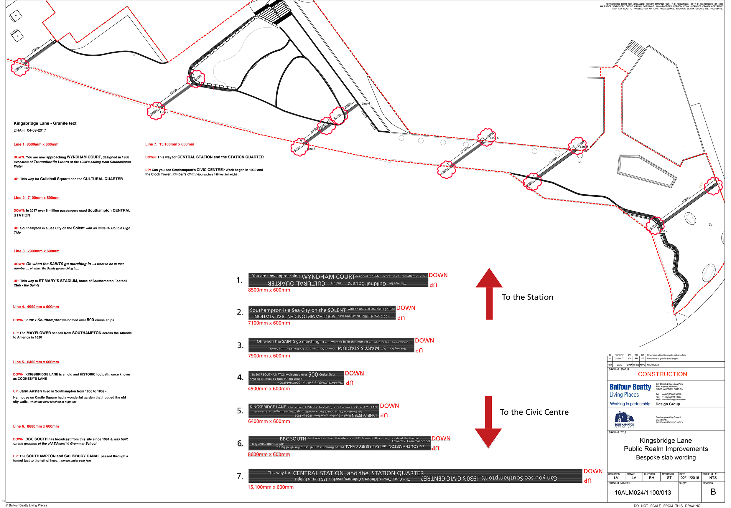
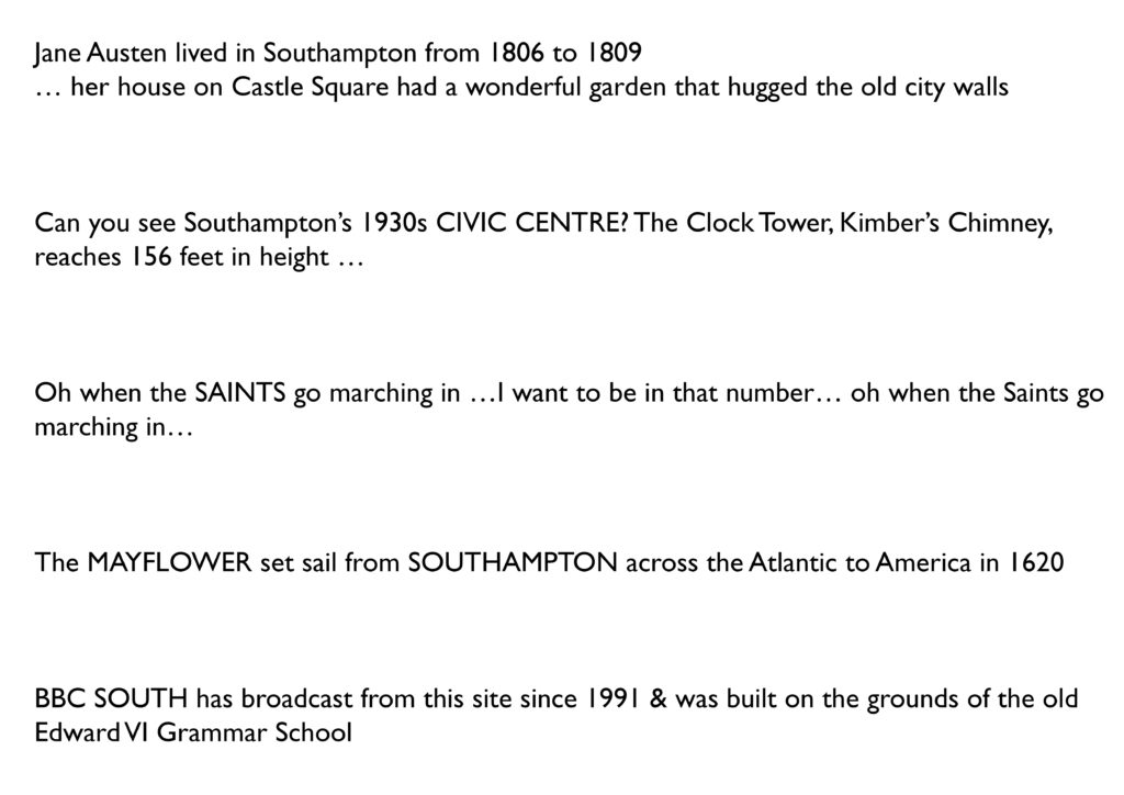
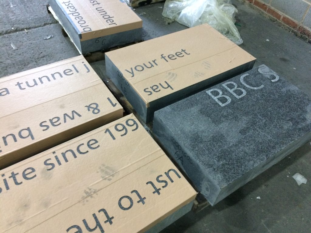
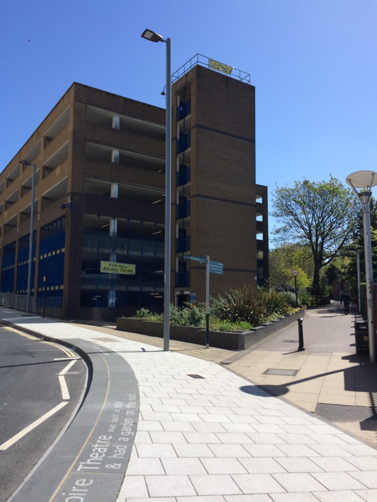
‘The SOUTHAMPTON and SALISBURY CANAL passed through a tunnel just to the left of here…almost under your feet’
Kingsbridge Lane with Civic Centre and Clocktower. Image: Massie Wilson
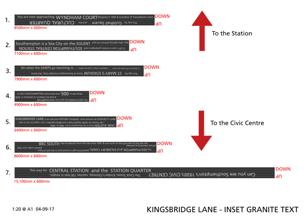
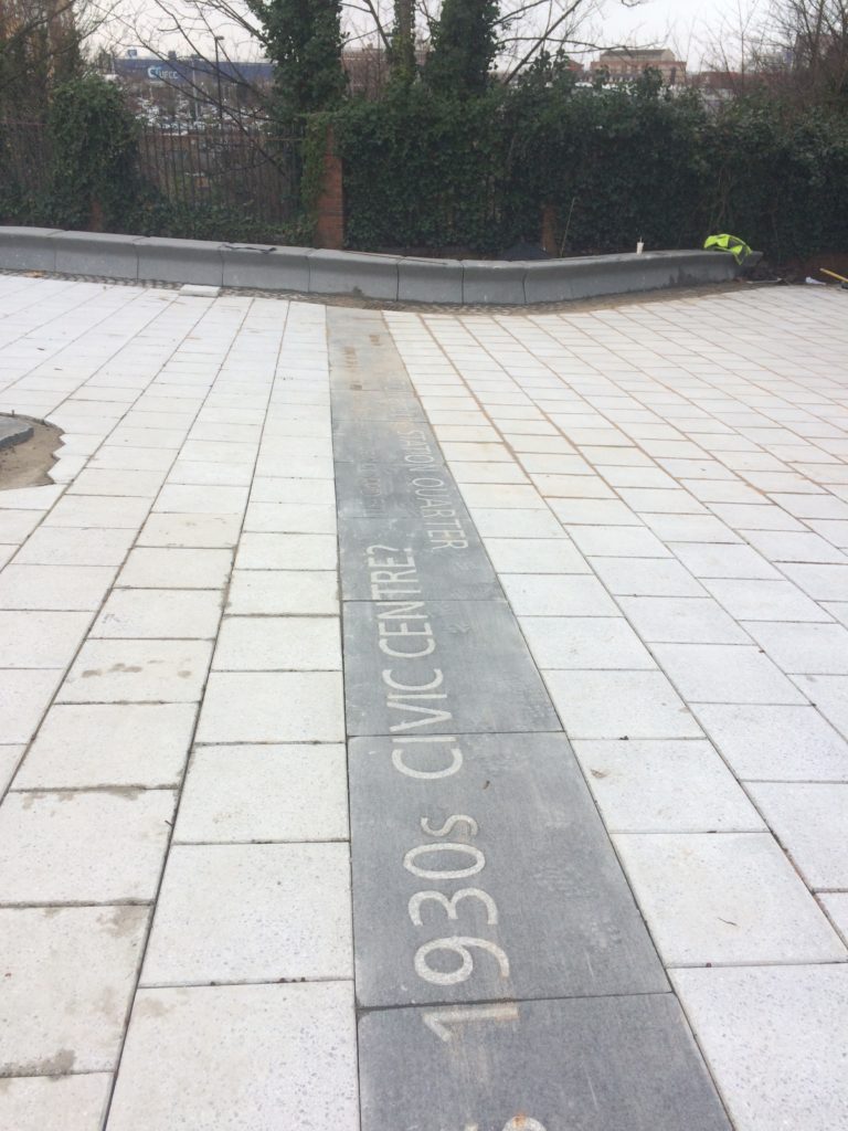
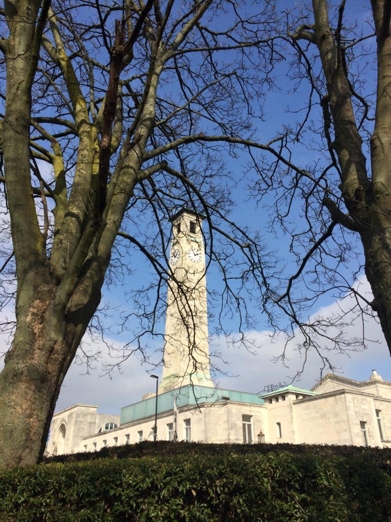
‘Can you see Southampton’s 1930s CIVIC CENTRE? The Clock Tower, Kimber’s Chimney, reaches 156 feet in height…’
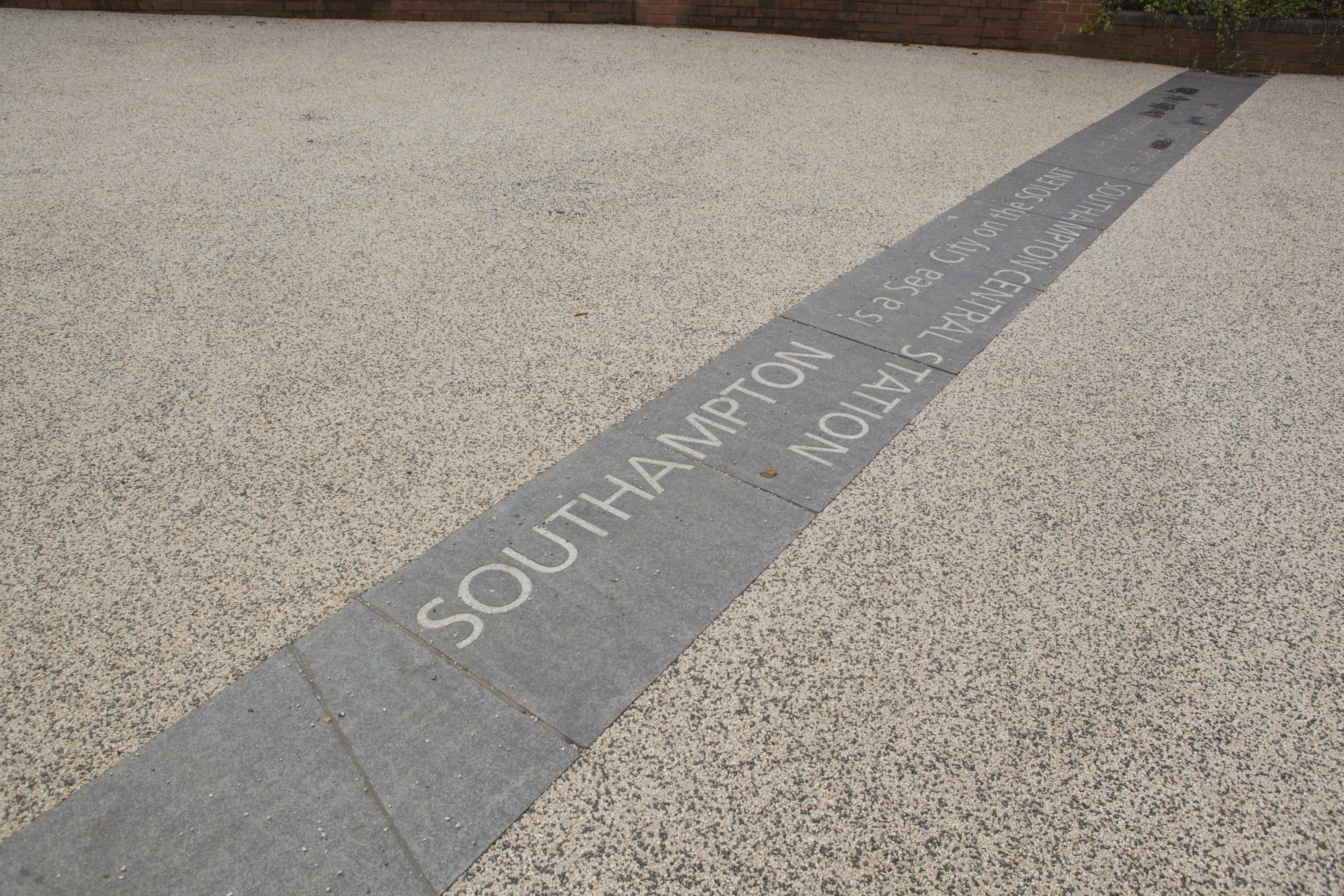
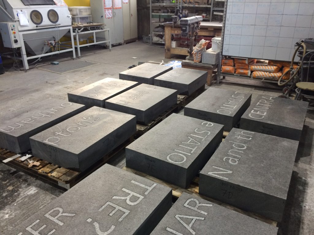
Text – white granite inset into contrasting black granite.
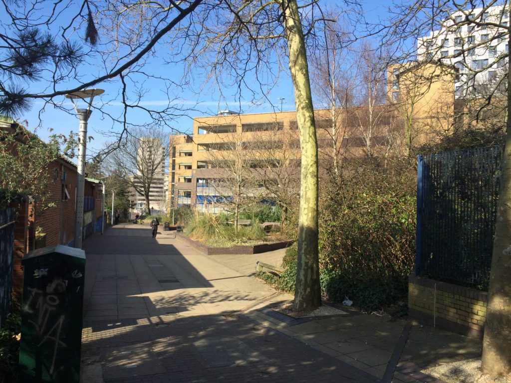
Kingsbridge Lane in Southampton is a historically important and longstanding pedestrian-only route with no vehicular access. This makes the site significant to Southampton. It is a long surviving link to the western route in and out of Southampton along the coastal strand, which formed the northern shore of the River Test Estuary until the early 20thCentury. The footpath runs along a narrow strip of land between the existing railway tunnel and the historic and long abandoned tunnel of the Southampton to Salisbury Canal, which ran along what is now Blechynden Terrace, linking Central Station to the Guildhall Square &Cultural Quarter. My role within this project was to develop a contextual response to the site, which would, hopefully, influence the landscape design and regenerative design process in collaboration Simon Taylor of Balfour Beatty Living Places , Southampton City Council and Hardscape.
Kingsbridge Lane, Southampton. Image: Massie WilsonKingsbridge Lane, Southampton. 14 lines of text – Image: Balfour Beatty
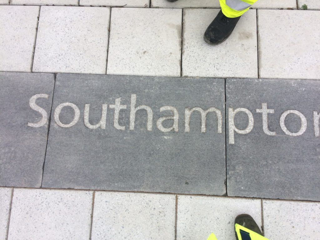
‘SOUTHAMPTON is a Sea City on the SOLENT …with and unusual Double High Tide’.
Text – white granite inset into contrasting black granite.
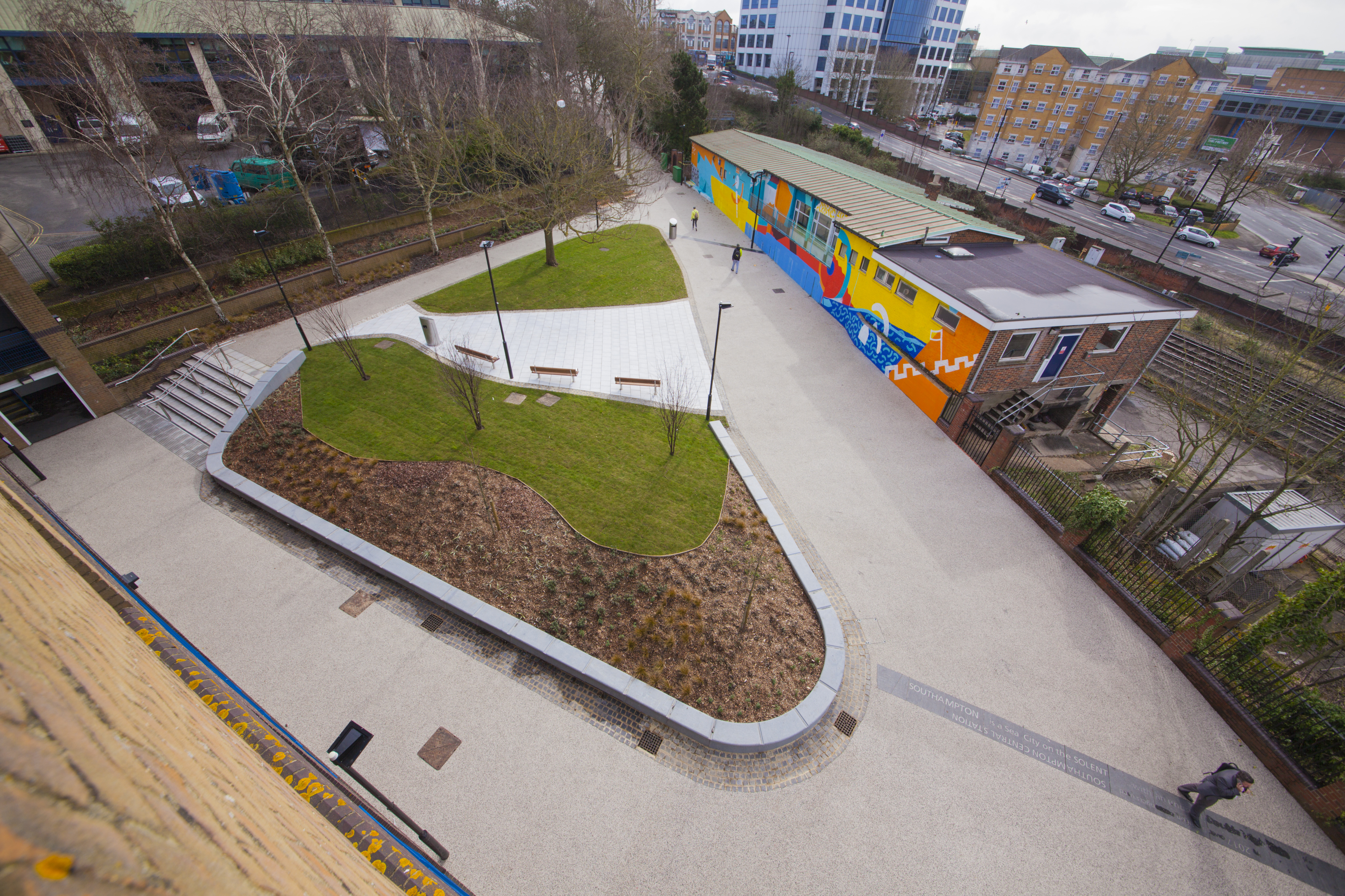
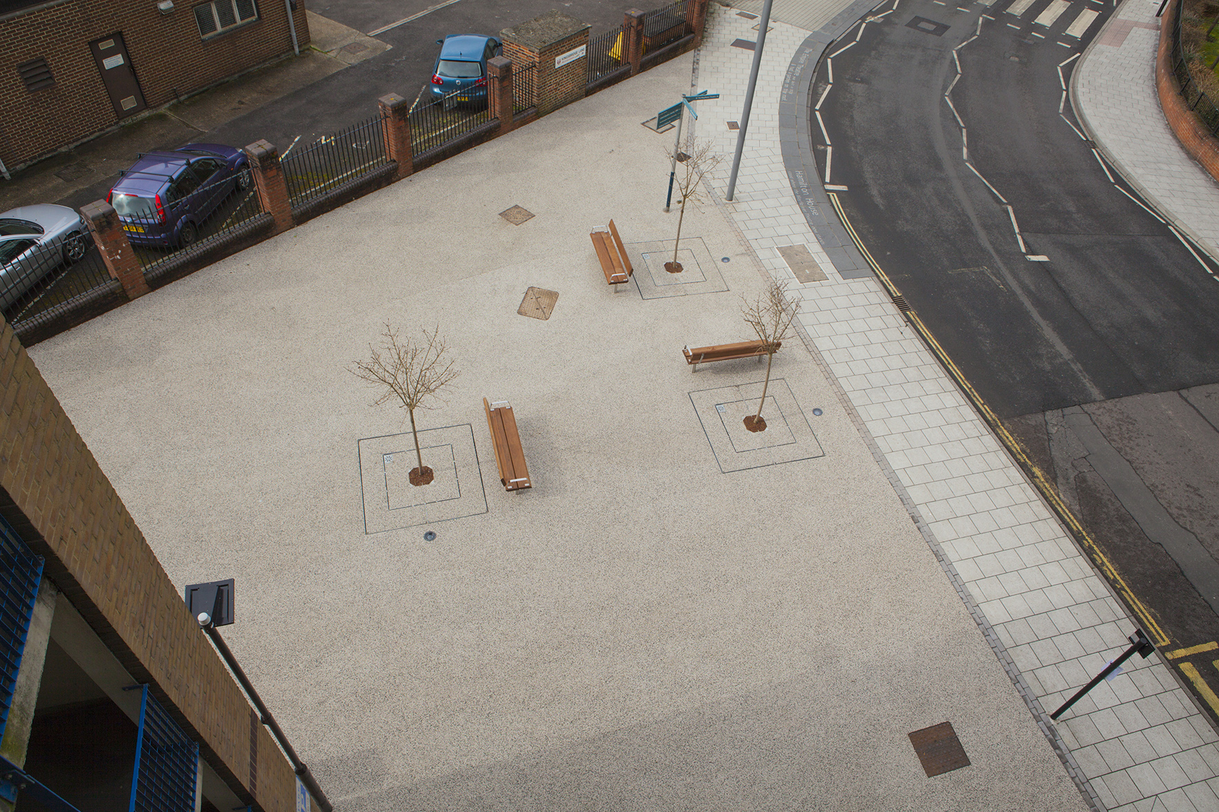
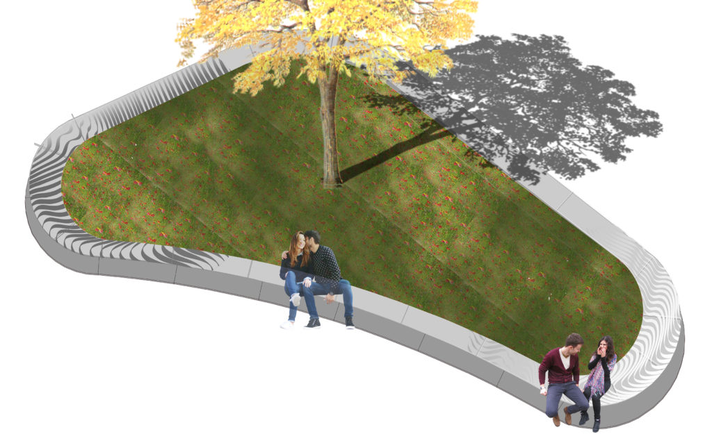
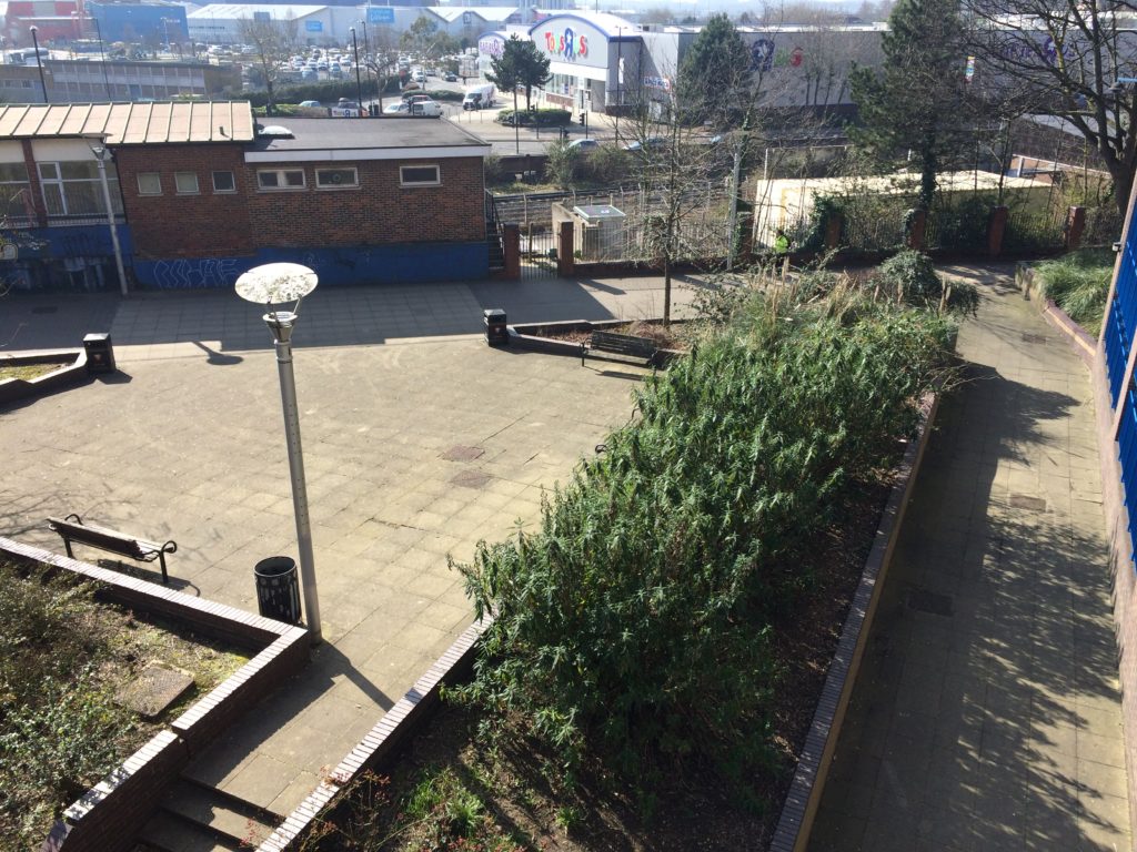
Aerial view of Kingsbridge Lane, Southampton. Image: Massie Wilson
‘Oh when the SAINTS go marching in …I want to be in that number… oh when the Saints go marching in…’
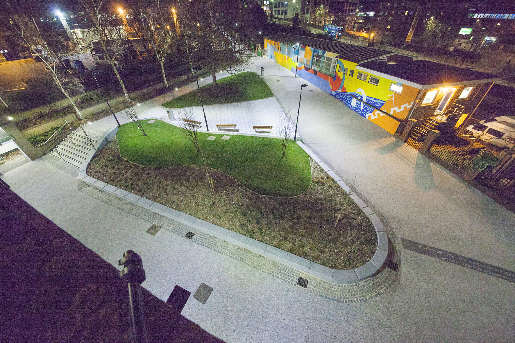
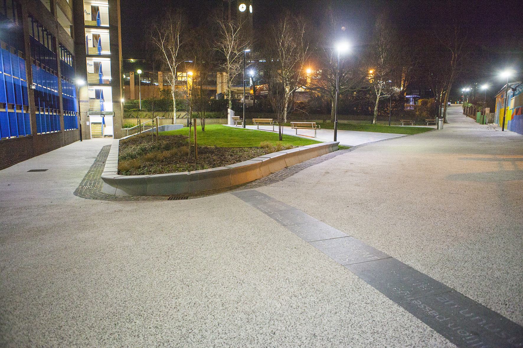
Nighttime aerial view of Kingsbridge Lane, Southampton. Image: Massie Wilson
‘In 2017 over 6 million passengers used Southampton CENTRAL STATION’
Kingsbridge Lane, Southampton. Nighttime view. Image: Massie Wilson
‘SOUTHAMPTON is a Sea City on the SOLENT …with and unusual Double High Tide’.
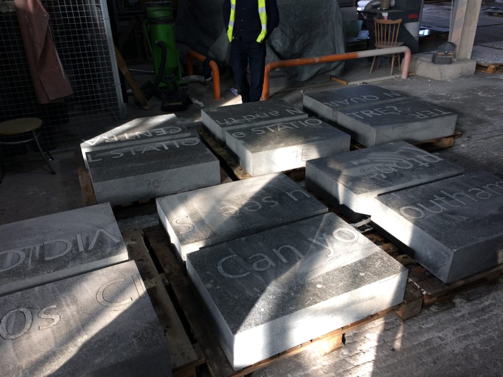
Basalt Slabs with inset text at Hardscape for Kingsbridge Lane, Southampton. Image: Christopher Tipping
Kingsbridge Lane, Southampton. Image: Massie Wilson
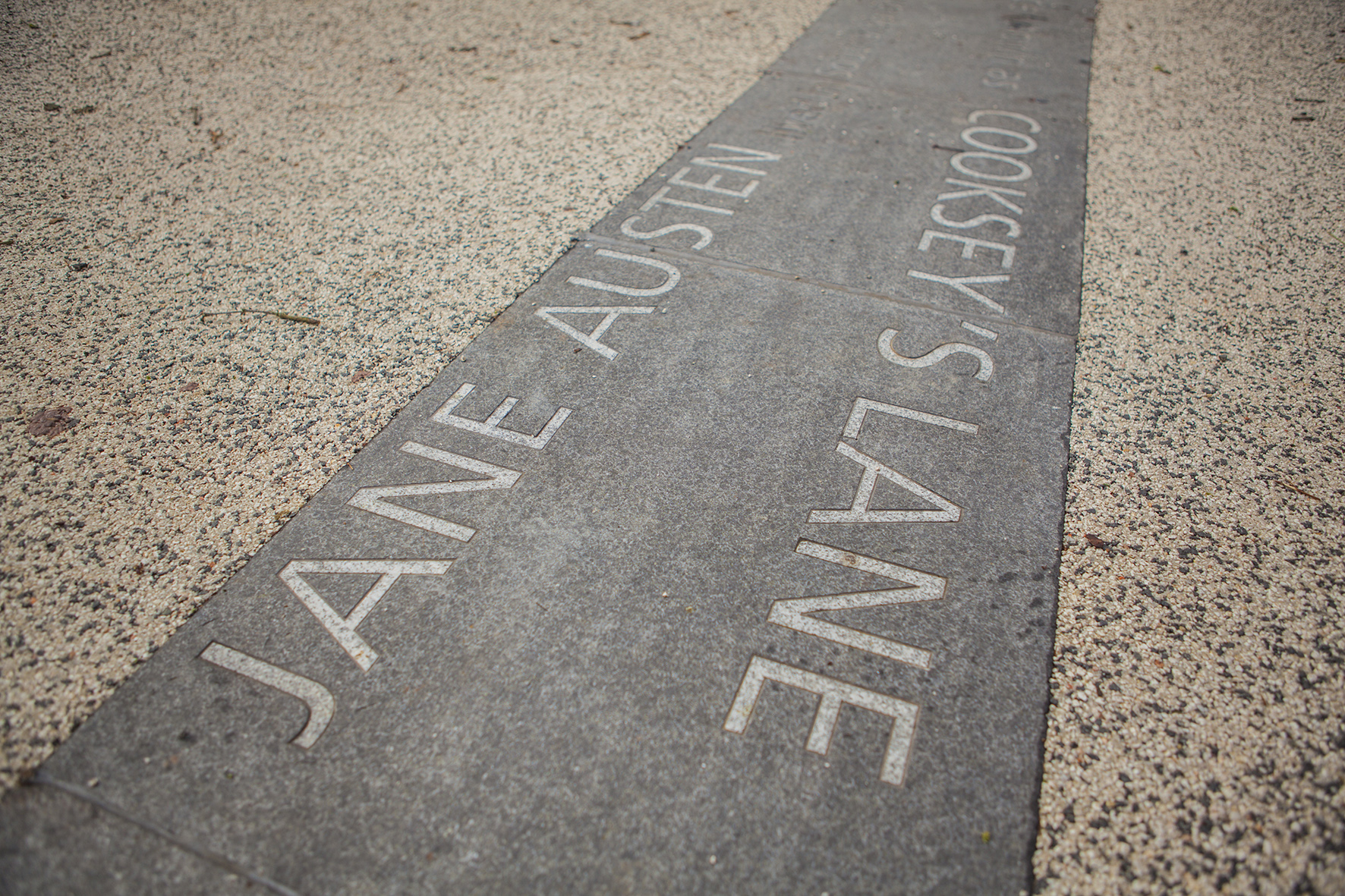
‘Jane Austen lived in Southampton from 1806 to 1809 … her house on Castle Square had a wonderful garden that hugged the old city walls’
Kingsbridge Lane, Southampton. Image: Massie Wilson
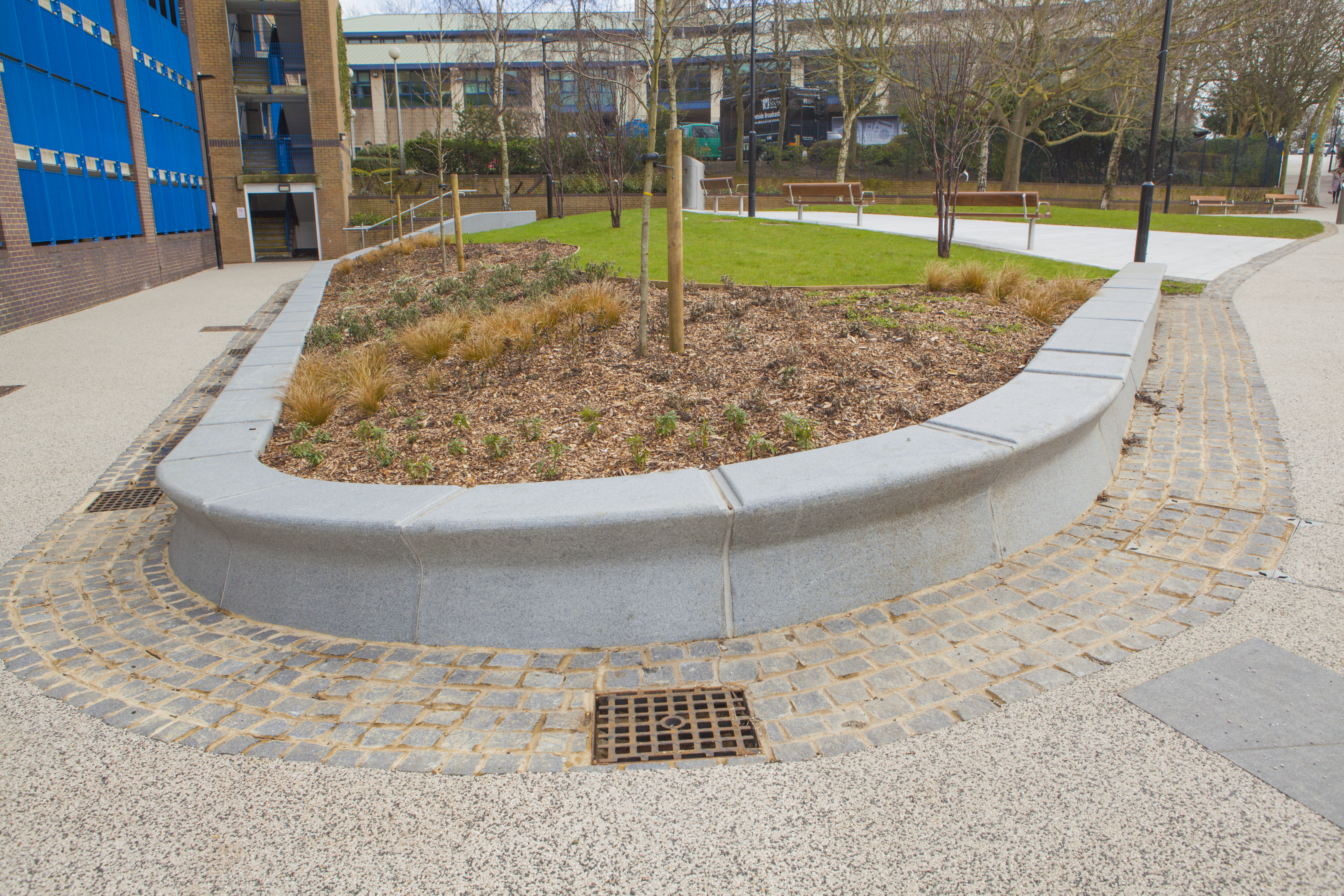
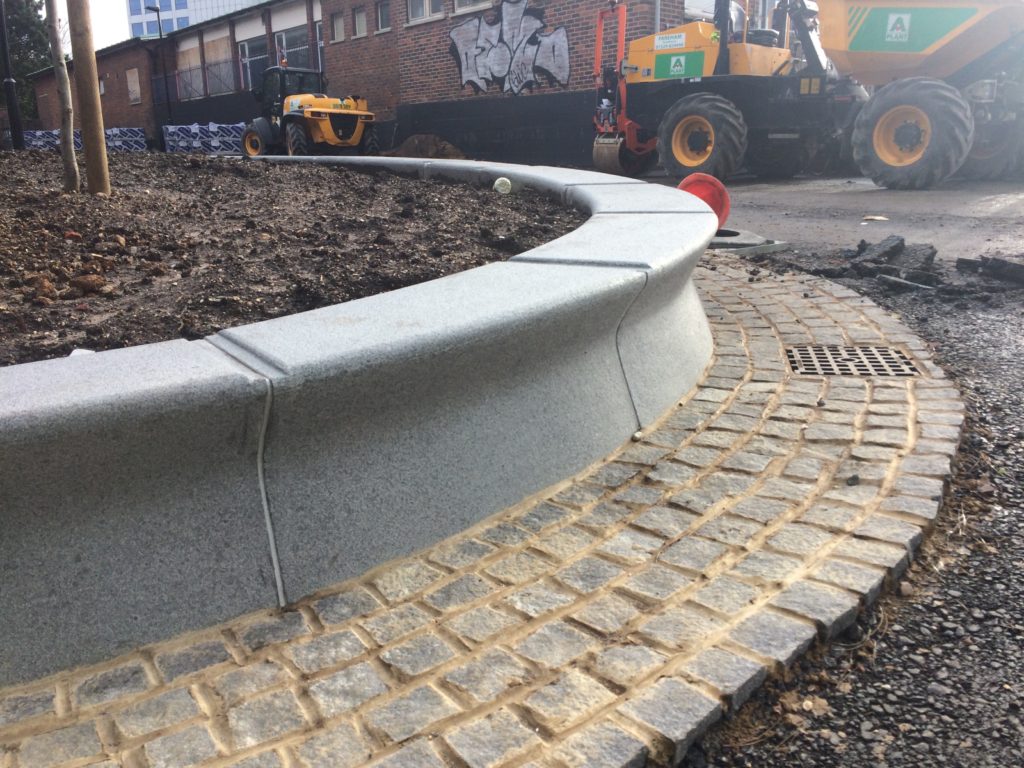
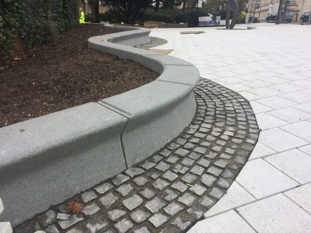
The granite seating and retaining walls by Hardscape are undercut along the front edge suggesting the movement of water throughout the site.
‘The MAYFLOWER set sail from SOUTHAMPTON across the Atlantic to America in 1620′
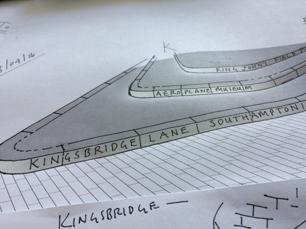
Aerial view of Kingsbridge Lane at the junction with Blechynden Terrace and West Park Rd, Southampton. Image: Massie Wilson
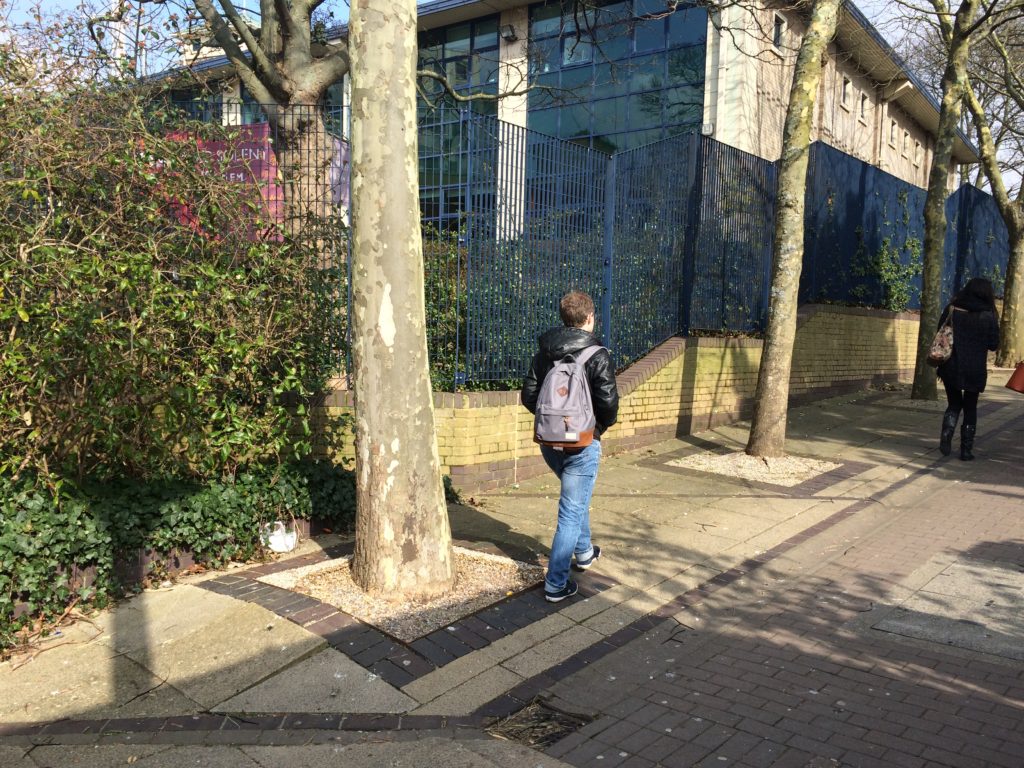
Kingsbridge Lane in Southampton is a historically important and longstanding pedestrian-only route with no vehicular access. This makes the site significant to Southampton. It is a long surviving link to the western route in and out of Southampton along the coastal strand, which formed the northern shore of the River Test Estuary until the early 20th Century. The footpath runs along a narrow strip of land between the existing railway tunnel and the historic and long abandoned tunnel of the Southampton to Salisbury Canal, which ran along what is now Blechynden Terrace, linking Central Station to the Guildhall Square &Cultural Quarter. My role within this project was to develop a contextual response to the site, which would, hopefully, influence the landscape design and regenerative design process in collaboration Simon Taylor of Balfour Beatty Living Places , Southampton City Council and Hardscape.
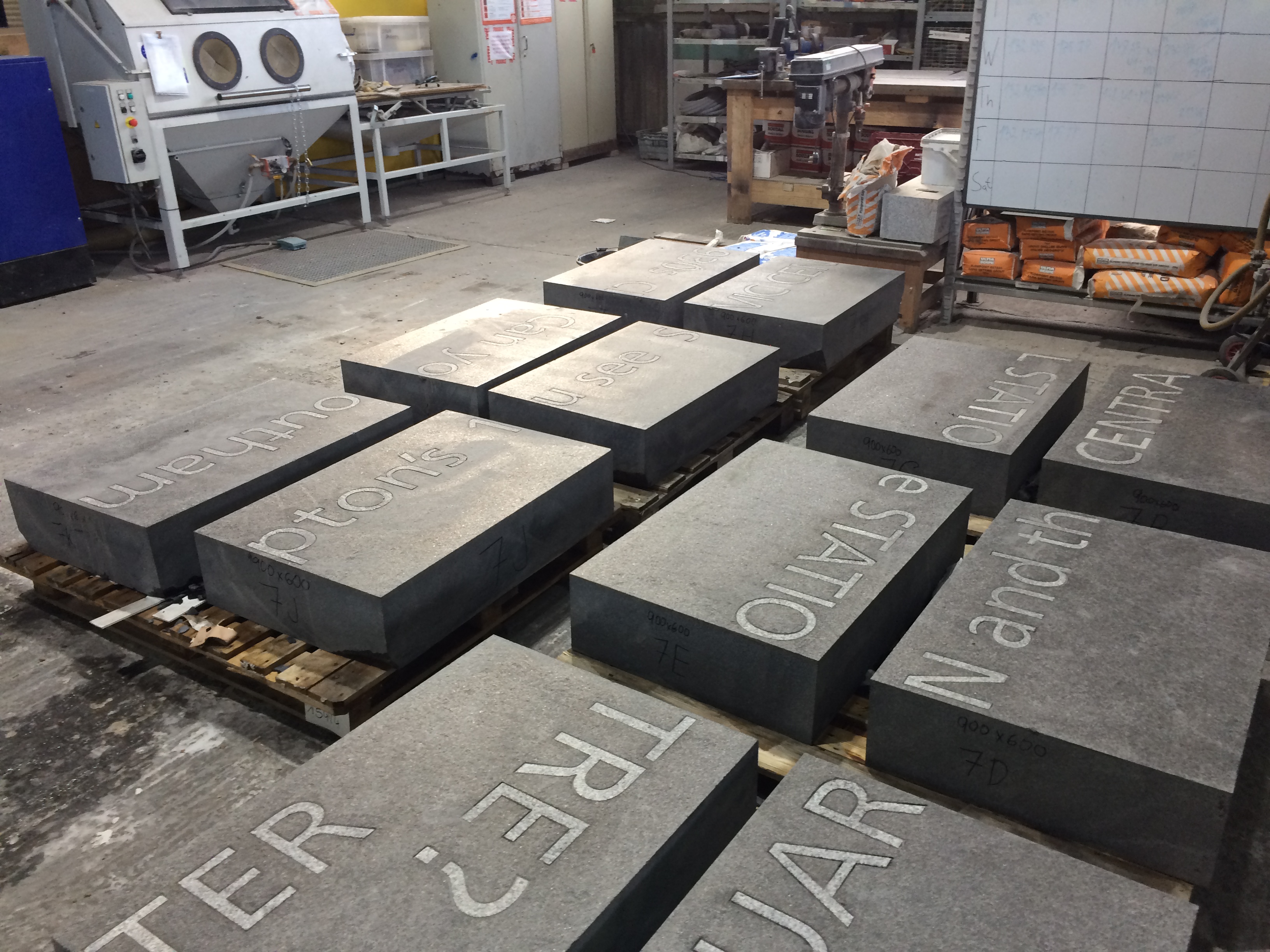
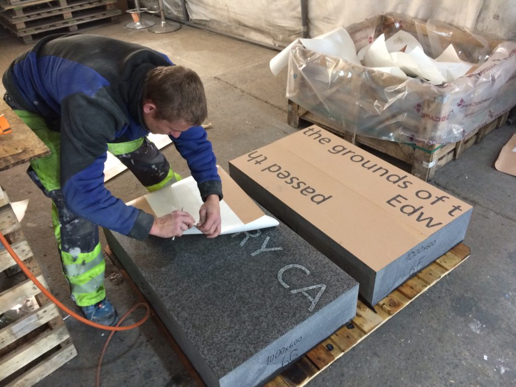
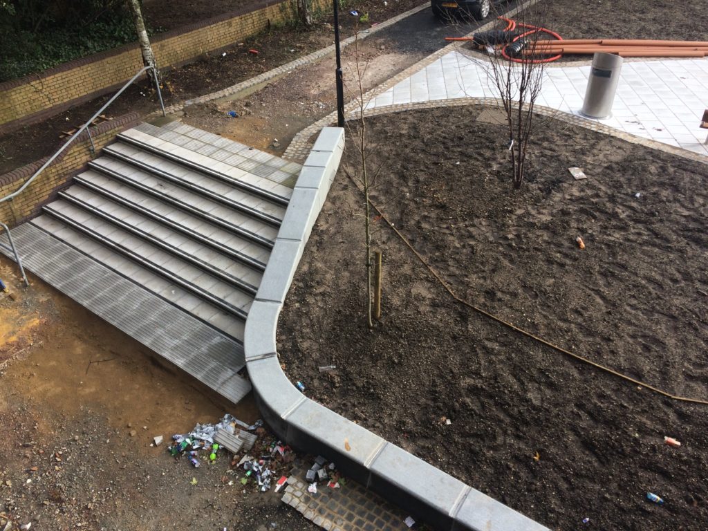
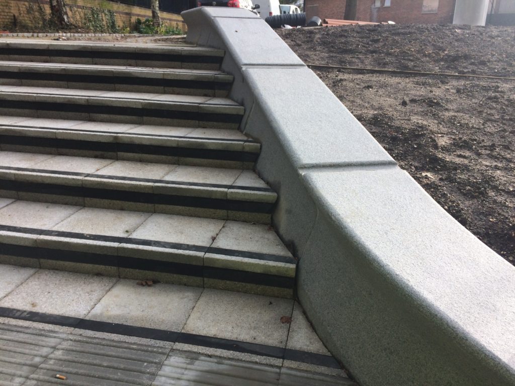
Contextual drafts – ‘BBC SOUTH has broadcast from this site since 1991 & was built on the grounds of the old Edward VI Grammar School’. Image: Christopher TippingBasalt Blocks with inset granite text set out during manufacture at Hardscape. Image: Christopher TippingBasalt Blocks awaiting sandblasting with text during manufacture at Hardscape. Image: Christopher TippingBasalt Blocks during sandblasting with text. Manufactured by Hardscape. Image: Christopher TippingBasalt Blocks with inset granite text set out during manufacture at Hardscape. Image: Christopher TippingGranite benches & retaining walls, Kingsbridge Lane, January 2018 during regeneration works on site. Image: Christopher TippingGranite benches, retaining walls and steps – Kingsbridge Lane, January 2018 during regeneration works on site. Image: Christopher TippingArtwork draft for granite benches and retaining walls. Image: Christopher TippingArtwork draft for granite benches, steps and retaining walls. Image: Christopher TippingGranite benches & retaining walls, Kingsbridge Lane, January 2018 during regeneration works on site. Image: Christopher TippingGranite benches & retaining walls, Kingsbridge Lane, January 2018 during regeneration works on site. Image: Christopher TippingFinal Text setting for Basalt Strips. Kingsbridge Lane, Southampton. Image: Christopher Tipping
Granite benches, retaining walls & Black Basalt slabs with inset and sandblasted contextual text – Kingsbridge Lane, January 2018 during regeneration works on site. Image: Christopher TippingBlack Basalt strips with inset and sandblasted contextual text, cross the footpath at intervals – Kingsbridge Lane, January 2018 during regeneration works on site. Image: Christopher Tipping
The footpath is busy, particularly at peak travel times, but is tired, with aged materials and and unkept vibe, even more striking now that the route connects the two recently completed ‘Quarters’, Cultural & Station – what is does have is brilliant a clear sight lines – with the Civic Centre Clocktower, Wyndham Court, Central Station and Southampton Docks all visible at points along the route.
The proposals for creative public realm interventions at Kingsbridge Lane are a direct response to the following:
Preservation of the historic legacy and contextual significance of the local area –
Topography – there is a 9m fall in height from the top of the route to the bottom –
Kingsbridge Lane as a primary pedestrian route today, linking Southampton Station Quarter to the Cultural Quarter, city centre & east to west pedestrian axis –
A practical need to screen existing Network Rail buildings and car park along the southern and northern boundaries of the site –
Entrance to Kingsbridge Lane is on the right hand side of this image from June 2016, prior to regeneration works starting. Image: Christopher TippingKingsbridge Lane March 2016 prior to regeneration. Image: Christopher TippingKingsbridge Lane March 2016 prior to regeneration. Image: Christopher TippingKingsbridge Lane March 2016 prior to regeneration. Image: Christopher TippingKingsbridge Lane March 2016 prior to regeneration. Image: Christopher TippingKingsbridge Lane March 2016 prior to regeneration. Image: Christopher Tipping
My work here is an extension of the ‘Canal Shore’ concepts and research underpinning the Station Quarter North Project completed a couple of years earlier in 2016, which I had been involved with since 2012. The text below set out the background of this work.
‘Inspiration, aspiration & delivery…
As project artist, I undertook a detailed investigation into the neighborhood’s social history, geography, ecology and culture to uncover hidden structures, which inform the area’s current form, identity & reputation. This site-specific & research-led activity assisted in driving the creative concept & rationale, which now underpins the general spatial layout, character and interpretation of the new proposals. I worked as part of an integrated design team including Engineers, Landscape Architects, Designers and specialist contractors. This collaborative process allowed me to work creatively, whilst being fully supported by the wider project team.
‘Southampton’s lost district: A landscape rediscovered’
An understanding of the site’s past physical condition drives the overall theme and character of the landscape & public realm interventions: a wooded valley, a meandering stream, the curve of the historic shoreline & the ill fated Southampton & Salisbury Canal. The primary human activities on the site over time, as evidenced by residential, industrial & cultural histories have been influential in drawing individual & collective ‘voices’ from the locality which will serve to imbue any outcomes with a distinctive & renewed sense of place.
This site, adjacent to the shoreline of the Test Estuary has always been a point of confluence. The main route West in & out of the city ran along the shoreline. In medieval times this route along the shore was known and ‘The Strand’. At a point marked by Achards Bridge, which crossed the Rollesbrook Stream to enter the River Test, the city boundary with Millbrook was established.
Today this point is almost exactly opposite the entrance to Southampton Station. Blechynden Terrace is considered to be built along the line of the filled in canal basin of the Southampton & Salisbury Canal. The historic shoreline and the highest point to which the tide rises was along the line of the road.
‘Canal Shore’ developed as a singular response to this research, which is supported by a broader influence, which has pervaded the whole site.
The artwork ‘Canal Shore’ is a consolidation of all that the site has to offer, both contextually and historically. In part it traced the line of the old shoreline & the only East to West route out of the city along the shingle beach from earliest times. It was the route of an ill-fated 19th Century canal. It is now a busy road and part of the transportation network of the city. Its route forms part of the perimeter of our site, so as a single element it has the capacity to help to unify the site and draw other more disparate elements together. The work represents the confluence of both historic and contemporary transportation routes within the city.
The location of the work dictates that it adds a tangible physical presence & value to the site. However, the materials and design are significant too. The black basalt kerb is deliberately large scale & incredibly robust, but has been engineered and designed with a particular aesthetic to blend well with its dual function. It considers traffic flow & movement through the site by allowing for transport access across its width, with elegant dropped kerb sets and large-scale corner quadrants. We have extended the width of the kerb to emphasize its importance as a marker of the historic shoreline of West Bay and the River Test Estuary, but also as a reference to the former Canal coping stone edge. Its function a physical kerb edge on the highway not only indicates that it is fit for purpose, but it deliberately aligns itself to the East to West axis of this transportation and pedestrian route within the City, extending and connecting to existing routes to the Cultural Quarter, QEII Mile and future Maritime Promenade’.