Tag Archives: Local

The Great Flood…and other Rochester Riverside stories (1 of 3)

Draft designs for granite or cast iron paving slabs. Rochester Riverside. Image: Christopher Tipping

“A creek separates the marsh here from Cory’s Wharf – apparently into which the watermill discharged…” “The marsh was full of logs (a huge stack of wooden piles from Rochester Old Bridge) and was home to many rabbits – wild rabbits, grey, brown and black…” ‘It was said that the Foord Family stocked the marsh, with animals from their farm at Darland’.  Stephen Hannington – Bygone Kent MagazineRochester’s Long Lost Common Part Two –

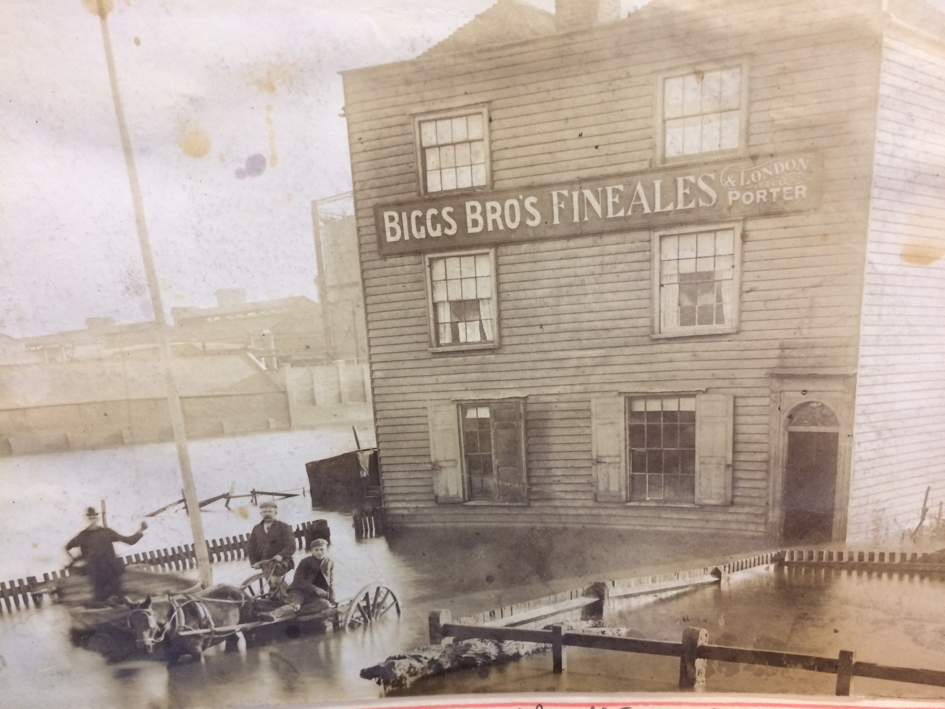
‘Floods of 1897 and 1928 inundated this area – the flooding in1897 was called The Great Flood and attributed to a record high tide on 29th November’. The image below shows the Homeward Bound Public House inundated by the flood waters. The Gas Holders of the Gasworks, can be seen in the background. The Gasworks, on Gas House Way was one of the earliest built in the UK in 1818. The area was known as Gas House Marshes. Image by kind permission of Medway Archives and Local Studies Centre.

The Homeward Bound Public House at Gas House Point inundated by the great flood of 1837. Image: By kind permission of MALSC


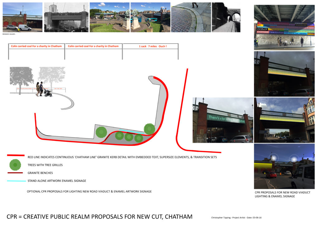
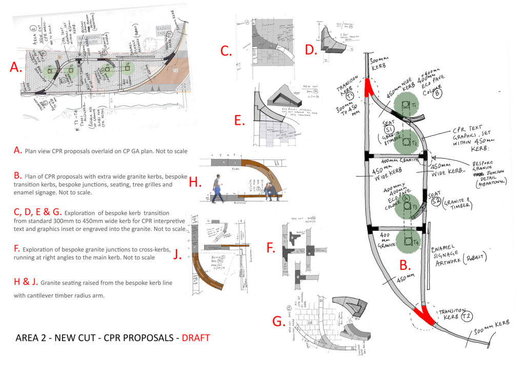
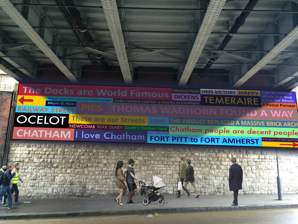
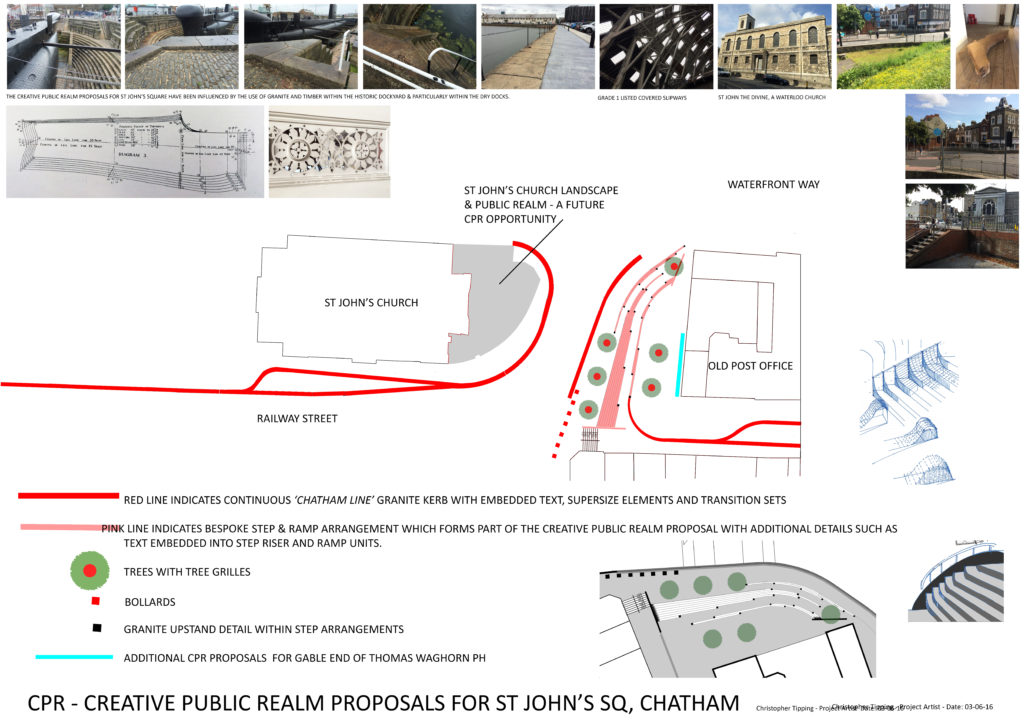
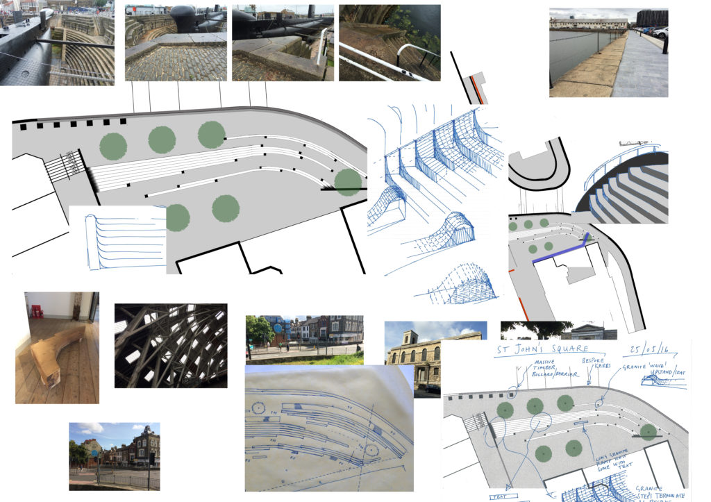
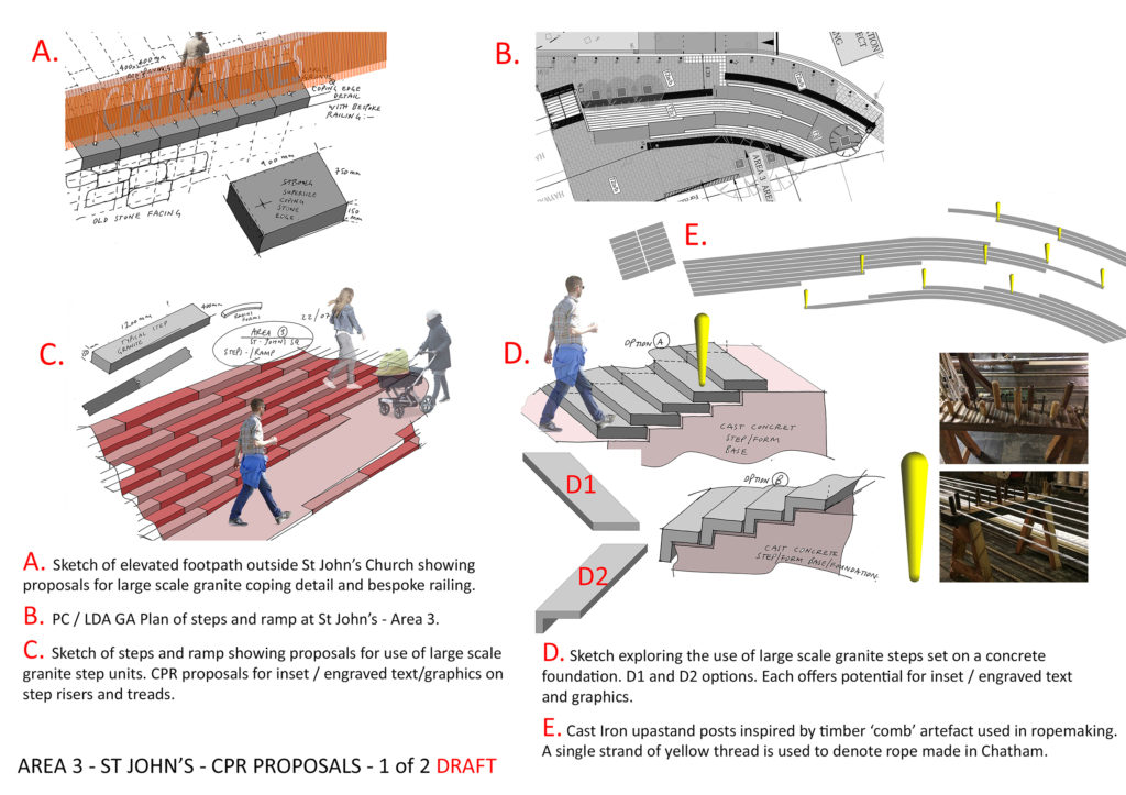
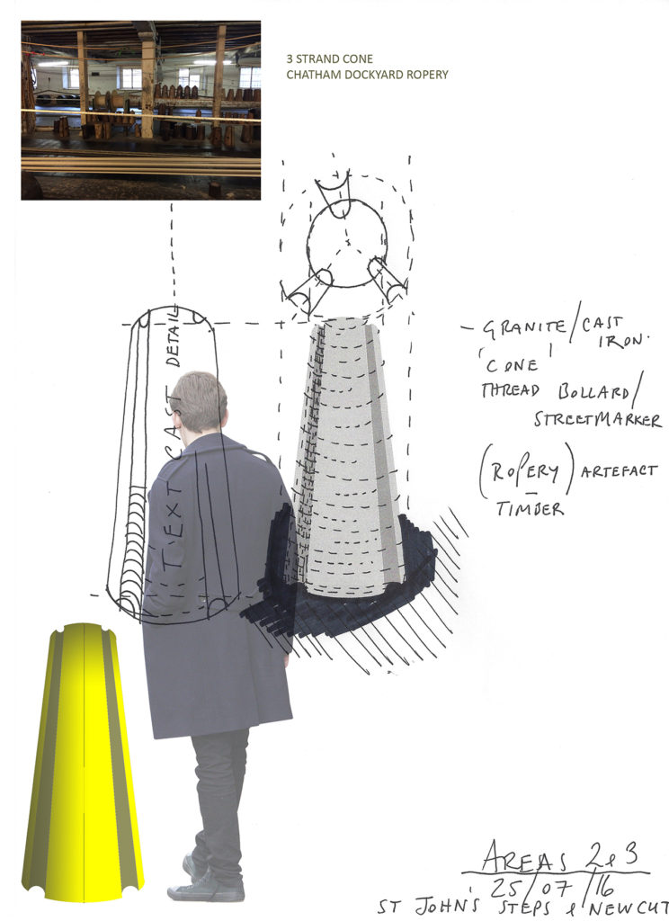
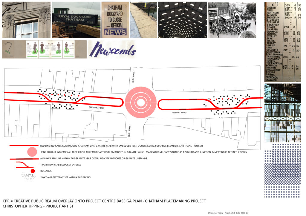
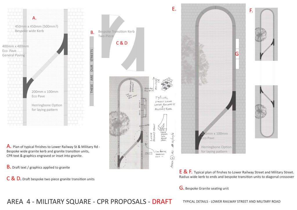
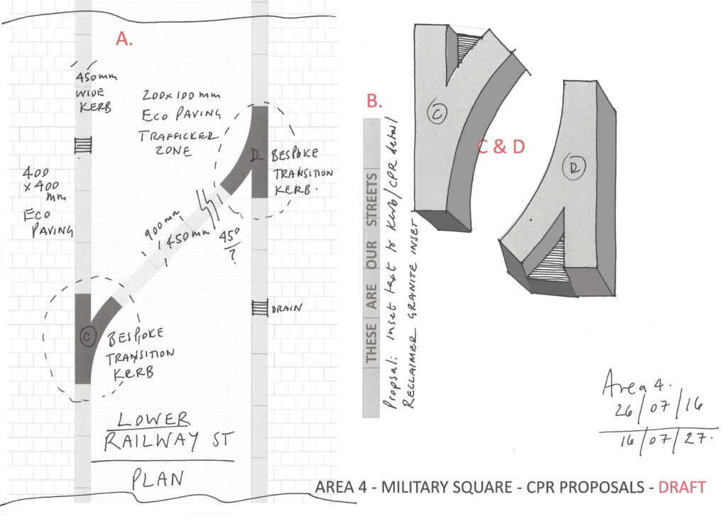
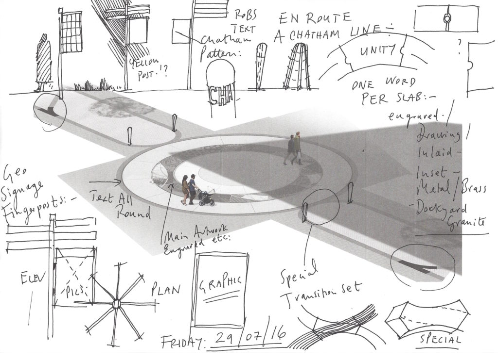
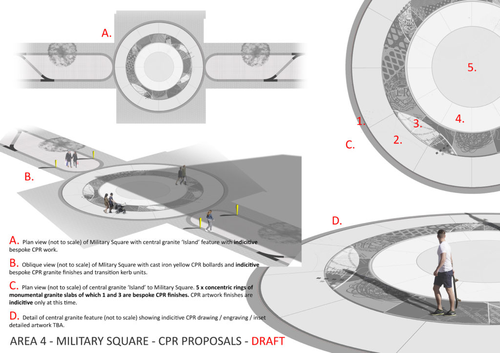
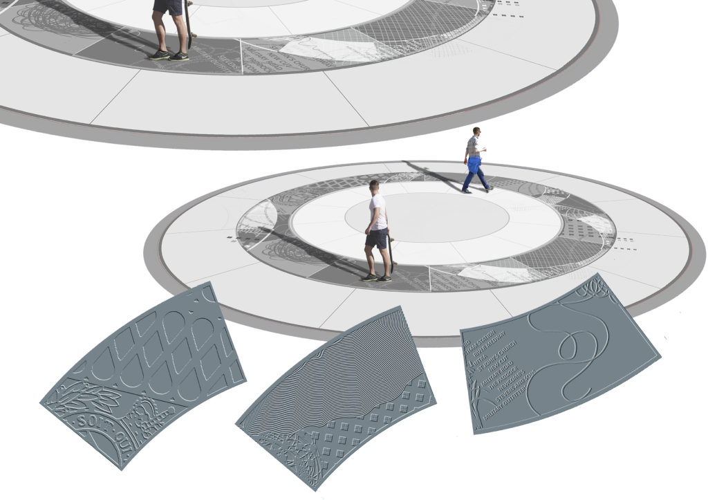
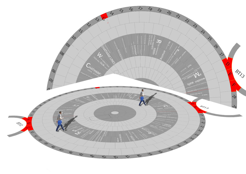
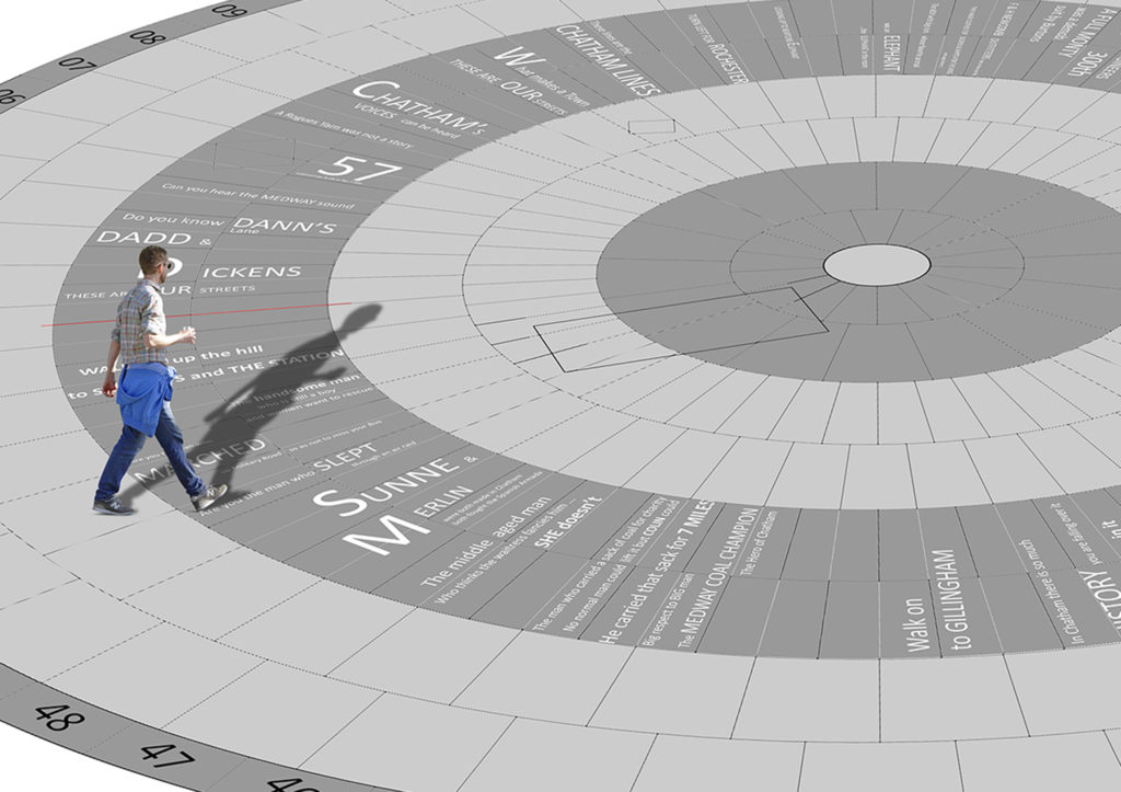
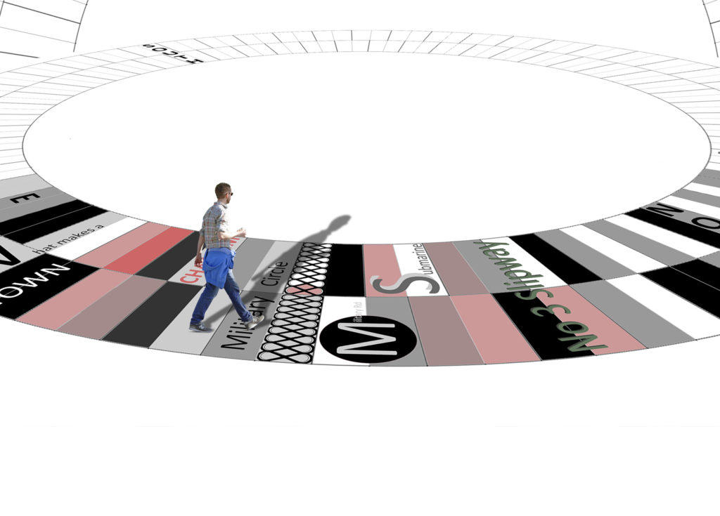
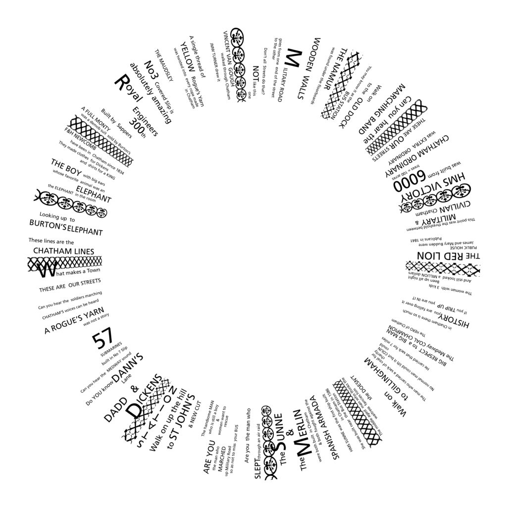
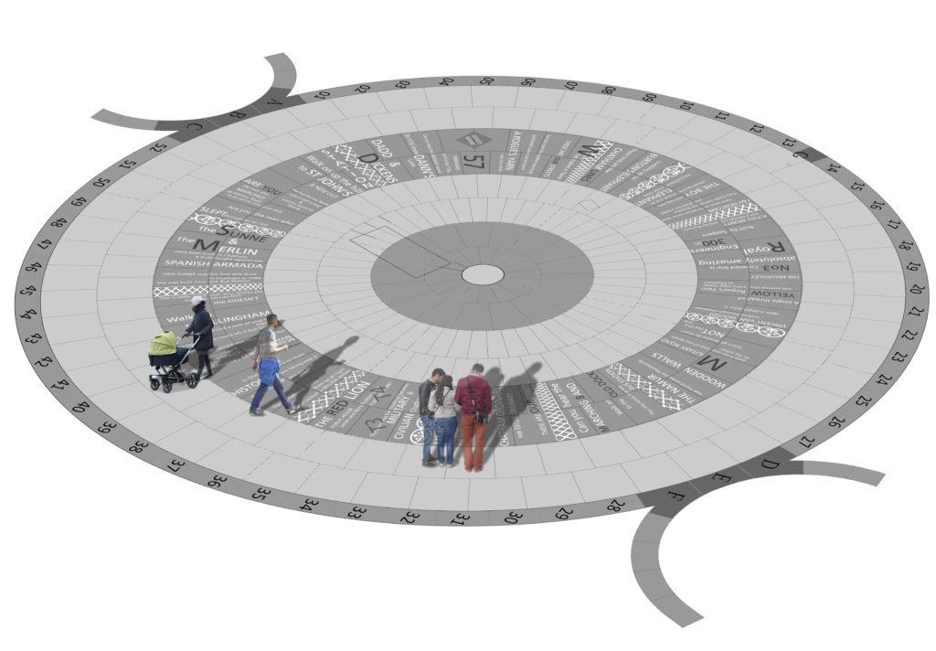
I thought I might post the artwork for all of the proposed granite and cast iron paving slab units. I can then add any historic anecdotes, images or information, which have caught my attention and may be of further interest. I’ll cover all these in this and the next two posts. 1 of 3


Draft designs for granite or cast iron paving slabs. Rochester Riverside. Image: Christopher Tipping

CAST IRON UNIT ‘BRICKIES‘ STACKIES STUMPIES’. You can also add MUDDIES to this list as well!  All colloquial names for the trades associated with Medway Barges built in and operating out of the Rochester Riverside site. Brickies carried up to 40,000 bricks on the up river journey to London and came back laden with London’s rubbish. Stackies were piled high with Hay and Straw. Stumpies could take cement, lime, timber, clay, coal, bricks, hops and other commodities. Muddies are self explanatory…the carried clay and mud dug from the banks of the Medway Estuary and destined for local brickworks.


Draft designs for granite or cast iron paving slabs. Rochester Riverside. Image: Christopher Tipping

CAST IRON UNIT ‘GOLDEN SAMPHIRE’. To the northwest the Medway Estuary consists of an extensive area of marshland, comprising of salt marsh and intertidal mudflats. The River remains tidal at this point and estuarine conditions would have dominated most of the site’s past.’  Ref: KCC HER 012. 2014 -371. Golden Samphire  grows on estuary mudflats and salt march. It is rare and I have used it as it represents the efforts being made by the client team to build upon the heritage and legacy of the natural environment with it’s diverse flora and fauna.

Draft designs for granite or cast iron paving slabs. Rochester Riverside. Image: Christopher Tipping

GRANITE UNIT  ‘BLUE BOAR CREEK’. “Blue Boar Wharf was our playground”. Edwin Harris

Blue Boar Creek is the one of the more distinctively named and well remembered places on our site. It also gave name to Blue Boar Lane, Blue Boar Hard, Blue Boar Lower Yard, Blue Boar Upper Yard, Blue Boar Lane Foundry and Blue Boar Pier. ‘Blue Boar Hard Pier: November 26th 1886′ as seen at the Medway Archives is set of beautiful, hand painted drawings of plans for a new Pier by draughtsman William Hoelking. Some details are referred to as ‘DOLPHINS’ & ‘DUMMY’. MALSC Ref: Plan 1 of 4 (002) MP/B/30/1 (1 of 4).

Blue Boar Hard Pier: November 26th 1886. Image: By kind permission of MALSC. Ref: Plan 1 of 4 (002) MP/B/30/1 (1 of 4).

William Banks City Surveyor has also signed this document. William was born in about 1850 at Edmonton. He married Anne Mary Everett in June 1876 at Islington. In 1891, he and his family were living at at 10 Albany Road, Rochester, William was by then aged 40 and a surveyor for the city of Rochester.

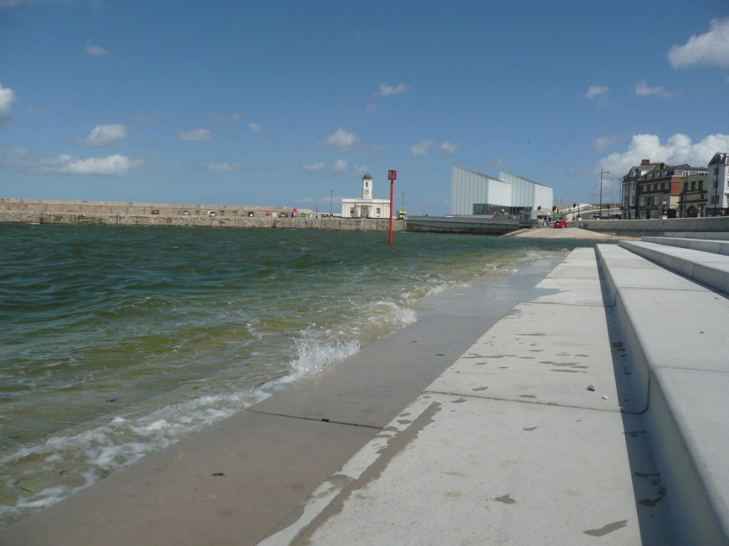
‘What is now left of Blue Boar Creek and the river beyond at Limehouse Reach, lies deathly silent. Coal is not longer unloaded from colliers at Cory’s Wharf. So too is the Pier, once festooned with skiffs and rowing boats, where formerly small boys with rod and line and a jar of worms could fish away the school holidays’. John K. Austin from his publication ‘Yesterday’s Medway’. Johns has been involved with this project from the outset, having been consulted by the project Architects BPTW on his local knowledge as a historian, author, teacher and artist.


Draft designs for granite or cast iron paving slabs. Rochester Riverside. Image: Christopher Tipping

GRANITE UNIT ‘THE FIVE BROTHERS’  William Higham had a Barge Building business on Blue Boar Hard. He was born in 1838 in Lewes Sussex. On 27th October 1864 he married Fanny Elizabeth Blake in Strood. By 1881 they had 9 children and lived in a private house on Victoria Street, Rochester. William employed 11 men and 7 boys. THE FIVE BROTHERS was the last barge built at this yard alongside DOROTHY in 1901.


Draft designs for granite or cast iron paving slabs. Rochester Riverside. Image: Christopher Tipping

GRANITE UNIT ‘PERENNIAL GLASSWORT’.  ‘The Medway Estuary is believed to be the most important area in North kent for wintering wildfowl in numbers of international significance. The saltmarsh serves as a roosting area for waders at high tide. Several scarce plant species include: golden samphire, perennial glasswort and one-flowered glasswort. The estuary is one of the best places in Britain for the study of glassworts. The grazing marsh has breeding and wintering birds of interest; the former include lapwing, redshank, pochard, mallard and gadwall, while in winter large flocks of may wildfowl and wader species are present.’ Ref: Environmental Stresses and Resource Use in Coastal Urban and Peri Urban Regions. DPSIR Approach to SECOA’s 17 Case Studies.


Draft designs for granite or cast iron paving slabs. Rochester Riverside. Image: Christopher Tipping

GRANITE UNIT ‘COAL: METER HEAVER WHIPPER’. Colloquial names for trades employed in the Coal business.Frederick Furrell was born in 1807 and died in 1877. Frederick Furrell & Son were Coal Merchants based at Furrell’s Wharf, a  He was also an Alderman & Shipowner. He had ten children with his wife Katherine who he had married on February 25th 1832 at St Margaret’s Church in Rochester. Fred was Mayor of Rochester in 1855. Furrell’s Wharf was a 30m length of post and plank revetment of Oak and Elm Posts, most likely made from re-used ships timbers was in use in 1865 making it one of the oldest sites for industry on Rochester Riverside. It was accessed via Furrell’s Road.

His name also lived on as ‘Furrells Pond’“where children swam and skated in Icy weather – The site flooded during exceptionally high tides” . Edwin Harris

 Furrells Wharf was also the destination of many travelling shows, menageries and circuses – such as Wombwells Wild Beasts & Edmonds Menagerie – George Sangers Circus, Pinder’s Circus, Middletons’ Marionettes. 

Coal was a major industry at Rochester, with several businesses engaged, most notable William Cory & Son of Fenchurch Street London were registered in 1896 after taking over he business of coal factors, merchants and Lightermen of William Cory & Son of Rochester at Rochester Coal Wharf.

Draft designs for granite or cast iron paving slabs. Rochester Riverside. Image: Christopher Tipping

GRANITE UNIT ‘MARSH COWS GRAZING’ 


Margate Steps – A look back in time

The last decade has seen Margate’s cultural landscape flourish with the dual success of Turner Contemporary and a resurgent Dreamland to book-end the seafront panorama. Successful regeneration by Thanet Council has also brought significant and tangible changes to the Old Town. One of the most significant outcomes delivered by the Council without fanfare or drama however, has been the Margate Flood & Coastal Protection Scheme – also known more fondly as Margate Steps. A scheme funded by the Environment Agency to the tune of £6million pounds and brought in on time and under budget …and somewhat under the radar. This example of coastal civil engineering encompassed not only the Steps, but the Harbour Arm and Sea Wall along Marine Drive. This elegant and functional concrete stepped revetment structure has also brought a much needed and highly activated public realm and pedestrian space to the Town.

Throughout its history, a major catalyst for change and development in Margate had been the destructive force of storms and storm surges. These pages are taken from the Contextual Research Document, which I delivered in collaboration with the project team.

MARGATE STEPS CONTEXTUAL RESEARCH DOCUMENT 1

Margate Flood & Coastal Protection Scheme – Contextual Research Text Image: Christopher Tipping


Margate Flood & Coastal Protection Scheme – Towards Turner Contemporary May 2013. Image: Christopher Tipping

I was commissioned as project artist on the scheme by Thanet District Council & the Environment Agency in December 2010. My role was to uncover and present  interpretive & contextual information & develop concepts with which to influence the design process & inform the structure & detailing of this major sea defence works. The work has now been completed and the project officially opened in May 2013.

Margate Flood & Coastal Protection Scheme – lunch al fresco May 2013. Image: Christopher Tipping

Client: TDC & Margate Renewal Partnership. Engineers: East Kent Engineering PracticeLandscape Architects and Urban Designers: Jacobs. Contractor: BreheneySpecialist Concrete Pre Cast: CCP Cornish Concrete Products.

Being part of an integrated design team from an early point was critical in enabling the contextual work, via a contribution to the detailed DESIGN & ACCESS STATEMENT , to influence the physical form of the structure, within its constraints as a sea defence work.

Margate Flood & Coastal Protection Scheme – evening light March 2013. Image: Christopher Tipping

The public realm and amenity space which the project afforded Margate’s sea front has been a tremendous addition to an enlivened and highly activated sea front promenade which has Turner Contemporary and the Harbour Arm at one end & Margate Station & Dreamland at the other.

Margate Flood & Coastal Protection Scheme – The New King’s Stairs May 2013. Image: Christopher Tipping

Chatham Placemaking Project – PROPOSALS

I haven’t updated this post for some time – actually since April 2017!  Head down and just getting on with it …time flies. OK – I’ll now try to sum up what’s happened in the interim.

Following on from the initial research period, consultation & creative engagement phases of the project, a series of Creative Public Realm proposals were submitted for review. This work originated and was inspired by the positive & creative collaboration with our supporting artists in residence, Rob Young – Writer, Simon Williams – Filmmaker and Xtina Lamb – Printmaker.   These collaborations proved to be highly creative as well as bringing a refreshing camaraderie and friendship to the work.

The proposals are presented here in the order in which the various sites are encountered along the route from Chatham Station down Railway Street to Military Road and the Waterfront. This is a visual account of how ideas developed and adopted into the scheme.

Chatham Station, although at the head of our scheme, will be the last Phase to be delivered on the ground & I will report on this work later in a separate post.

The sites where our work and interventions has been focussed are:


NEW CUT & NEW ROAD VIADUCT

ST JOHN’S SQUARE

LOWER RAILWAY STREET

MILITARY SQUARE 

MILITARY ROAD

Chatham Placemaking Project. Route & Plan of Creative Public Realm. Image: Christopher Tipping


The Red Line indicates our project route & is titled the ‘Chatham Line’, after the Chatham Lines, the nearby defensive fortifications.  The lines follow the historic granite kerb line & will be replaced in relevant sections by bespoke wide

granite kerbs and special transition granite units often with sandblasted or inset granite text. Text is based upon the surrounding local historic legacy & community engagement work & narrative developed by our writer in residence, Rob Young.

AREA 2 – NEW CUT 

New Cut – Plan of Creative Public Realm. Image: Christopher Tipping
New Cut – Sketches & Draft Plan of Creative Public Realm. Image: Christopher Tipping
New Cut – Sketches & draft plan of bespoke granite kerb units. Creative Public Realm. Image: Christopher Tipping
New Cut – Sketches & draft plan of bespoke granite & timber seating. Creative Public Realm. Image: Christopher Tipping
New Cut – Sketches & draft plan of bespoke granite kerb units. Creative Public Realm. Image: Christopher Tipping
New Cut – New Road Viaduct – Draft proposals for bespoke enamel panels below the balustrade, welcoming you to Chatham. Image: Christopher Tipping


As with most projects, not all ideas and proposals succeed.Budget limitations, critical rigour and often the subjective nature of the collaborative creative process all bring issues to bear in deciding what is destined to be built on site and what is left in the studio !


New Cut – New Road Viaduct – Draft proposals for bespoke enamel panels below the balustrade, welcoming you to Chatham. Image: Christopher Tipping
New Cut & New Road Viaduct – Draft proposals for bespoke lighting scheme welcoming you to Chatham. Image: Christopher Tipping
New Cut & New Road Viaduct – Draft proposals for bespoke enamel panels under the bridge, welcoming you to Chatham. Image: Christopher Tipping
St John’s Square – Draft proposals for bespoke landscape interventions. Image: Christopher Tipping

The approach to the materiality and scale of St John’s Square & elsewhere along our route, was influenced by the architectural & industrial heritage of the Historic Chatham Dockyard.

St John’s Square – Draft proposals for bespoke landscape interventions. Image: Christopher Tipping


This monolithic detail seen above was titled ‘The Submarine’, inspired by HMS OCELOT on display at Chatham Historic Dockyard . This sculptural form was to act as a dividing feature separating two flights of steps at different levels.

I didn’t make it through the final evaluation process…

HMS OCELOT, Chatham Historic Dockyard. Image: Christopher Tipping
St John’s Square – Draft proposals for bespoke landscape interventions. Image: Christopher Tipping & Hardscape
St John’s Square – Draft proposals for bespoke yellow enamel cast iron bollards & landscape interventions. Image: Christopher Tipping
St John’s Square – Research Image of Ropery Artefacts. Draft proposals for bespoke yellow enamel cast iron bollards & landscape interventions. Image: Christopher Tipping

LOWER RAILWAY STREET & MILITARY SQUARE

Lower Railway Street & Military Square. Draft proposals for bespoke landscape interventions. Image: Christopher Tipping

Military Square is a major pedestrian intersection in Chatham, at the crossroads between Railway Street, Military Road and the High Street.

Lower Railway Street & Military Square. Draft proposals for bespoke landscape interventions. Image: Christopher Tipping
Military Square draft proposals for bespoke landscape interventions. Image: Christopher Tipping


THE CIRCLE IN THE SQUARE 

Military Square draft proposals for bespoke landscape interventions. Image: Christopher Tipping