It’s a while since I last posted on the project. My creative scope has now been submitted and contains a number of research-led works, including:
Site visits to Chatham, for the purposes of research and site analysis.
A review of local landmarks and key buildings, places and organisations –
Meetings with archivists –
A personal blog –
Pinterest Board of research images and aspirations –
A text based creative analysis made as a contribution to the Masterplan document being prepared by LDA
‘Another Chatham Line…’ – an illustrated creative scope pdf document –
Concept and diagrammatic drawings to accompany and illustrate the creative scope and concept approach –
The work submitted will be added into the supporting documents or as an appendix to the work. We will now be looking towards a public consultation exercise, which is scheduled for early December 2015.
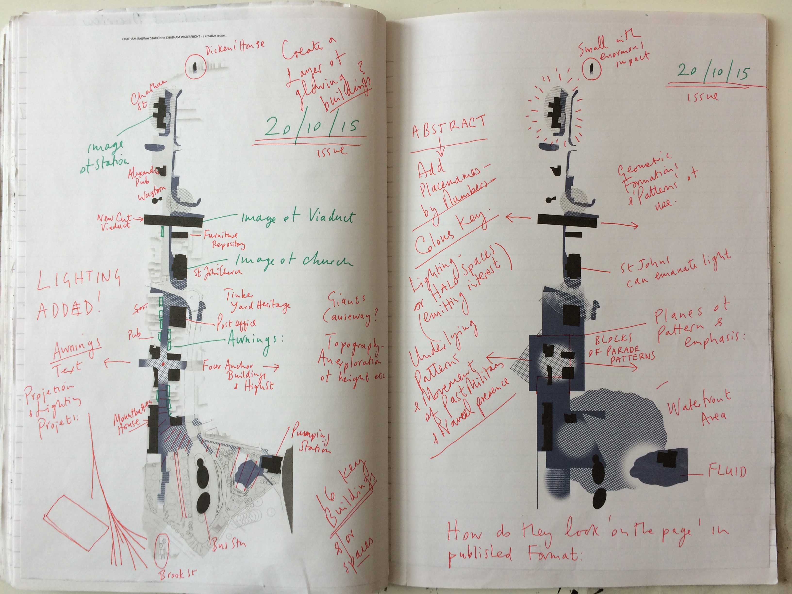
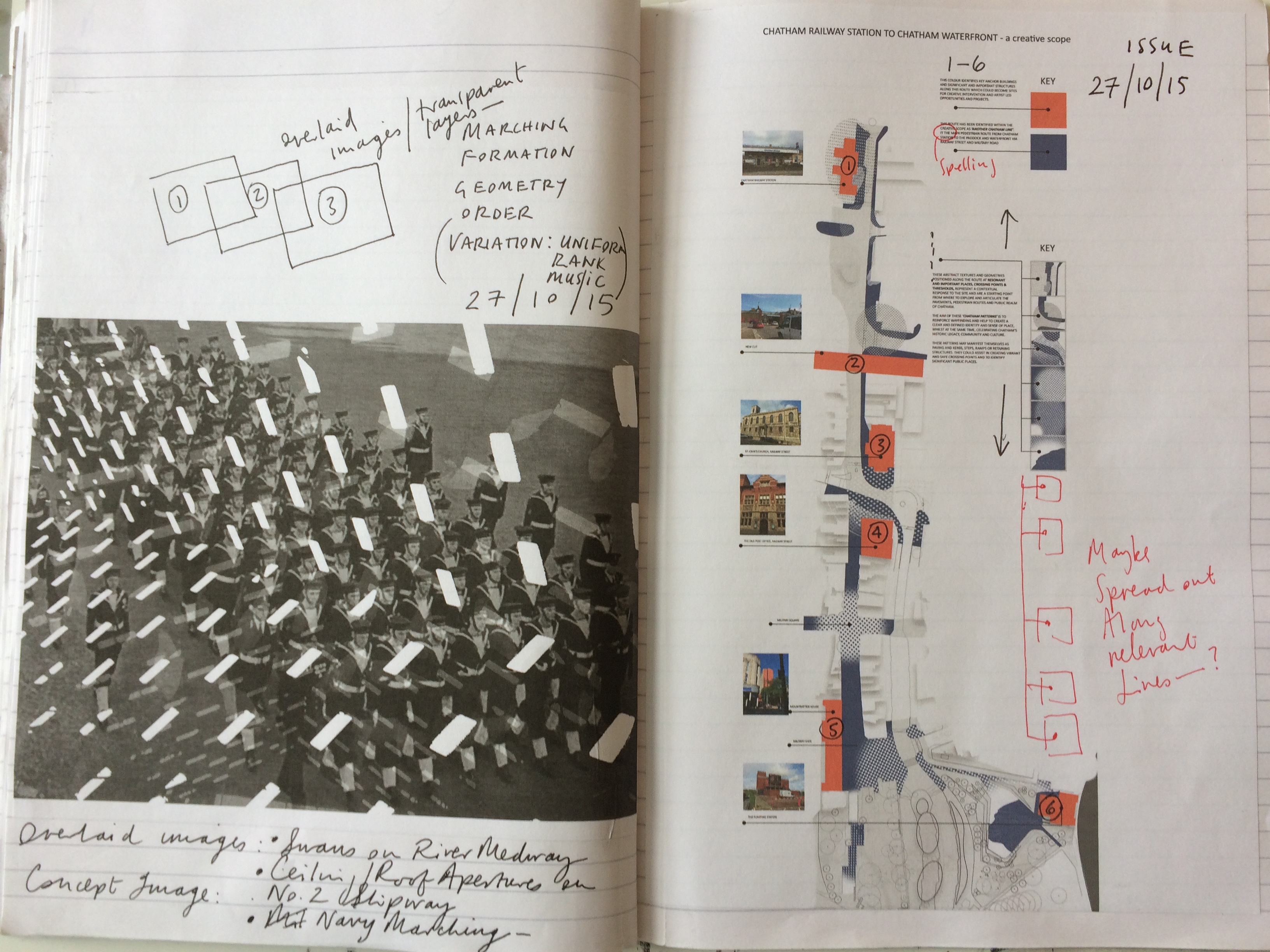
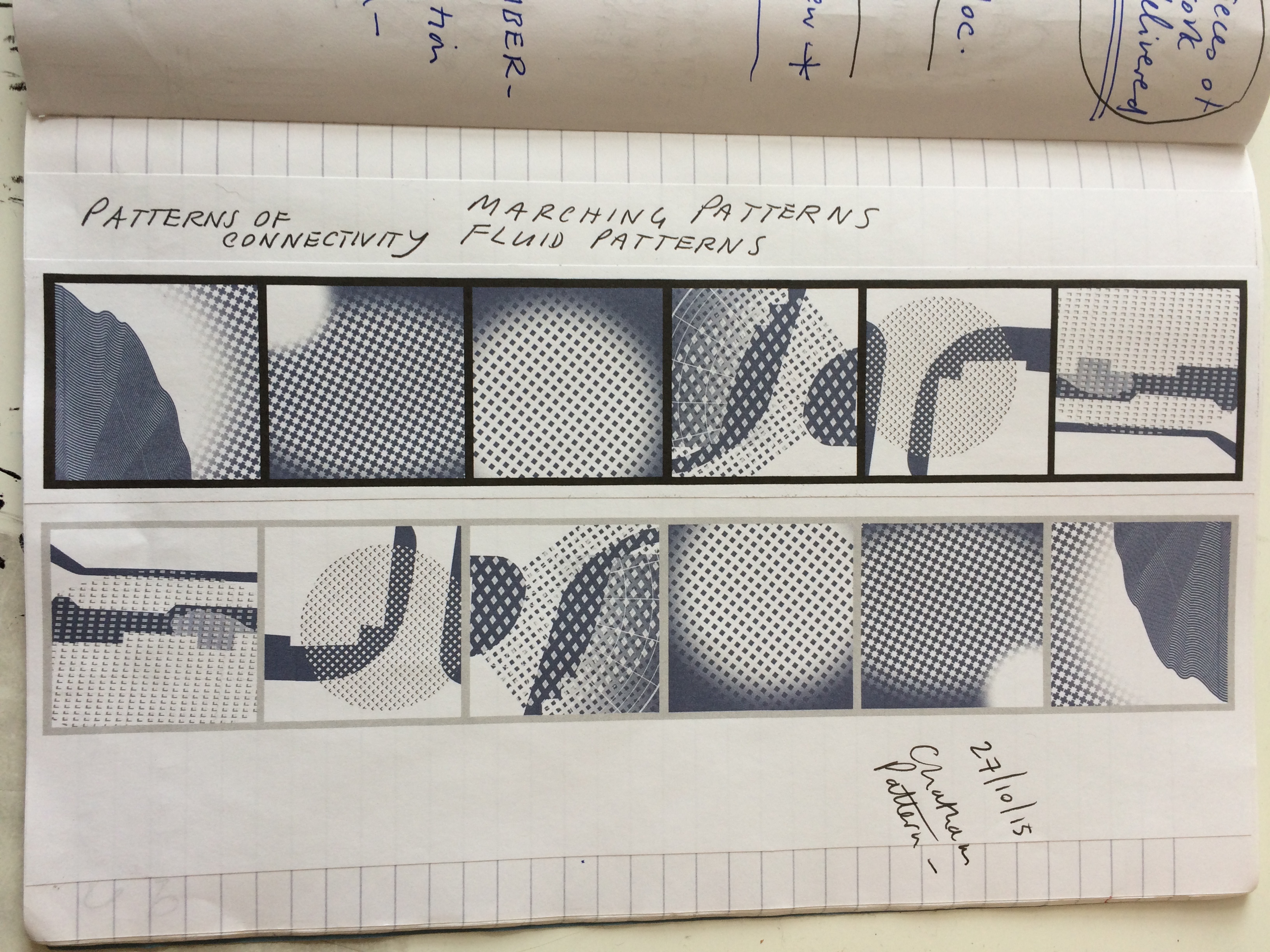
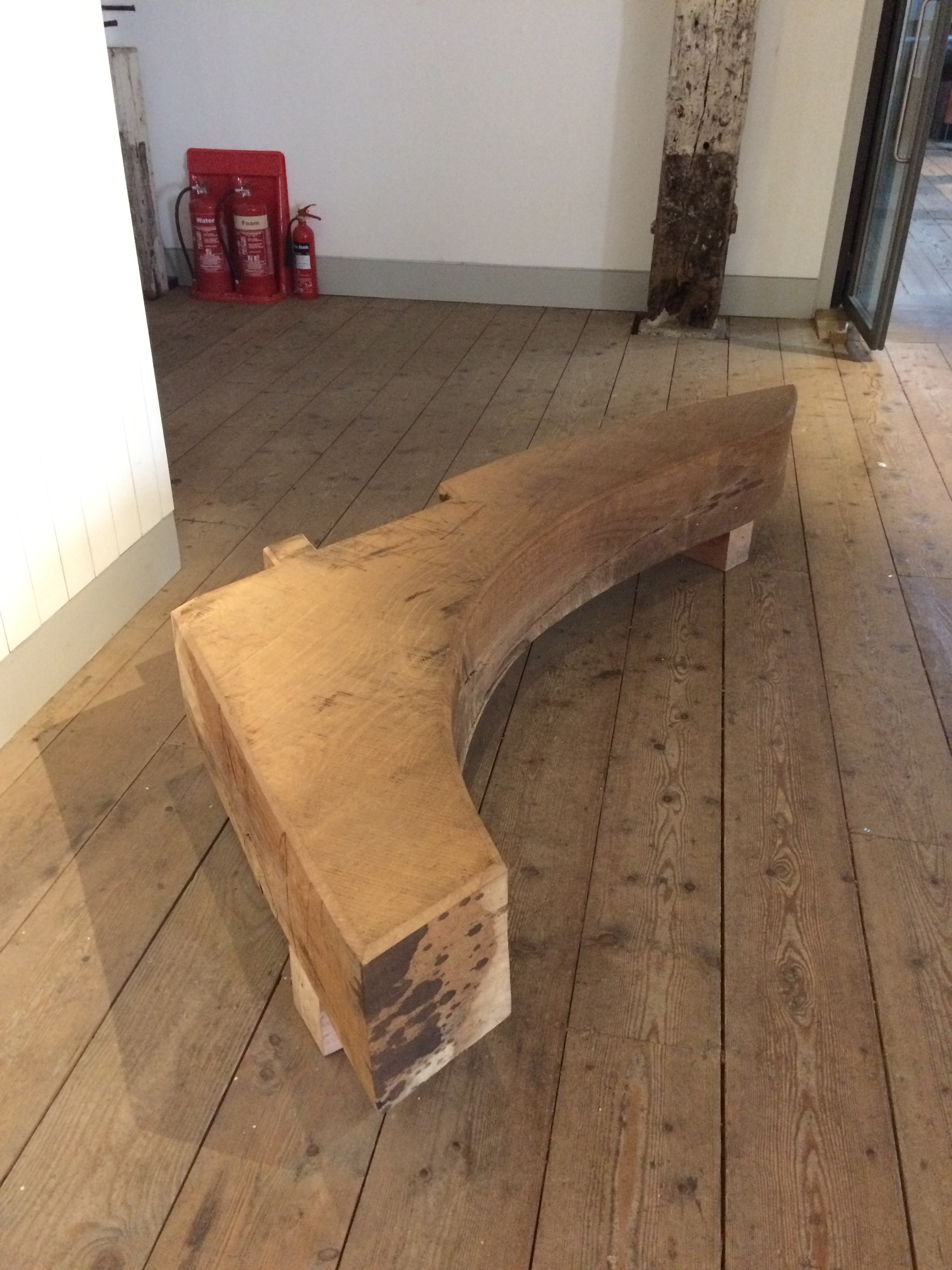
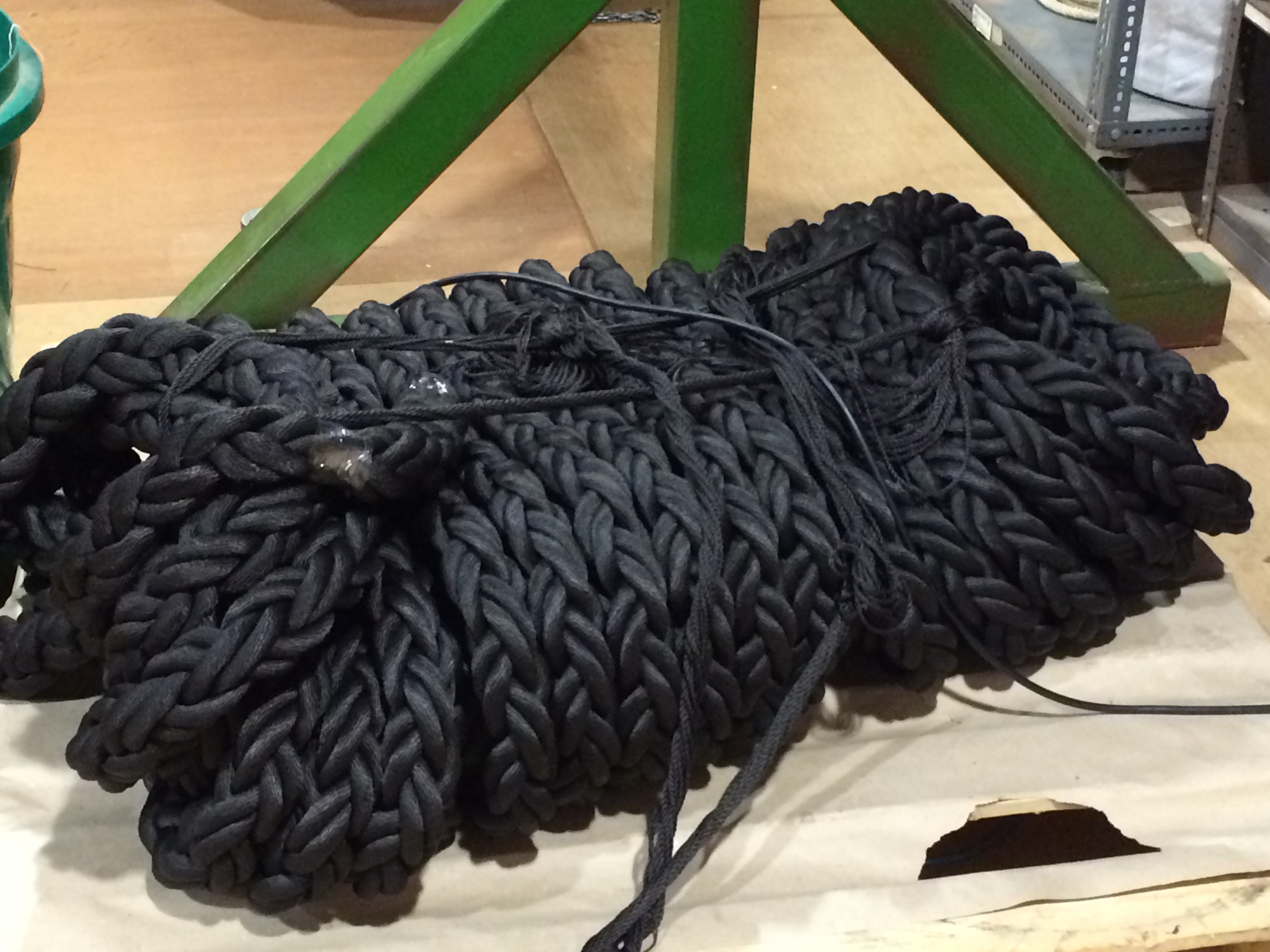
The following images are from draft artworks I have produced, exploring the idea of a thematic pedestrian route from Chatham Station to the Waterfront and The Paddock.
Chatham Creative Scope – artist sketchbook drafts. Image: Christopher TippingChatham Creative Scope – artist sketchbook drafts. Image: Christopher TippingChatham Creative Scope – artist sketchbook drafts. Image: Christopher TippingChatham Creative Scope – artist sketchbook drafts. Image: Christopher TippingChatham Creative Scope – artist sketchbook drafts. Image: Christopher Tipping
I am waiting for approval to use some of the images in my documentation here, as both collections have some brilliant photographs, maps and diagrams, with which to ‘animate’ research for the project.
This is my 5th visit to Chatham – and the first blue sky day ! – so I had to put this image in…
This is the junction of the High Street, Chatham, with Railway Street and Military Road. The Halifax is on the left and the red brick gable end of Mountbatten House looms large in the centre. Image:Christopher TippingThe Halifax building at the junction of High Street, Chatham and Military Road has elephants carved on its facade. Have you seen them? Image:Christopher Tipping
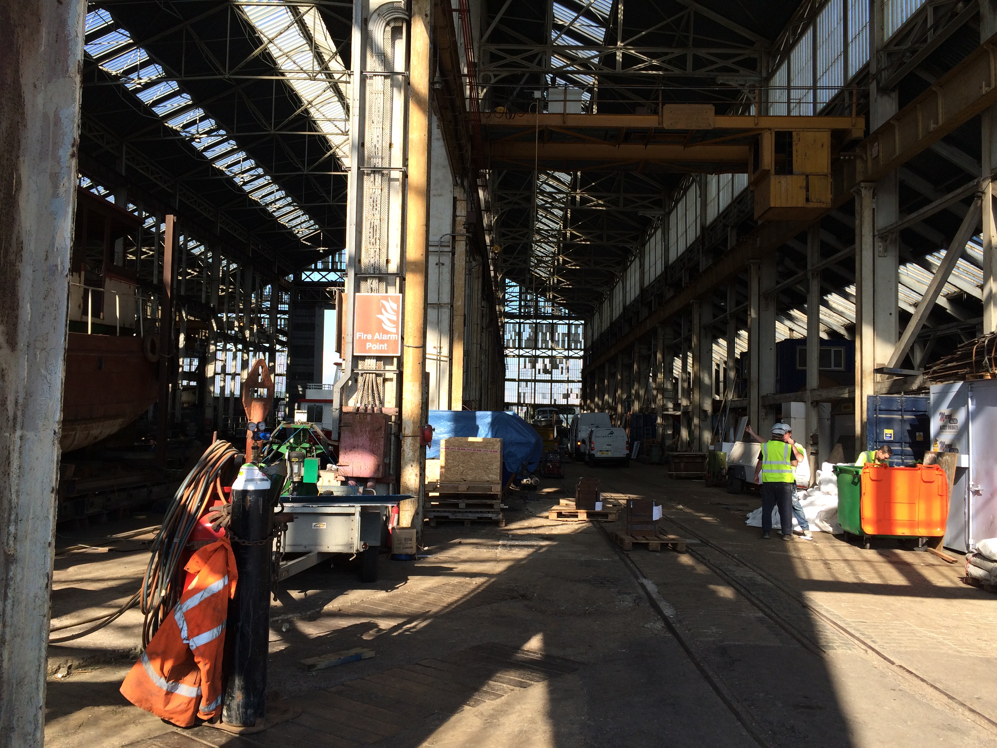
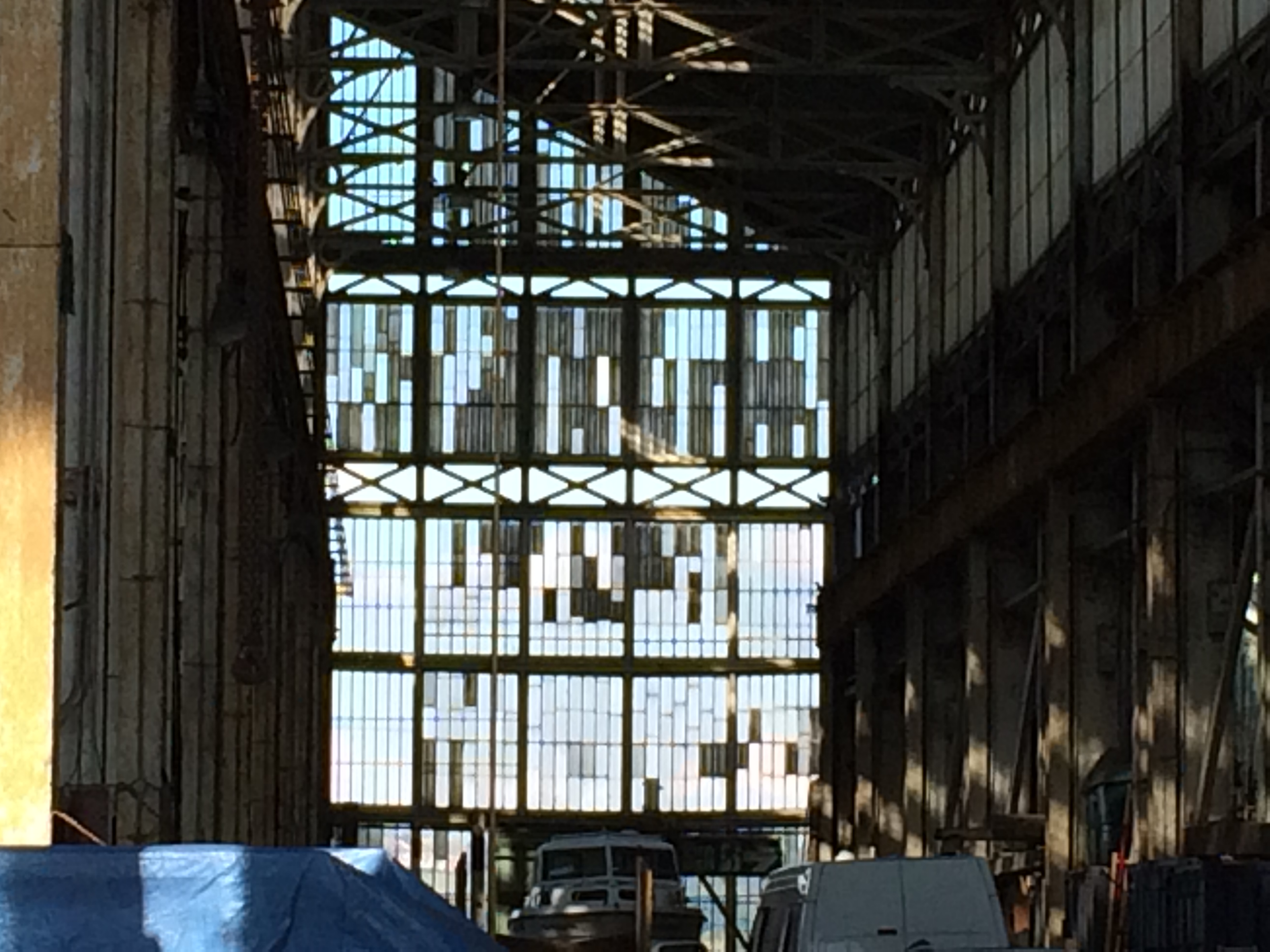
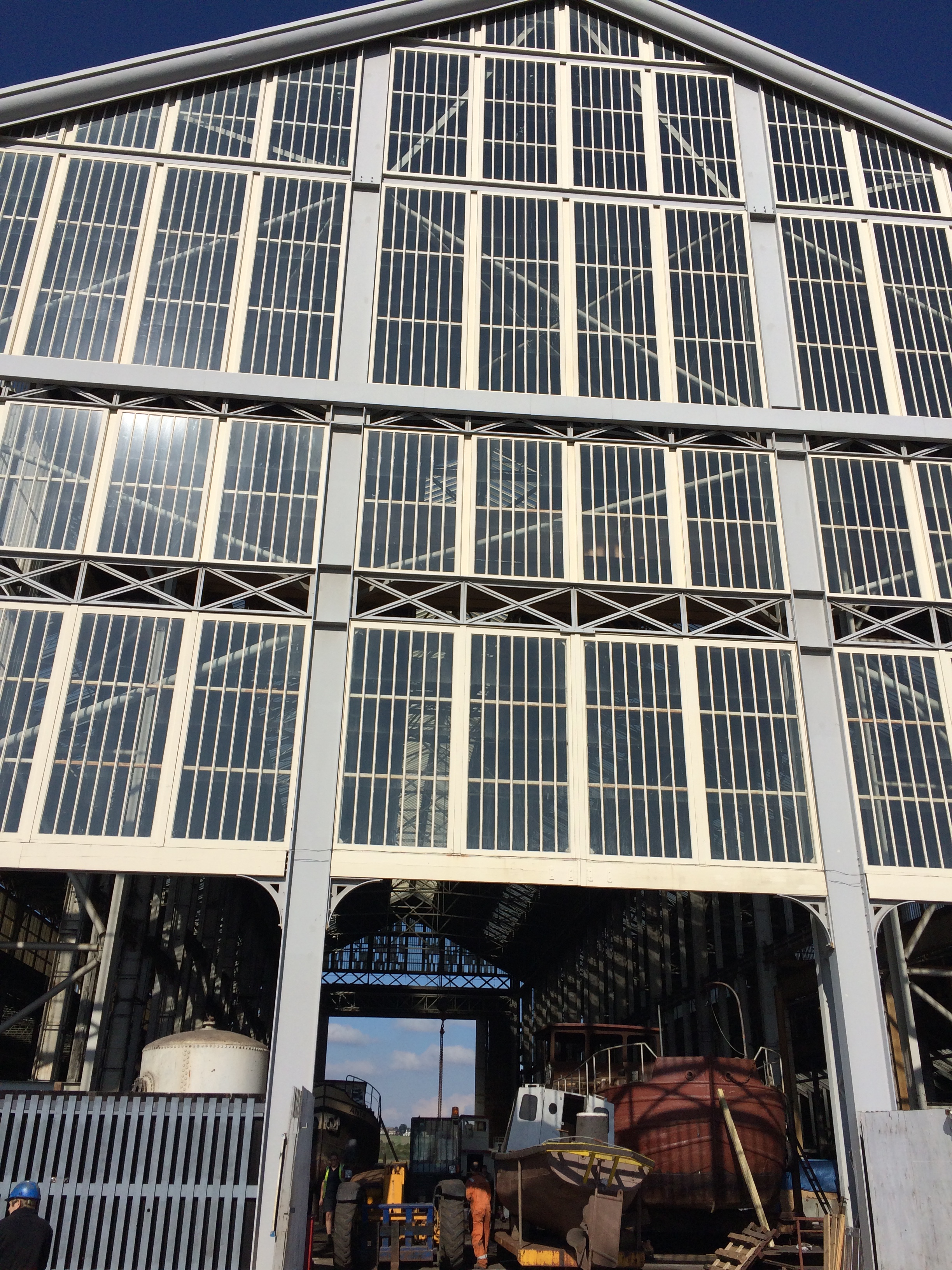
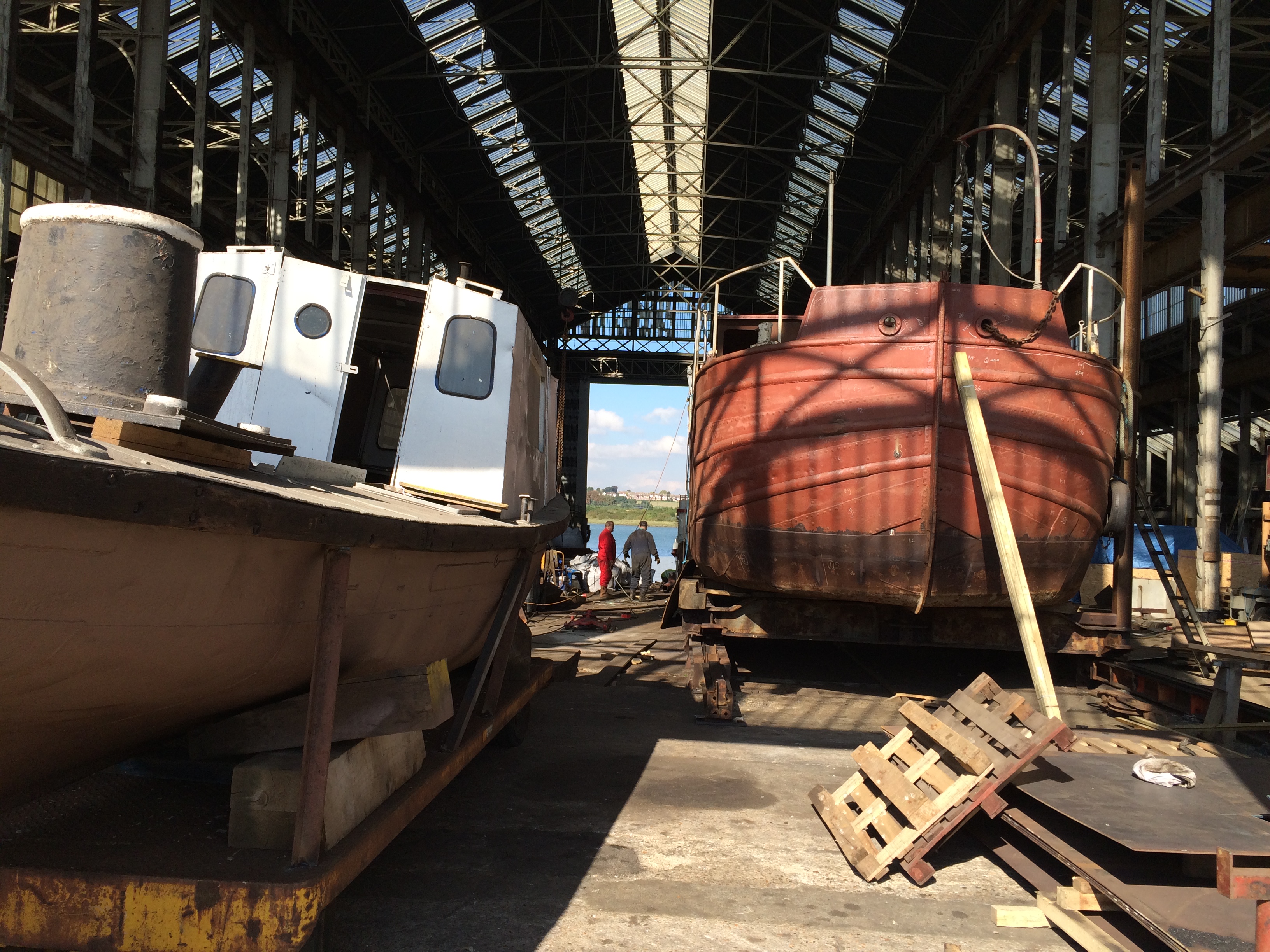
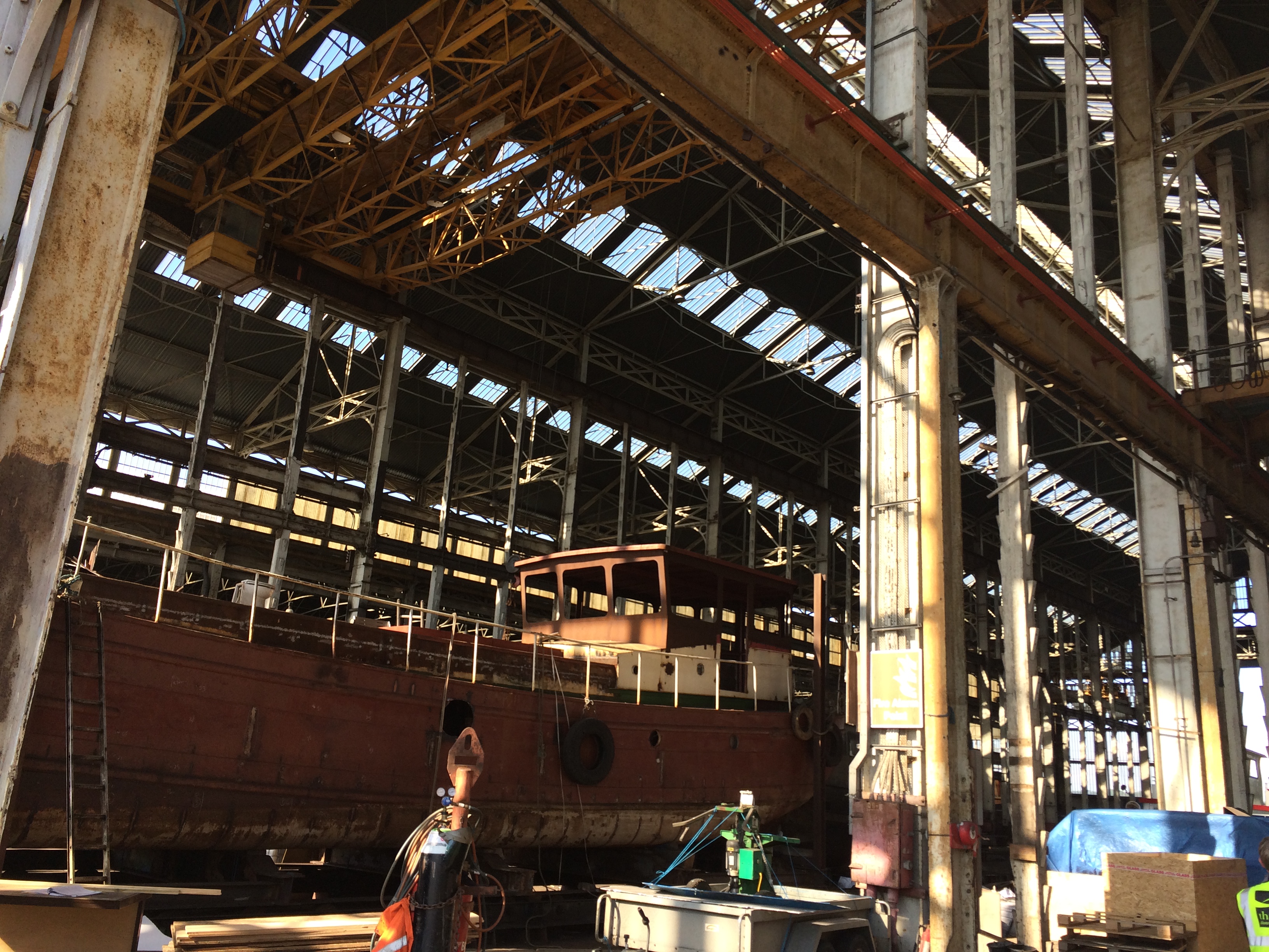
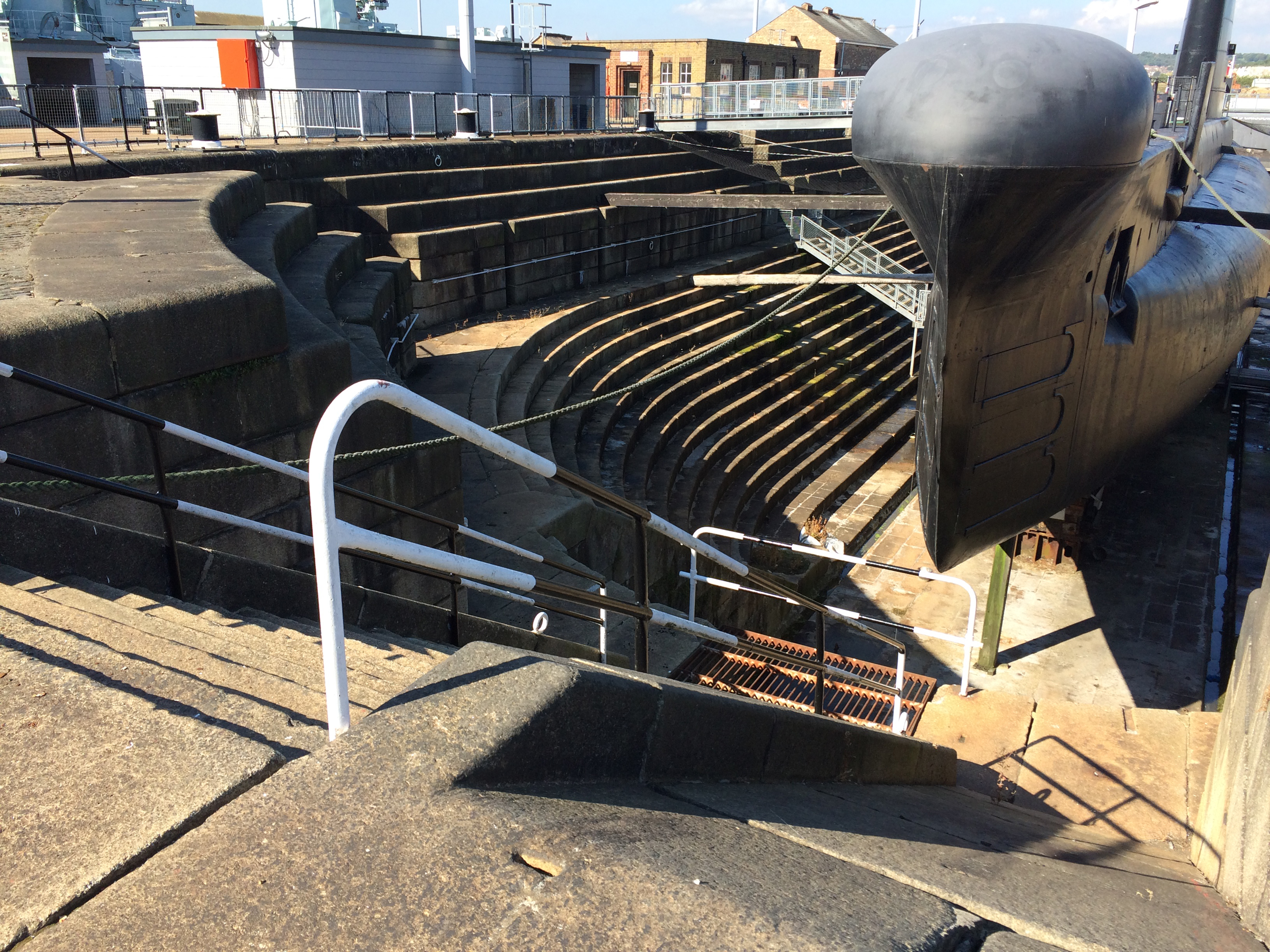
At the Dockyards I was drawn to the activity at Turks Shipyard, which is a fully working yard. The light coming through the roof and riverside doors was beautiful.
Turks Shipyard within the Historic Dockyard site at Chatham. Image:Christopher TippingTurks Shipyard within the Historic Dockyard site at Chatham. Image:Christopher TippingTurks Shipyard within the Historic Dockyard site at Chatham. Image:Christopher TippingTurks Shipyard within the Historic Dockyard site at Chatham. Image:Christopher TippingTurks Shipyard within the Historic Dockyard site at Chatham. Image:Christopher TippingDry Dock, Historic Dockyard, Chatham. Image:Christopher TippingDry Dock, Historic Dockyard, Chatham. Constructed of massive bespoke granite blocks. Image:Christopher Tipping
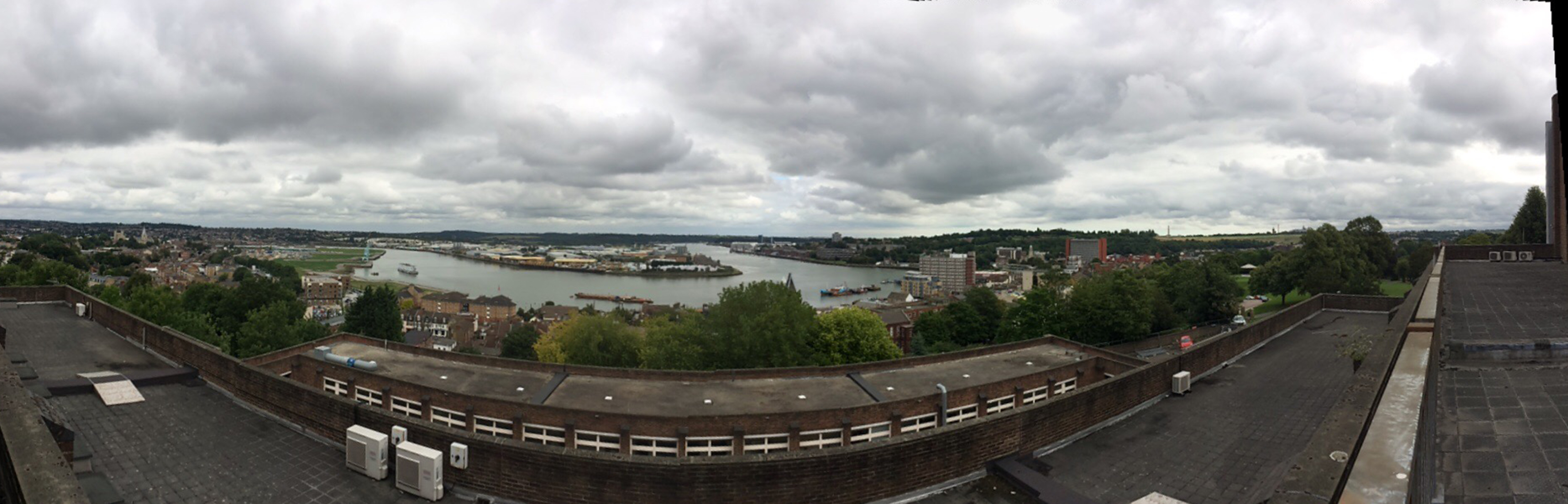
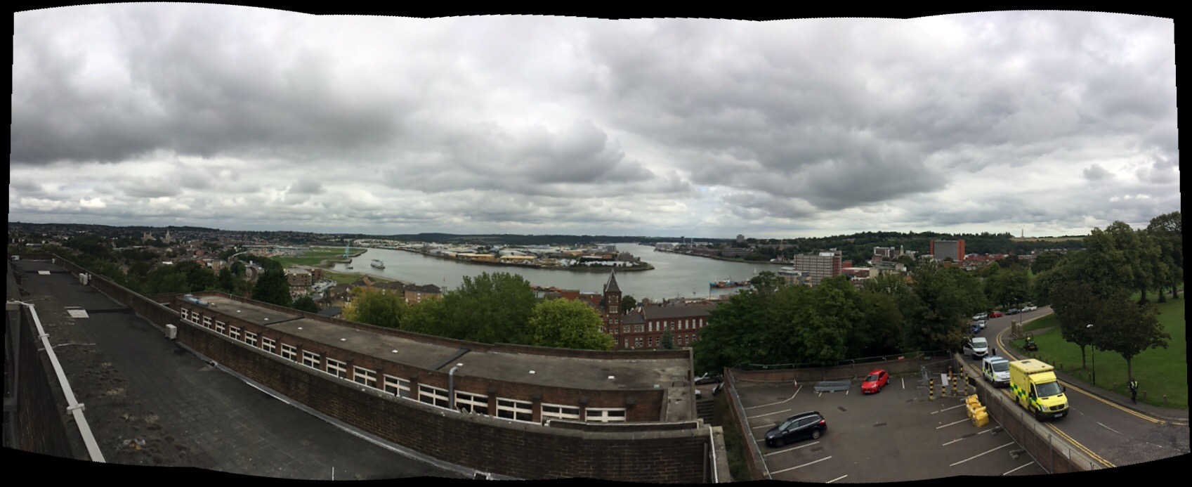
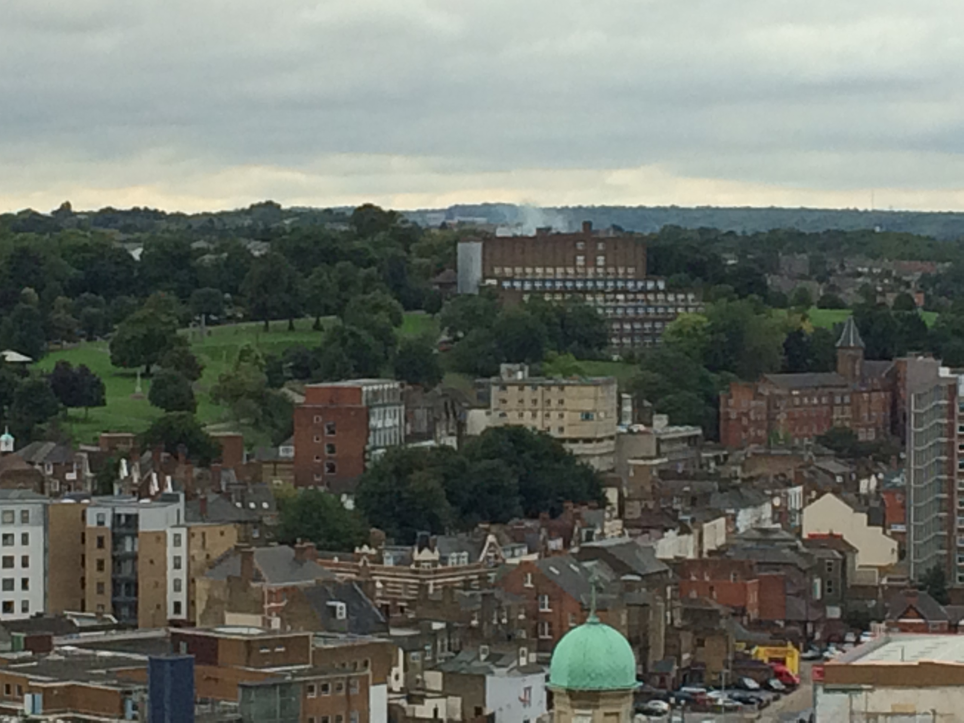
I walked up to the site from Chatham Station, which is only 5mins walk away, passing by Dickens’ House on Ordnance Terrace on the way. I was allowed up onto the upper floors and the terrace, which offers spectacular views across Chatham and Rochester, the Medway and The Historic Dockyards beyond. This vantage point makes clear why Chatham developed as it did as a strategically important defensive site on the River.
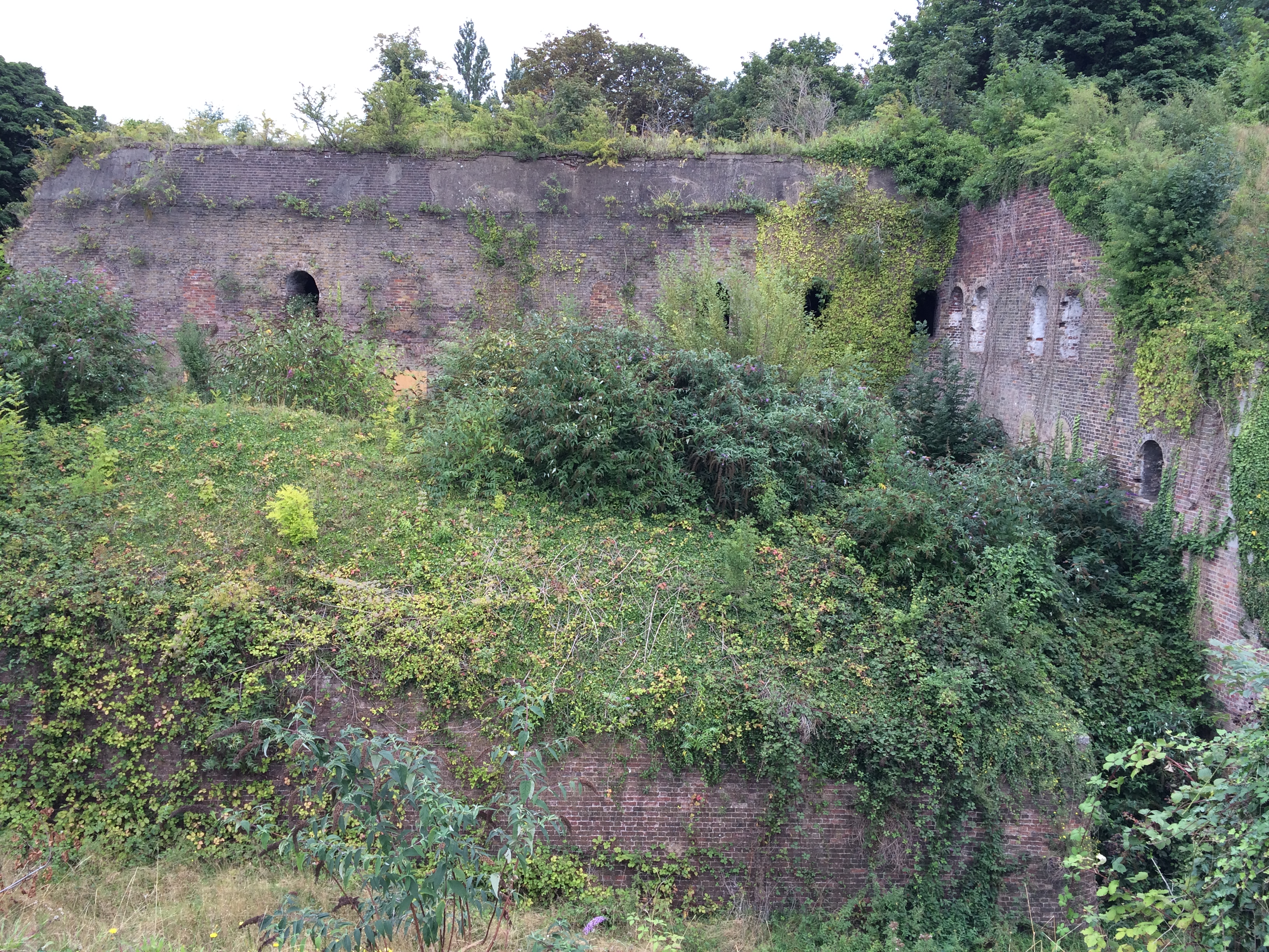
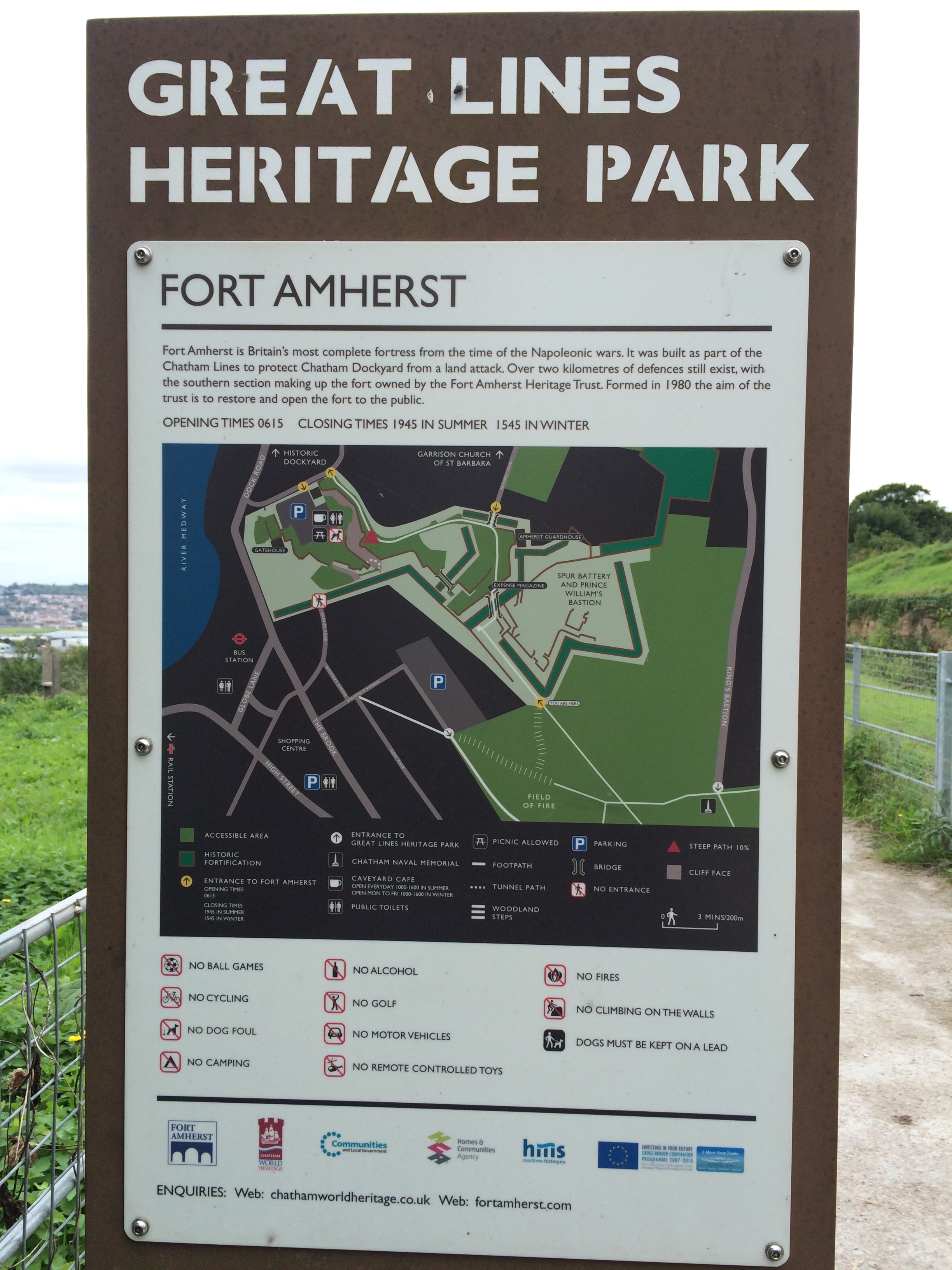
Chatham Lines – comprising a number of impressive defensive structures, earthworks and Forts, developed since Napoleonic times to protect the Docks from a landward attack, are clearly visible in the landscape and although now long past any active role in the defence of the country, have served to shape the town and its inhabitants in both its topography, physical landscape and social history.
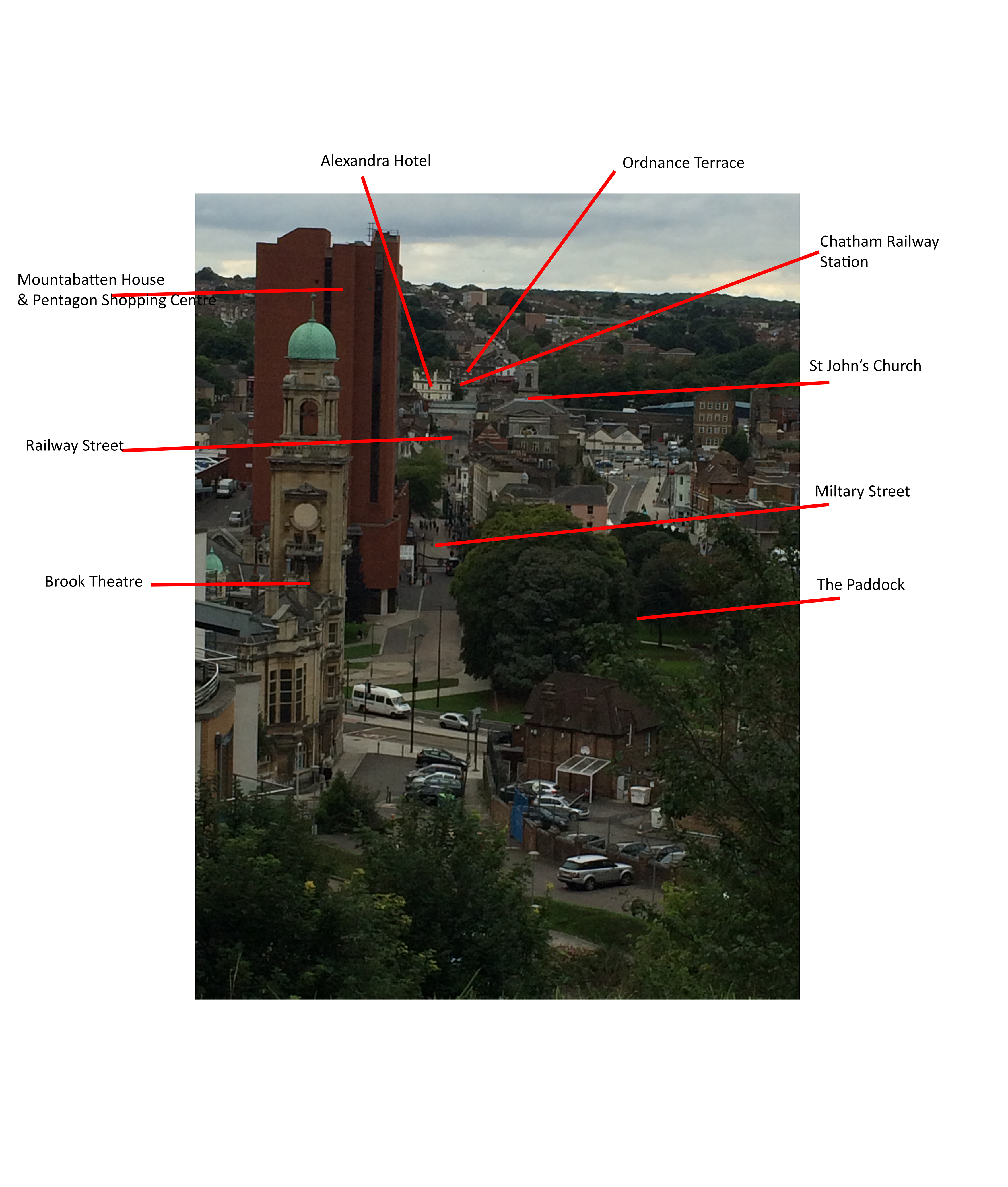
Chatham and the Historic Dockyard as seen from the upper floors of the University for the Creative Arts, Rochester Campus at Fort Pitt. Image:Christopher Tipping
Chatham and the Historic Dockyard as seen from the upper floors of the University for the Creative Arts, Rochester Campus at Fort Pitt. Image:Christopher Tipping
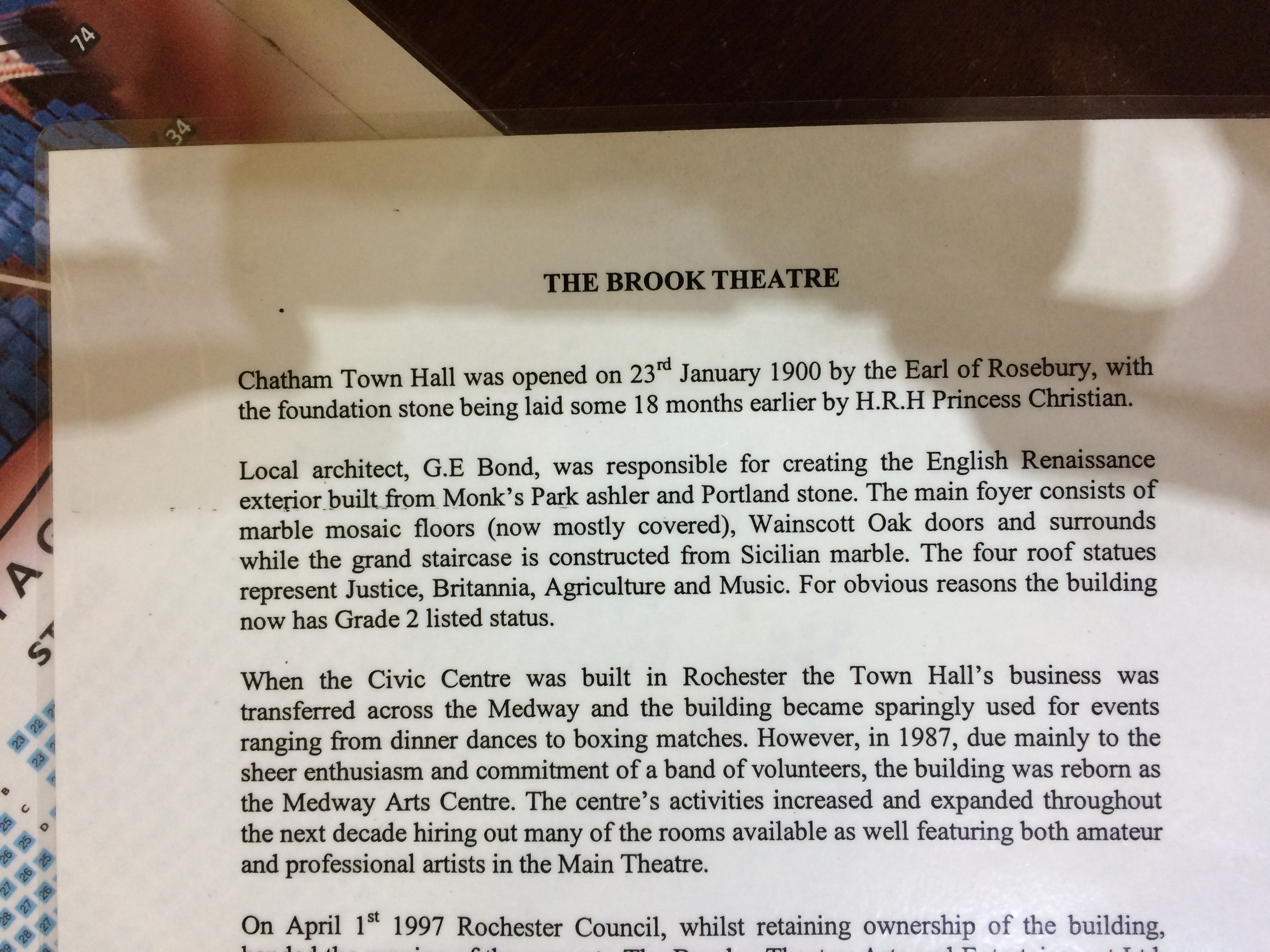
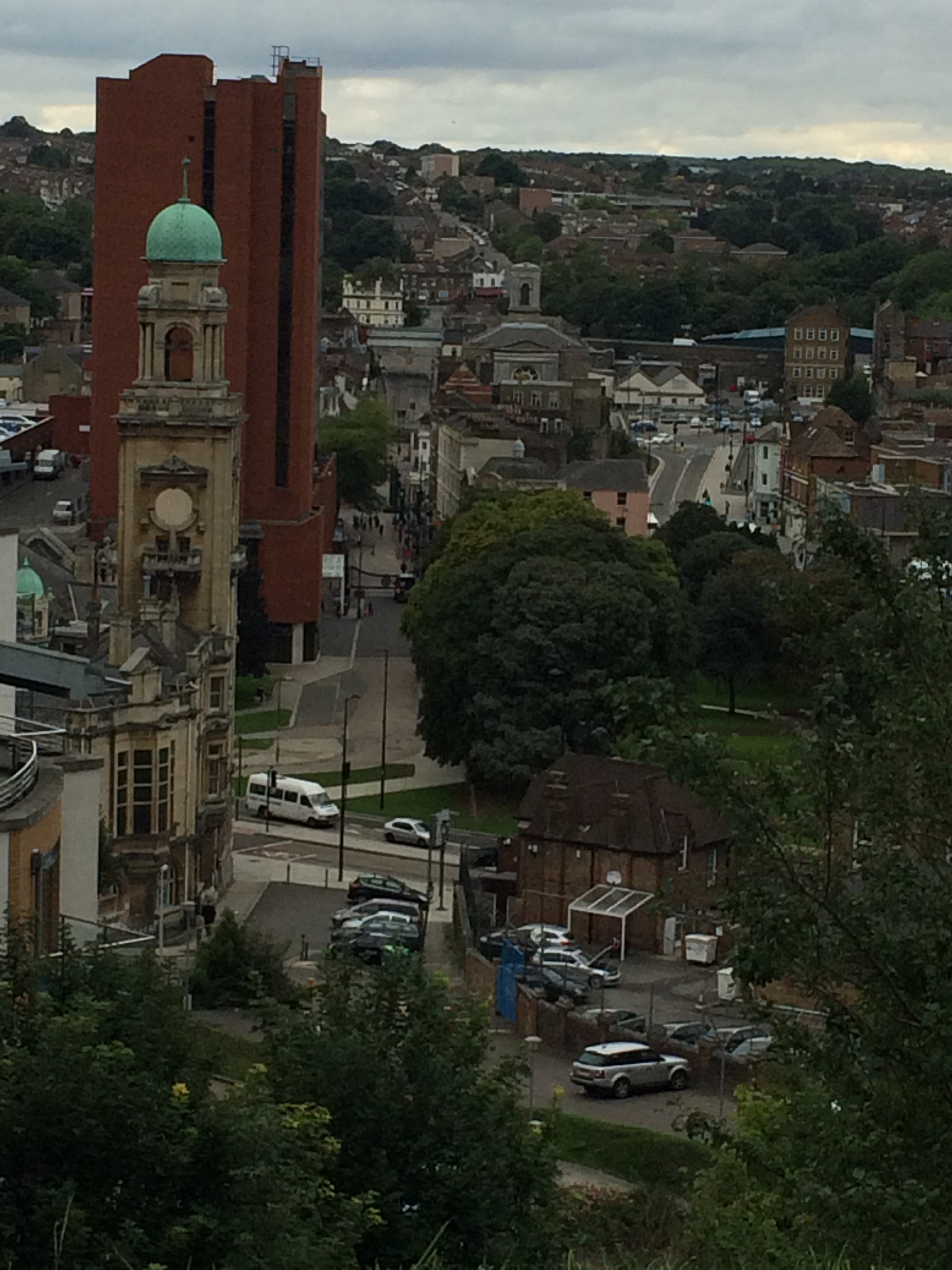
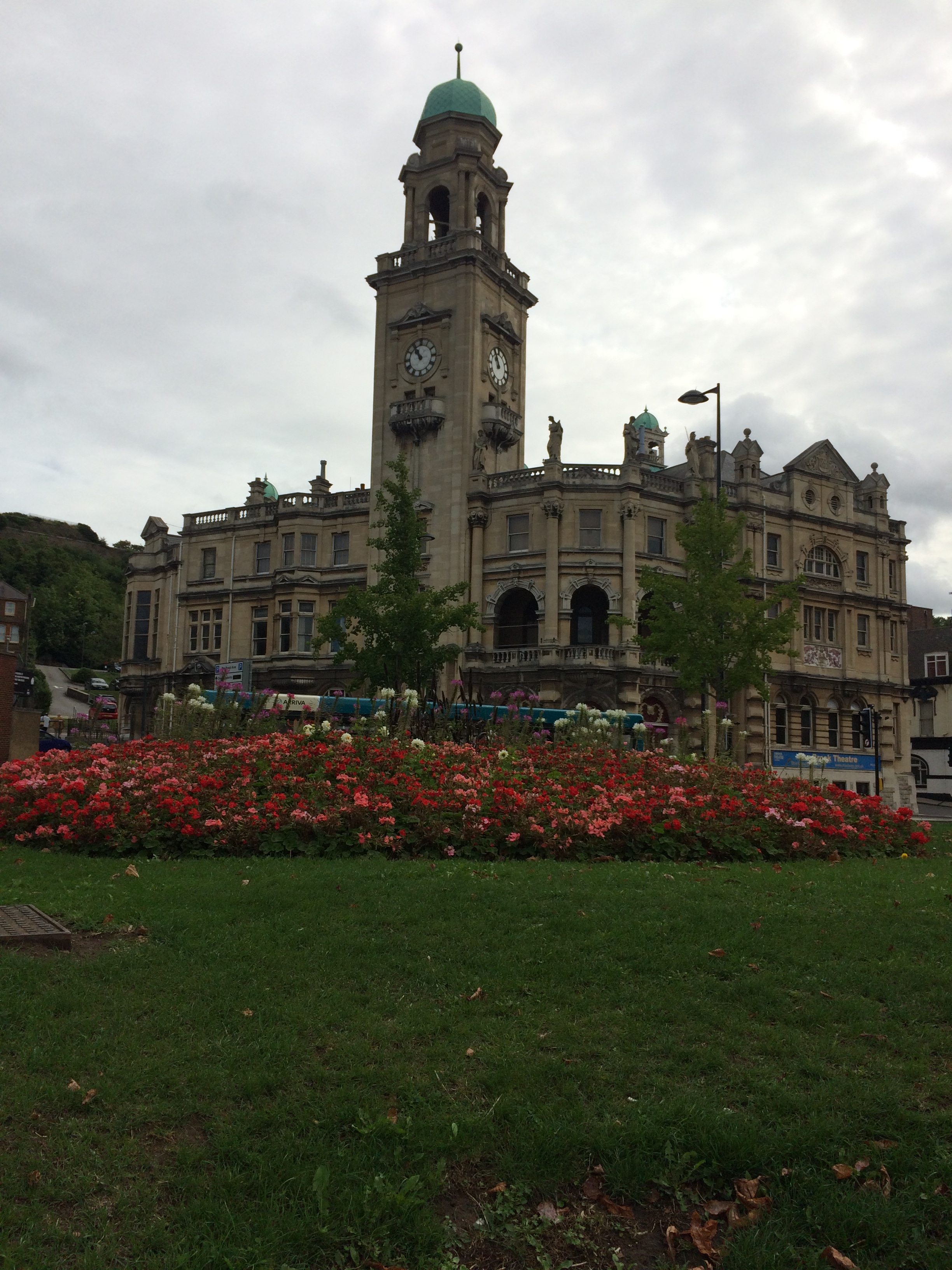
The copper green copula of the Brook Theatre, Chatham can be seen in the above image at the top right section of the image to the left of the red brick office clock Mountbatten House, the dominant landmark in the Town.
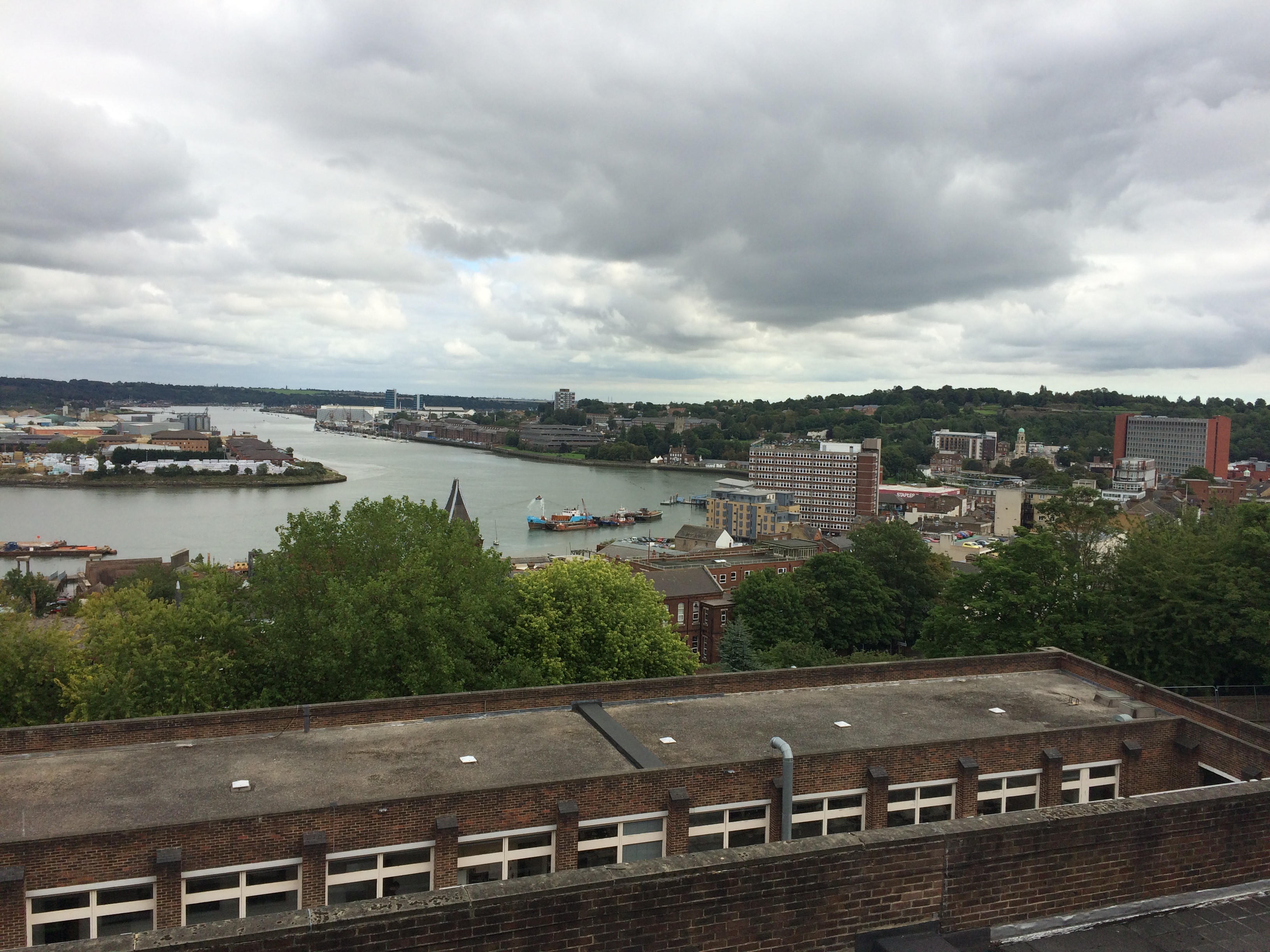
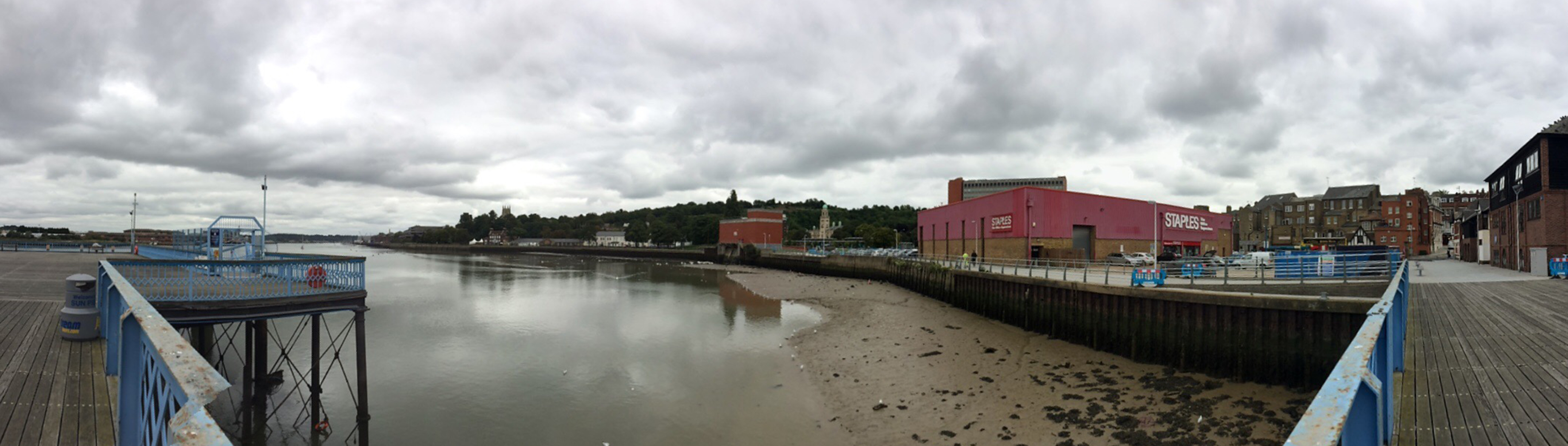
Chatham and the Historic Dockyard as seen from the upper floors of the University for the Creative Arts, Rochester Campus at Fort Pitt. Image:Christopher TippingChatham Waterfront and Gun Wharf as seen from Sun Pier. Image:Christopher Tipping
Chatham Waterfront and Gun Wharf as seen from Sun Pier. Image:Christopher Tipping
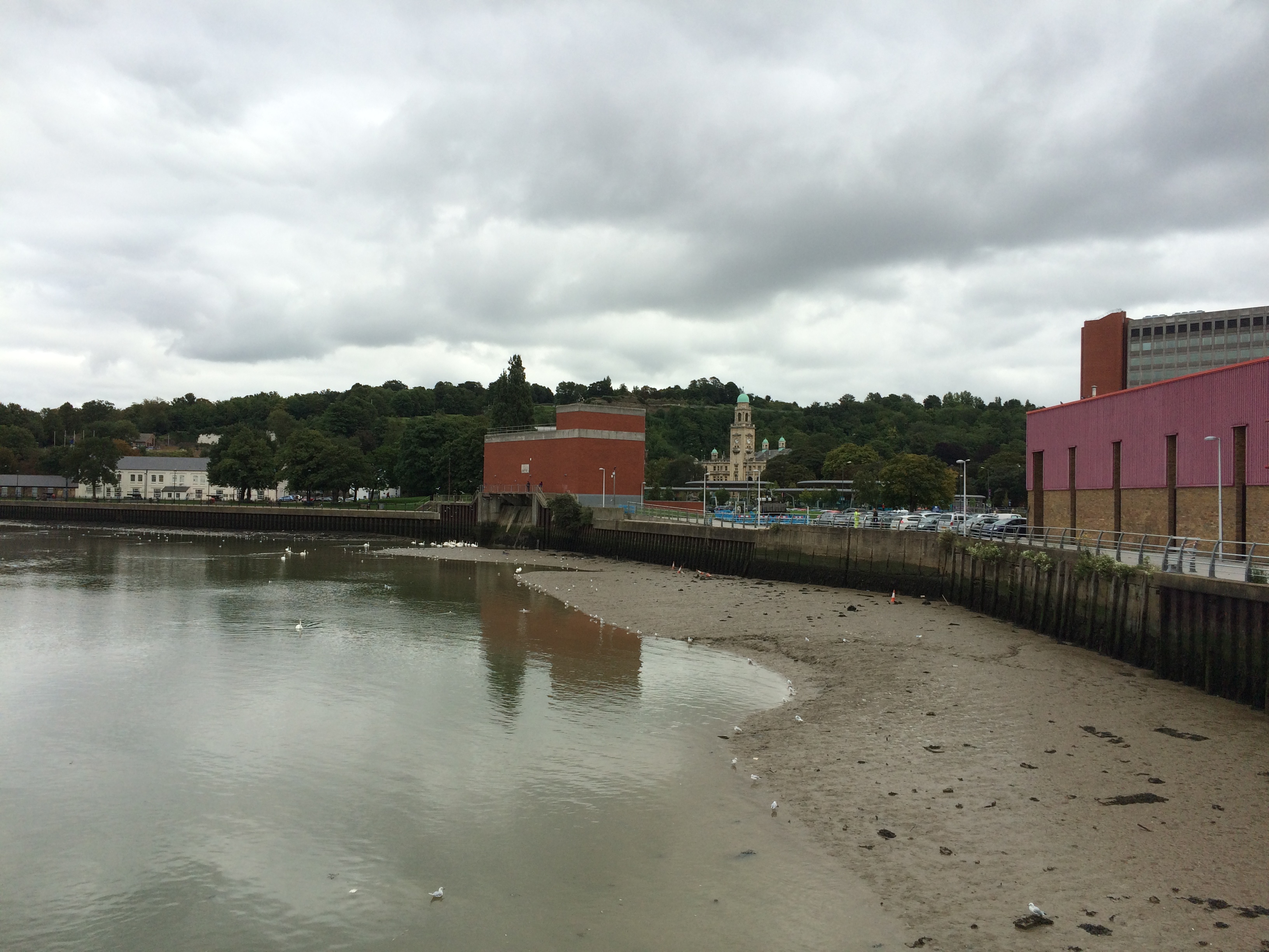
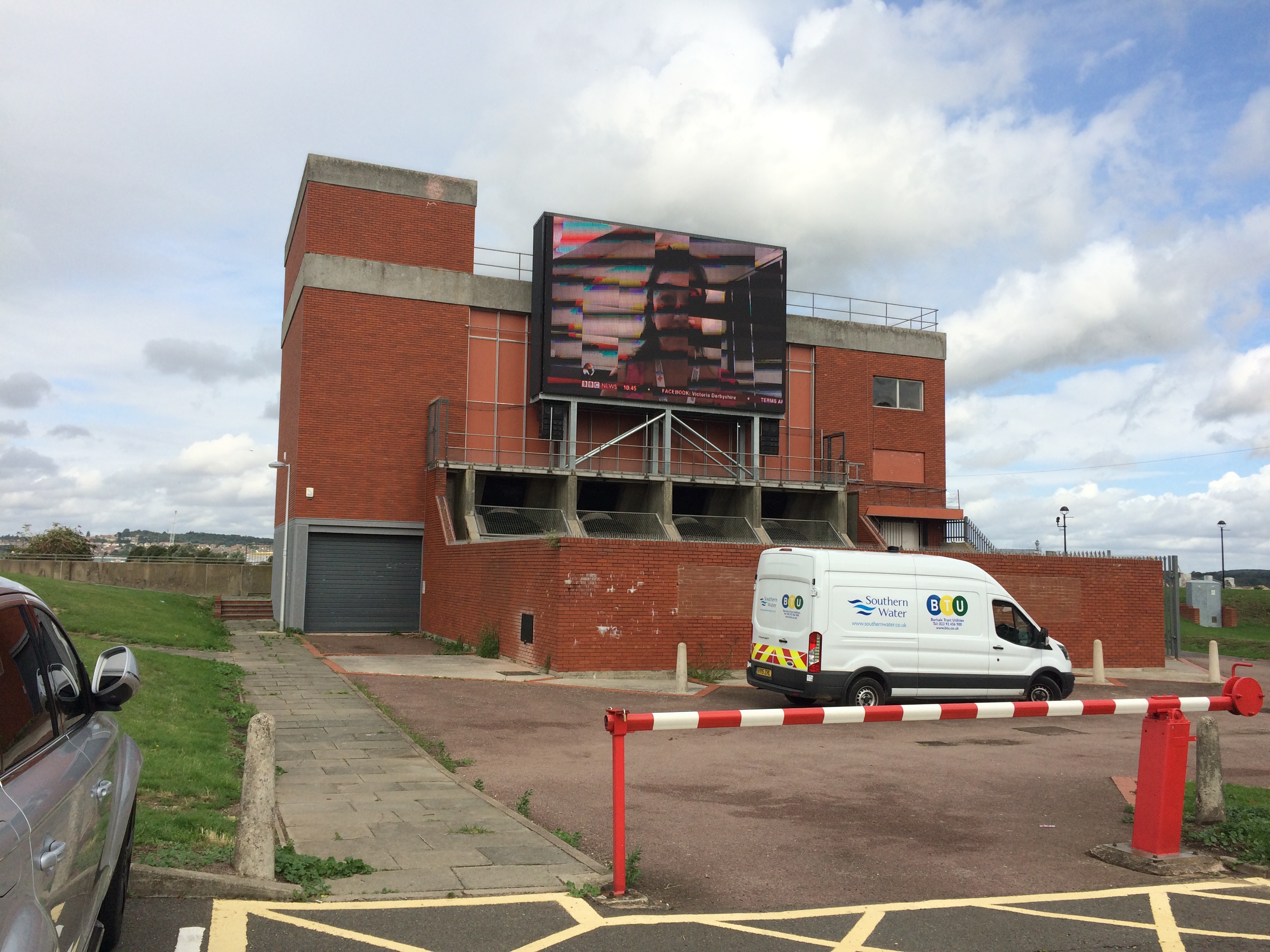
The Waterfront Pumping Station and Brook Theatre as seen from Sun Pier, Chatham. If ever something cried out for some form of intervention – then the Pumping Station takes poll position on the list. An eyesore on the waterfront, it could become an icon and focal point.
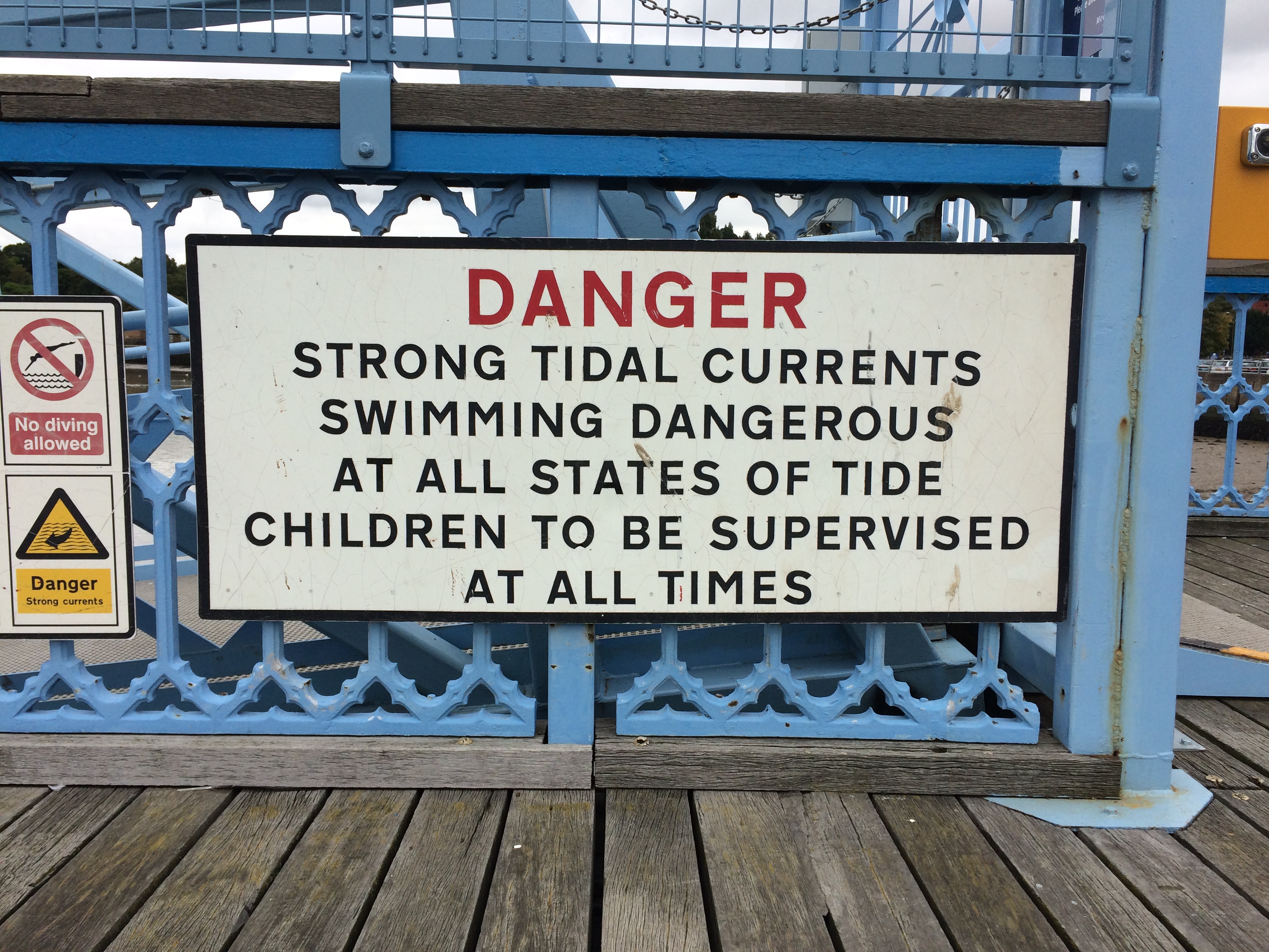
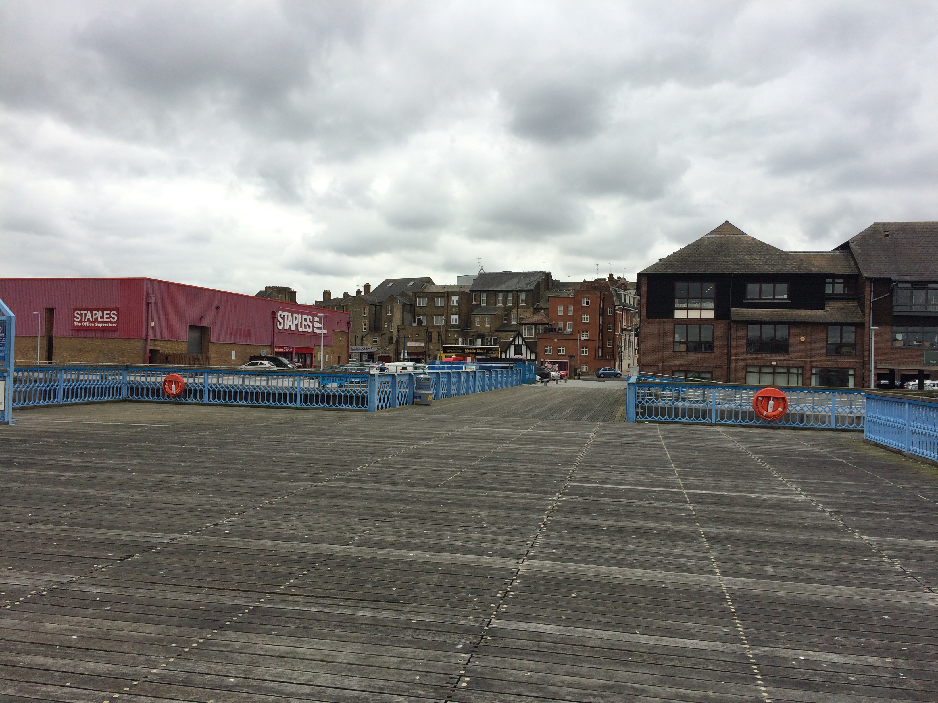
Sun Pier, Chatham with warning sign. Image:Christopher TippingThe empty timber deck of Sun Pier, Chatham. Image:Christopher Tipping
Although historically, the waterfront and area around Sun Pier would have been dominated by warehouses and river bases businesses. The industrial shed which houses Staples, does the site and its potential no favours here. Some softening landscape works and green screening may help.
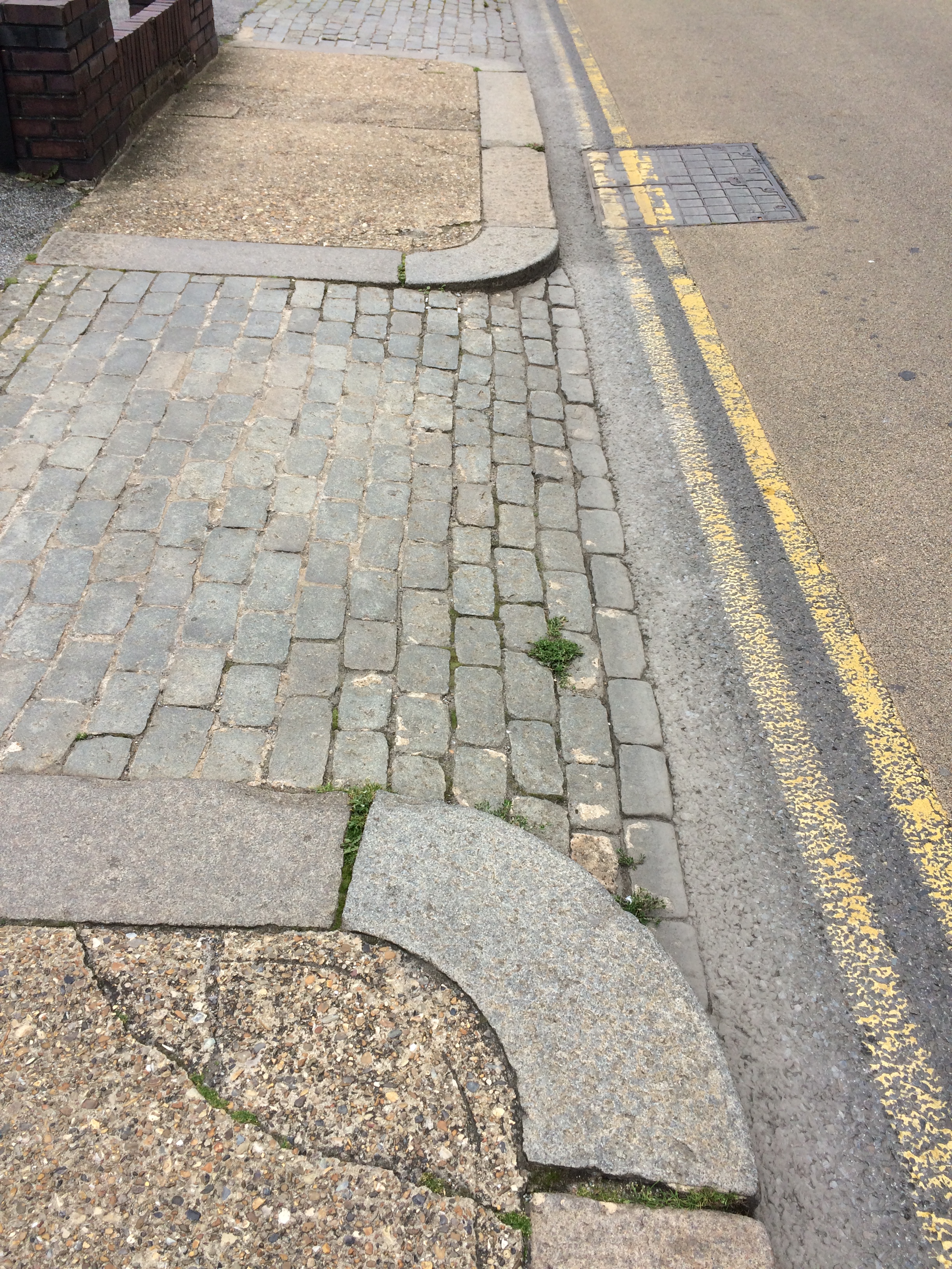
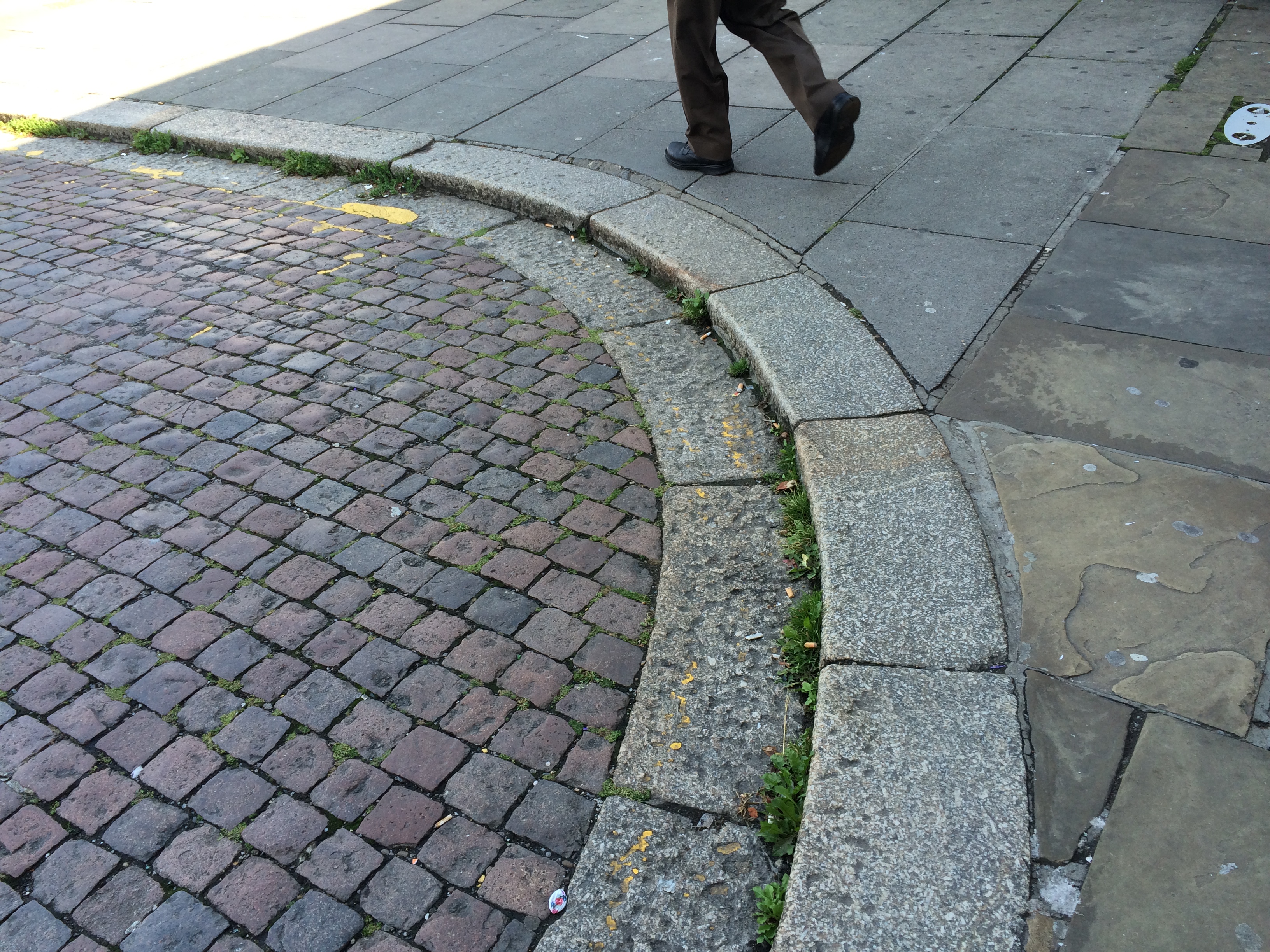
Walking back from Sun Pier to the Waterfront and Bus Station, these historic granite kerbs and cobbles jump out for their simplicity, texture and purpose.
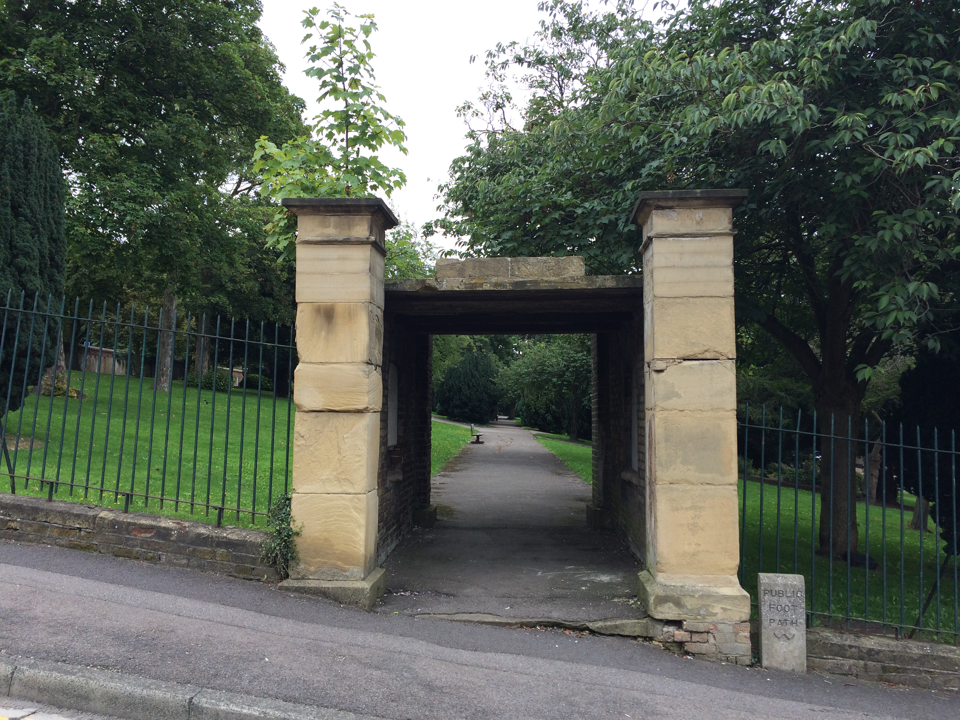
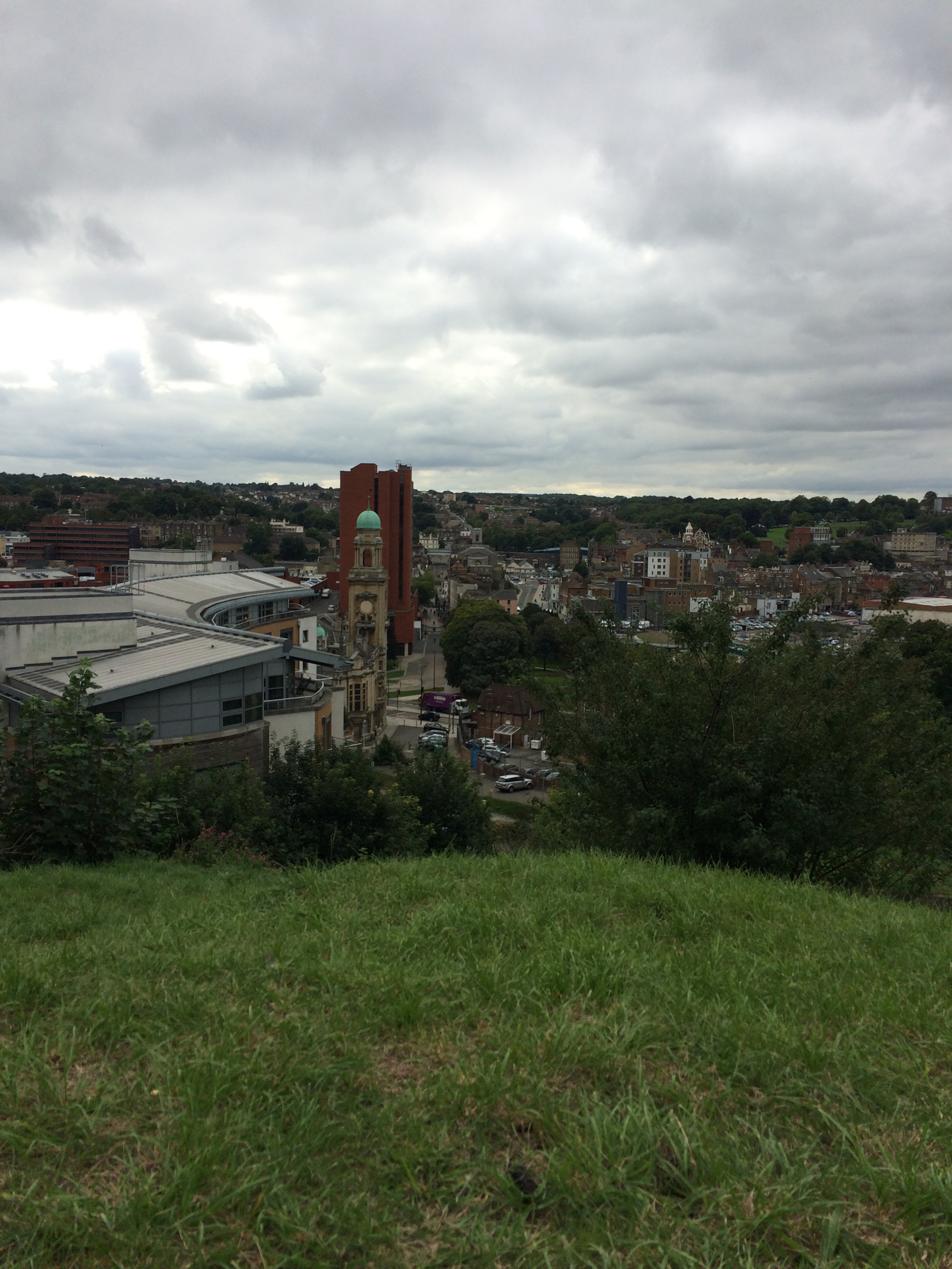
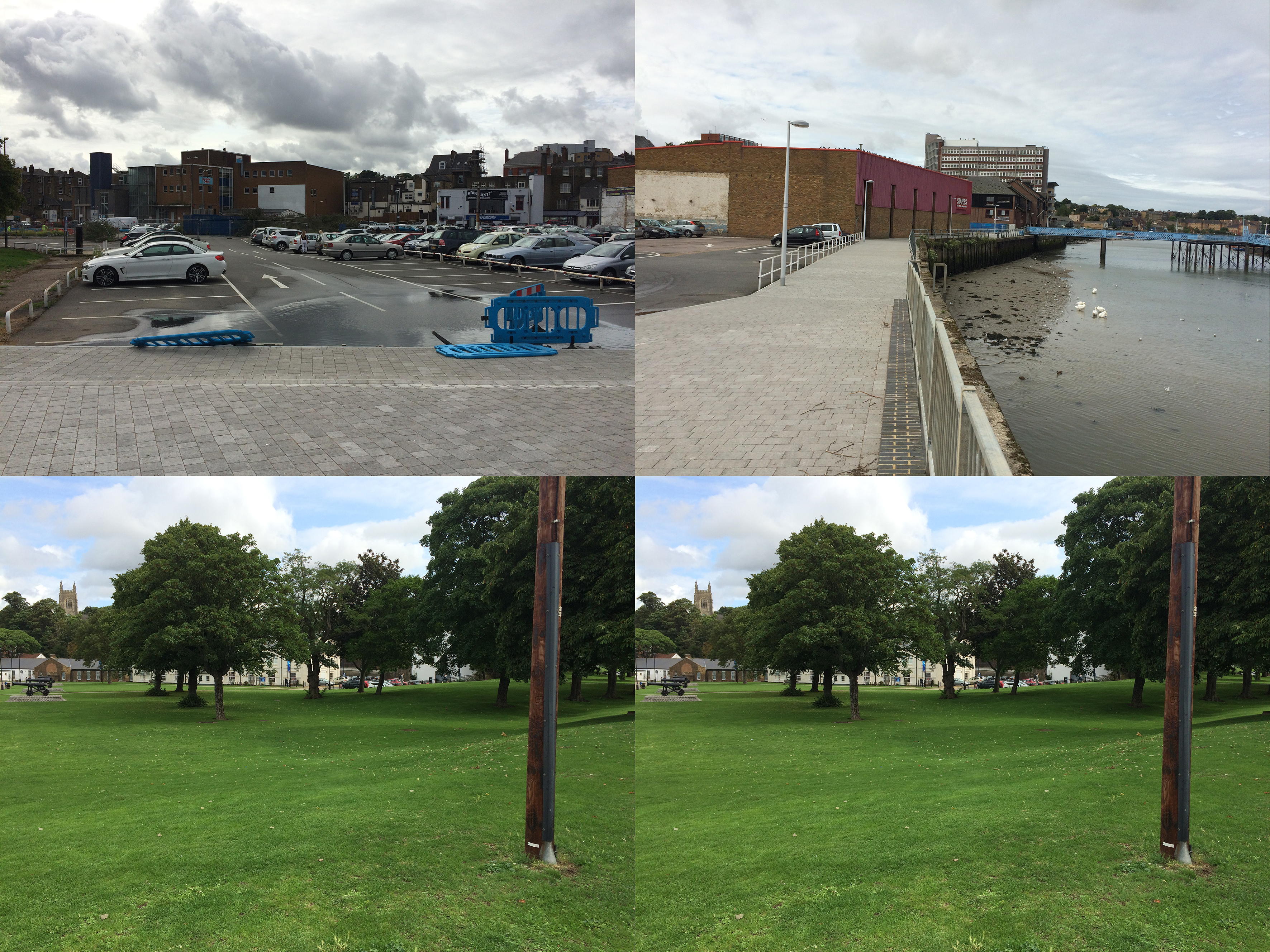
I wanted to see the town from the opposite vantage point of Fort Amherst adjacent to Great Lines Park, formerly known as the Field of Fire , so walked across to the Brook Theatre and beyond to the Town Hall Gardens, the former Town Burial Ground. Prior to 1828, the site was a former Rope Works.
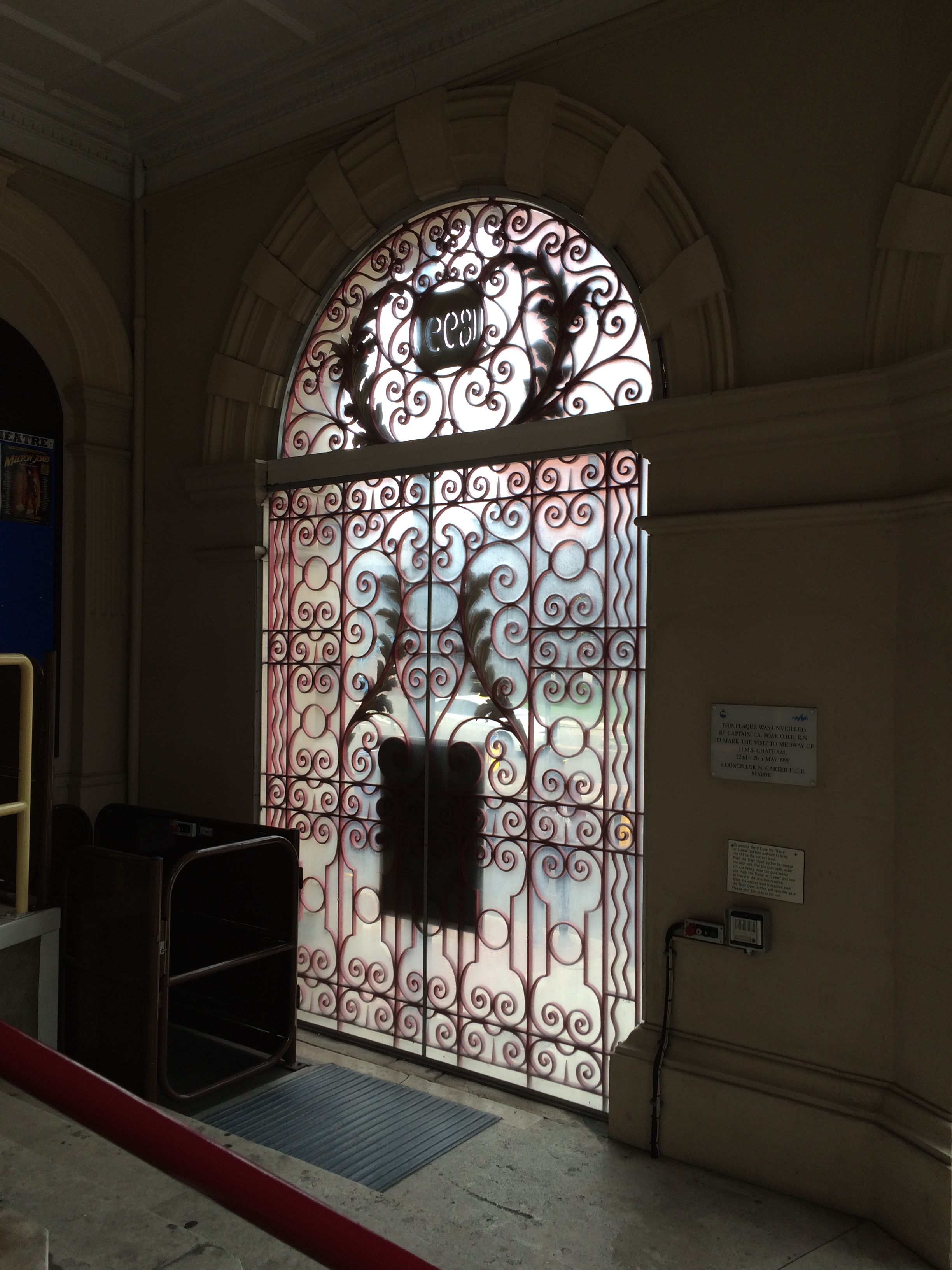
The Brook Theatre, Chatham. Image:Christopher TippingDecorative wrought ironwork gates inside the Brook Theatre, Chatham. Image:Christopher TippingDecorative wrought ironwork gates inside the Brook Theatre, Chatham. Image:Christopher TippingThe gates to the Town Hall Gardens, Chatham. Image:Christopher Tipping
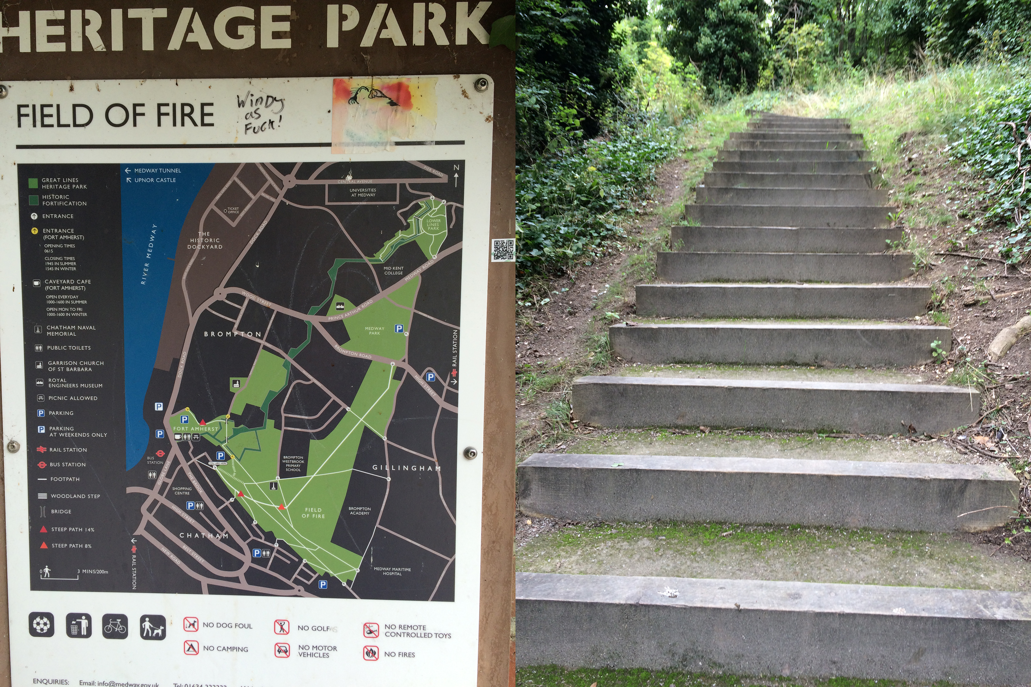
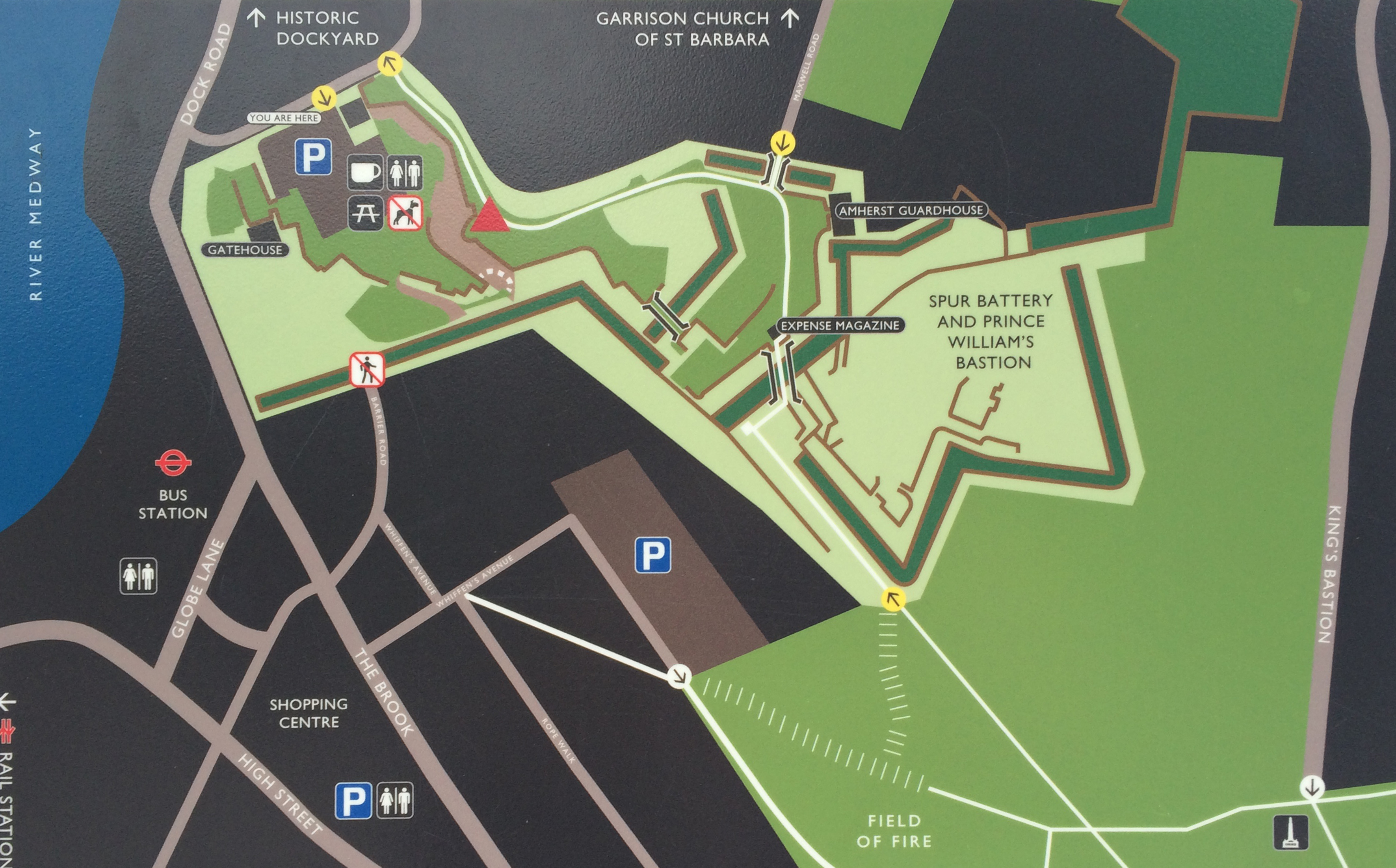
Just a short walk further up the hill is the path and steps leading up to the Great Lines Park and Fort Amherst.
Several steep fights of steps meet the visitor to the Great Lines Heritage Park and Fort Amherst, Chatham. Image:Christopher TippingThe Napoleonic brick faced defensive structures of Fort Amherst, Chatham. Image:Christopher TippingFort Amherst Signage, Chatham. Image:Christopher TippingA detail of the Fort Amherst Signage found at Great Lines Park, Chatham. Image:Christopher TippingA view of the University for the Creative Arts at Fort Pitt, Rochester, taken from Belvedere Battery, Fort Amherst, Chatham. Image:Christopher Tipping
UCA at Fort Pitt is at top centre of this image. The copper green copula of the Brook Theatre is at the centre bottom.
The pedestrian route from Chatham Railway Station to The Paddock and Bus Station can be made out in this image taken from Belvedere Battery, Fort Amherst, Chatham. Image:Christopher TippingThe pedestrian route from Chatham Railway Station to The Paddock and Bus Station can be made out in this image taken from Belvedere Battery, Fort Amherst, Chatham. Image:Christopher TippingThe pedestrian route from Chatham Railway Station to The Paddock and Bus Station can be made out in this annotated image taken from Belvedere Battery, Fort Amherst, Chatham. Image:Christopher Tipping
They have a brilliant book on Chatham and it’s history – “The Story of a Dockyard Town”by James Presnail, published by the Corporation of Chatham in 1952 MCMLII. Ref:942.23 CHA. I was much taken by it’s last paragraph on social responsibility.
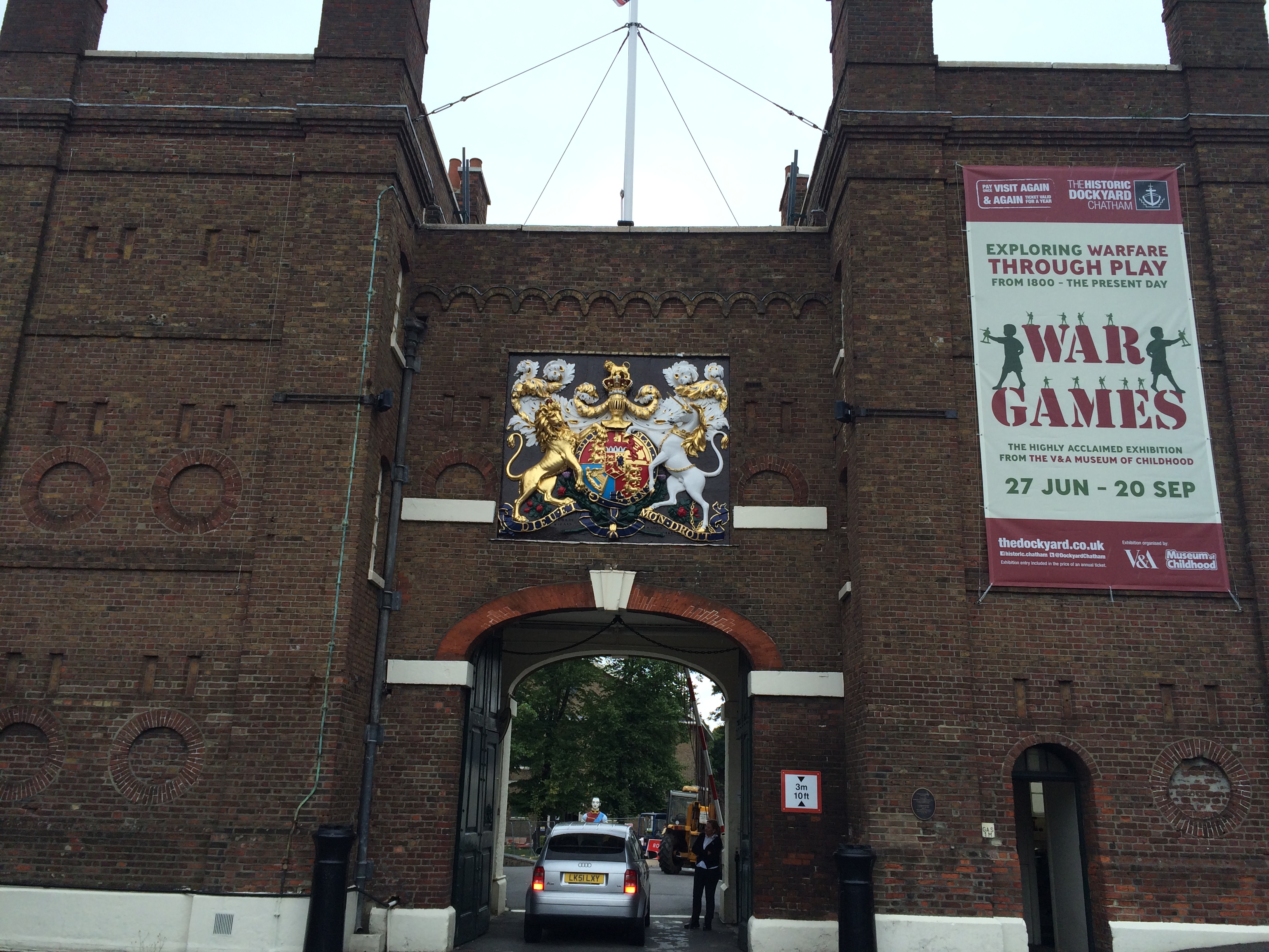
A long day of walking streets in Chatham, trying to understand how it all works – I finally made my way along Dock Rd, past Medway Councilbuildings at Gun Wharfand St Mary’s Church, where Pepys and Dickens both worshipped; past Fort Amherst – to The Historic Dockyard.
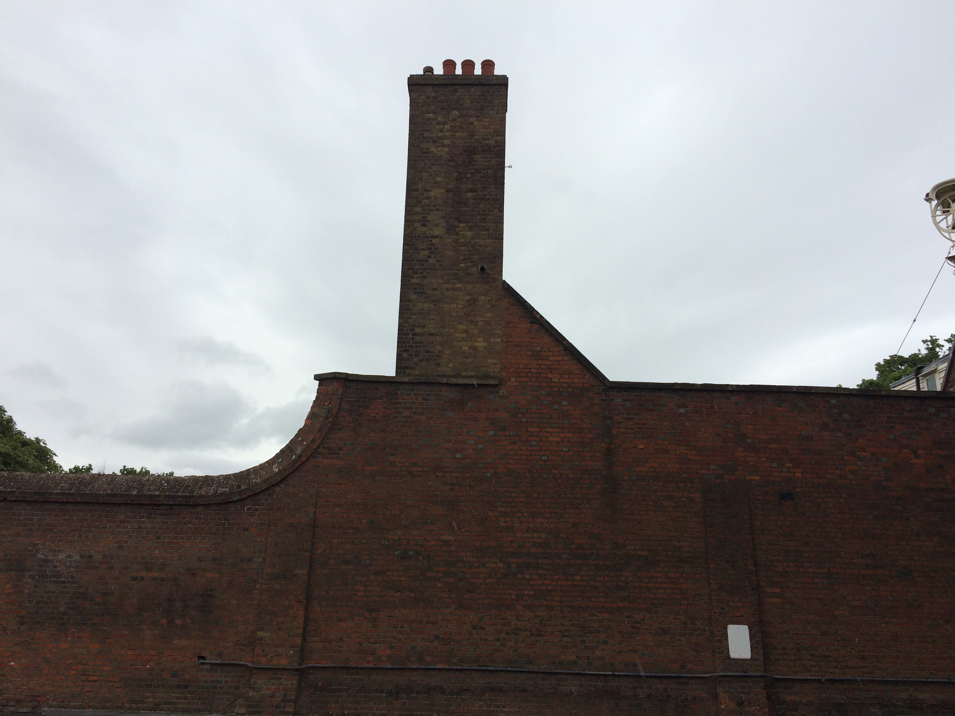
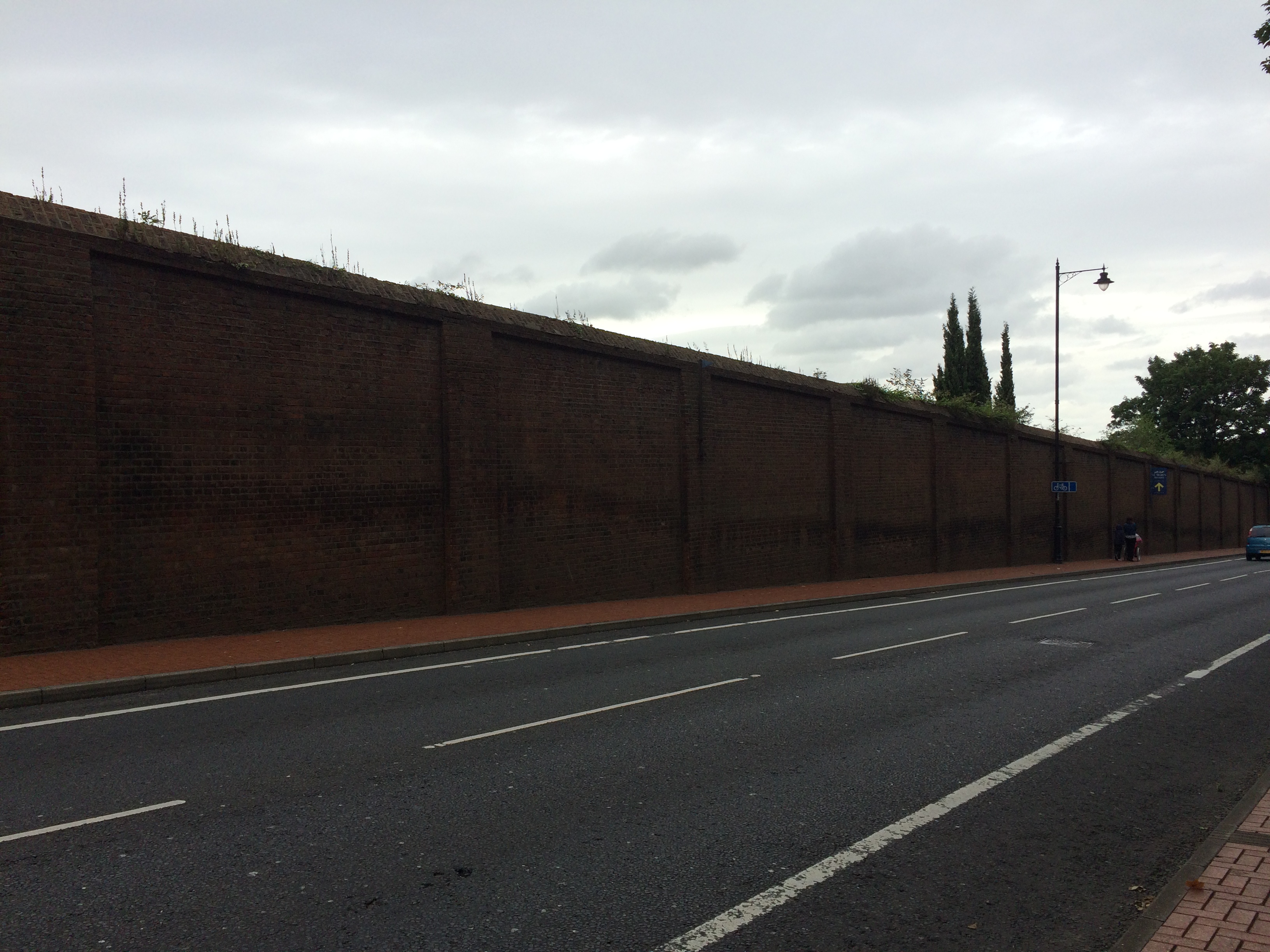
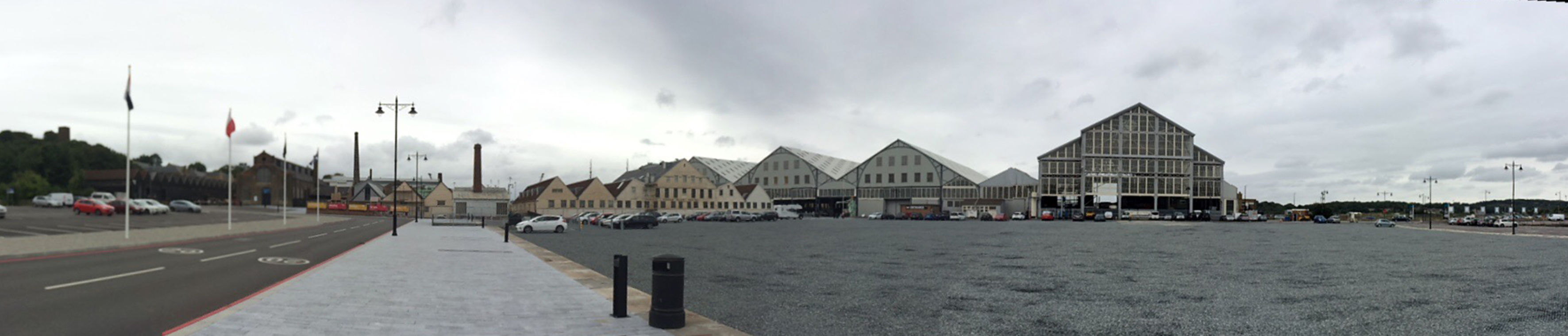
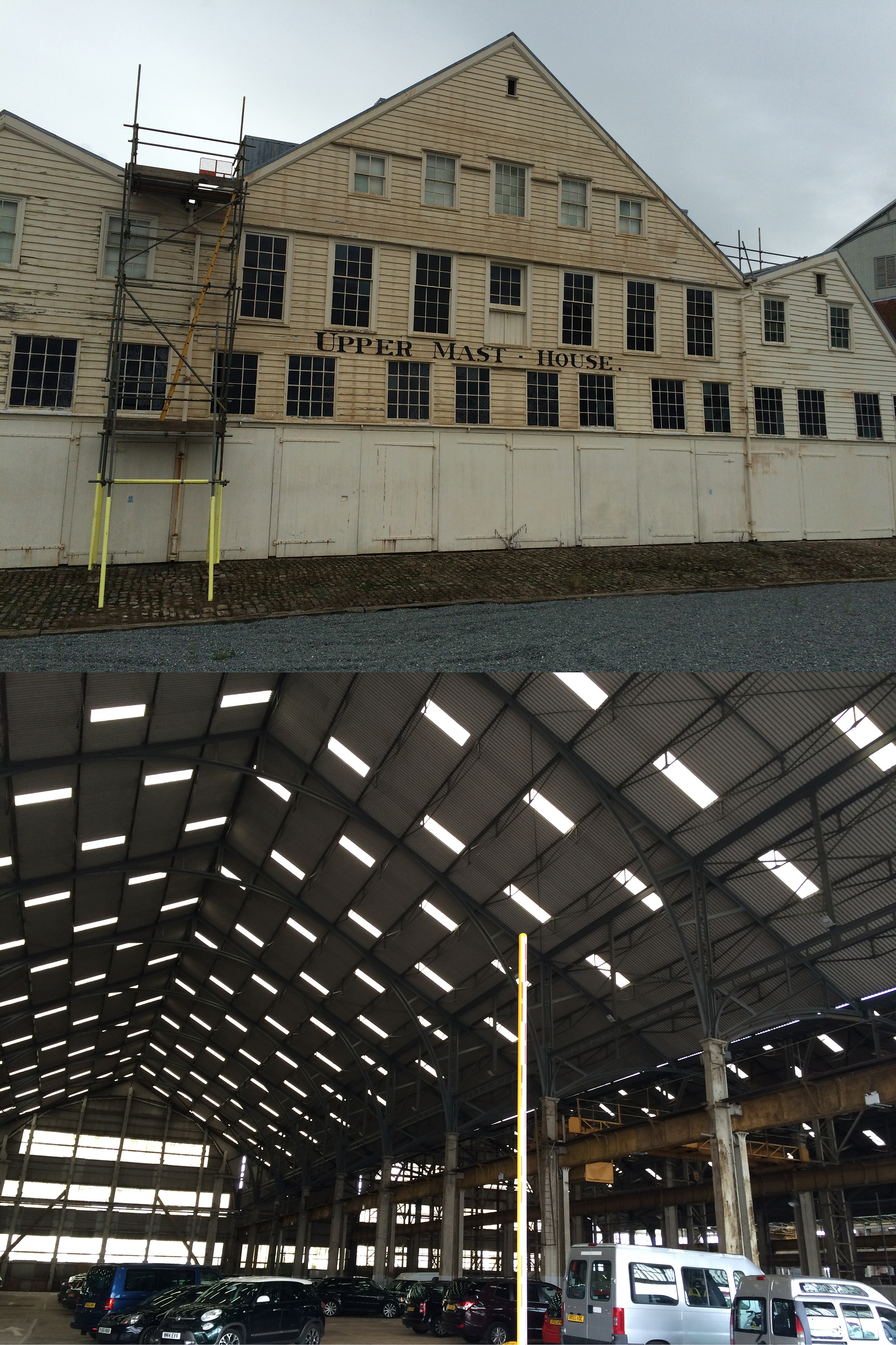
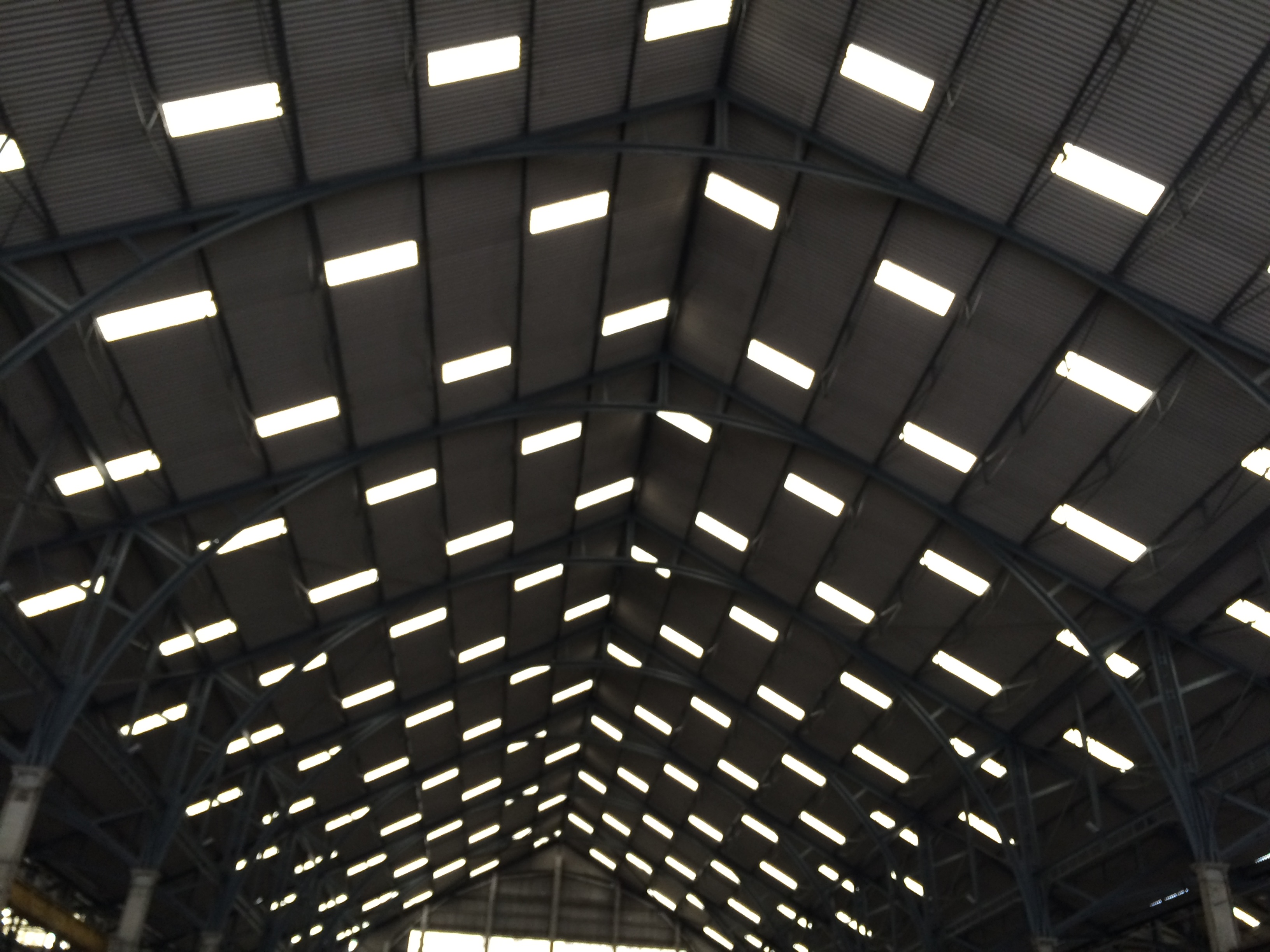
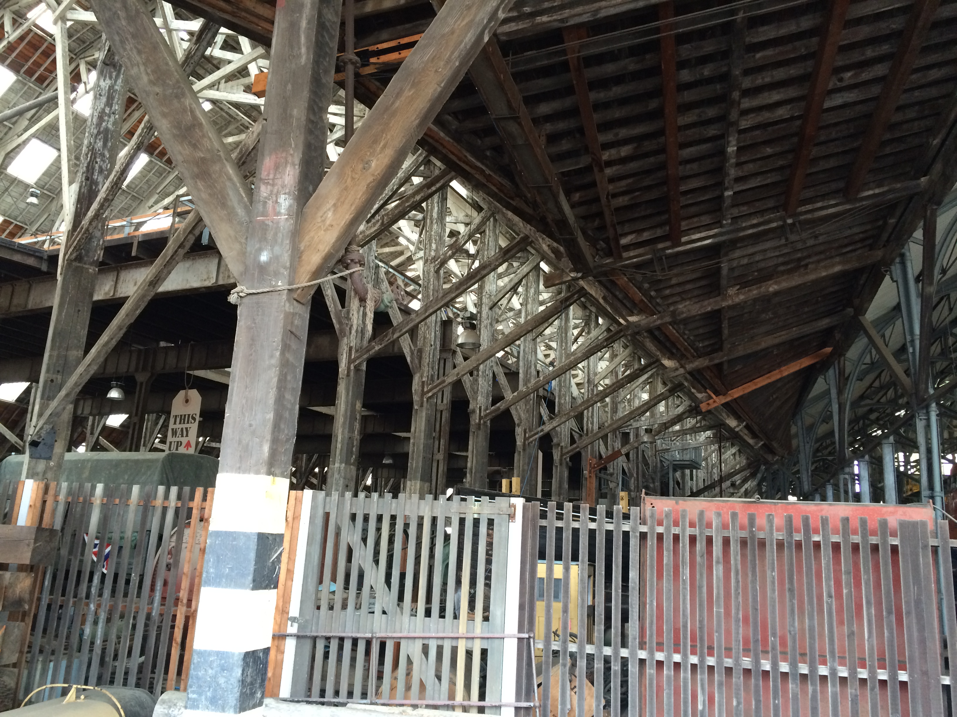
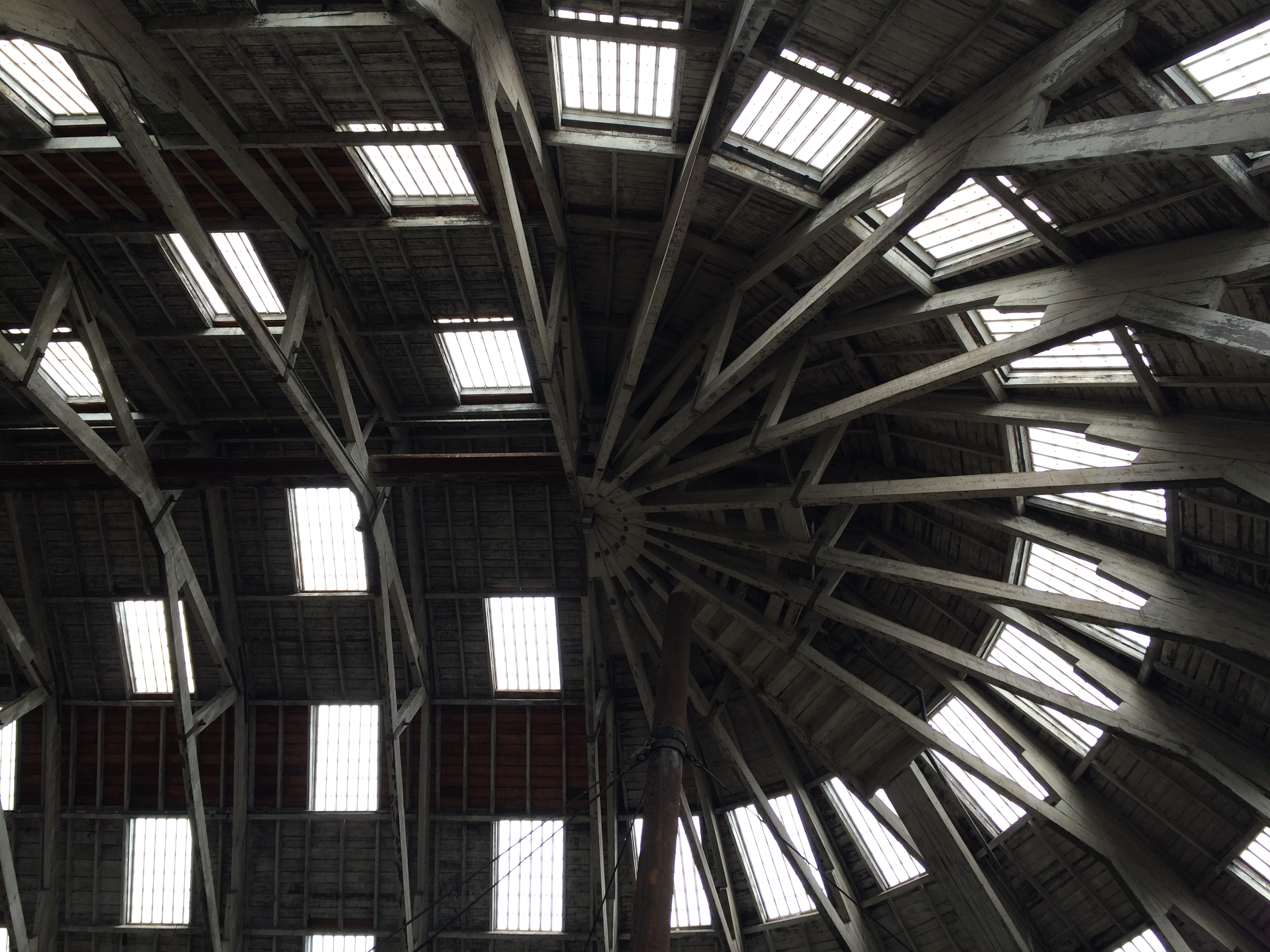
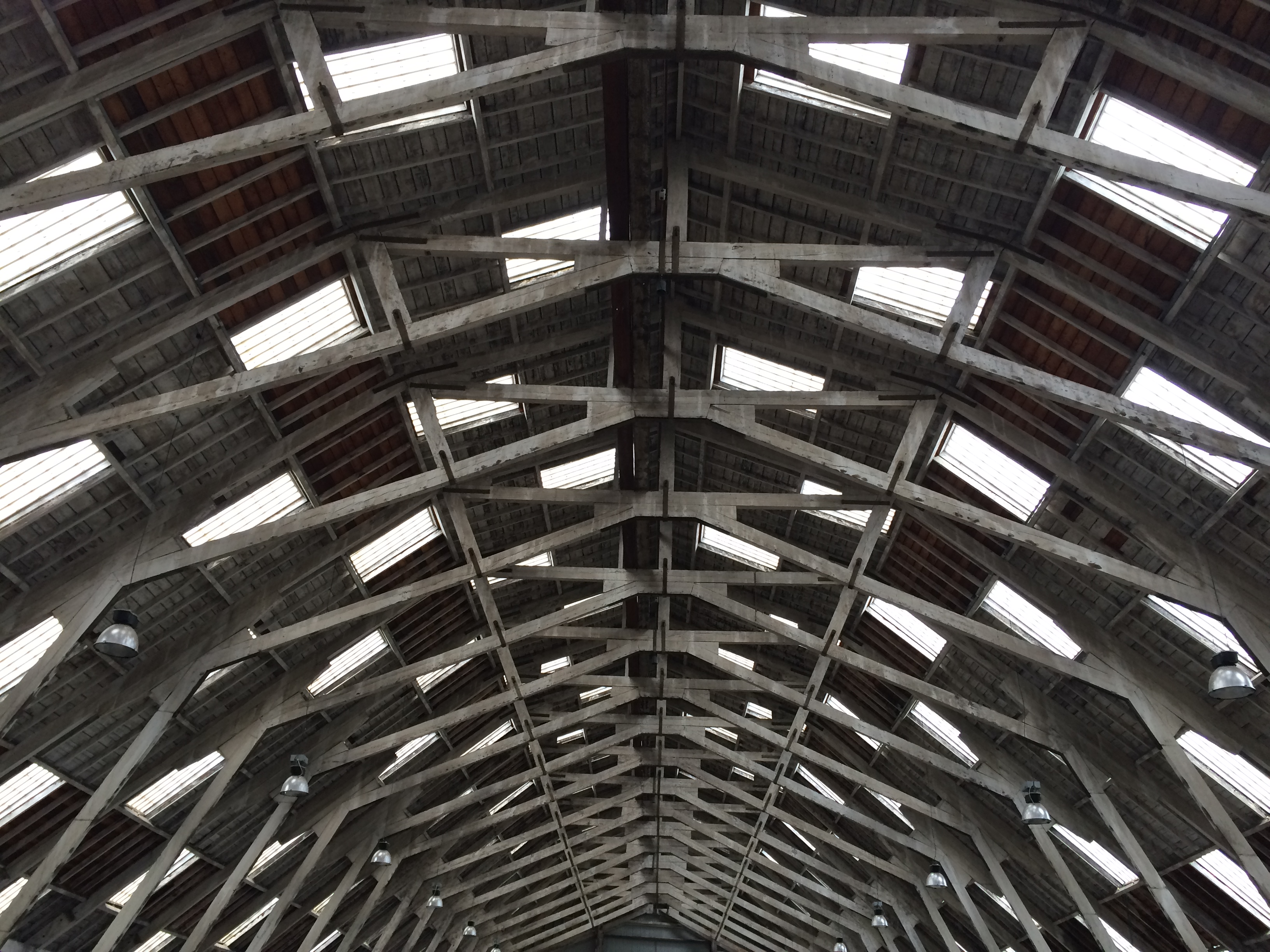
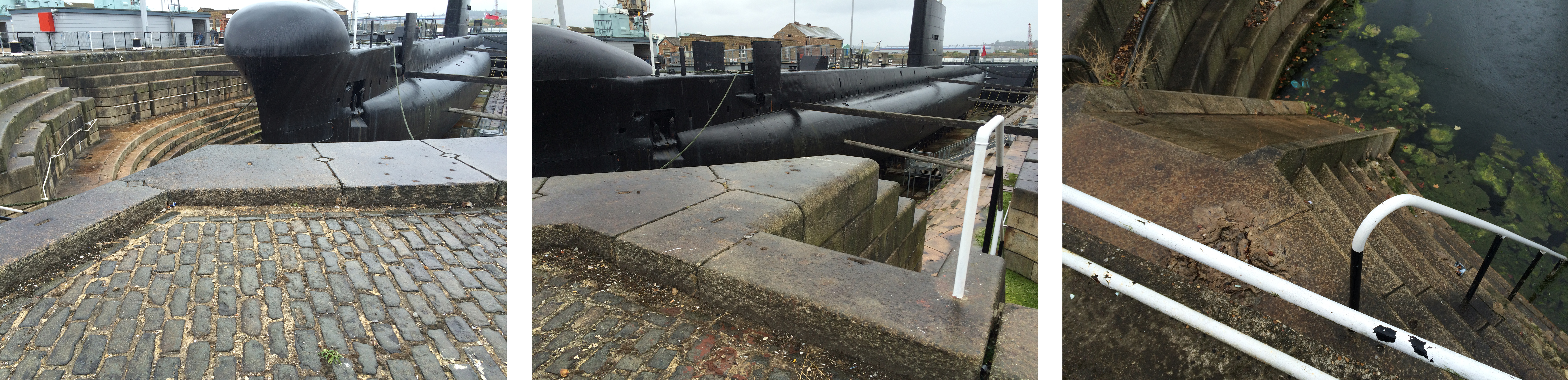
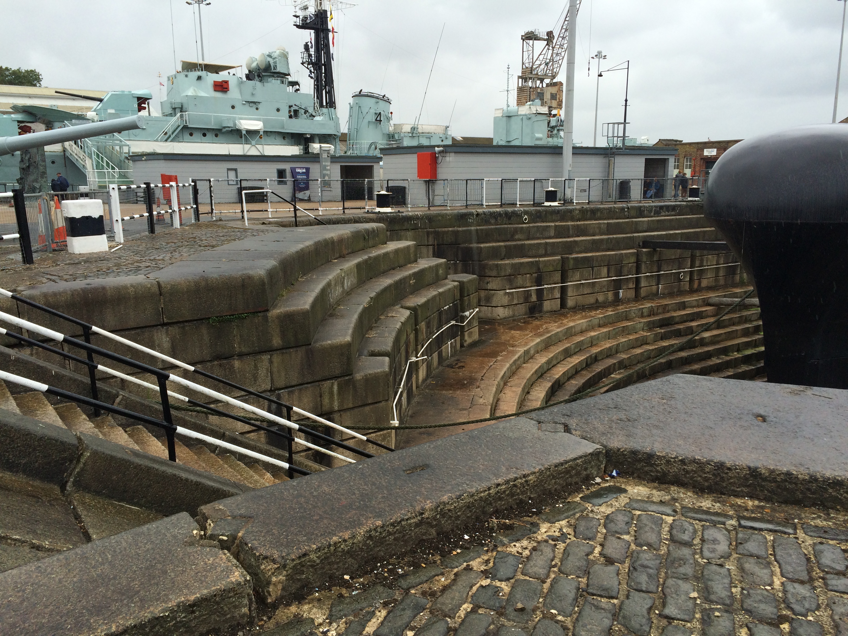
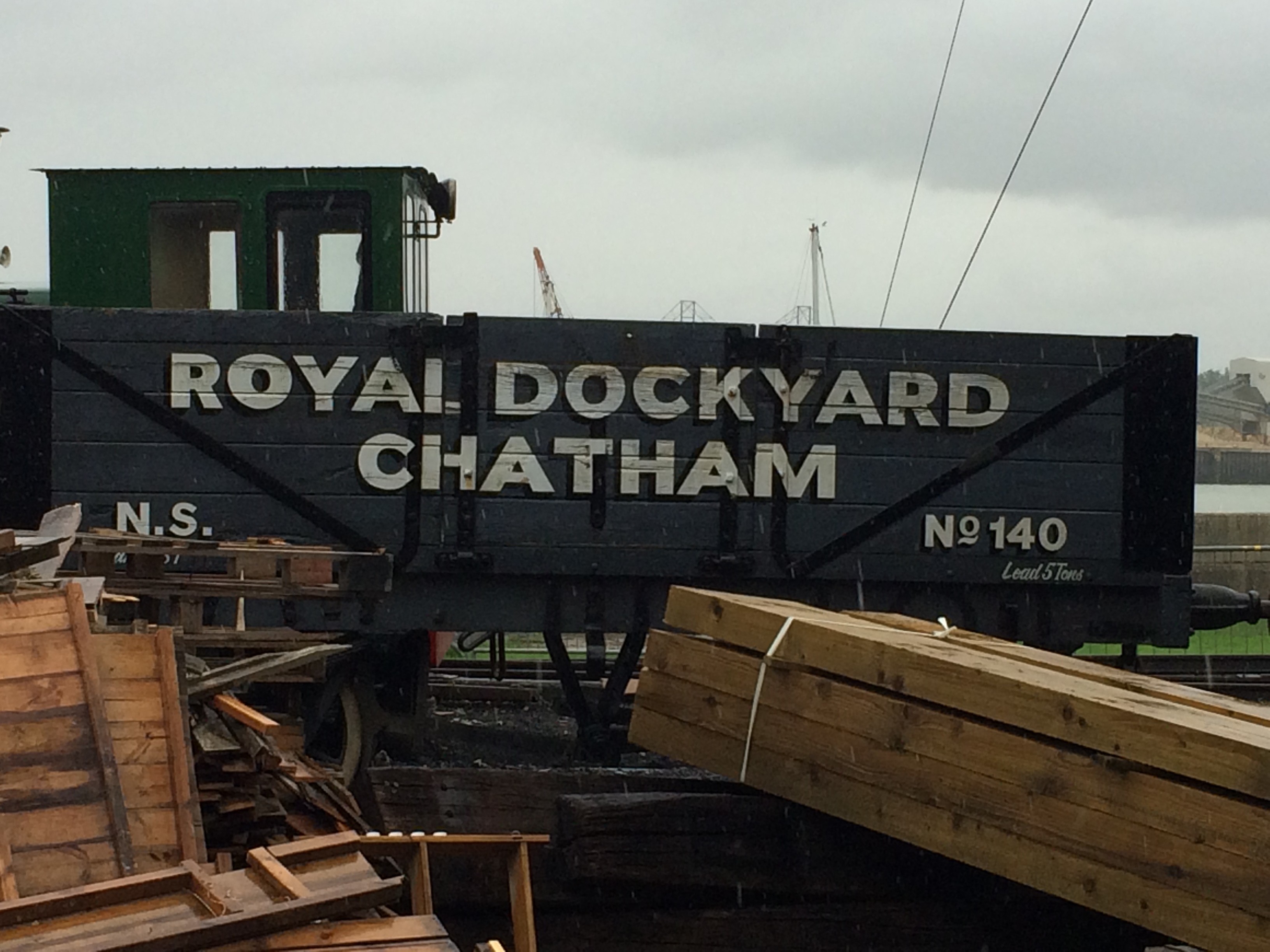
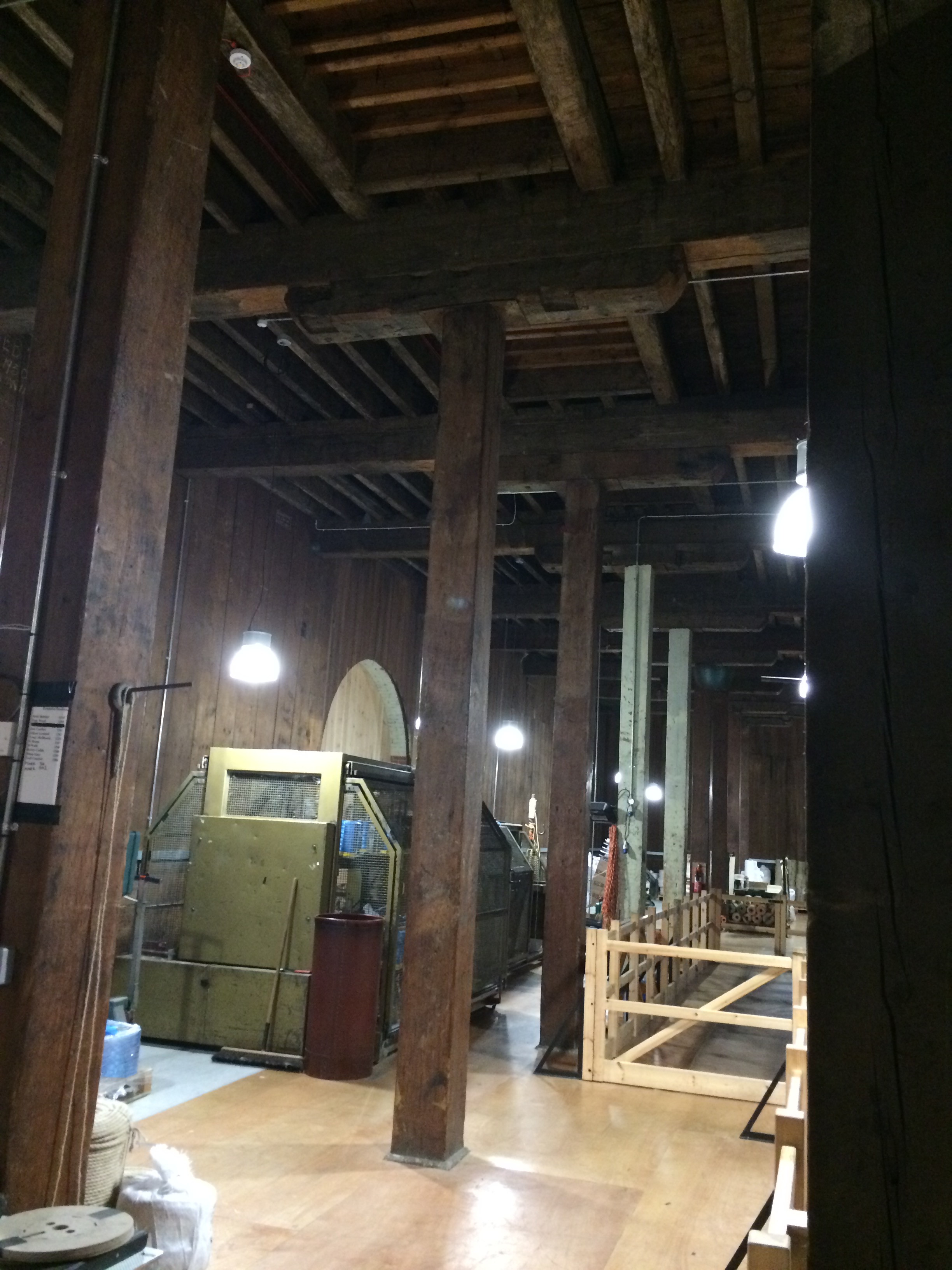
Historic Dockyards, Chatham – Georgian brickwork of the main gateway entrance. Image:Christopher TippingHistoric Dockyards, Chatham – The imposing and very long brick perimeter wall along Dock Road. Image:Christopher TippingHistoric Dockyards, Chatham – The imposing and very long brick perimeter wall along Dock Road. Image:Christopher TippingHistoric Dockyards, Chatham – the massive extant granite coping stones along the edge of Mast Dock. Image:Christopher TippingHistoric Dockyards, Chatham – The scale of the original Dockyard architecture is so impressive. Image:Christopher TippingHistoric Dockyards, Chatham – The geometry and pattern within the buildings are evident in structure and light. Image:Christopher TippingHistoric Dockyards, Chatham – The internal roof of the slipway buildings is really something to behold ! Image:Christopher TippingHistoric Dockyards, Chatham – The massive structural timbers of the No 2 Slipway building. Image:Christopher TippingHistoric Dockyards, Chatham – the roof apertures & timbers of the No 2 Slipway building create wonderful geometry and rhythms. Image:Christopher TippingHistoric Dockyards, Chatham – the roof apertures & timbers of the No 2 Slipway building create wonderful geometry and rhythms. Image:Christopher TippingHistoric Dockyards, Chatham – the early oak timbers were part of what were revered as ‘Chatham Timbers’ – Impressive forms with considerable interpretive merit. Image:Christopher TippingHistoric Dockyards, Chatham – the massive bespoke granite forms which make up the dry docks are particularly impressive. Image:Christopher Tipping
Historic Dockyards, Chatham – the massive bespoke granite forms which make up the dry docks are particularly impressive. Image:Christopher Tipping
Material use within the Historic Dockyards is often massive in form, frugal in detail and places enormous emphasis on function and being ‘fit for purpose’. This robust, economic and honest use of material and form is influential and informative and should be used as a template and contextual influence within the regeneration of the Town Centre of Chatham.
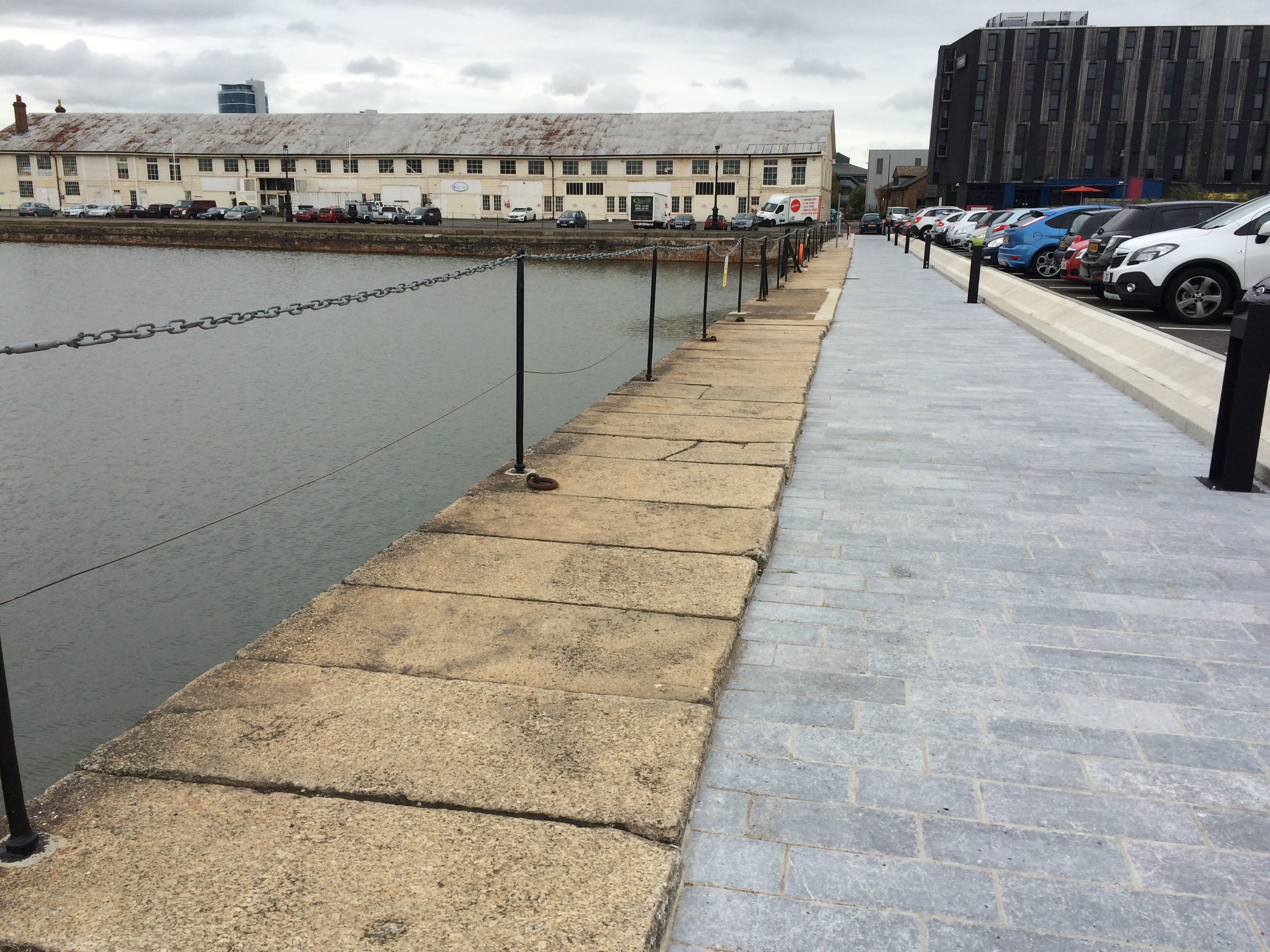
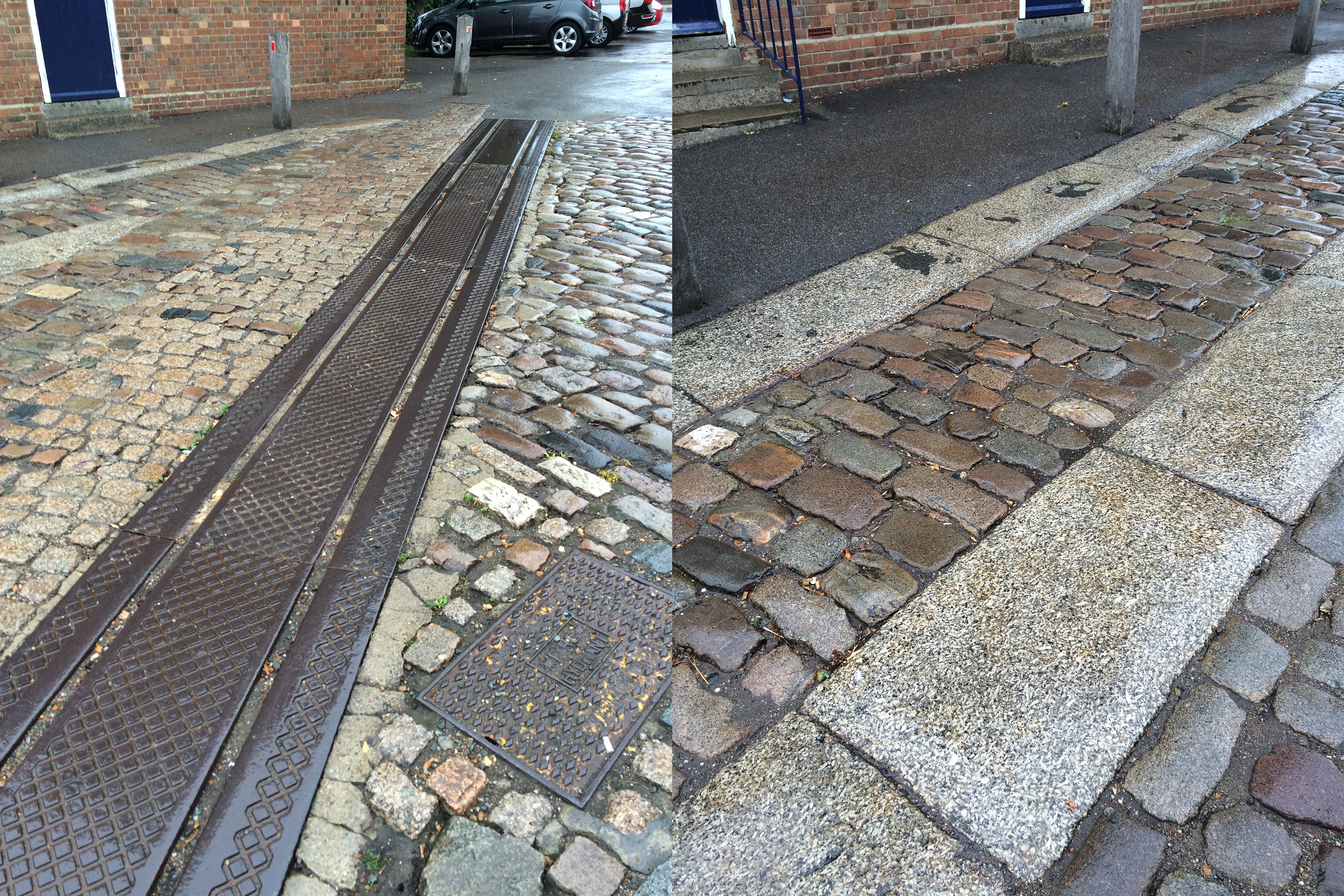
Historic Dockyards, Chatham – the bespoke granite paving forms and trackways which criss cross the site conjure up the legacy of movement and industrious activity of the dockyard. Image:Christopher Tipping
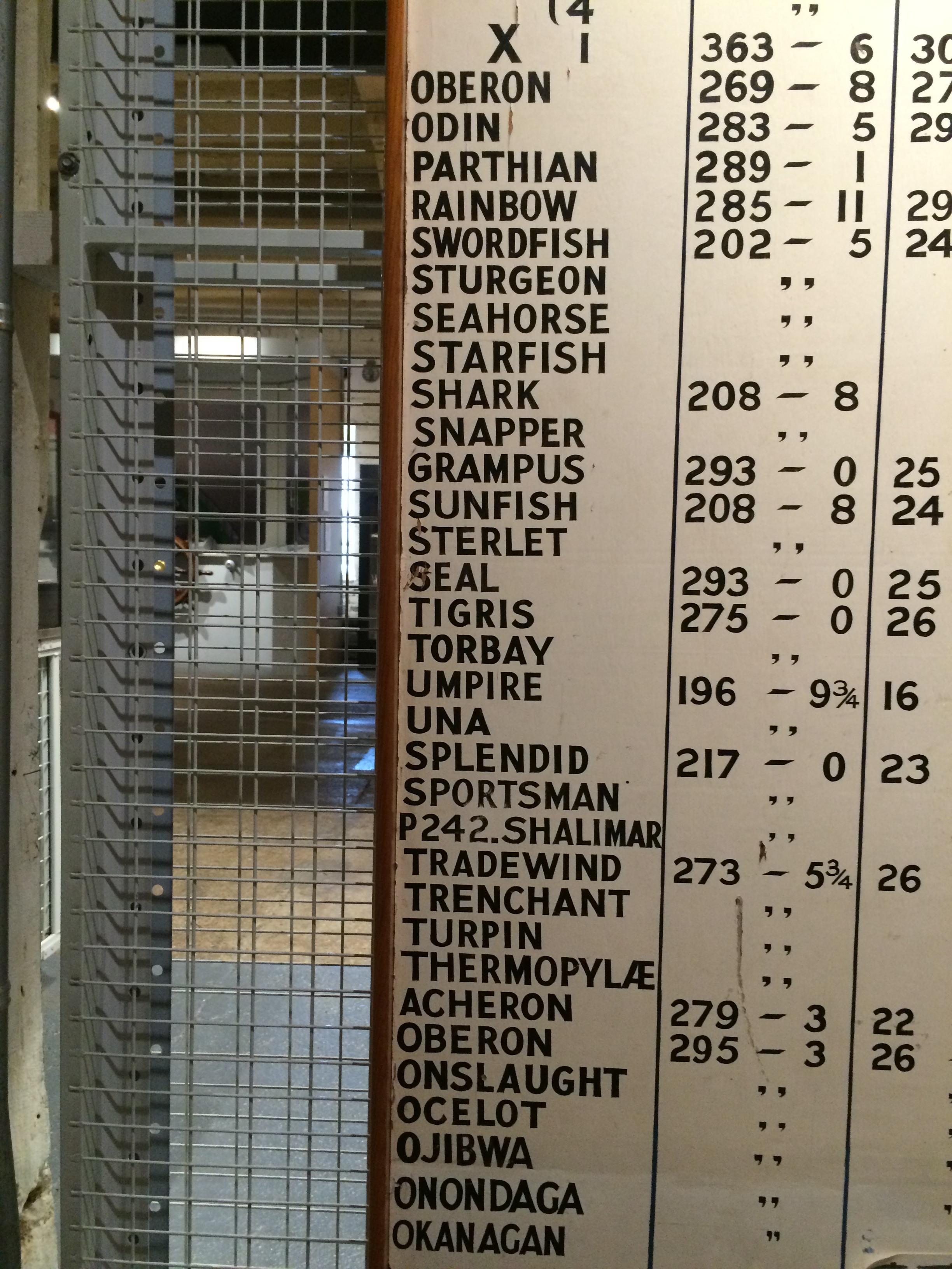
Historic Dockyards, Chatham – Dockyard Trains with great text – Image:Christopher TippingHistoric Dockyards, Chatham – List of submarines built in Chatham Docks. Image:Christopher TippingHistoric Dockyards, Chatham – the interiors of some of the buildings on site are immensely evocative and full of abstract forms. Image:Christopher TippingHistoric Dockyards, Chatham – the interiors of some of the buildings on site are immensely evocative and full of abstract forms. Image:Christopher TippingHistoric Dockyards, Chatham – the interiors of some of the buildings on site are immensely evocative and full of abstract forms. Image:Christopher TippingHistoric Dockyards, Chatham – the interiors of some of the buildings on site are immensely evocative and full of abstract forms. Image:Christopher Tipping
In early August this year I was commissioned by FrancisKnight Art Consultants and Medway Council to identify and scope creative public realm opportunities within the strategic Chatham Placemaking Project, which is being delivered by LDA Design.
“FrancisKnight have been appointed to work with LDA DESIGN and Medway Council on the Chatham Placemaking Project and in particular producing a creative public realm strategy to enhance the proposals and to add a sense of place and purpose to the spaces.
At the heart of the Thames Gateway, only 30 miles from central London, Medway is the largest conurbation between the capital and continental Europe. A modern place with green spaces and a superb quality of life, close to breathtaking countryside, the area has a young and culturally diverse population.
Chatham is located at the heart of Medway, with a population of 264,900 people living in the urban area in 2013. The area is world famous for its historic naval dockyard, and has also been a strategic centre for trade”.
This is a short term consultancy for me, which focuses particularly on the pedestrian route between Chatham Railway Station and The Waterfront, Chatham, via Railway Street and Military Road. This route leads on towards the Historic Dockyard Chatham – which is the subject of a World Heritage Bid –
I had up till this point never been to Chatham! I know of Chatham via Dickens and Pepys – as well as having looked at the Historic Dockyards online ! I have passed through the Medway Townsmany times on the train between Ramsgate and London, which does not really help frame a complete & honest image of the town.
This is a small sample of the visual record I made of my first visit in response to the project brief –
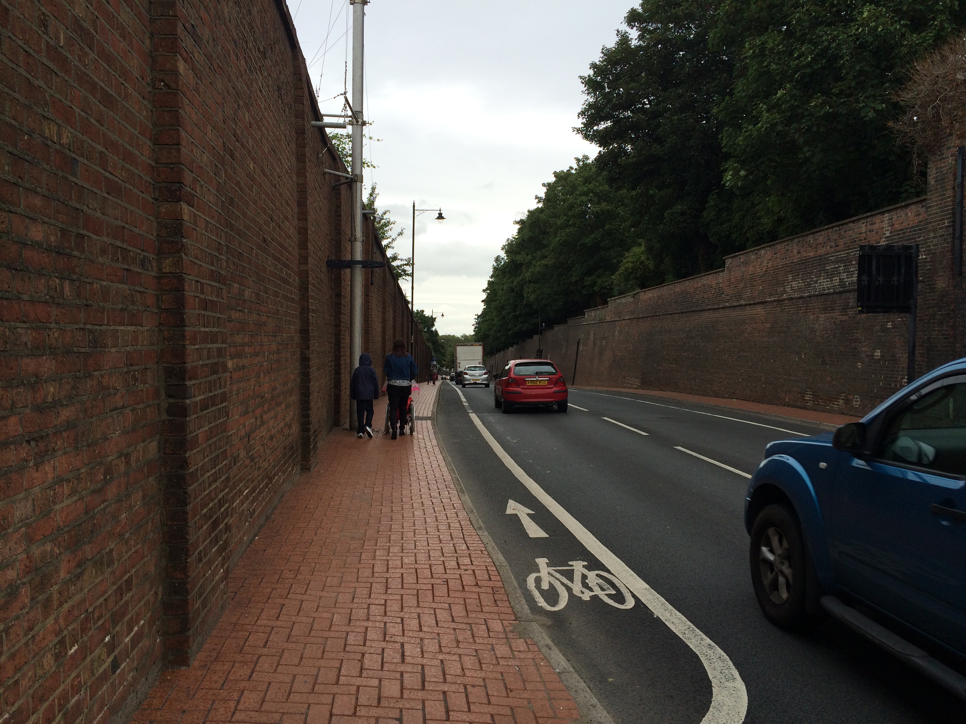
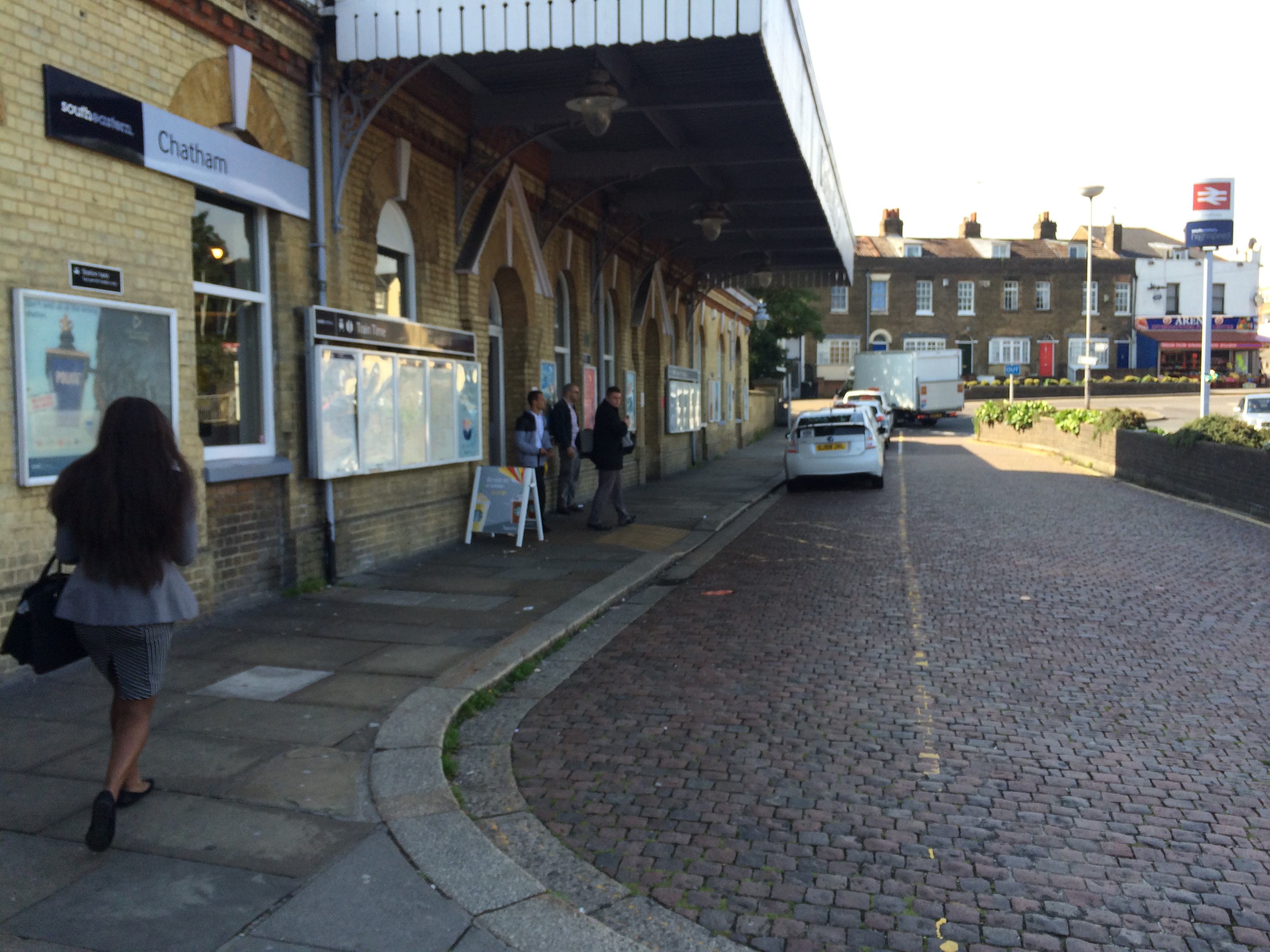
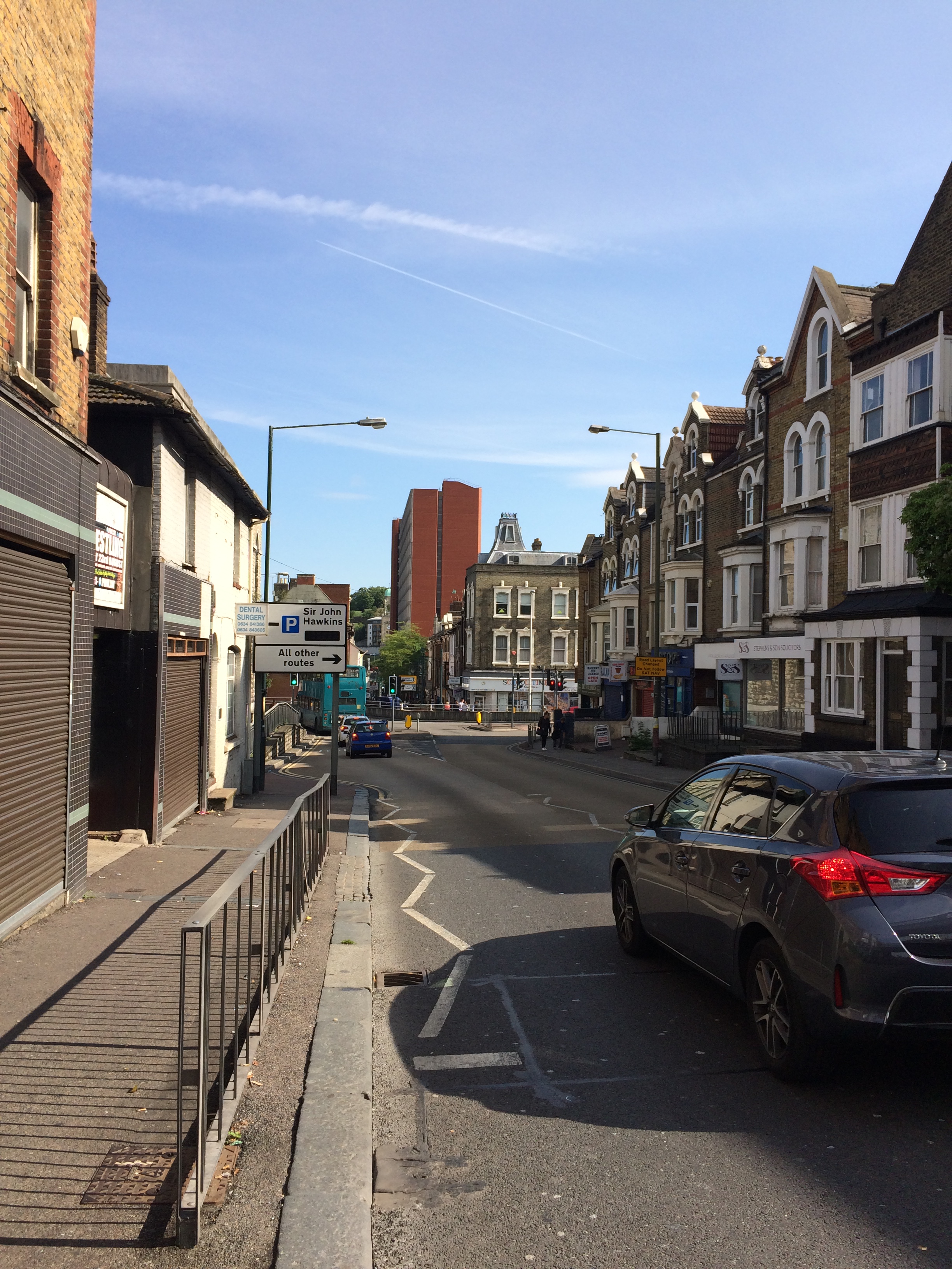
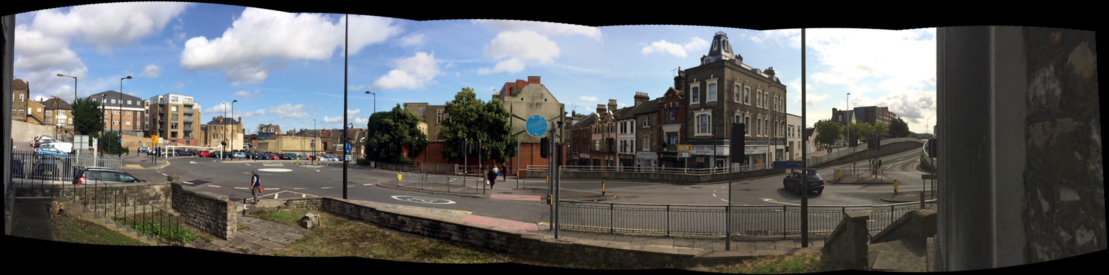
As you leave the Station and turn left, this leads you, via Railway Street towards the Town Centre and The Waterfront – however this route is a difficult one to navigate – if you know the town, then various landmarks map this out for you, but for a visitor, the experience is confusing and not for the faint hearted. The first 100m of this route, the car is certainly King – much to the detriment (& risk) of the pedestrian!
Railway Street, Chatham, Kent. The same view – Image:Christopher TippingRailway Street, Chatham, Kent. Image:Christopher Tipping
This view looks down Railway Street towards the Town Centre with the red brick edifice of Mountbatten House dominating the centre view.
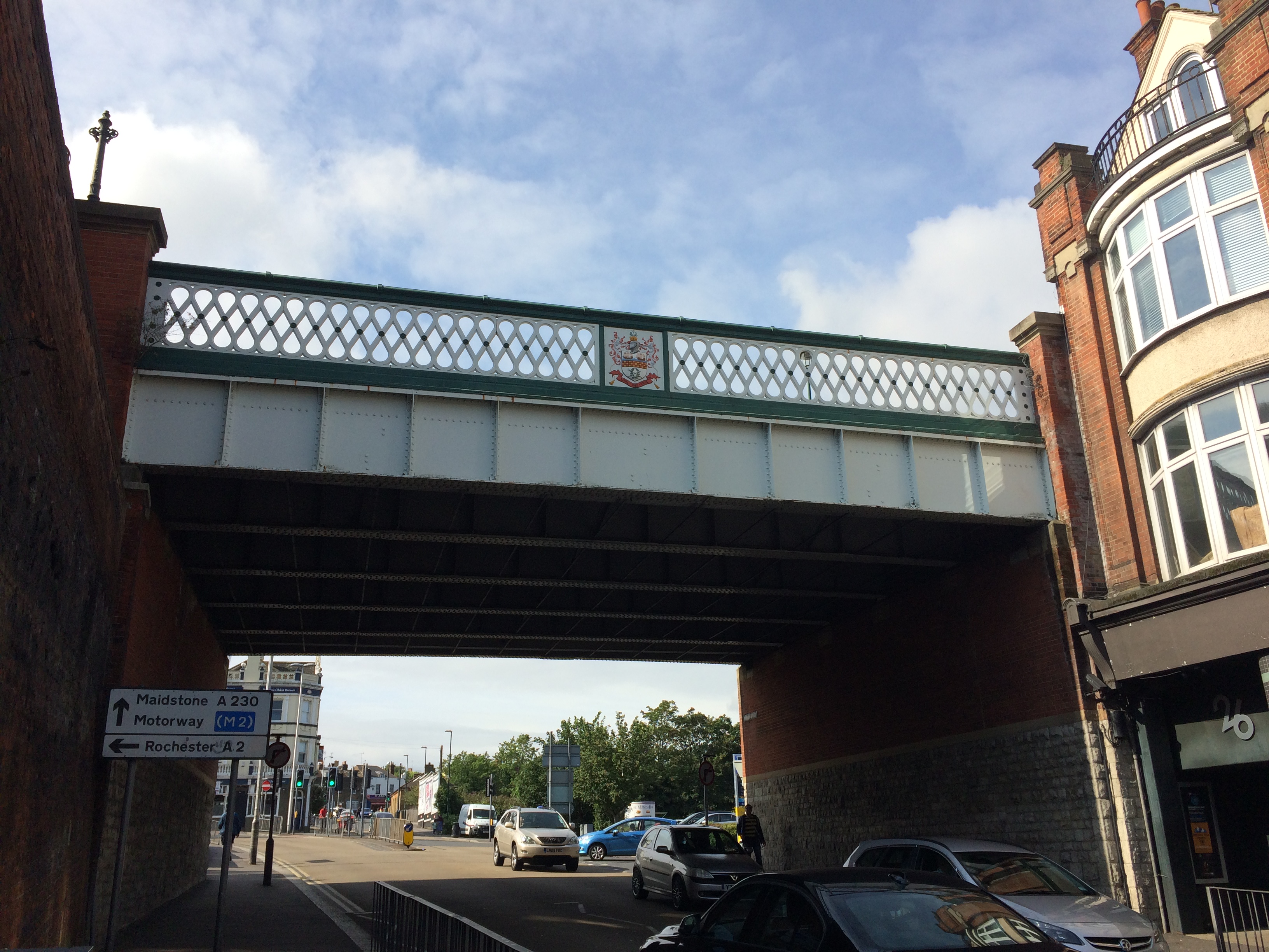
Railway Street, Chatham, Kent. Looking up towards the Train Station through the Viaduct, which replaced the original Old Viaduct of 1794, which was referred to as a ‘defensive’ gateway. Image:Christopher TippingSt John the Divine Church, Railway Street. Built in 1820/21 & closed in 1998. Image:Christopher Tipping
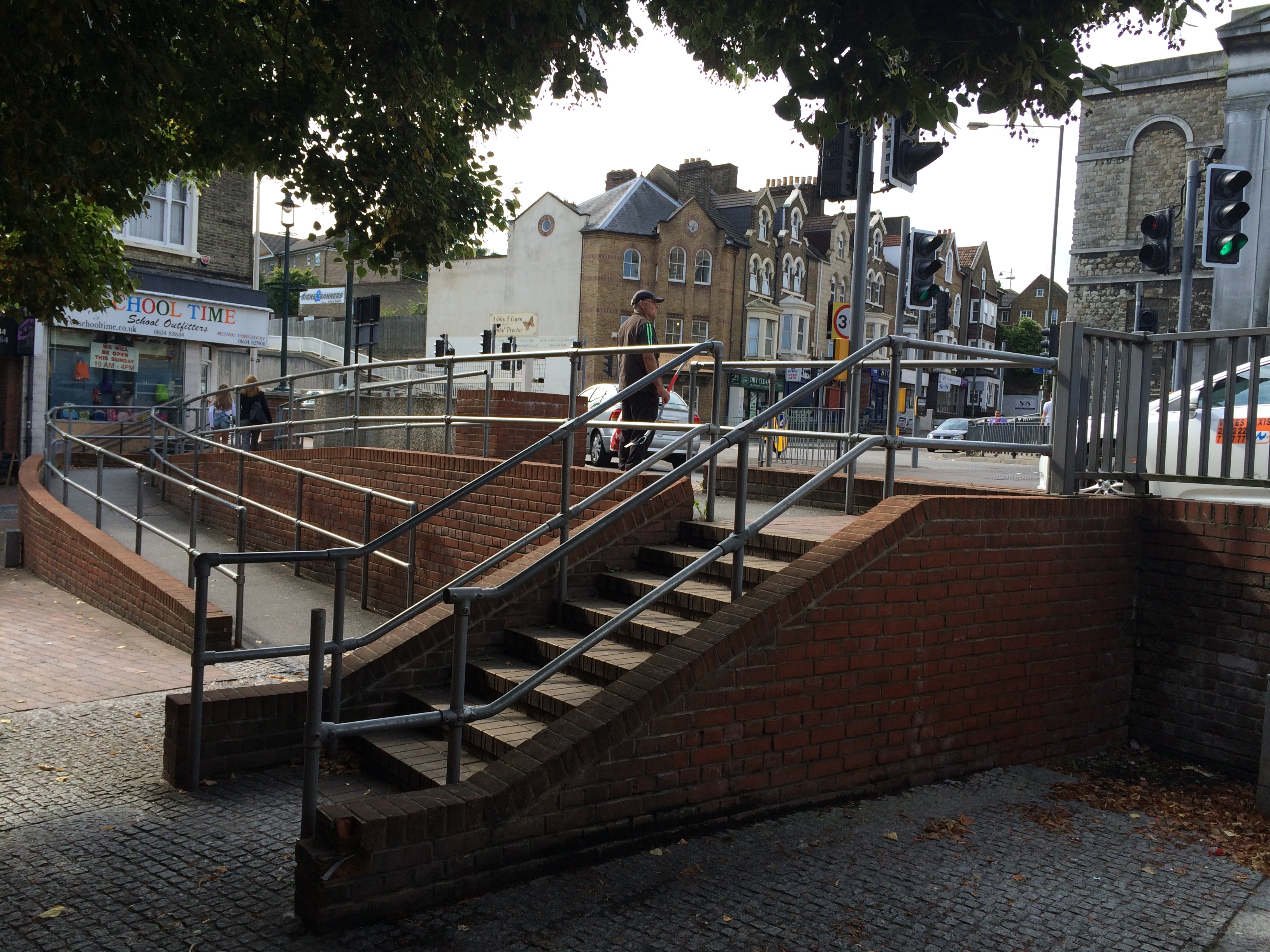
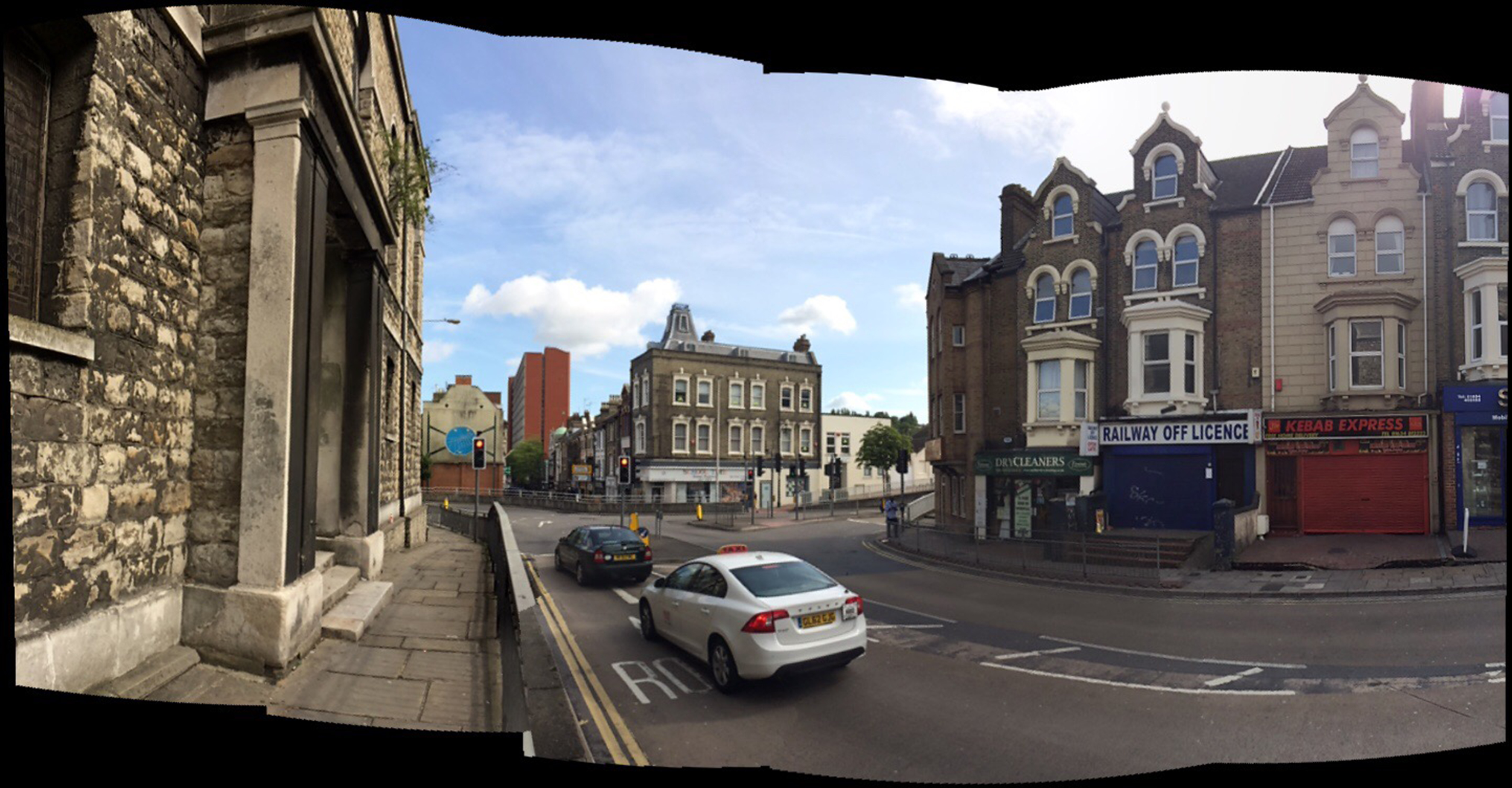
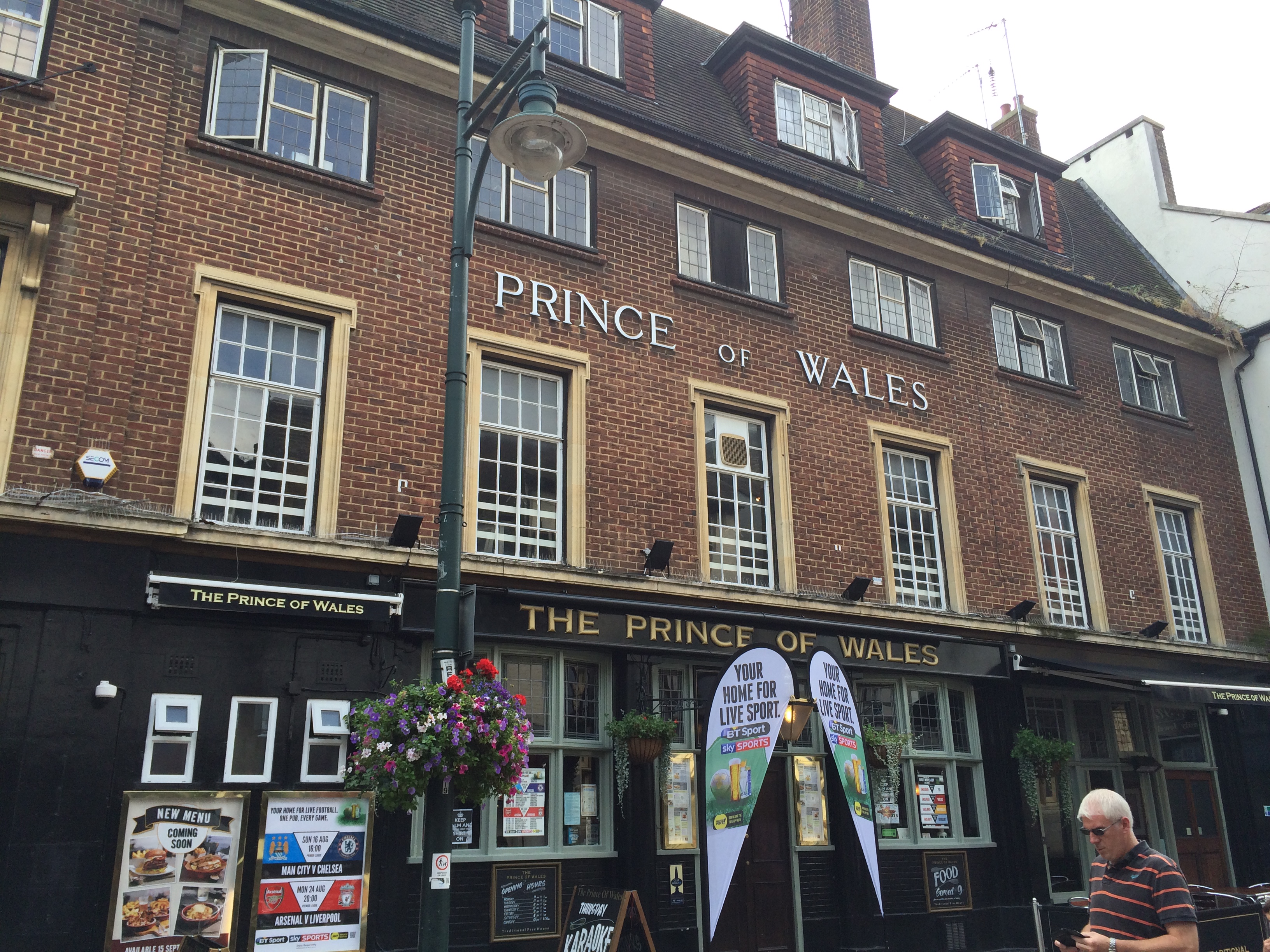
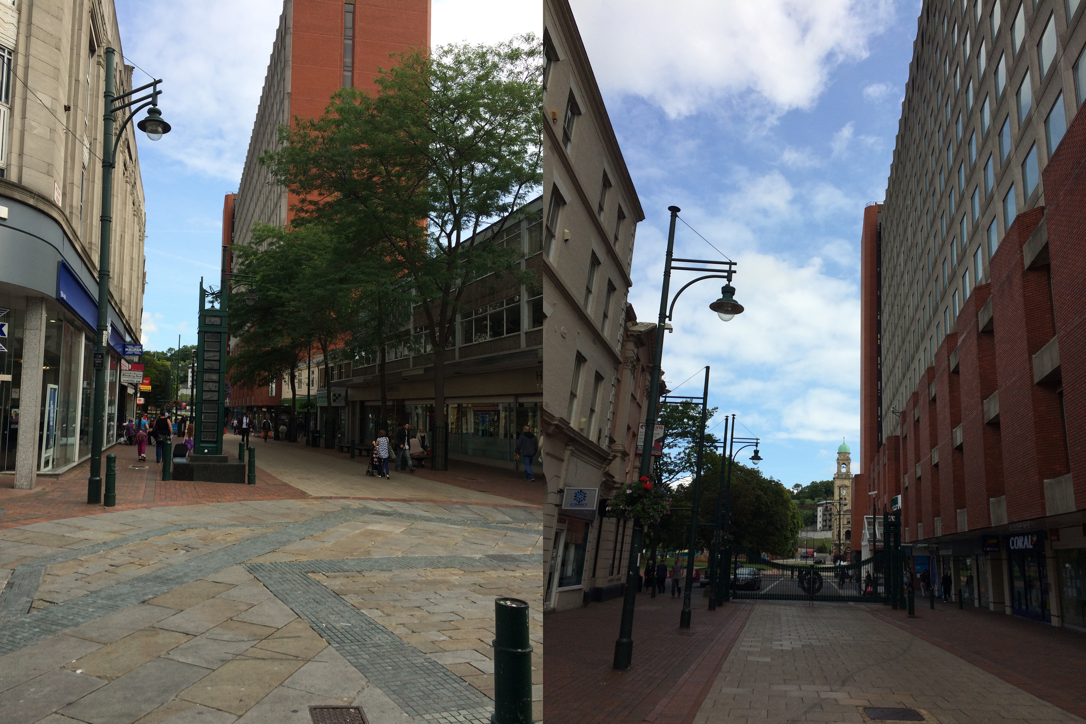
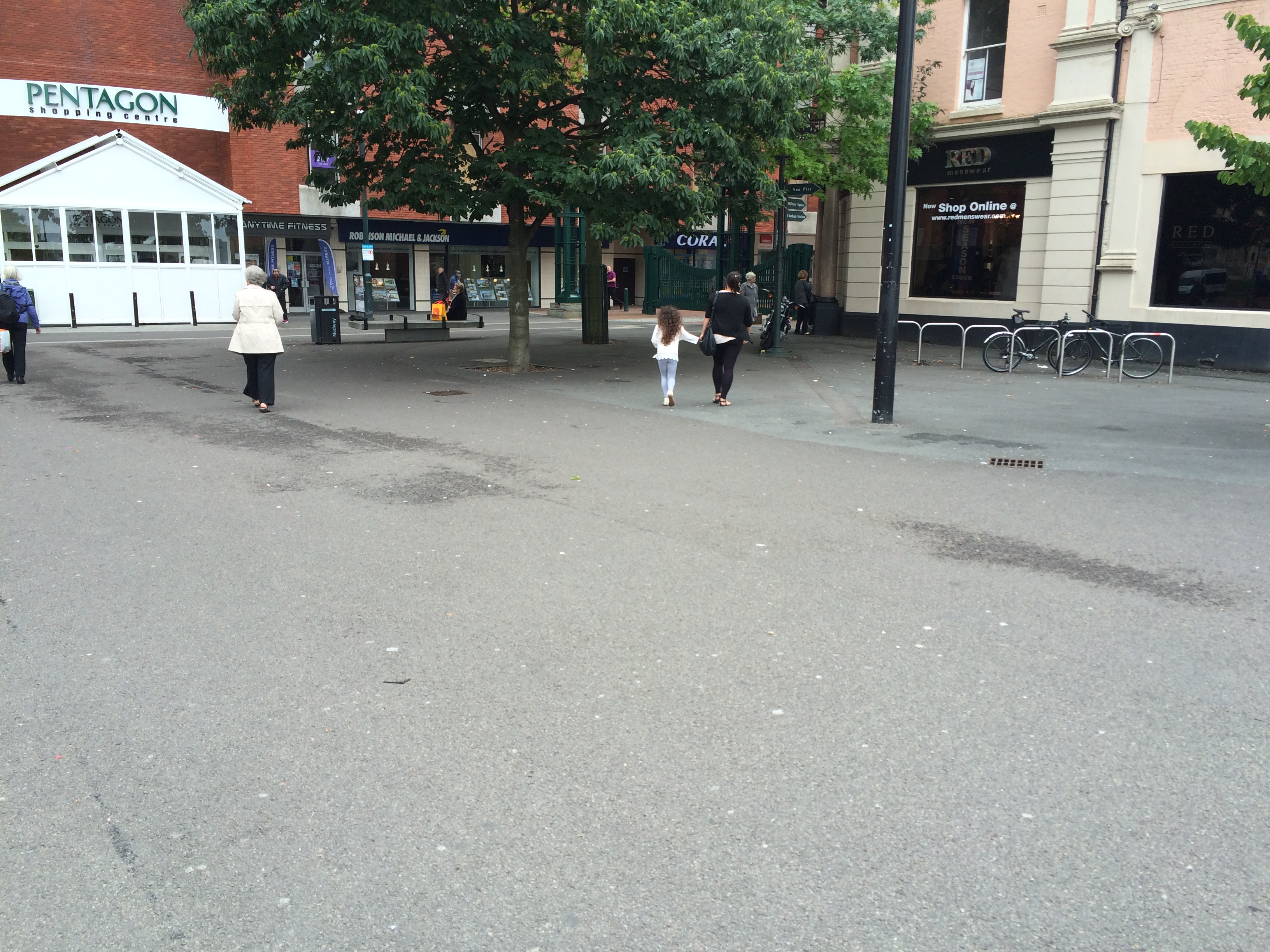
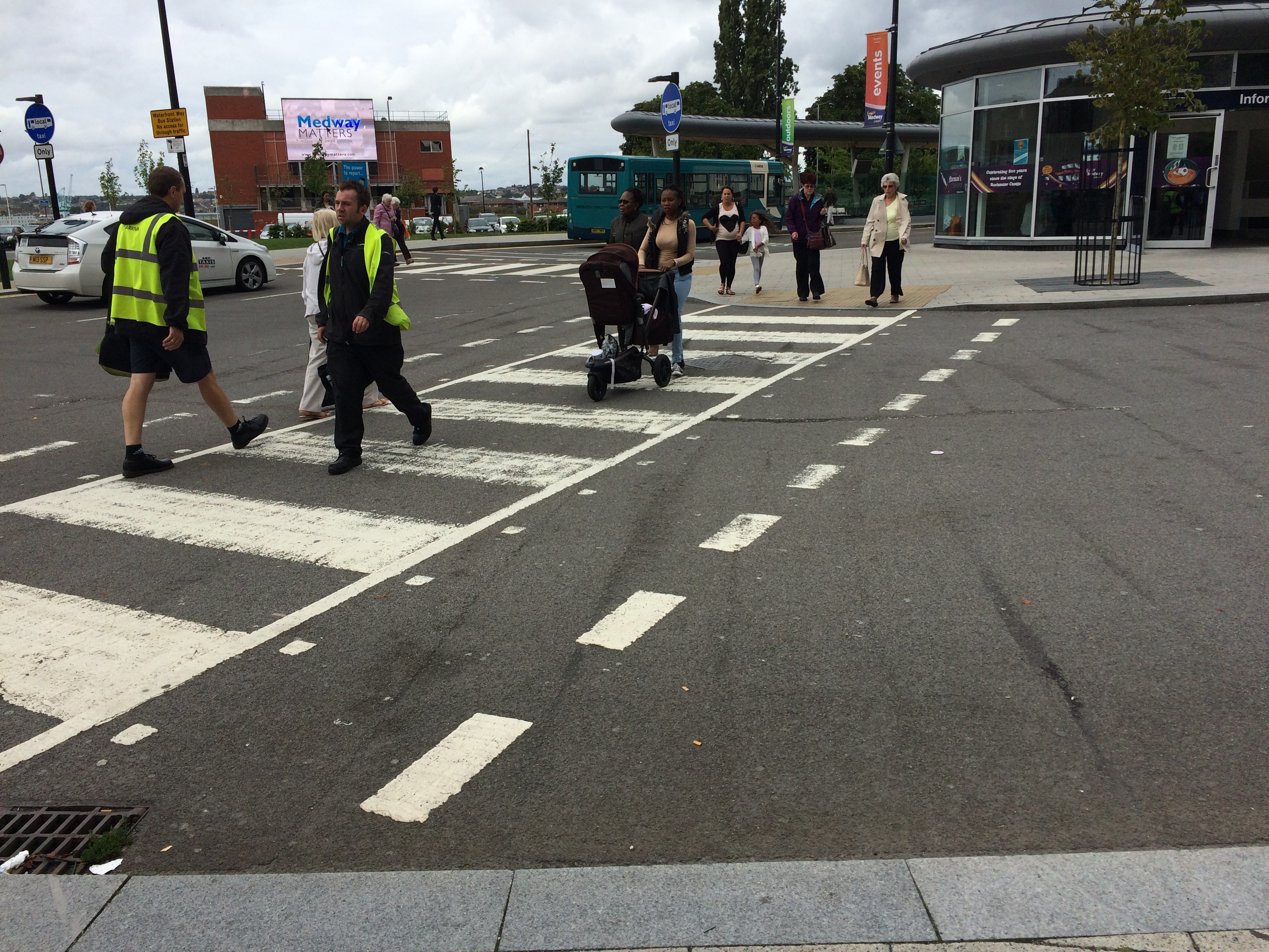
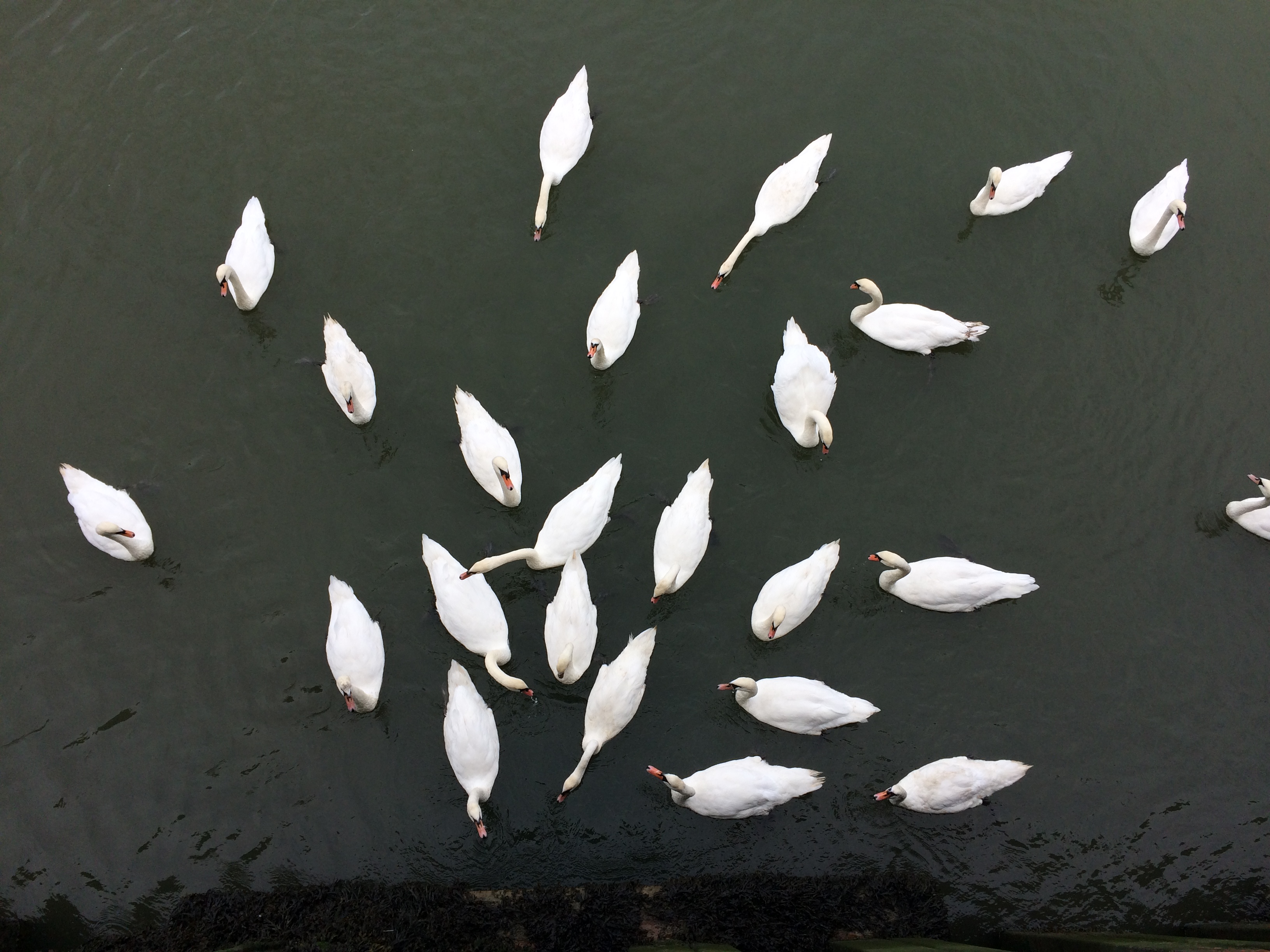
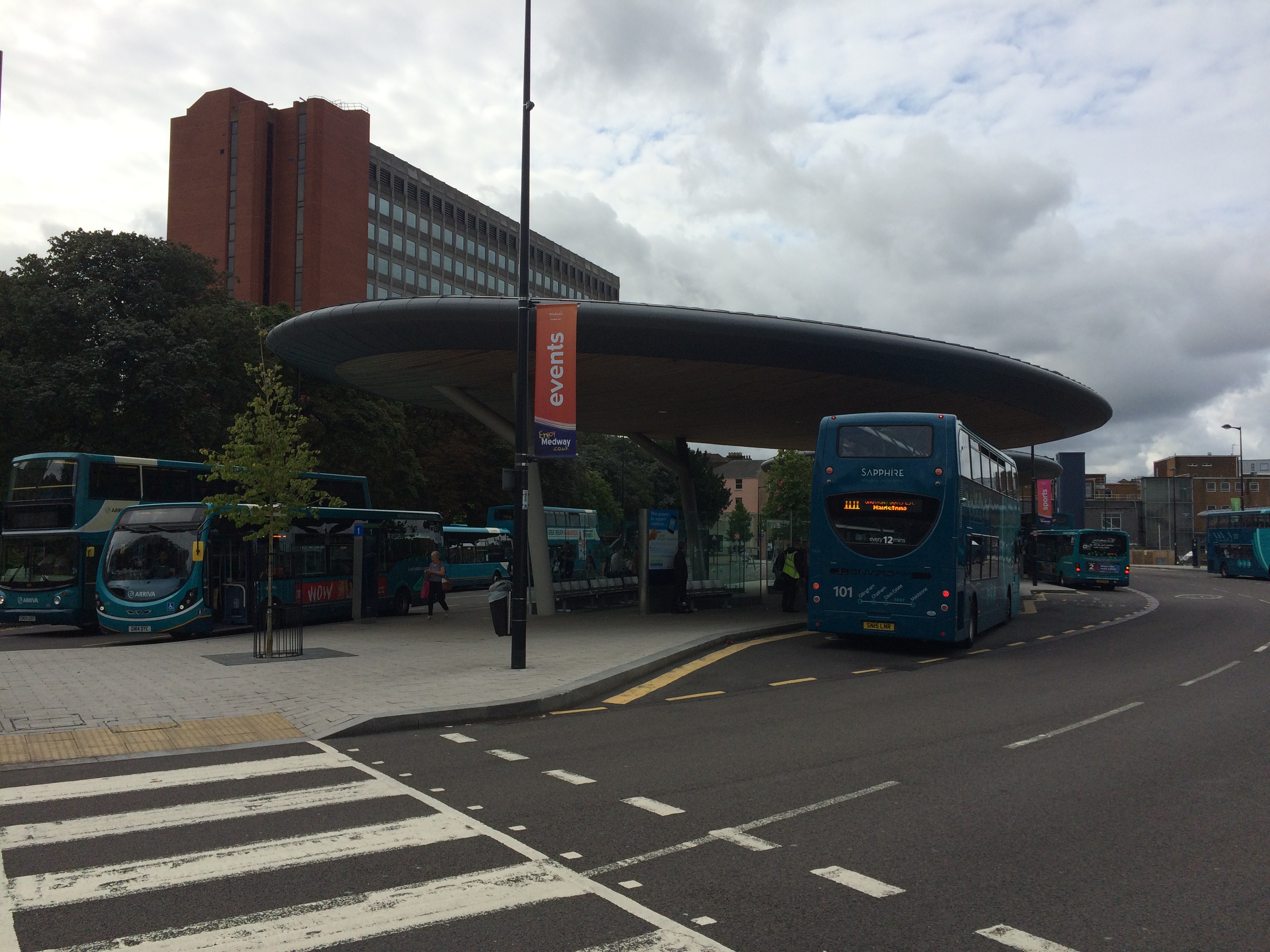
Railway Steet was split into two sections with Waterfront Way connecting to the A2. This created issues with pedestrian flow and connectivity. Image:Christopher TippingRailway Street, Chatham, looking towards the Town Centre from St John’s Church. Image:Christopher TippingRailway Street, Chatham, looking towards the Town Centre from St John’s Church. Image:Christopher TippingA variety of great buildings still extant on Railway Street. Image:Christopher TippingThe ‘Prince of Wales’ Public House on the lower part of Railway Street, Chatham. Image:Christopher TippingTwo views along Military Road, Chatham, which is dominated by the red brick office block on the right hand side – Mountbatten House and the Pentagon Shopping Centre. At the far end of the long view is the beautiful Brook Theatre, the former Town Hall. Image:Christopher TippingA wide view at the lower end of Military Road looking towards the Brook Theatre and the New Bus Station. Image:Christopher TippingA wide view at the lower end of Military Road looking towards the new Bus Station and Waterfront. Image:Christopher TippingWalking from the Bus Station towards The Pentagon Shopping Centre and Military Road, Chatham. Image:Christopher TippingThe main pedestrian crossing point towards the Bus Station & Pumping Station. Image:Christopher TippingChatham Waterfront Pumping Station and Big Screen, Chatham. Image:Christopher TippingThe Pumping Station appears to divide two distinct landscapes along the river frontage. Top – looking left of the Pumping Station. Bottom – looking right of the Pumping Station. Image:Christopher TppingThe local population on the river below the Pumping Station. Image:Christopher TippingThe local population sit on railings along the waterfront, Chatham. Image:Christopher TippingThe new Bus Station looking towards Mountbatten House. Image:Christopher TippingThe Paddock, which is green space between the Bus Station, Mountbatten House and the Pentagon Shopping Centre. Image:Christopher TippingBrook Theatre, Chatham, the former Chatham Town Hall. Image:Christopher Tipping


