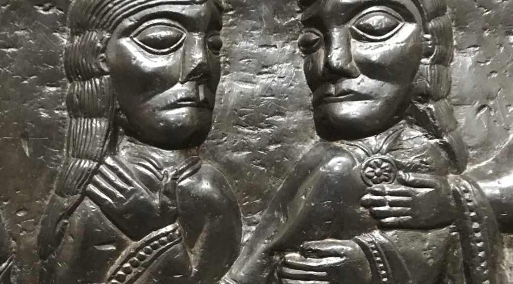
The image above is a detail of the beautifully carved ebony black polished stone 12th Century font, with its depiction of the miracles of St Nicholas. It is without doubt one of the Cathedral’s greatest treasures. It was brought from Tournai, in modern day Belgium. It has been in use ever since. It is astonishingly fresh and wonderful.
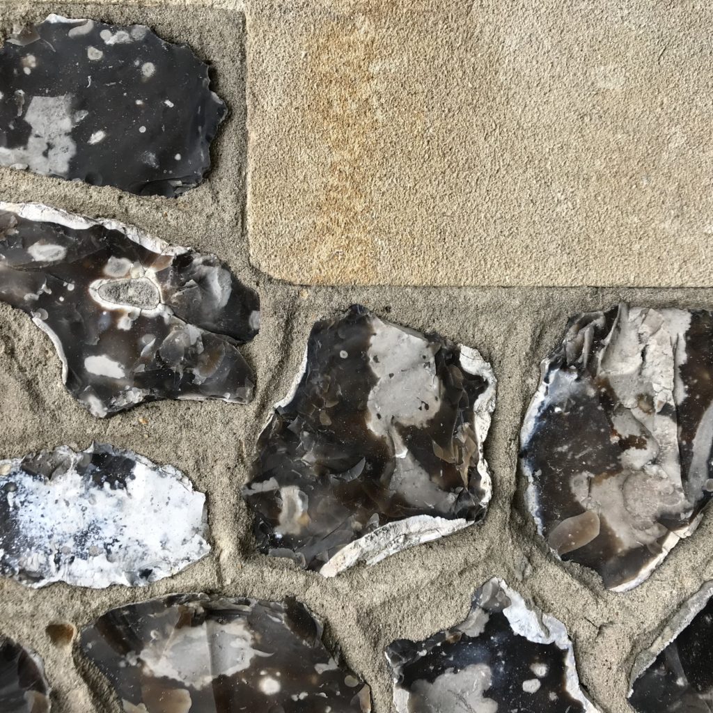
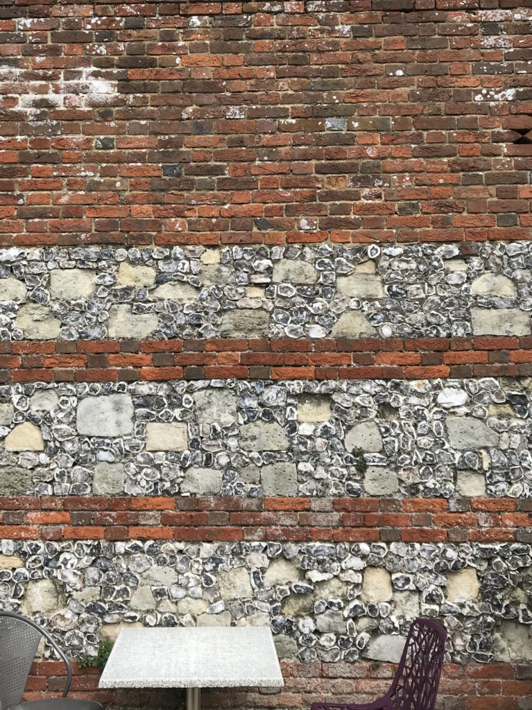
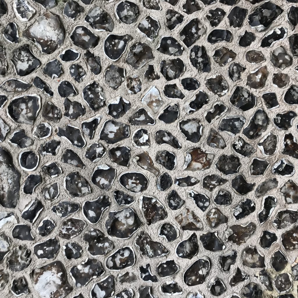
The building materials of Winchester. Image: Christopher Tipping
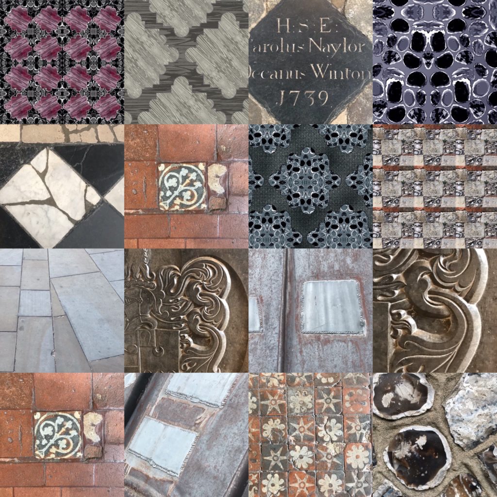
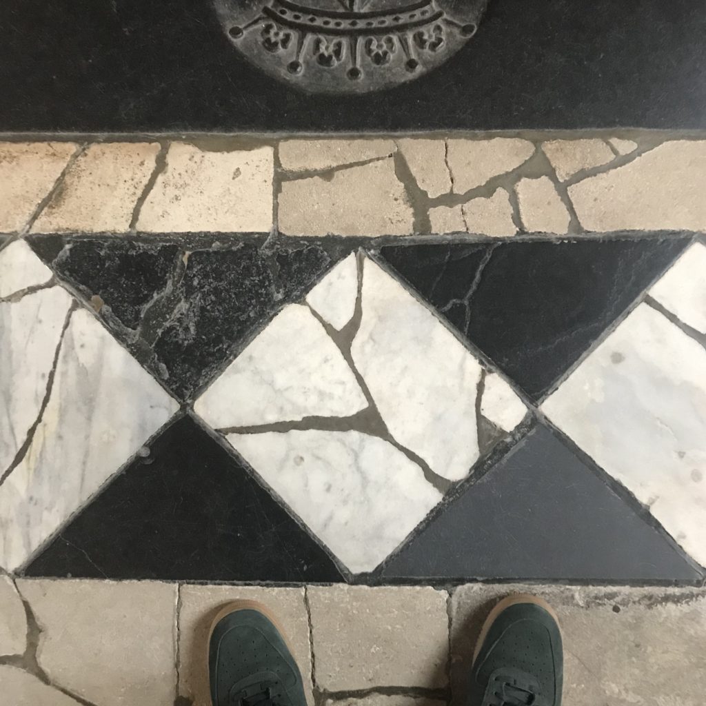
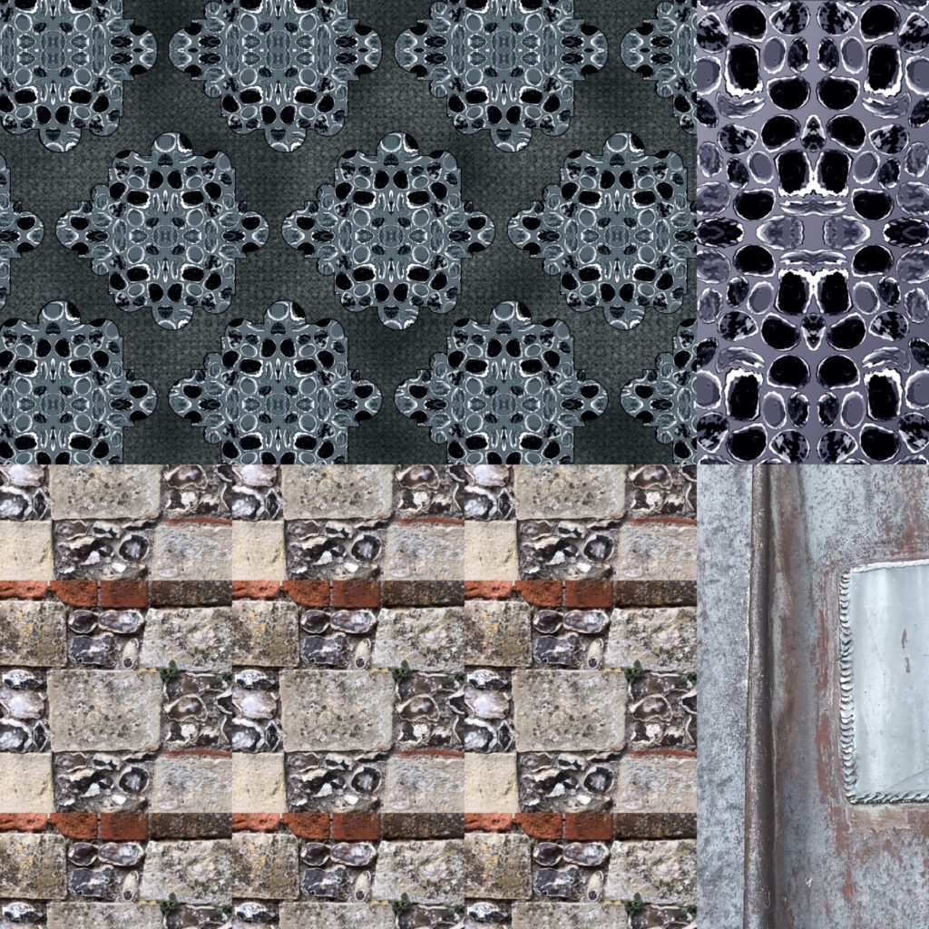
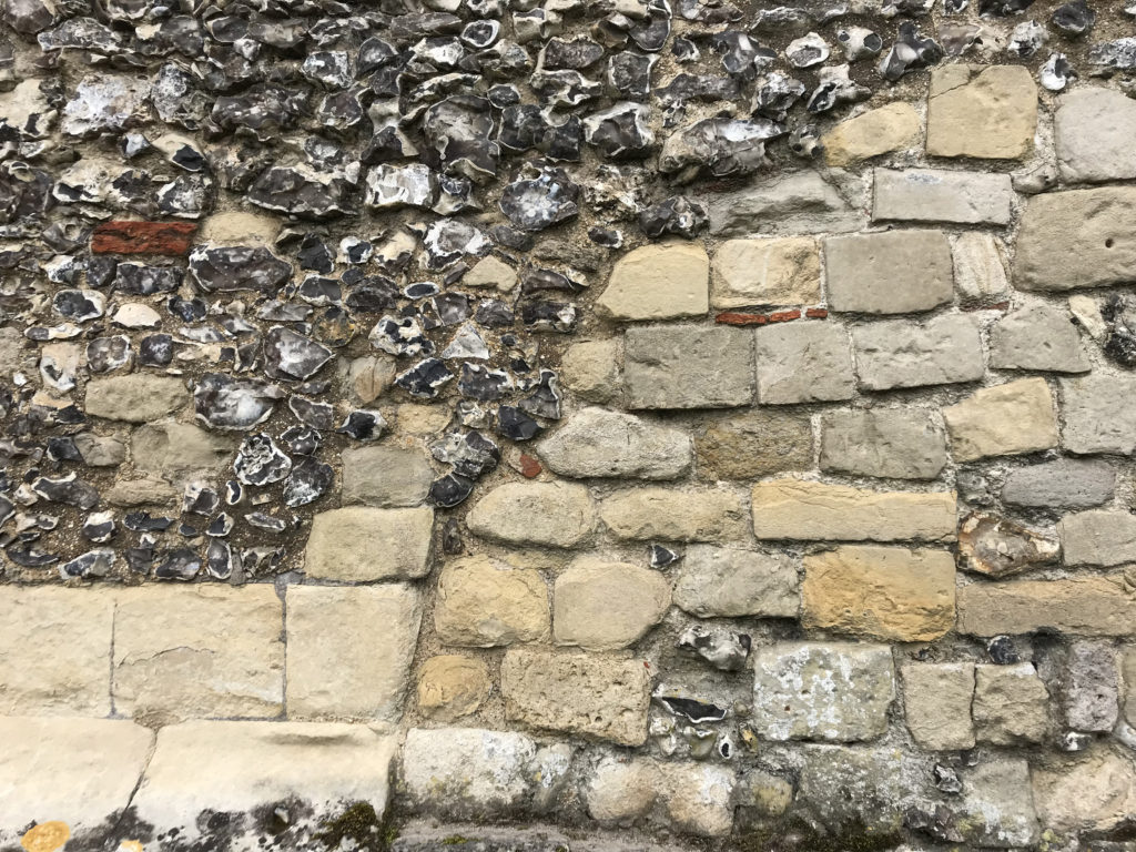
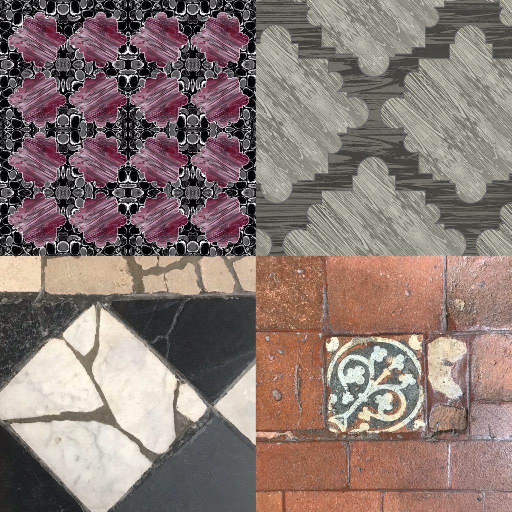
It isn’t too hard to find odd and quirky combinations of both mundane & exotic materials and examples of spectacular & naive decorative arts and crafts side by side in Winchester, especially in the Cathedral. Almost one thousand years of continual occupation of this religious site bears witness to an unbroken architectural legacy, one that is brimful of odd juxtapositions, exotic materials, renewed or replaced fabric, scratched graffiti, vandalism and destruction. Like walking through a time-warp. Robust Norman Romanesque Architecture to Perpendicular Gothic in one step. Swedish Marble to Purbeck Stone in another. Extant 13th Century inlaid ceramic floor tiles to 1960’s replicas. Striking thresholds crossed mixing time and material, yet the experience is not jarring or disjointed. Time itself has softened these transitions and blurred the edges.
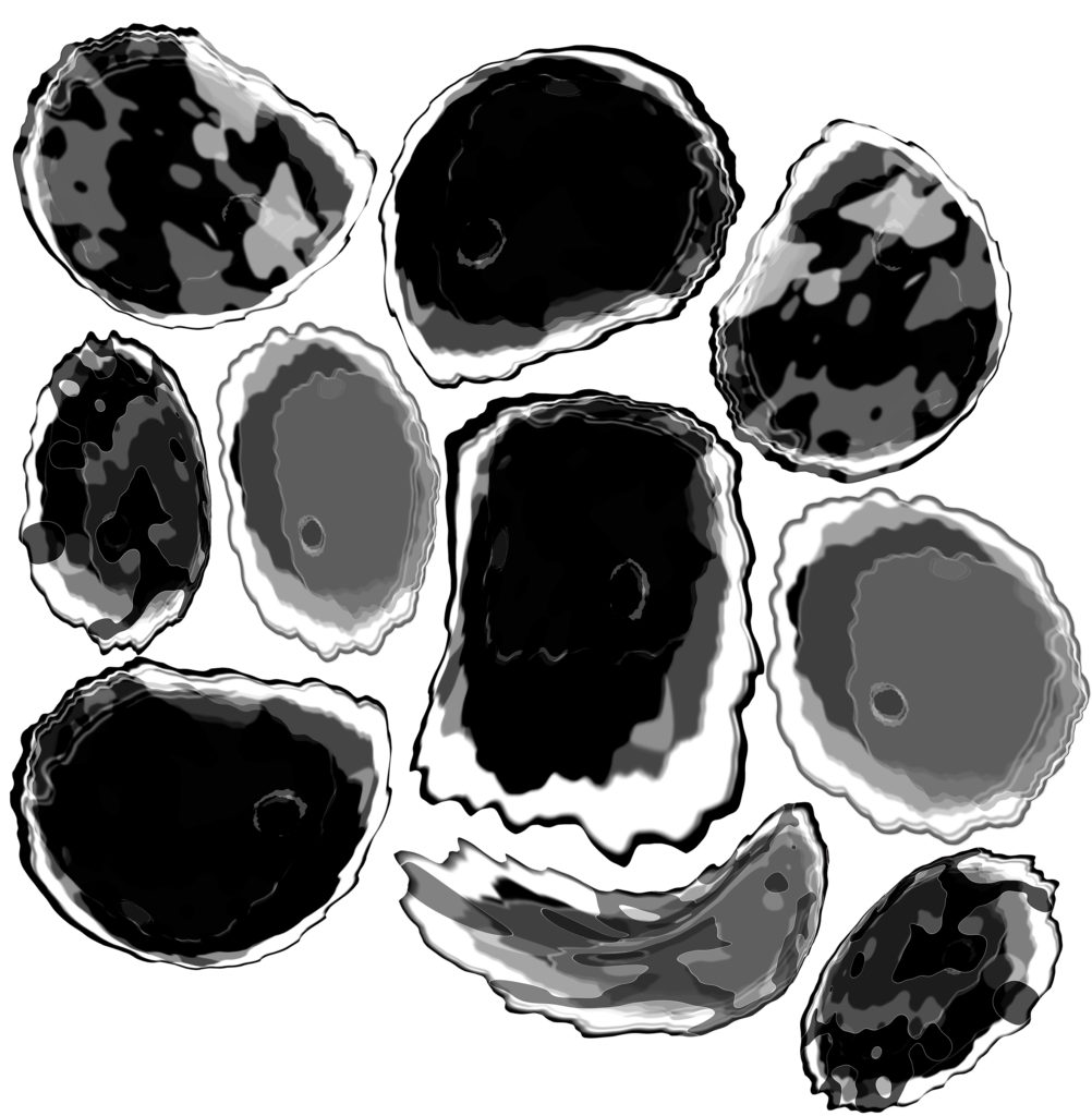
I am continually cherry picking from the world around me, plucking at things, tucking things away for later – like a squirrel, gathering nuts for winter or in the manner of a herbivore, continually grazing, & chewing the cud. I am gathering visual information – an extraordinary cabinet of curiosity in my mind. Certain things catch my attention, whilst others pass me by. This eclectic meander is not a considered or deliberate creative manoeuvre. It is innate. It is my pattern of speech, it is my handwriting. It simply is.
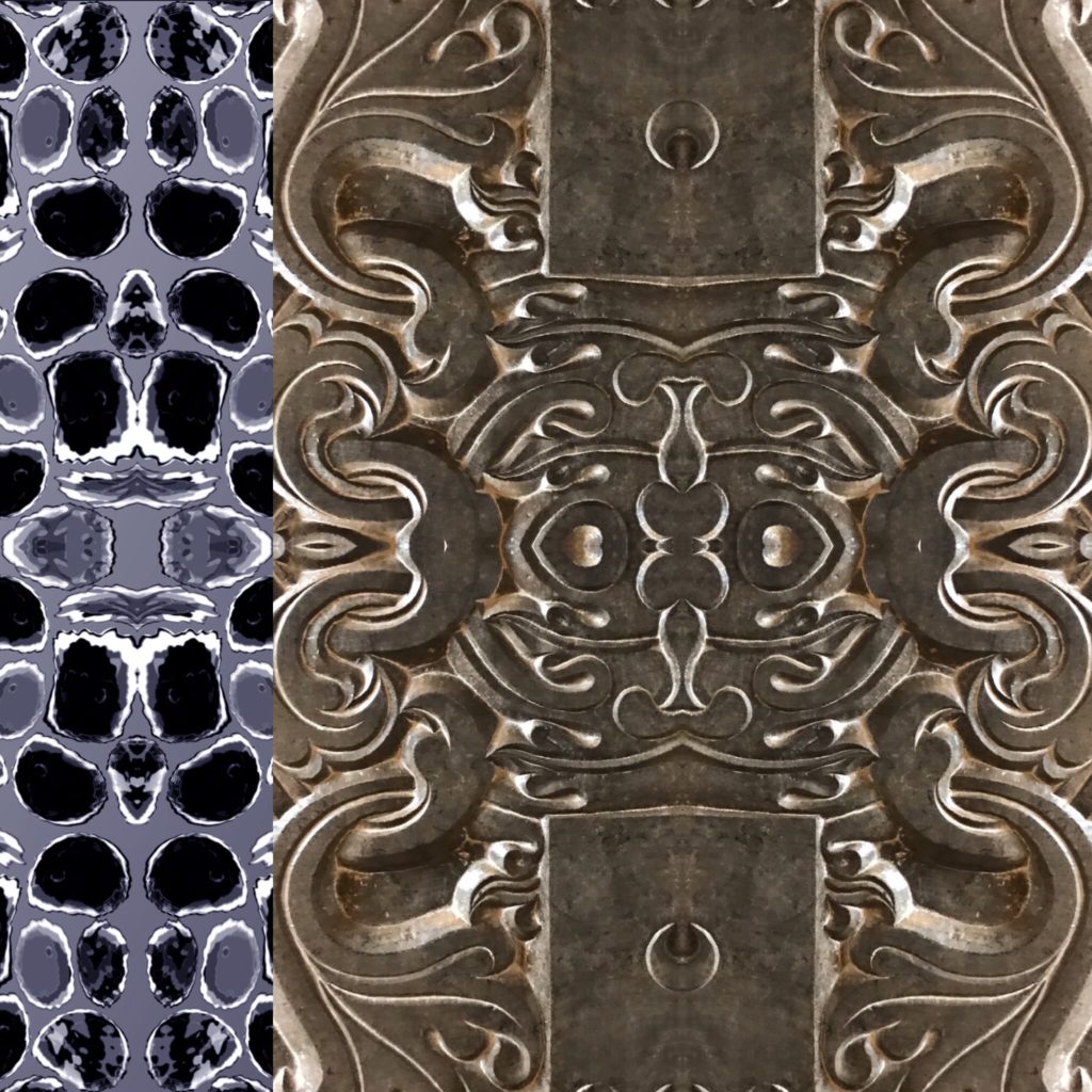
A mash-up of the decorative building materials of Winchester & my own patterns. Image: Christopher Tipping
SANDSTONE – FLINT – LIMESTONE – EBONY BLACK TOURNAI MARBLE – HAND MADE BRICK – OAK TIMBERS – INLAID CERAMIC TILES – MONOLITHIC GRANITE – CAST IRON – GUN METAL – CARVED OAK – STAINED GLASS – WINDOW TRACERY – LEAD
The building materials & memorials of Winchester Cathedral. Image: Christopher TippingAn abstract mash-up of the decorative building materials & styles of Winchester mixed with my own ‘Winchester inspired’ patterns. Image: Christopher TippingThe building materials & memorials of Winchester Cathedral. Image: Christopher TippingThe building materials of Winchester. Image: Christopher TippingThe building materials of Winchester. Image: Christopher TippingAbstract drawings based on knapped flints, one of the building materials of Winchester. Image: Christopher TippingAbstract drawings based on knapped flints, one of the building materials of Winchester. Image: Christopher TippingA mash-up of the decorative building materials of Winchester & my own patterns. Image: Christopher TippingThe building materials of Winchester. Image: Christopher TippingThe building materials of Winchester. Image: Christopher TippingAn abstract mash-up of the decorative building materials & styles of Winchester mixed with my own ‘Winchester inspired’ patterns. Image: Christopher TippingA mash-up of the decorative building materials of Winchester & my own patterns. Image: Christopher Tipping
The dominant theme in this project is transport & transport links. Fluid and effective connectivity for cars, trains, buses and pedestrians alike. My role is specifically to try to ‘influence’ the design process being delivered by the teams involved in the Bus Station & Link Bridge. Creative Influence can be brought via research into the heritage and legacy of the town. Contextual research can also look at the practicalities of what a Bus Station or a shared pedestrian and cyclist Footbridge require to function. I can also investigate the aspiration and hope for the future which both of these elements of the town’s infrastructure could bring. All these threads of influence can combine to create a visual and conceptual aesthetic to use as a tool to aid the design and engineering process.
Social history in Merthyr Tydfil has shaped and re-shaped this landscape over a few hundred years perhaps more than natural history did since the last Ice Age. If you look at old OS Maps of Merthyr Tydfil from around 1840 to 1960, patterns of use and development begin to emerge. Transport leads the way, starting with the management of water: rivers, streams, ponds, canals, reservoirs, culverts & aqueducts. Railways, roads, embankments, cuttings, tunnels & spoil heaps all enable the efficient delivery & transportation of goods and materials, whilst also removing & storing waste products. All this happened in a fairly small locality, geographically speaking. This had a fundamental impact on the landscape. Maps show this impact in patterns and textures to evoke a man-made industrial environment. Even the The architecture of industry – buildings, factories, furnaces is also rich in patterns and repeating systems.
I am very grateful for the permission of Merthyr Tydfil CBC Librariesto allow me to photograph the maps in their collection. As these maps are also over 50 years old, the Ordnance Surveyrequest only that the following information is added to each image: ‘Reproduced from the (add date) Ordnance Survey map’.
These are my annotations upon an OS Map of Merthyr Tydfil of 1876. Reproduced from the 1876 Ordnance Survey Map. Collection of Merthyr Tydfil CBC Libraries.
The annotated detail of the 1876 OS Map of Merthyr Tydfil Town Centre, shows the present day approximate positions of the following: Left to Right –
The College at Merthyr Tydfil
The current pedestrian footbridge
The proposed site of the new Bus Station on Swan Street
Detail of OS Public Health Map of 1875 – showing the weirs crossing the Taff. The Glamorganshire Canal can be seen to the left. Reproduced from the 1875 Ordnance Survey Map. Collection of Merthyr Tydfil CBC Libraries.
The image above showing the weirs on the River Taff is the exact site of the current pedestrian footbridge link form the College at Merthyr Tydfil, to the St Tydfil Shopping Centre.
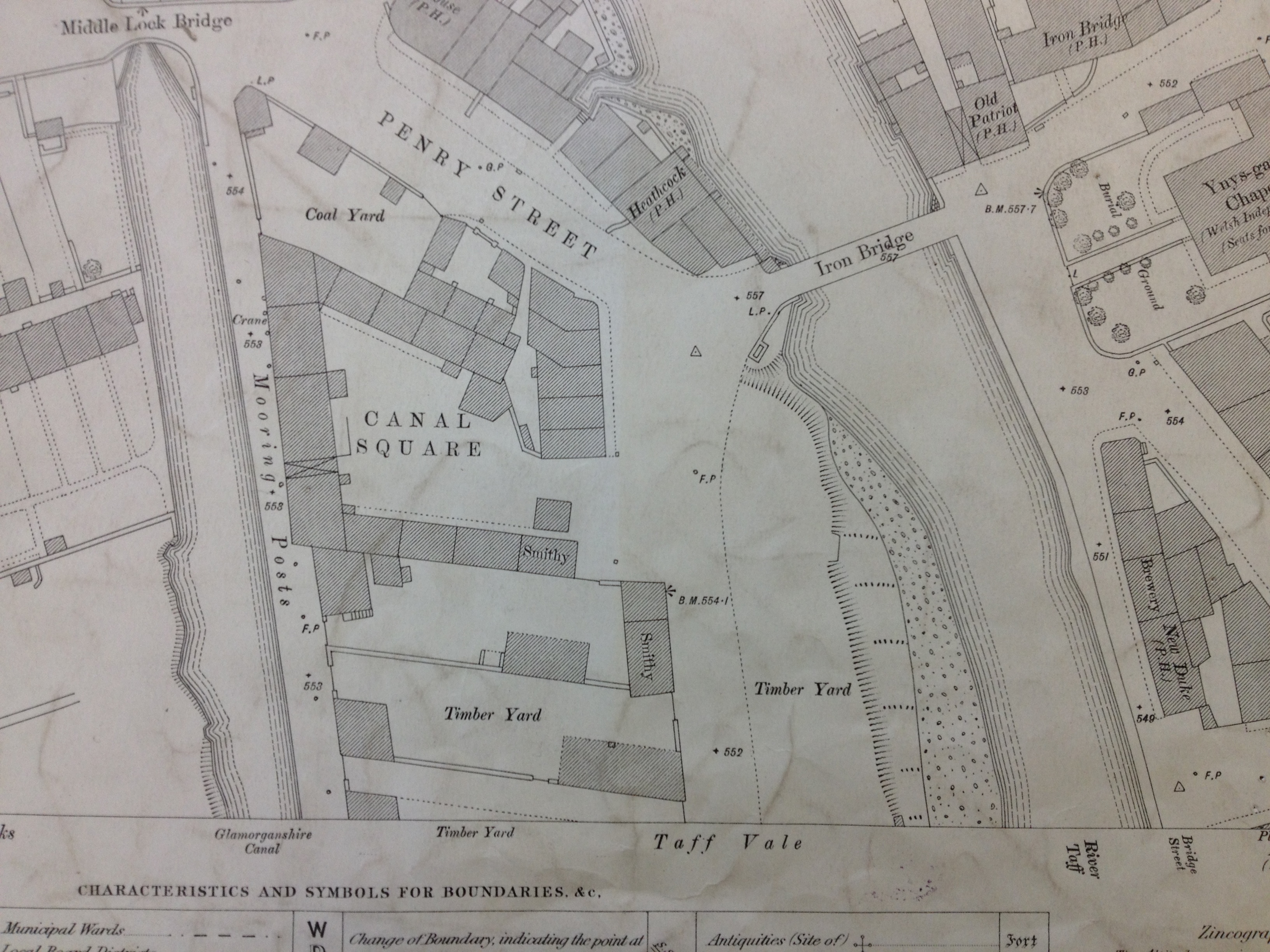
Detail of OS Public Health Map of 1875 – showing the original Iron Bridge at Ynysgau crossing the Taff. The Glamorganshire Canal can be seen to the left. Reproduced from the 1875 Ordnance Survey Map. Collection of Merthyr Tydfil CBC Libraries.
The Ynysgau Iron Bridge of 1799 is just a few hundred yards upstream from the weirs in the previous image. The Glamorganshire Canal is clearly seen on the left.
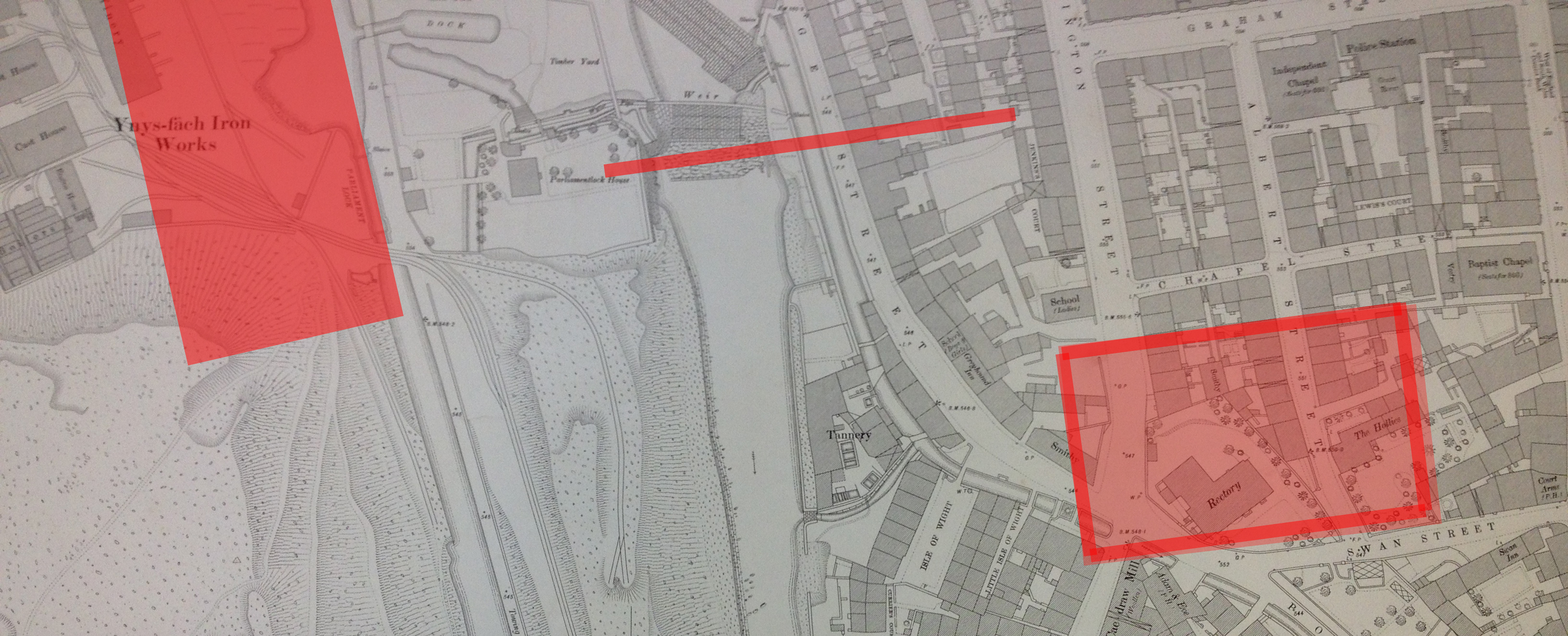
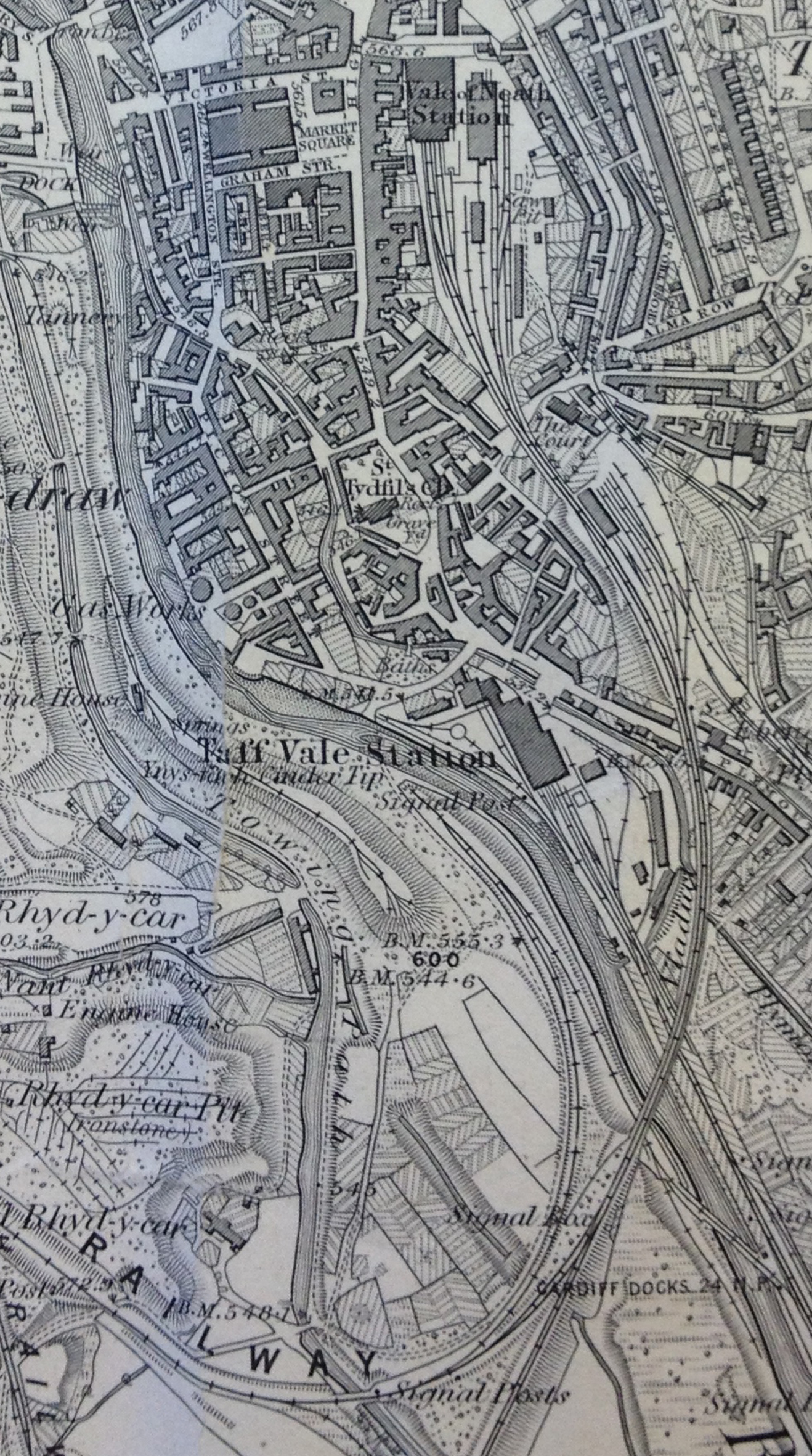
Detail of OS Public Health Map of 1875 – showing the large Rectory building on Swan Street, Cae-Draw, top right. The River Taff is on the left of the image. Reproduced from the 1875 Ordnance Survey Map. Collection of Merthyr Tydfil CBC Libraries.
The Buildings on Swan Street in the above image – including the large Rectory and the adjacent property called The Hollies, were demolished at some point during the 1960’s to make way for new developments and roads. The Hollies Medical Centre and the Police Station – both built on this site, are now being demolished to make way for the new Bus Station.
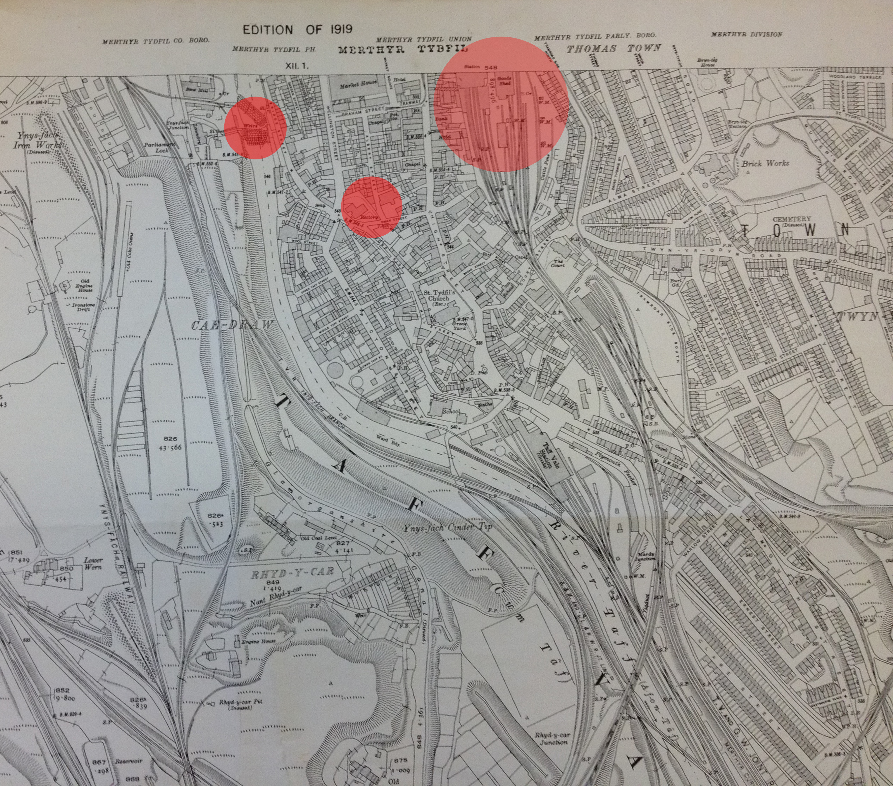
Reproduced from the 1919 Ordnance Survey Map of Merthyr Tydfil and surrounding areas. Collection of Merthyr Tydfil CBC Libraries.
The above detail from an OS map of 1919, has been annotated by me to show the positions of the existing pedestrian footbridge (left), the site for the new Bus Station (middle) and the site of the old Merthyr Tydfil Train Station (right). The train Station was built on the site of the current Tesco Store in the centre of town. The original station building was by I.K.Brunel.
A detail from an OS map of Merthyr Tydfil and Cyfarthfa Iron Works. Reproduced from the 1865 Ordnance Survey Map. Collection of Merthyr Tydfil CBC.
I very much like the interconnectivity between the Ironworks – in pink – and the railway tracks and River Taff. The word that keeps coming to mind is ‘Confluence’, – describing the point at which two bodies of water meet. In this case – the dynamic interchange of the man-made and the the natural – albeit controlled – forces of water.
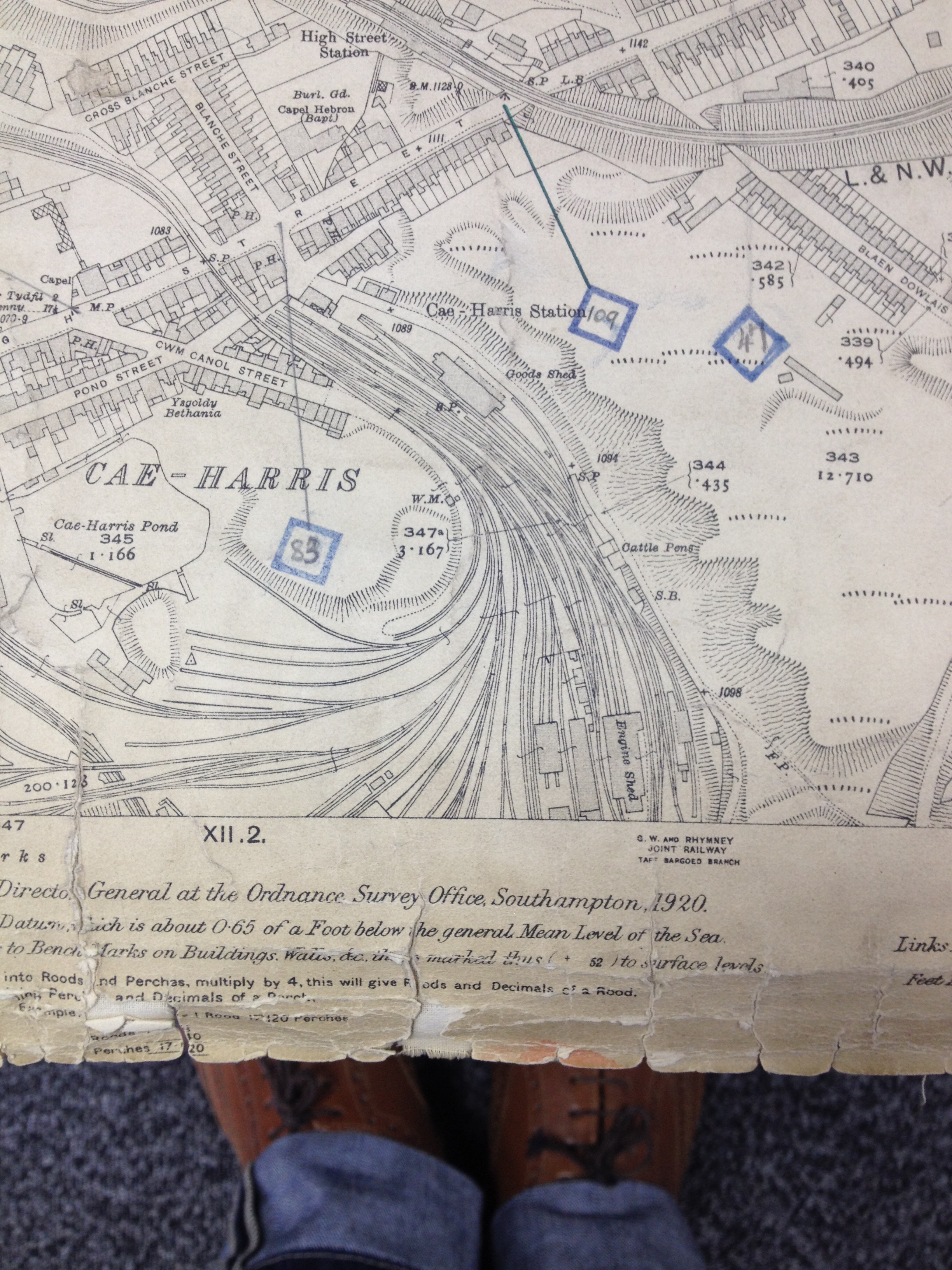
Railway tracks at Cae-Harris, Dowlais. Reproduced from the 1920 Ordnance Survey Map. Collection: Merthyr Tydfil CBC
The branching patterns of rail tracks are fluid and respond to the local topography.
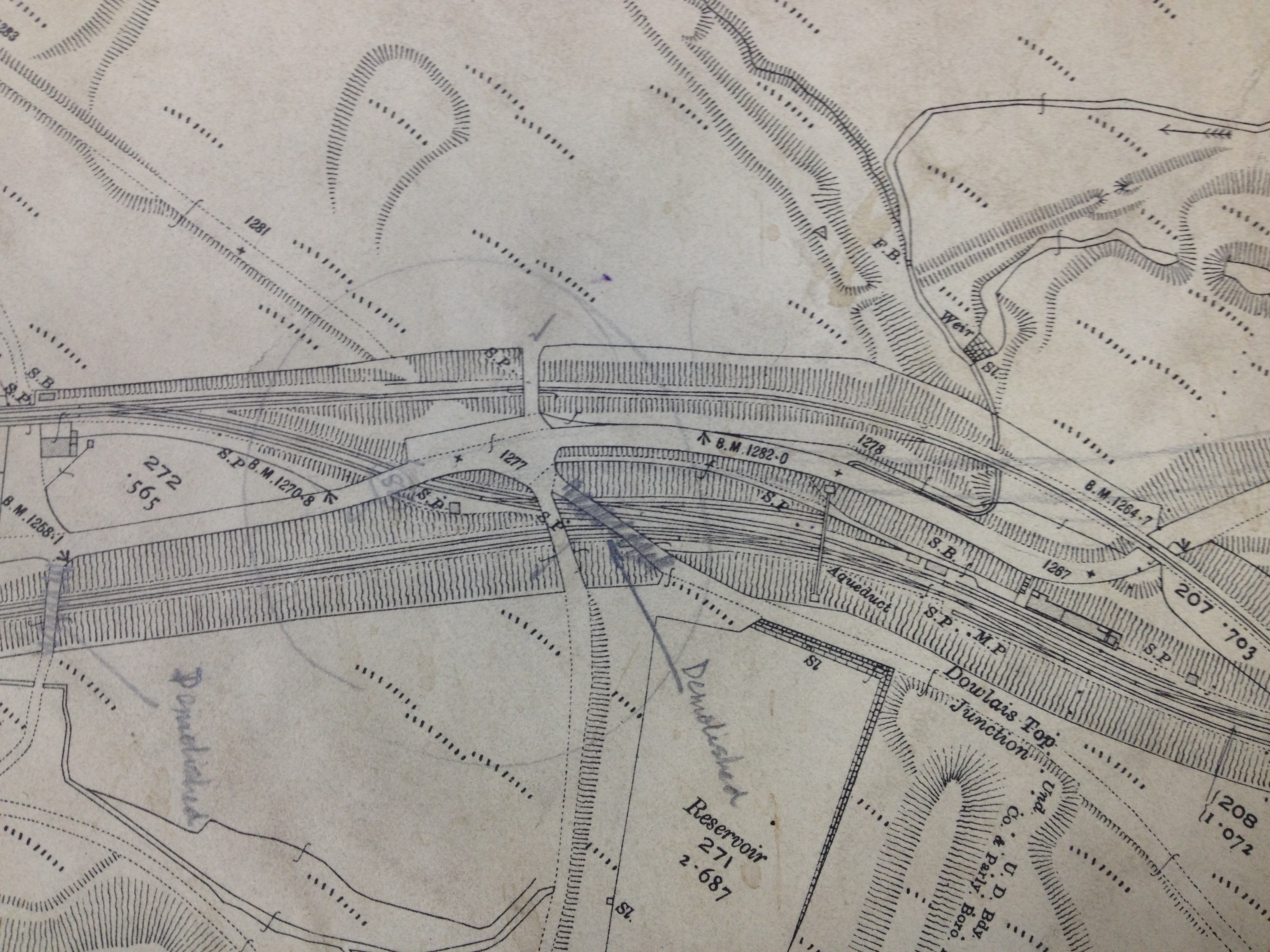
Detail: Railway tracks & cuttings at Dowlais Top, Merthyr Tydfil Reproduced from the 1920 Ordnance Survey Map. Collection: Merthyr Tydfil CBC
The above detail is from the 1920 OS Map above, shows rail lines in cuttings with embankments and raised trackways and crossing points.
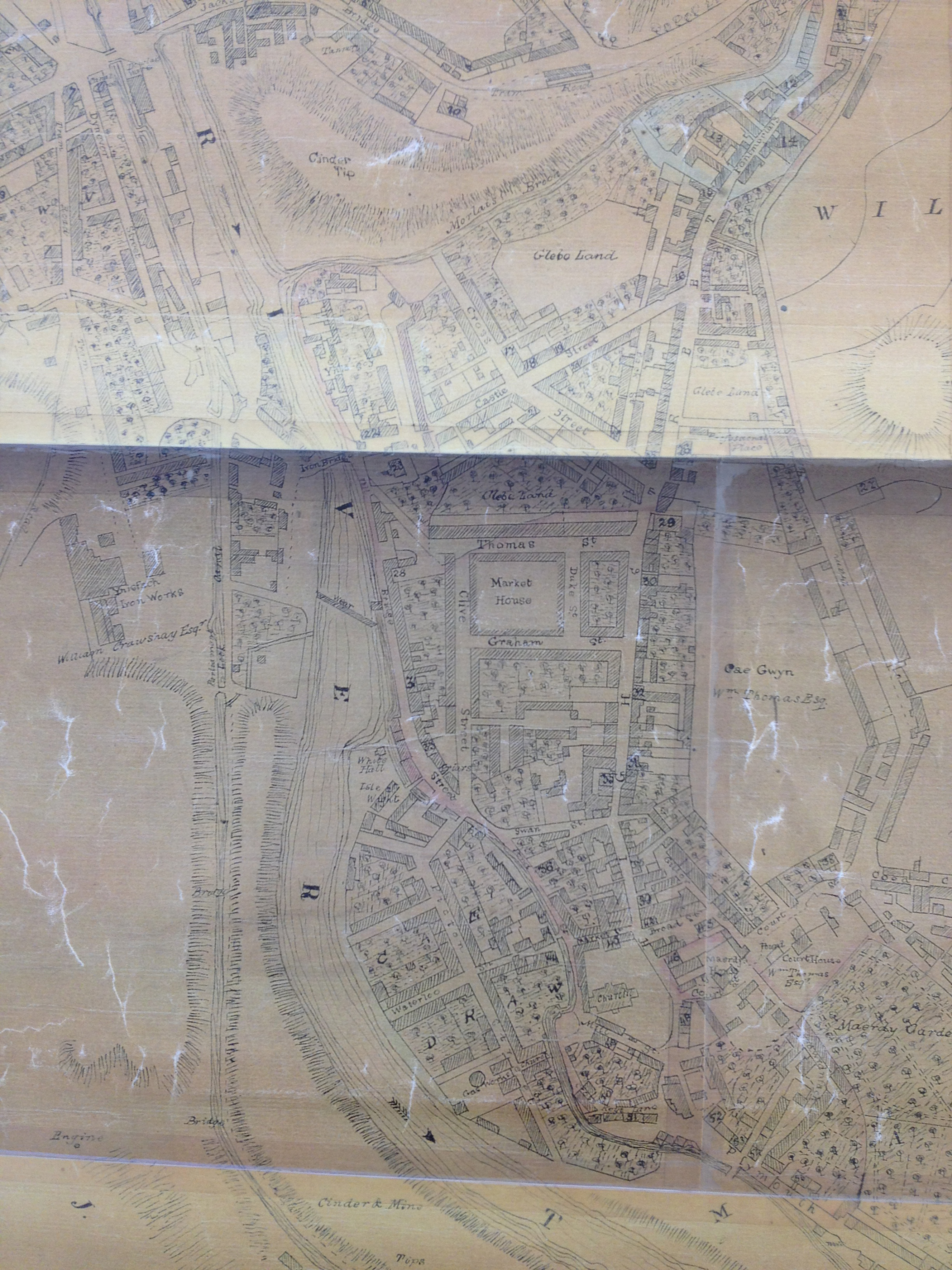
A detail from an OS map of Merthyr Tydfil Town Centre. Reproduced from the 1836 Ordnance Survey Map. Collection of Merthyr Tydfil CBC Libraries.
This lovely map clearly shows the positions of the Iron Bridge of 1799 & the weir on the River Taff. The pedestrian footbridge of 1970 crosses immediately downstream of the weir linking the College – on the site of the former Ynysfach Iron works, to the St Tydfil Shopping Centre – which was built upon the site of the old Market Square– seen on this map. Swan Street is also clearly marked – a couple of streets below the Market Buildings. This is the site for the new Bus Station. The Old Station was at the top of the map on the site known as Glebeland– originally land belonging to the Church.
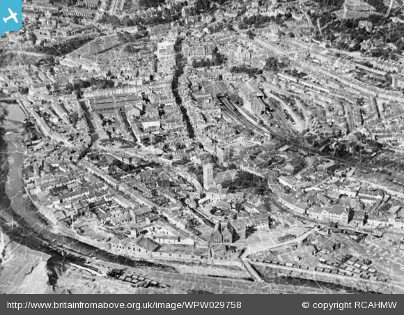
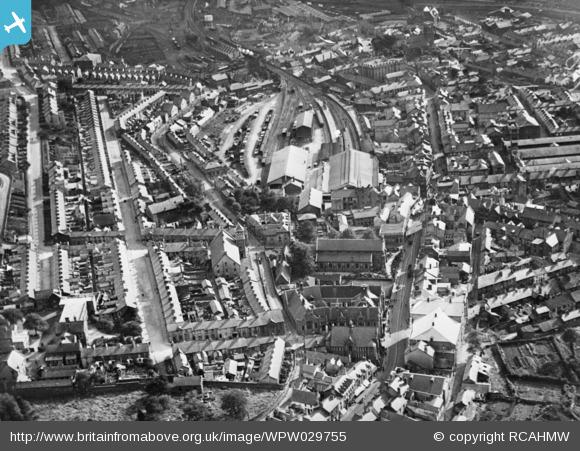
These images of Old Merthyr Tydfil come from the website Britain From Above– they really serve to show how dense the footprint of the town was in 1929. This pattern of community within the town centre remained pretty much unchanged until the 1950’s.
Detail of OS Public Health Map of 1851 – showing Cyfarthfa Iron works. Reproduced from the 1851 Ordnance Survey Map. Collection of Merthyr Tydfil CBC Libraries.
Detail of OS Public Health Map of 1851 – showing Ynysfach Iron Works. The Glamorganshire Canal can be seen to the right. Reproduced from the 1851 Ordnance Survey Map. Collection of Merthyr Tydfil CBC Libraries.
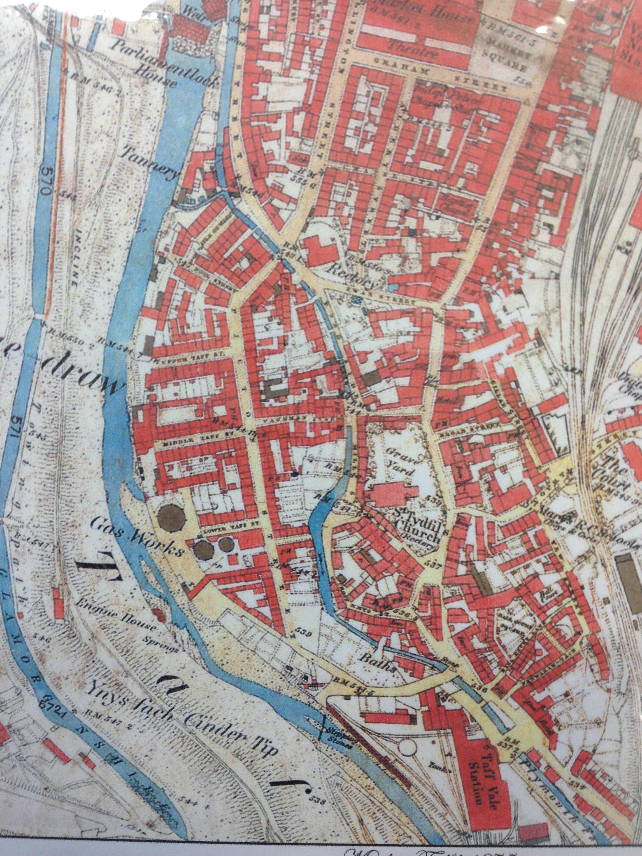
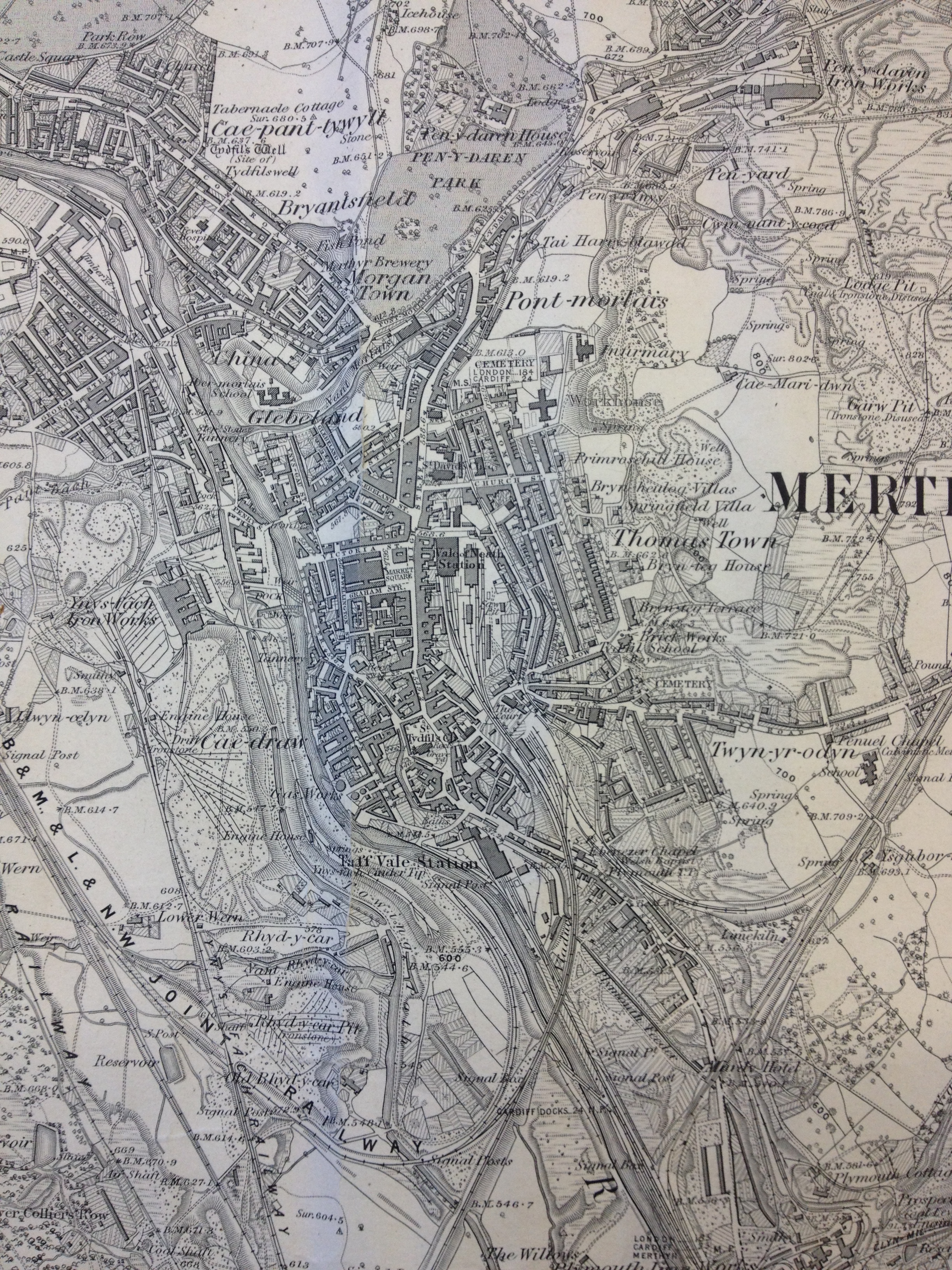
Merthyr Tydfil Map. Reproduced from the 1875 Ordnance Survey Map. Collection of Merthyr Tydfil CBC Libraries.
Reproduced from the 1885 Ordnance Survey Map of Merthyr Tydfil and surrounding areas. Collection of Merthyr Tydfil CBC Libraries.
This 1885 OS Map of Merthyr Tydfil and surrounding areas is richly – almost decoratively detailed with the patterns of industrial development.
Railways in particular, dominate the landscape with curvilinear arcs branching and dovetailing into one another. The scene at the time must have been frenetic and constantly moving. What the map cannot easily show is the variation in topography and the ways in which the rail tracks were over-sailing one another in cuttings, over bridges and on raised embankments.
Detail. Reproduced from the 1885 Ordnance Survey Map of Merthyr Tydfil and surrounding areas. Collection of Merthyr Tydfil CBC Libraries.
The detail above illustrates the complexity of transportation & landscape management and how it interweaves in the landscape. Train Stations and Sidings, various roads and trackways, River Taff, Glamorganshire Canal with towing path, reservoirs, cinder tips, working quarries, disused workings. Sitting tightly in the midst of it all is the dense footprint of the Town Centre.
Great news to end 2014 & a promising start to 2015 !
On 22nd December 2014 I was appointed as the artist to the team for the new bus station at Merthyr Tydfil.
“The appointed artist will work as part of a multi disciplinary design team to look for opportunities to contribute to the design of the bus station both in terms of function and aesthetics. The development of a new Central Bus Station for Merthyr Tydfil is one of the last major regeneration projects for the heart of the town centre.
Through extensive public consultation held in June 2014, the majority of the public recognised the need to relocate the bus station; however concerns were raised over anti-social behaviour, accessibility and close proximity to a residential area. It is critical that the design addresses these concerns whilst looking for a contemporary design that has a unique appearance which is respectful to the surrounding area.
This is an excellent opportunity for an artist to make a real contribution to the design of an important part of the town’s transport infrastructure and a critical building within the townscape. The appointed artist will be expected to bring a new perspective to the design team crossing traditional skills boundaries and linking different design disciplines.”
The brief and scope is wide ranging at this stage, but is focussed on the use of research led contextual studies with which to influence the design process and eventual outcome of the project.
I will be starting work on the project in January 2015 & look forward to working & collaborating with the people of Merthyr Tydfil as soon as possible.
This blog will be made open to everyone involved in the project to review, comment upon & contribute to the programme and research.