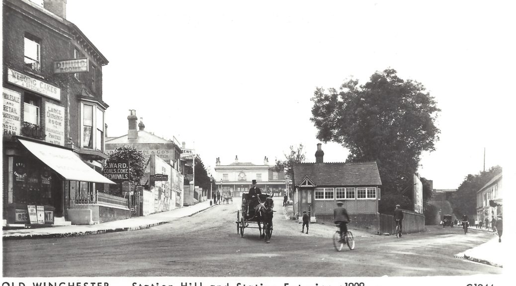
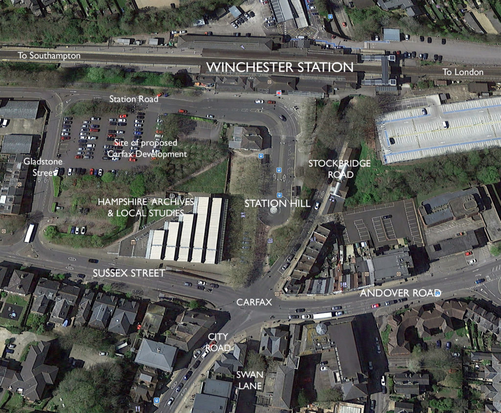
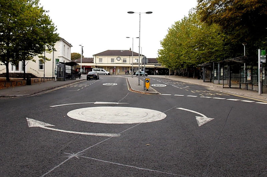
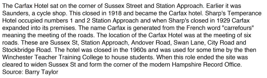
Station Hill leads up to Winchester Train Station from the busy junction of Stockbridge Road, City Road, Andover Road and Sussex Street. Swan Lane also joins here. The site has been historically known as Carfax, meaning the meeting of roads. The Carfax Hotel, formerly on the site now occupied by the Hampshire Records Office took its name from this historic site. The Masterplan proposals for this whole site, developed by Winchester City Council’s Consultants Lifschutz Davidson Sandilands Architects, is referred to as the Carfax Site. and incorporates the Station Approaches & public realm.
Station Hill today doesn’t give much away about it’s local community or life as a lively neighbourhood, but this wasn’t always the case.
I will try to add to this post throughout the project as new research throws up characters and stories.
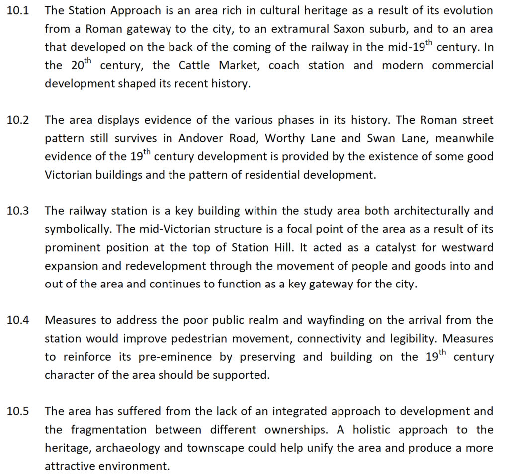
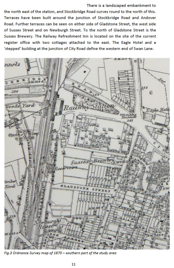
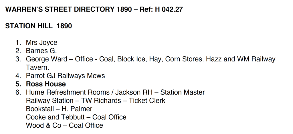
A page referencing the history and standing of Station Hill, the Train Station and environs taken from the Cultural Heritage Assessment for Station Approach, Winchester, by Elaine Milton, Heritage and Planning. Winchester City Council 2015 Station Hill, Winchester. Warren’s Street Directory 1890 – Ref: H 042.27. Hampshire Archives and Local Studies, Sussex Street, Winchester.
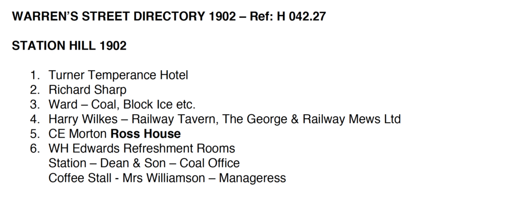
Above: Warren’s Street Directories, held in the Hampshire Records Office on our doorstep, lists street by street, almost everyone who lived at each residential property. If this was a business, then it lists the nature of the business, as well as the people who owned it. A wonderful archive. The books also contain the most interesting advertising for local products and services, mostly & brilliantly illustrated.
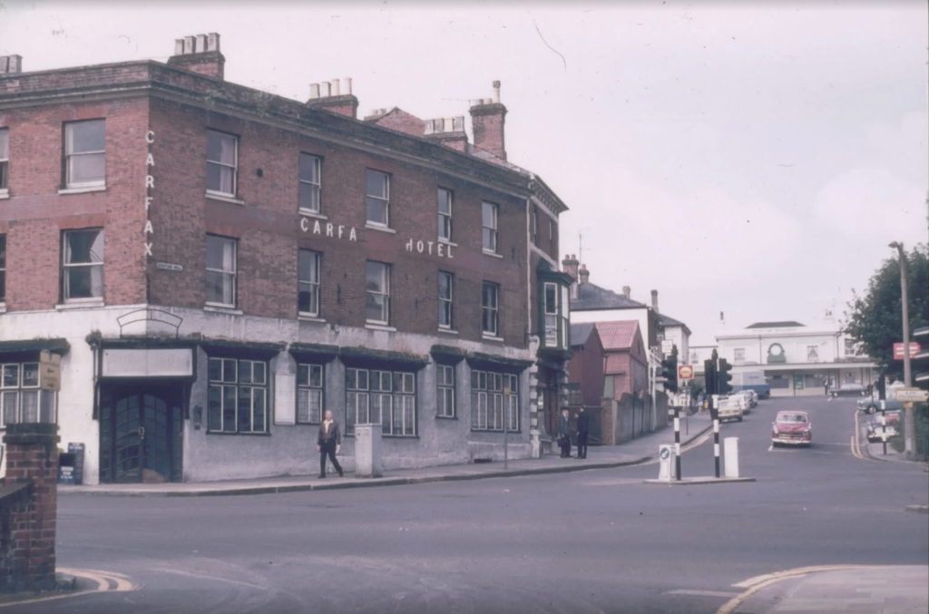
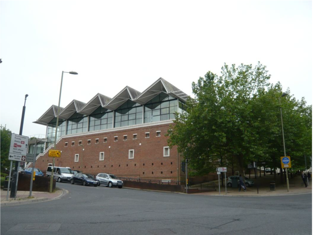
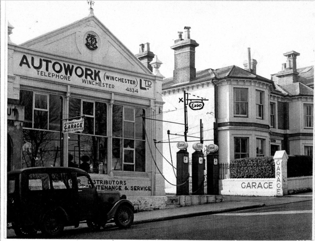
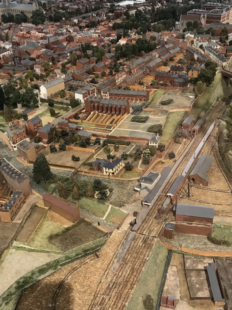
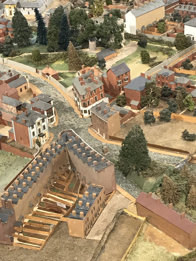
Carfax Hotel, Station Hill & Sussex Street, Winchester.Date unknown. Winchester Station Approaches Project. Image: Winchester City Trust. Description of the Carfax Hotel by Barry Taylor from The Lost Pubs Project. http://www.closedpubs.co.uk/hampshire/winchester_carfaxhotel.htmlHampshire Archives and Local Studies. Sussex Street, Winchester. This building replaced the old Carfax Hotel. Image: Winchester City CouncilAUTOWORK , (Winchester)Ltd. Station Hill, Winchester. Date Unknown. Winchester Station Approaches Project. Image: Winchester City Council Station Hill looking down towards Sussex Street and Swan Lane. Date unknown. Winchester Station Approaches Project. Image: Winchester City Council.Station Hill, Winchester. 1902 Warren’s Street Directory. Image: Hampshire Archives and Local Studies. Roger Brown’s Model of Winchester circa 1873. This brilliant model was made in the 1980’s and took 9 years to complete. Image: Christopher Tipping. Copyright: City of Winchester Museum.
The Train Station is seen above in the bottom left quadrant. Roger Brown’s model was based on the OS Map of 1873. Roger had been a Planning Officer for Winchester City Council.
Some key building are still extant , such as the Station and the South Western Inn, formerly the Railway Refreshment Inn – & up until 2015, Winchester Register Office. The Carfax Hotel is visible on the junction of Station Hill & Sussex Street. The terraced houses of Gladstone Street are there too, but the Reservoirs of the Sussex Brewery, seen on the OS Map of 1870 now appear to be allotment gardens. Needs a bit more investigating to discover what the reservoirs were for. I can’t find any reference to the Sussex Brewery.
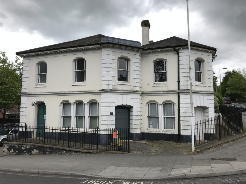
The original Railway Refreshment Inn opposite the Station, was up until 2015 the Winchester Register Office at No.6 Station Hill. Image: Christopher TippingRoger Brown’s Model of Winchester circa 1873. Copyright: City of Winchester Museum.
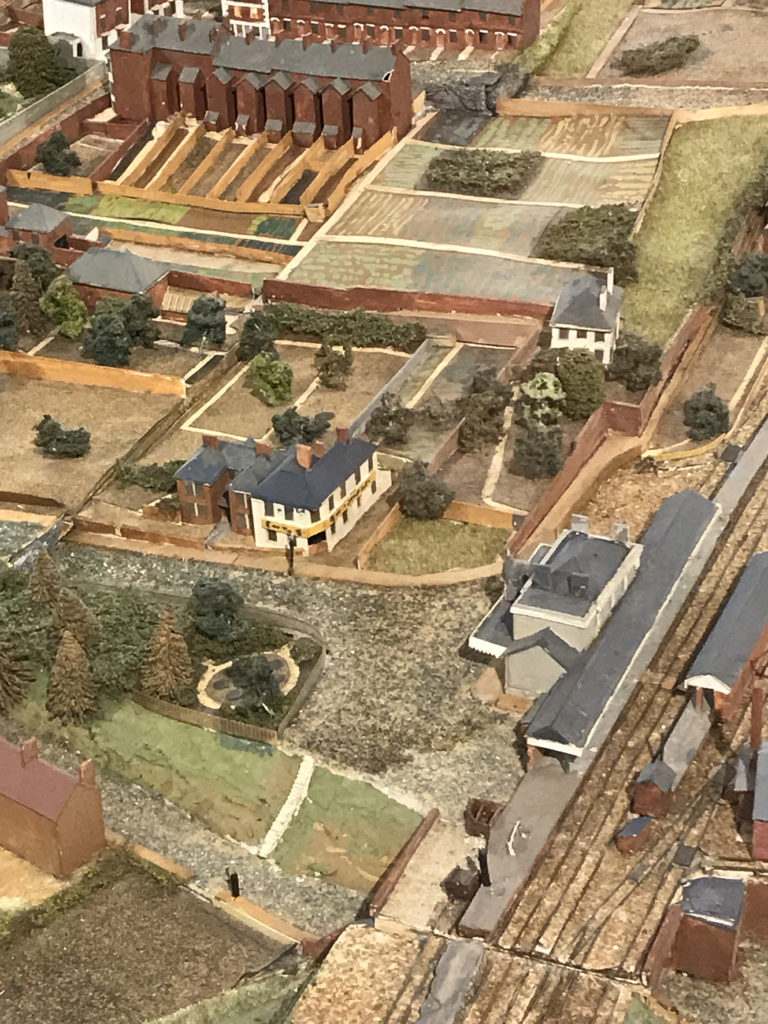
Above: A bit blurry…but nonetheless the Station and Public House are clearly shown. A narrow footpath leads to Sussex House just beyond the Station in this image. A lovely circular garden feature can also be seen just left of the Station forecourt behind a fence. I wonder if this was a public or private space?
Roger Brown’s Model of Winchester circa 1873. Copyright: City of Winchester Museum.
Above; At centre is the Carfax Hotel building on Station Hill and Sussex Street. This important crossroads, (or Carfax), shows a complex junction of City Road, Swan Lane, Station Hill, Andover Road and Sussex Street. Looking rather genteel – and not the complicated crossing for pedestrians we experience today.
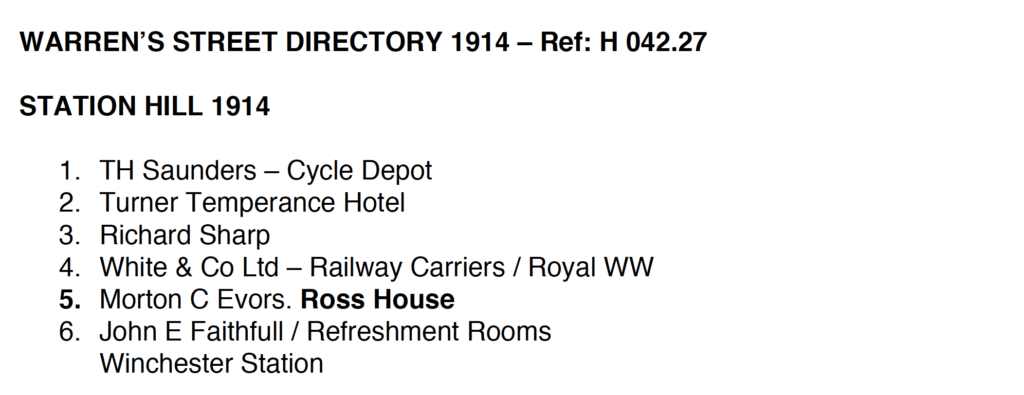
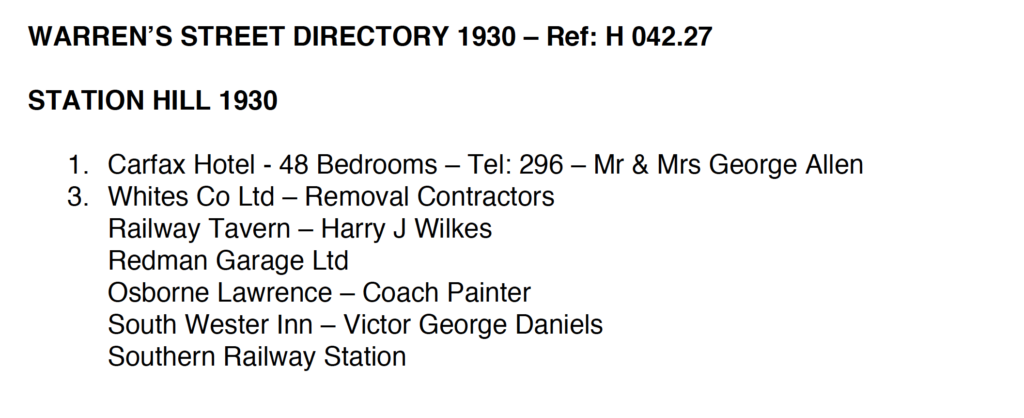
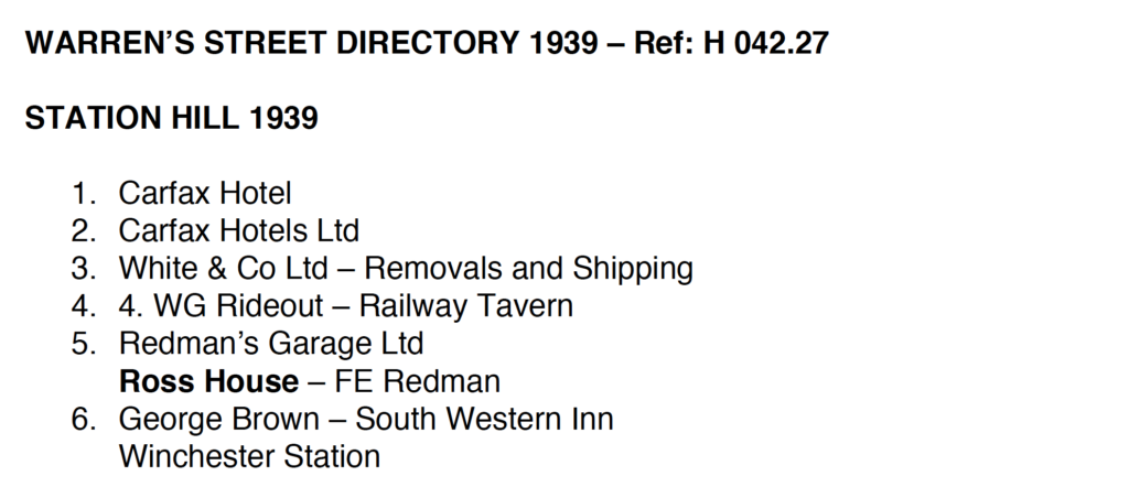
Station Hill, Winchester. 1914 Warren’s Street Directory. Image: Hampshire Archives and Local Studies. Station Hill, Winchester. 1930 Warren’s Street Directory. Image: Hampshire Archives and Local Studies. Station Hill, Winchester. 1939 Warren’s Street Directory. Image: Hampshire Archives and Local Studies.
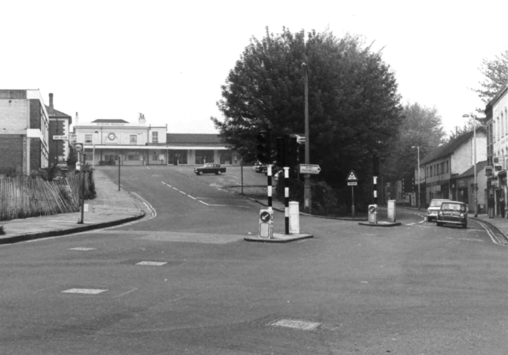
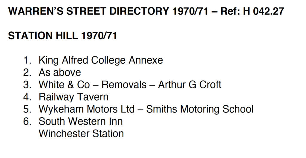
By 1970, the Carfax Hotel, first named in 1918, had fallen into disrepair during the 1960’s. It had been taken over by the King Alfred Teacher Training College as student accommodation. However, it was demolished in 1972 as part of a road improvement scheme.
Station Hill, Winchester. 1970/71 Warren’s Street Directory. Image: Hampshire Archives and Local Studies.
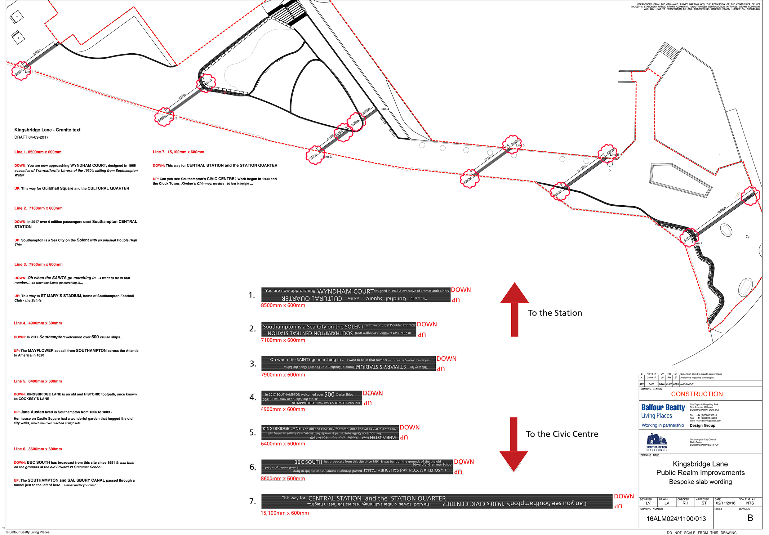
‘The SOUTHAMPTON and SALISBURY CANAL passed through a tunnel just to the left of here…almost under your feet’
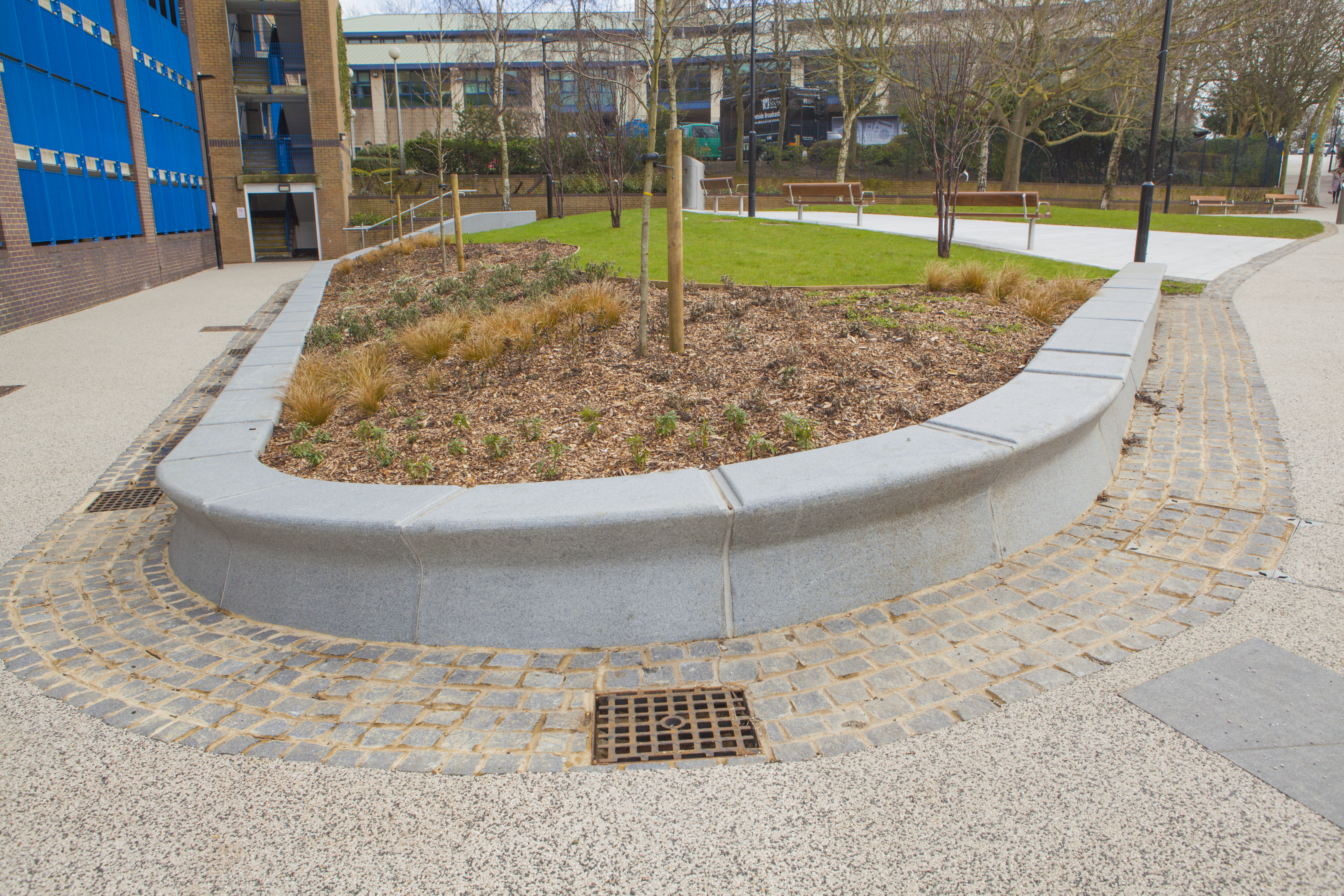
Kingsbridge Lane with Civic Centre and Clocktower. Image: Massie Wilson
‘Can you see Southampton’s 1930s CIVIC CENTRE? The Clock Tower, Kimber’s Chimney, reaches 156 feet in height…’
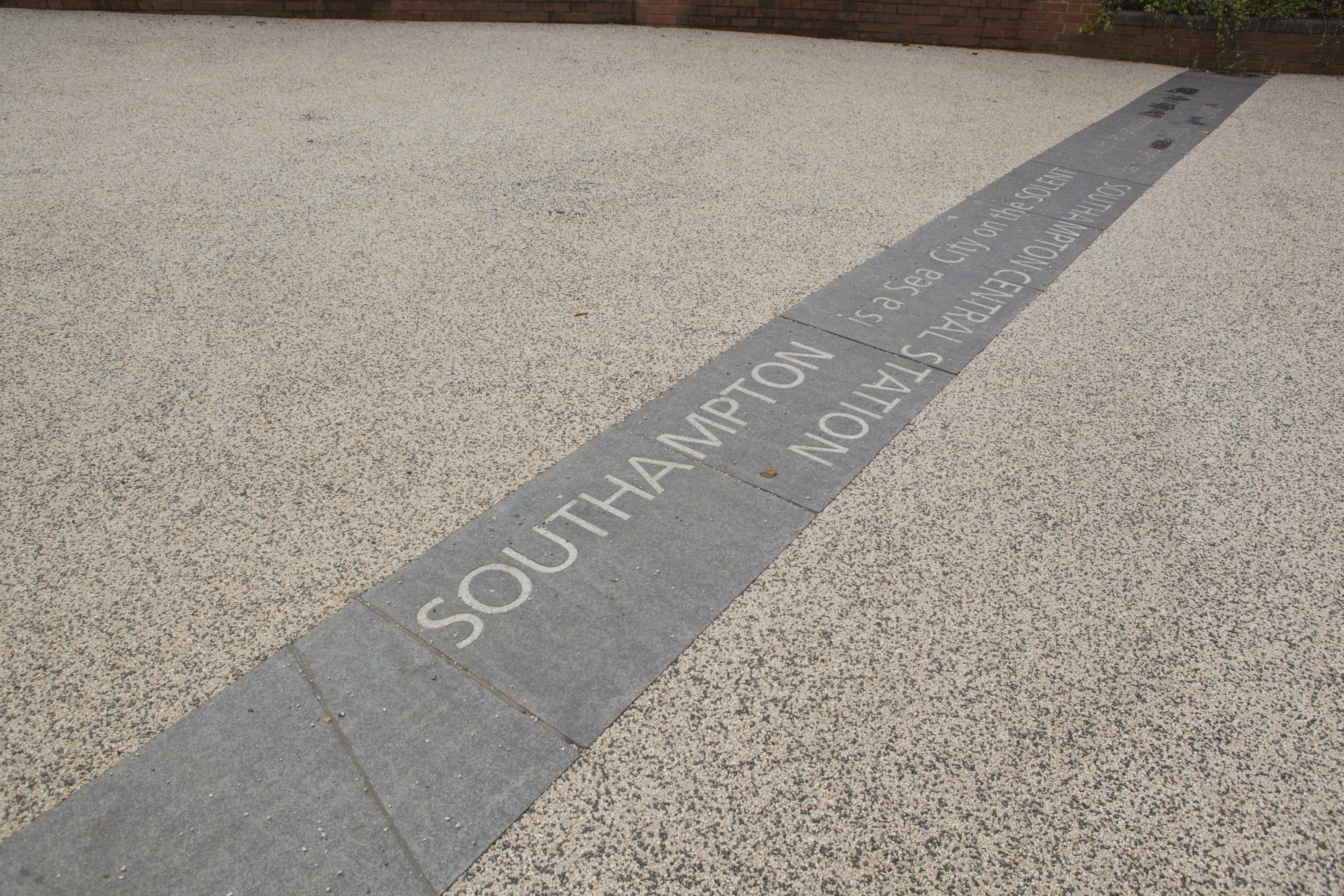
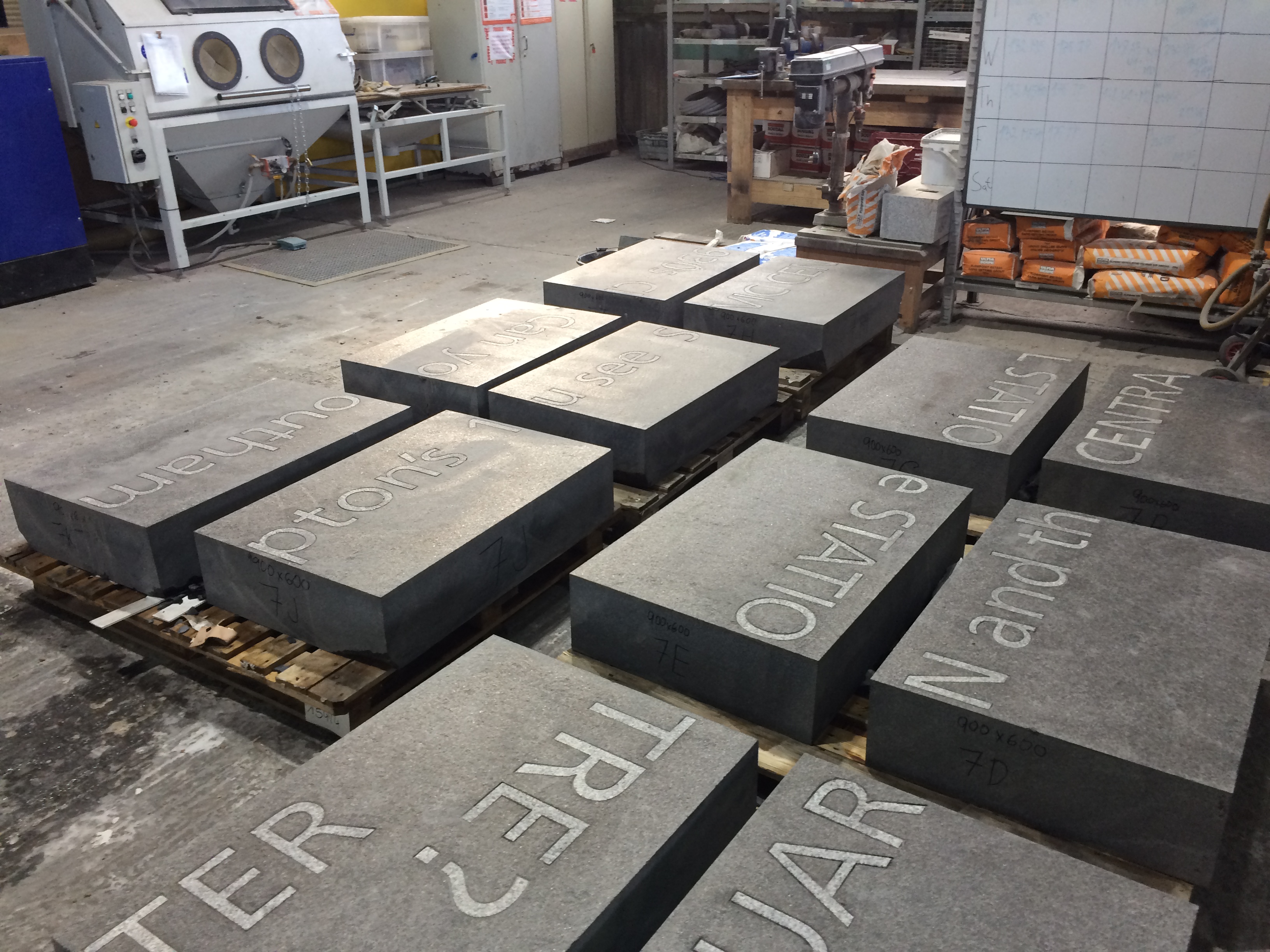
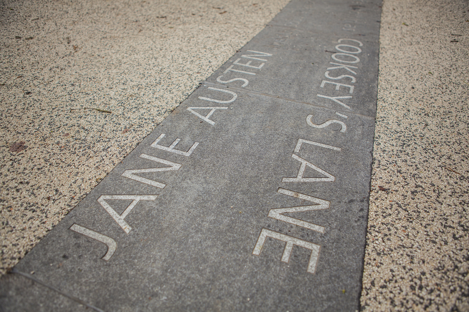
Text – white granite inset into contrasting black granite.
Kingsbridge Lane in Southampton is a historically important and longstanding pedestrian-only route with no vehicular access. This makes the site significant to Southampton. It is a long surviving link to the western route in and out of Southampton along the coastal strand, which formed the northern shore of the River Test Estuary until the early 20thCentury. The footpath runs along a narrow strip of land between the existing railway tunnel and the historic and long abandoned tunnel of the Southampton to Salisbury Canal, which ran along what is now Blechynden Terrace, linking Central Station to the Guildhall Square &Cultural Quarter. My role within this project was to develop a contextual response to the site, which would, hopefully, influence the landscape design and regenerative design process in collaboration Simon Taylor of Balfour Beatty Living Places , Southampton City Council and Hardscape.
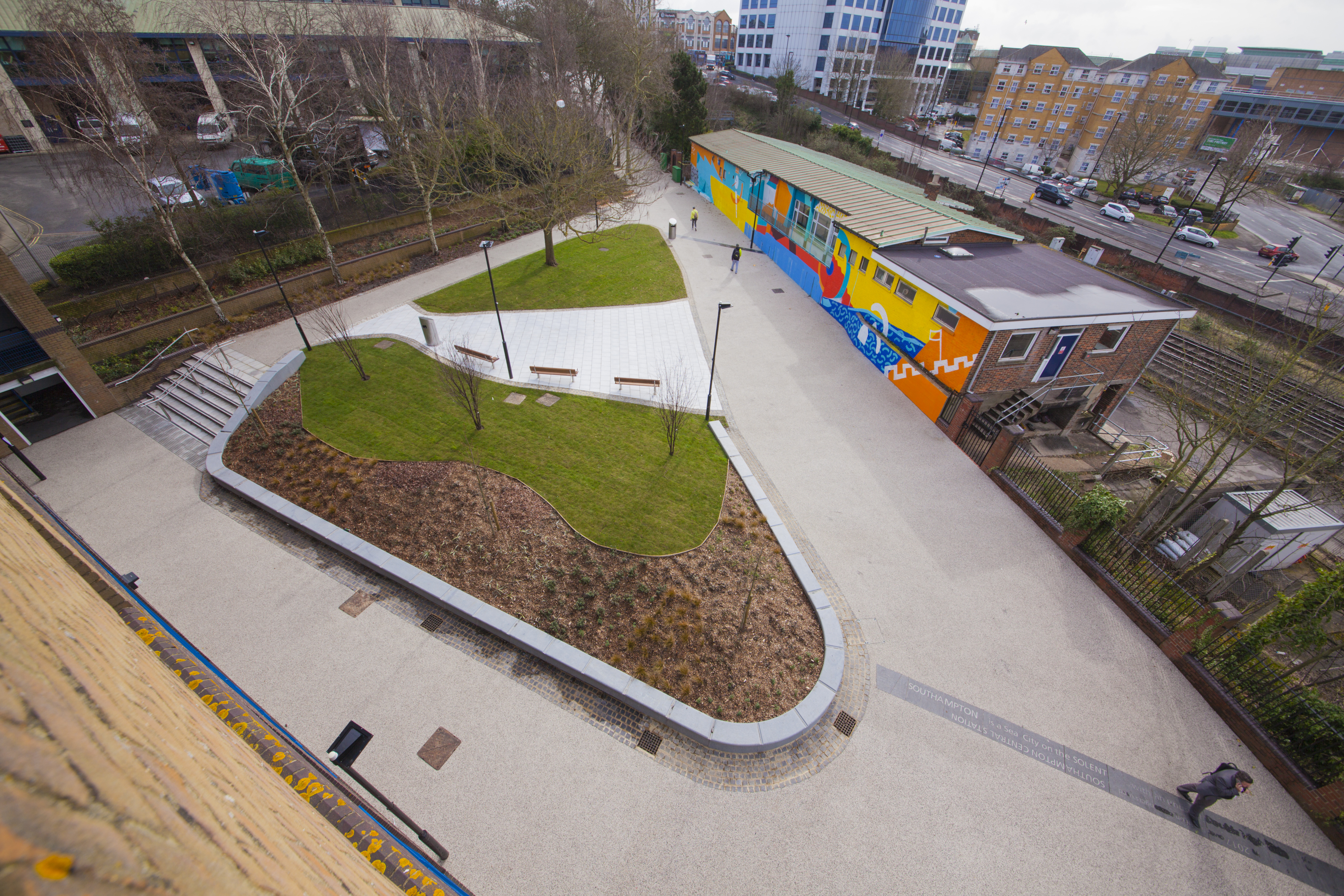
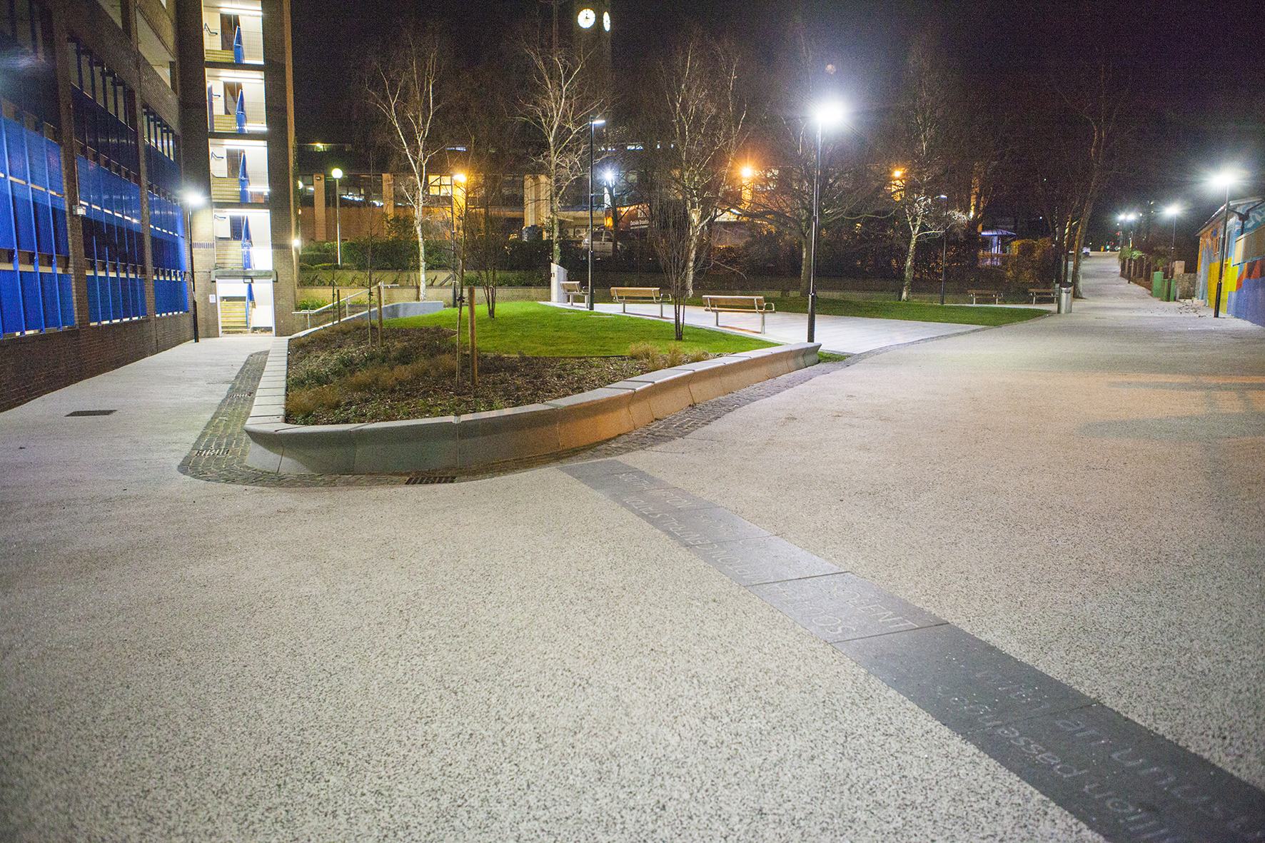
Kingsbridge Lane, Southampton. Image: Massie Wilson
Kingsbridge Lane, Southampton. 14 lines of text – Image: Balfour Beatty
‘SOUTHAMPTON is a Sea City on the SOLENT …with and unusual Double High Tide’.
Text – white granite inset into contrasting black granite.
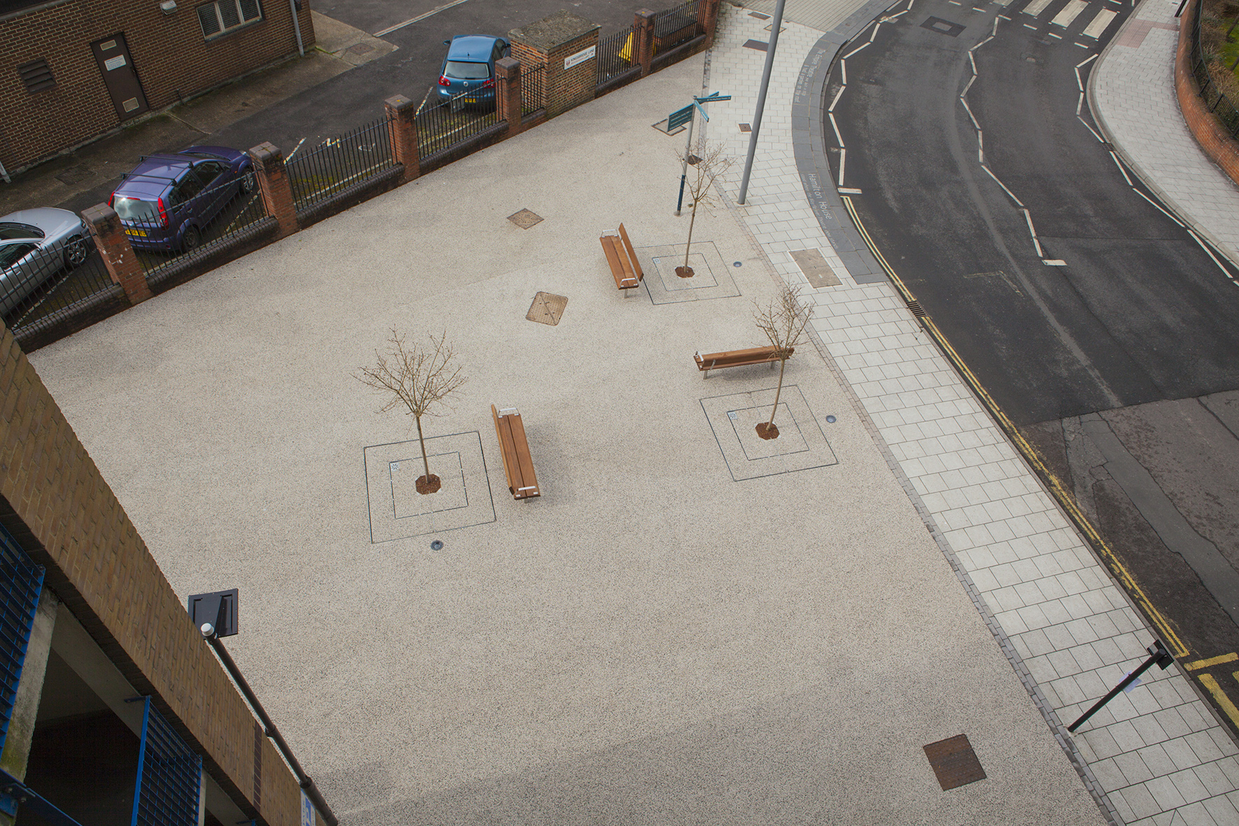
Aerial view of Kingsbridge Lane, Southampton. Image: Massie Wilson
‘Oh when the SAINTS go marching in …I want to be in that number… oh when the Saints go marching in…’
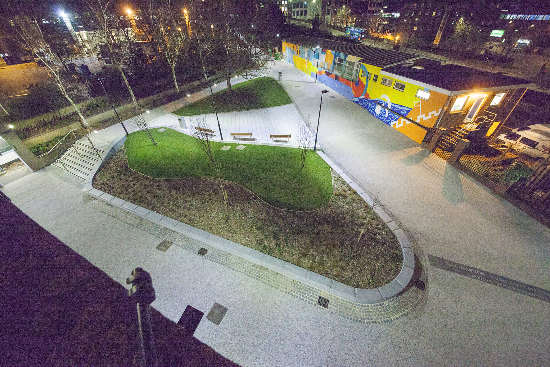
Nighttime aerial view of Kingsbridge Lane, Southampton. Image: Massie Wilson
‘In 2017 over 6 million passengers used Southampton CENTRAL STATION’
Kingsbridge Lane, Southampton. Nighttime view. Image: Massie Wilson
‘SOUTHAMPTON is a Sea City on the SOLENT …with and unusual Double High Tide’.
Basalt Slabs with inset text at Hardscape for Kingsbridge Lane, Southampton. Image: Christopher Tipping
Kingsbridge Lane, Southampton. Image: Massie Wilson
‘Jane Austen lived in Southampton from 1806 to 1809 … her house on Castle Square had a wonderful garden that hugged the old city walls’
Kingsbridge Lane, Southampton. Image: Massie Wilson
The granite seating and retaining walls by Hardscape are undercut along the front edge suggesting the movement of water throughout the site.
‘The MAYFLOWER set sail from SOUTHAMPTON across the Atlantic to America in 1620′
Aerial view of Kingsbridge Lane at the junction with Blechynden Terrace and West Park Rd, Southampton. Image: Massie Wilson
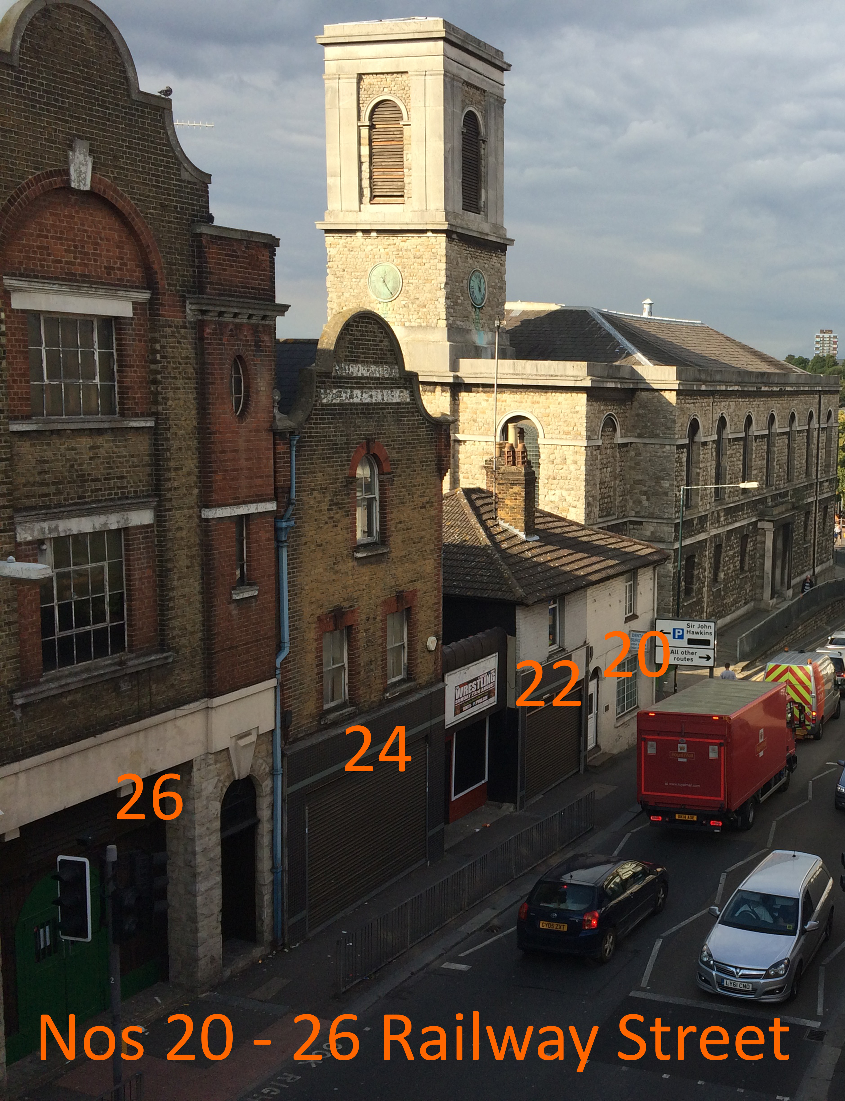
B.R. Philips made Home Brewed Ginger Beer at The Invicta Works, Nos 22 – 24 Railway Street – Chatham Placemaking Project – Chatham Patterns – Image: Christopher Tipping
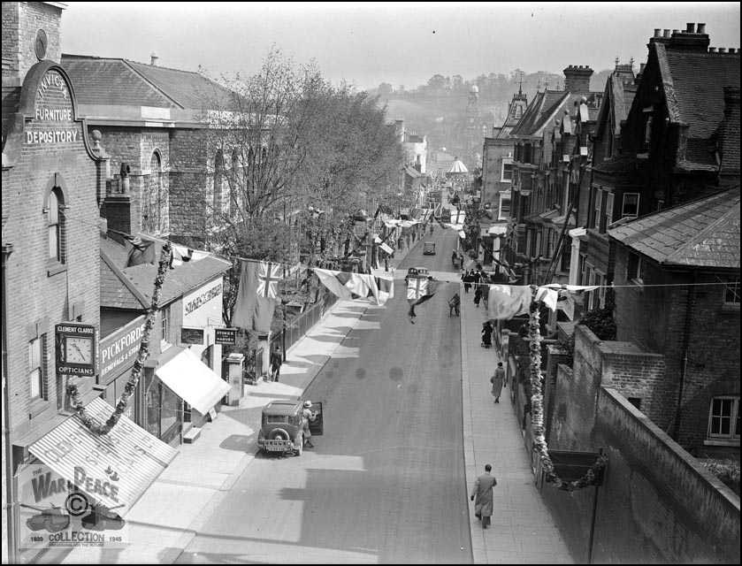
Railway Street from New Cut Viaduct date unknown. Collection of Rex Cadman. by Permission of Rex Cadman and Kent Photo Archive.
No. 26 Railway Street. In 1961, this was the premises of Frank Bannister & Son Ltd – Motor and Motorcycle Engineers. Chatham Placemaking Project – Chatham Patterns – Image: Christopher Tipping
In 1912 – No 26 was the home of the Invicta Furniture and Baggage Depository. No 28 was a Garage and Cycle Works.
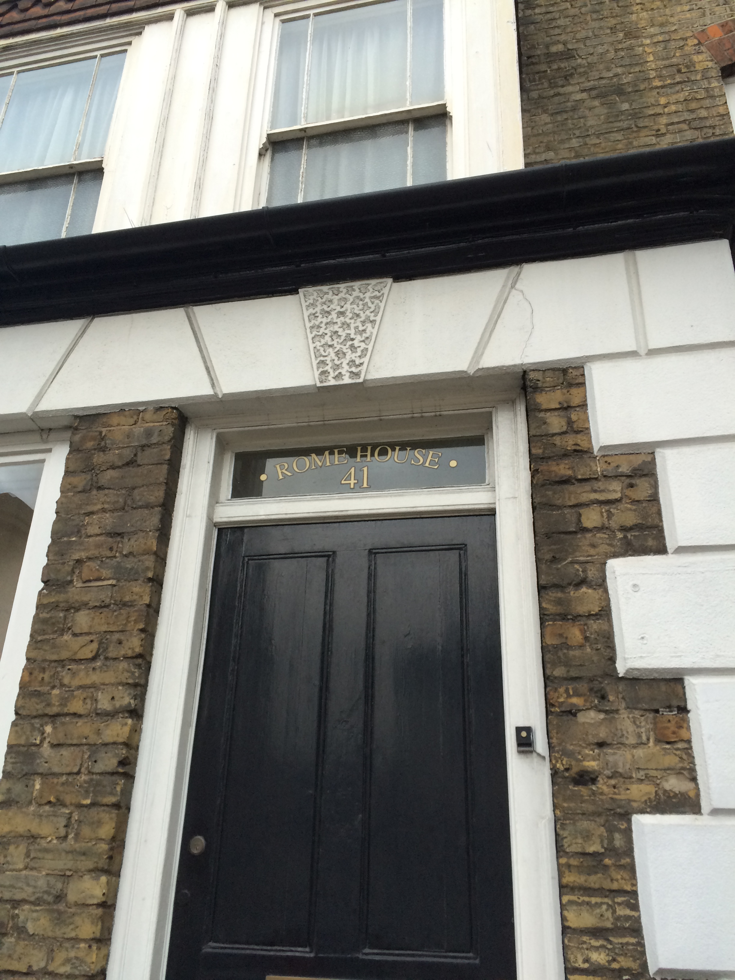
Rome House, No 41 Railway Street. Chatham Placemaking Project – Chatham Patterns – Image: Christopher Tipping
The 1848 Ordnance Survey Public Health Map of Chatham shows Rome House – a large detached mansion set in landscaped gardens – opposite St John’s Church on Rome Lane. Following the building of Chatham Railway Station, Rome Lane became Railway Street sometime after 1871. No 41 would have been a new property named after the original house.
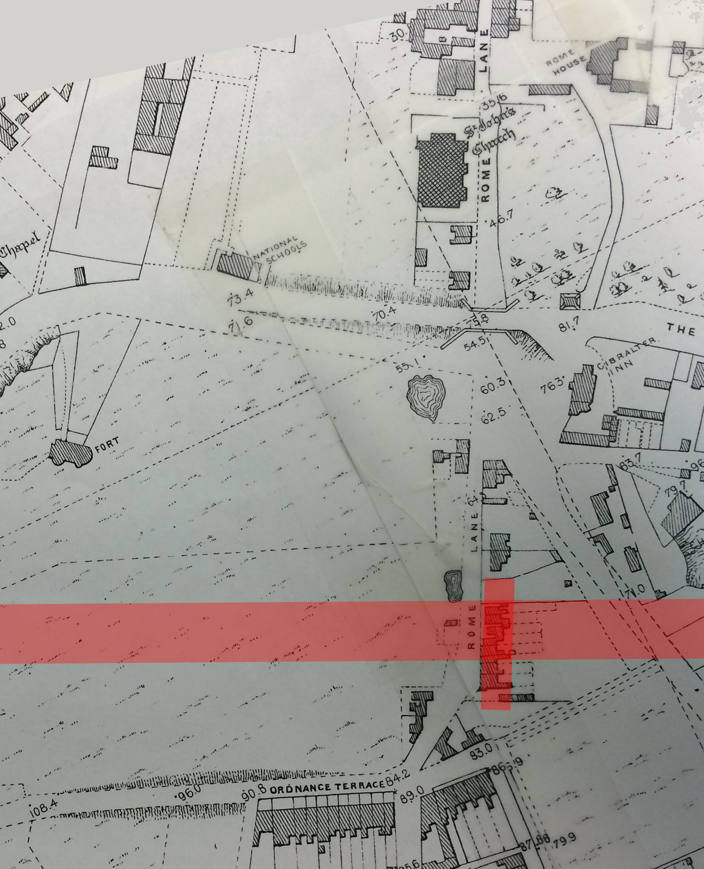
A detail from the 1848 OS Public Health Map of Chatham, with St John’s Church and Rome House on Rome Lane at top right. The pink line shows the eventual route of the railway and Chatham Railway Station, which opened in January 1858. By permission of Medway Archives and Local Studies Centre. Chatham Placemaking Project.
A detail of the OS Map of Chatham from 1864. By permission of Medway Archives and Local Studies Centre. Chatham Placemaking Project. Image: Christopher Tipping
This detail of the OS 1864 Map of Chatham shows Chatham Station at the bottom of this image. Railway Street to Military Road runs from the middle of the image to the top of the image. St John’s Church and Rome House can clearly be seen.
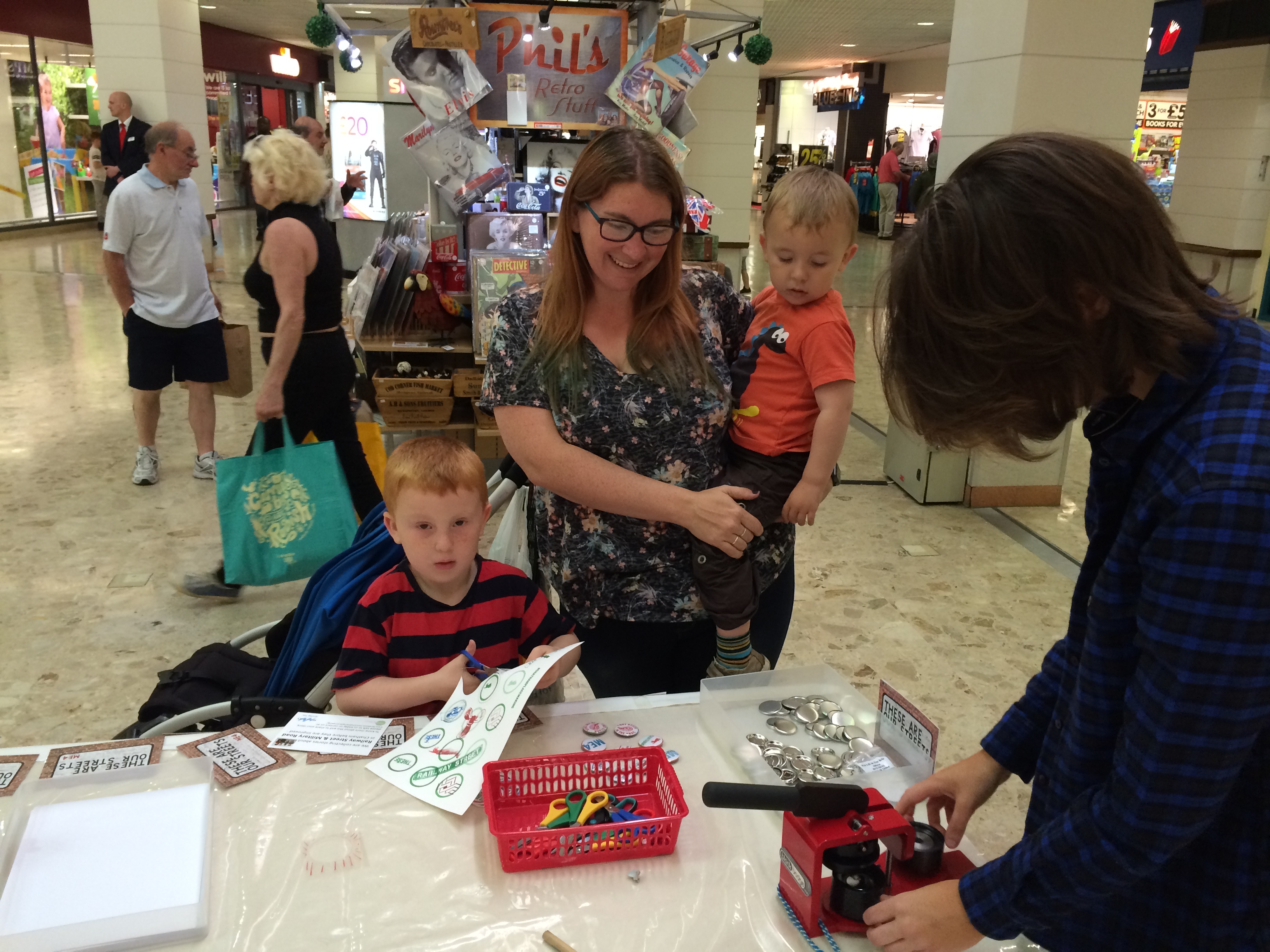
Saturday 7th May 2016 – Pentagon Shopping Centre, Chatham
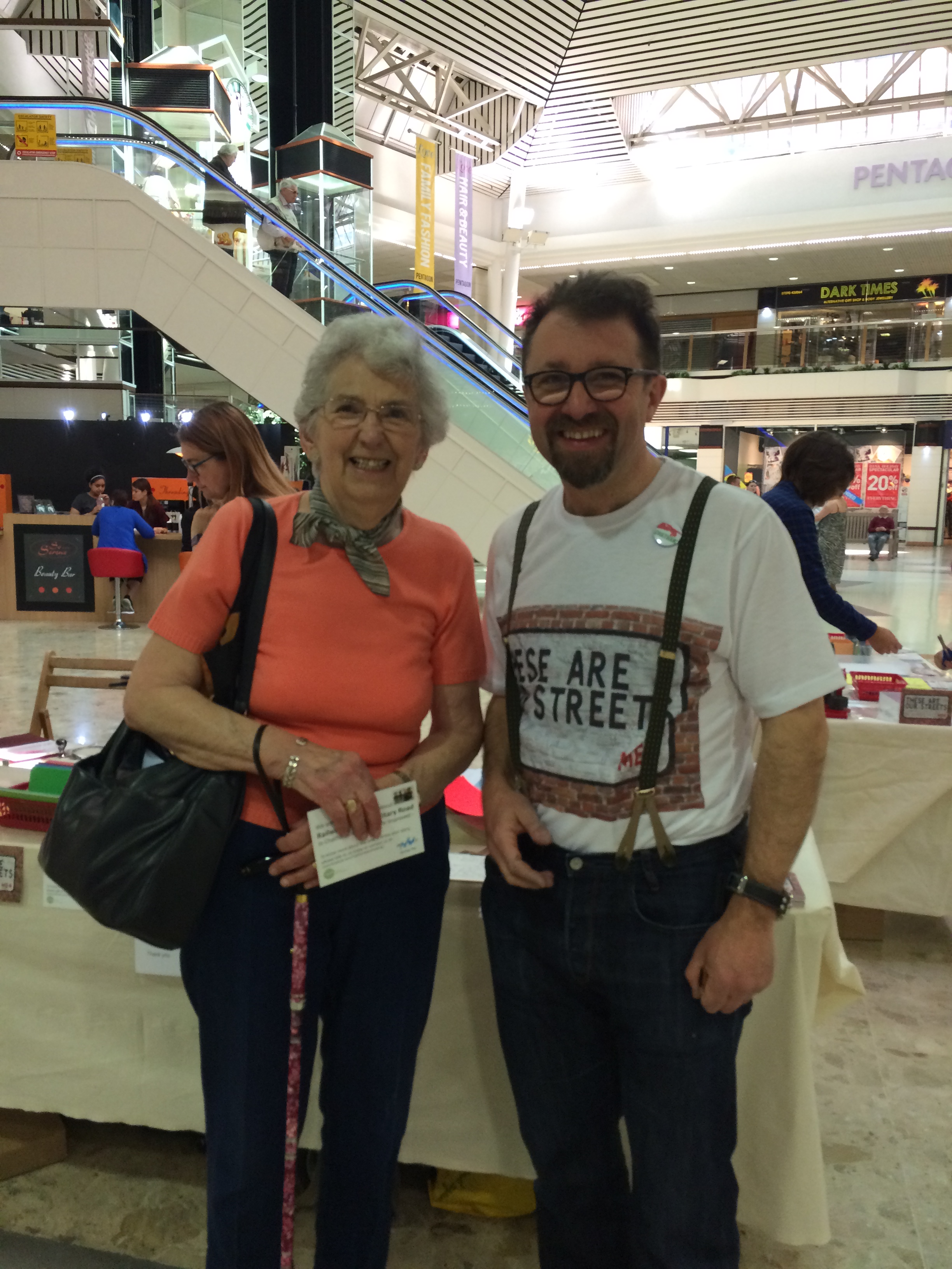
A workshop day – talking, being talked to – gathering stories, memories and an understanding of life in Chatham. Thanks to all who cam to speak to us – Elsie was one of them ! Her Dad used to say that the Thomas Waghorn Statue on Railway Street pointed to the toilets under the New Road viaduct. As a young girl, her impression of Chatham was that it was brim full of Public Houses.
Rob Young and Elsie – Pentagon Shopping Centre, Chatham. Chatham Placemaking Project. Image: Christopher Tipping
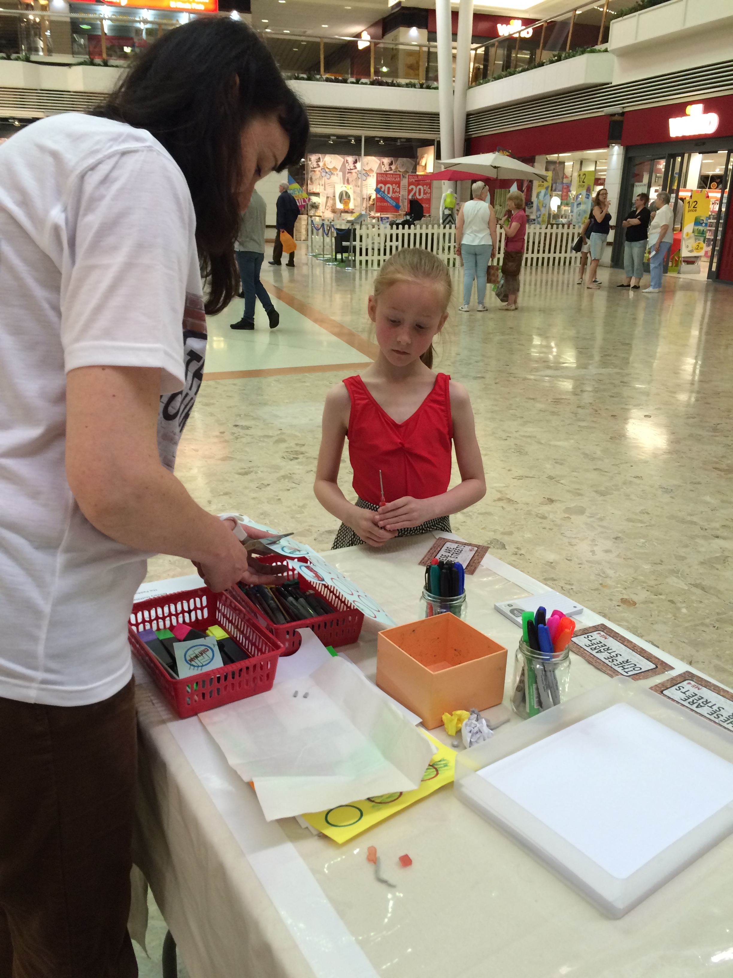
One of our brilliant badge-makers working with Xtina Lamb. Pentagon Shopping Centre. Chatham Placemaking Project. Image: Christopher Tipping
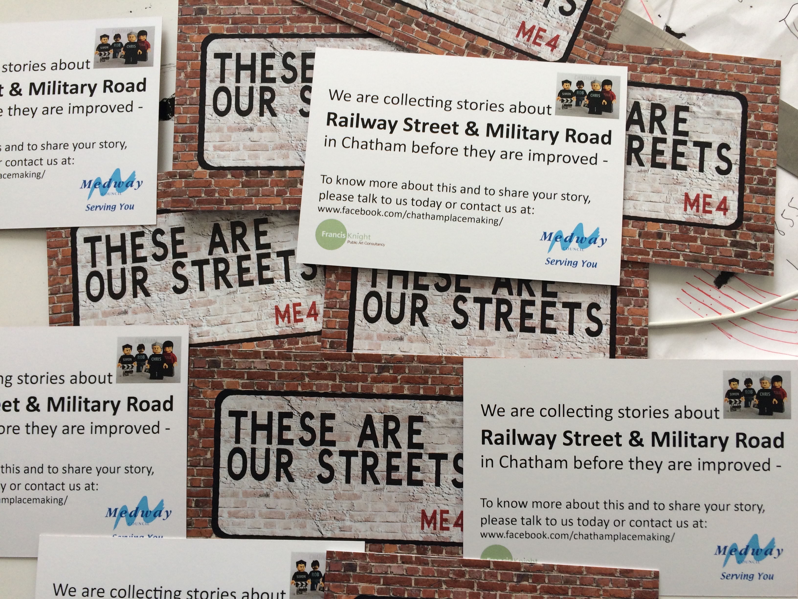
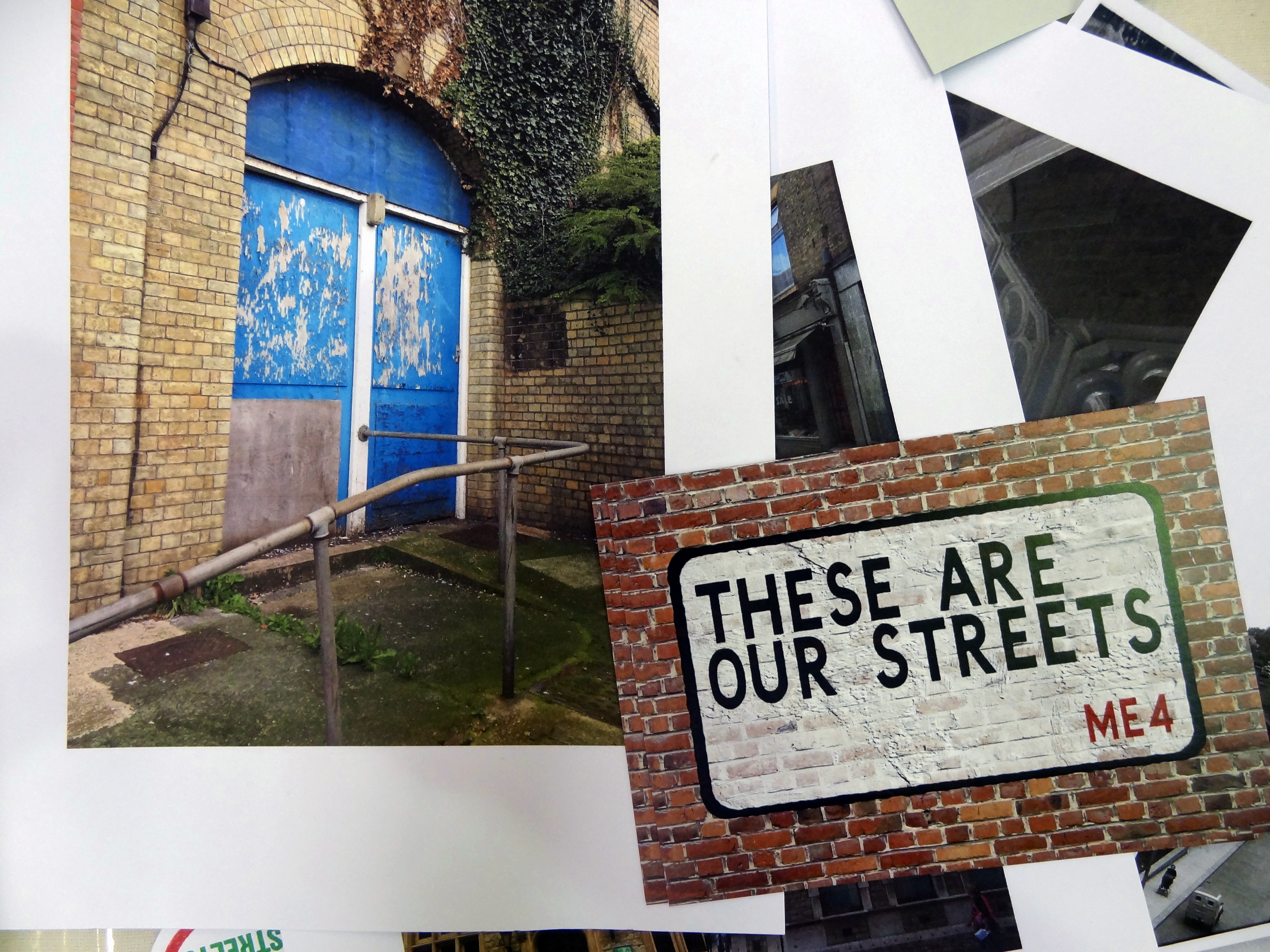
‘These are our Streets’ – Postcards handed out at the Pentagon Shopping Centre. Chatham Placemaking Project. Image: Christopher Tipping
WE HAVE THE POSTCARDS !
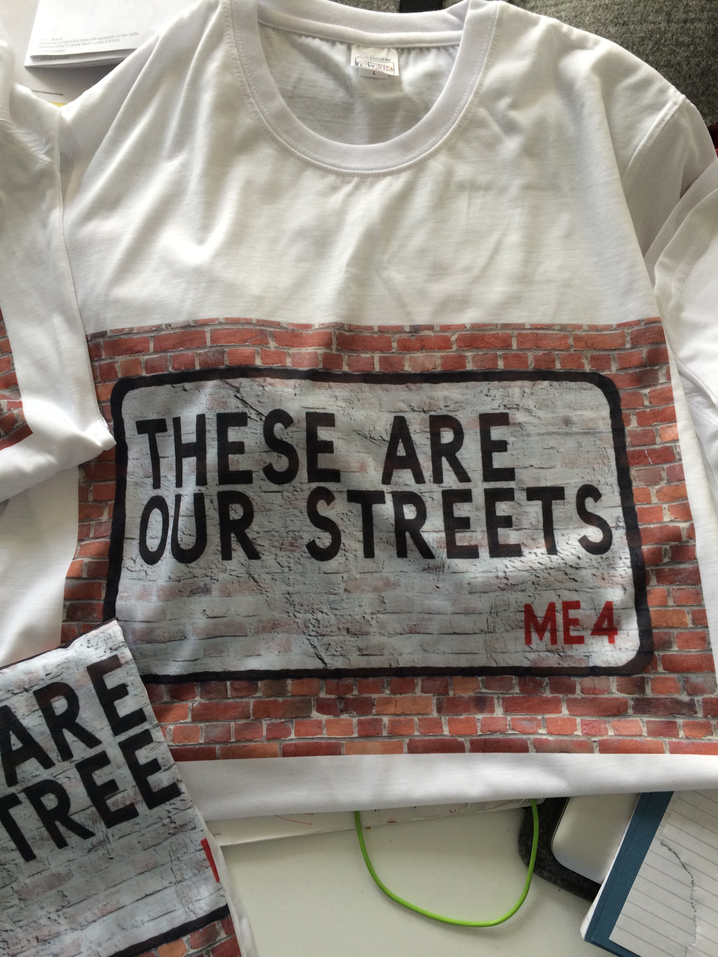
…and we wore the T Shirts! Chatham Placemaking Project. Pentagon Shopping Centre. Image: Christopher Tipping
AND WE WORE THE T SHIRTS !
Very grateful to Shelly Goldsmith, Senior Lecturer in Fashion Textiles: Print at UCA Rochester for producing the shirts for us at very short notice !
Some enthusiastic badge-makers ! Pentagon Shopping Centre. Chatham Placemaking Project. Image: Christopher Tipping
Badges made at our Pentagon Shopping Centre workshop day. Chatham Placemaking Project. Image: Christopher Tipping
Chatting about Chatham’s History at the Pentagon Shopping Centre. Chatham Placemaking Project. Image: Rob Young
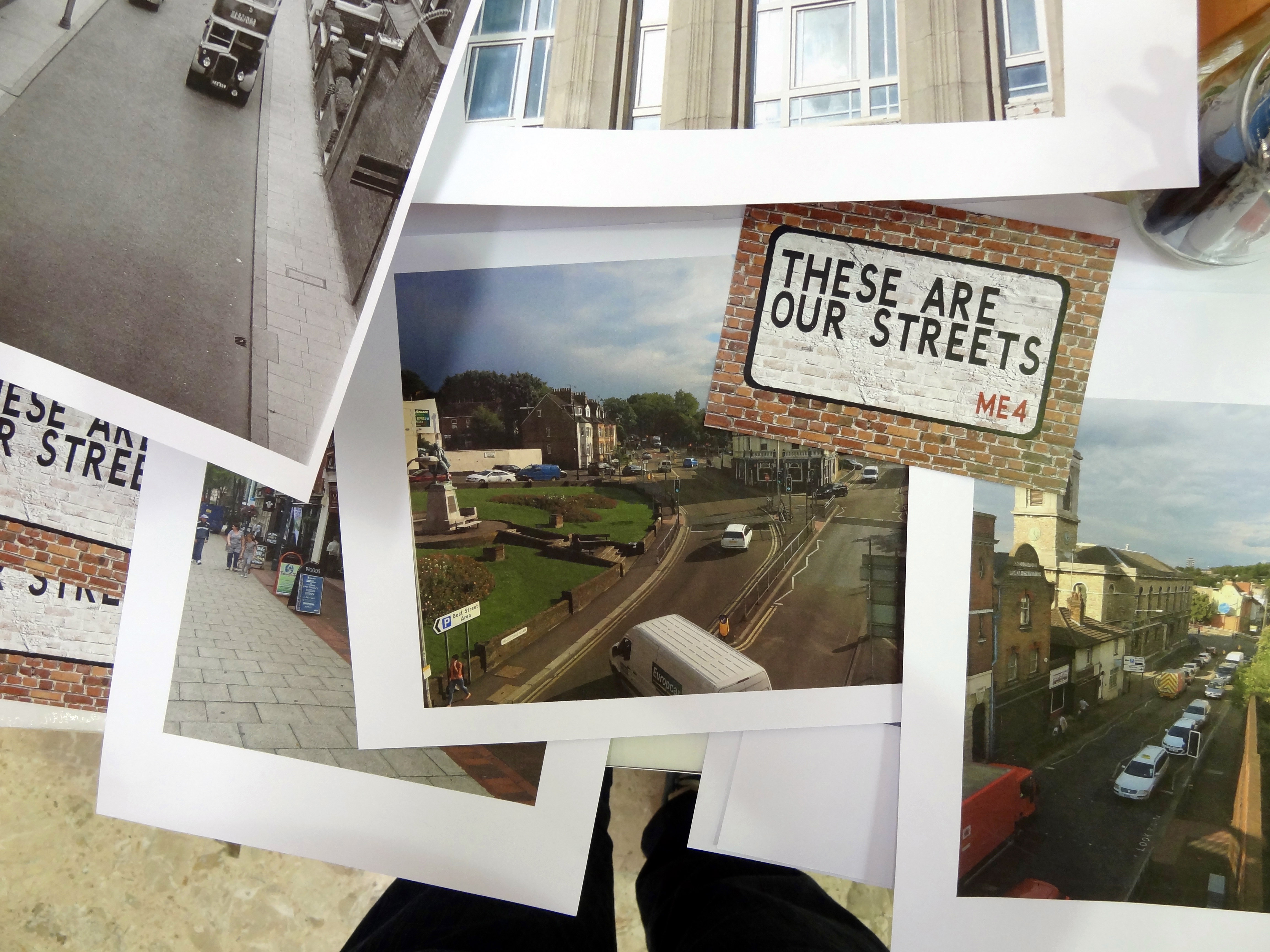
Photographs of Chatham past and present helped to jog memories and start conversations. Chatham Placemaking Project. Image: Rob Young
Photographs of Chatham past and present helped to jog memories and start conversations. Chatham Placemaking Project. Image: Rob Young
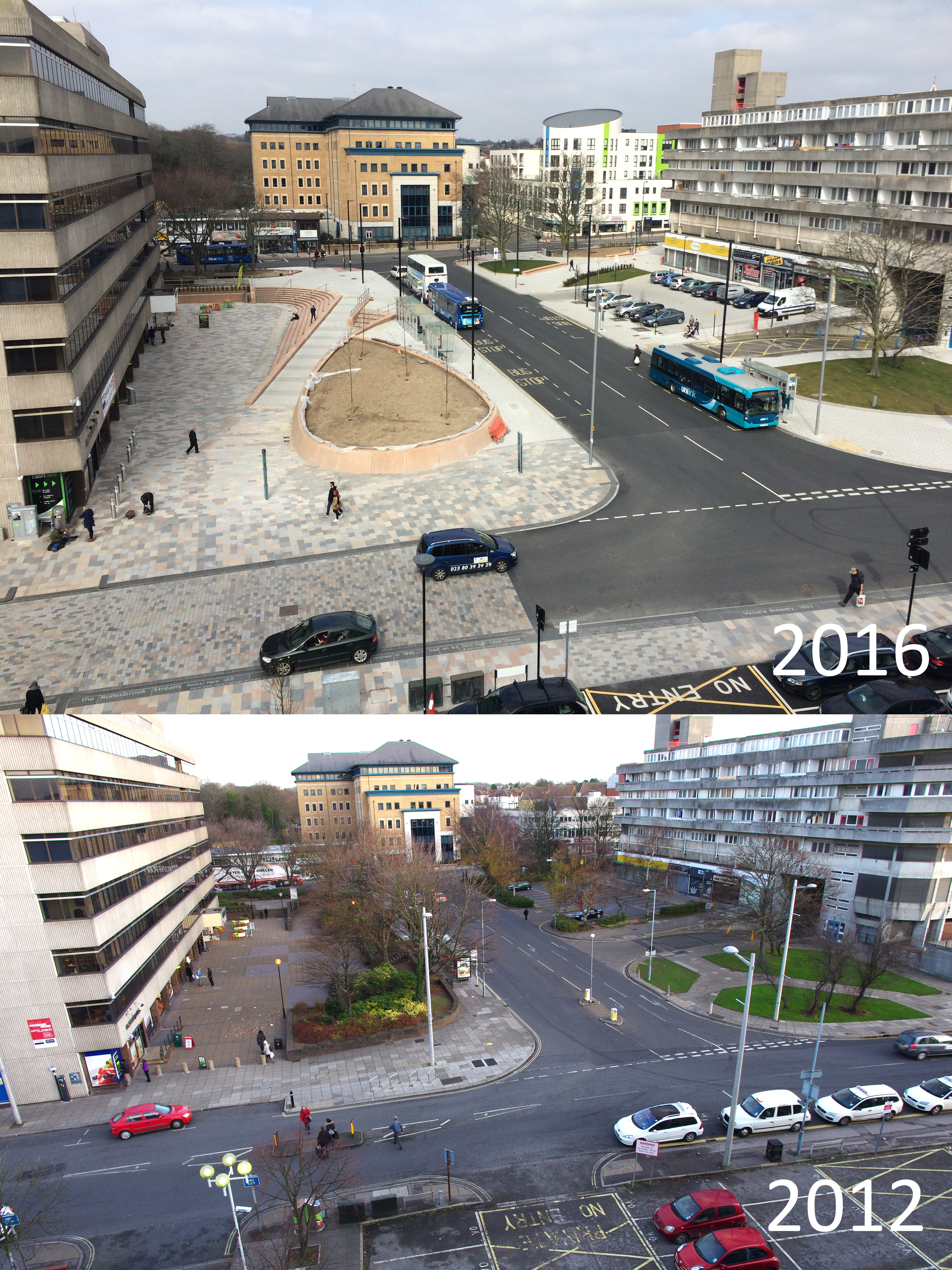
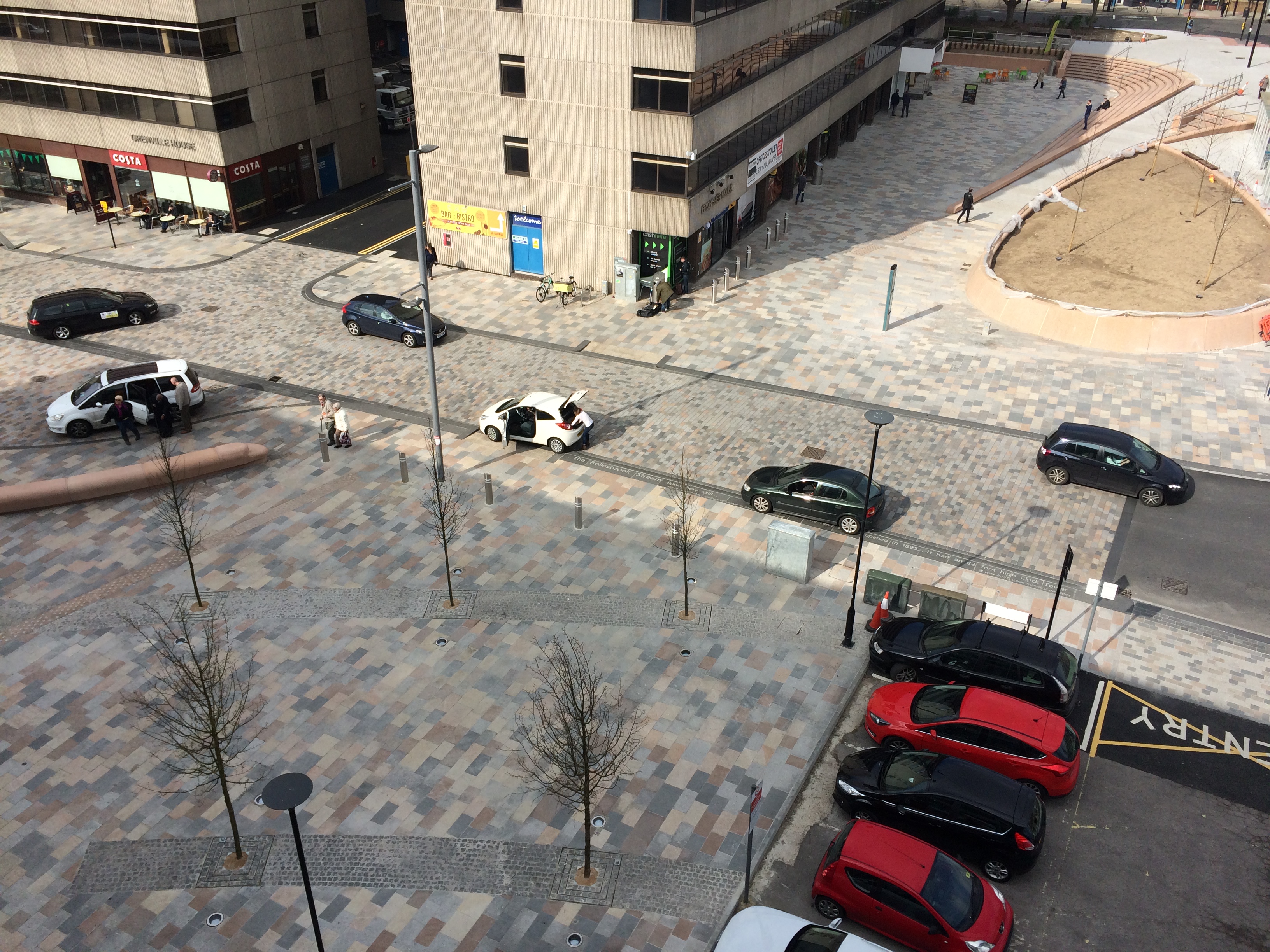
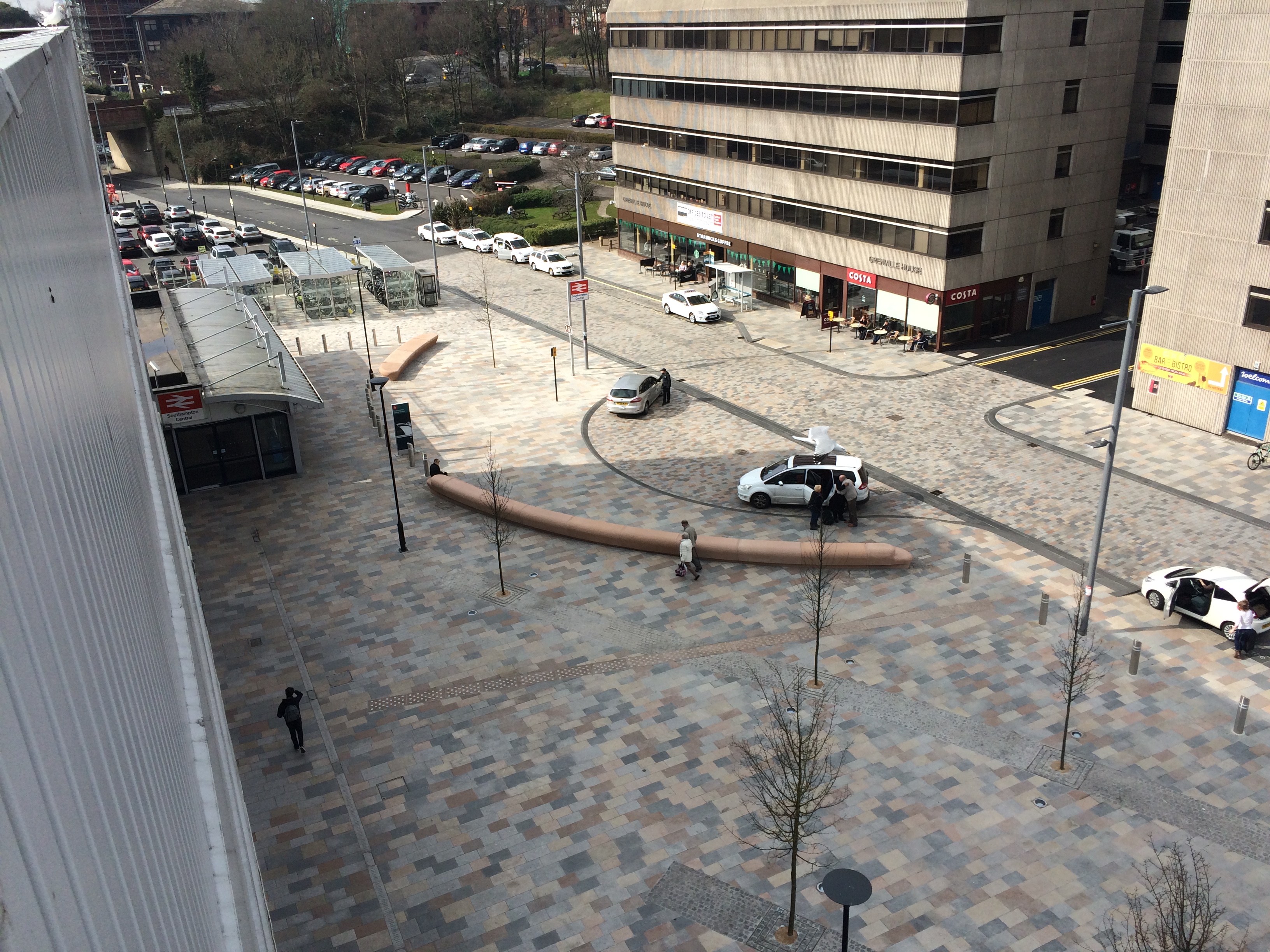
Very much earlier in the project – back in 2012 – one of the Urban Design consultants on the project – I think from Urban Initiatives – managed to get access to the roof of Overline House, which sits adjacent to the train lines and overlooks our site.
This image is seen below – along with another taken this week from a similar vantage point on the roof.
A section of Southampton Station Quarter North Project on Wyndham Place as seen from the roof of Overline House on Blechynden Terrace in 2016 & 2012. 2016 Image by Project Artist Christopher Tipping. 2012 Image by Urban Initiatives.
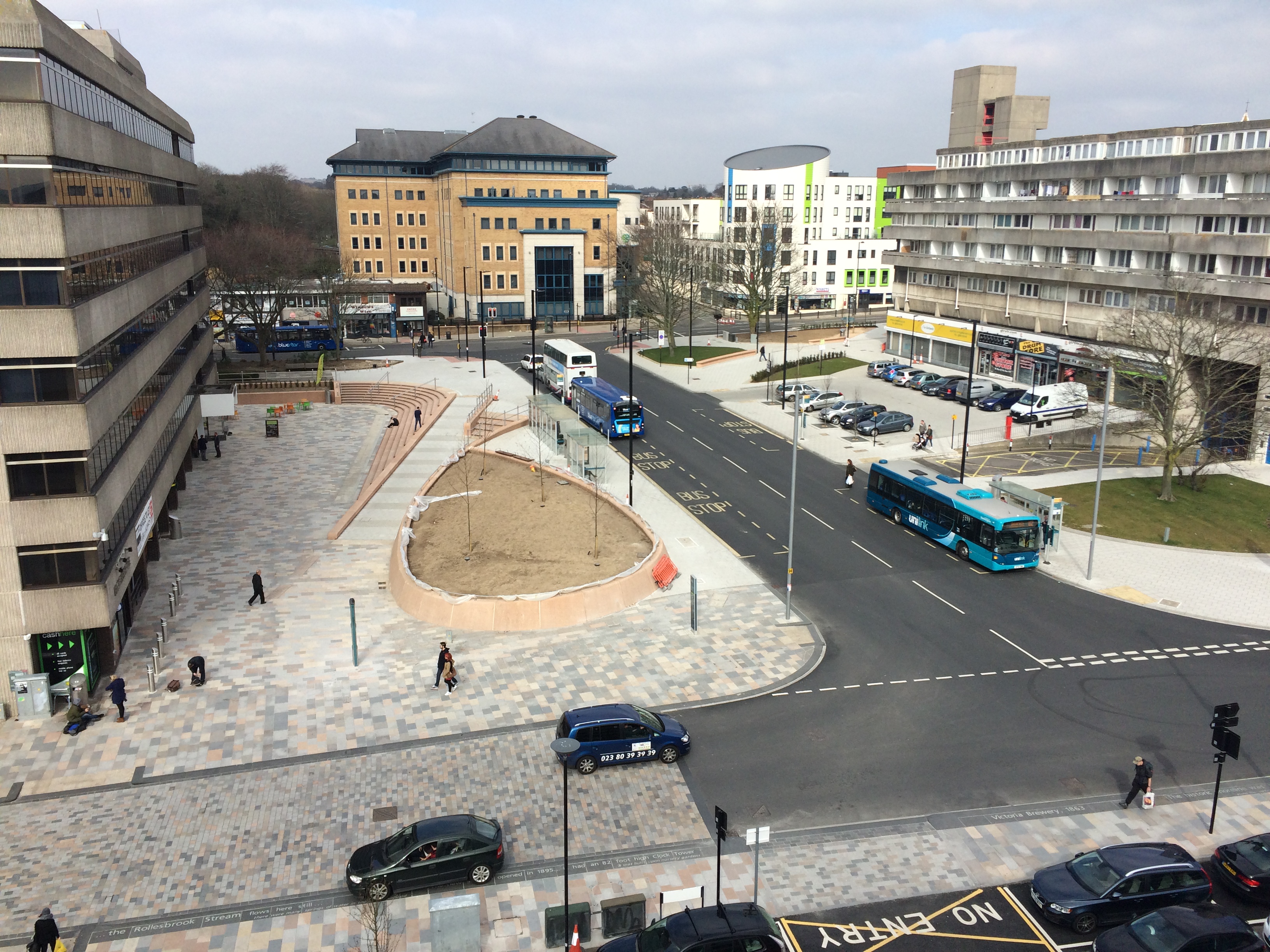
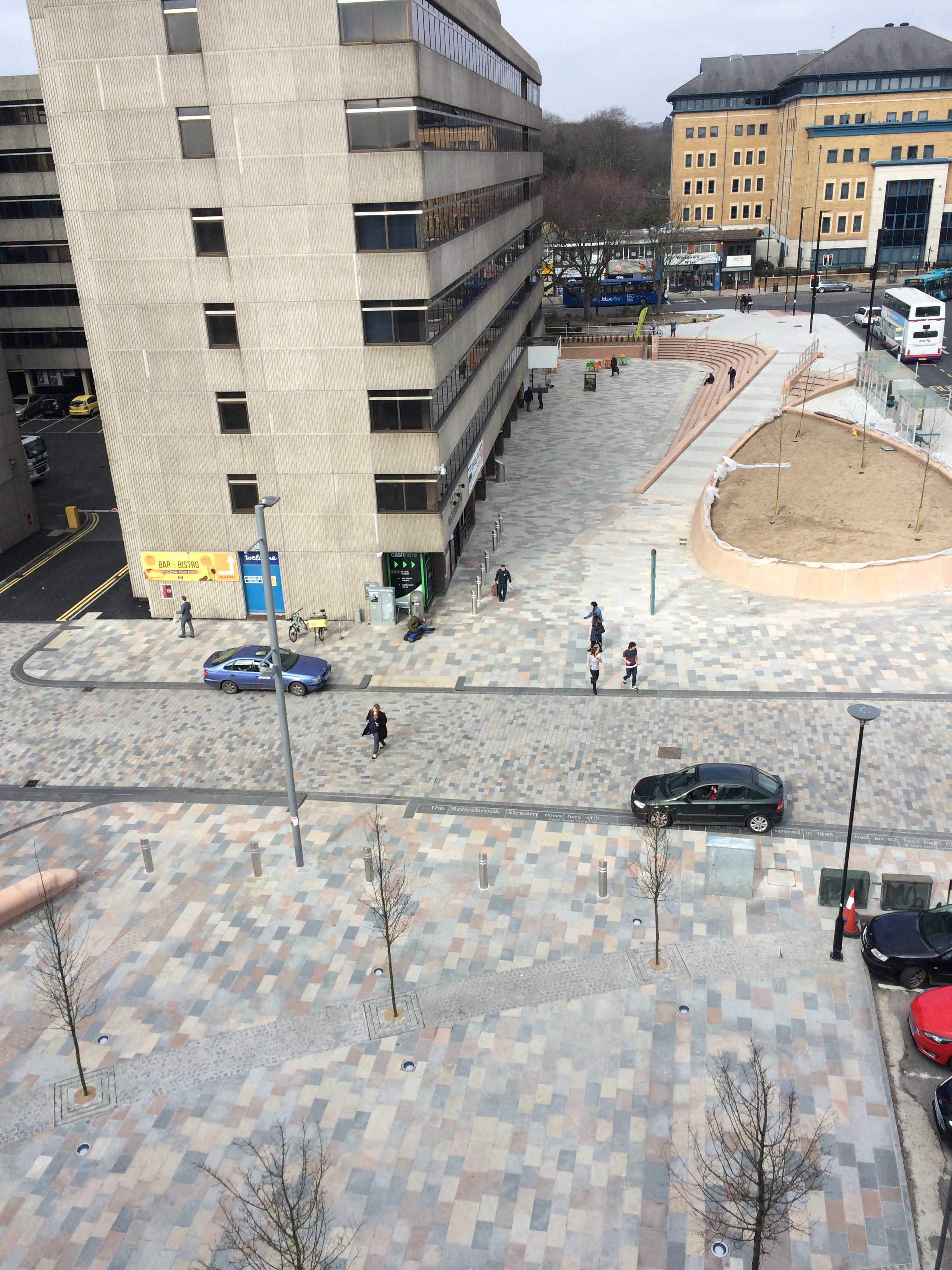
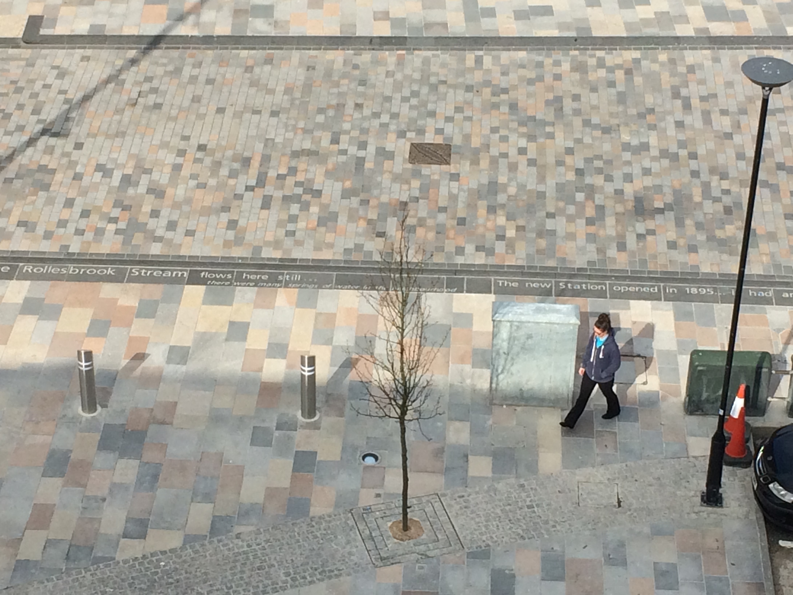
A section of Southampton Station Quarter North Project on Wyndham Place as seen from the roof of Overline House, Blechynden Terrace. Image by Project Artist Christopher Tipping
A section of Southampton Station Quarter North Project, Wyndham Place as seen from the roof of Overline House, Blechynden Terrace. Image by Project Artist Christopher Tipping
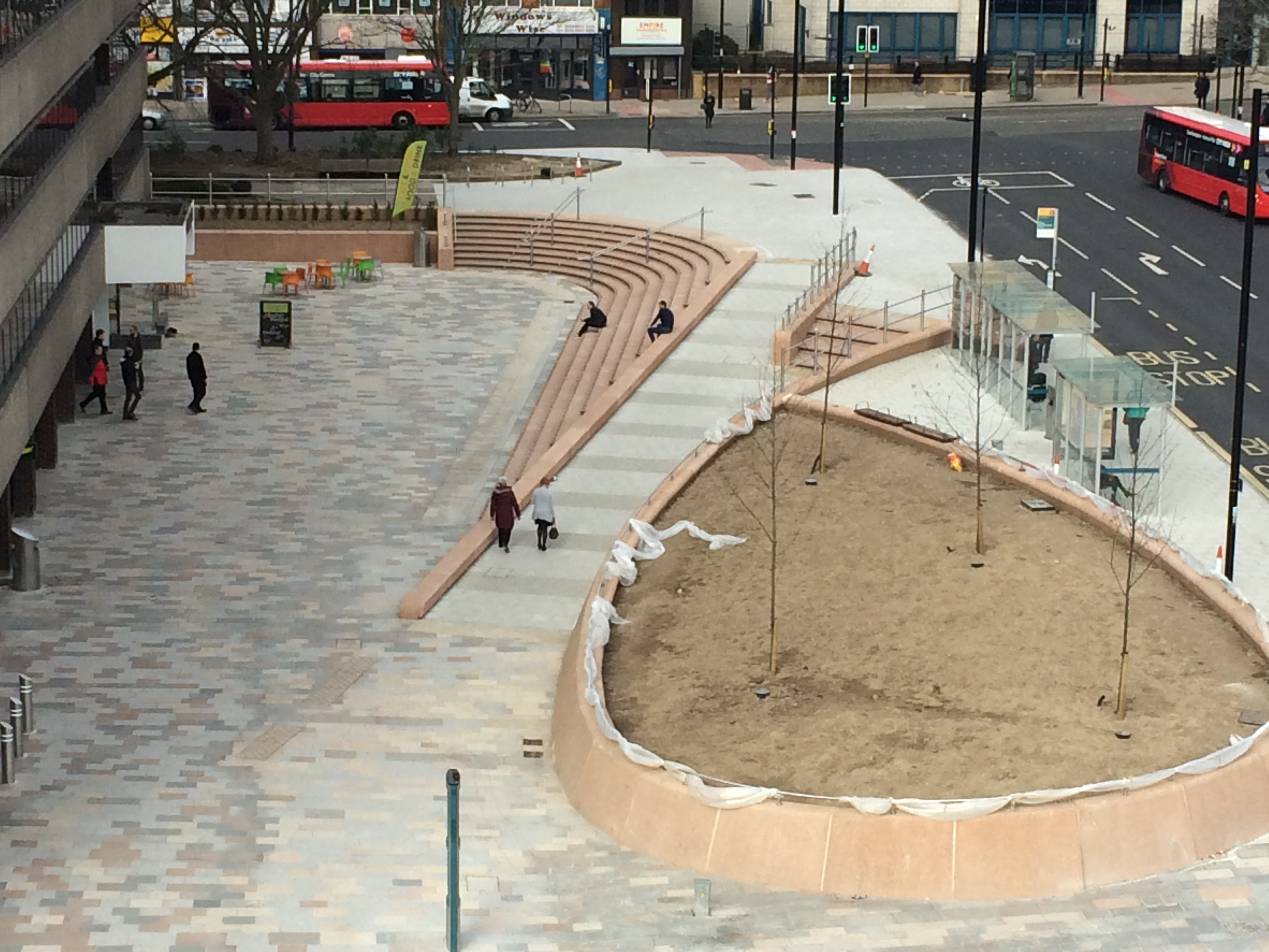
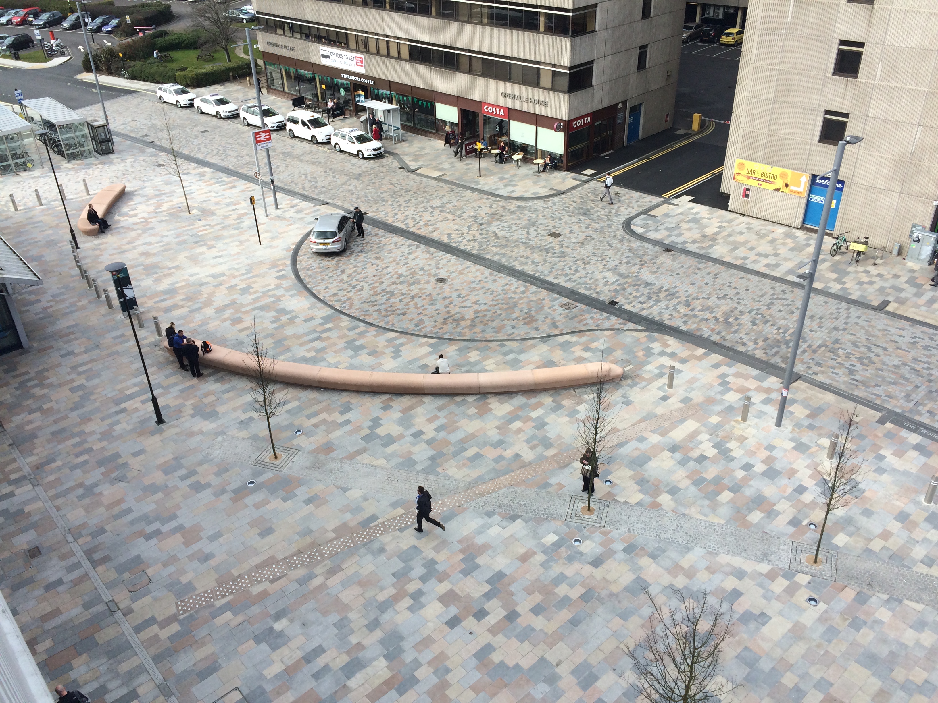
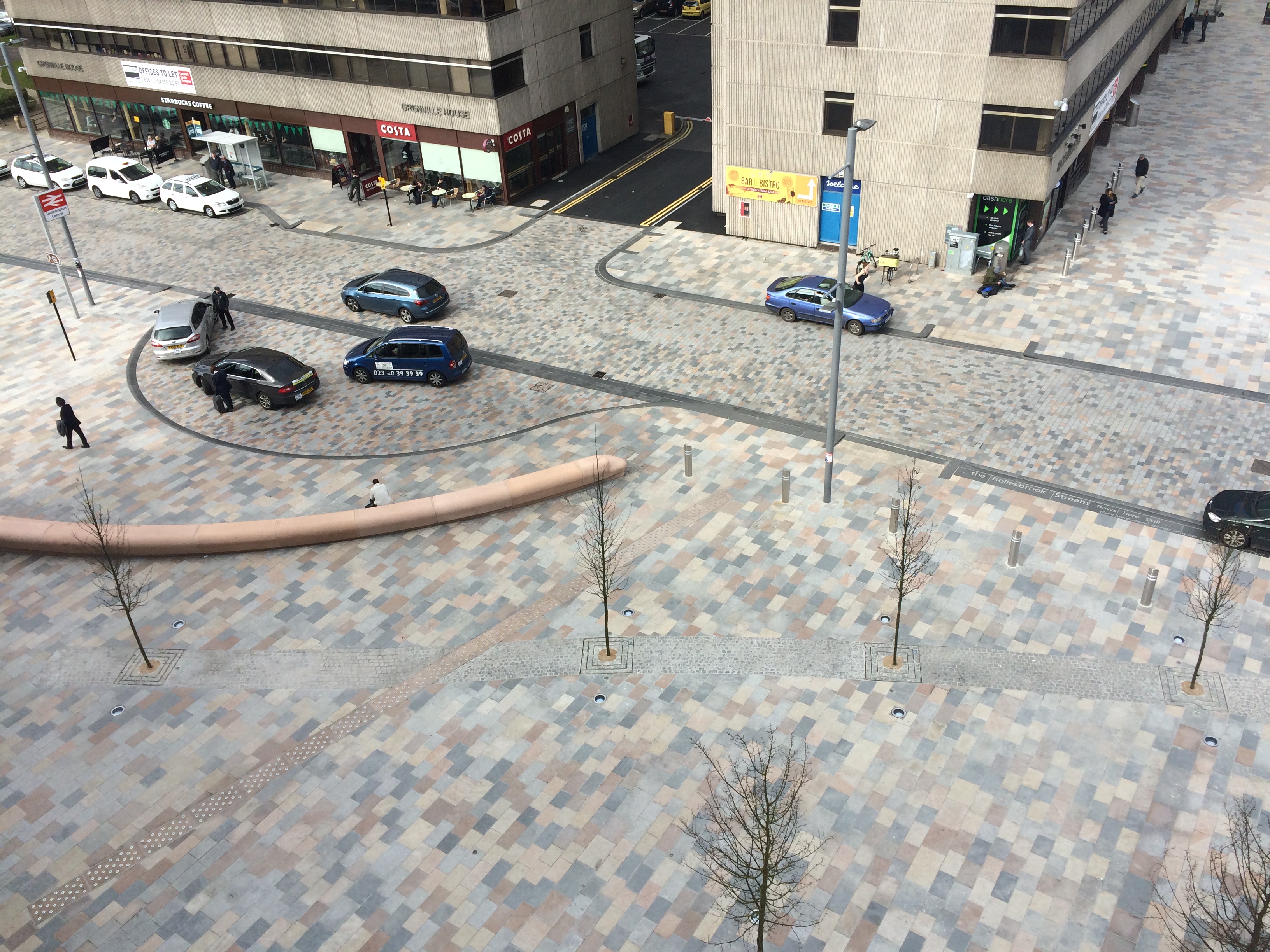
A section of Southampton Station Quarter North Project – Wyndham Place & Station Forecourt as seen from the roof of Overline House, Blechynden Terrace. Image by Project Artist Christopher Tipping
A section of Southampton Station Quarter North Project – Wyndham Place & Station Forecourt as seen from the roof of Overline House, Blechynden Terrace. Image by Project Artist Christopher Tipping
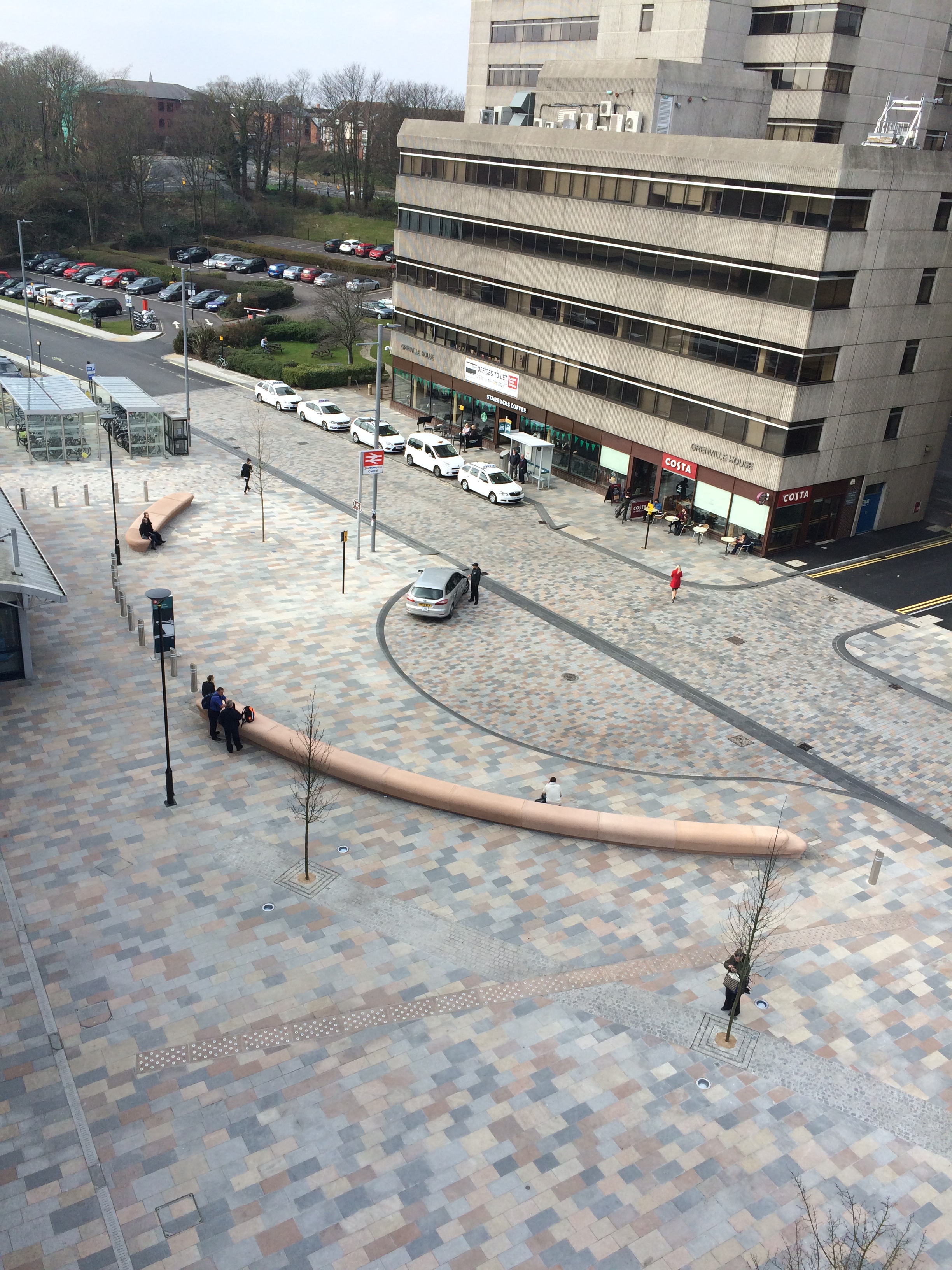
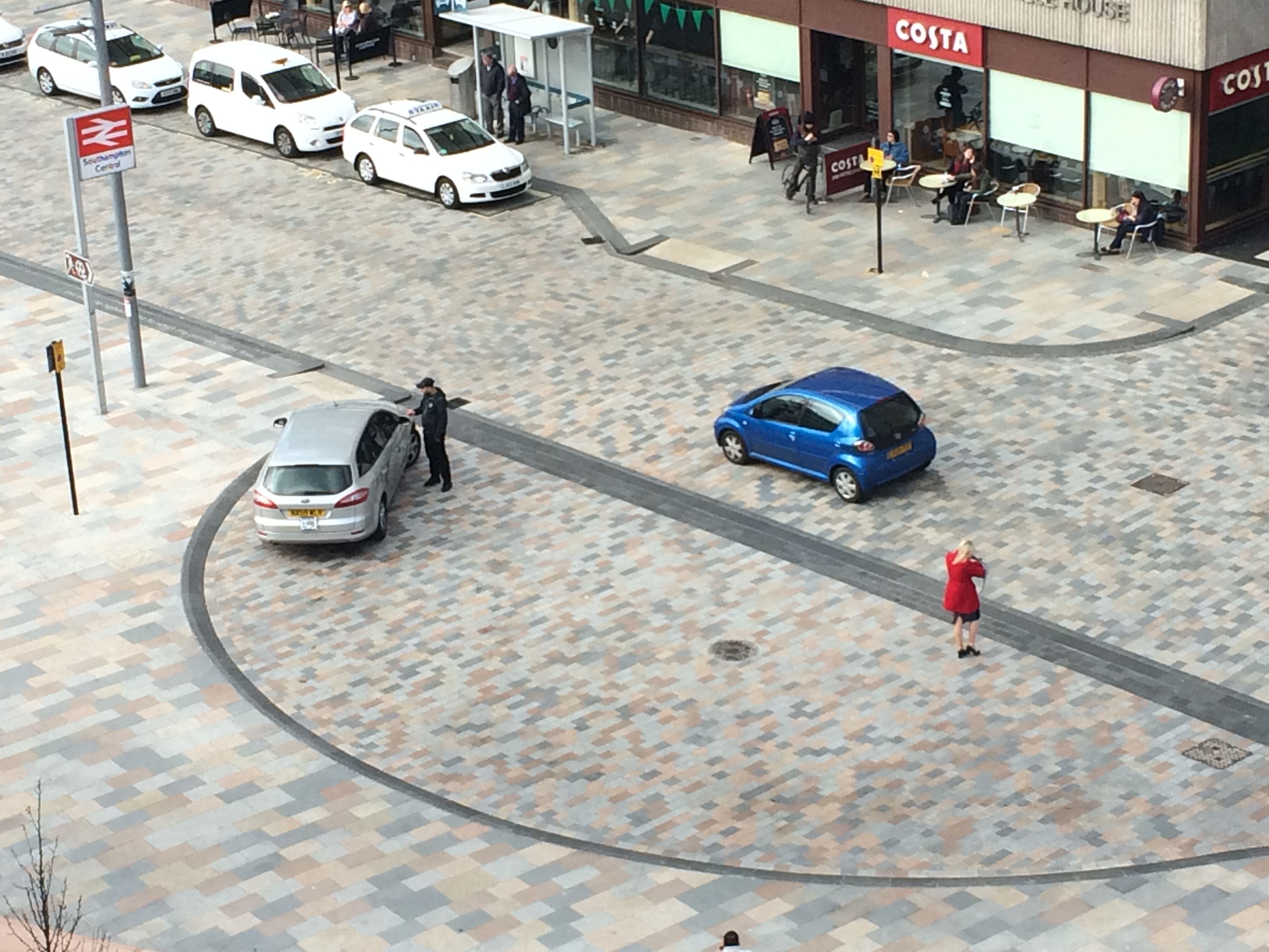
A section of Southampton Station Quarter North Project – Blechynden Terrace & Station Forecourt as seen from the roof of Overline House, Blechynden Terrace. Image by Project Artist Christopher Tipping
A section of Southampton Station Quarter North Project – Blechynden Terrace & Station Forecourt as seen from the roof of Overline House, Blechynden Terrace. Image by Project Artist Christopher Tipping
A section of Southampton Station Quarter North Project – Blechynden Terrace & Station Forecourt as seen from the roof of Overline House, Blechynden Terrace. Image by Project Artist Christopher Tipping
A section of Southampton Station Quarter North Project – Blechynden Terrace & Station Forecourt as seen from the roof of Overline House, Blechynden Terrace. Image by Project Artist Christopher Tipping
A section of Southampton Station Quarter North Project – Blechynden Terrace & Station Forecourt as seen from the roof of Overline House, Blechynden Terrace. Image by Project Artist Christopher Tipping
A section of Southampton Station Quarter North Project – Blechynden Terrace & Station Forecourt as seen from the roof of Overline House, Blechynden Terrace. Image by Project Artist Christopher Tipping
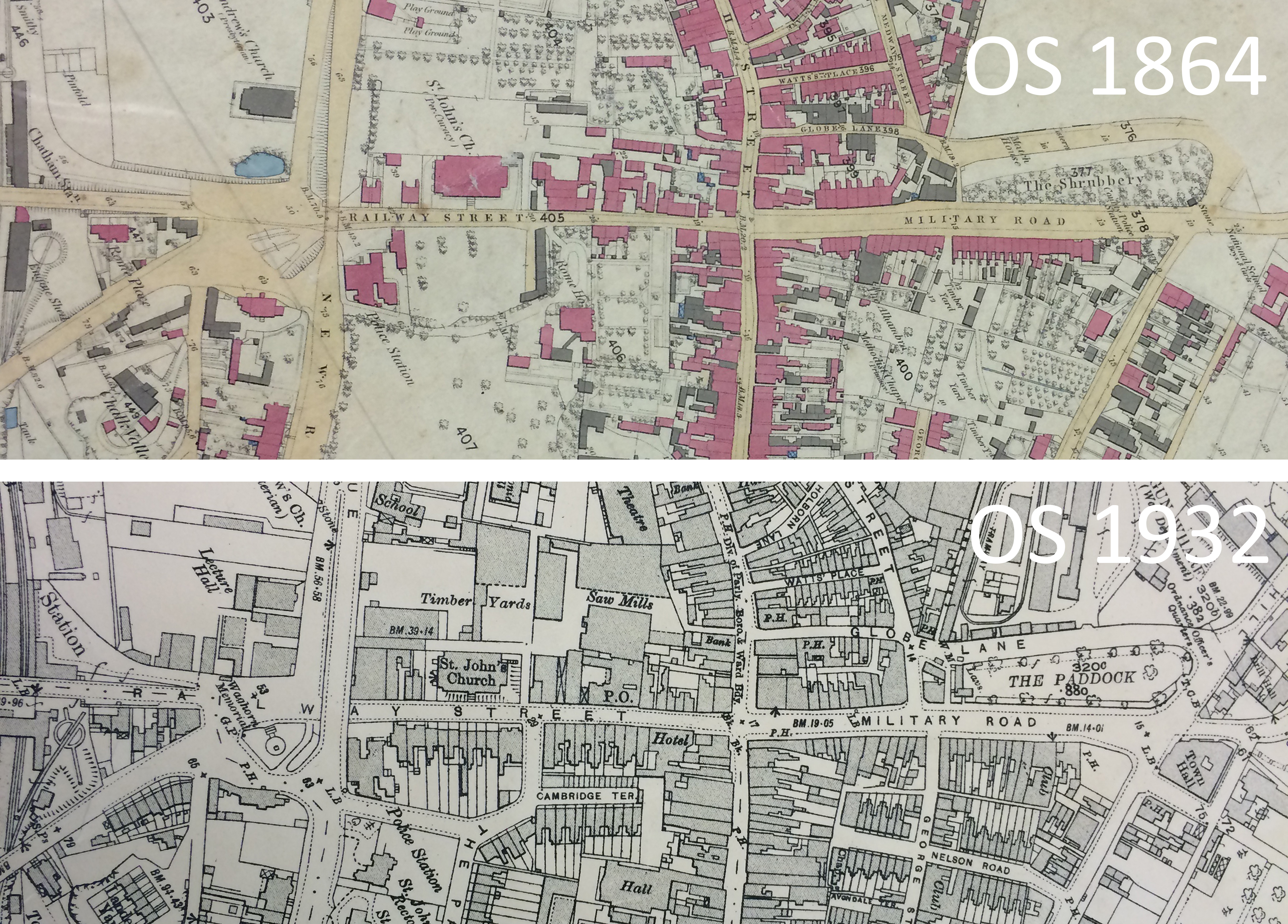
Details from OS 1864 & OS 1932 Maps of Chatham – by permission of Medway Archives and Local Studies Centre. Chatham Placemaking Project. Image: Christopher Tipping
The two OS Maps above show developments along the project route over 68 years between 1864 and 1932. The maps can be read left to right – from Chatham Station, along Railway Street, Military Road and The Paddock. Of particular interest is the area just above St John’s Church. In 1864 this appears to have been private gardens or grounds, with trees or orchards planted. BY 1932 this had all been consumed by timber Yards and Sawmills. This was the site of Scott’s Timber Yard.
The new development at Orchard Park, due for completion in 2017 is to be called ‘Harrison Park’ , 100 years after Jack Harrison VC, a former Hull FC Rugby League Star was killed at Oppy Wood, Arras, France in 1917 during the First World War.
A Pinterest Board of research images about Orchard Park and its history, can be found here.This will be added to throughout the project.
Hull was awarded City of Culture 2017so there is much to celebrate in the lead up to this brilliant event for the city.
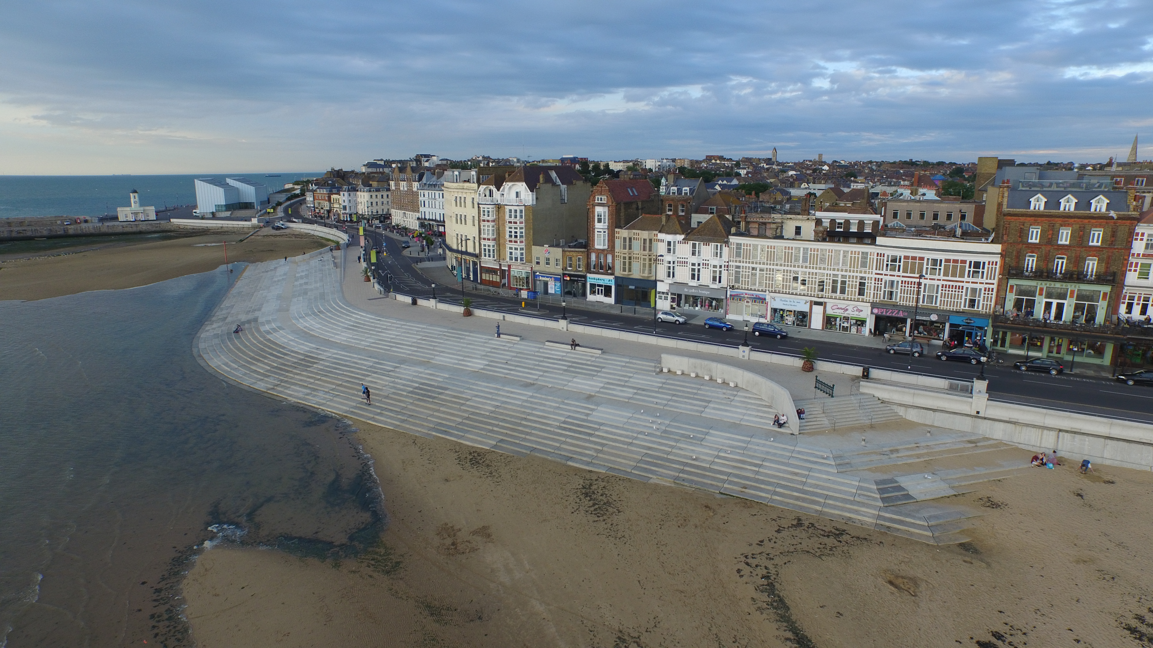
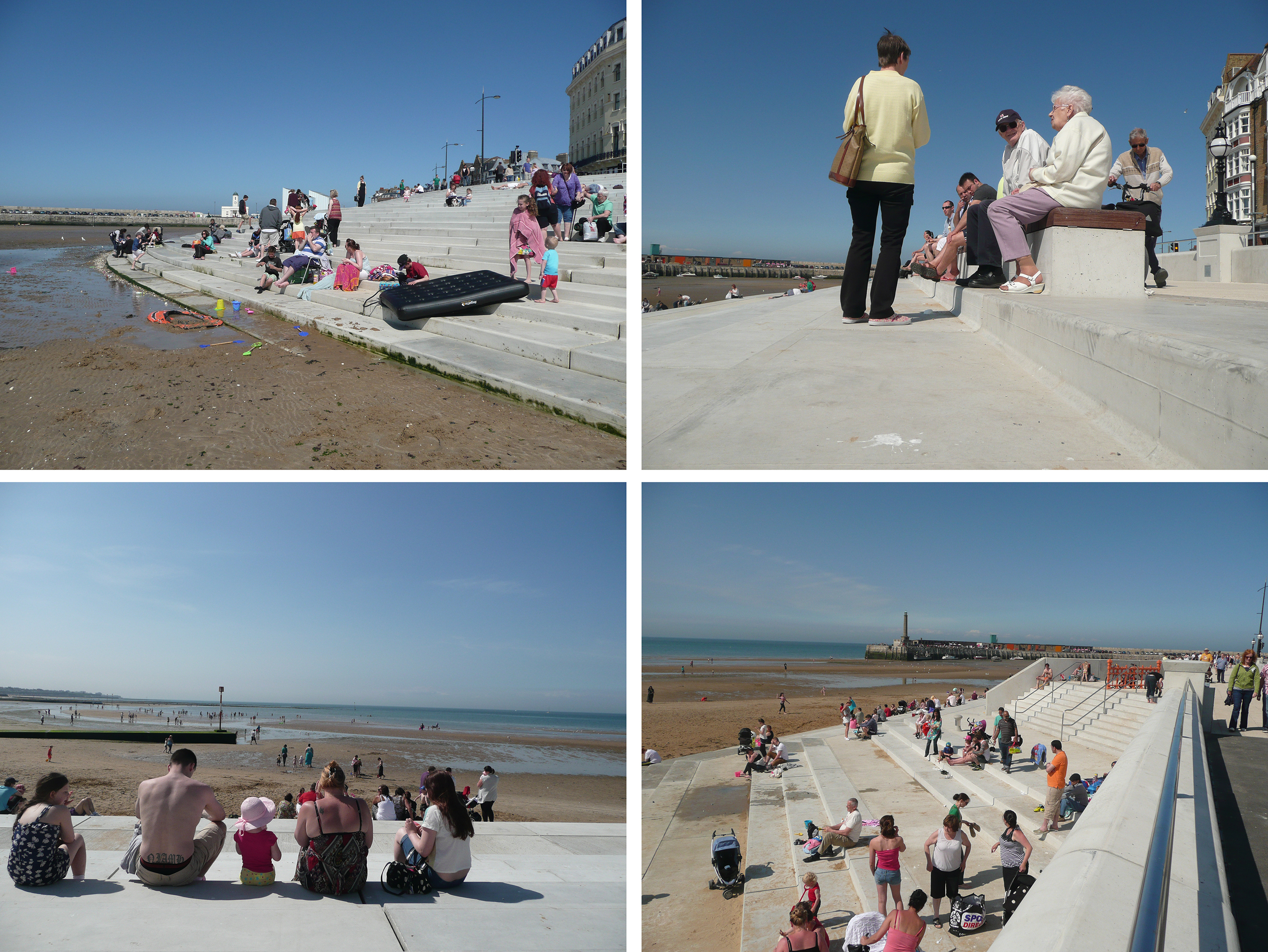
I met up with Laura Knight and Louise Francis of FrancisKnight Public Art Consultants along with Neil Mattinson and Jennifer Corlett of LDA Design. Neil & Jennifer hadn’t visited Margate or the Margate Steps before so this was a good opportunity to see a successful coastal engineering project , which also happens to provide a considerable and much need public realm and meeting place for residents and visitors alike. The project also encompasses much of Margate’s legacy and heritage as a seaside town which has seen storms and weather act as the primary catalyst for changes and regeneration.
My role as project artist within the integrated design team on the Margate Coastal Flood & Protection Project – aka Margate Steps – was to influence and challenge the design process via contextual and site responsive research and collaborative practice. The scope for influencing the process within the Chatham Placemaking Project is a similar one – albeit a much shorter consultancy – and is as much about a collaborative and discussive one.
This was a useful and engaging meeting, where we had an open discussion about the scope for the Chatham project, whilst also experiencing and reviewing a recent regeneration project at first hand.
I have now made two visits to Merthyr Tydfil & am preparing to go up again this week for two days to meet with the project team and Capita, who will be delivering the Bus Station. Capita recently completed the The River Taff Central Link and Bridge – a new road system that connects Merthyr Learning Quarterat the existing Penry Street Bridge, through Avenue De Clichy, across the new road bridge located south of Swan Street, and via the new road in front of the College. The new bridge is a major landmark for the town.
The town centre is fascinating & has some wonderful architecture. Just remember to look up above the shop fronts to see the architectural detail! Key anchor buildings are still extant & a good deal of regeneration is breathing new life into these buildings and by default, back into the town centre. The RedHouse, an arts and cultural centre – in the former Town Hall – is a singular example of great regeneration practice & takes in the adjoining Penderyn Square – “As part of the Heritage Quarter development, a new civic square outside the renovated Old Town Hall will be a key focal point for the cultural identity of Merthyr Tydfil. The square will be a vibrant environment that will host events across the year celebrating the heritage of the town”.
I have done a lot of walking and am talking to whoever I can to enlighten me on the legacy and heritage of the town, but also about its aspiration and spirit for the future.
I have also been asked to contribute to a feasibility study commissioned by Merthyr Tydfil CBC, to look into replacing the existing footbridge link from the College, to St Tydfil’s Shopping Centre with a new footbridge which also extends to the site of the new Bus Station on Swan Street. The project is being delivered by Mott MacDonald & Knight Architects. This pedestrian connectivity is a critical element in unifying the accessibility of trains, buses and pedestrian routes in the town. It serves also to improve and build upon the visual impact a new footbridge may have as a landmark attraction and destination along the Taff Trail, bringing more tourists and visitors to the town centre.
The site of the new Bus Station on Swan Street. Image: Christoher Tipping
This site, on the corner of Swan Street and Avenue de Clichy was until recently, the home of the Hollies Health Centre, which has now moved to state of the art new facilities in the Keir Hardie Health Park at Cyfarthfa. The old buildings have now been demolished. The old Police Station – right & centre of picture, is also in process of demolition to make way for the Bus Station. The back of the St Tydfil’s Shopping Centre can be see on the left of this image.
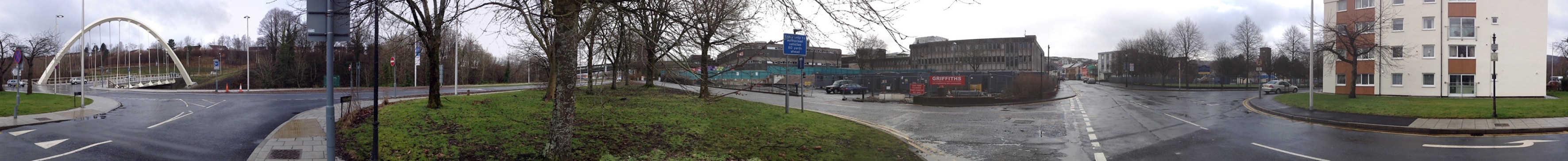
The new Bus Station site as seen from the new River Taff Road bridge. Image: Christopher Tipping
360 Panoramic image of the Swan Street site. Residential flats and two schools lie to the south of the site & a sensitive response is imperative. Image: Christopher Tipping
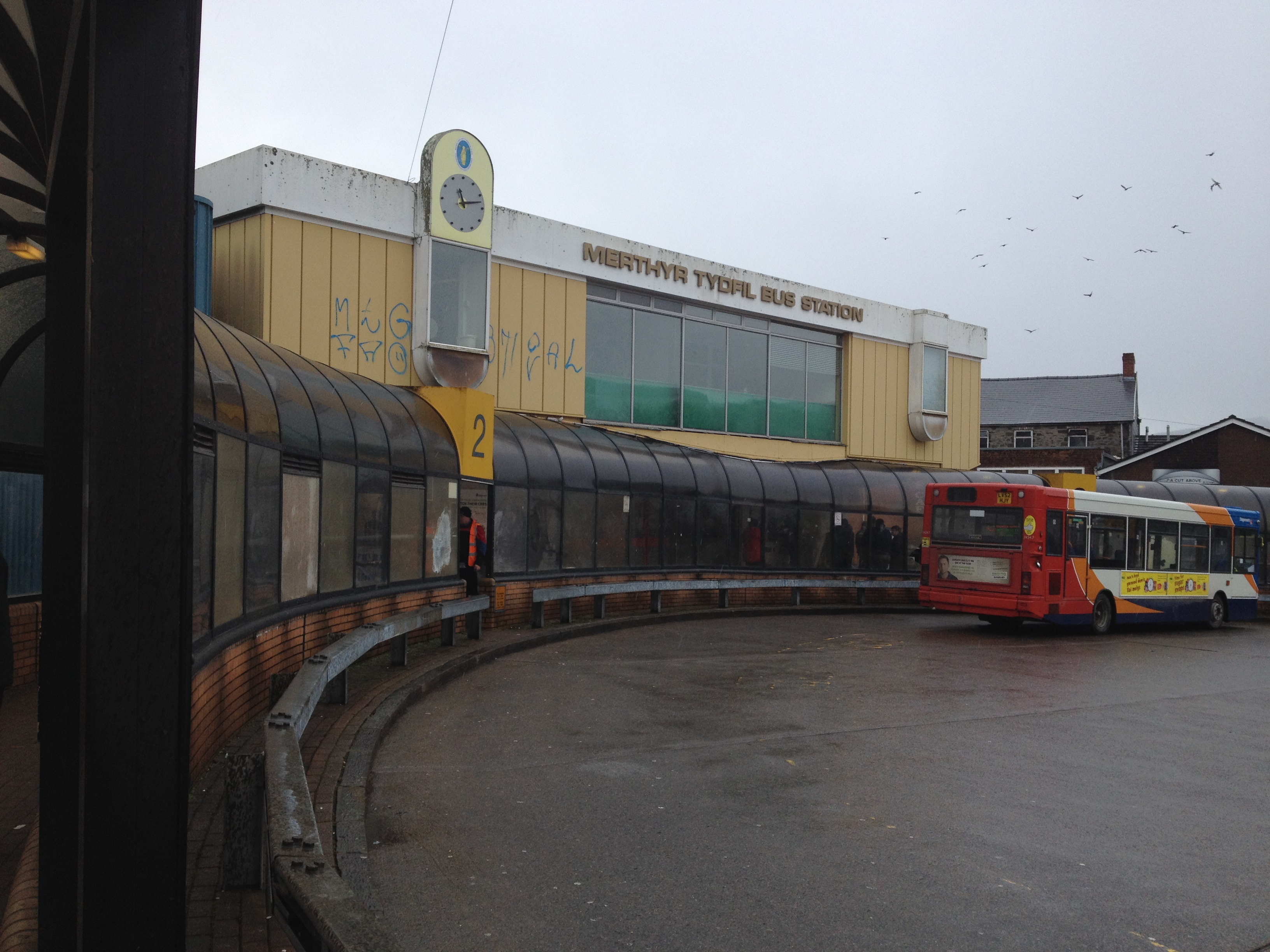
The current Bus Station off Castle Street. Image: Christopher Tipping
This image looks grim, but to be fair, the weather on the day was dreadful ! If you turned around, the views out to the surrounding hills are great, even on a horrible day. Castle Street now leads onto the new River Taff Central Link Road at one end and the Redhouse at the other – both, great examples of the power of regeneration schemes in the town to make credible changes.
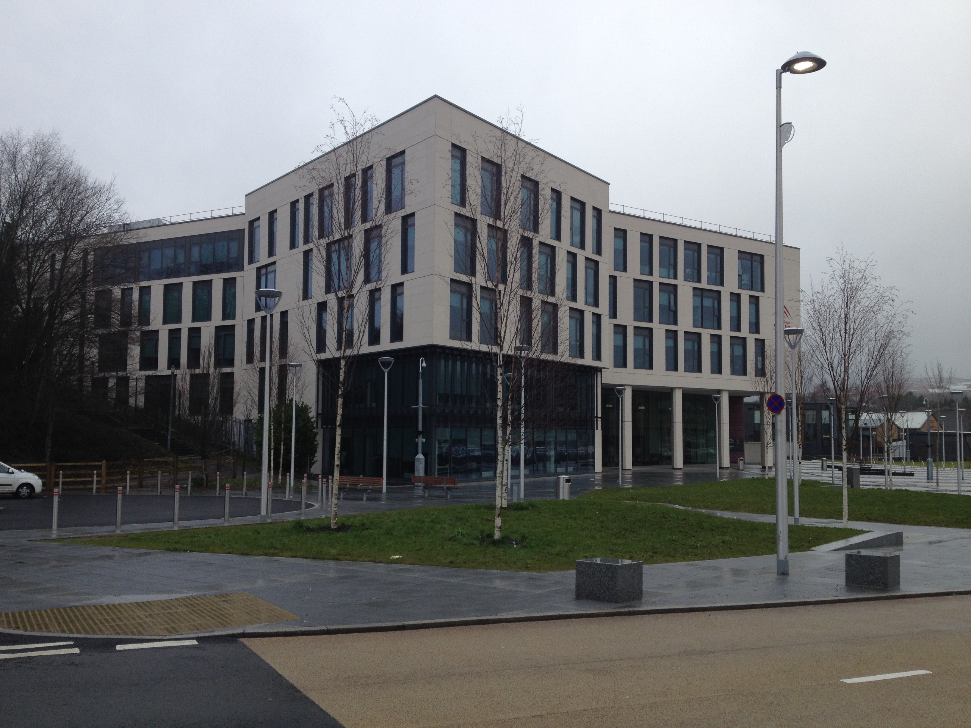
The College, Merthyr Tydfil, which opened on September 2nd 2013. Image: Christopher Tipping
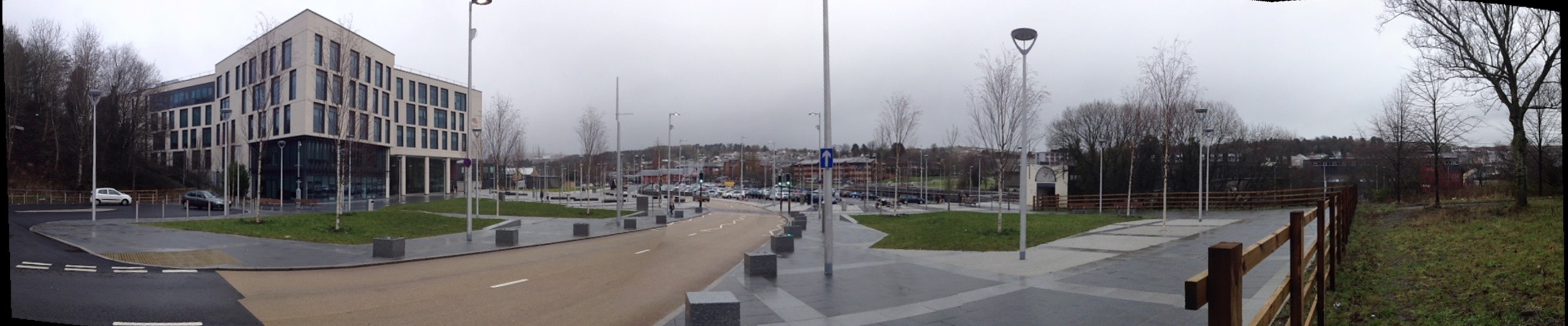
Panoramic image of the College at Merthyr Tydfil showing the new road and extensive public realm. The River Taff footbridge is at the far right of this image. Image: Christopher Tipping
This area was the site of the former Ynysfach Ironworks, owned and run by the Crawshay Family of Cyfarthfa Ironworks. The new road seen running through the site above almost follows the path of the former Glamorganshire Canal,which was fully opennd in 1794 and declined progressively between 1898 & 1951. Much of the Canal route is now buried beneath the A470 Cardiff to Merthyr Tydfil Truck Rd.
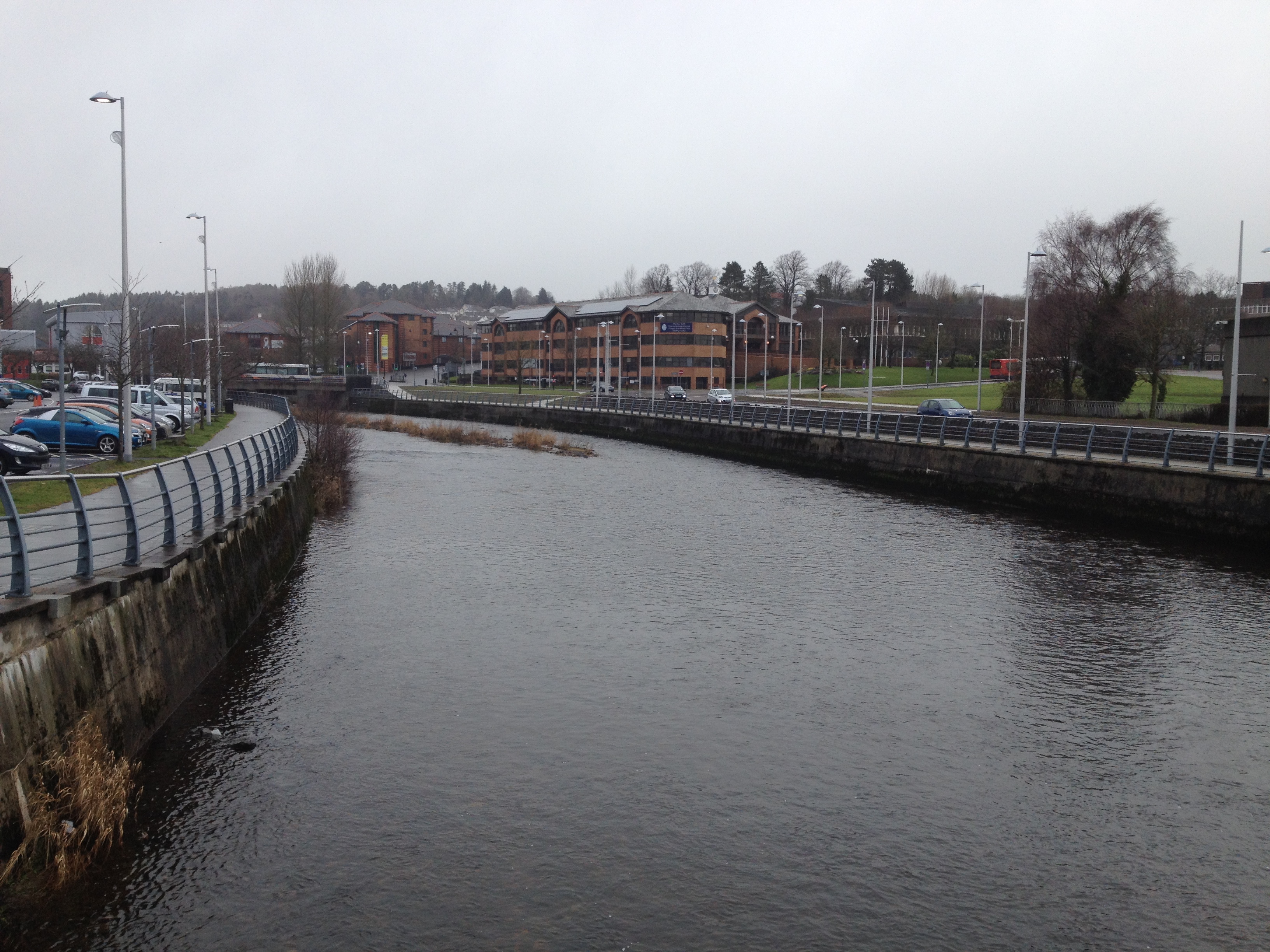
The view upstream from the River Taff Footbridge. towards the Civic Centre. Image: Christopher Tipping
Where the River Taff meanders to the left in the above image and turns the corner, was the site of the Ynysgau Iron Bridge, one of the first Cast Iron Bridges built anywhere in the world, started in 1799 & completed in 1800. The bridge was designed and built by Watkins George, a brilliant engineer working for Richard Crawshay of CyfarthfaIronworks, known as the Iron King. The bridge was constructed for the workforce to cross the Taff to reach the Ironworks. It was dismantled in 1963 and is now stored by Merthyr Tydfil CBC.
Sections and details of the Ynysgau Iron Bridge, dismantled in 1963 and now stored by Merthyr Tydfil CBC. Image: Christopher Tipping
Communications and advances in transport were critical factors behind the expansion of Iron production during the Industrial Revolution. Natural water supplies found in the Taff and its tributaries & streams provided the source of power, but this had to be managed and controlled. Innovation and technological advances were the powerhouses.
Merthyr Tydfil may no longer claim to be the Iron Capitol of the world, but transport and innovation continues to be the catalyst for change in the area.
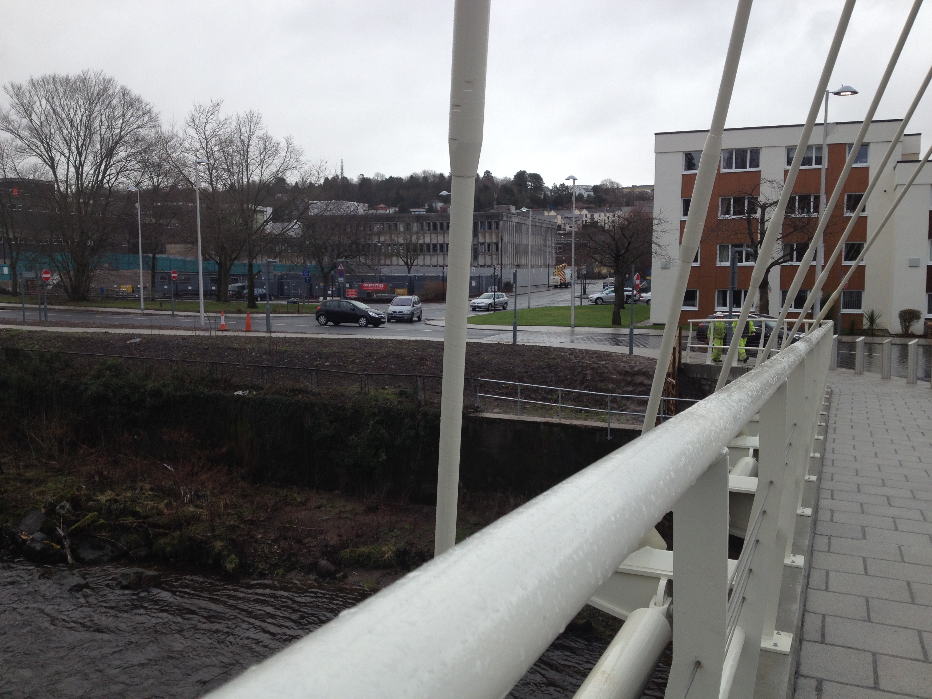
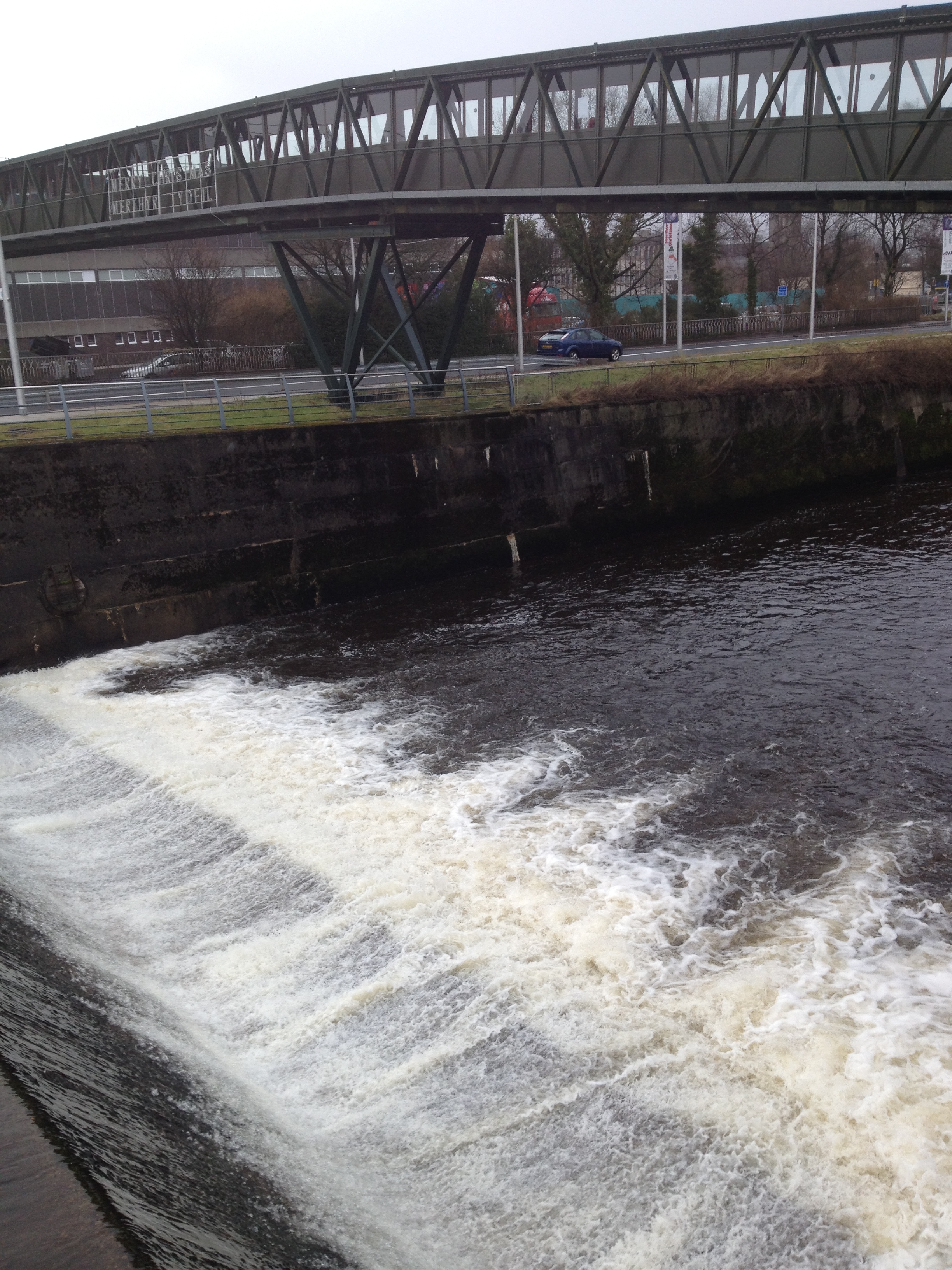
The River Taff footbridge crosses just below the weir from the College to St Tydfils Shopping Centre. Image: Christopher Tipping
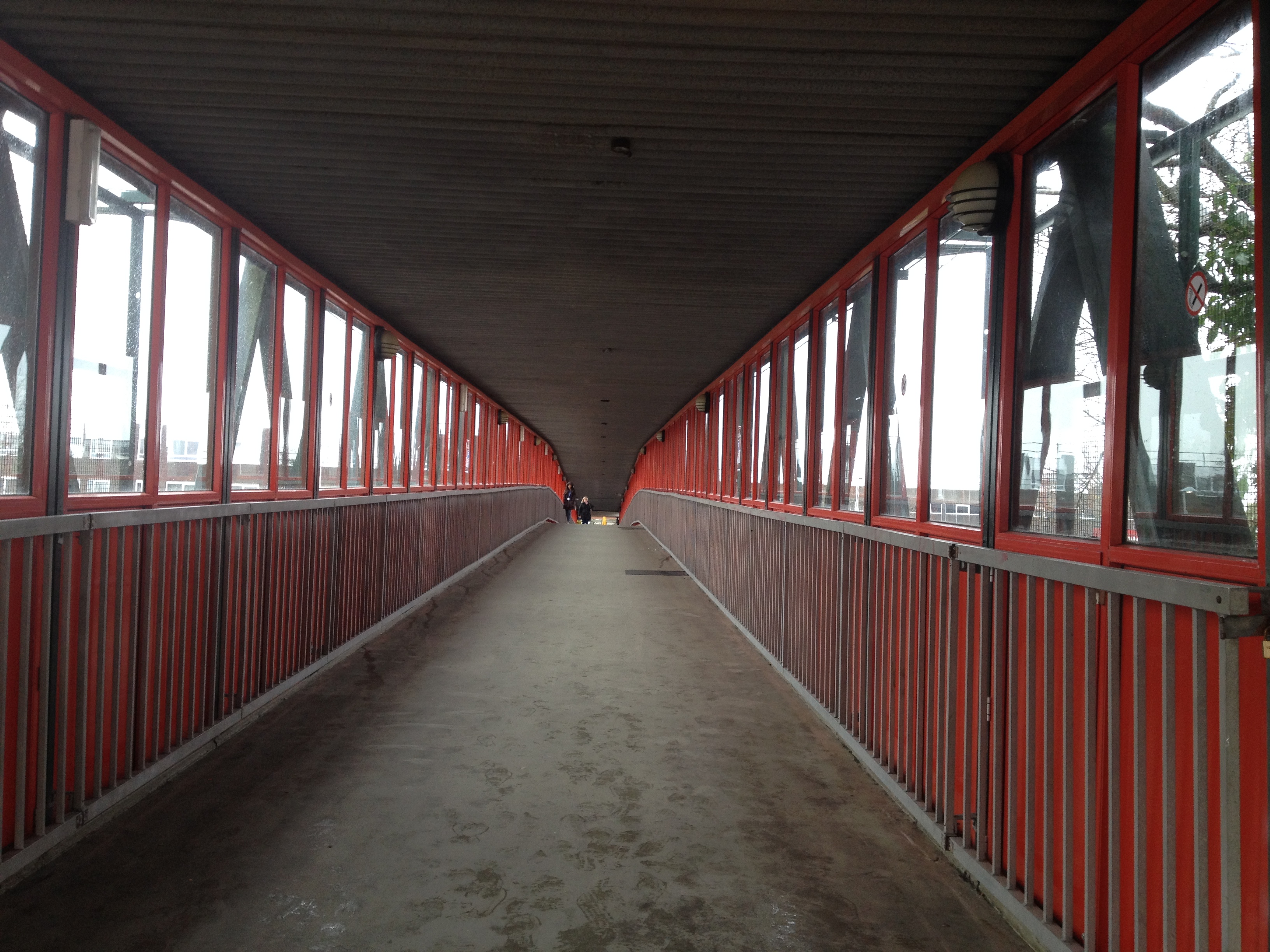
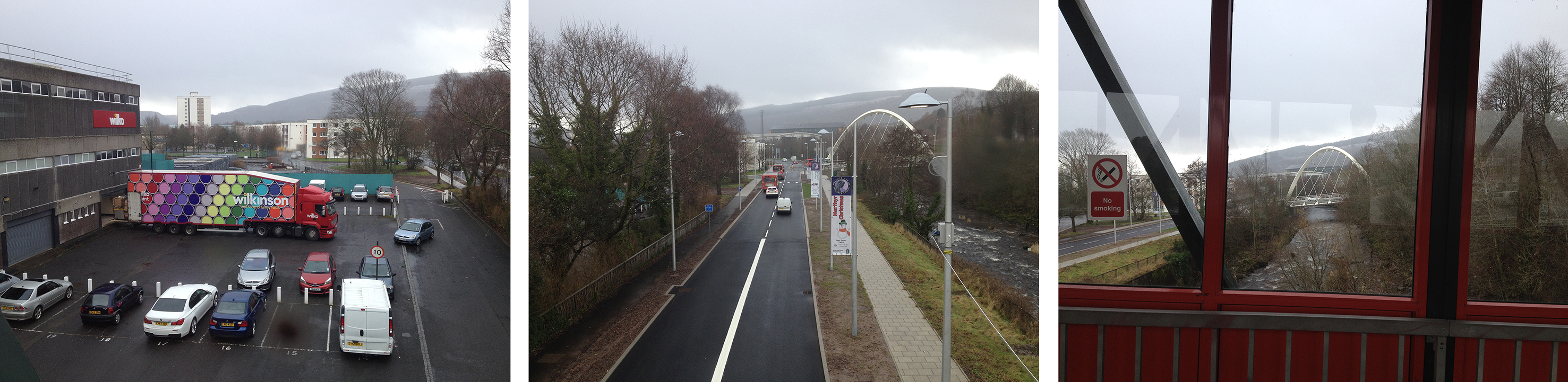
The footbridge was built in the early 1970’s but wasn’t always covered. The bridge spans not only the River Taff, but the Avenue de Clichy & Wilkinson’s Carpark . Image: Christopher Tipping
Looking downstream from the footbridge the views change between retail carpark, highway and river. Image: Christopher Tipping
This distinct zoning of views as one crosses the bridge could also change considerable during the year. It’s a great feature from where to see the town – its downfall being that it isn’t particularly good to look at ! A new footbridge would have the potential to exploit this fact too and make the most of the opportunities presented.
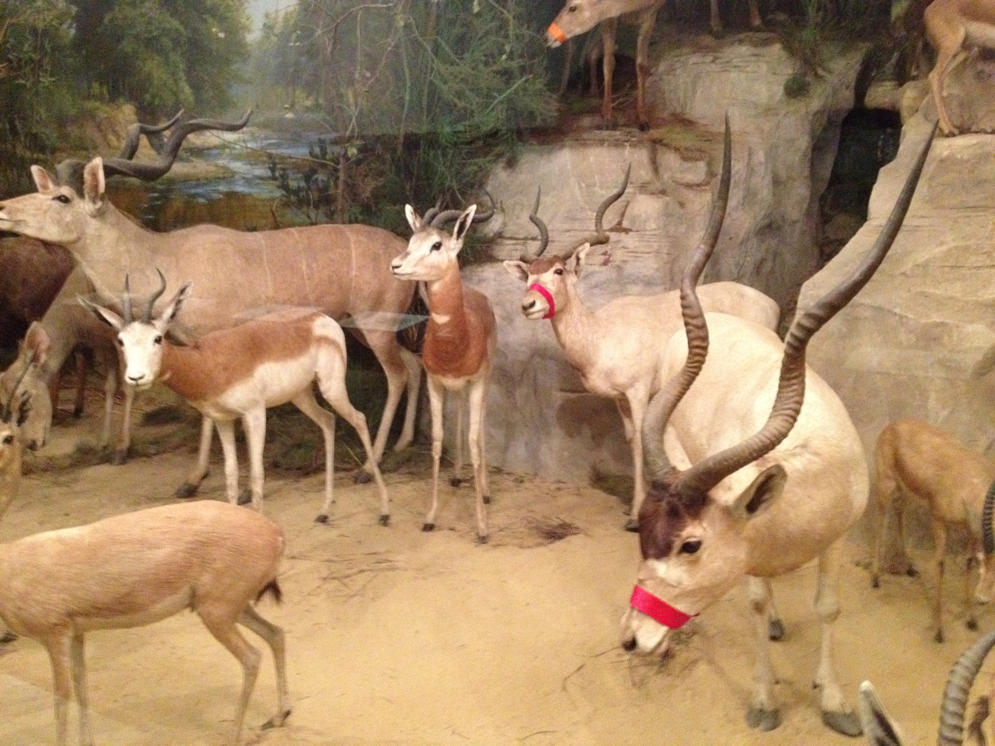
Spent the morning yesterday at the Powell-Cotton Museum at Quex Park, Birchington, Kent. I have been here a lot & it never fails to impress and surprise me.
These following images have been taken during a number of recent visits –
Diorama at Powell-Cotton Museum, Quex Park, Kent
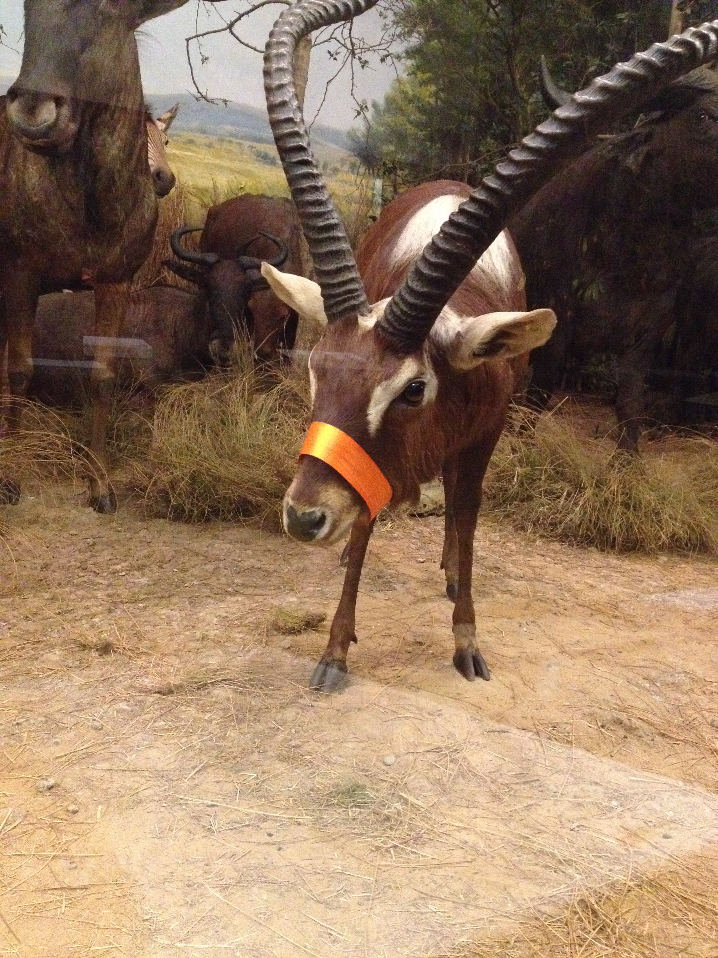
Detail from diorama at Powell-Cotton Museum, Quex House, Kent
Detail from diorama at Powell-Cotton Museum, Quex Park, Kent
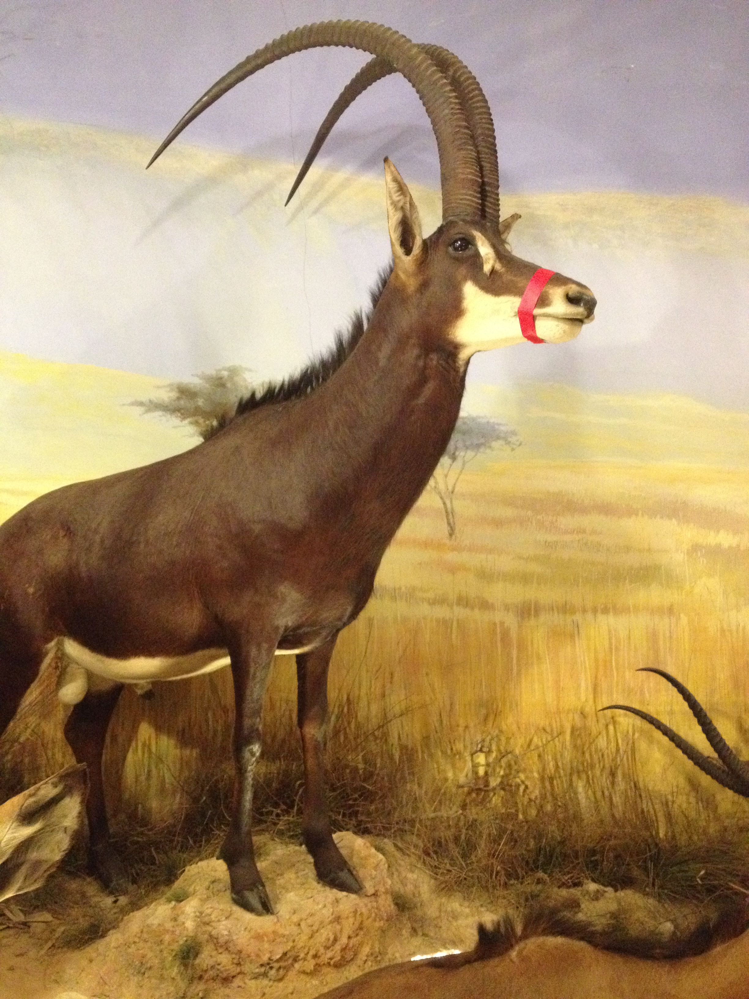
Giant Sable Antelope – by far my favourite exhibit ! Detail from diorama at Powell-Cotton Museum, Quex Park, Kent –
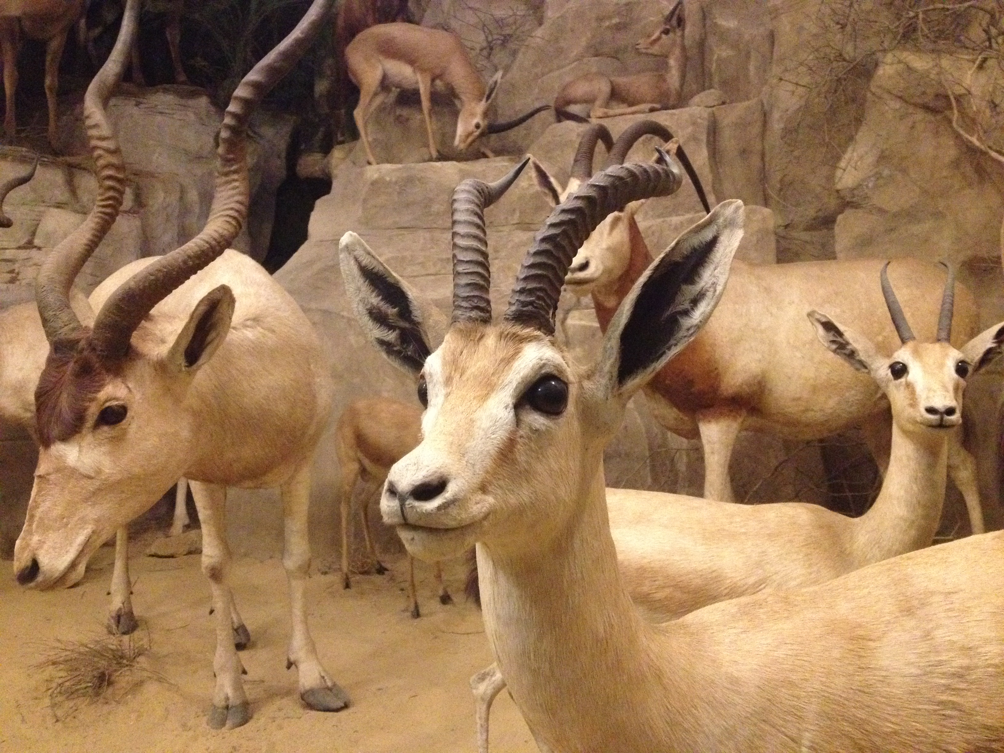
Detail from diorama at Powell-Cotton Museum, Quex House, Kent.
Detail from diorama at Powell-Cotton Museum. Quex Park, Kent