The new development at Orchard Park, due for completion in 2017 is to be called ‘Harrison Park’ , 100 years after Jack Harrison VC, a former Hull FC Rugby League Star was killed at Oppy Wood, Arras, France in 1917 during the First World War.
A Pinterest Board of research images about Orchard Park and its history, can be found here.This will be added to throughout the project.
Hull was awarded City of Culture 2017so there is much to celebrate in the lead up to this brilliant event for the city.
This is one of three developments in the City which Riverside are delivering concurrently. The other sites are Leads Road on the north Bransholme Estate and Hawthorne Avenue in West Hull. There is a substantial integrated arts strategy and programme, developed and being delivered by RKL Consultants. I am one of a number of artists who have been commissioned to respond to these sites. The other artists are: Jyll Bradley, Katayoun Dowlatshahi, Rona Smith, Tim Norris and Angus Ross.
“Riverside (one of the leading social housing providers in the UK), in partnership with Wates Living Space, is developing three new high quality extra care schemes within the city of Hull;
Harrison Park, Hall Road (65 apartments, 60 x 2bed, 5 x 1 bed)
Cecil Gardens, Hawthorn Avenue (95 apartments, 89 x 2 bed, 6 short stay)
Redwood Glades, Leads Road (156 apartments 60 x 2 bed, 96 x 1 bed))
The developments will be delivered under the PFI protocol. They will be high quality residential developments providing lifetime homes for adults who need some form of extra care and support. Riverside is committed to engaging the skills and imagination of artists in providing people with living environments which enhance their quality of life, stimulate their imagination and which contribute meaningfully to life of the community”.RKL Artist Project Brief.
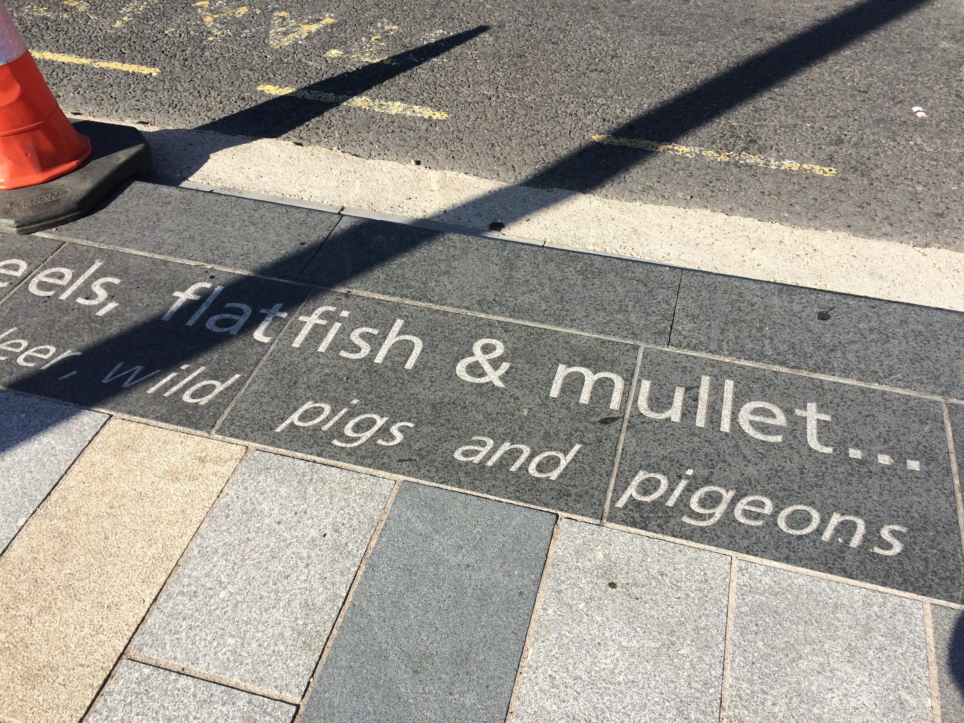
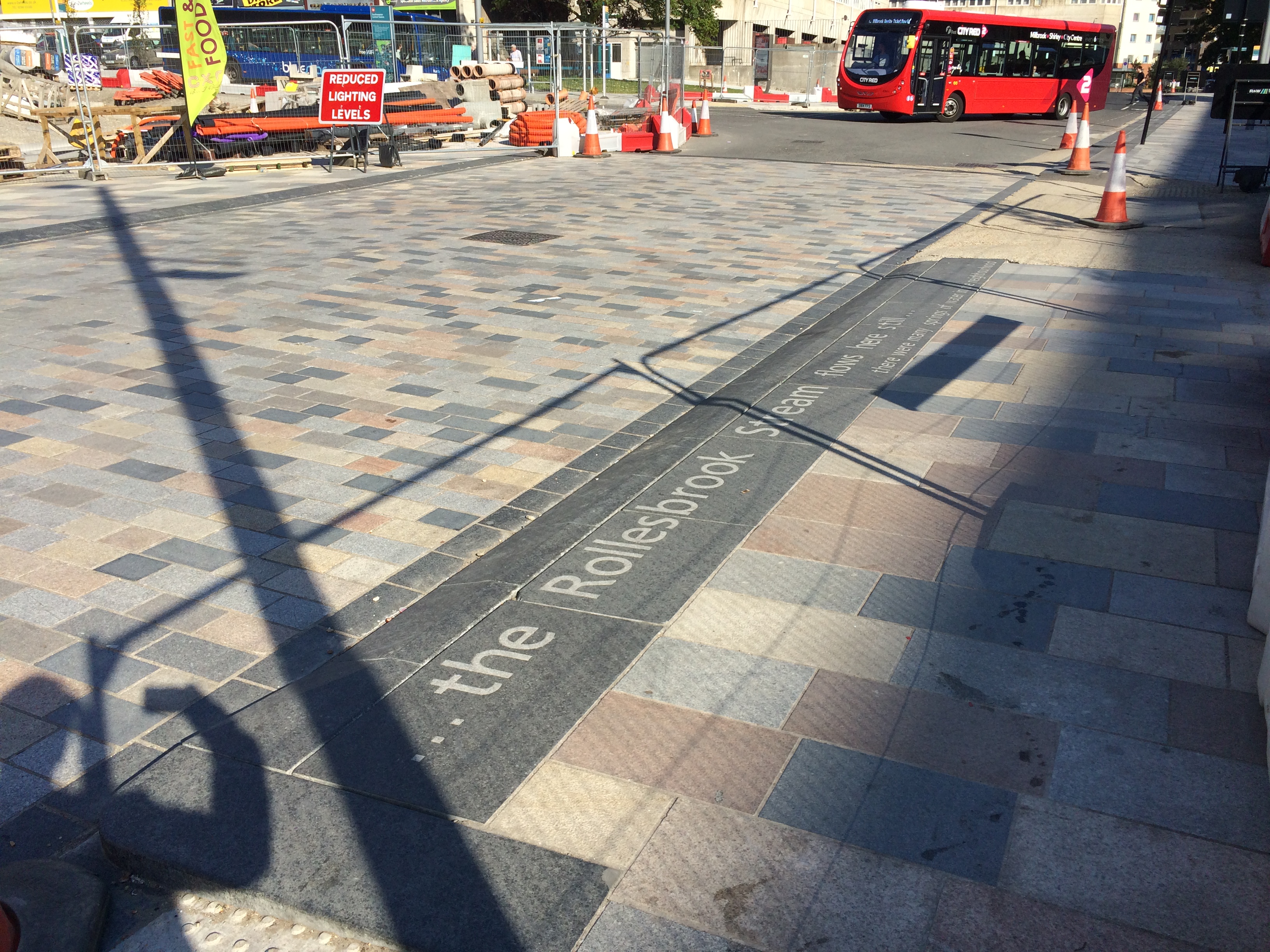
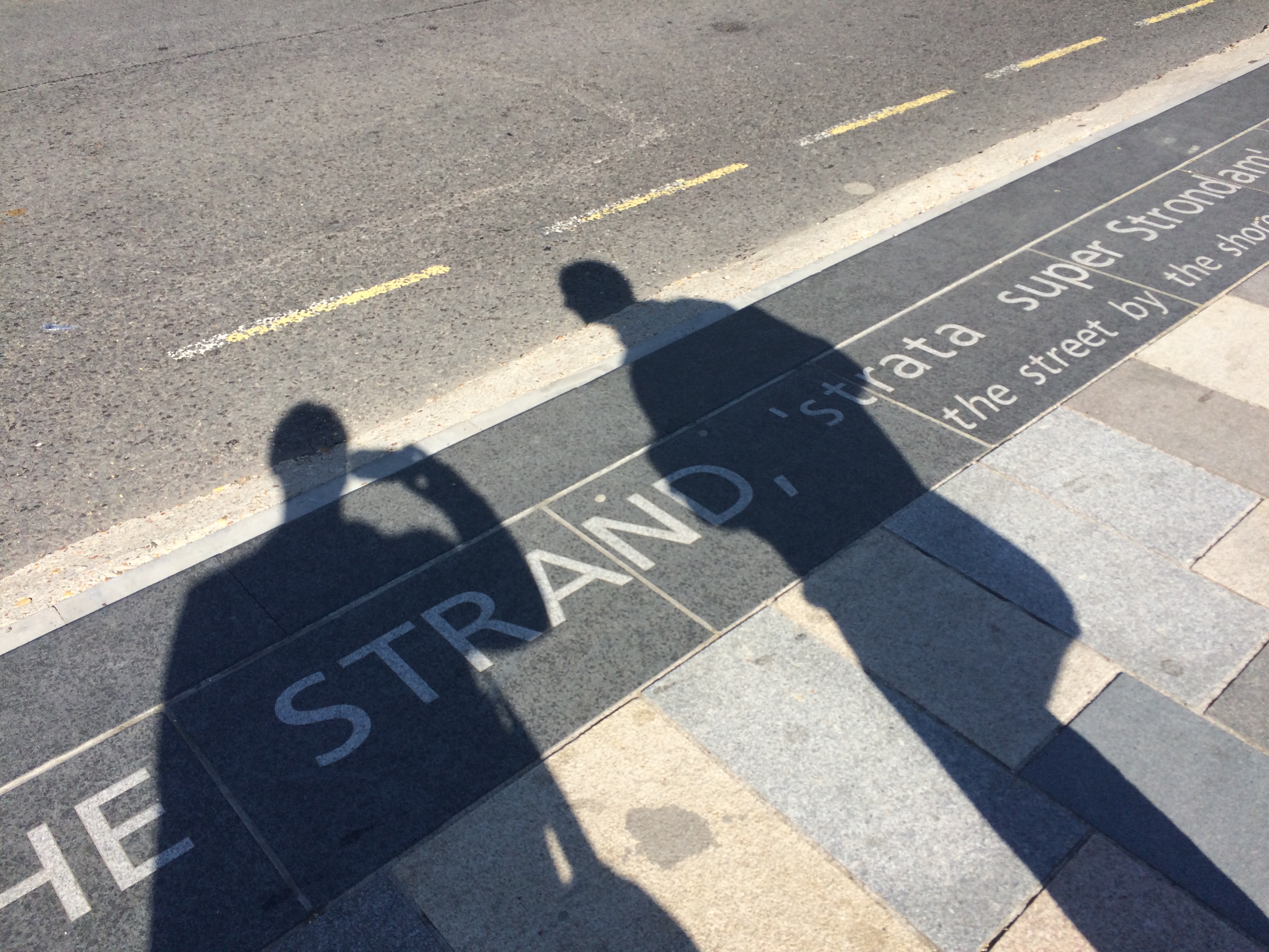
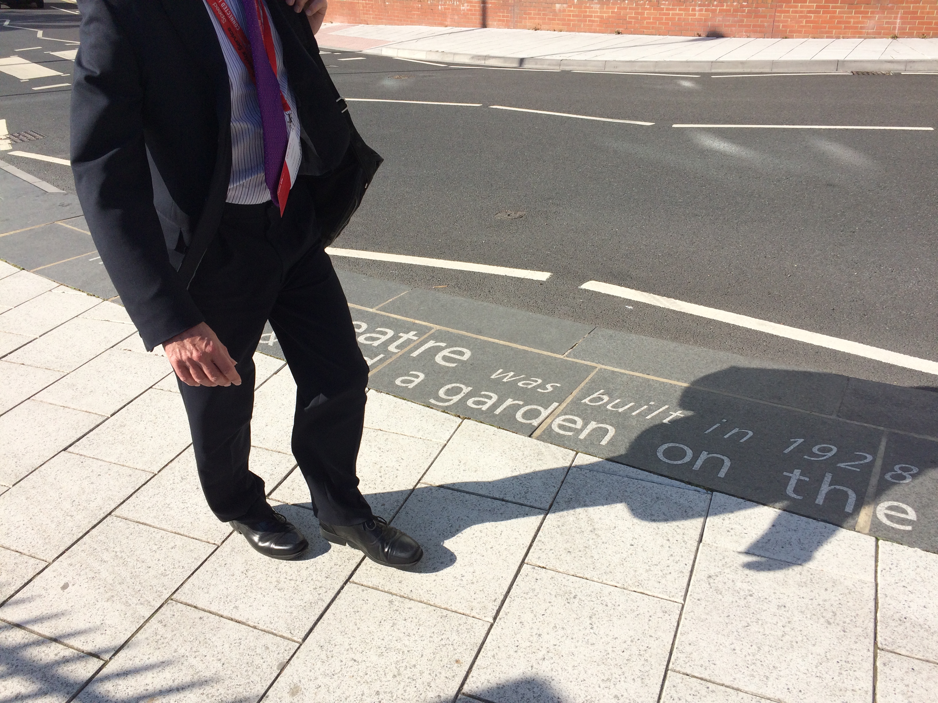
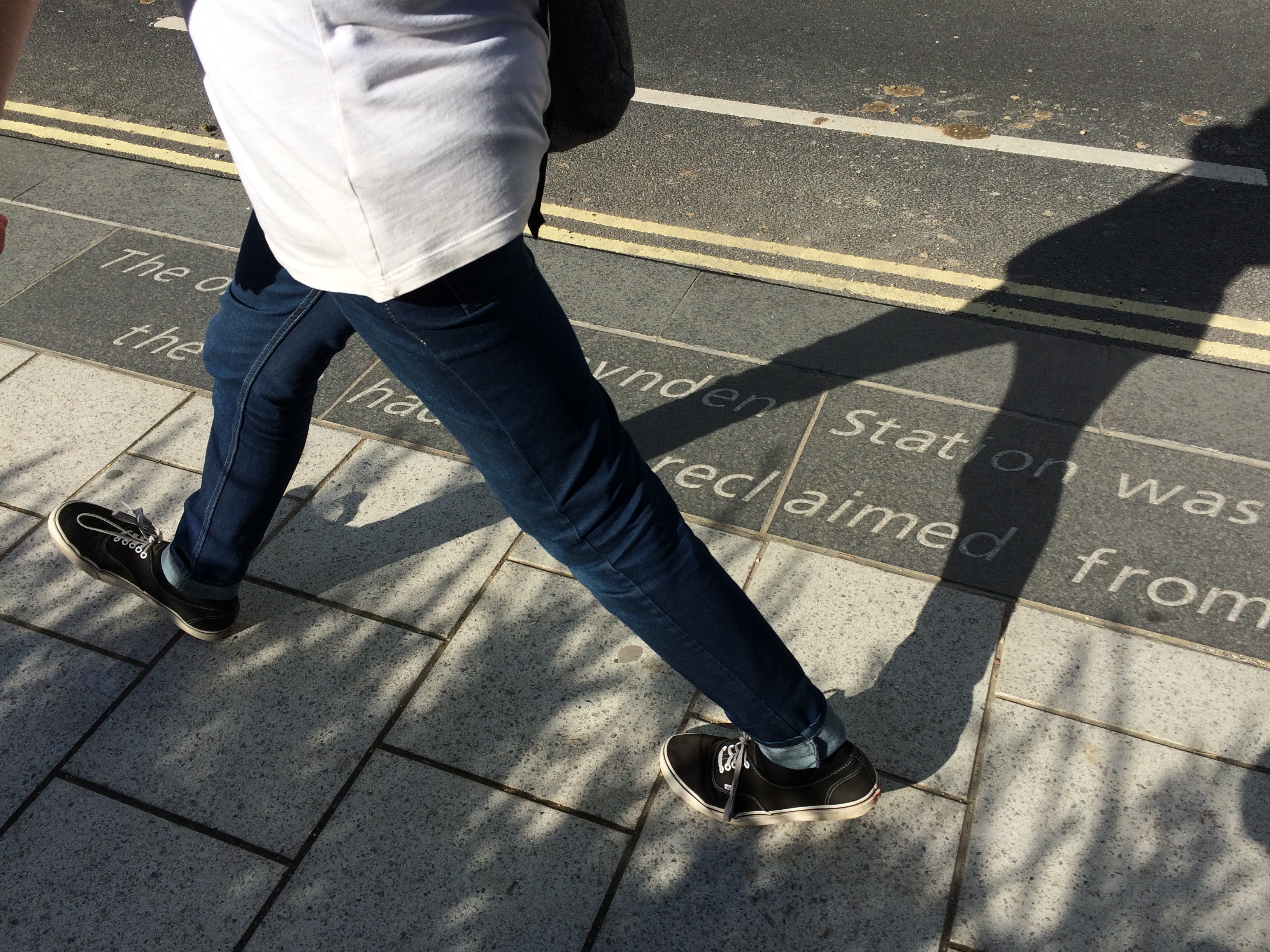
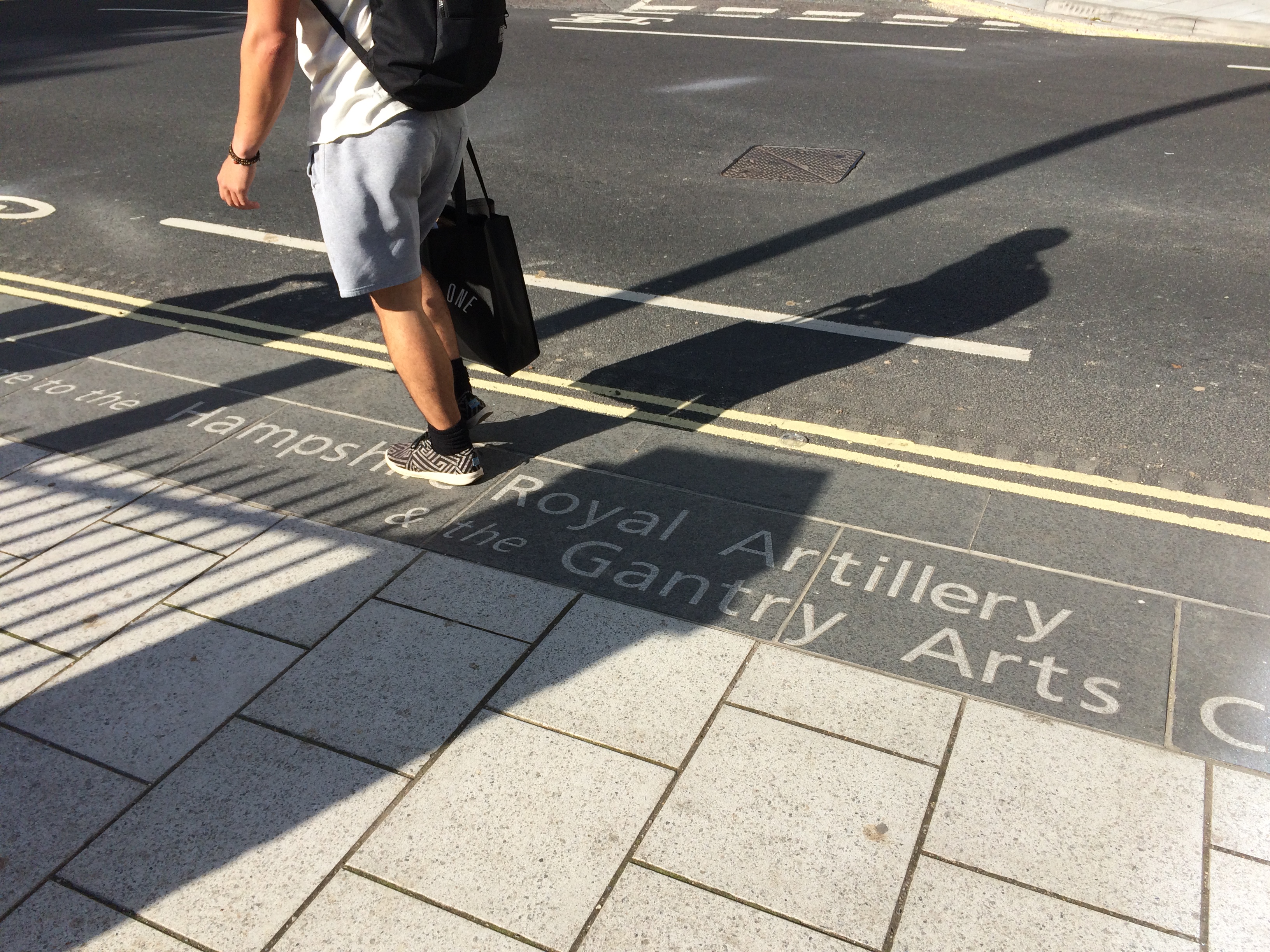
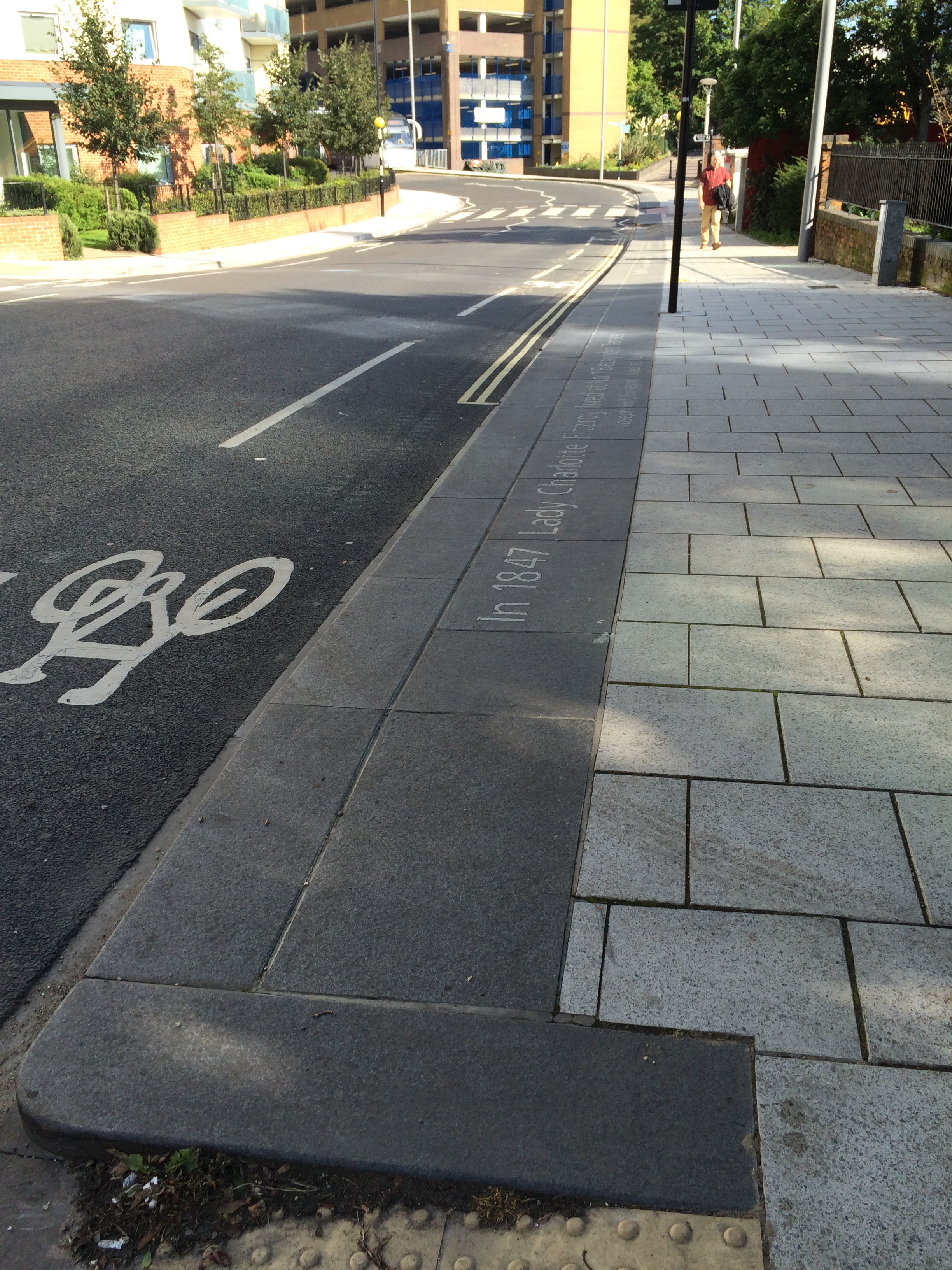
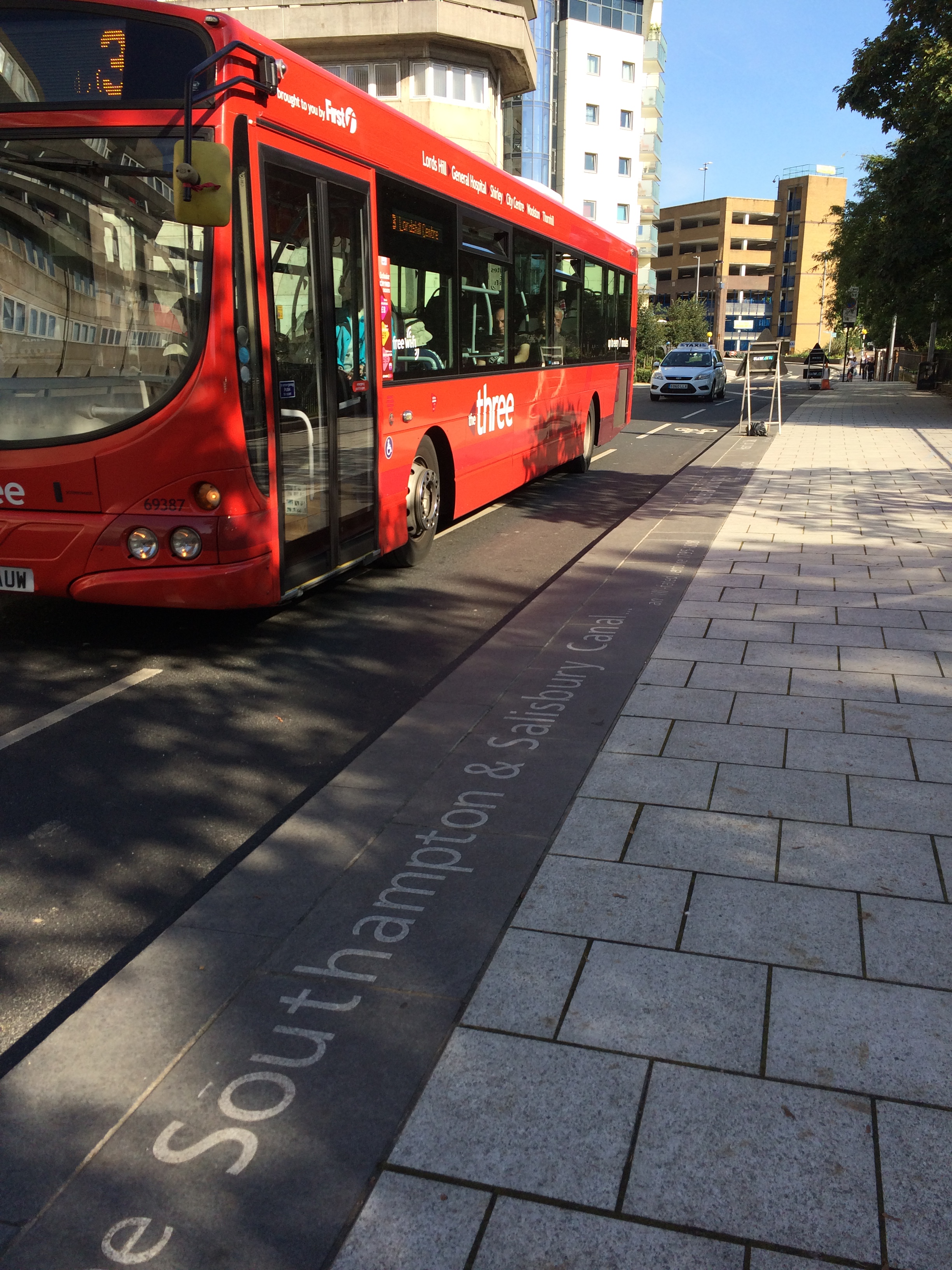
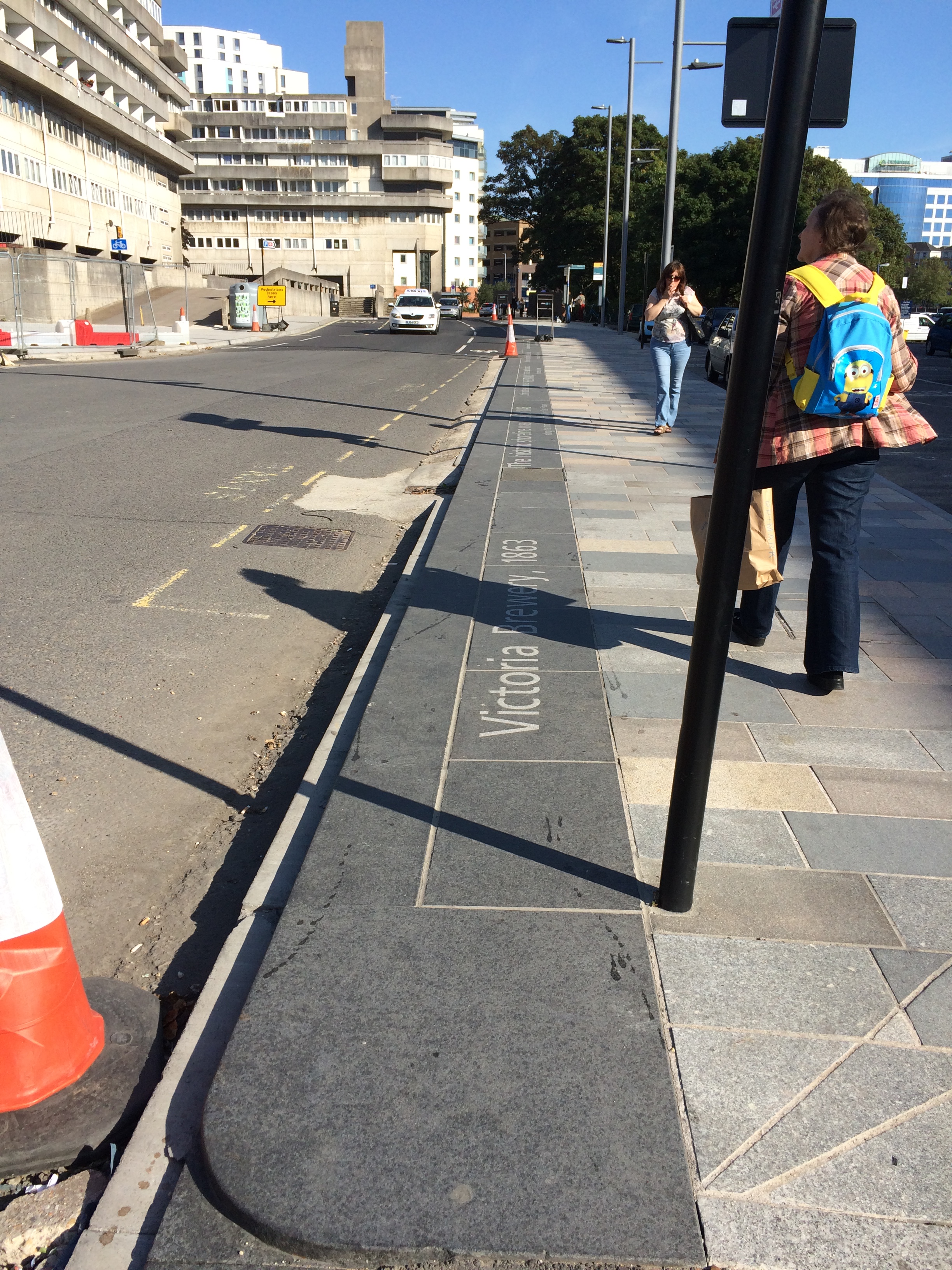
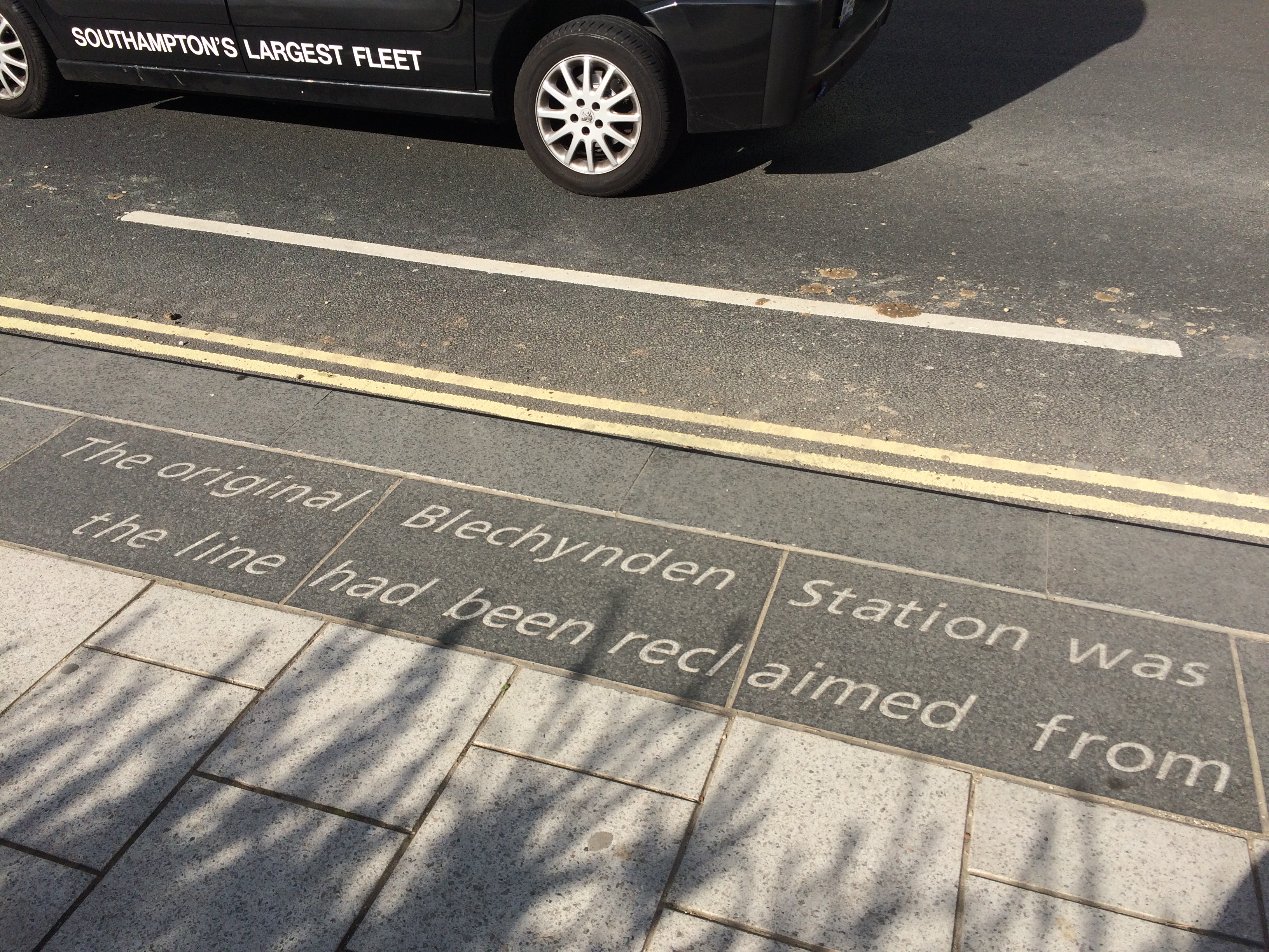
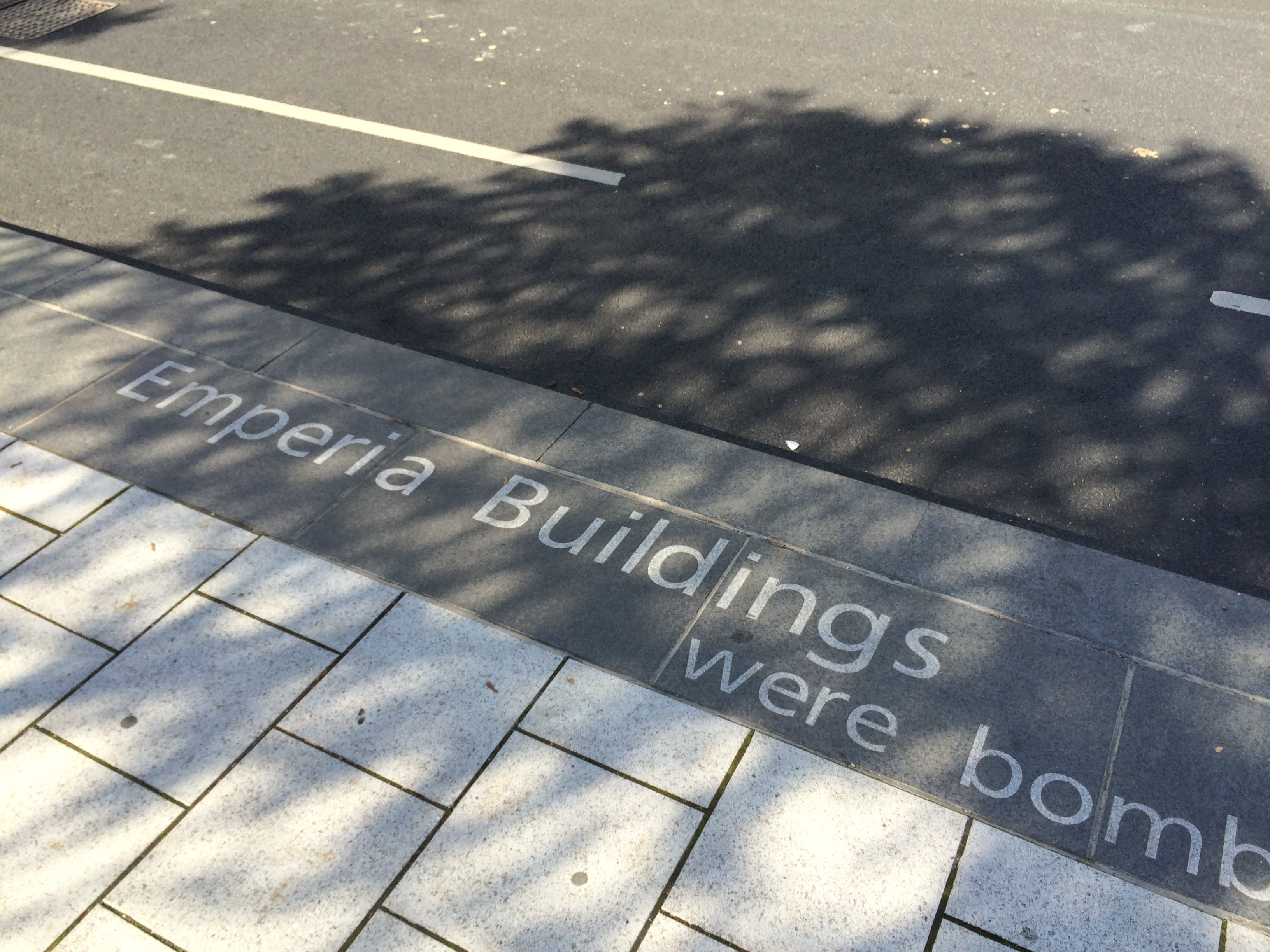
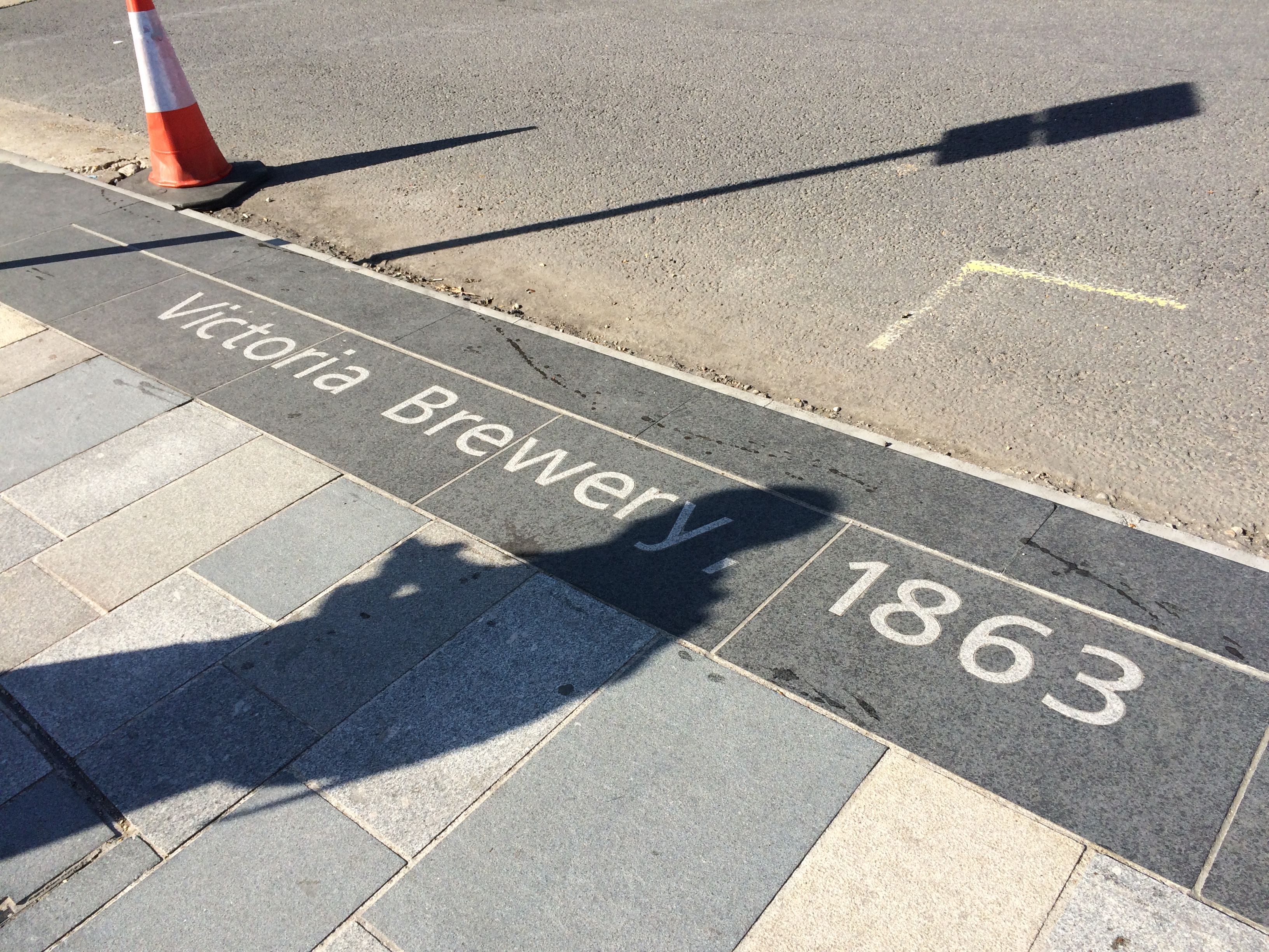
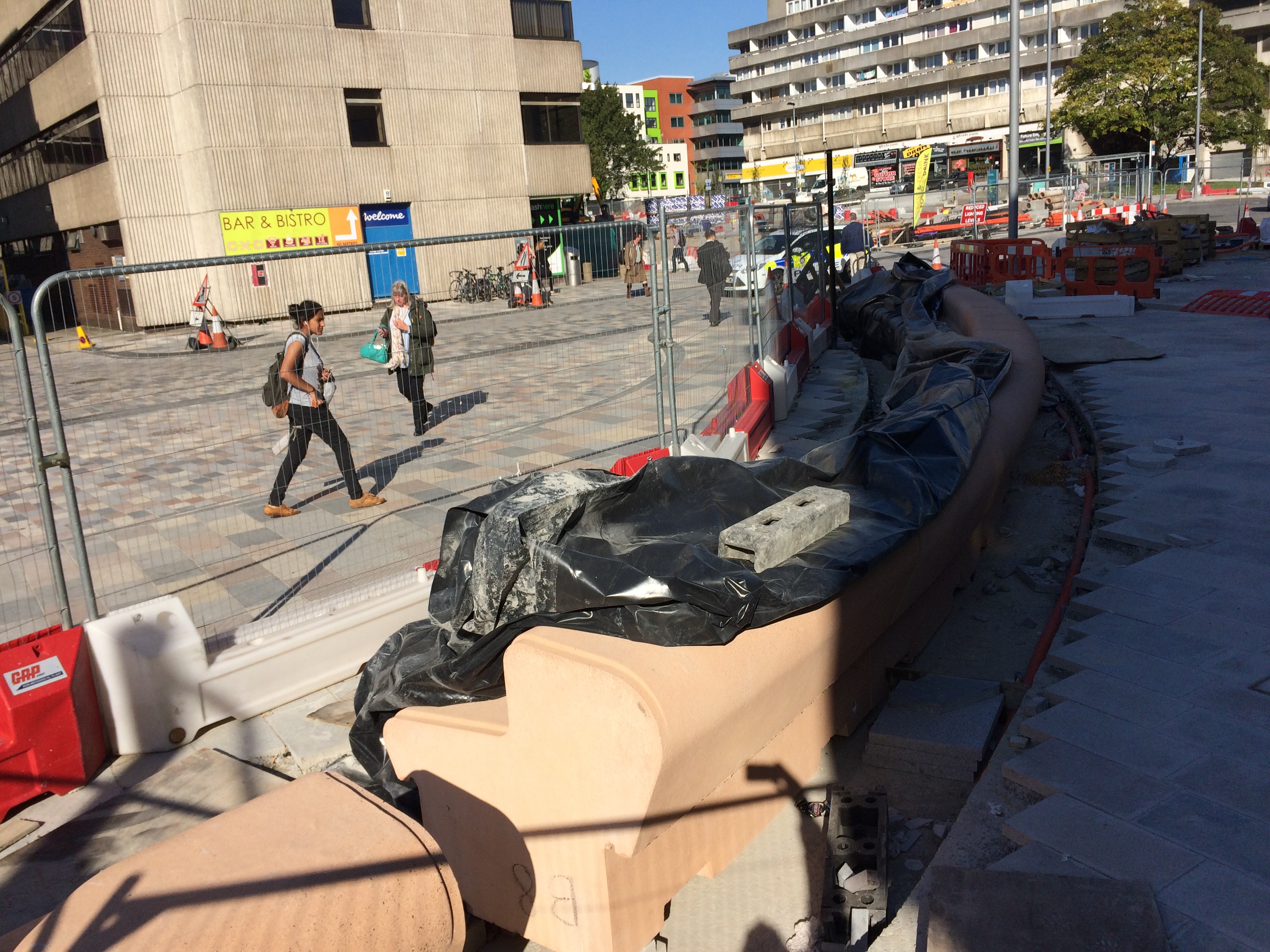
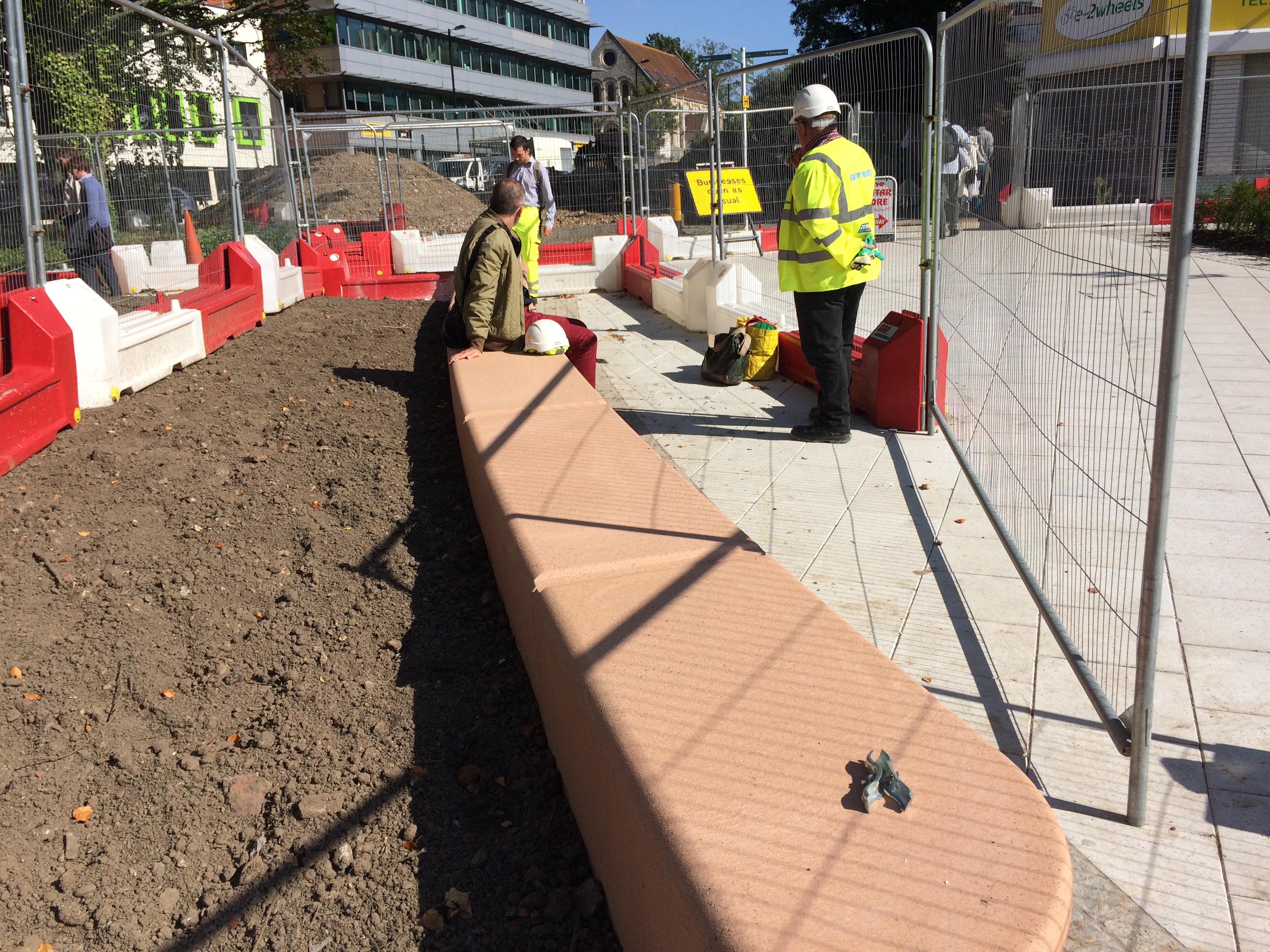
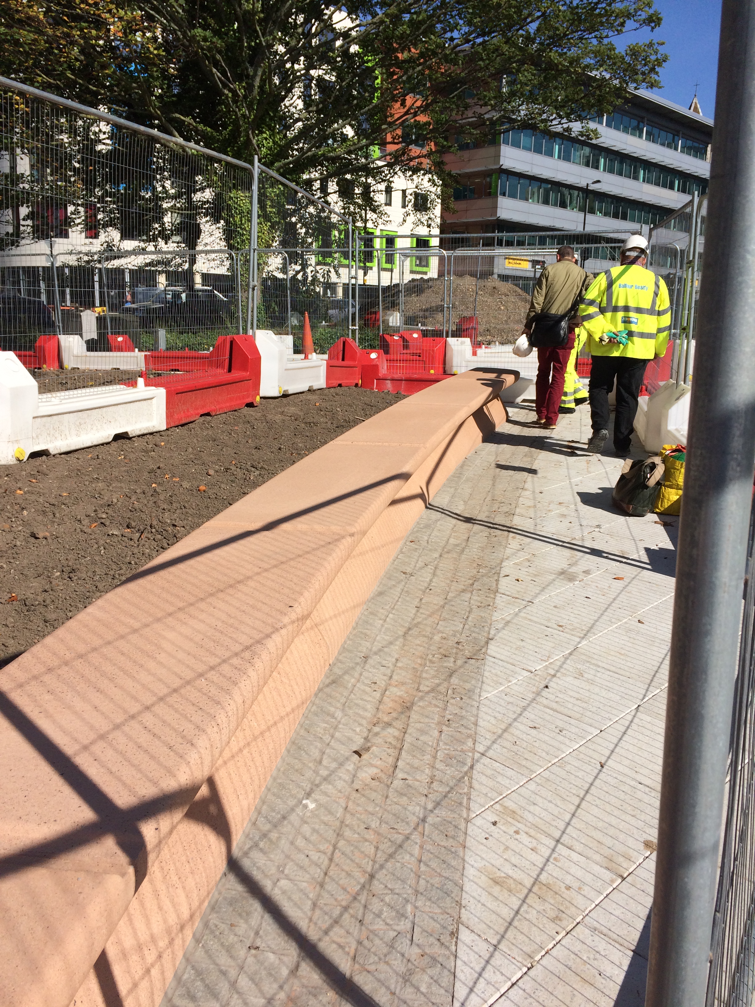
Station Quarter North, Southampton. ‘Canal Shore’ is a 205m long bespoke basalt kerb detail with inset granite text, running along Blechynden Terrace. Artist : Christopher TippingStation Quarter North, Southampton. ‘Canal Shore’ is a 205m long bespoke basalt kerb detail with inset granite text, running along Blechynden Terrace. Artist : Christopher Tipping
Monday 28th September 2015 – Station Quarter Visit –
The kerbside artwork ‘Canal Shore‘, which is a vital part of the Station Quarter programme, is very nearly completed. Only a short section remains to be finished, once the Station Forecourt area is completed. ‘Canal Shore’ is a 205m long black basalt kerb with inset granite text, which traces the route of the former Southampton to Salisbury Canal and also happens to be the line of the historic shoreline of the River Test Estuary.
The narrative refers to places, people and events which have marked the development of this landscape. Importantly, the work is also a strategic part of the wayfinding and placemaking ambitions for the Station Quarter project, as it makes an emphatic statement along the main east to west pedestrian route to the Station from the Above Bar area of the city and the Cultural Quarter.
Station Quarter North, Southampton. ‘Canal Shore’ is a 205m long bespoke basalt kerb detail with inset granite text, running along Blechynden Terrace. Artist : Christopher TippingStation Quarter North, Southampton. ‘Canal Shore’ is a 205m long bespoke basalt kerb detail with inset granite text, running along Blechynden Terrace. Artist : Christopher TippingStation Quarter North, Southampton. ‘Canal Shore’ is a 205m long bespoke basalt kerb detail with inset granite text, running along Blechynden Terrace. Artist : Christopher TippingStation Quarter North, Southampton. ‘Canal Shore’ is a 205m long bespoke basalt kerb detail with inset granite text, running along Blechynden Terrace. Artist : Christopher TippingStation Quarter North, Southampton. ‘Canal Shore’ is a 205m long bespoke basalt kerb detail with inset granite text, running along Blechynden Terrace. Artist : Christopher TippingStation Quarter North, Southampton. ‘Canal Shore’ is a 205m long bespoke basalt kerb detail with inset granite text, running along Blechynden Terrace. Artist : Christopher TippingStation Quarter North, Southampton. ‘Canal Shore’ is a 205m long bespoke basalt kerb detail with inset granite text, running along Blechynden Terrace. Artist : Christopher TippingStation Quarter North, Southampton. ‘Canal Shore’ is a 205m long bespoke basalt kerb detail with inset granite text, running along Blechynden Terrace. Artist : Christopher TippingStation Quarter North, Southampton. ‘Canal Shore’ is a 205m long bespoke basalt kerb detail with inset granite text, running along Blechynden Terrace. Artist : Christopher TippingStation Quarter North, Southampton. ‘Canal Shore’ is a 205m long bespoke basalt kerb detail with inset granite text, running along Blechynden Terrace. Artist : Christopher TippingStation Quarter North, Southampton. ‘Canal Shore’ is a 205m long bespoke basalt kerb detail with inset granite text, running along Blechynden Terrace. Artist : Christopher TippingStation Quarter North, Southampton. ‘Canal Shore’ is a 205m long bespoke basalt kerb detail with inset granite text, running along Blechynden Terrace. Artist : Christopher TippingStation Quarter North, Southampton. ‘Canal Shore’ is a 205m long bespoke basalt kerb detail with inset granite text, running along Blechynden Terrace. Artist : Christopher TippingStation Quarter North, Southampton. ‘Canal Shore’ is a 205m long bespoke basalt kerb detail with inset granite text, running along Blechynden Terrace. Artist : Christopher TippingStation Quarter North, Southampton. ‘Canal Shore’ is a 205m long bespoke basalt kerb detail with inset granite text, running along Blechynden Terrace. Artist : Christopher Tipping
It’s been a while since I posted an update on the Station Quarter Project –
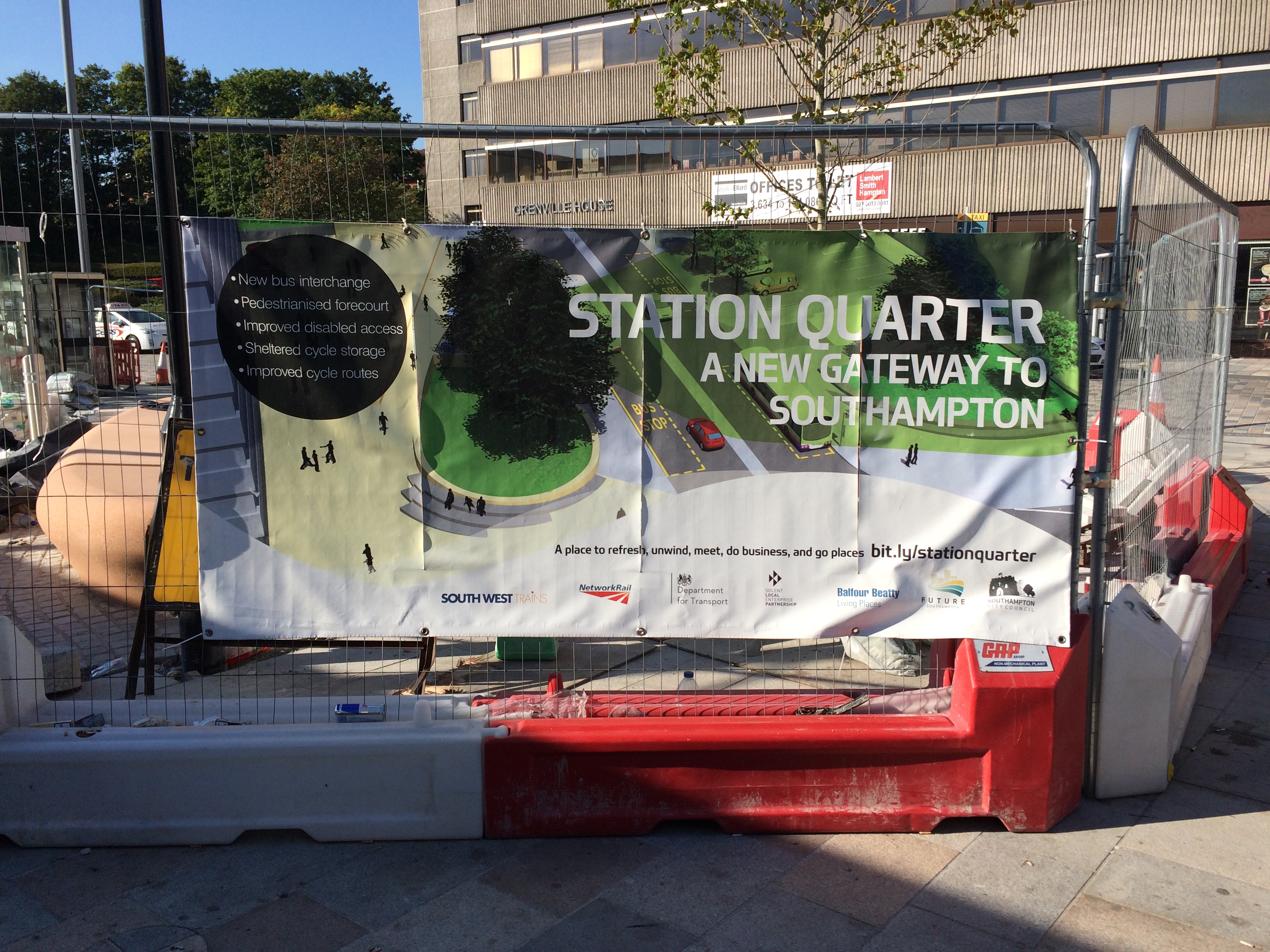
Station Quarter – A new Gateway to Southampton. Works on site – Image:Christopher Tipping
I met up on site with Simon Taylor – Urban Design Manager, Balfour Beatty Living Placesand Pete Boustred – Transport Policy & Sustainable Travel Team Leader at Southampton City Council. I was first commissioned to work on the interpretive and site responsive elements of the project by Simon at BBLP in 2012. We have worked together several times previously in the City. BBLP are delivering the project for Southampton City Council.
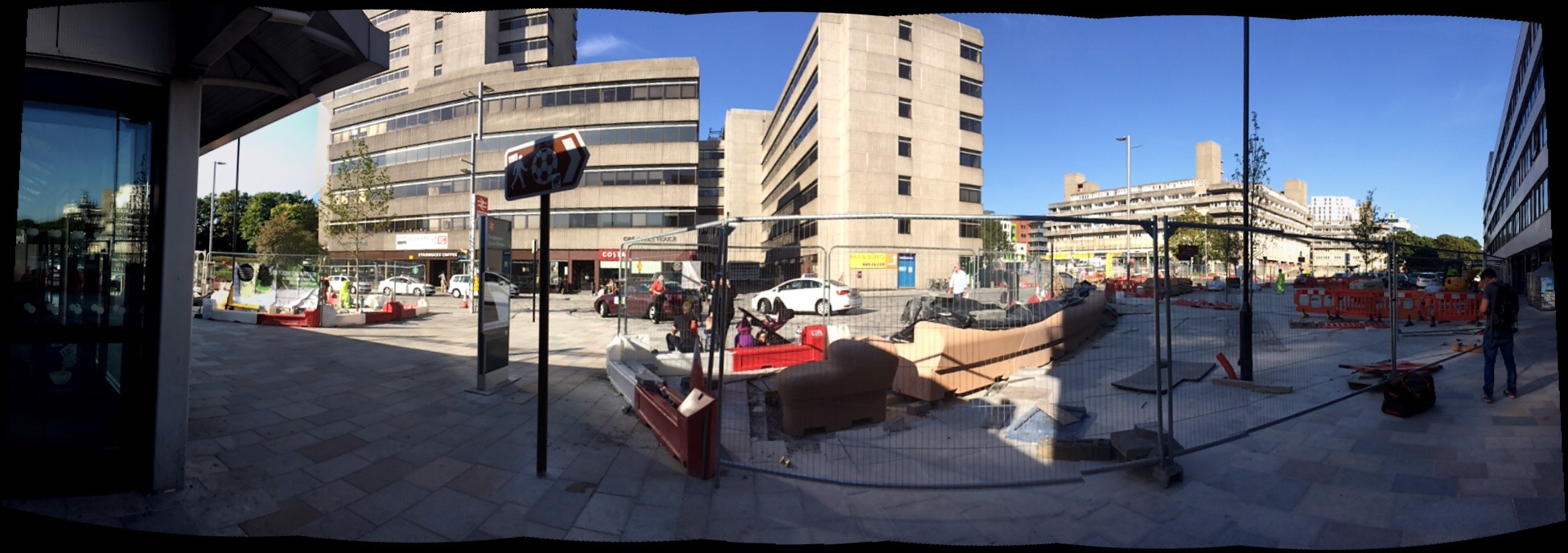
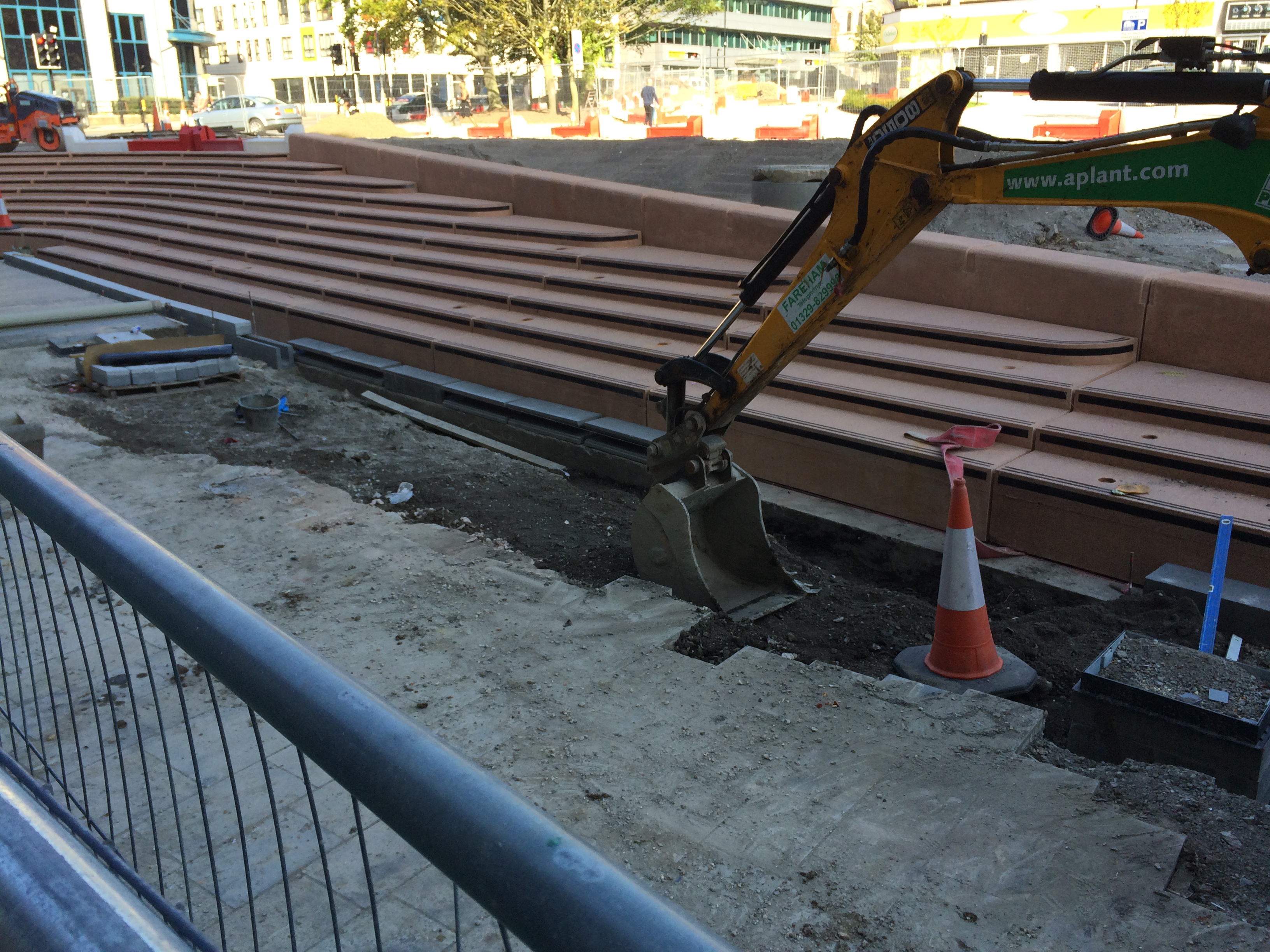
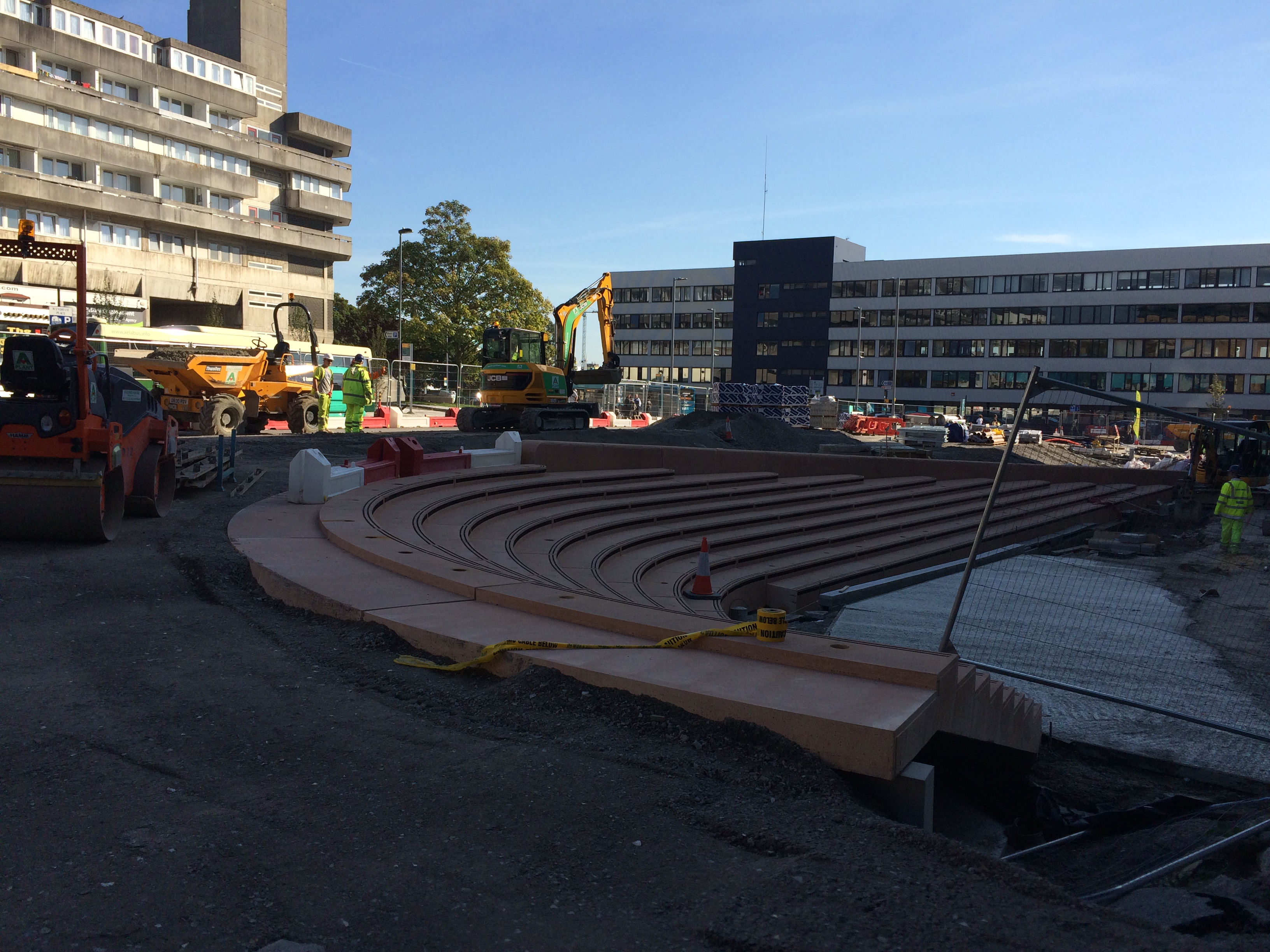
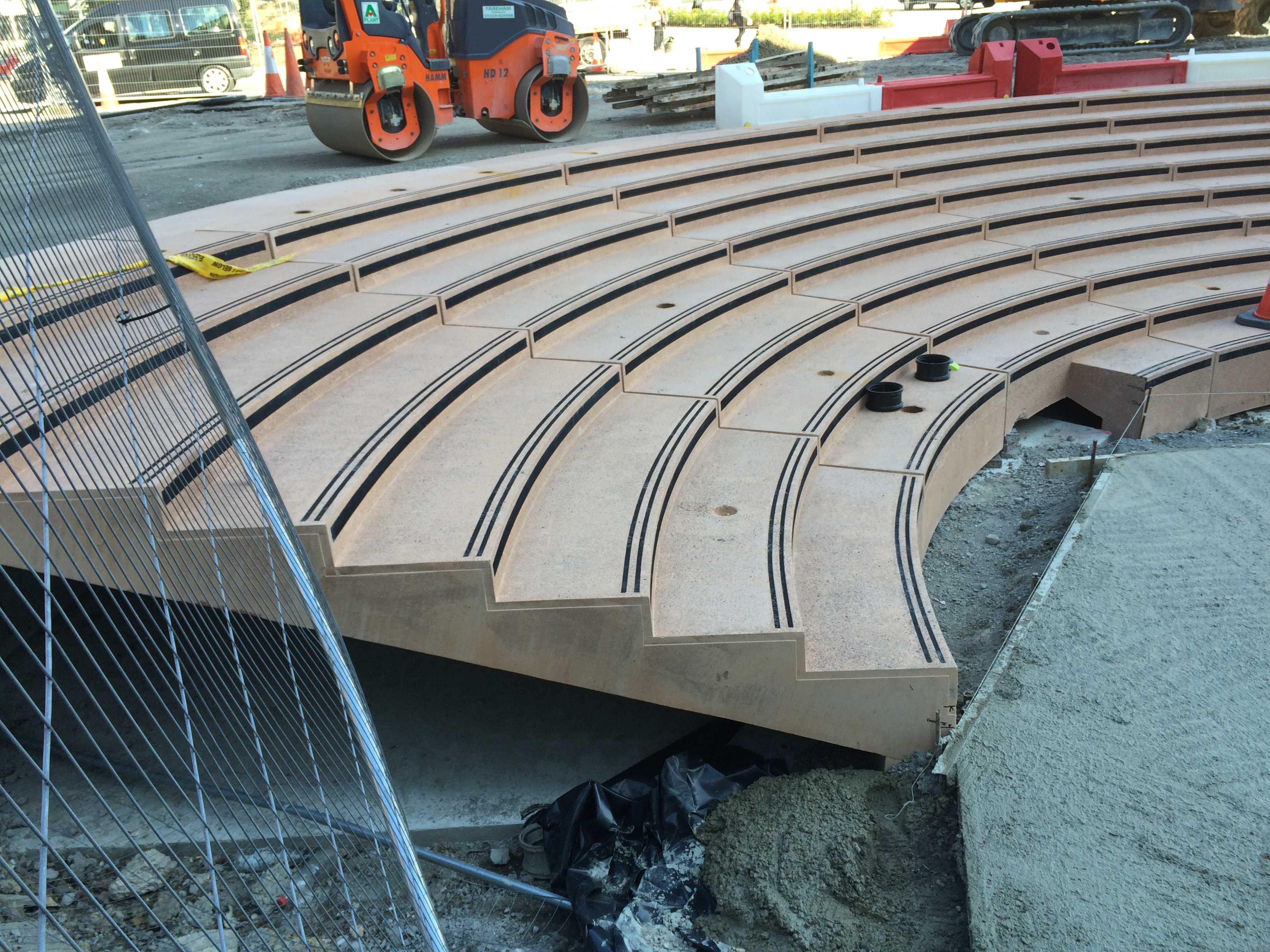
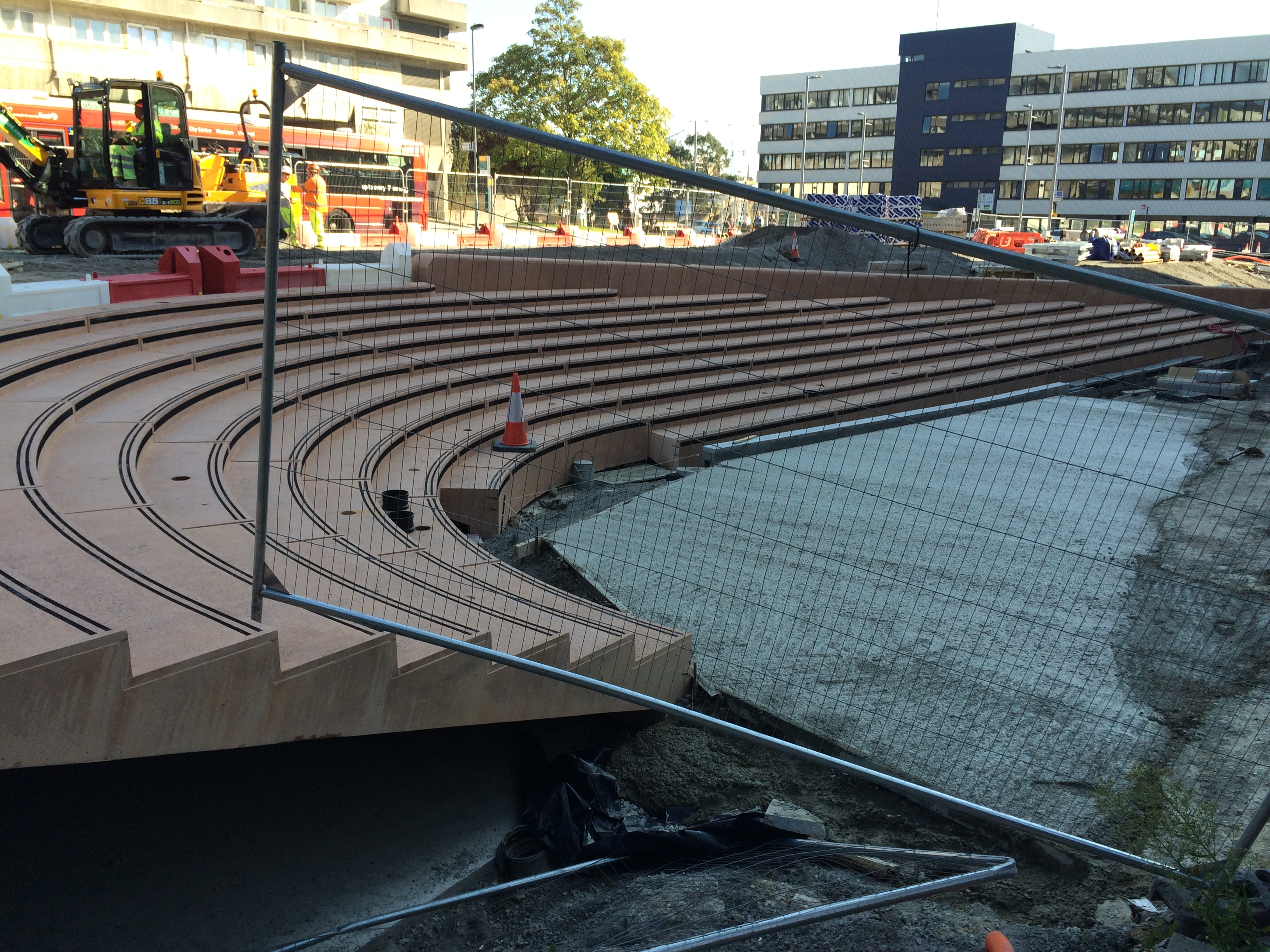
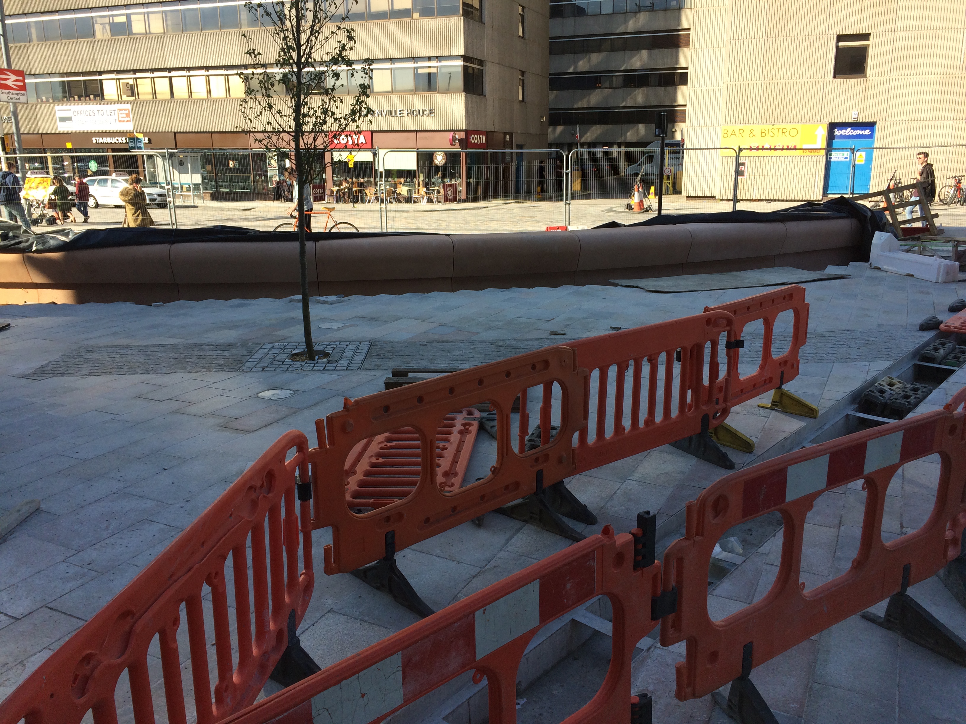
Massive changes since my last visit if you look at earlier posts, but brilliant to see the project coming together so well. The amphitheatre steps, part of the Phase 2 works on Wyndham Place have arrived and have been lifted into place. There are a number of other structures still with the manufacturer and these are expected to arrive over the coming weeks. The installation of the large-scale bespoke cast concrete benches, amphitheatre steps and retaining structures manufactured by CCPwill continue over the coming weeks. Hopefully I will get down to Southampton again soon to record more progress.
Station Quarter North, Southampton. The view on exiting the Station. Bespoke cast concrete works being installed on the Station Forecourt as part pf the new public realm and transport hub. Image:Christopher TippingStation Quarter North, Southampton. Bespoke Cast Concrete Amphitheatre Steps during installation at Wyndham Place. Image:Christopher TippingStation Quarter North, Southampton. Bespoke Cast Concrete Amphitheatre Steps during installation at Wyndham Place. Image:Christopher Tipping
What was a real pain was that although it was a brilliant blue day – this part of the site was in deep shadow, so the images are a bit too dark to do the work justice !
Station Quarter North, Southampton. Bespoke Cast Concrete Amphitheatre Steps during installation at Wyndham Place. Image:Christopher TippingStation Quarter North, Southampton. Bespoke Cast Concrete Amphitheatre Steps during installation at Wyndham Place. Image:Christopher Tipping
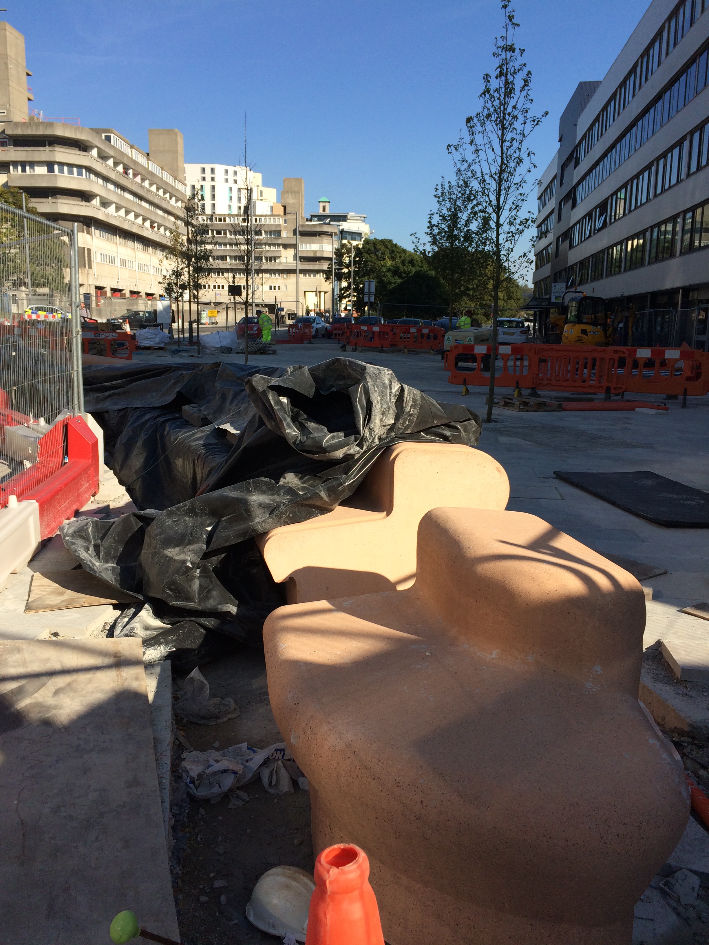
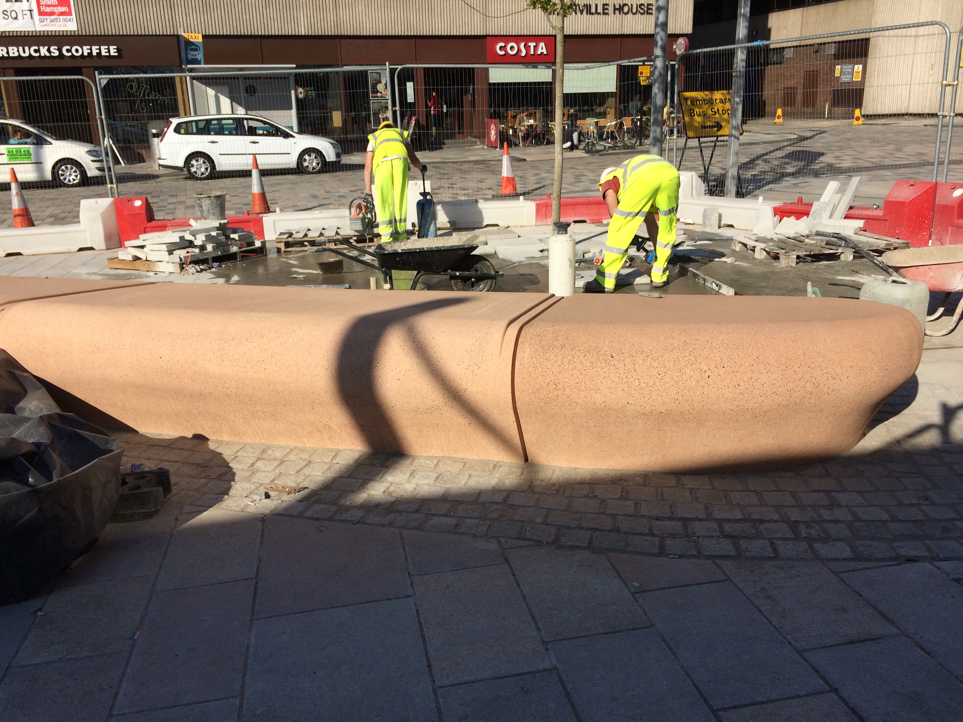
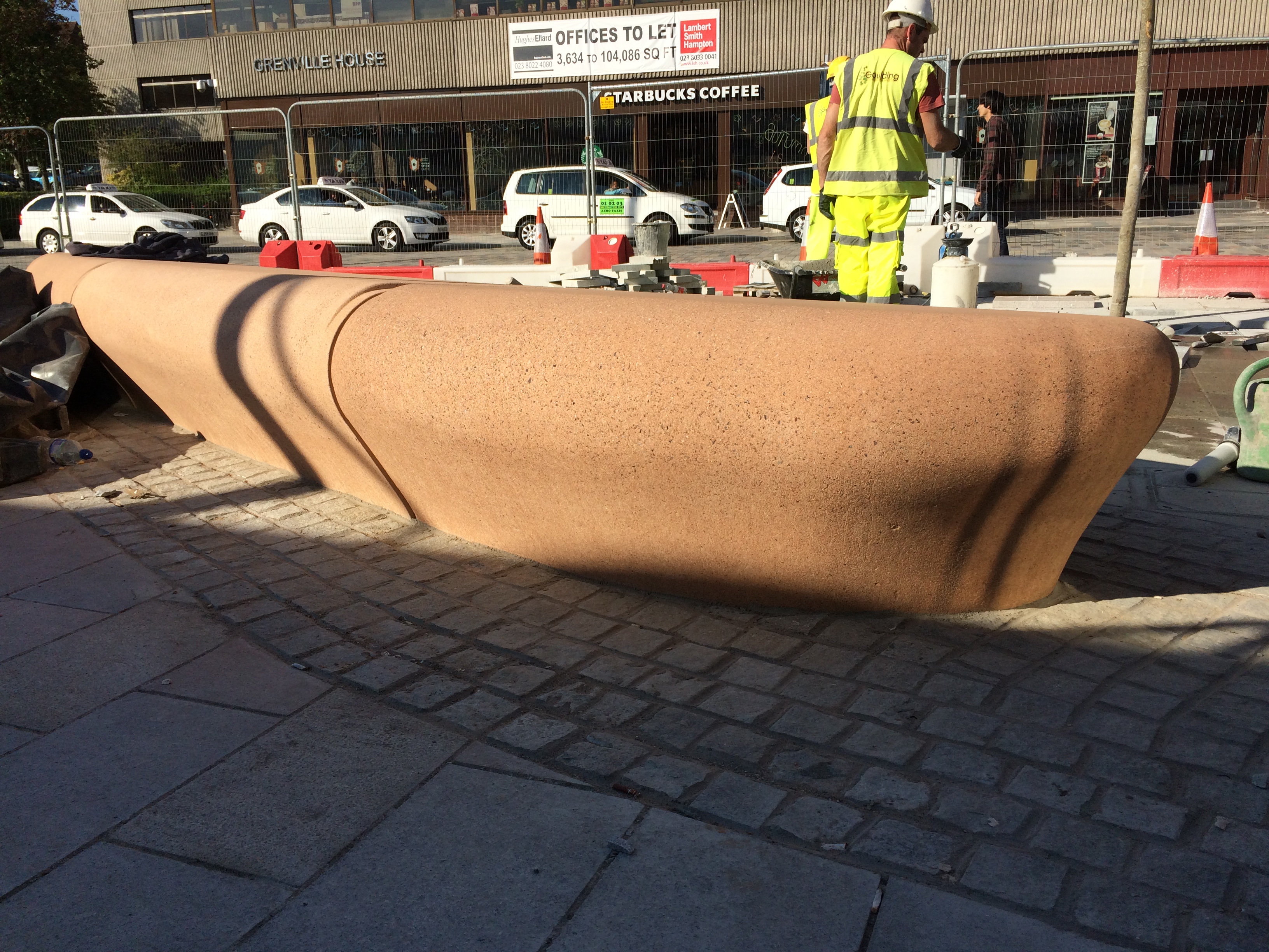
Other cast concrete works are also on site –
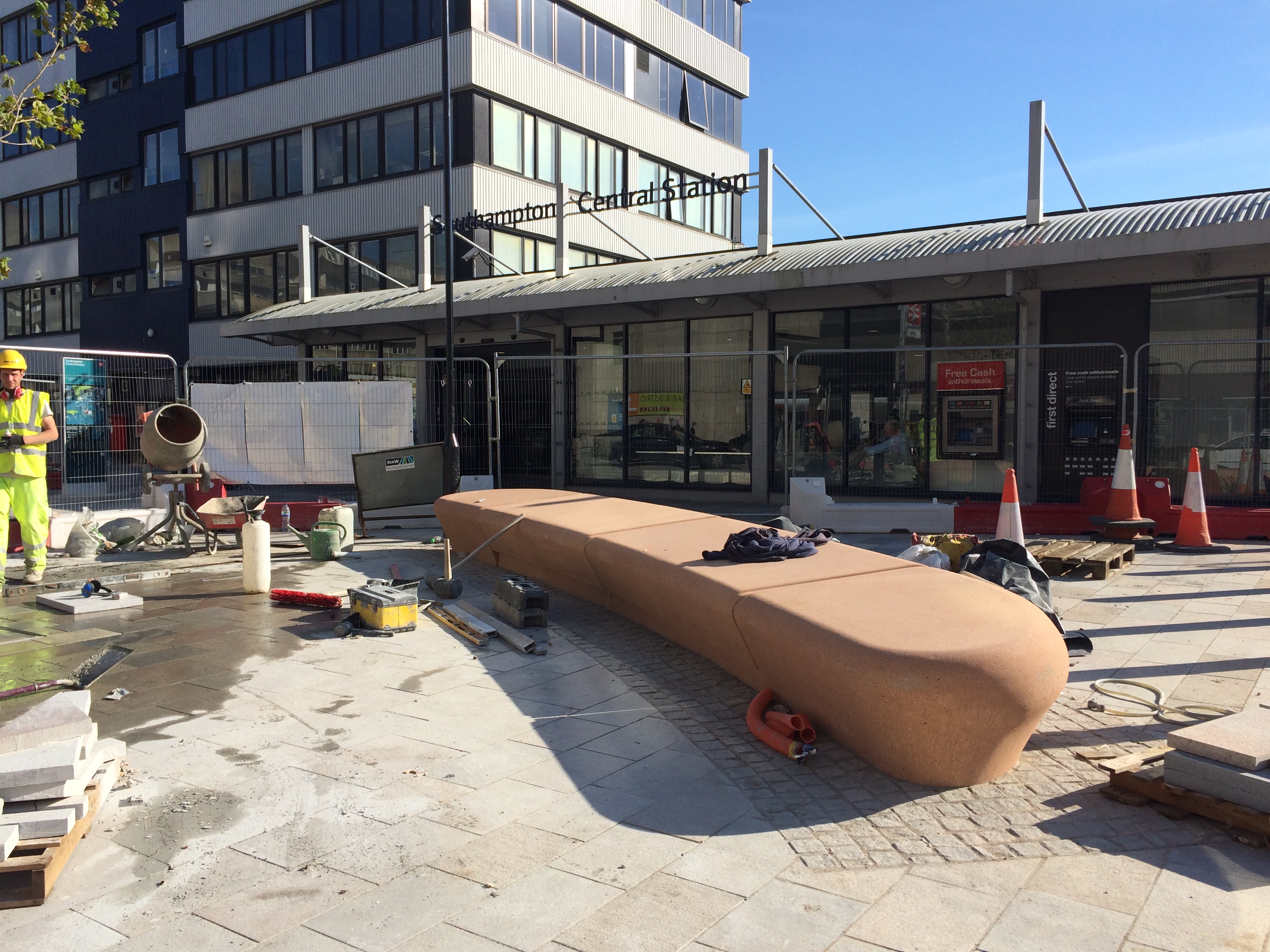
These benches are on the Station Forecourt, immediately as you enter or exit the Station building. This is one section of a large curving two tier bench and way-finding feature within the scheme.
Station Quarter North, Southampton. Bespoke cast concrete two tier radius bench awaiting final installation on the Station Forecourt. Image:Christopher TippingStation Quarter North, Southampton. Bespoke cast concrete two tier radius bench awaiting final installation on the Station Forecourt. Image:Christopher TippingStation Quarter North, Southampton. Bespoke cast concrete two tier radius bench in multiple sections awaiting final installation on the Station Forecourt. Image:Christopher TippingStation Quarter North, Southampton. Bespoke four piece cast concrete radius bench during final installation on the Station Forecourt. Image:Christopher TippingStation Quarter North, Southampton. Bespoke four piece cast concrete radius bench during final installation on the Station Forecourt. Image:Christopher TippingStation Quarter North, Southampton. Bespoke four piece cast concrete radius bench during final installation on the Station Forecourt. Image:Christopher TippingStation Quarter North, Southampton. Bespoke four piece cast concrete radius bench during final installation on the Station Forecourt. Image:Christopher TippingStation Quarter North, Southampton. Bespoke four piece cast concrete radius bench during final installation on Commercial Road. Image:Christopher TippingStation Quarter North, Southampton. Bespoke four piece cast concrete radius bench during final installation on Commercial Road. Image:Christopher TippingStation Quarter North, Southampton. Bespoke four piece cast concrete radius bench during final installation on Commercial Road. Image:Christopher Tipping
I am waiting for approval to use some of the images in my documentation here, as both collections have some brilliant photographs, maps and diagrams, with which to ‘animate’ research for the project.
This is my 5th visit to Chatham – and the first blue sky day ! – so I had to put this image in…
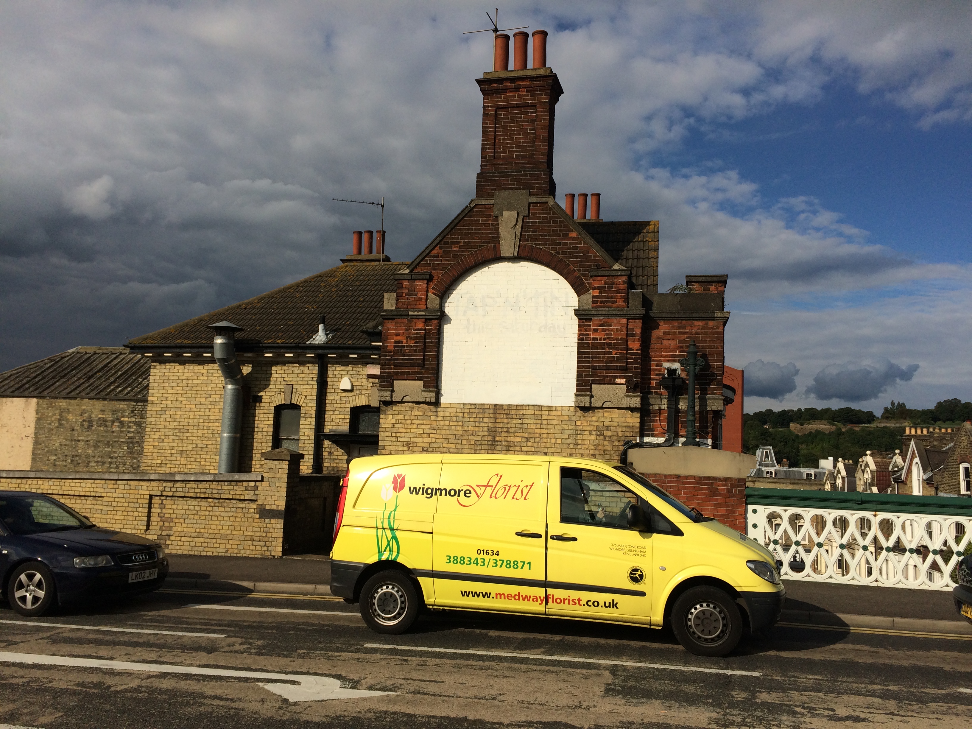
This is the junction of the High Street, Chatham, with Railway Street and Military Road. The Halifax is on the left and the red brick gable end of Mountbatten House looms large in the centre. Image:Christopher TippingThe Halifax building at the junction of High Street, Chatham and Military Road has elephants carved on its facade. Have you seen them? Image:Christopher Tipping
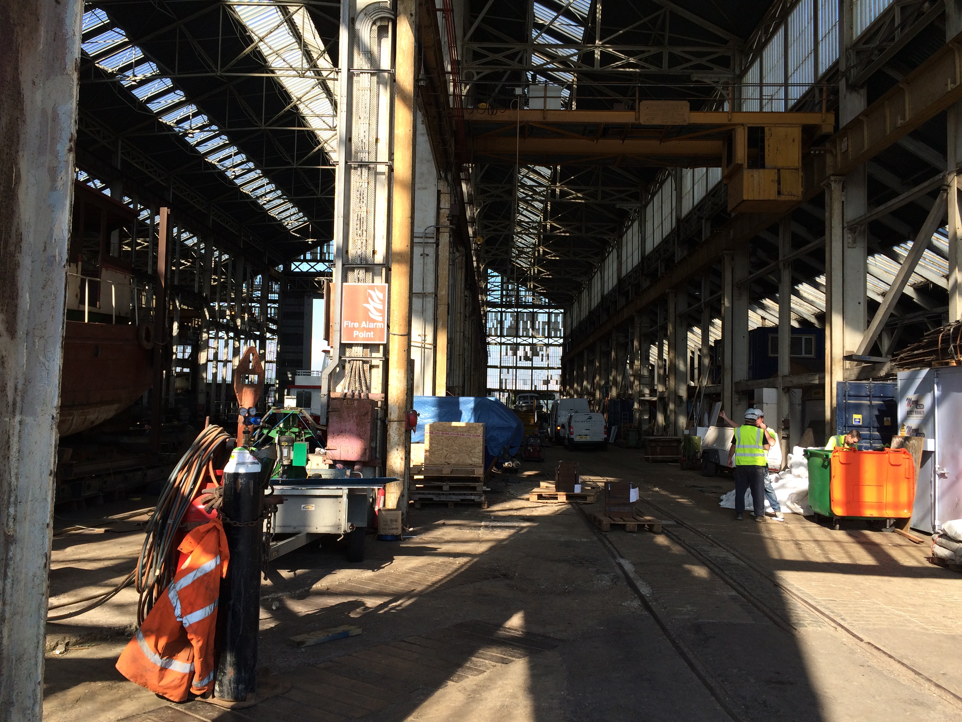
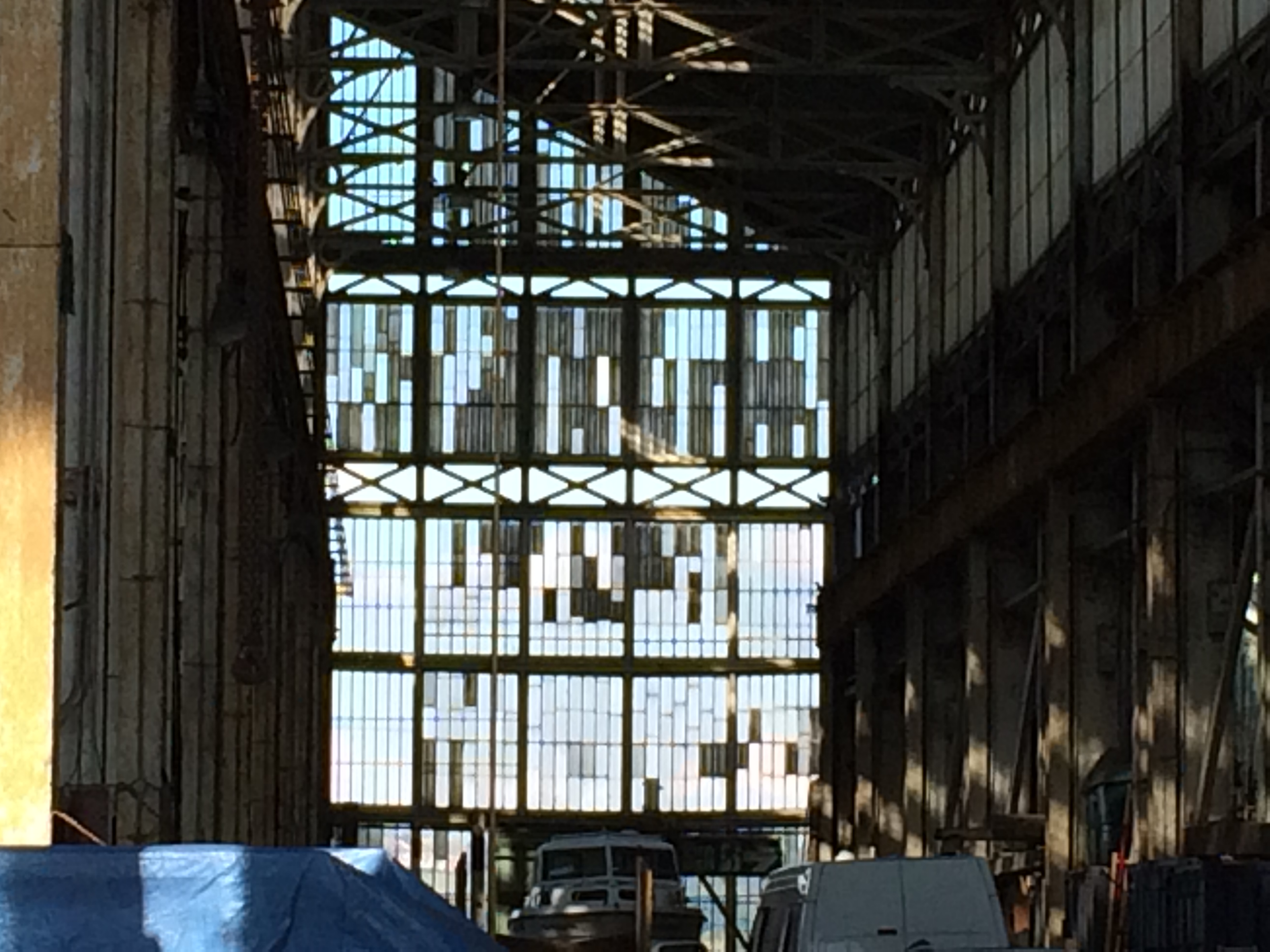
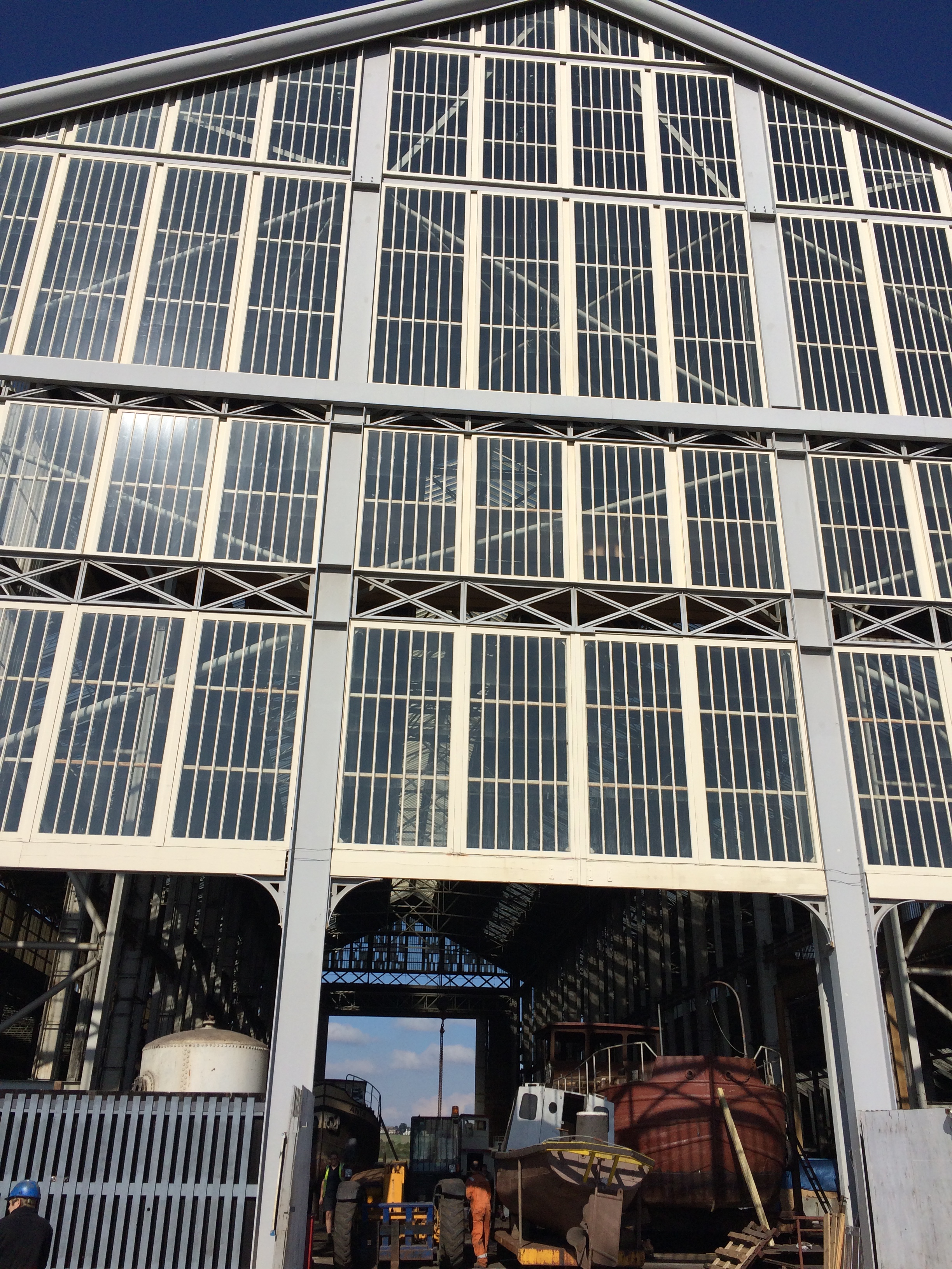
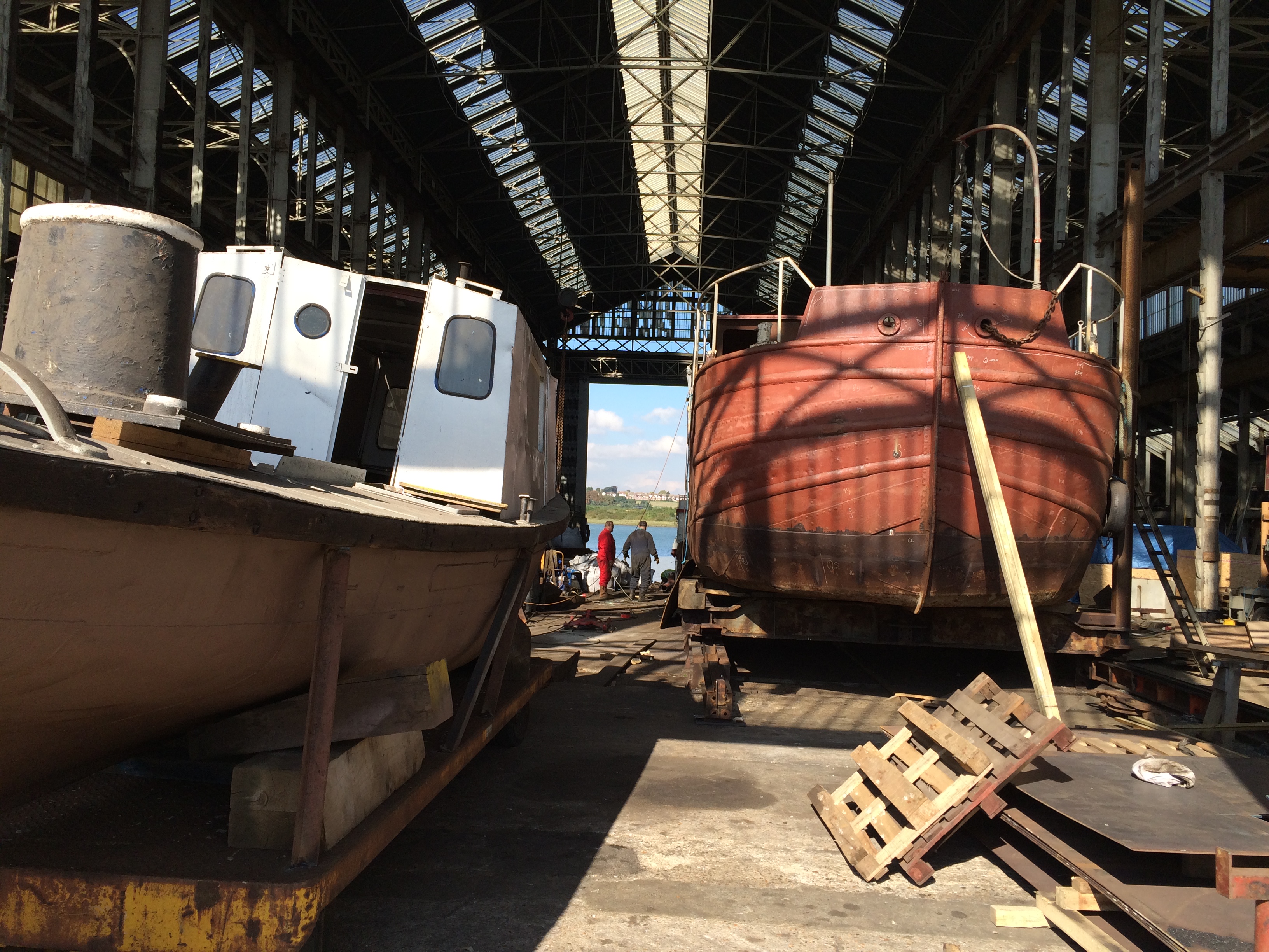
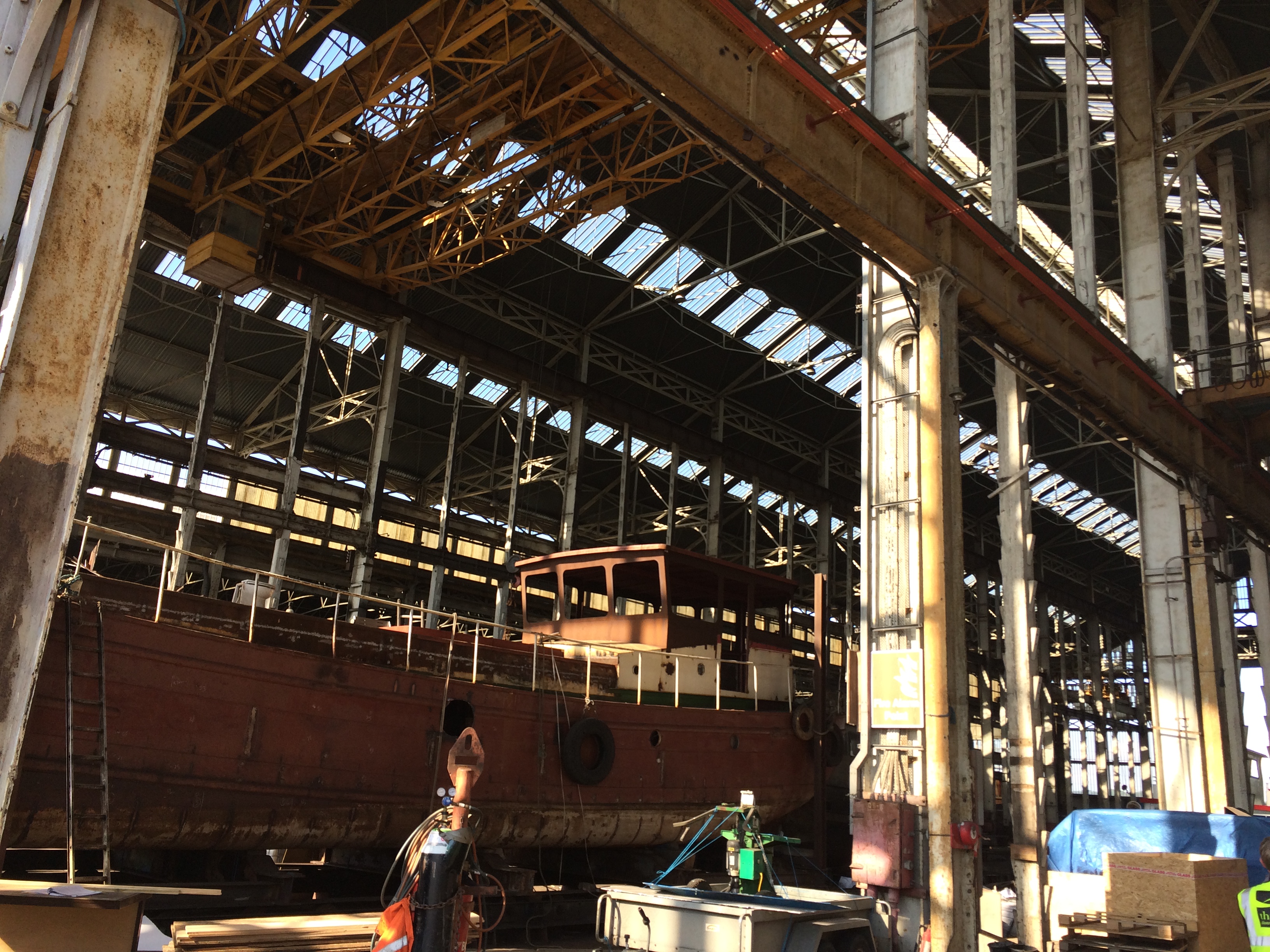
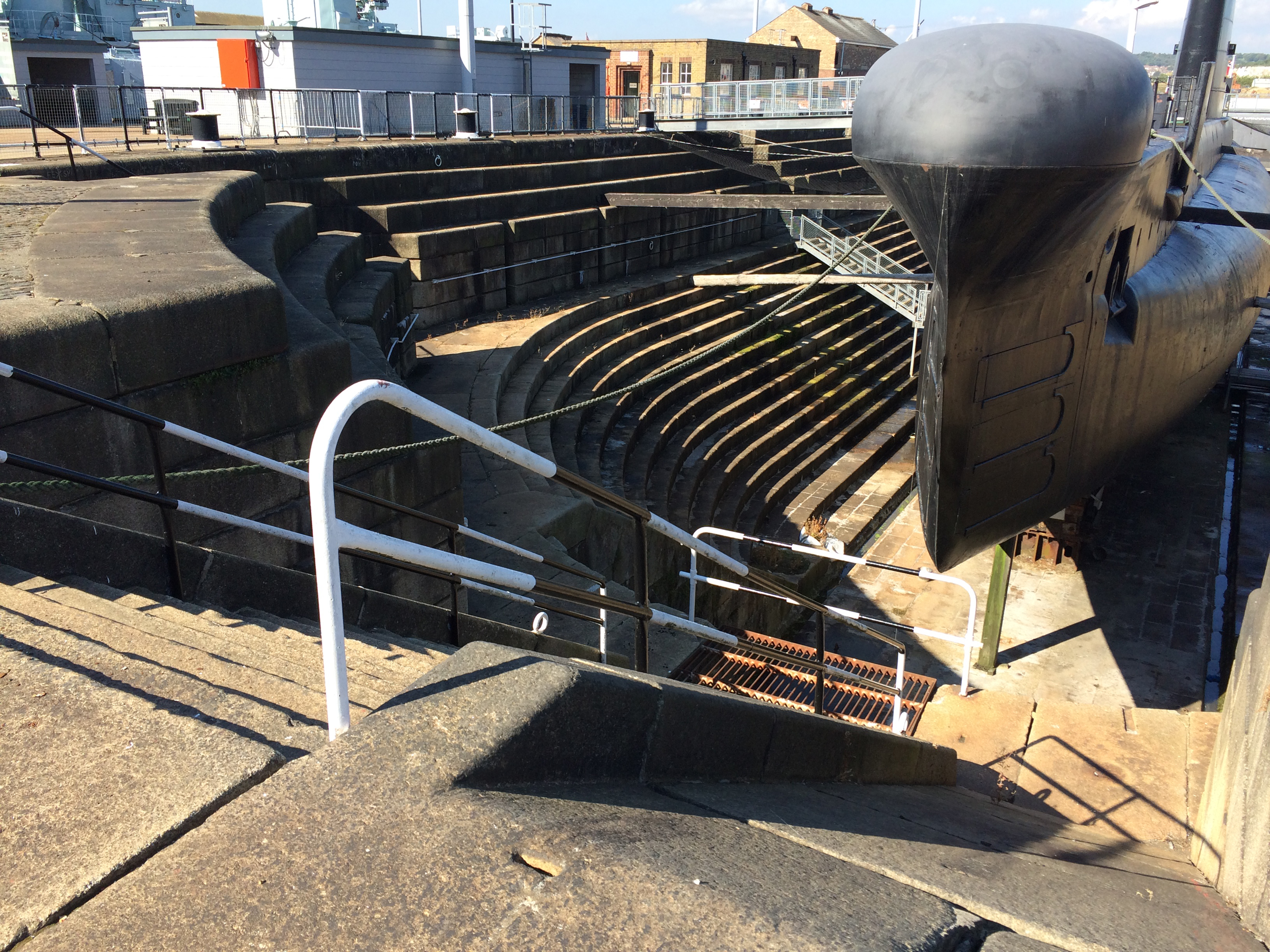
At the Dockyards I was drawn to the activity at Turks Shipyard, which is a fully working yard. The light coming through the roof and riverside doors was beautiful.
Turks Shipyard within the Historic Dockyard site at Chatham. Image:Christopher TippingTurks Shipyard within the Historic Dockyard site at Chatham. Image:Christopher TippingTurks Shipyard within the Historic Dockyard site at Chatham. Image:Christopher TippingTurks Shipyard within the Historic Dockyard site at Chatham. Image:Christopher TippingTurks Shipyard within the Historic Dockyard site at Chatham. Image:Christopher TippingDry Dock, Historic Dockyard, Chatham. Image:Christopher TippingDry Dock, Historic Dockyard, Chatham. Constructed of massive bespoke granite blocks. Image:Christopher Tipping
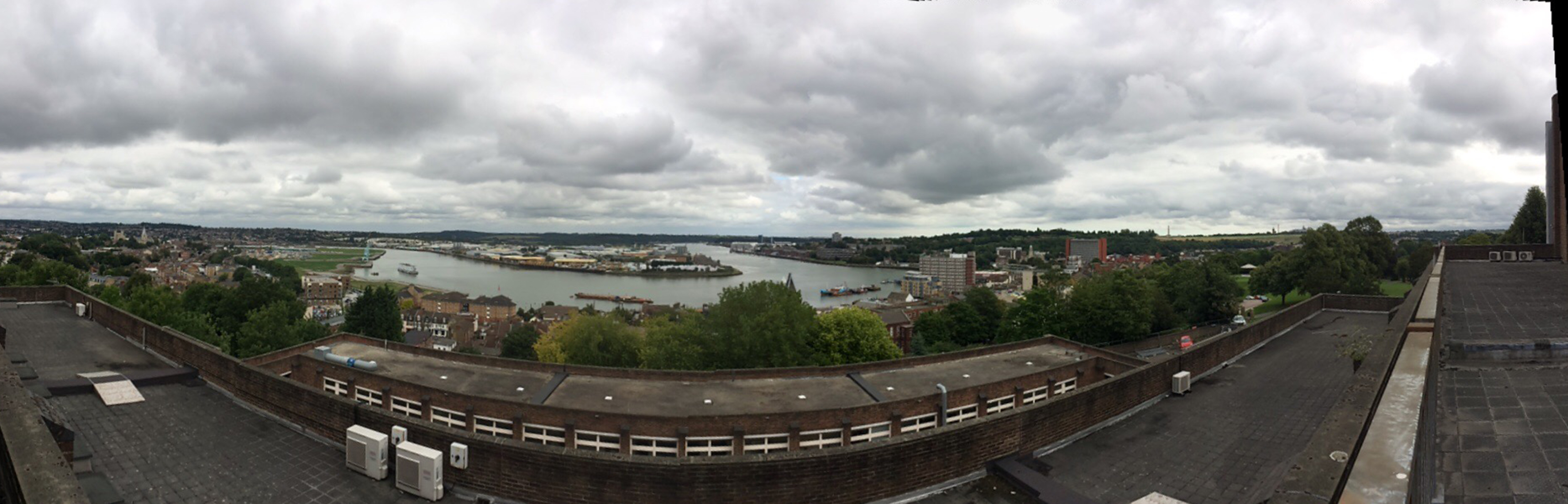
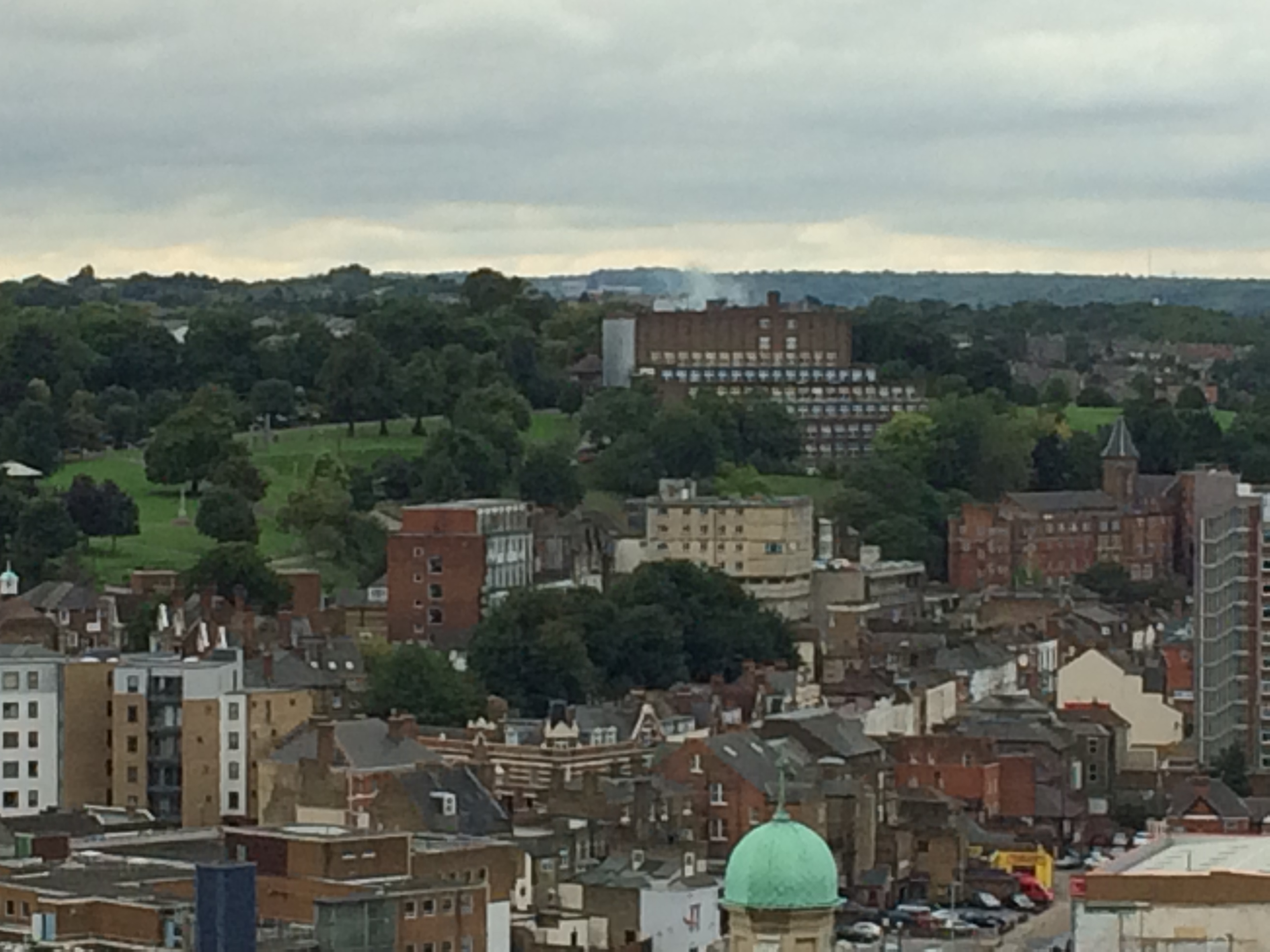
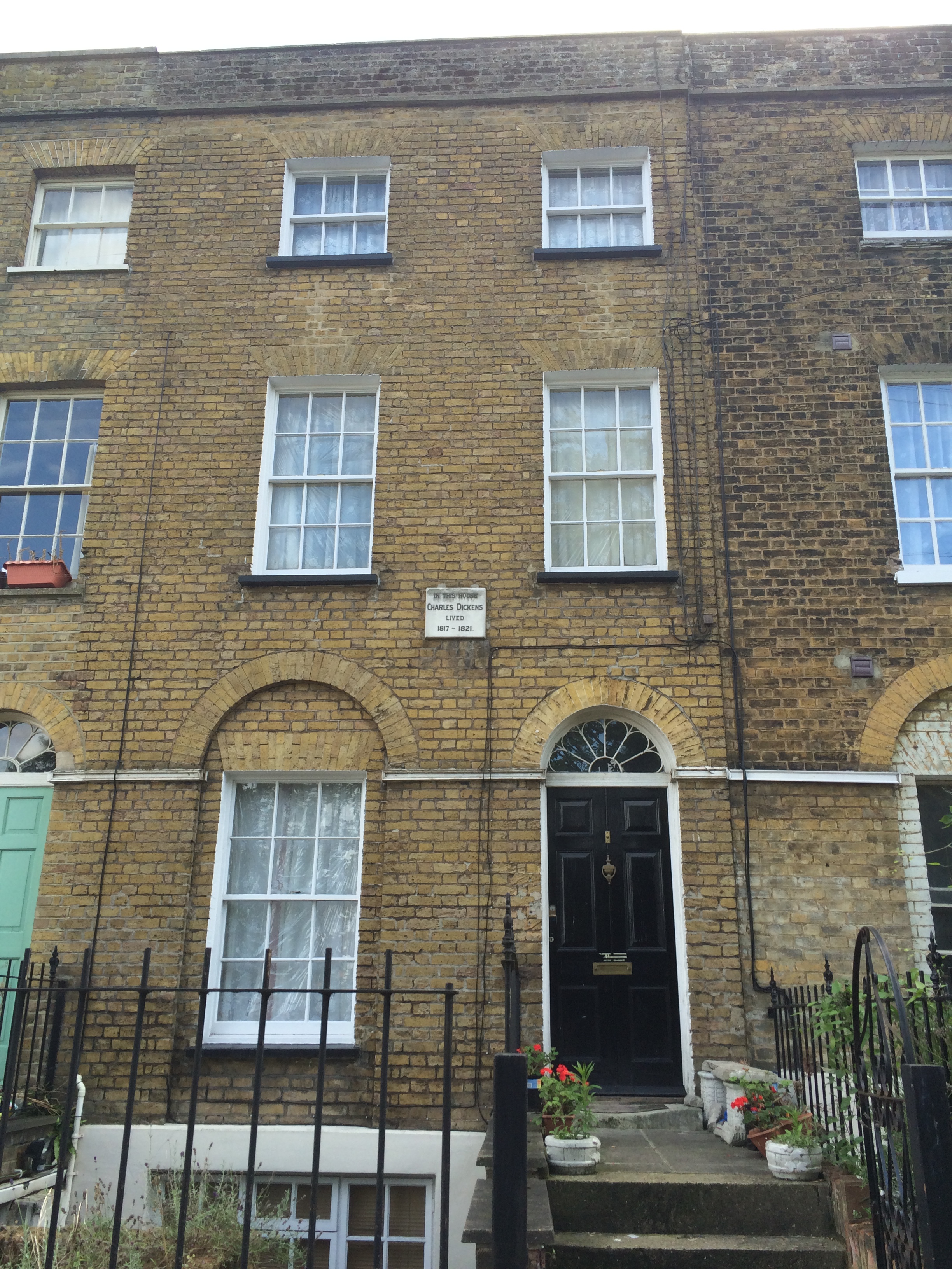
I walked up to the site from Chatham Station, which is only 5mins walk away, passing by Dickens’ House on Ordnance Terrace on the way. I was allowed up onto the upper floors and the terrace, which offers spectacular views across Chatham and Rochester, the Medway and The Historic Dockyards beyond. This vantage point makes clear why Chatham developed as it did as a strategically important defensive site on the River.
Chatham Lines – comprising a number of impressive defensive structures, earthworks and Forts, developed since Napoleonic times to protect the Docks from a landward attack, are clearly visible in the landscape and although now long past any active role in the defence of the country, have served to shape the town and its inhabitants in both its topography, physical landscape and social history.
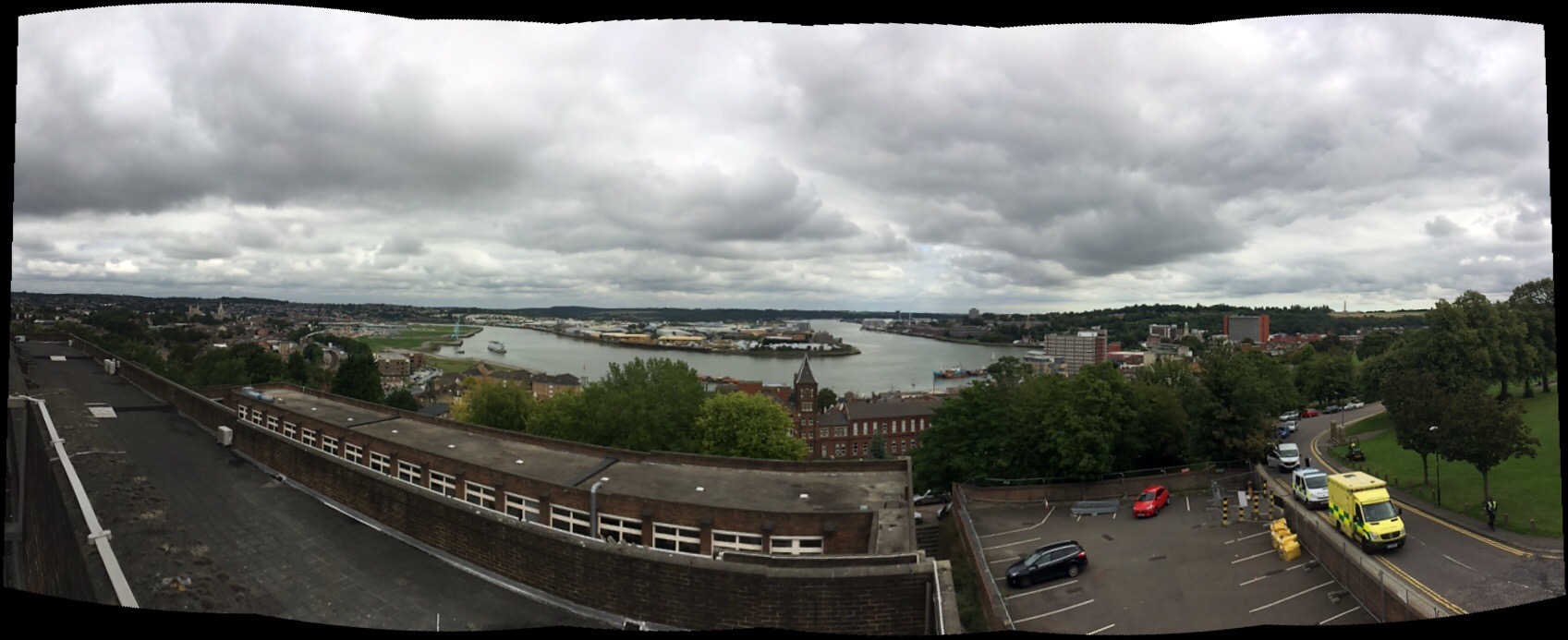
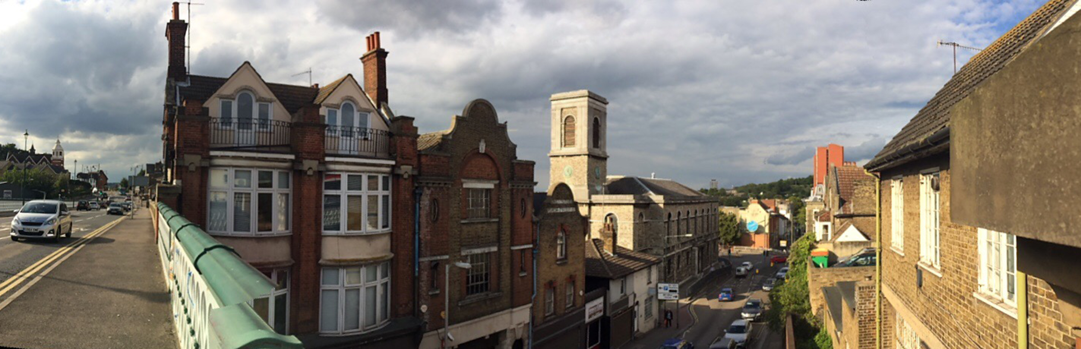
Chatham and the Historic Dockyard as seen from the upper floors of the University for the Creative Arts, Rochester Campus at Fort Pitt. Image:Christopher Tipping
Chatham and the Historic Dockyard as seen from the upper floors of the University for the Creative Arts, Rochester Campus at Fort Pitt. Image:Christopher Tipping
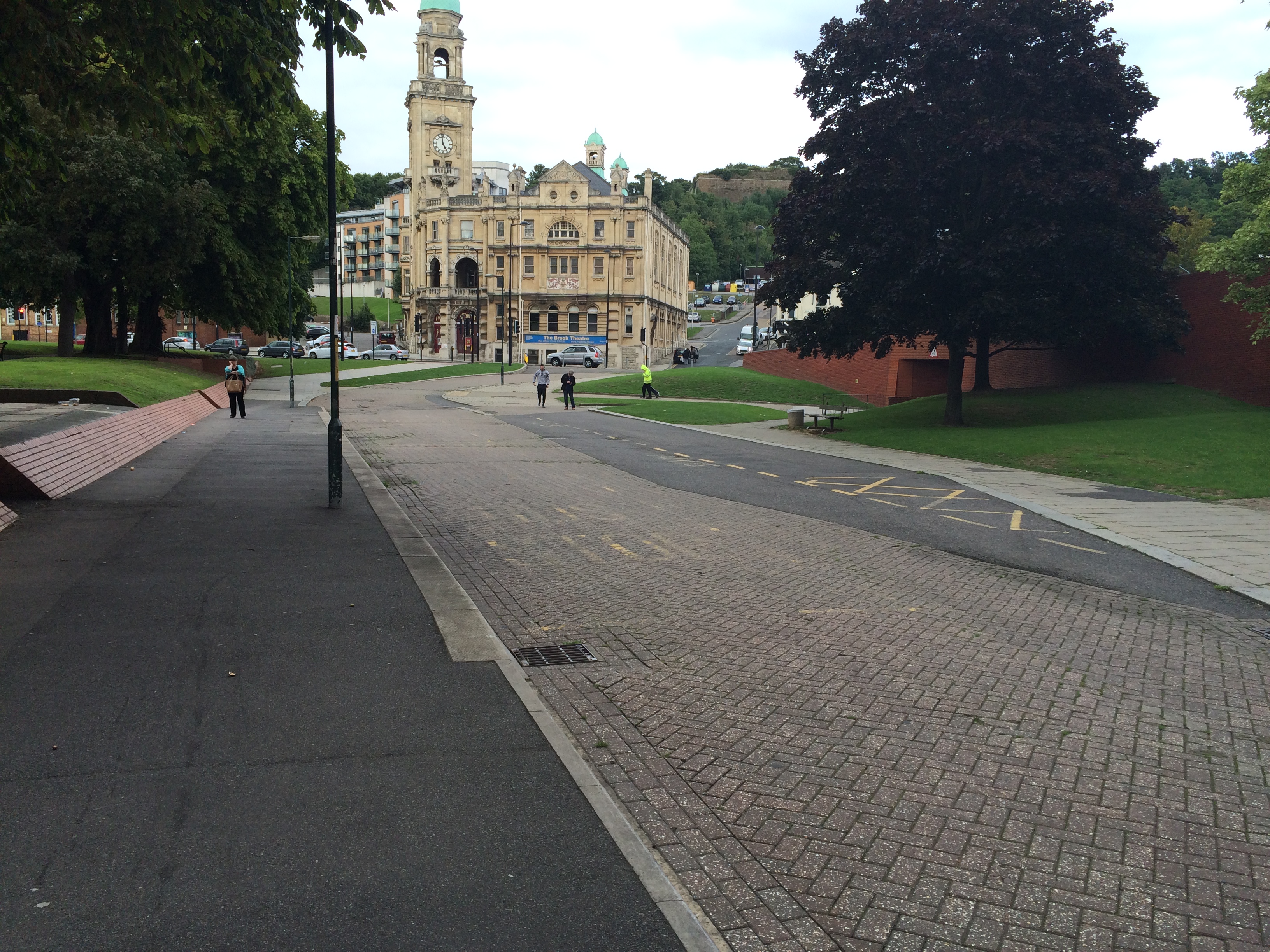
The copper green copula of the Brook Theatre, Chatham can be seen in the above image at the top right section of the image to the left of the red brick office clock Mountbatten House, the dominant landmark in the Town.
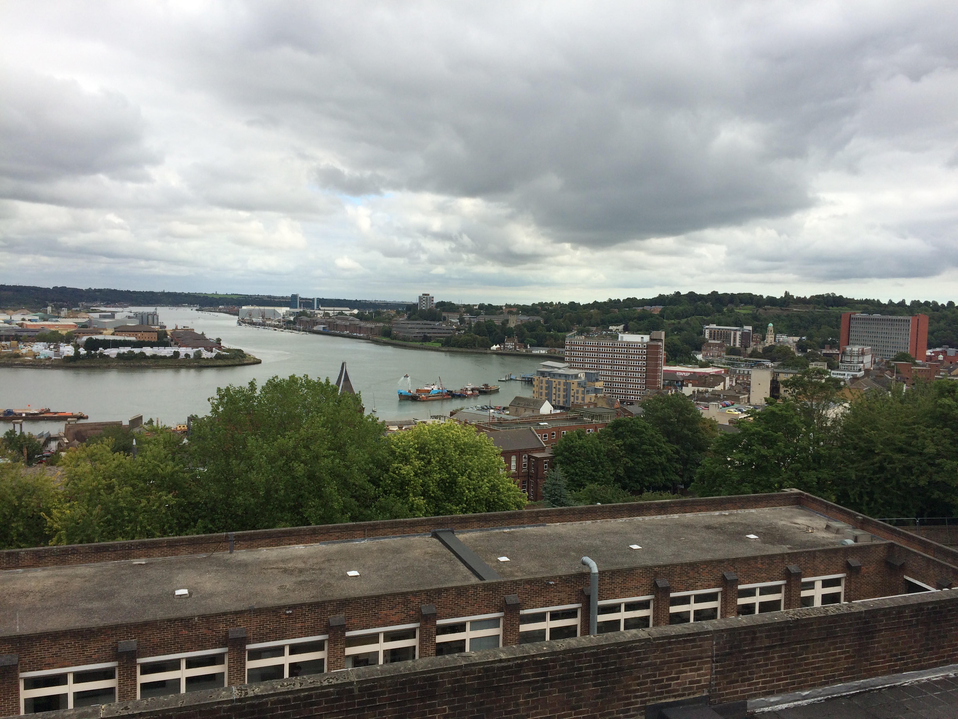
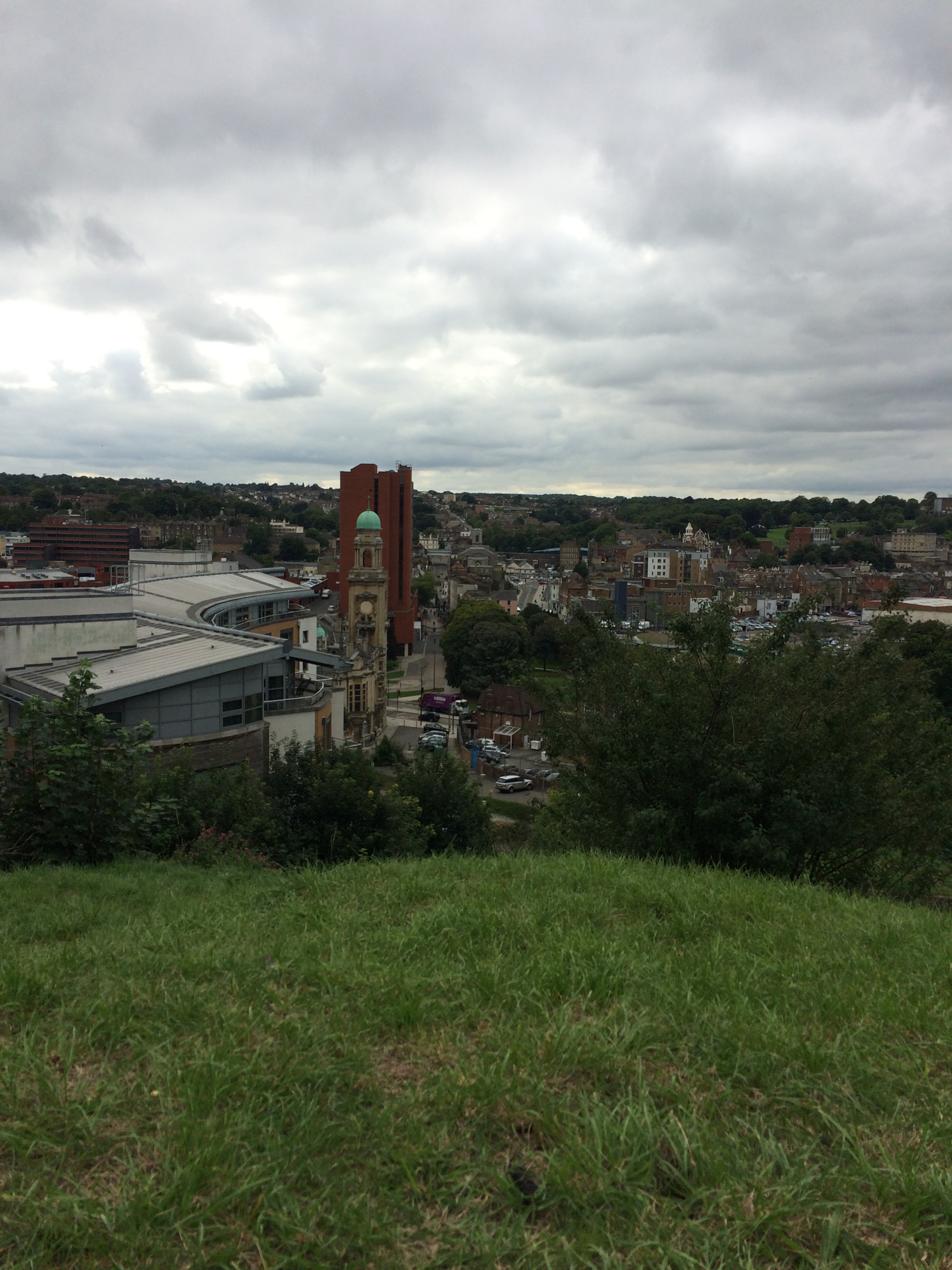
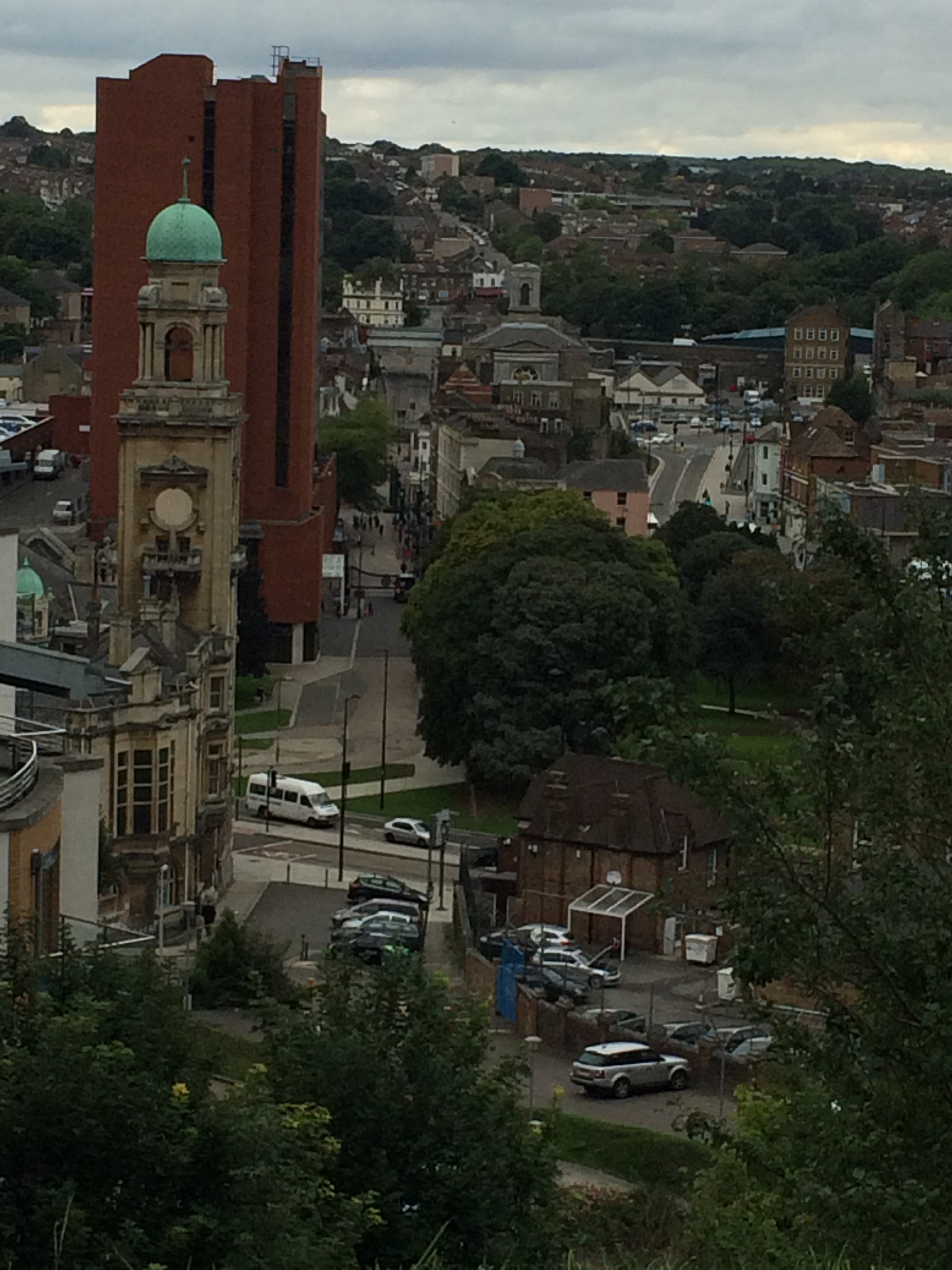
Chatham and the Historic Dockyard as seen from the upper floors of the University for the Creative Arts, Rochester Campus at Fort Pitt. Image:Christopher TippingChatham Waterfront and Gun Wharf as seen from Sun Pier. Image:Christopher Tipping
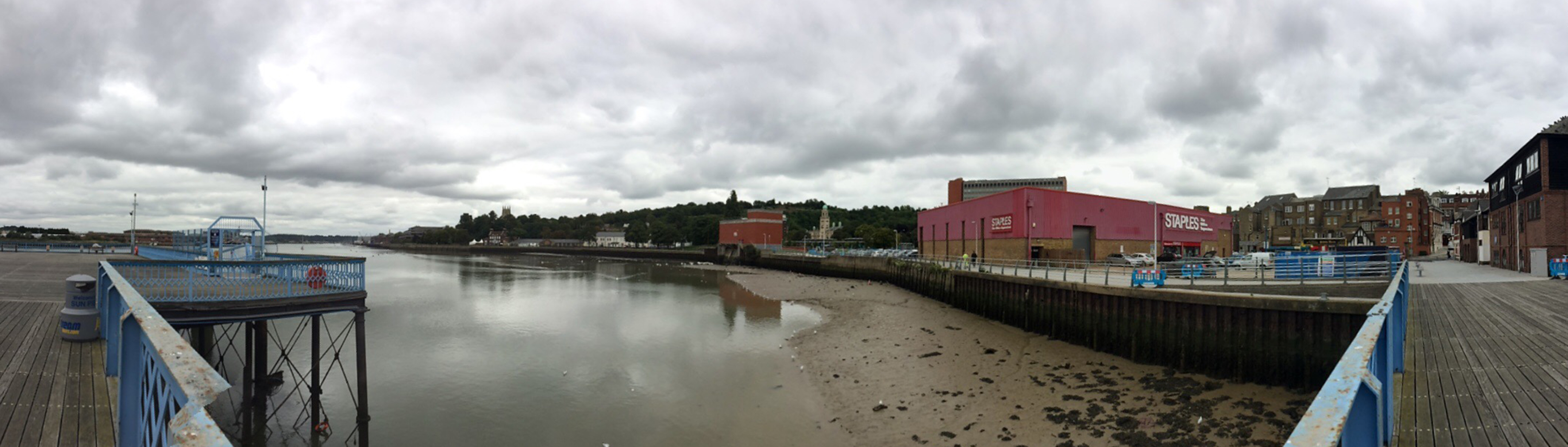
Chatham Waterfront and Gun Wharf as seen from Sun Pier. Image:Christopher Tipping
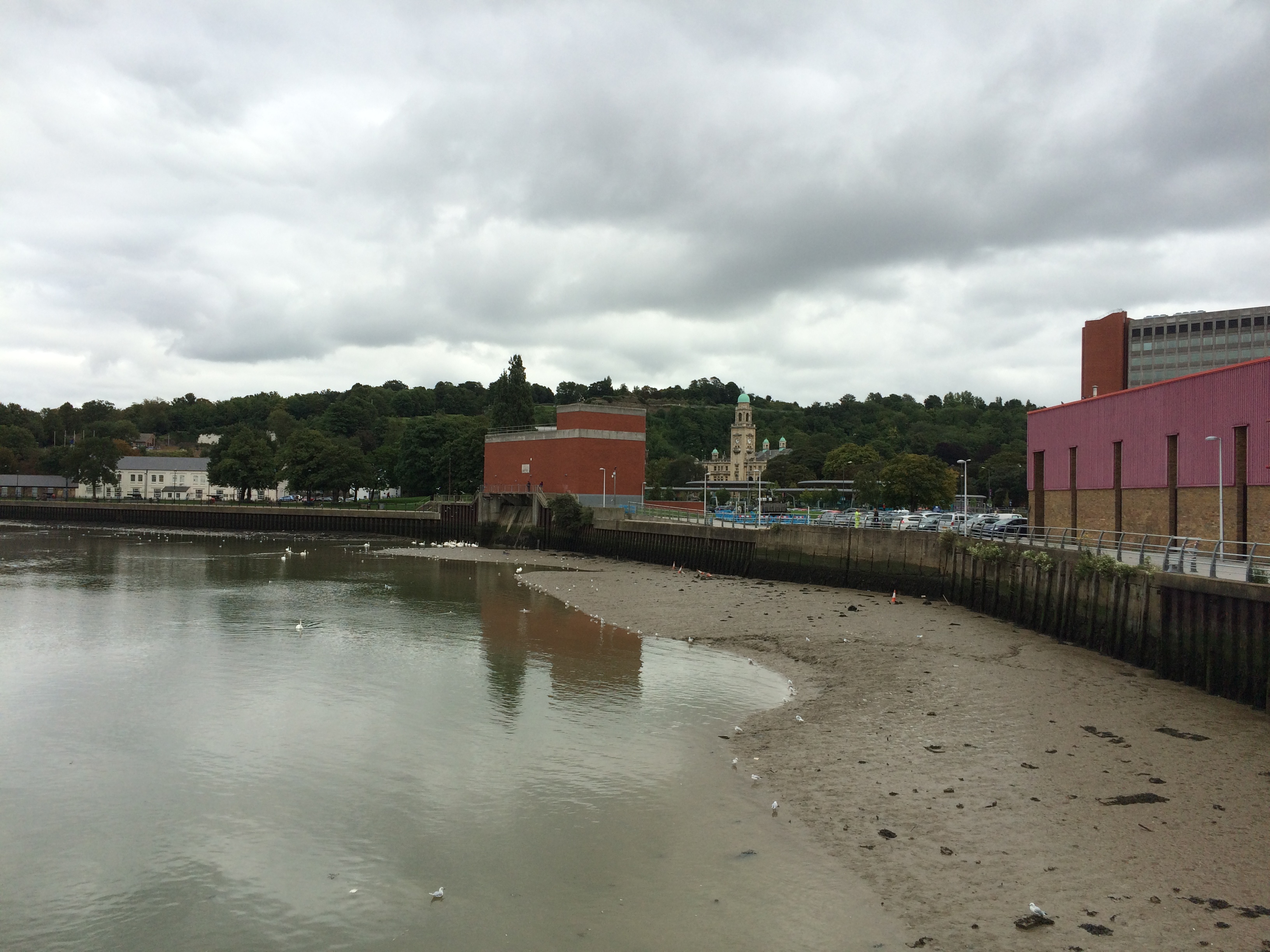
The Waterfront Pumping Station and Brook Theatre as seen from Sun Pier, Chatham. If ever something cried out for some form of intervention – then the Pumping Station takes poll position on the list. An eyesore on the waterfront, it could become an icon and focal point.
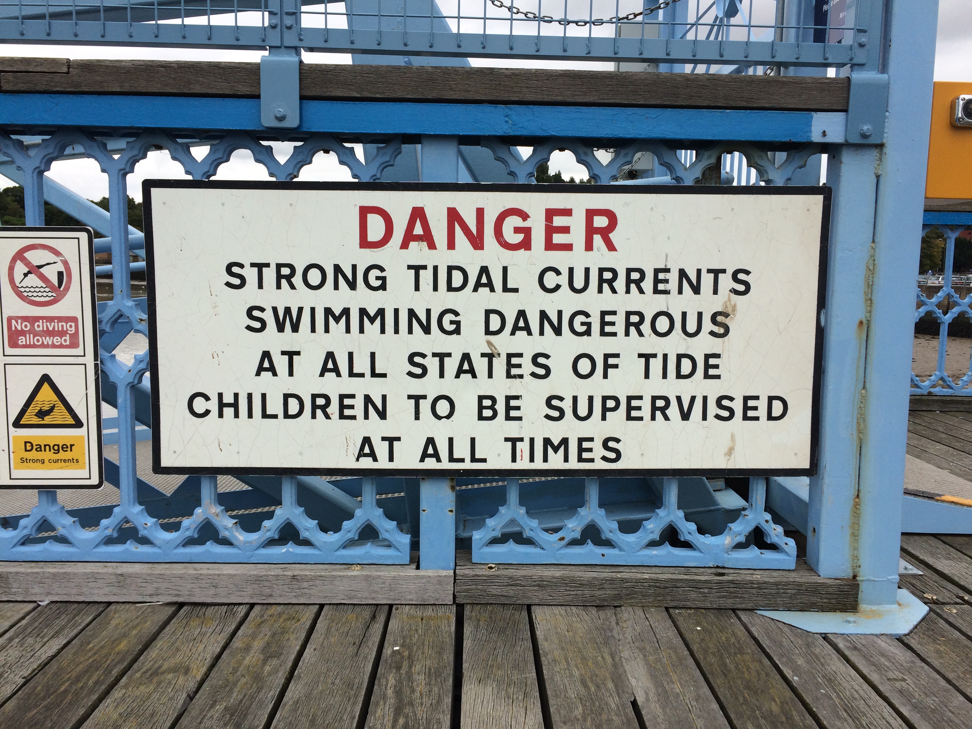
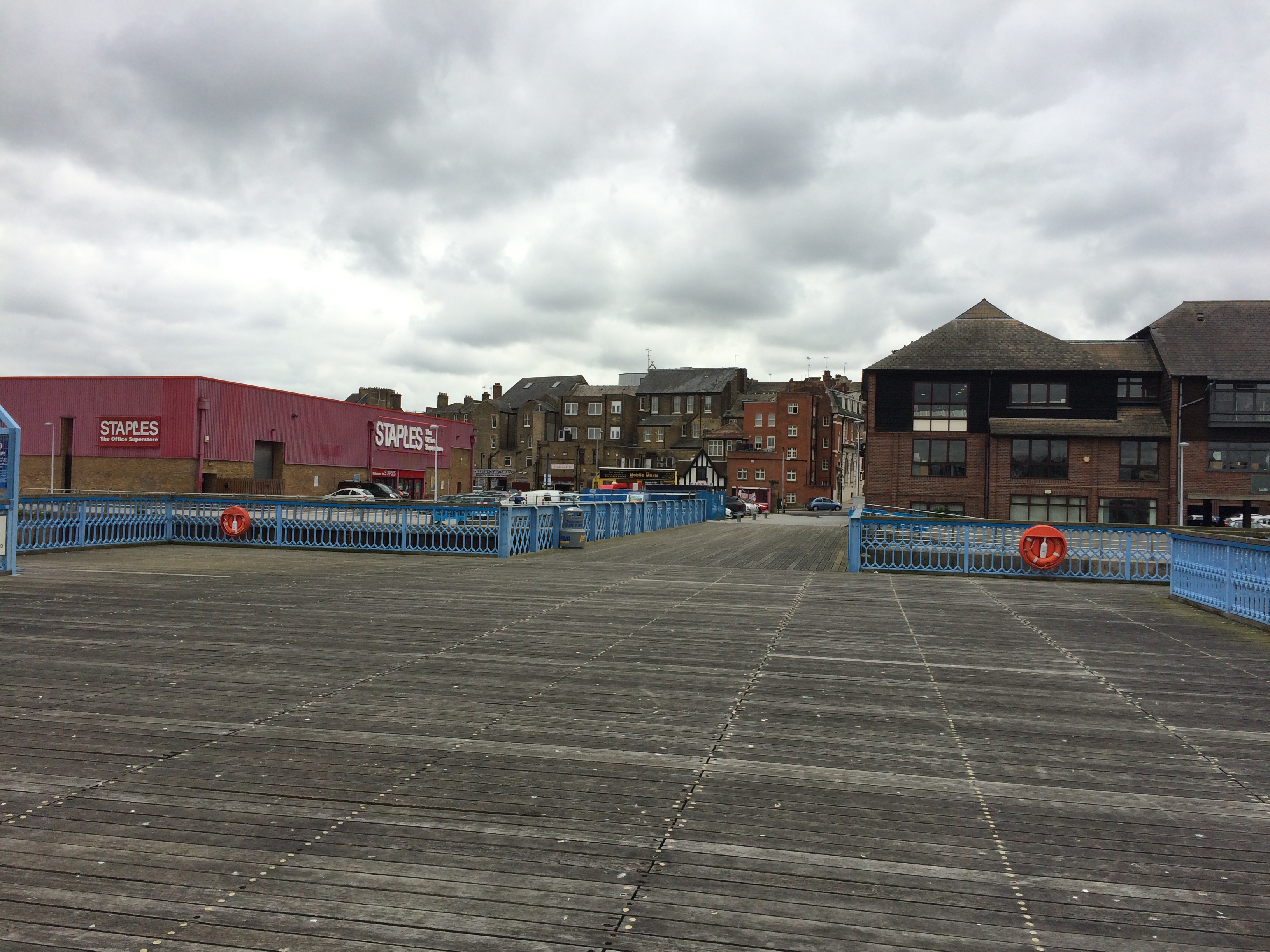
Sun Pier, Chatham with warning sign. Image:Christopher TippingThe empty timber deck of Sun Pier, Chatham. Image:Christopher Tipping
Although historically, the waterfront and area around Sun Pier would have been dominated by warehouses and river bases businesses. The industrial shed which houses Staples, does the site and its potential no favours here. Some softening landscape works and green screening may help.
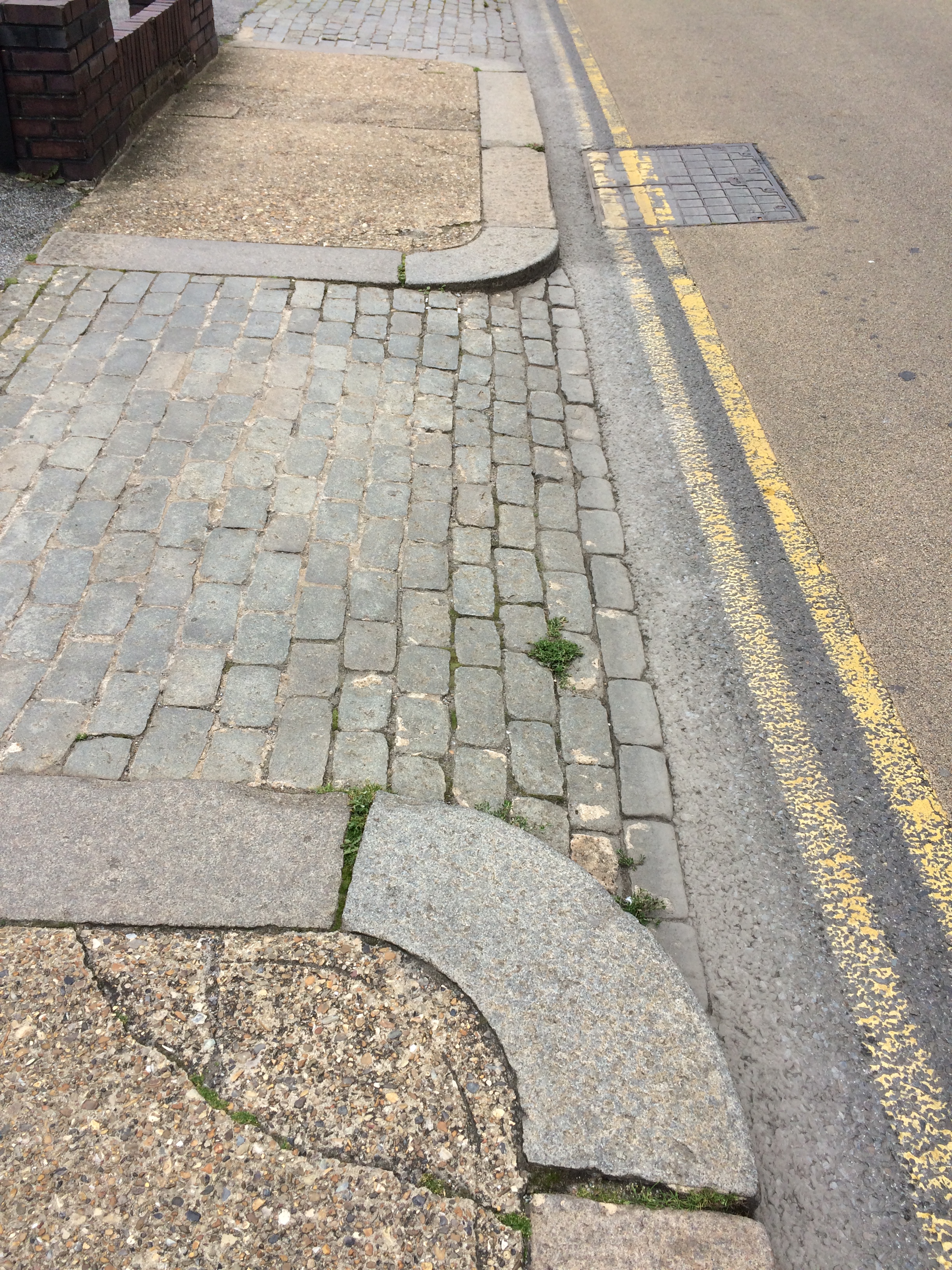
Walking back from Sun Pier to the Waterfront and Bus Station, these historic granite kerbs and cobbles jump out for their simplicity, texture and purpose.
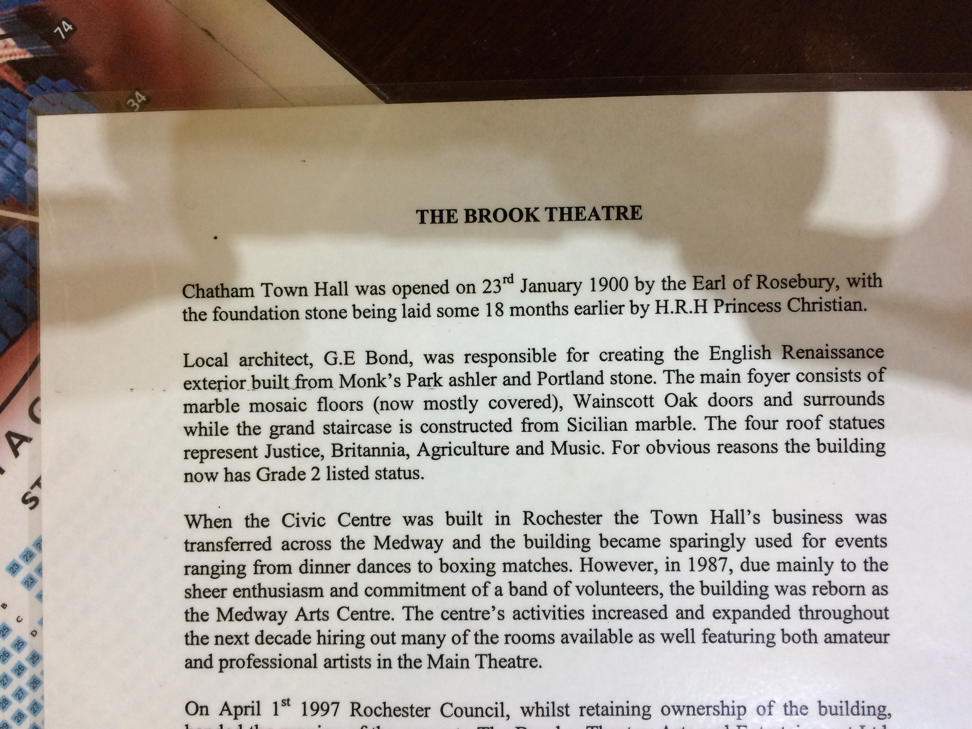
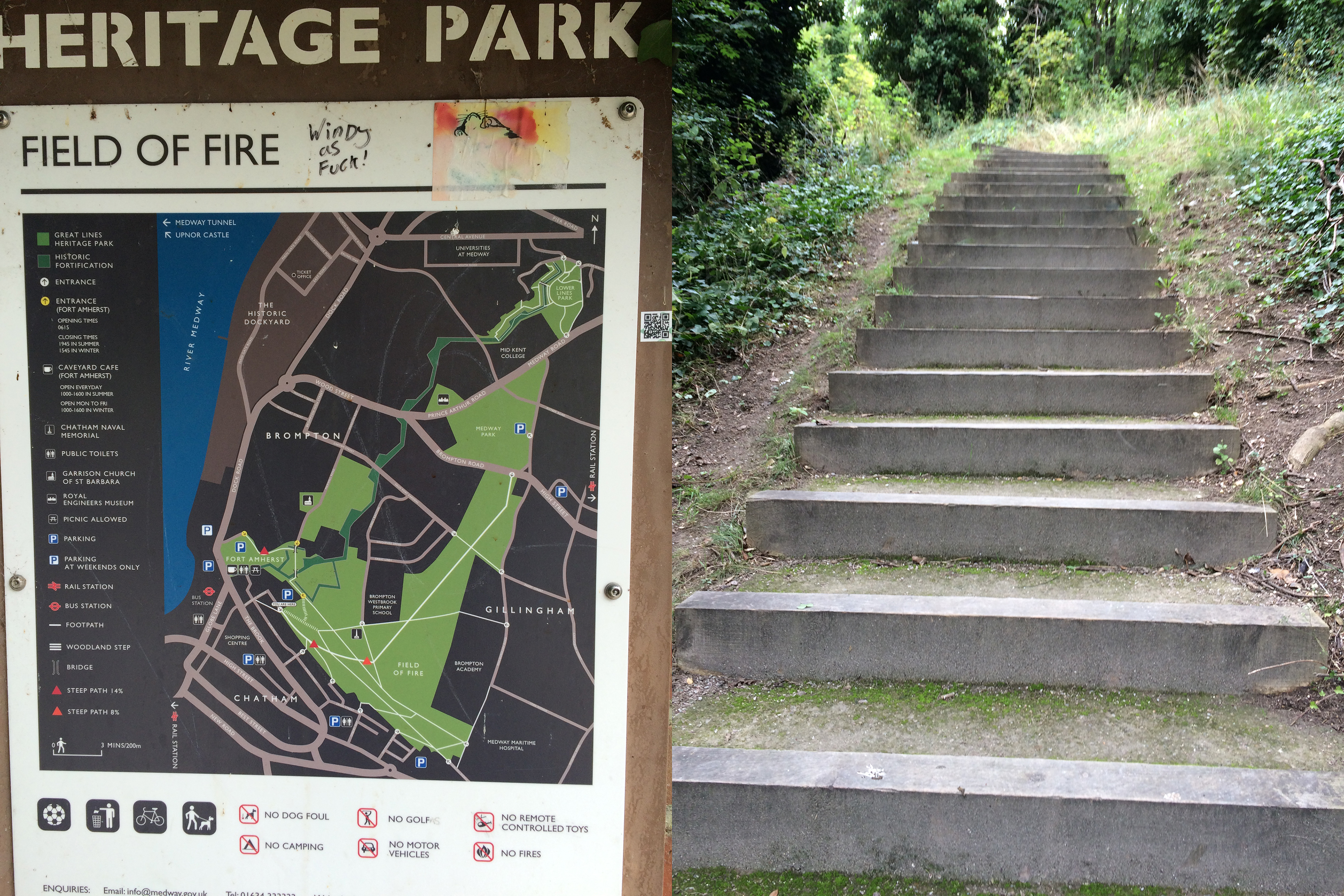
I wanted to see the town from the opposite vantage point of Fort Amherst adjacent to Great Lines Park, formerly known as the Field of Fire , so walked across to the Brook Theatre and beyond to the Town Hall Gardens, the former Town Burial Ground. Prior to 1828, the site was a former Rope Works.
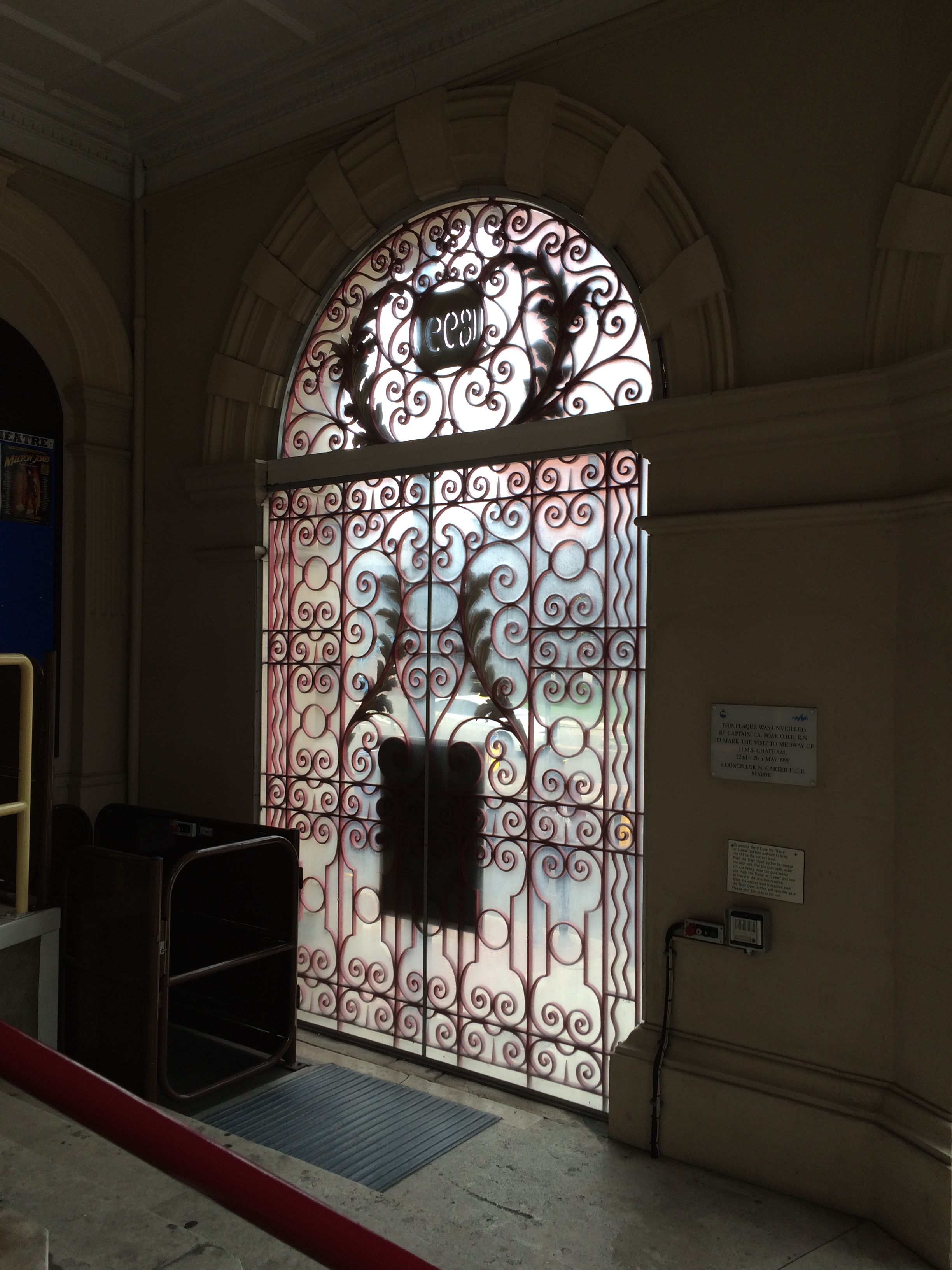
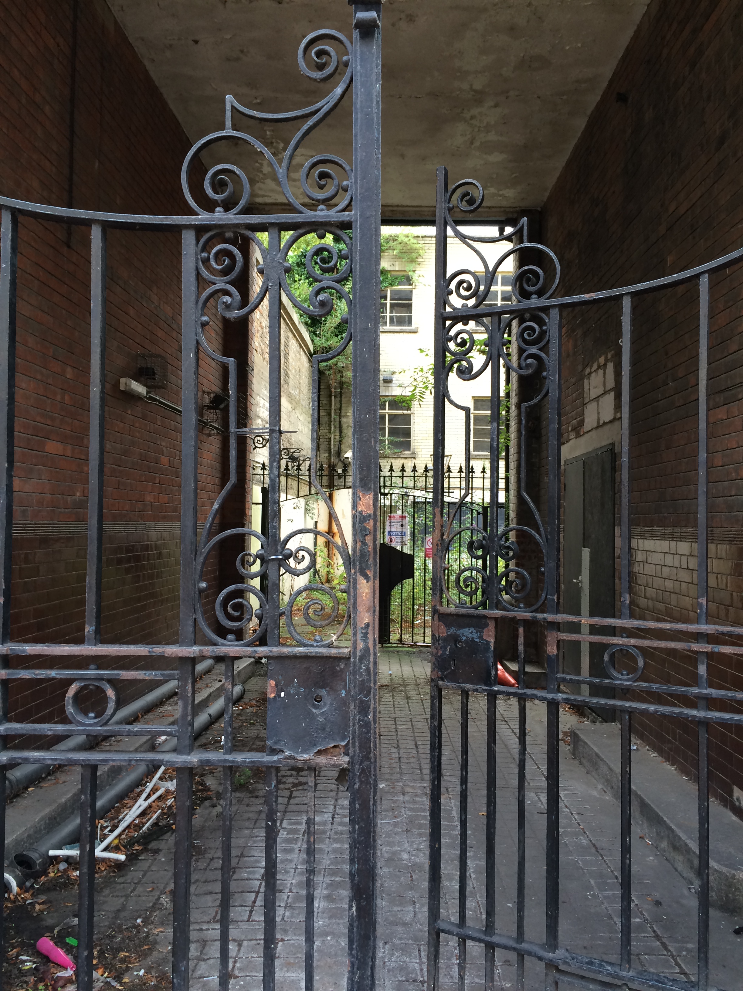
The Brook Theatre, Chatham. Image:Christopher TippingDecorative wrought ironwork gates inside the Brook Theatre, Chatham. Image:Christopher TippingDecorative wrought ironwork gates inside the Brook Theatre, Chatham. Image:Christopher TippingThe gates to the Town Hall Gardens, Chatham. Image:Christopher Tipping
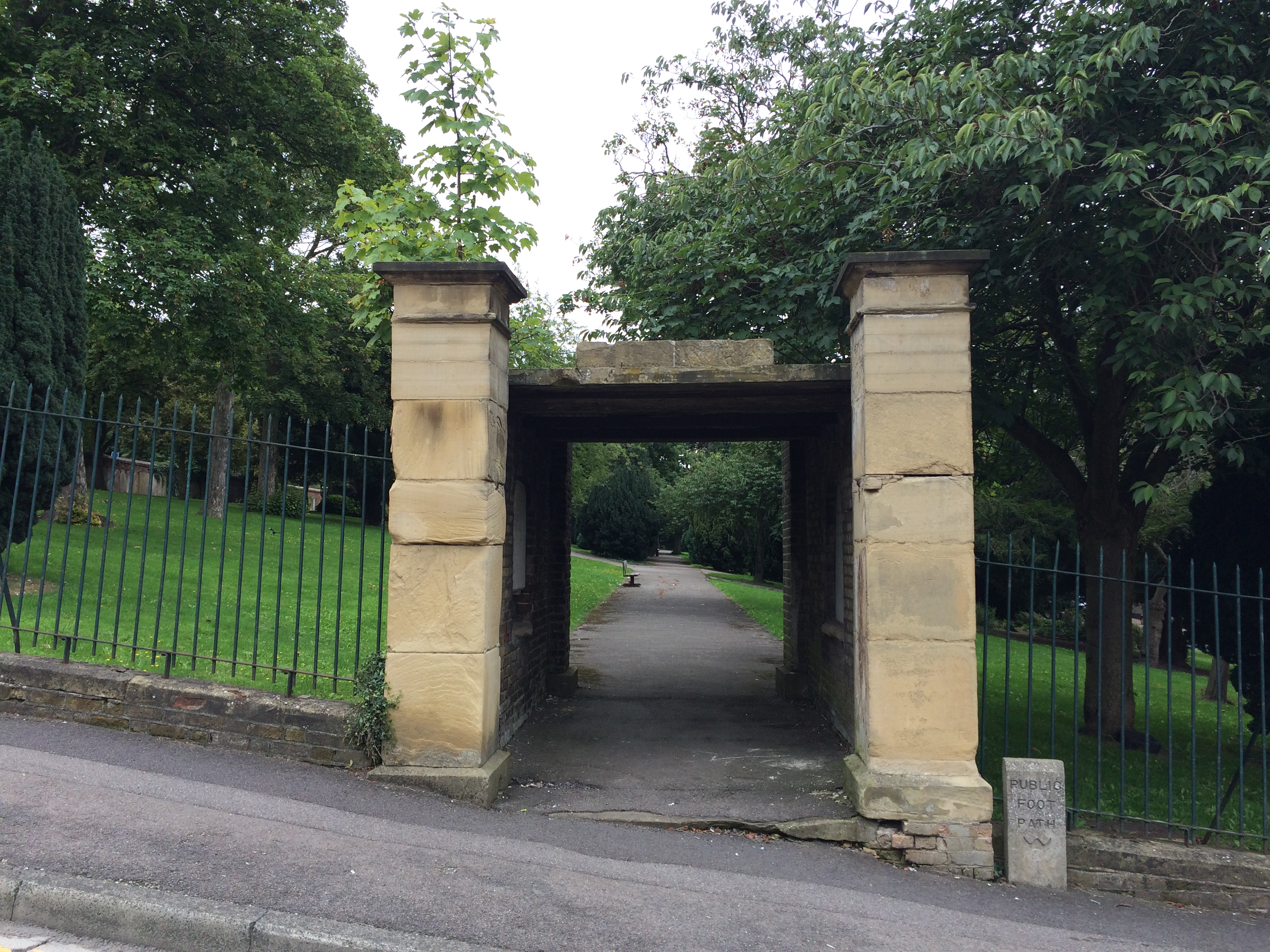
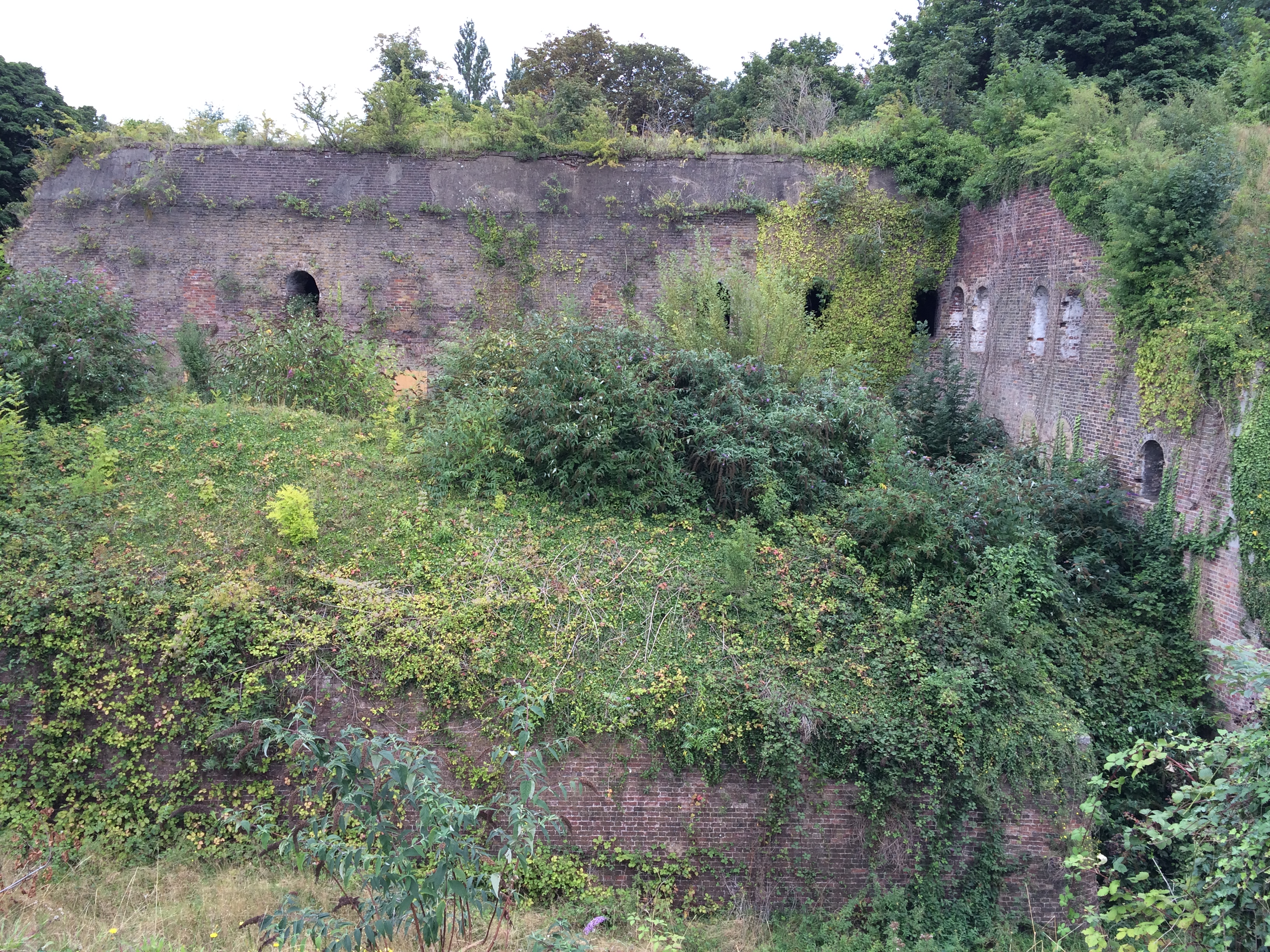
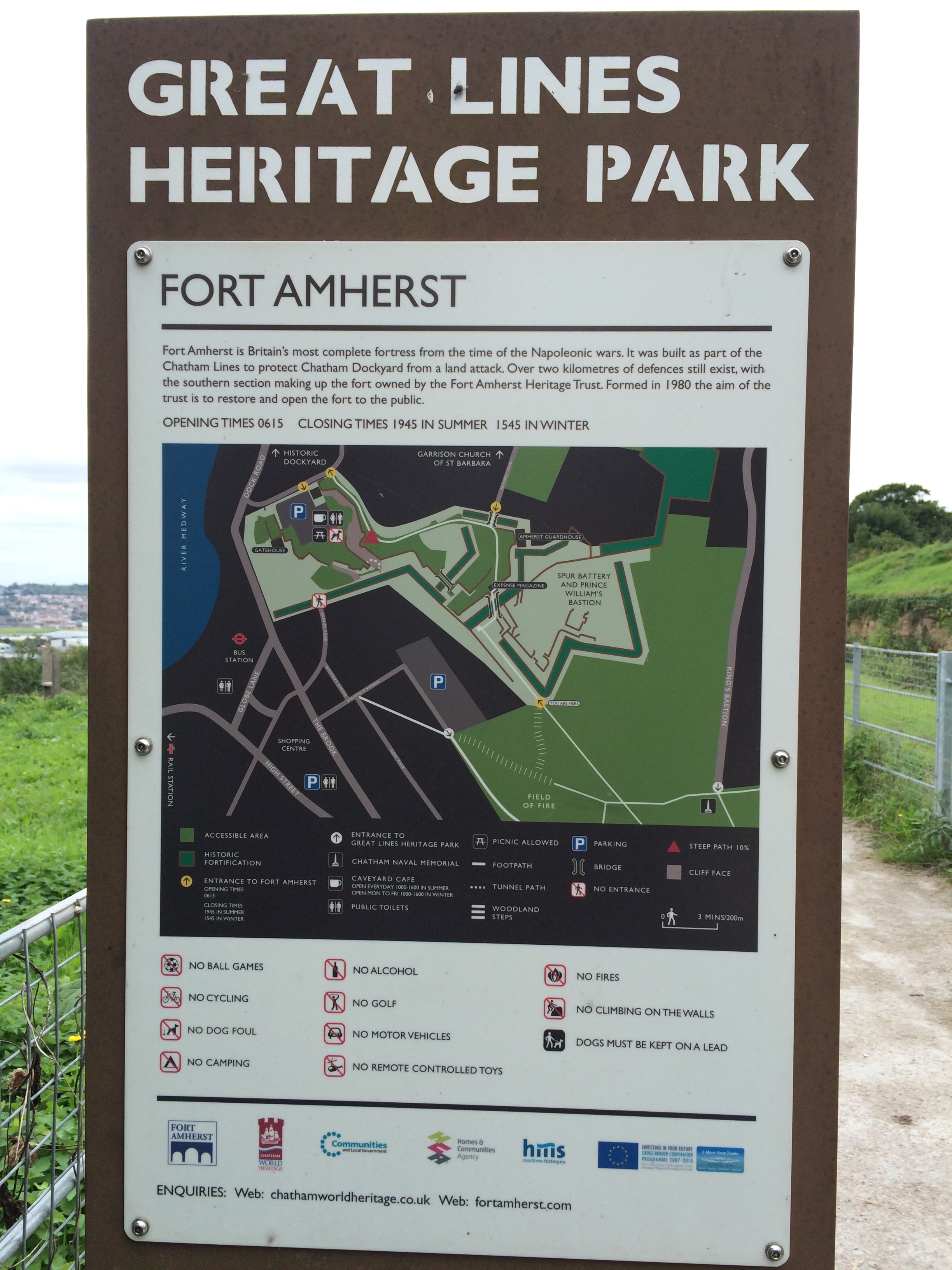
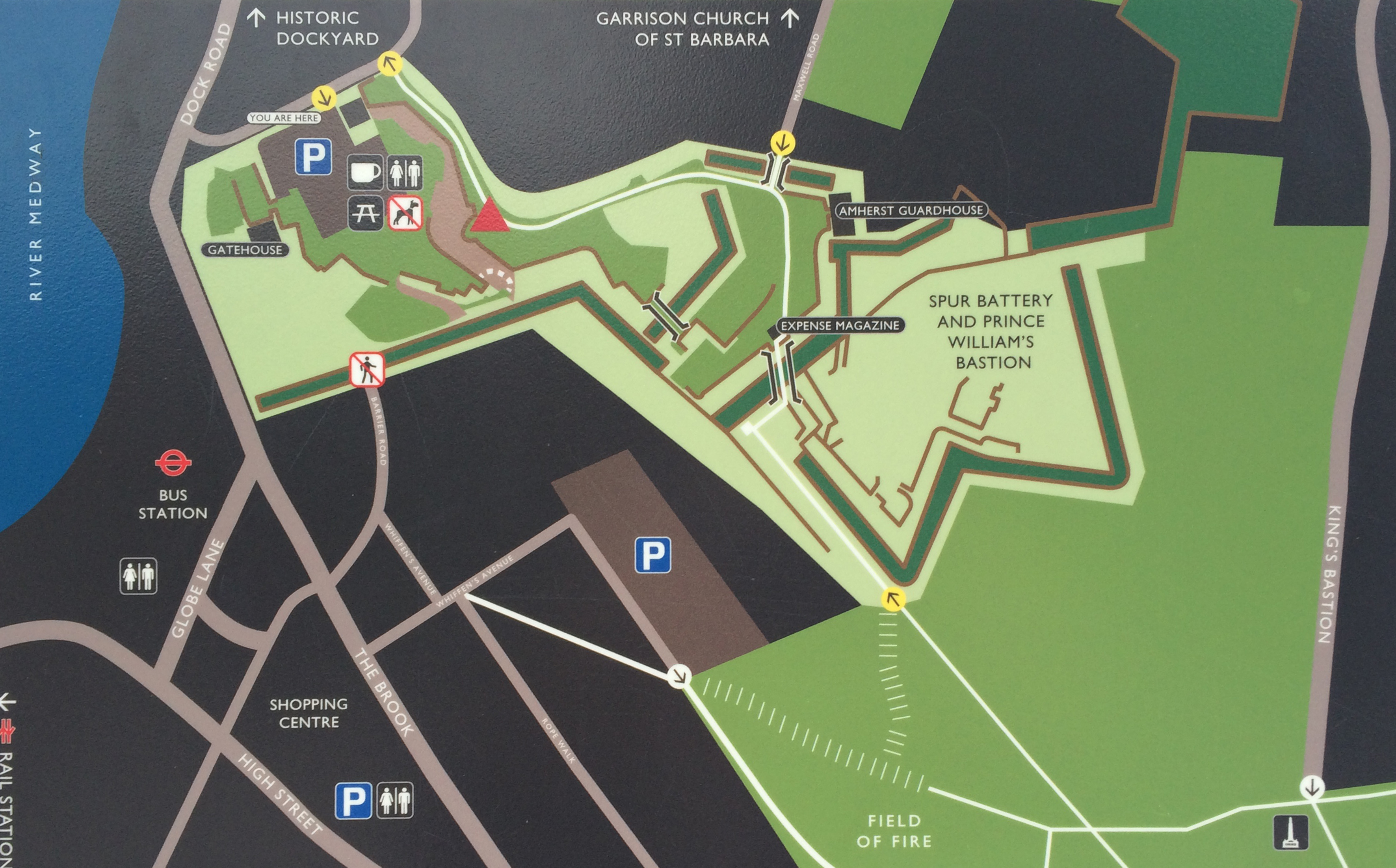
Just a short walk further up the hill is the path and steps leading up to the Great Lines Park and Fort Amherst.
Several steep fights of steps meet the visitor to the Great Lines Heritage Park and Fort Amherst, Chatham. Image:Christopher TippingThe Napoleonic brick faced defensive structures of Fort Amherst, Chatham. Image:Christopher TippingFort Amherst Signage, Chatham. Image:Christopher TippingA detail of the Fort Amherst Signage found at Great Lines Park, Chatham. Image:Christopher TippingA view of the University for the Creative Arts at Fort Pitt, Rochester, taken from Belvedere Battery, Fort Amherst, Chatham. Image:Christopher Tipping
UCA at Fort Pitt is at top centre of this image. The copper green copula of the Brook Theatre is at the centre bottom.
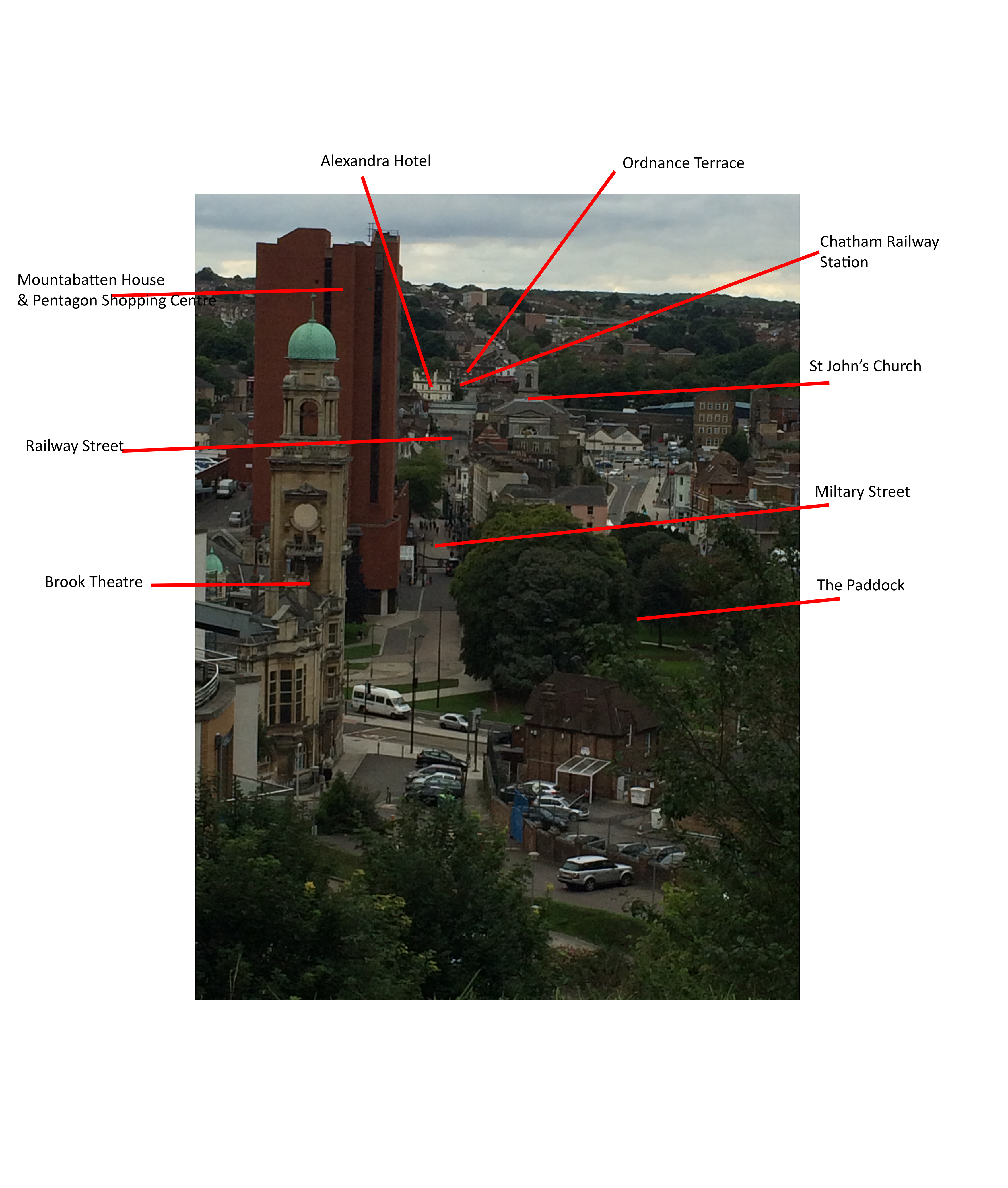
The pedestrian route from Chatham Railway Station to The Paddock and Bus Station can be made out in this image taken from Belvedere Battery, Fort Amherst, Chatham. Image:Christopher TippingThe pedestrian route from Chatham Railway Station to The Paddock and Bus Station can be made out in this image taken from Belvedere Battery, Fort Amherst, Chatham. Image:Christopher TippingThe pedestrian route from Chatham Railway Station to The Paddock and Bus Station can be made out in this annotated image taken from Belvedere Battery, Fort Amherst, Chatham. Image:Christopher Tipping
They have a brilliant book on Chatham and it’s history – “The Story of a Dockyard Town”by James Presnail, published by the Corporation of Chatham in 1952 MCMLII. Ref:942.23 CHA. I was much taken by it’s last paragraph on social responsibility.
Margate Flood & Coast Protection Scheme. Aerial image obtained from a multi-rotor copter by photographer Dean Barkley. Image: Dean BarkleyMargate Coastal Flood & Protection Project aka Margate Steps. Margate, Kent. Image: Christopher Tipping
I met up with Laura Knight and Louise Francis of FrancisKnight Public Art Consultants along with Neil Mattinson and Jennifer Corlett of LDA Design. Neil & Jennifer hadn’t visited Margate or the Margate Steps before so this was a good opportunity to see a successful coastal engineering project , which also happens to provide a considerable and much need public realm and meeting place for residents and visitors alike. The project also encompasses much of Margate’s legacy and heritage as a seaside town which has seen storms and weather act as the primary catalyst for changes and regeneration.
My role as project artist within the integrated design team on the Margate Coastal Flood & Protection Project – aka Margate Steps – was to influence and challenge the design process via contextual and site responsive research and collaborative practice. The scope for influencing the process within the Chatham Placemaking Project is a similar one – albeit a much shorter consultancy – and is as much about a collaborative and discussive one.
This was a useful and engaging meeting, where we had an open discussion about the scope for the Chatham project, whilst also experiencing and reviewing a recent regeneration project at first hand.
I had an appointment to meet the archivist at MALSC to review their photographic collection – particularly in regard to Railway Street and Military Street. I took a number of digital images from old photographs, but will require permission to post them on the blog. Hopefully, I can do this in due course.
Old OS Maps of the area were of particular interest as these obviously mapped out – some in great detail – large areas of the site where building had been lost during ‘development’ and / or razed to the ground by fire or neglect. Again – watch this space as i hope to post these images too.
Of particular interest were the OS 1848 Board of Health Map and the 1843 Tithe Map.
Thursday 3rd September 2015 – Chatham Research Visit No 2 – A clearer vision…
Chatham is making more sense ! – the topography here is incredibly helpful in aiding navigation around the town. Geography, topography and the particular curve of the River Medway provided the strategic advantage which led to the exponential growth of the Docks and town from the early part of the 18th Century. The day today was clearer and brighter – unlike my first visit when it poured down all day – this really makes a considerable difference! Still walking as much as possible – by far the best way of getting to grips with a place – today I went as far as Strood, via Rochester and visited the Medway Archives and Local Studies Centre.
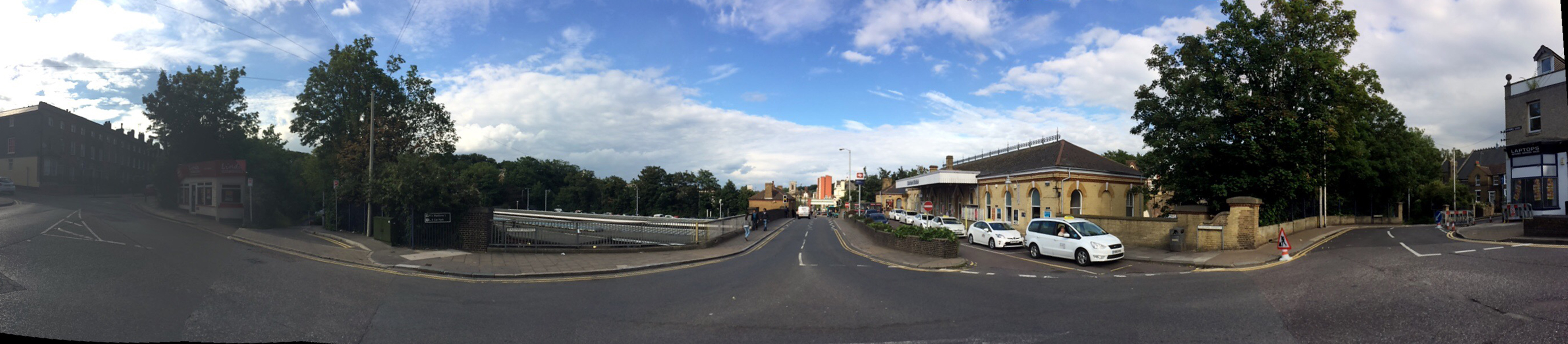
The following images again trace the pedestrian route from the Rail Station to the Waterfront.
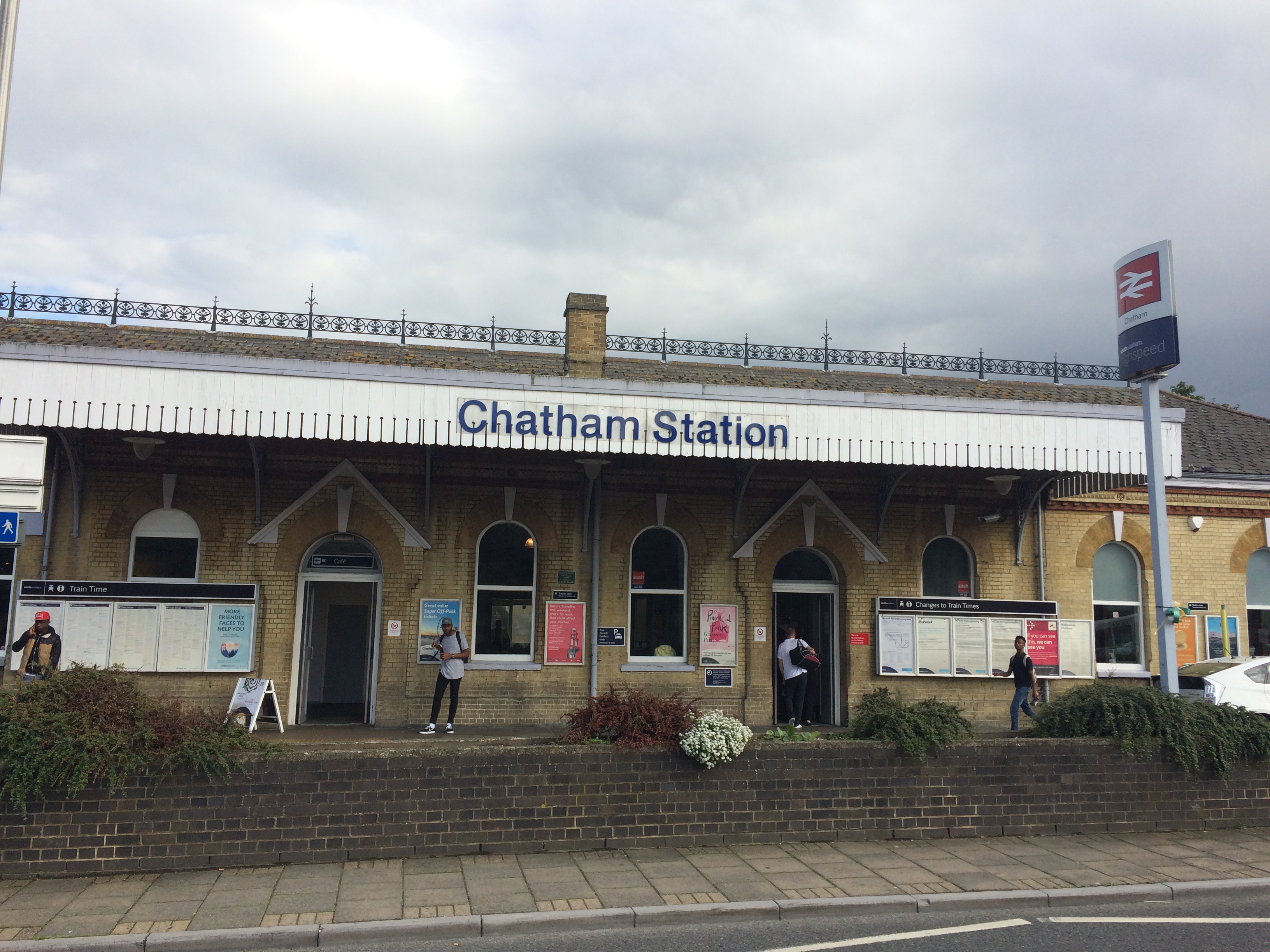
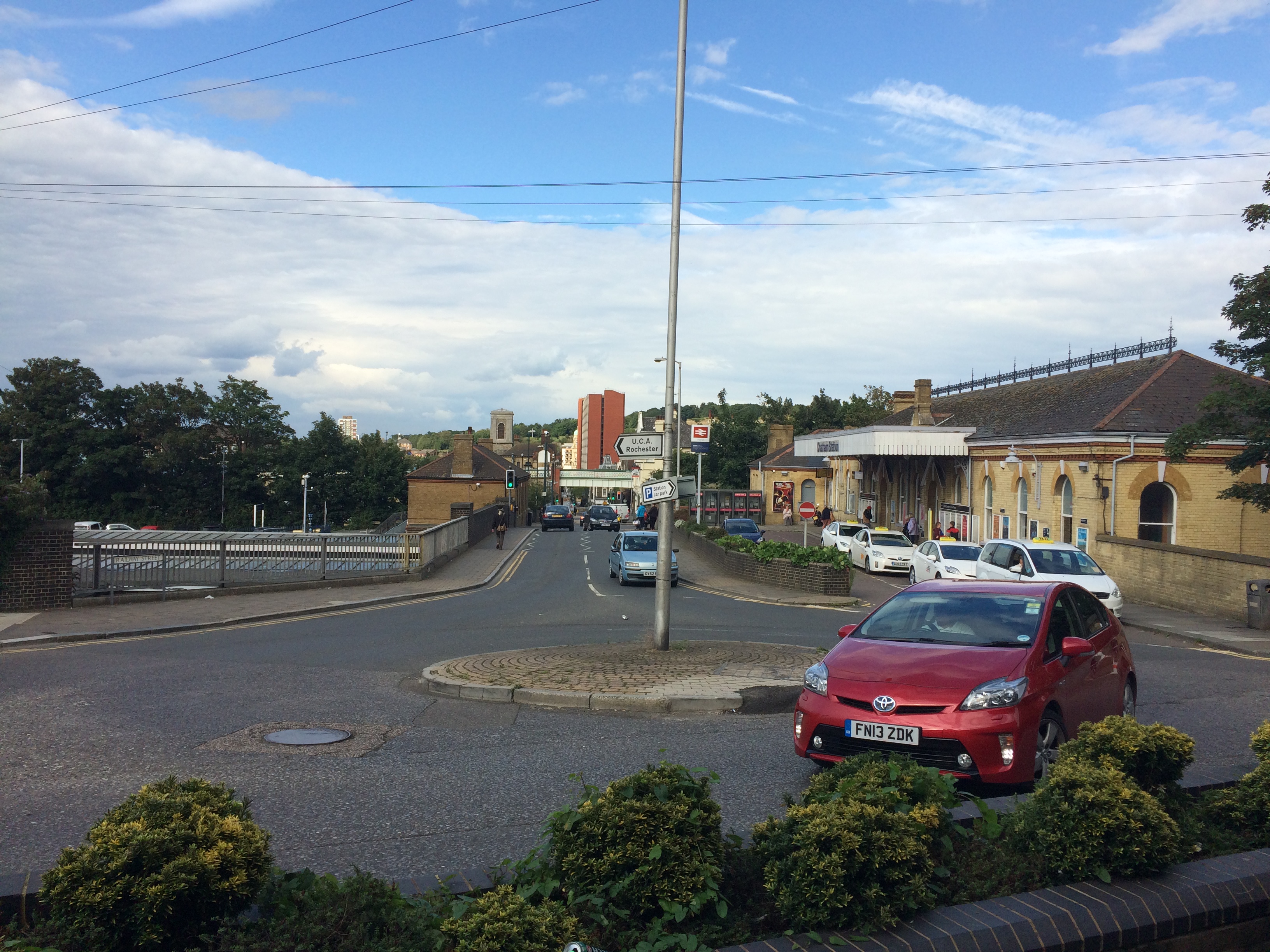
Chatham Railway Station – Image:Christopher TippingA short walk from Chatham Railway Station and in clear view from the station entrance is Ordnance Terrace and the house where Charles Dickens lived for several years as a small boy. Image:Christopher TippingChatham Railway Station and Railway Street looking from Ordnance Terrace. Image:Christopher Tipping
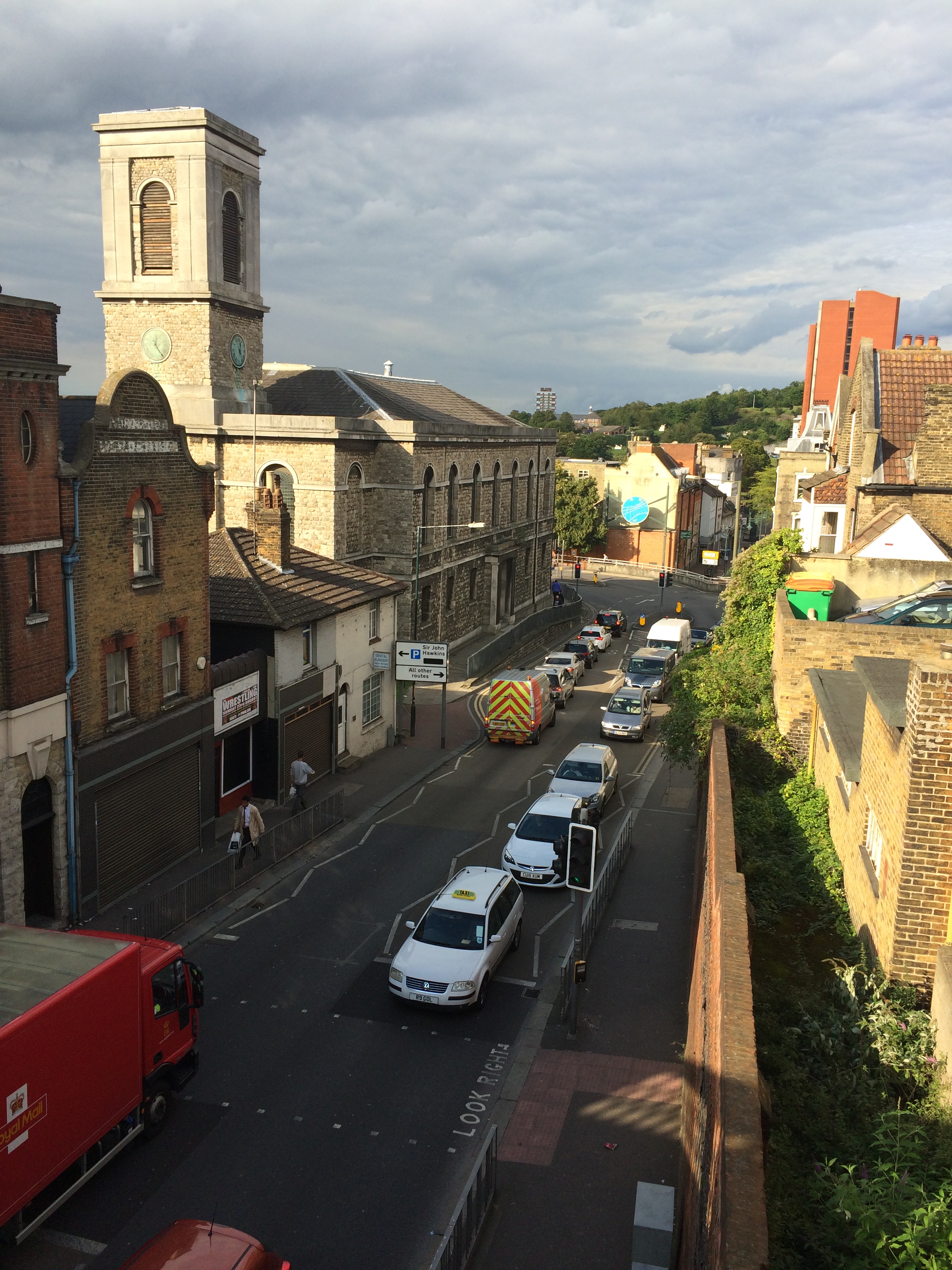
At the centre of the image, the Viaduct with New Road can be clearly seen, as can the tower of St John’s Church and the red brick monolith of Mountbatten House on Military Street, adjacent to the new Bus Station.
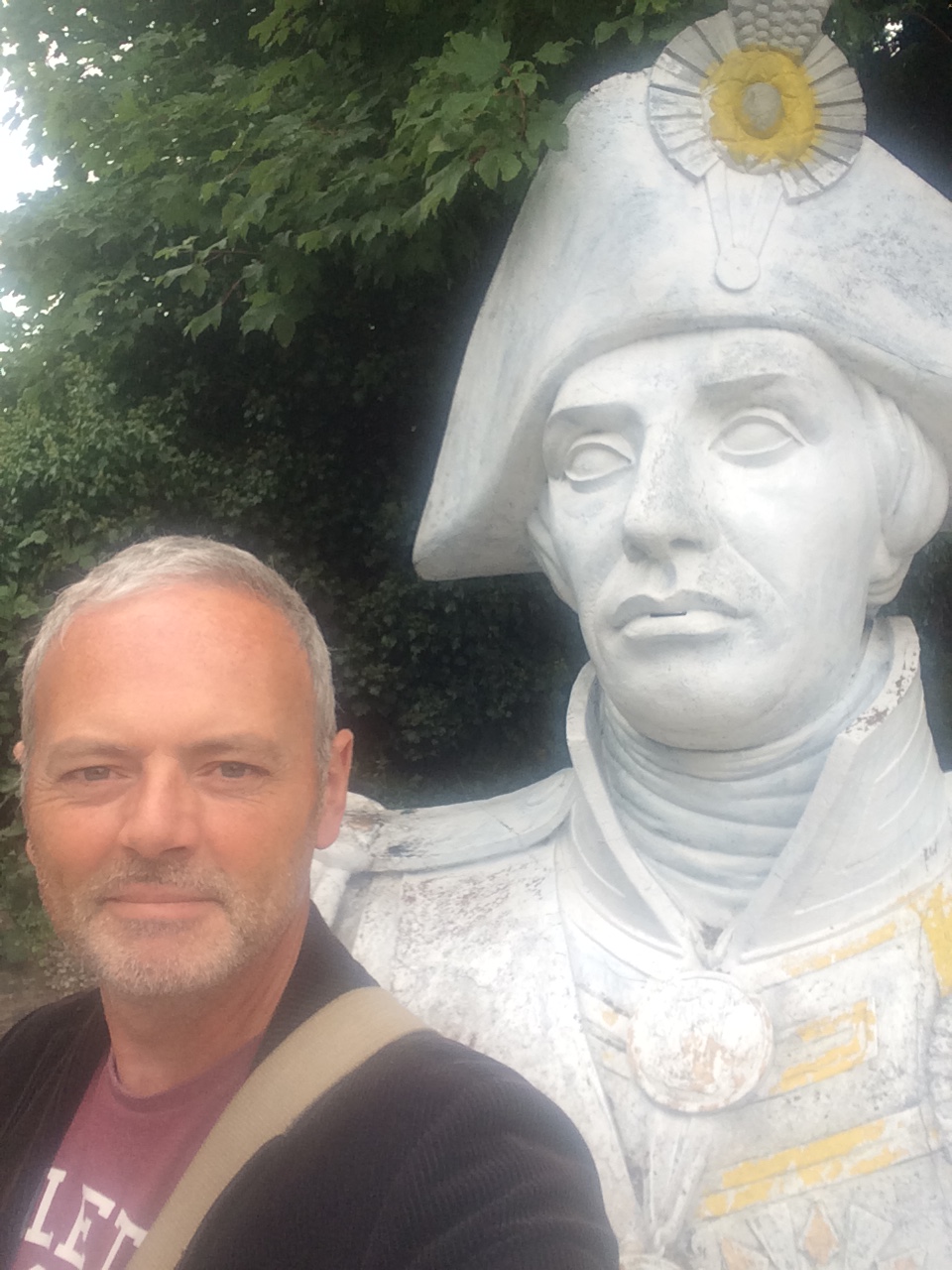
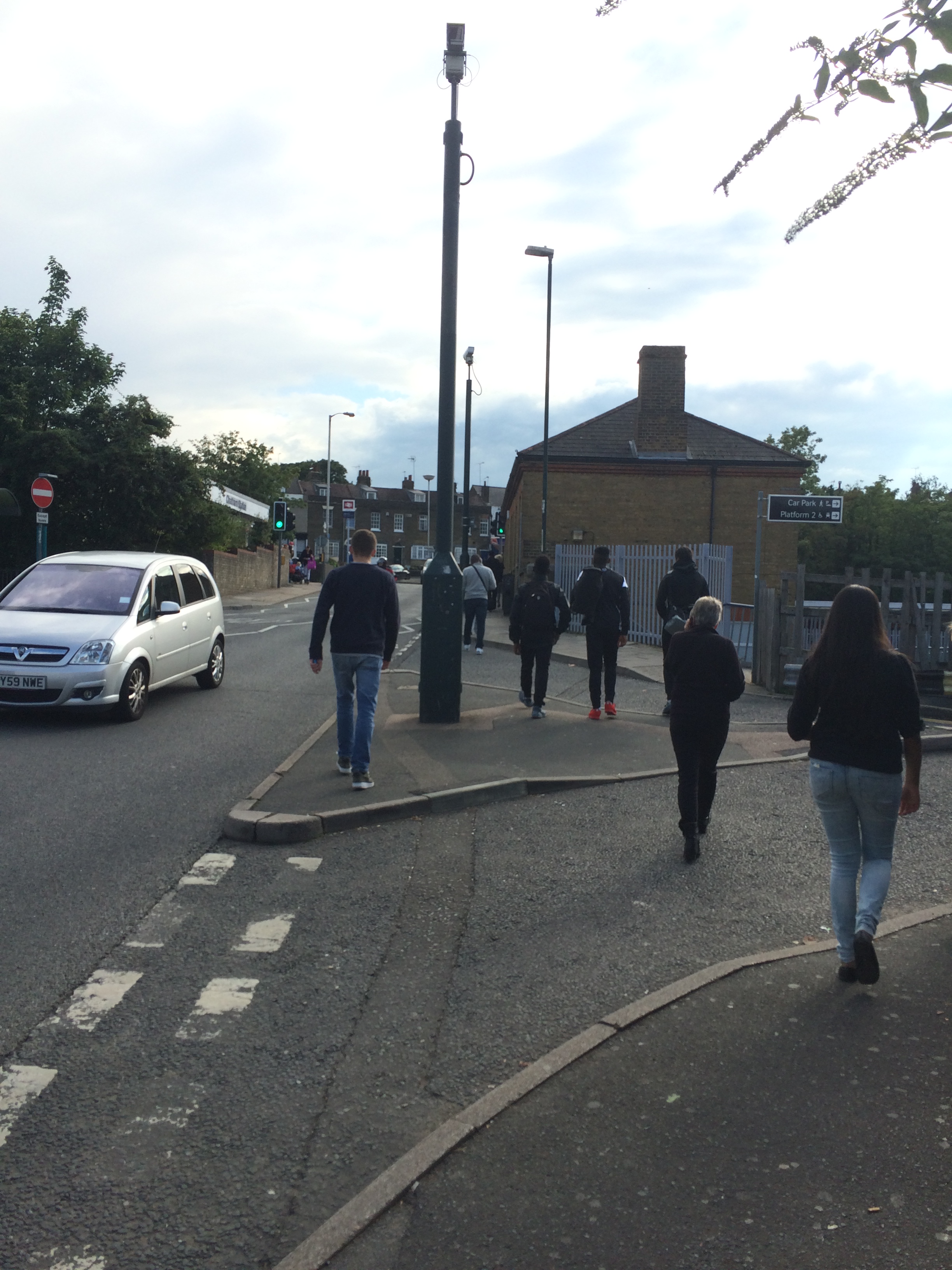
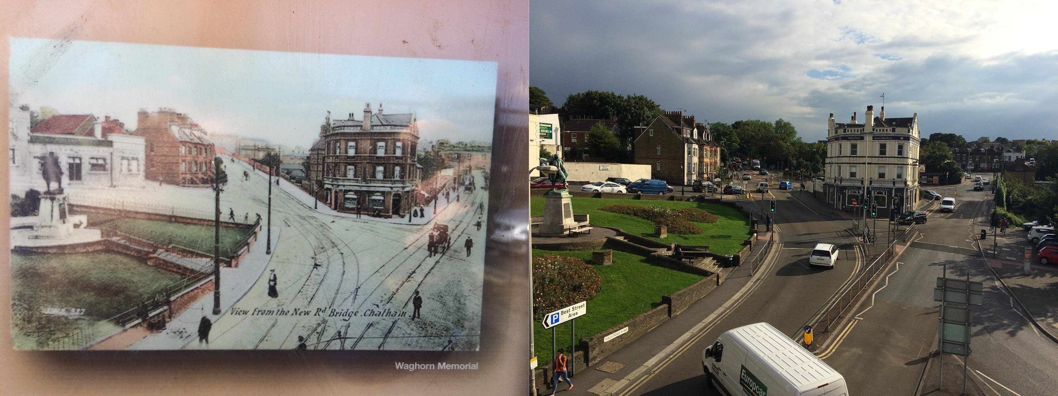
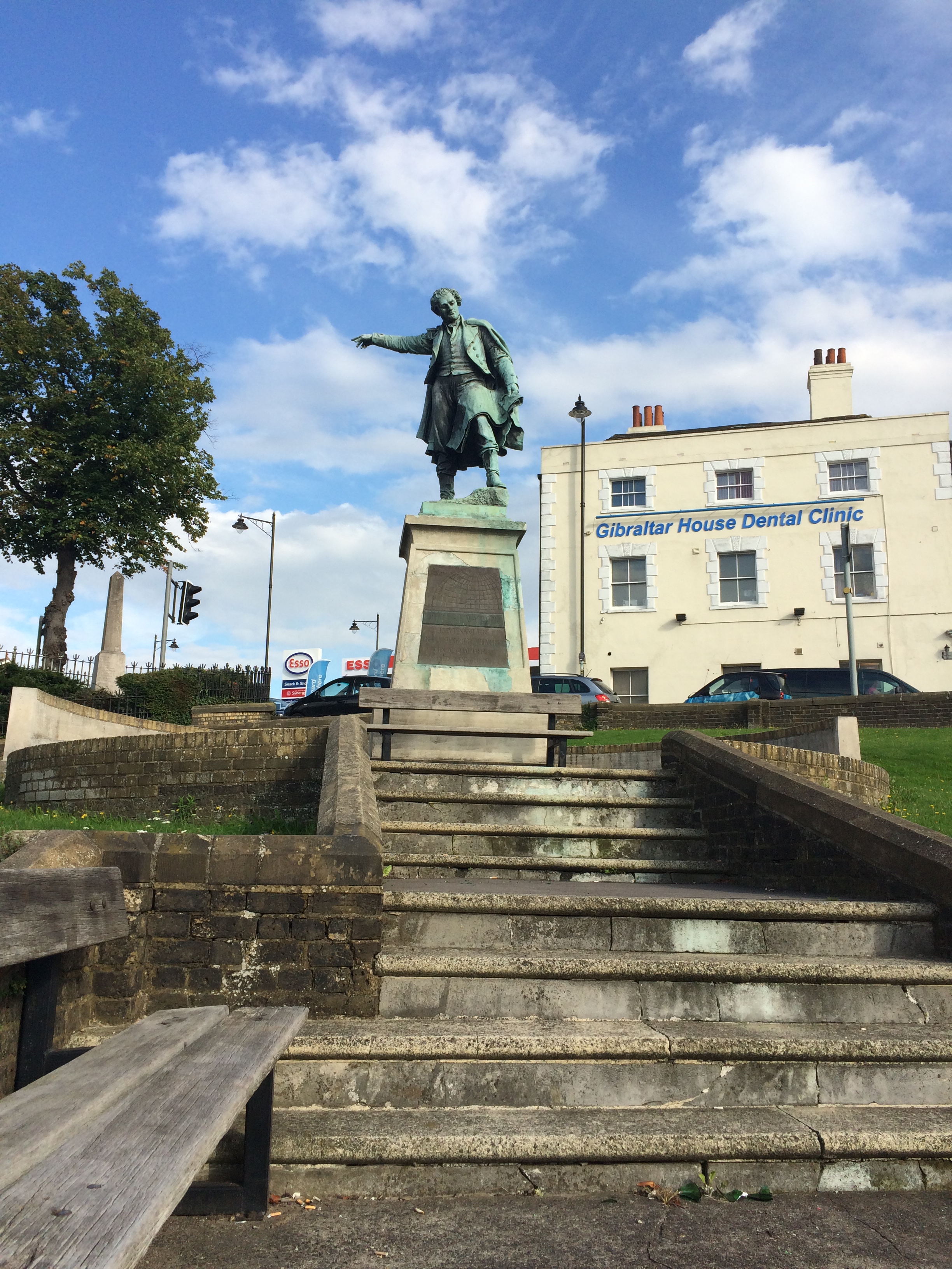
A wide panoramic shot of Chatham Railway Station and Railway Street from Ordnance Terrace. Image:Christopher TippingPedestrians walking up to Chatham Rail Station along Railway Street. Image:Christopher TippingPedestrians walking up to Chatham Rail Station along Railway Street. Image:Christopher TippingThe roads around the Railway Station and Railway Street are heavily trafficked by cars, buses and lorries, making for a poor pedestrian experience. Image:Christopher TippingA view from the Viaduct over Railway Street looking towards the Railway Station and the Alexandra Hotel. The older image is circa 1905. Image:Christopher TippingThe Alexandra Hotel at 53 Railway Street, Chatham has stood on this site for over a Century. Image:Christopher TippingThe statue of Thomas Fletcher Waghorn was raised on Railway Street, Chatham in 1888. Image:Christopher Tipping
“Thomas Fletcher Waghorn (1800–1850), whose statue stands in Chatham, Kent, was a postal pioneer who developed a new route from Great Britain to India. Waghorn’s route reduced the journey from 16,000 miles, via the Cape of Good Hope to 6,000 miles: from three months to between 35 and 45 days.Waghorn was born in Chatham, England, and baptised at St Mary’s Church on 16 July 1800″. Wikipedia
Interestingly, Thomas appears to be pointing the way to the Town Centre and Waterfront to pedestrians coming down from the Rail Station. Good man ! –
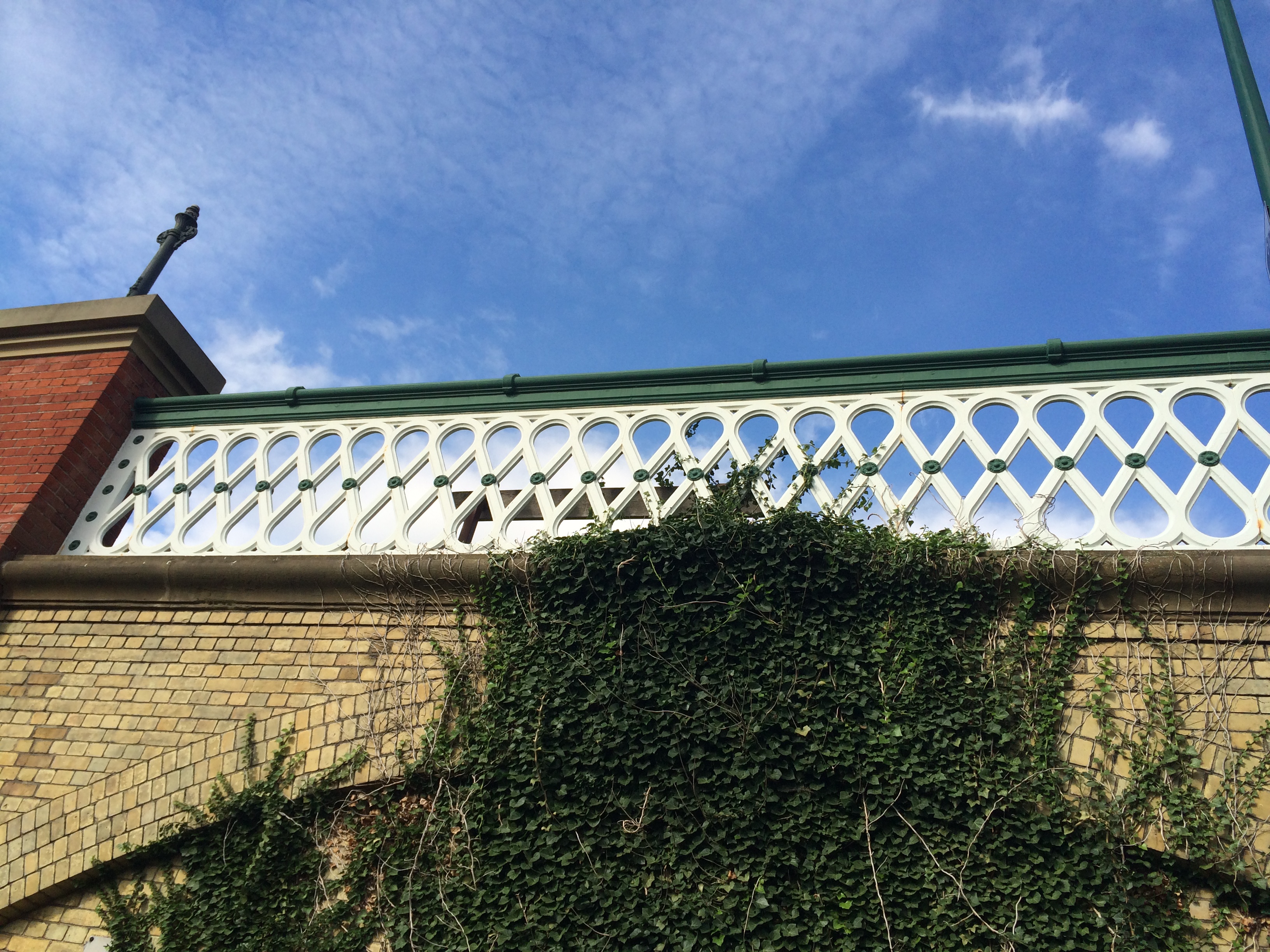
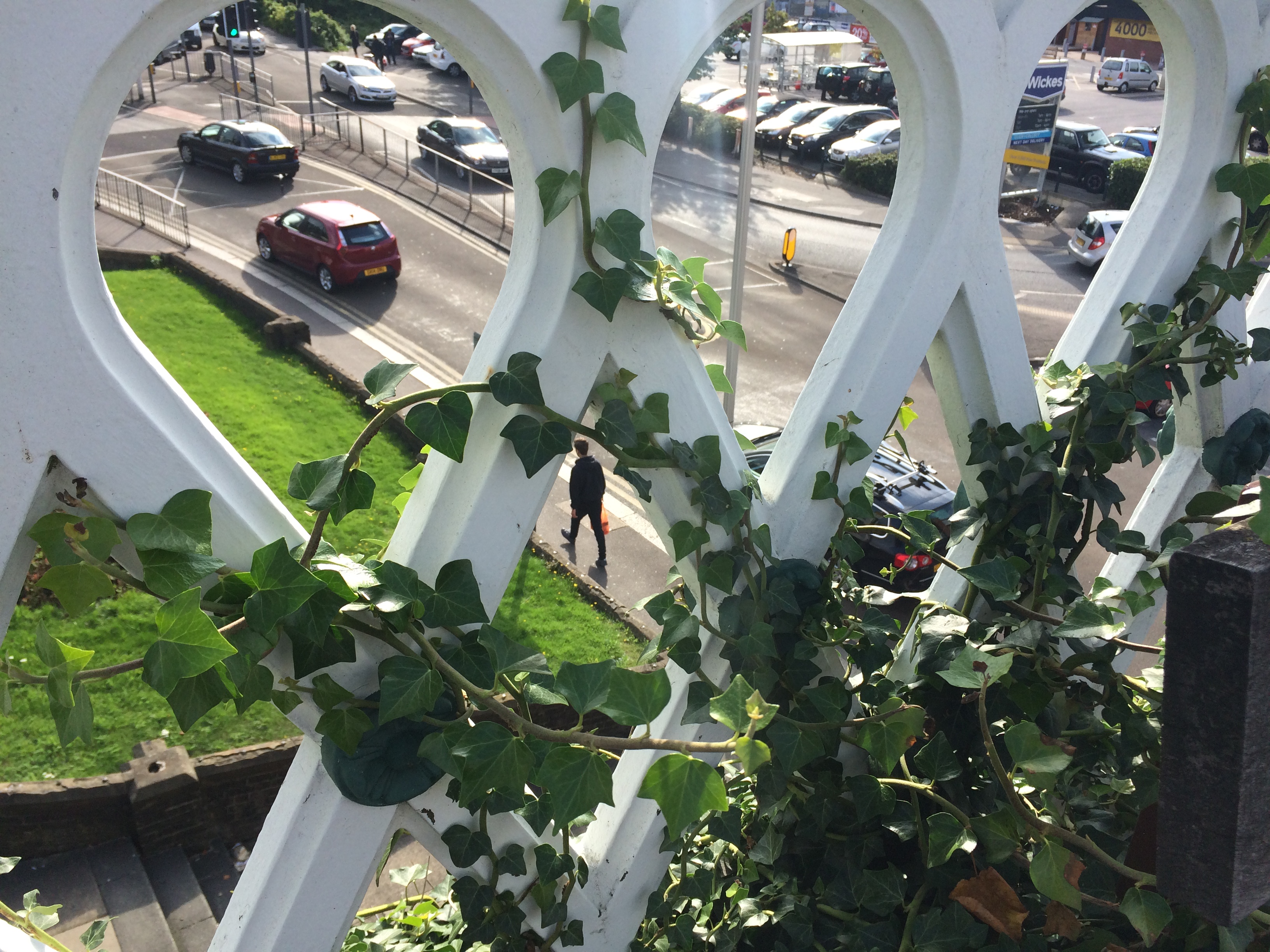
The Viaduct over Railway Street, Chatham, with detailed ironwork balustrade. Image: Christopher TippingA view from the Viaduct over Railway Street, Chatham, with a detailed view through the ironwork balustrade. Image: Christopher Tipping
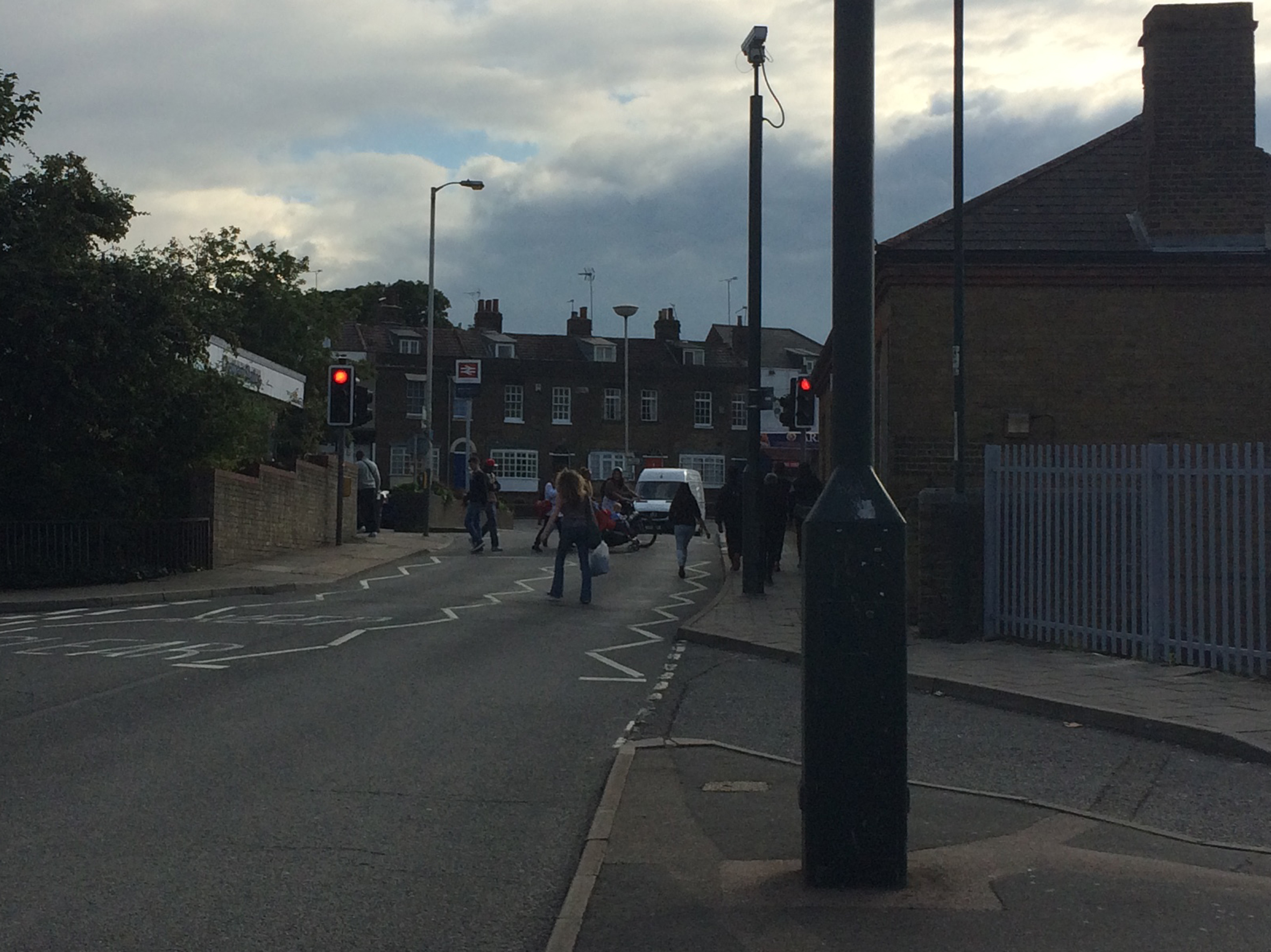
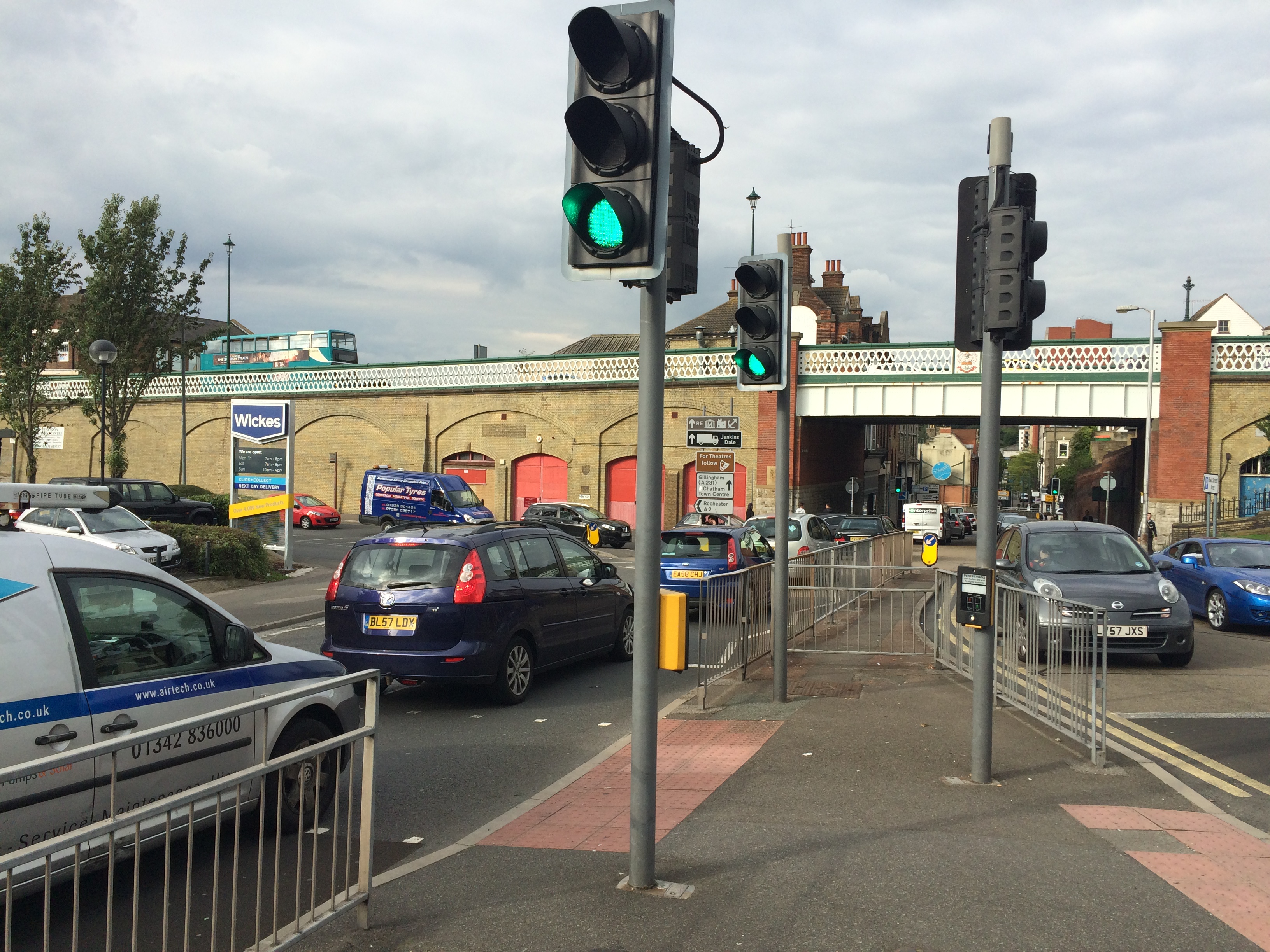
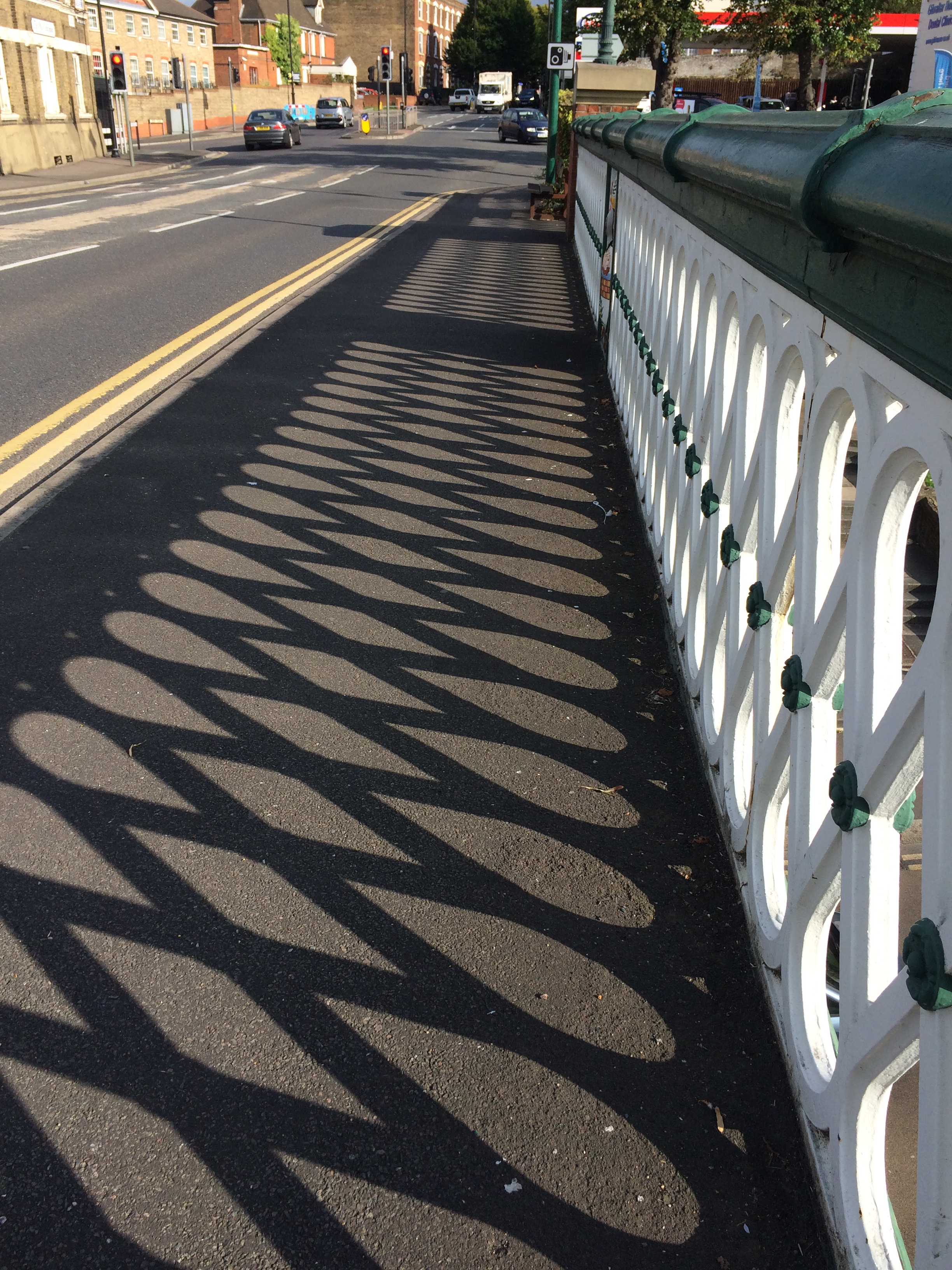
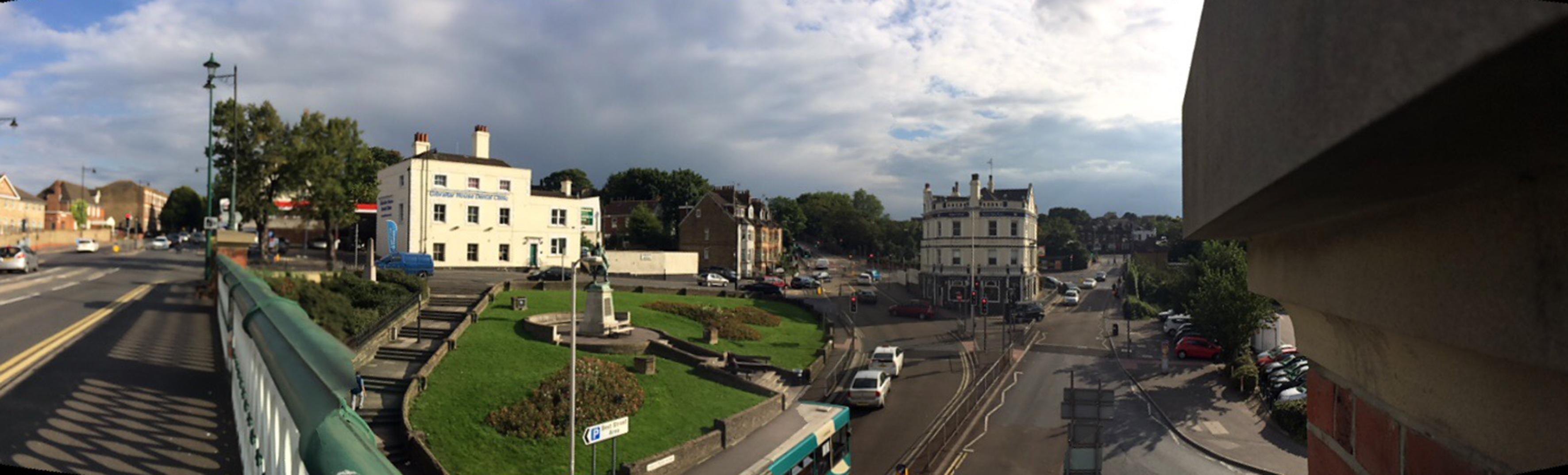
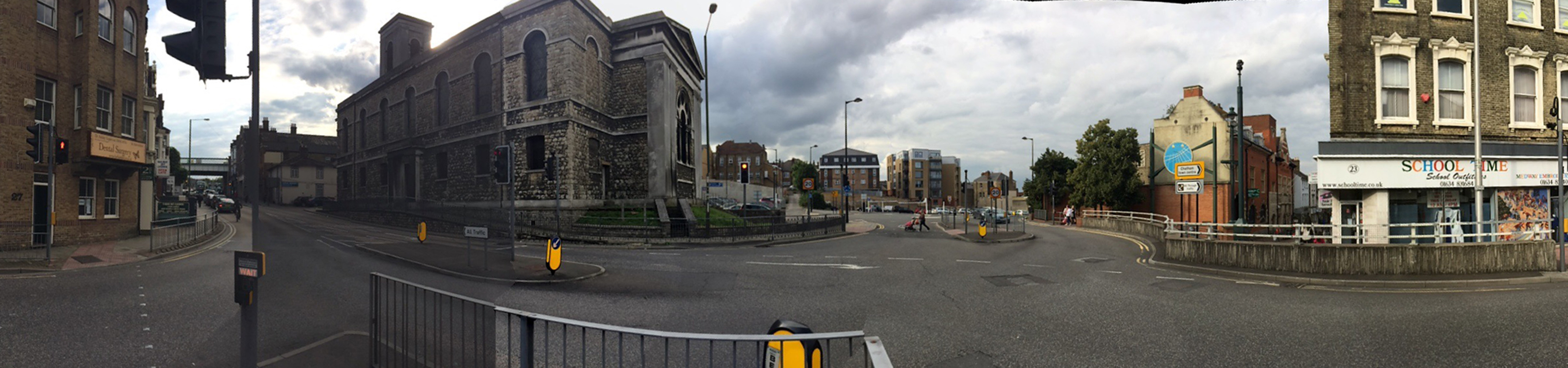
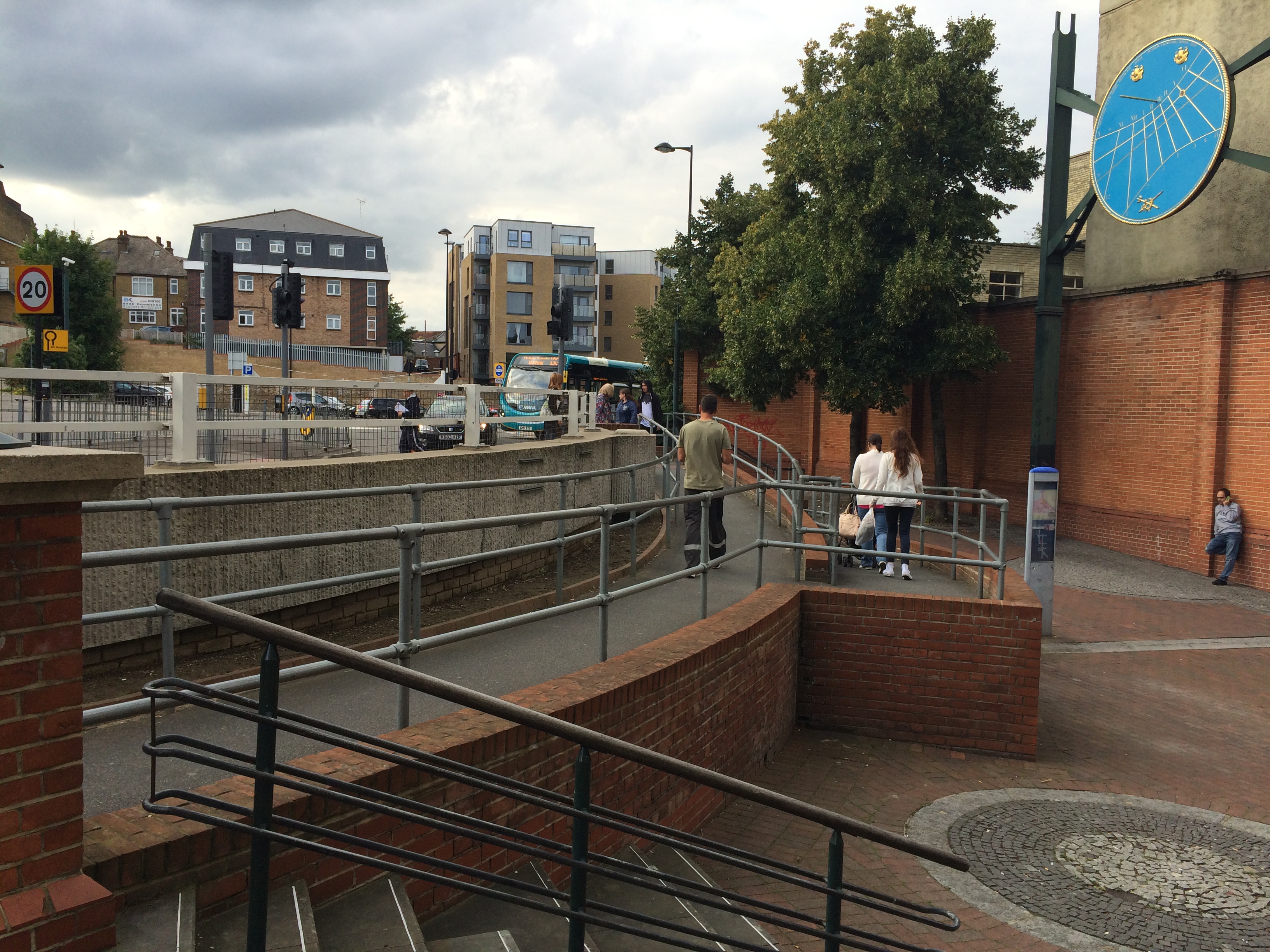
Shadows cast by the cast iron balustrade of the Viaduct over Railway Street, Chatham. Image: Christopher TippingA panoramic view of Gibralter Hill and Railway Street, Chatham, looking up to wards the Railway Station. Image:Christopher TippingOn the New Road Viaduct over Railway Street, Chatham, looking to wards the Waterfront. Image:Christopher TippingOn the New Road Viaduct over Railway Street, Chatham, looking down Railway Street towards St John’s Church on the left and the Town Centre. Image:Christopher TippingA view from the New Road Viaduct over Railway Street, Chatham, looking down towards St John’s Church and the Town Centre. Image:Christopher TippingThe junction of Waterfront Way with the A2 at St John’s Church, Chatham, where the highway has been punched through Railway Street, creates a hostile zone for pedestrians and effectively cuts off the lower part of Railway Street and the Town Centre, from the upper section and the Railway Station. Image:Christopher TippingWhere Railway Street is dissected by the A2 by St Joh’s Church in Chatham, pedestrians have to navigate a complex & carbuncle-like step/ramp/concrete barrier arrangement to gain access to and from lower Railway Street and the retail centre of the town. Image:Christopher TippingWrought iron gates remain intact at the courtyard entrance to the old Post Office Building on lower Railway Street, Chatham. The building is a handsome addition to the fabric of the street, but is currently empty. Image:Christopher TippingThe retail units along the lower section of Railway Street, Chatham, appear busy and animated. The streetscape is abruptly interrupted and stifled by the A2 cutting and awkward steps, ramps and concrete wall. Image:Christopher Tipping
Architectural text and detailing on the upper stories of extant buildings along Railway Street, provide clues to the rich legacy of activity and usage in the area.
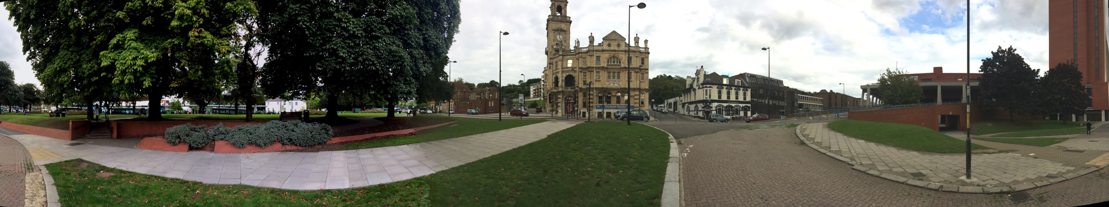
The lower section of Military Road, Chatham ought to be a highly activated, fluid, dynamic and versatile public space with the Brook Theatre as the anchor building and focus. Unfortunately the space is a dead zone, underused and slightly unsettling. Image:Christopher TippingA panoramic image of the lower section of Military Road, Chatham, which ought to be a highly activated, fluid, dynamic and versatile public space with the Brook Theatre as the anchor building and focus along with the adjacent Bus Station. Unfortunately the space is something of a dead zone, underused and slightly unsettling. Image:Christopher Tipping


