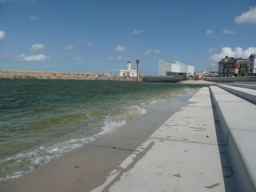
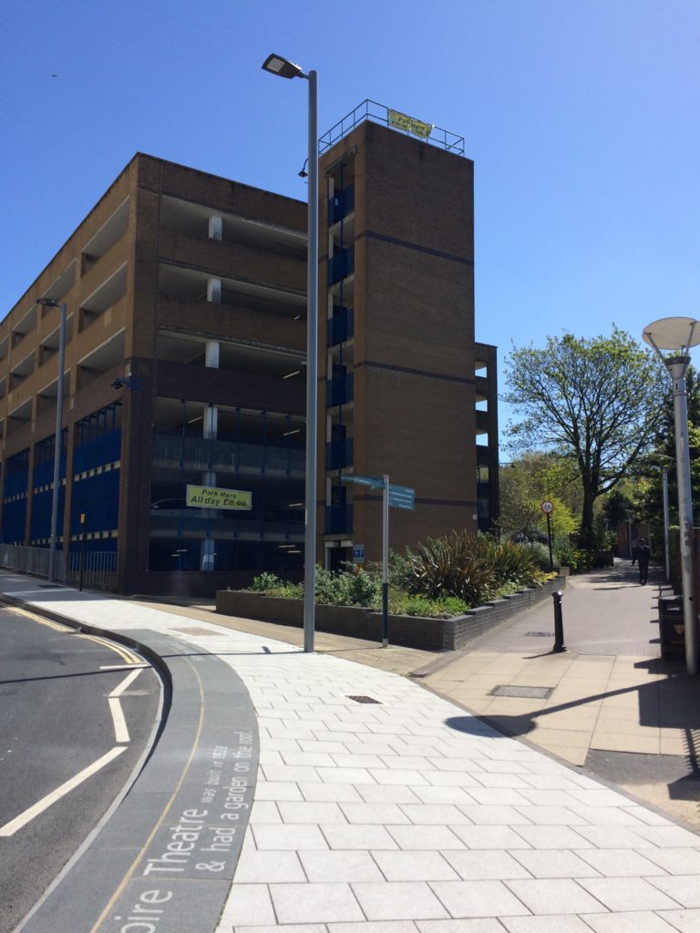
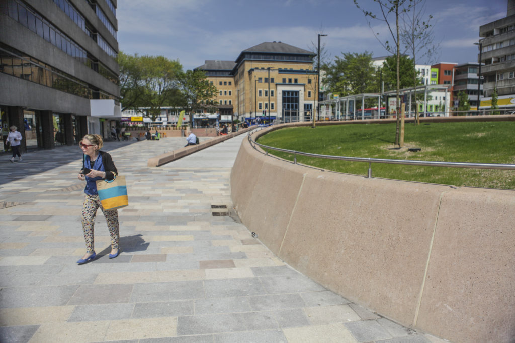
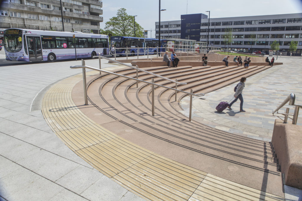
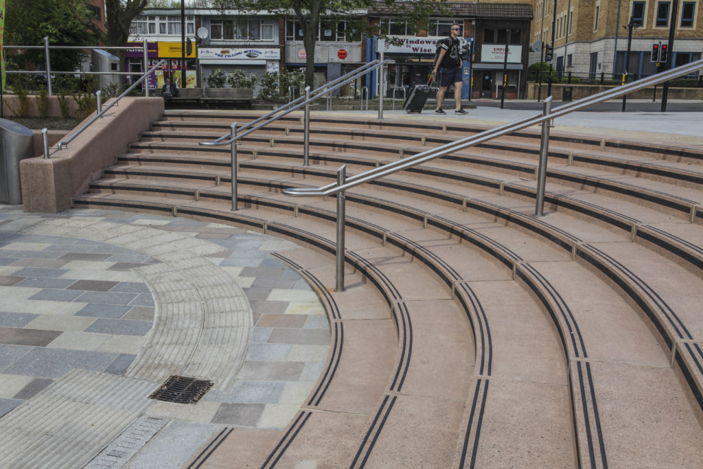
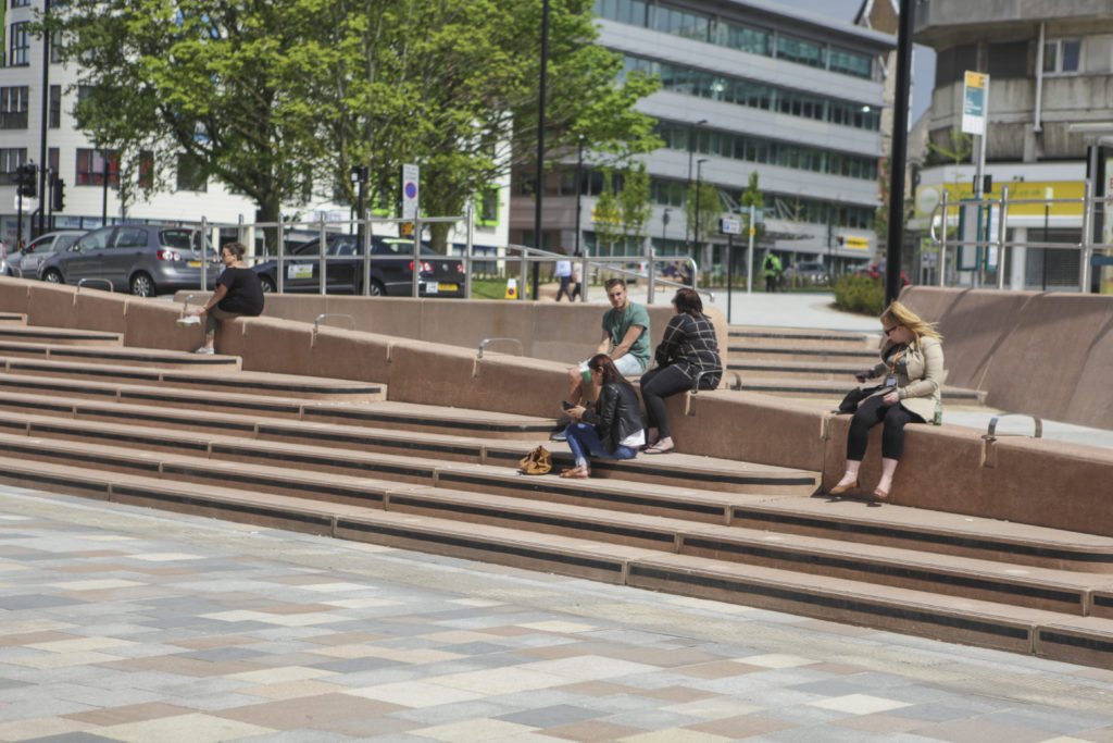
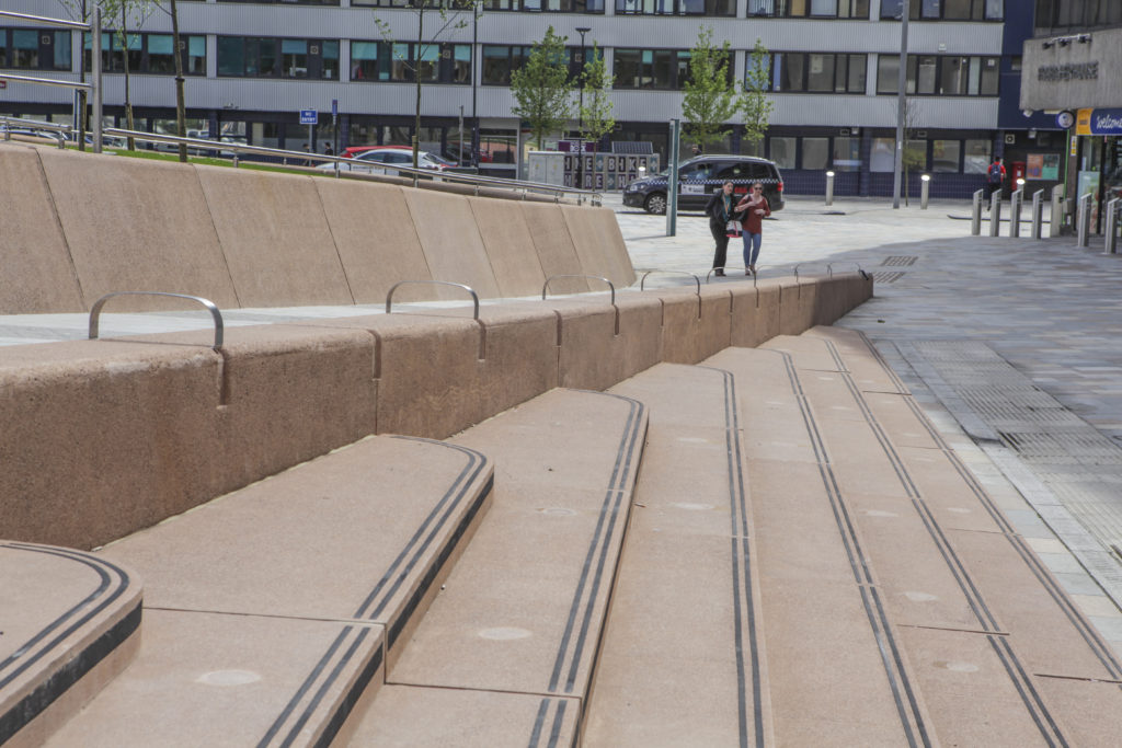
The last decade has seen Margate’s cultural landscape flourish with the dual success of Turner Contemporary and a resurgent Dreamland to book-end the seafront panorama. Successful regeneration by Thanet Council has also brought significant and tangible changes to the Old Town. One of the most significant outcomes delivered by the Council without fanfare or drama however, has been the Margate Flood & Coastal Protection Scheme – also known more fondly as Margate Steps. A scheme funded by the Environment Agency to the tune of £6million pounds and brought in on time and under budget …and somewhat under the radar. This example of coastal civil engineering encompassed not only the Steps, but the Harbour Arm and Sea Wall along Marine Drive. This elegant and functional concrete stepped revetment structure has also brought a much needed and highly activated public realm and pedestrian space to the Town.
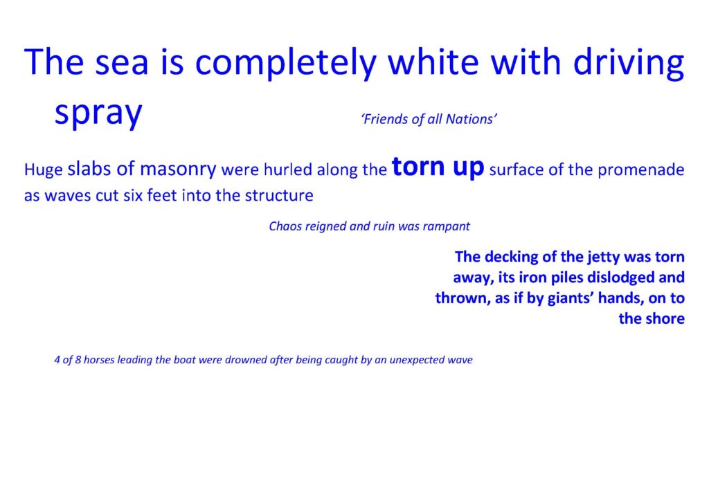
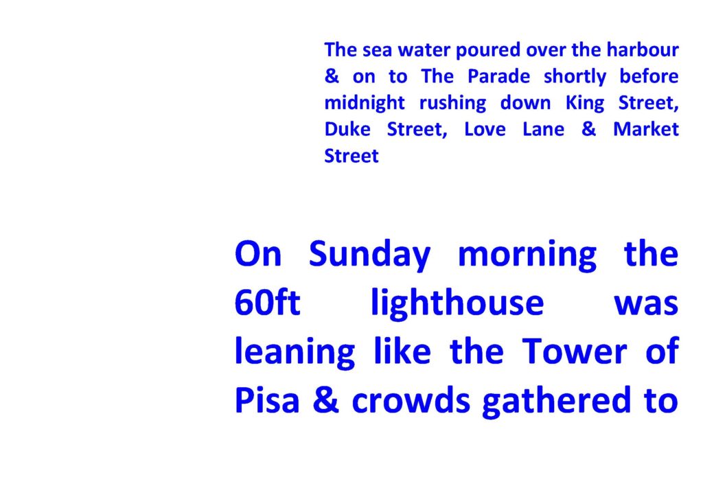
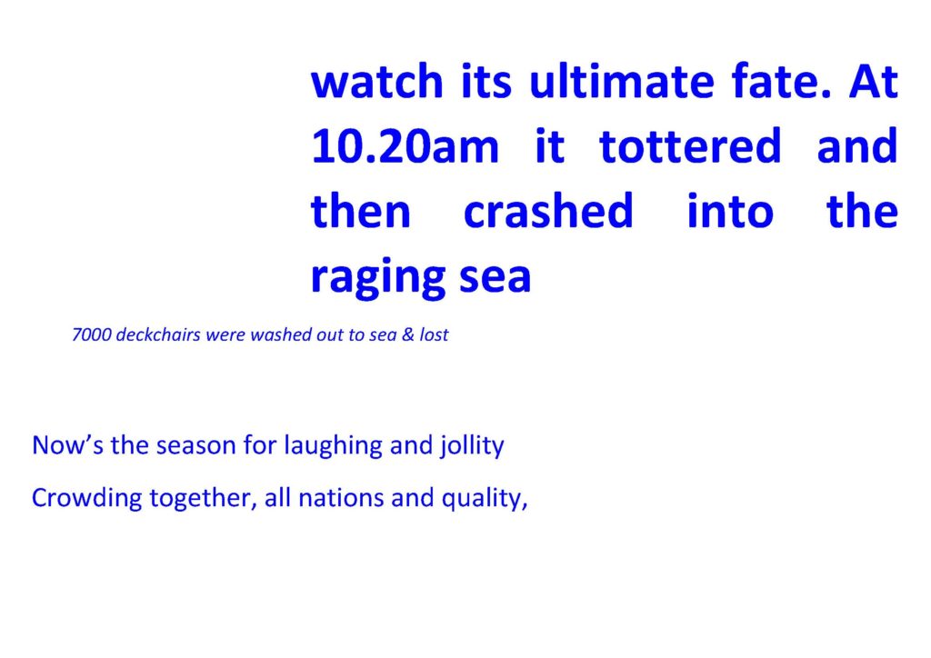
Throughout its history, a major catalyst for change and development in Margate had been the destructive force of storms and storm surges. These pages are taken from the Contextual Research Document, which I delivered in collaboration with the project team.
Margate Flood & Coastal Protection Scheme – Contextual Research Text Image: Christopher TippingMargate Flood & Coastal Protection Scheme – Contextual Research Text Image: Christopher TippingMargate Flood & Coastal Protection Scheme – Contextual Research Text Image: Christopher Tipping
Margate Flood & Coastal Protection Scheme – Towards Turner Contemporary May 2013. Image: Christopher Tipping
I was commissioned as project artist on the scheme by Thanet District Council & the Environment Agency in December 2010. My role was to uncover and present interpretive & contextual information & develop concepts with which to influence the design process & inform the structure & detailing of this major sea defence works. The work has now been completed and the project officially opened in May 2013.
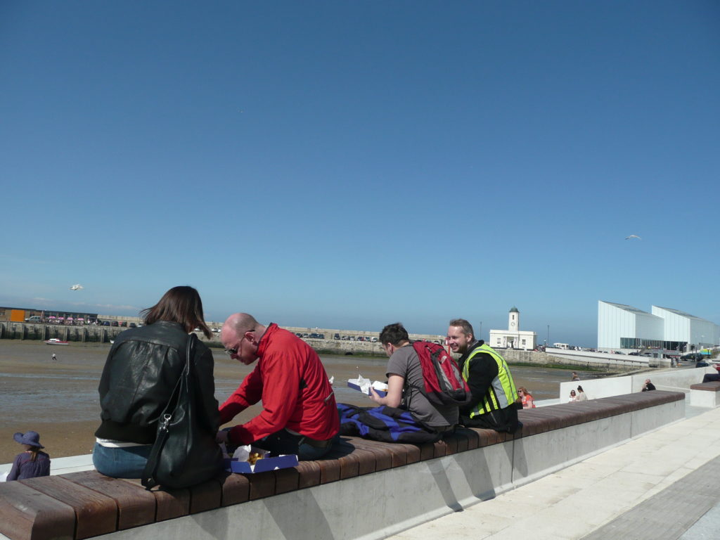
Margate Flood & Coastal Protection Scheme – lunch al fresco May 2013. Image: Christopher Tipping
Being part of an integrated design team from an early point was critical in enabling the contextual work, via a contribution to the detailed DESIGN & ACCESS STATEMENT , to influence the physical form of the structure, within its constraints as a sea defence work.
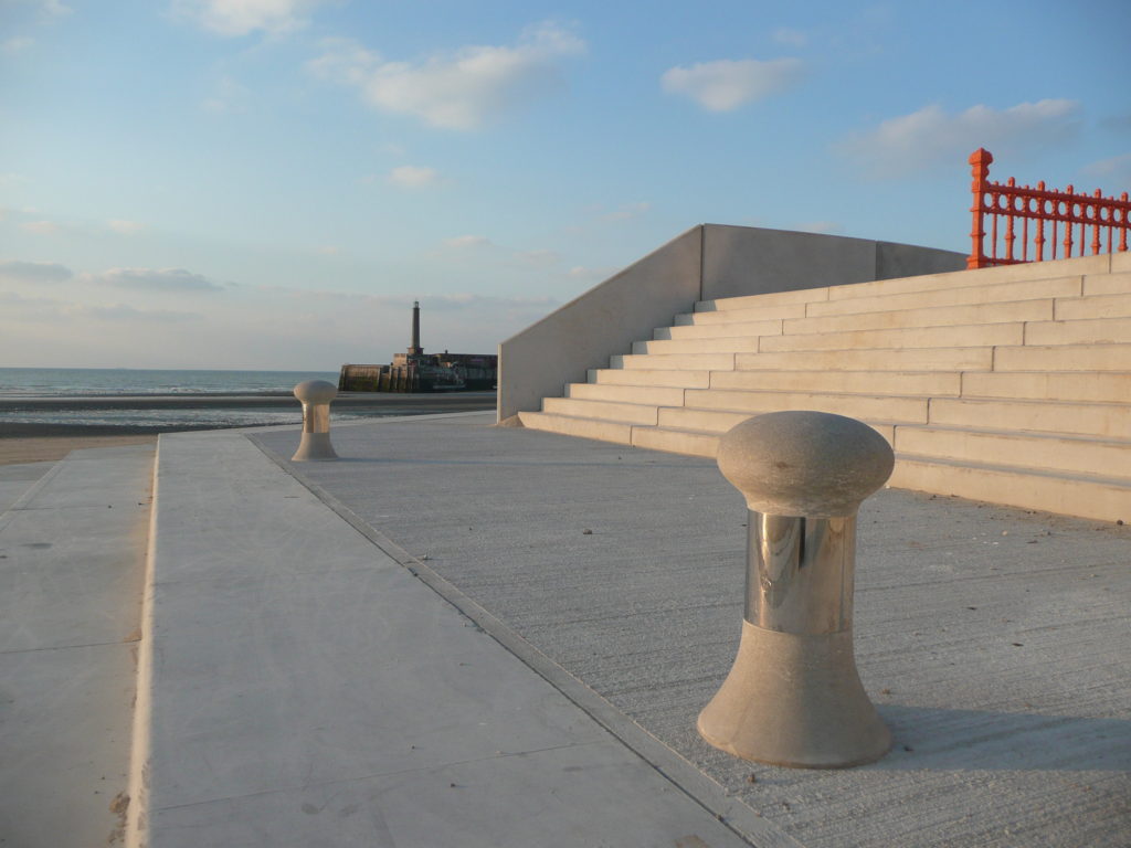
Margate Flood & Coastal Protection Scheme – evening light March 2013. Image: Christopher Tipping
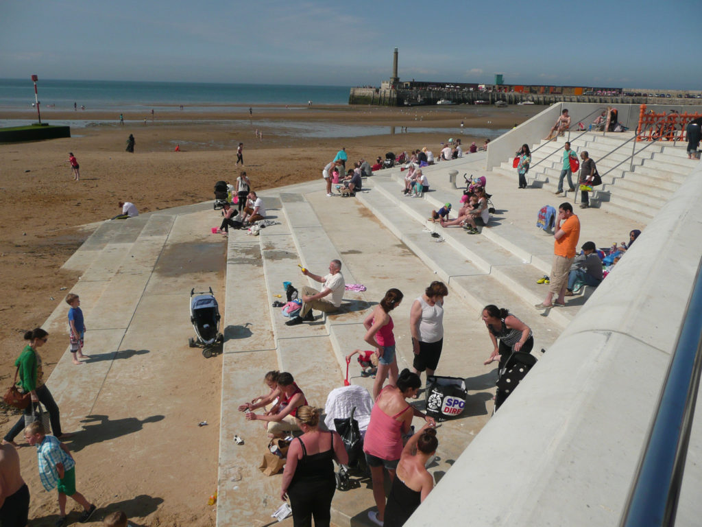
The public realm and amenity space which the project afforded Margate’s sea front has been a tremendous addition to an enlivened and highly activated sea front promenade which has Turner Contemporary and the Harbour Arm at one end & Margate Station & Dreamland at the other.
Margate Flood & Coastal Protection Scheme – The New King’s Stairs May 2013. Image: Christopher Tipping
I haven’t updated this post for some time – actually since April 2017! Head down and just getting on with it …time flies. OK – I’ll now try to sum up what’s happened in the interim.
Following on from the initial research period, consultation & creative engagement phases of the project, a series of Creative Public Realm proposals were submitted for review. This work originated and was inspired by the positive & creative collaboration with our supporting artists in residence, Rob Young – Writer, Simon Williams – Filmmakerand Xtina Lamb – Printmaker. These collaborations proved to be highly creative as well as bringing a refreshing camaraderie and friendship to the work.
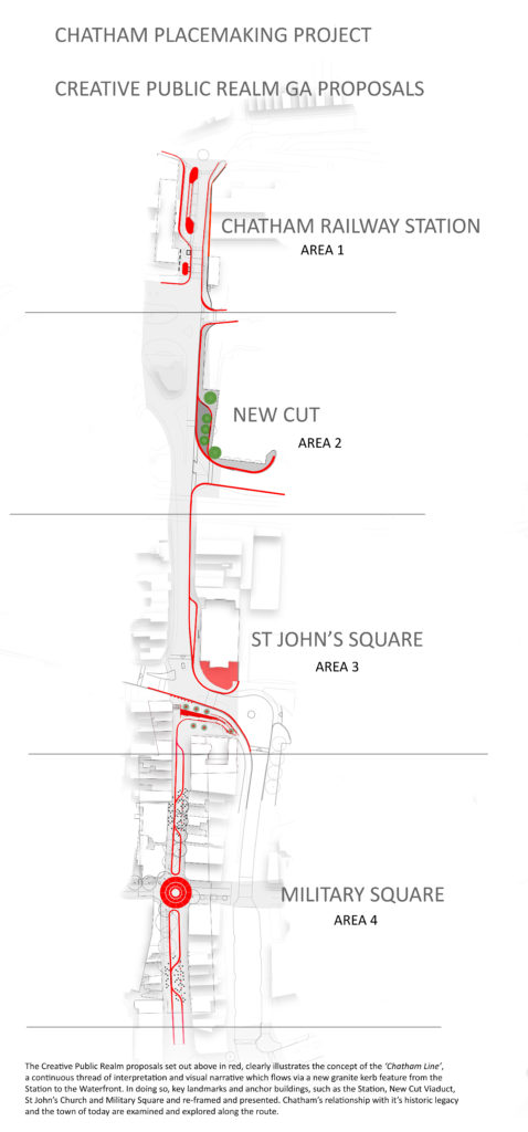
The proposals are presented here in the order in which the various sites are encountered along the route from Chatham Station down Railway Street to Military Road and the Waterfront. This is a visual account of how ideas developed and adopted into the scheme.
Chatham Station, although at the head of our scheme, will be the last Phase to be delivered on the ground & I will report on this work later in a separate post.
The sites where our work and interventions has been focussed are:
NEW CUT & NEW ROAD VIADUCT
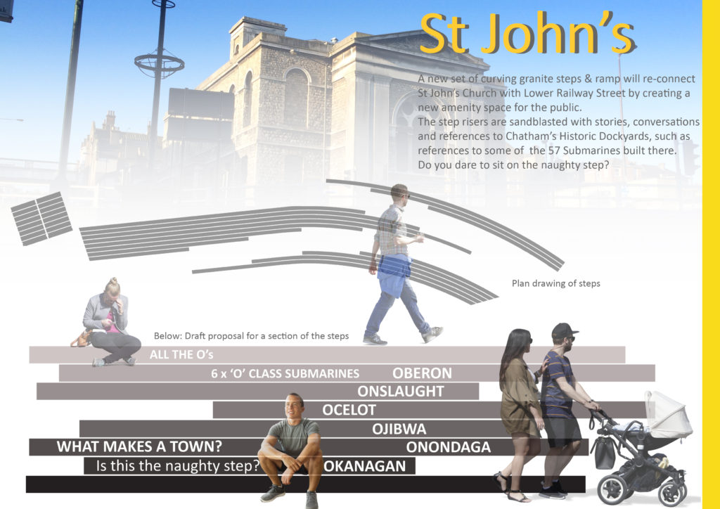
ST JOHN’S SQUARE
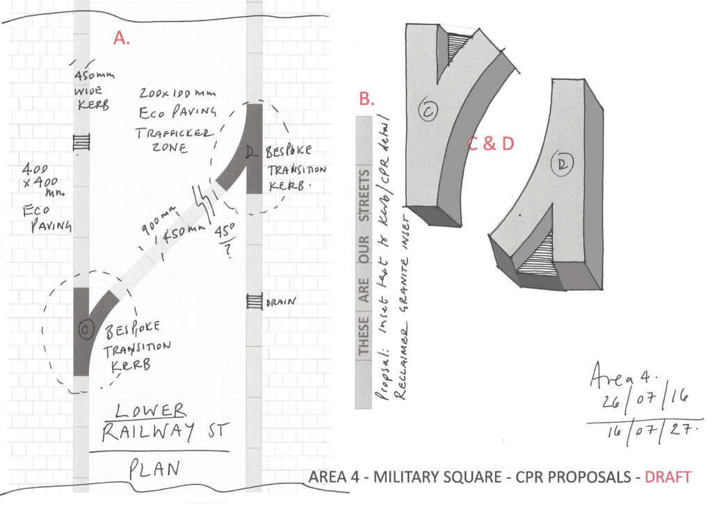
LOWER RAILWAY STREET
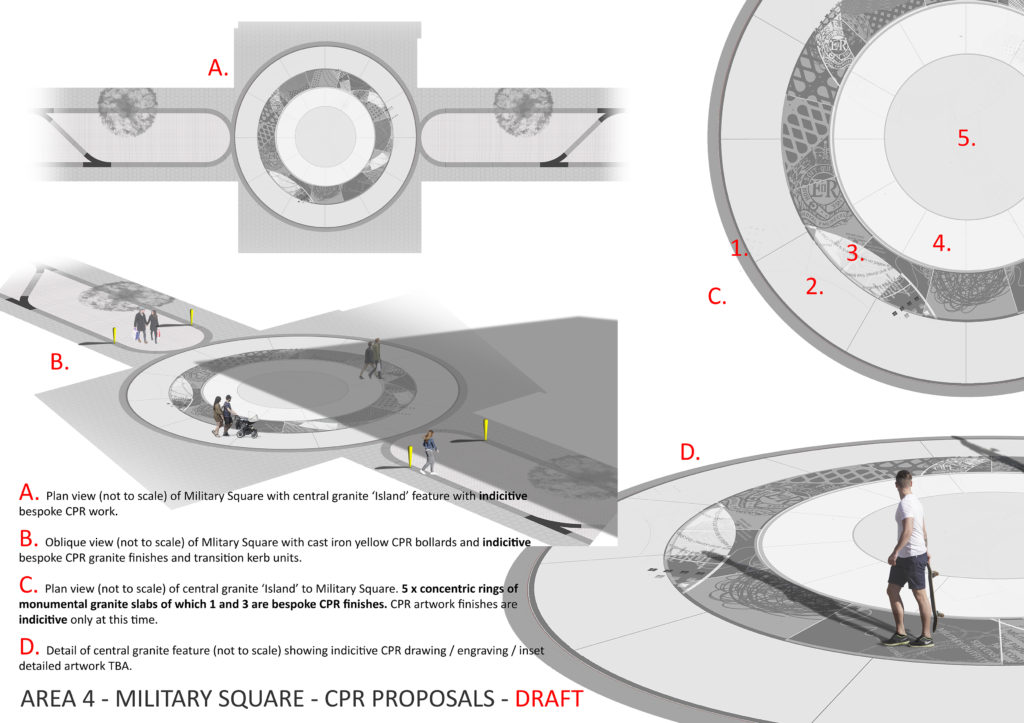
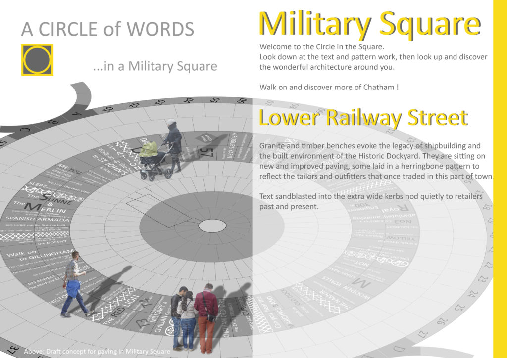
MILITARY SQUARE
MILITARY ROAD
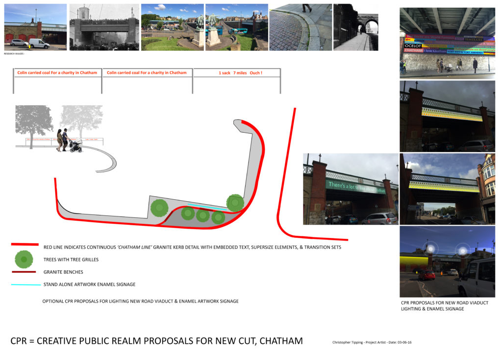
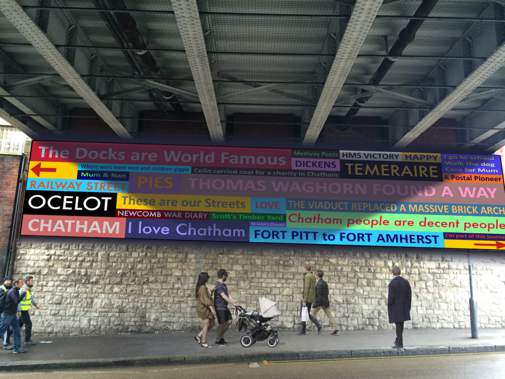
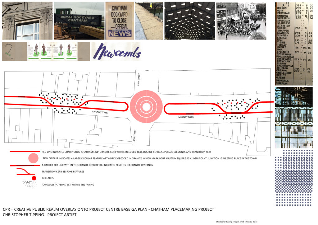
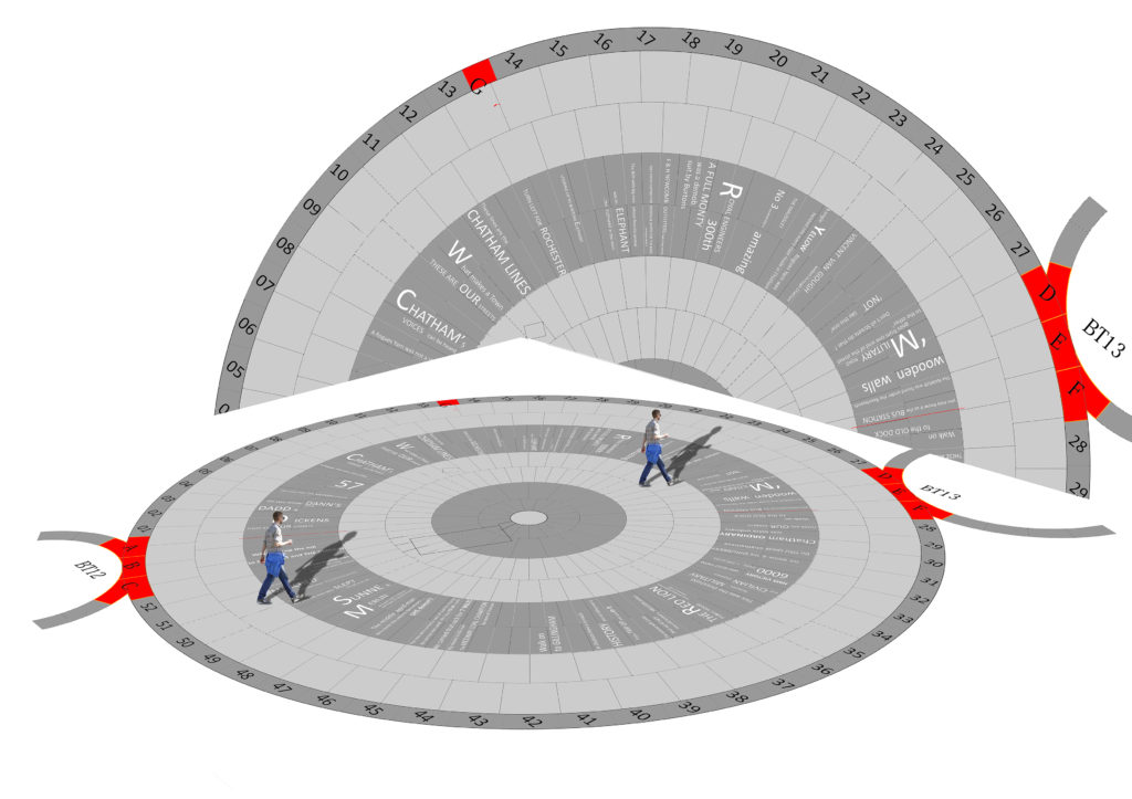
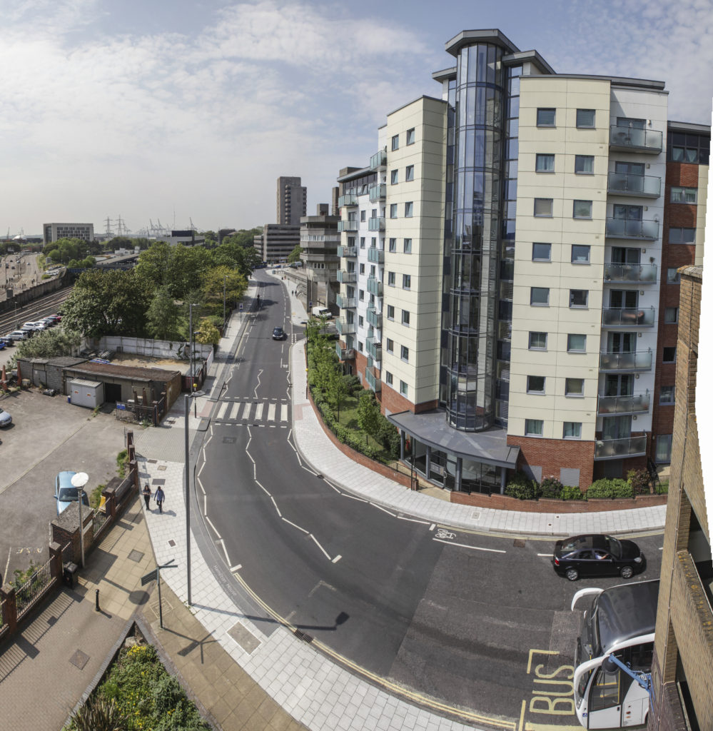
Chatham Placemaking Project. Route & Plan of Creative Public Realm. Image: Christopher Tipping
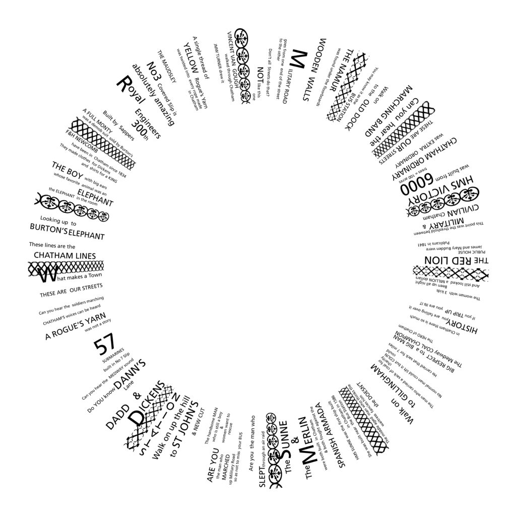
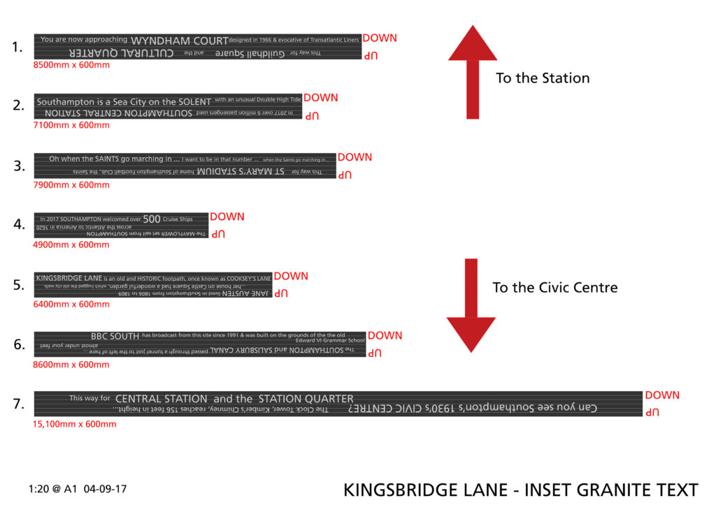
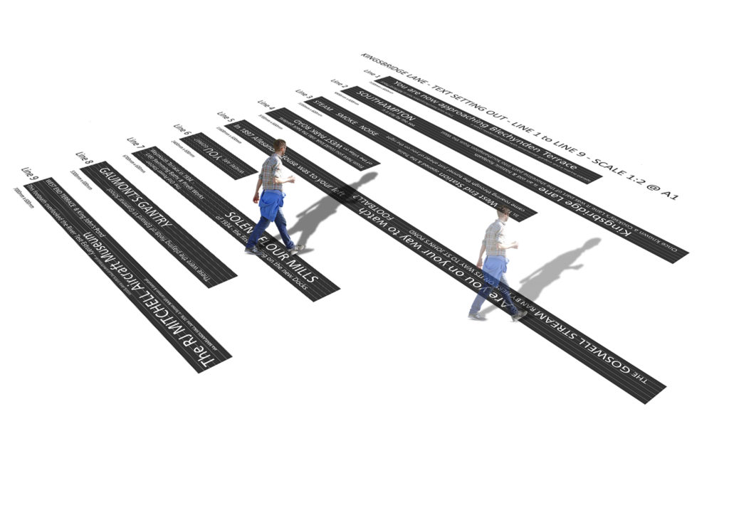
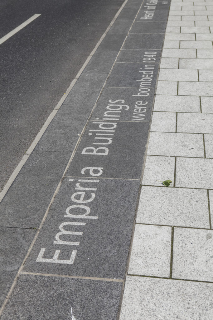
The Red Line indicates our project route & is titled the ‘Chatham Line’, after the Chatham Lines, the nearby defensive fortifications. The lines follow the historic granite kerb line & will be replaced in relevant sections by bespoke wide
granite kerbs and special transition granite units often with sandblasted or inset granite text. Text is based upon the surrounding local historic legacy & community engagement work & narrative developed by our writer in residence, Rob Young.
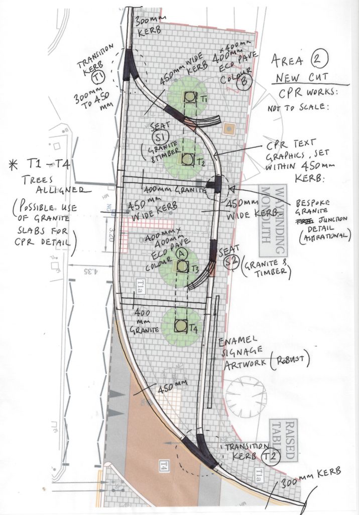
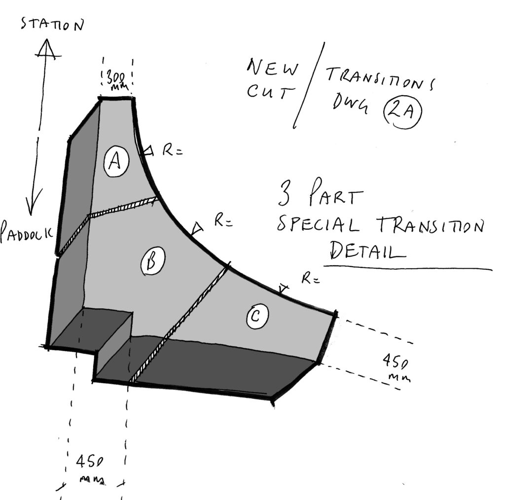
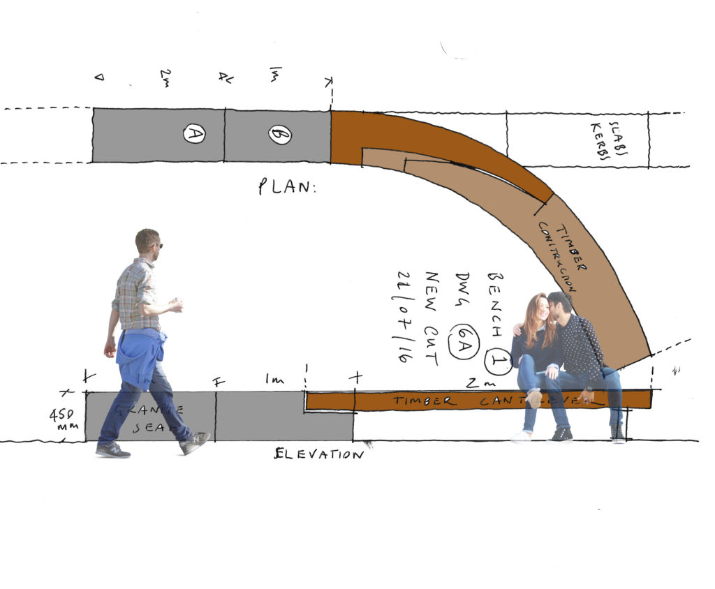
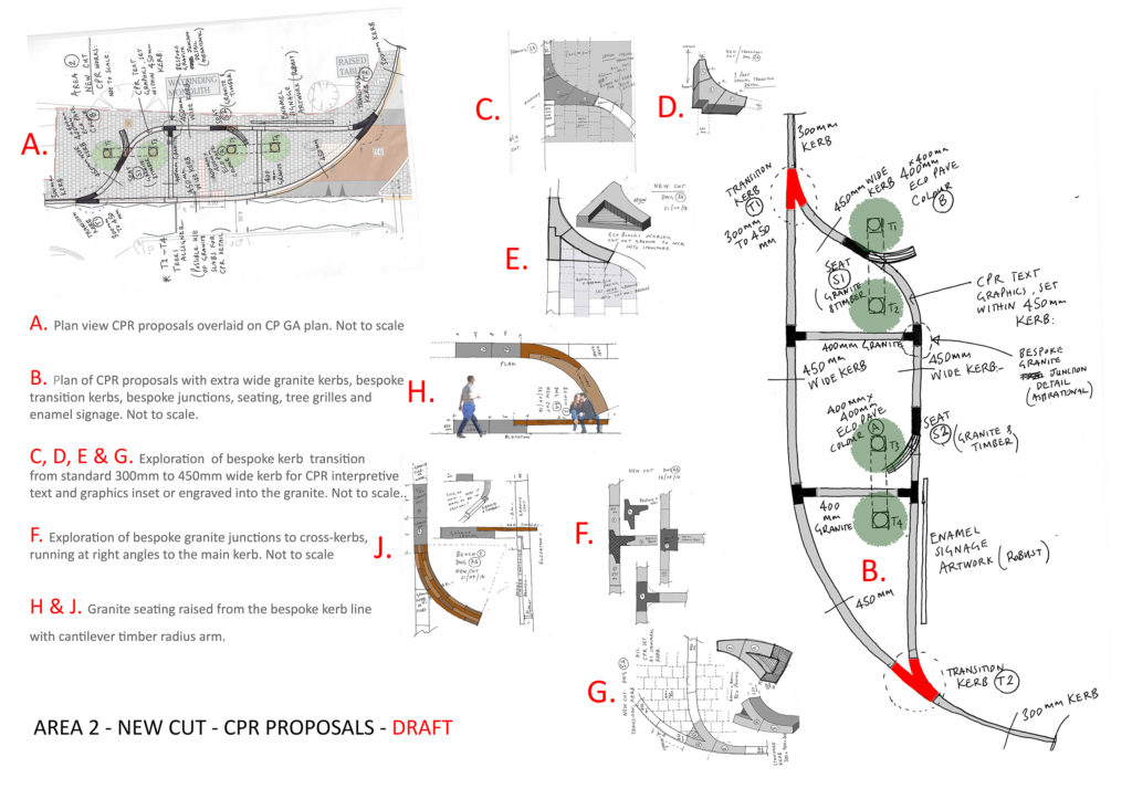
AREA 2 – NEW CUT
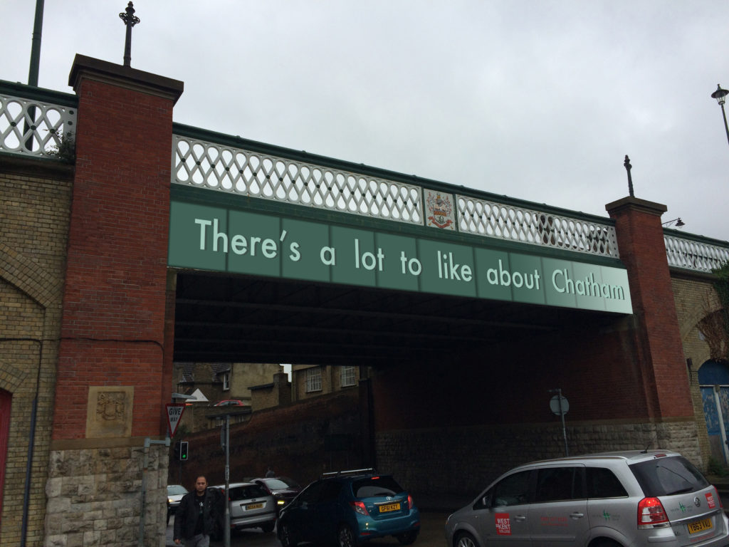
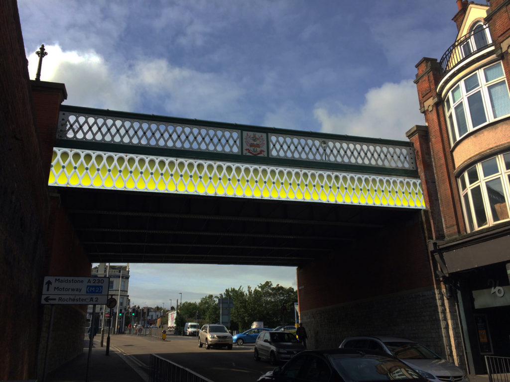
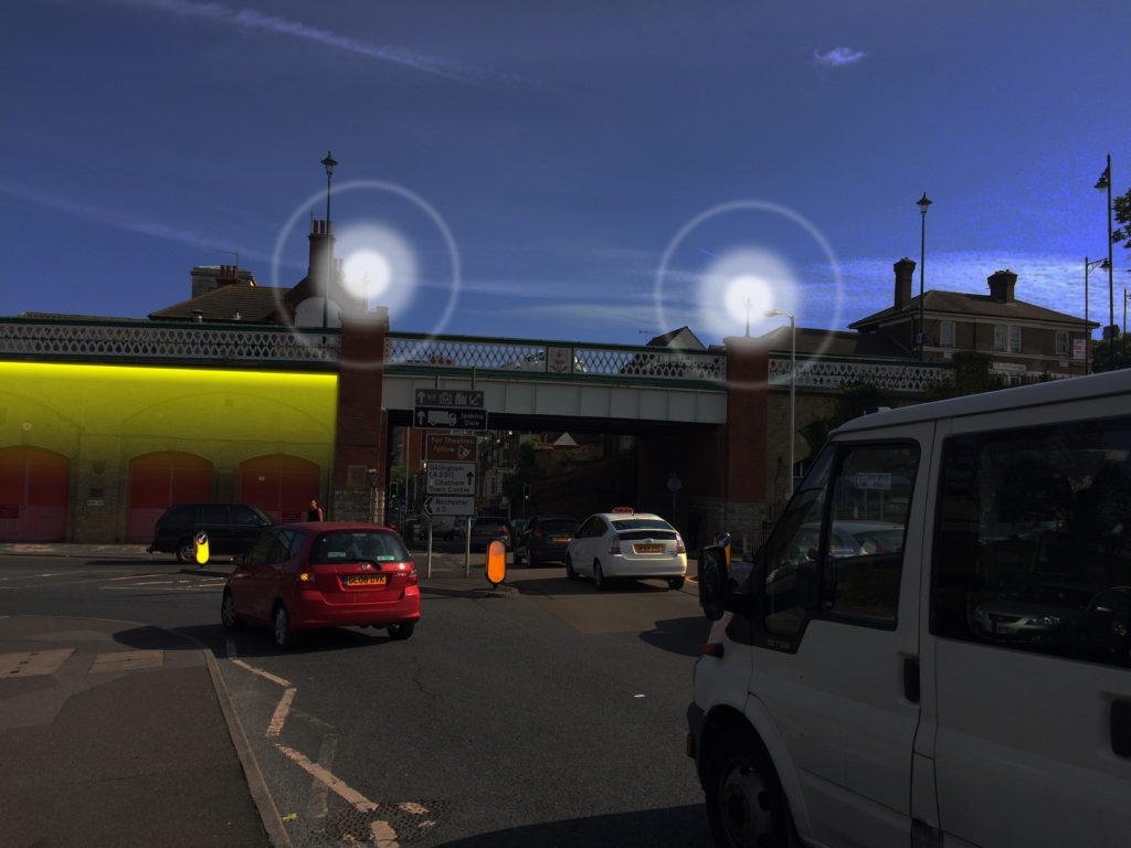
New Cut – Plan of Creative Public Realm. Image: Christopher TippingNew Cut – Sketches & Draft Plan of Creative Public Realm. Image: Christopher TippingNew Cut – Sketches & draft plan of bespoke granite kerb units. Creative Public Realm. Image: Christopher TippingNew Cut – Sketches & draft plan of bespoke granite kerb units. Creative Public Realm. Image: Christopher TippingNew Cut – Sketches & draft plan of bespoke granite & timber seating. Creative Public Realm. Image: Christopher TippingNew Cut – Sketches & draft plan of bespoke granite kerb units. Creative Public Realm. Image: Christopher TippingNew Cut – New Road Viaduct – Draft proposals for bespoke enamel panels below the balustrade, welcoming you to Chatham. Image: Christopher Tipping
As with most projects, not all ideas and proposals succeed.Budget limitations, critical rigour and often the subjective nature of the collaborative creative process all bring issues to bear in deciding what is destined to be built on site and what is left in the studio !
New Cut – New Road Viaduct – Draft proposals for bespoke enamel panels below the balustrade, welcoming you to Chatham. Image: Christopher TippingNew Cut & New Road Viaduct – Draft proposals for bespoke lighting scheme welcoming you to Chatham. Image: Christopher TippingNew Cut & New Road Viaduct – Draft proposals for bespoke enamel panels under the bridge, welcoming you to Chatham. Image: Christopher TippingSt John’s Square – Draft proposals for bespoke landscape interventions. Image: Christopher TippingSt John’s Square – Draft proposals for bespoke landscape interventions. Image: Christopher TippingSt John’s Square – Draft proposals for bespoke landscape interventions. Image: Christopher Tipping
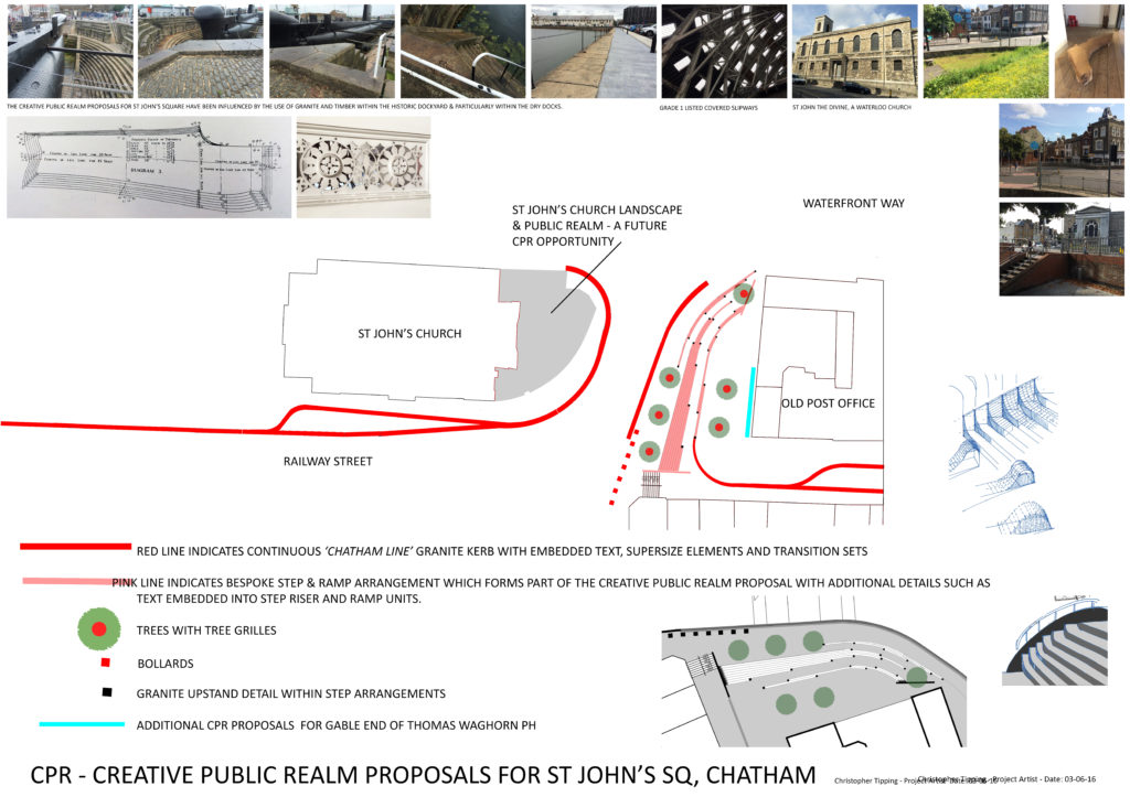
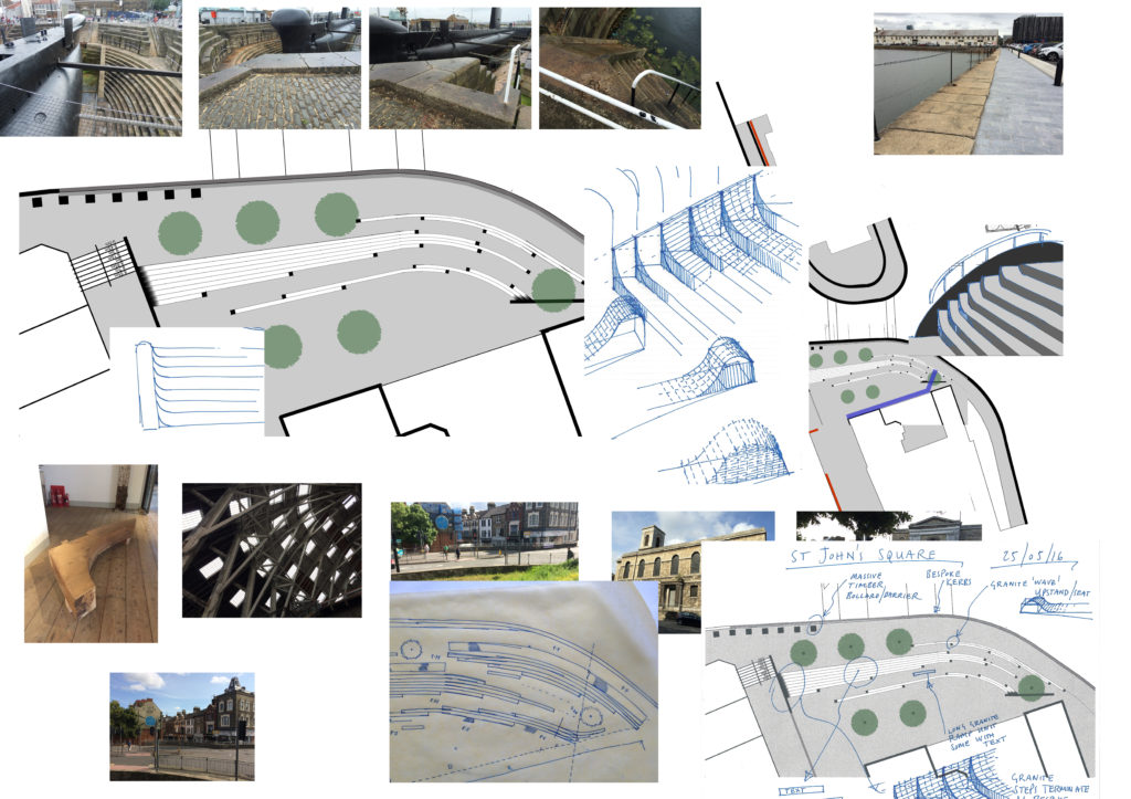
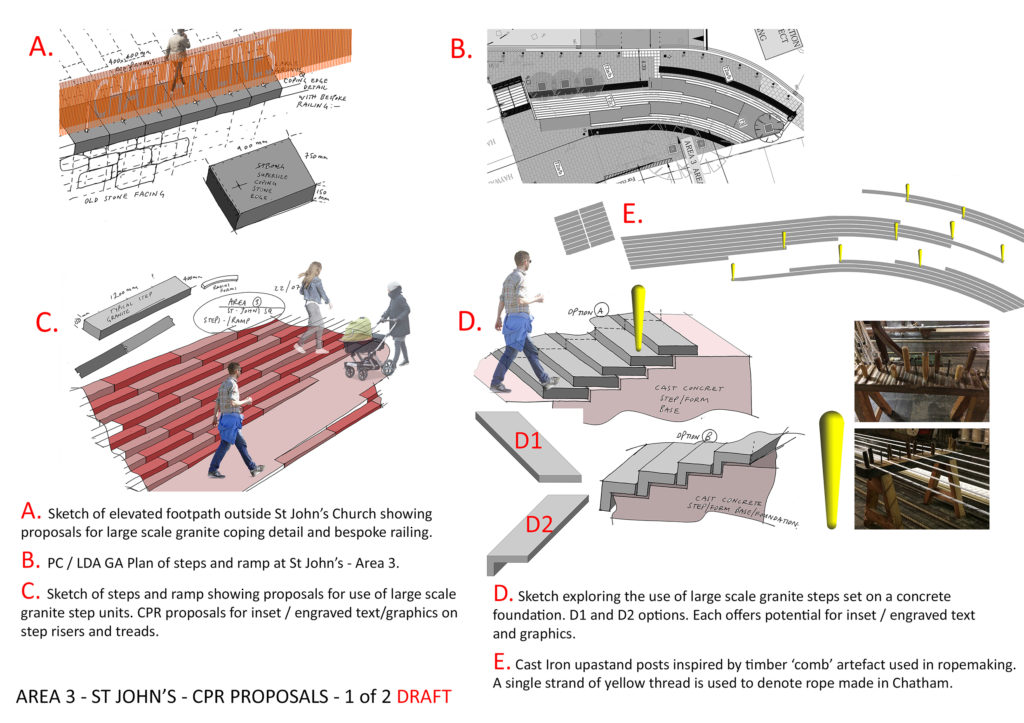
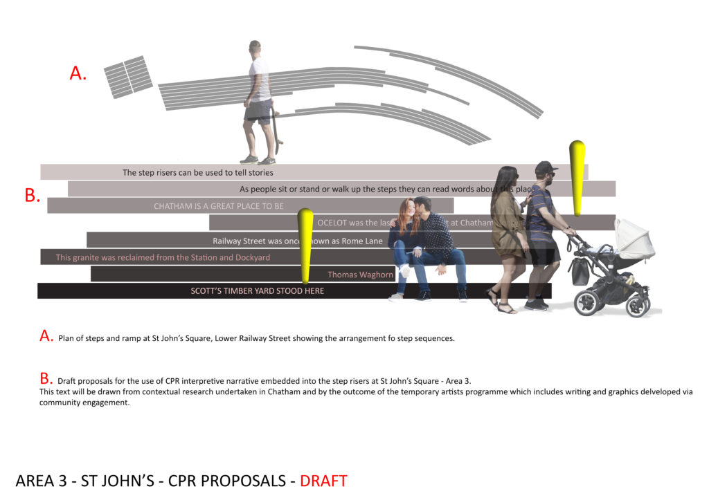
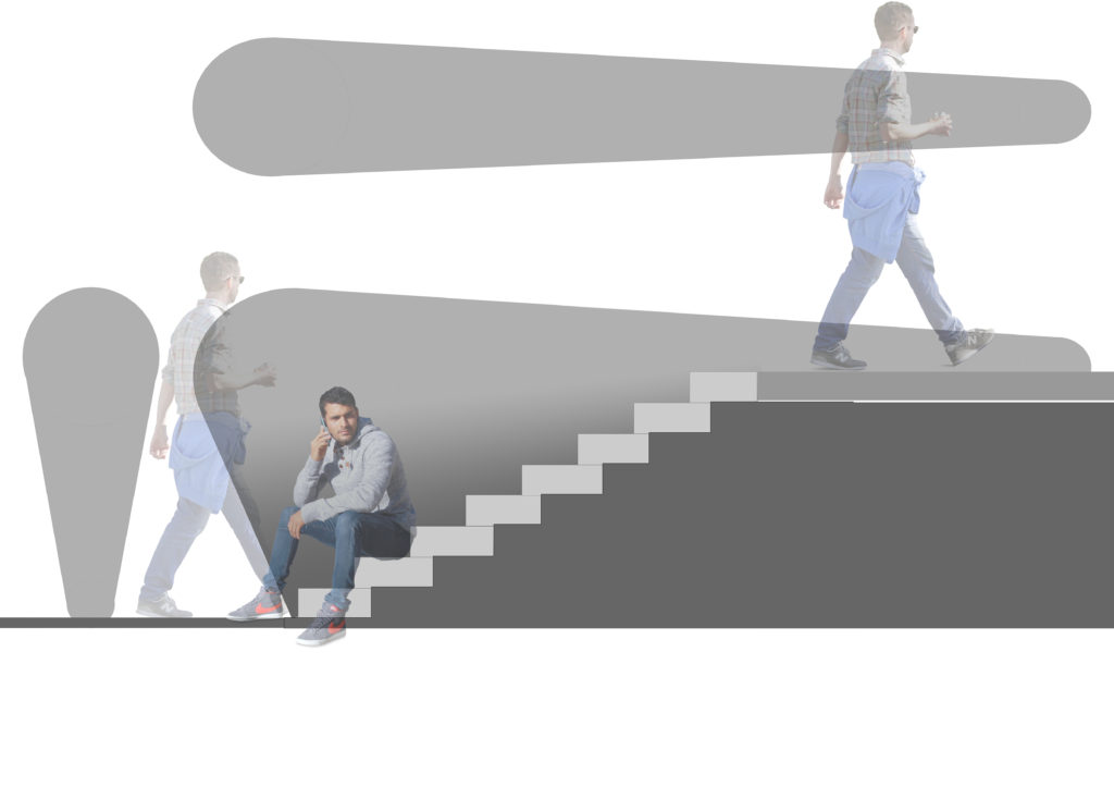
The approach to the materiality and scale of St John’s Square & elsewhere along our route, was influenced by the architectural & industrial heritage of the Historic Chatham Dockyard.
St John’s Square – Draft proposals for bespoke landscape interventions. Image: Christopher TippingSt John’s Square – Draft proposals for bespoke landscape interventions. Image: Christopher TippingSt John’s Square – Draft proposals for bespoke landscape interventions. Image: Christopher Tipping
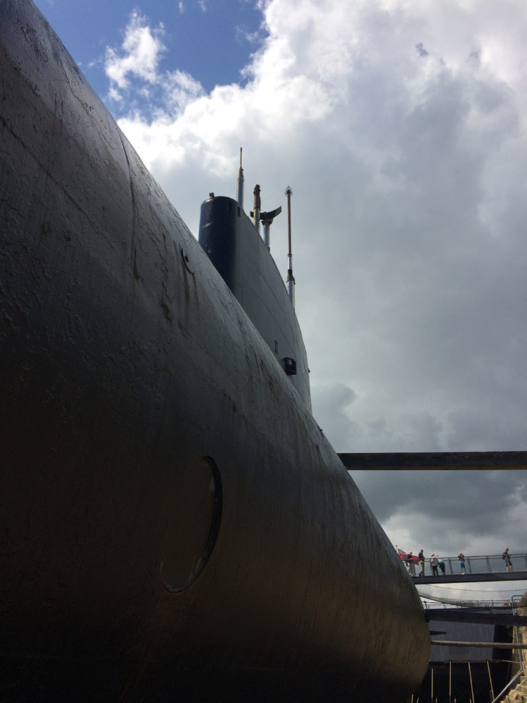
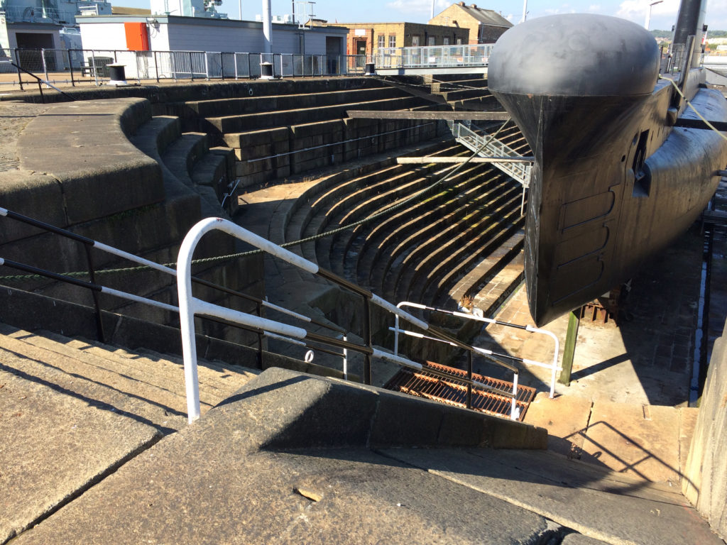
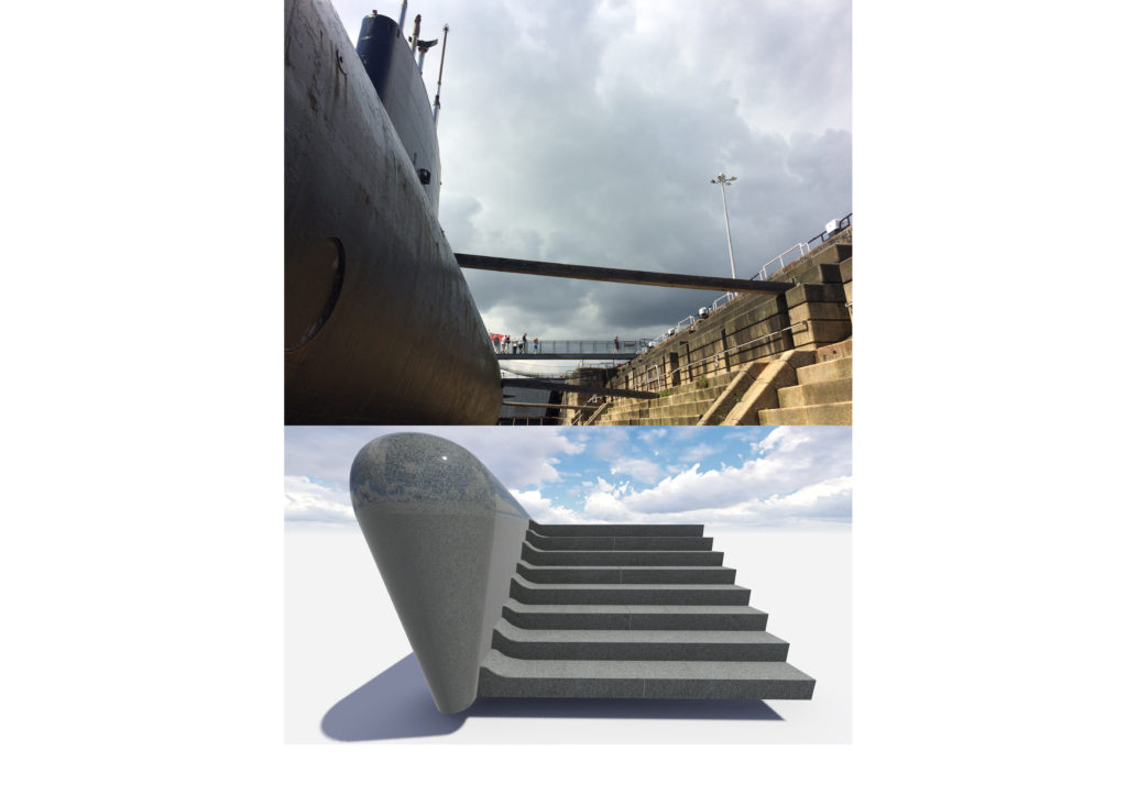
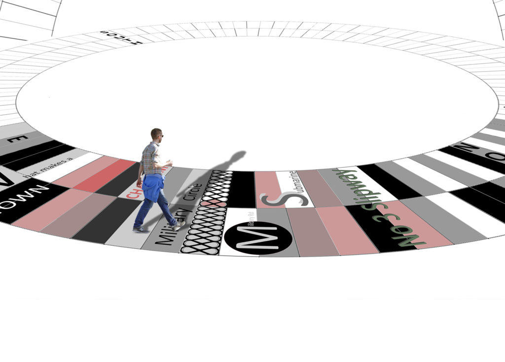
This monolithic detail seen above was titled ‘The Submarine’, inspired by HMS OCELOT on display at Chatham Historic Dockyard . This sculptural form was to act as a dividing feature separating two flights of steps at different levels.
I didn’t make it through the final evaluation process…
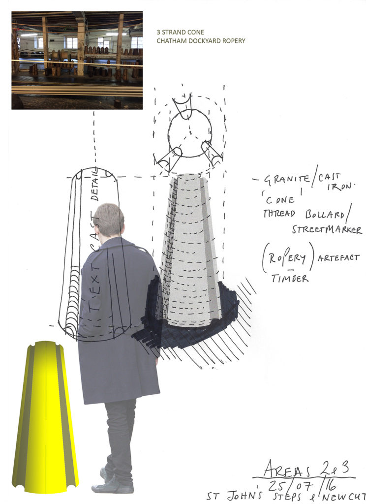
HMS OCELOT, Chatham Historic Dockyard. Image: Christopher TippingHMS OCELOT, Chatham Historic Dockyard. Image: Christopher TippingSt John’s Square – Draft proposals for bespoke landscape interventions. Image: Christopher Tipping & HardscapeSt John’s Square – Draft proposals for bespoke yellow enamel cast iron bollards & landscape interventions. Image: Christopher TippingSt John’s Square – Research Image of Ropery Artefacts. Draft proposals for bespoke yellow enamel cast iron bollards & landscape interventions. Image: Christopher Tipping
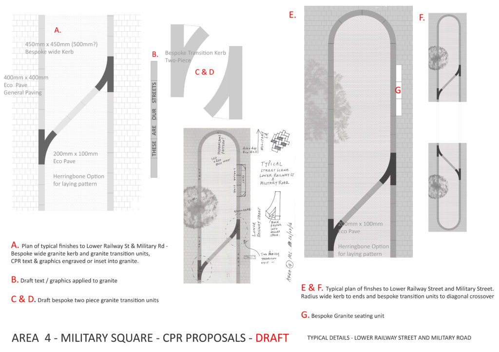
LOWER RAILWAY STREET & MILITARY SQUARE
Lower Railway Street & Military Square. Draft proposals for bespoke landscape interventions. Image: Christopher TippingLower Railway Street & Military Square. Draft proposals for bespoke landscape interventions. Image: Christopher TippingLower Railway Street & Military Square. Draft proposals for bespoke landscape interventions. Image: Christopher TippingLower Railway Street & Military Square. Draft proposals for bespoke landscape interventions. Image: Christopher TippingLower Railway Street & Military Square. Draft proposals for bespoke landscape interventions. Image: Christopher Tipping
Military Square is a major pedestrian intersection in Chatham, at the crossroads between Railway Street, Military Road and the High Street.
Lower Railway Street & Military Square. Draft proposals for bespoke landscape interventions. Image: Christopher TippingLower Railway Street & Military Square. Draft proposals for bespoke landscape interventions. Image: Christopher TippingMilitary Square draft proposals for bespoke landscape interventions. Image: Christopher TippingMilitary Square draft proposals for bespoke landscape interventions. Image: Christopher TippingMilitary Square draft proposals for bespoke landscape interventions. Image: Christopher TippingMilitary Square draft proposals for bespoke landscape interventions. Image: Christopher Tipping
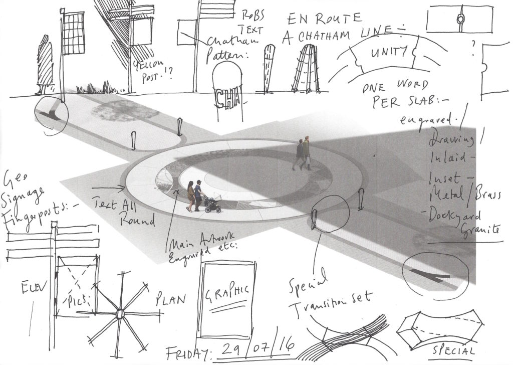
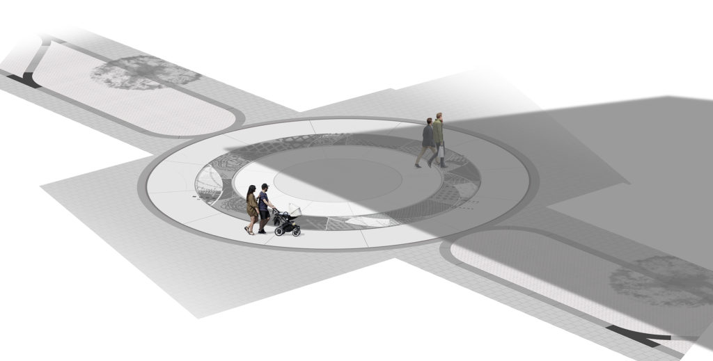
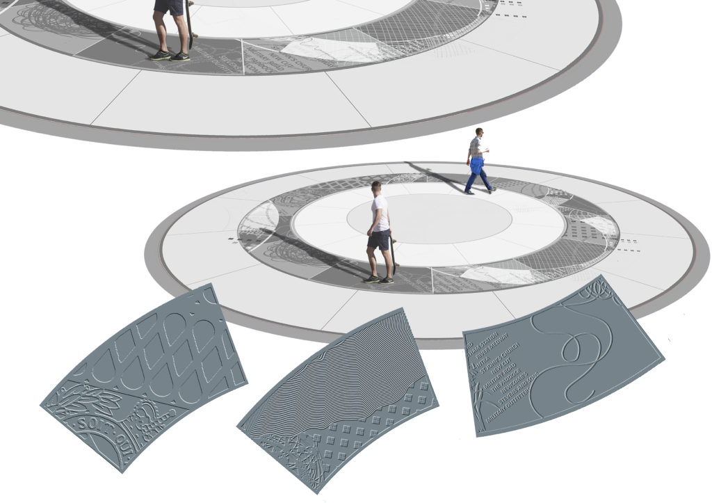
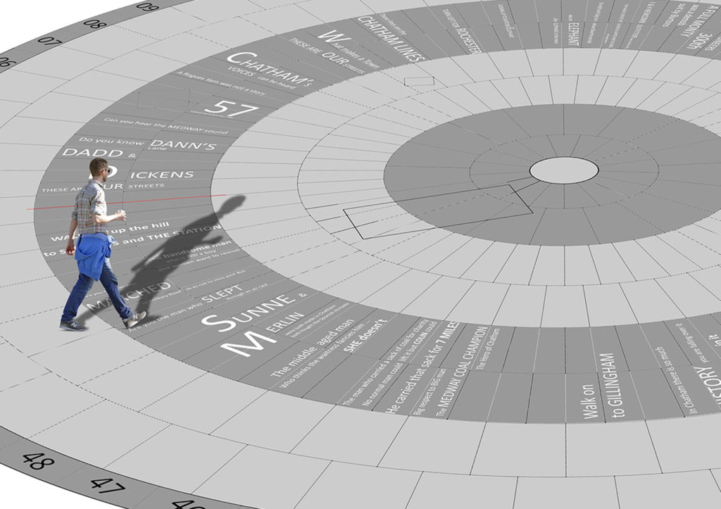
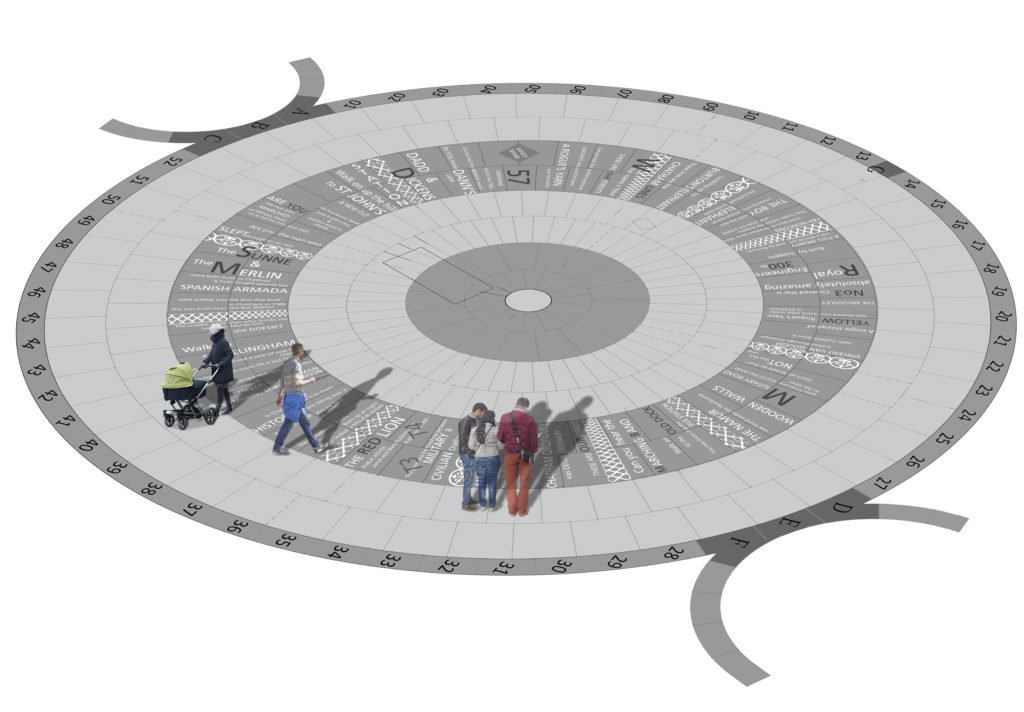
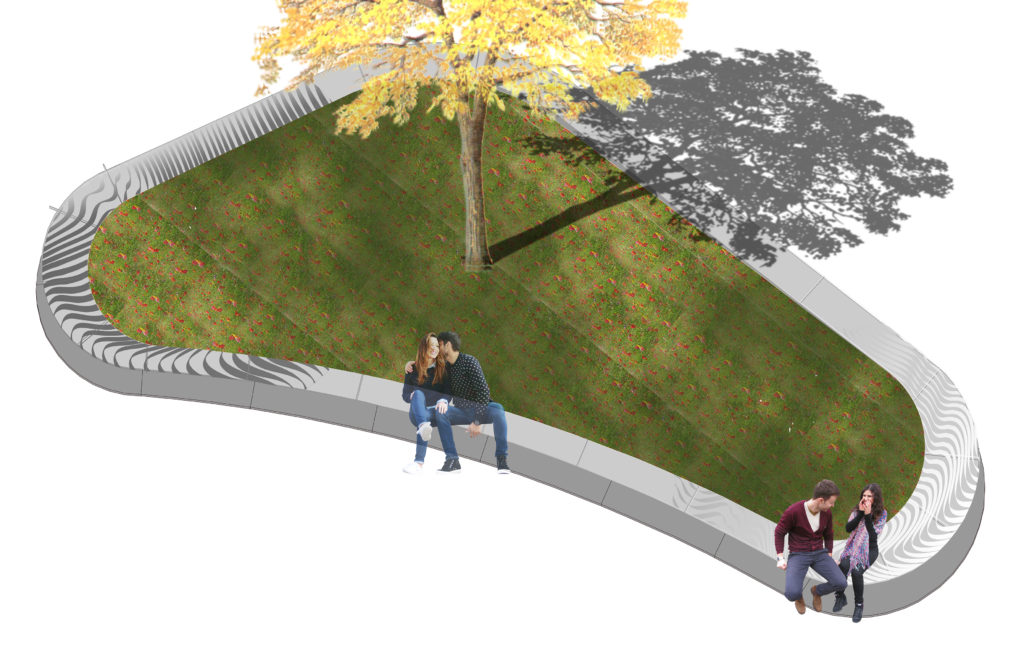
THE CIRCLE IN THE SQUARE
Military Square draft proposals for bespoke landscape interventions. Image: Christopher Tipping
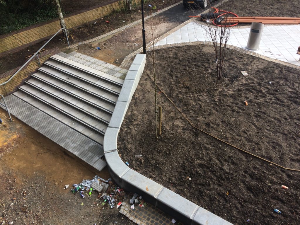
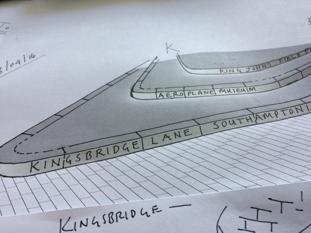
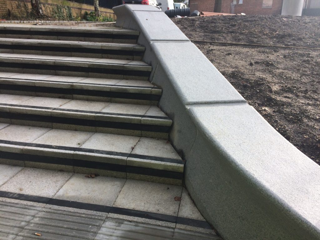
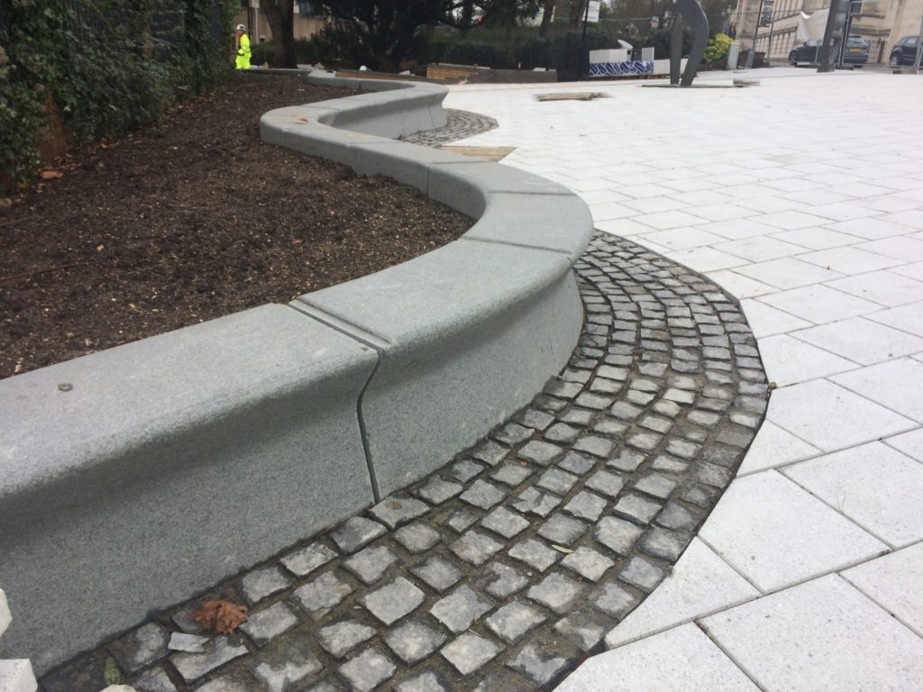
Kingsbridge Lane in Southampton is a historically important and longstanding pedestrian-only route with no vehicular access. This makes the site significant to Southampton. It is a long surviving link to the western route in and out of Southampton along the coastal strand, which formed the northern shore of the River Test Estuary until the early 20th Century. The footpath runs along a narrow strip of land between the existing railway tunnel and the historic and long abandoned tunnel of the Southampton to Salisbury Canal, which ran along what is now Blechynden Terrace, linking Central Station to the Guildhall Square &Cultural Quarter. My role within this project was to develop a contextual response to the site, which would, hopefully, influence the landscape design and regenerative design process in collaboration Simon Taylor of Balfour Beatty Living Places , Southampton City Council and Hardscape.
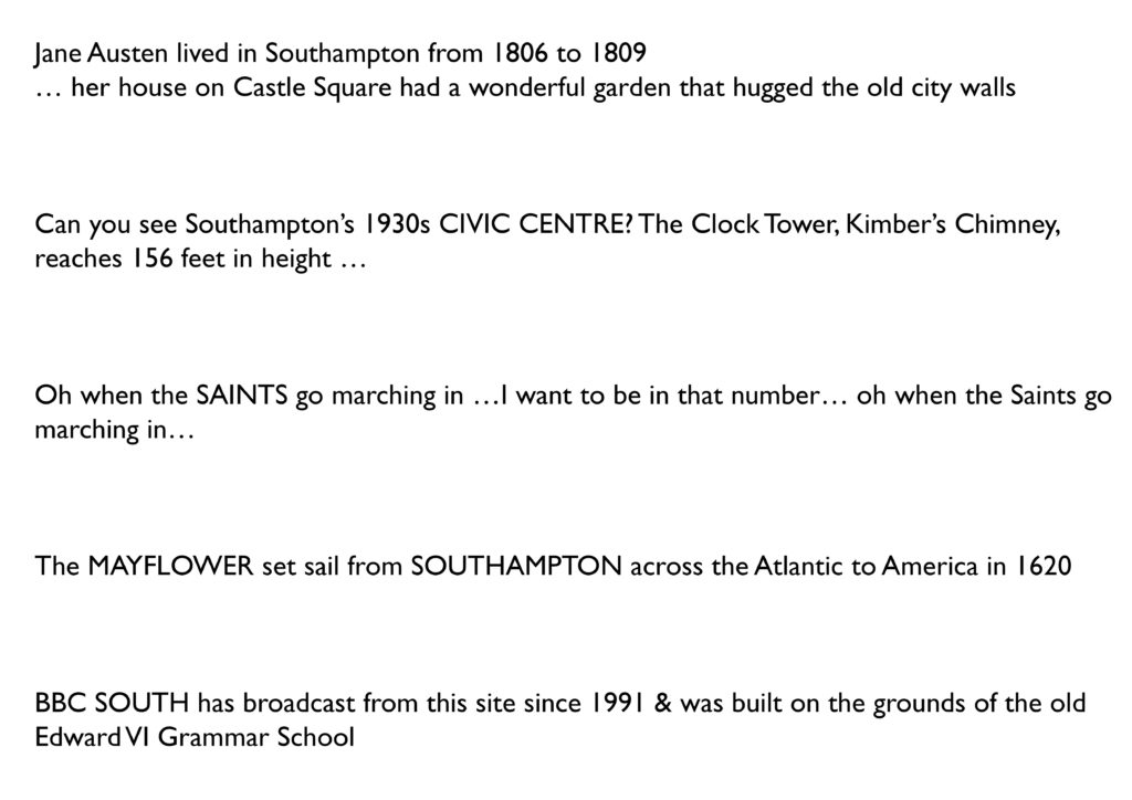
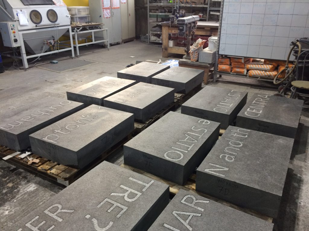
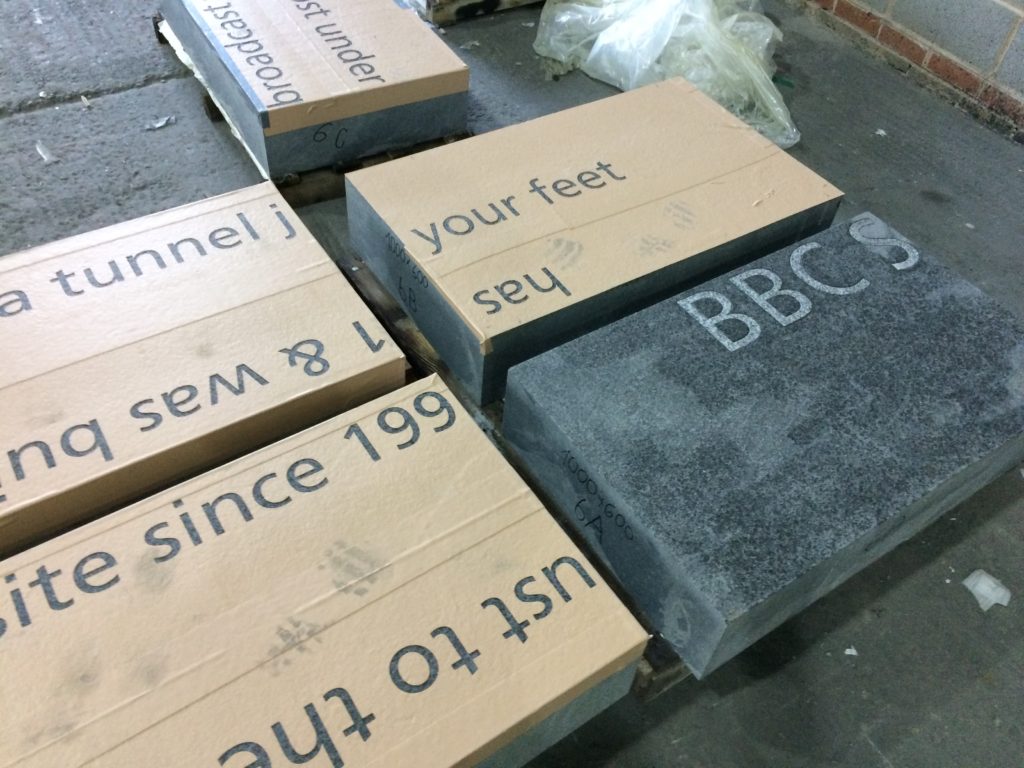
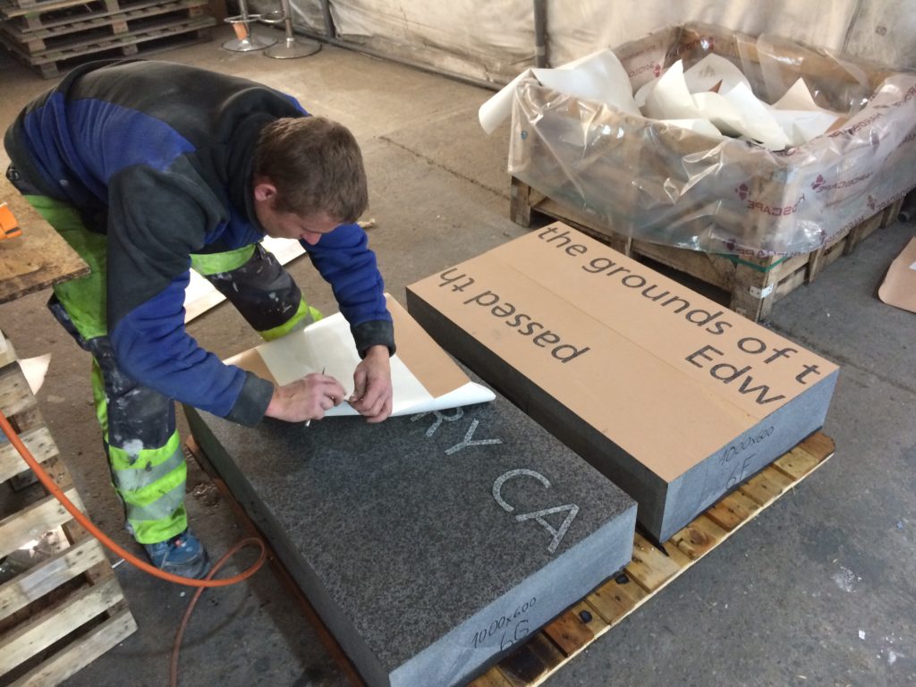
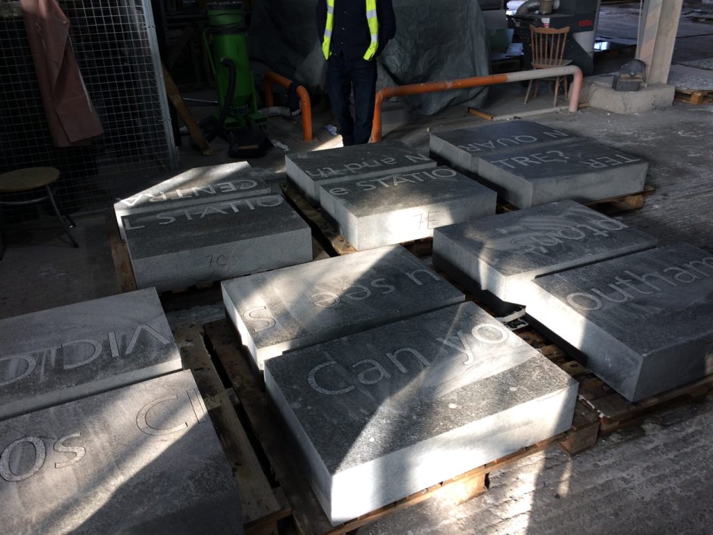
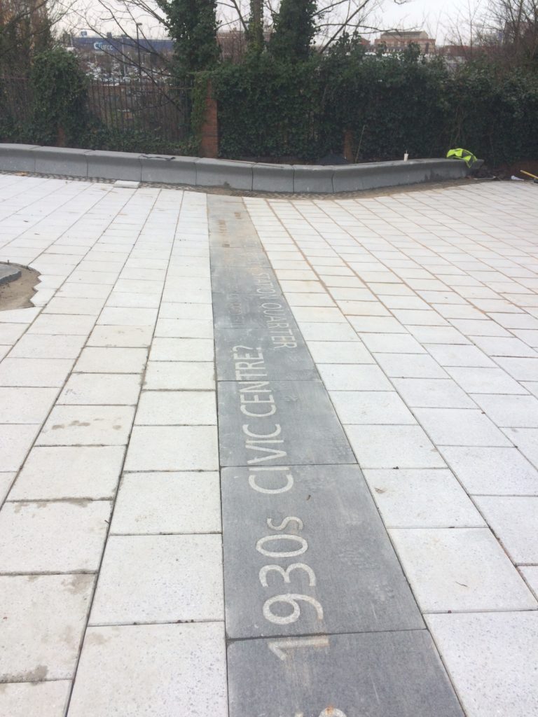
Contextual drafts – ‘BBC SOUTH has broadcast from this site since 1991 & was built on the grounds of the old Edward VI Grammar School’. Image: Christopher TippingBasalt Blocks with inset granite text set out during manufacture at Hardscape. Image: Christopher TippingBasalt Blocks awaiting sandblasting with text during manufacture at Hardscape. Image: Christopher TippingBasalt Blocks during sandblasting with text. Manufactured by Hardscape. Image: Christopher TippingBasalt Blocks with inset granite text set out during manufacture at Hardscape. Image: Christopher TippingGranite benches & retaining walls, Kingsbridge Lane, January 2018 during regeneration works on site. Image: Christopher TippingGranite benches, retaining walls and steps – Kingsbridge Lane, January 2018 during regeneration works on site. Image: Christopher TippingArtwork draft for granite benches and retaining walls. Image: Christopher TippingArtwork draft for granite benches, steps and retaining walls. Image: Christopher TippingGranite benches & retaining walls, Kingsbridge Lane, January 2018 during regeneration works on site. Image: Christopher TippingGranite benches & retaining walls, Kingsbridge Lane, January 2018 during regeneration works on site. Image: Christopher TippingFinal Text setting for Basalt Strips. Kingsbridge Lane, Southampton. Image: Christopher Tipping
Granite benches, retaining walls & Black Basalt slabs with inset and sandblasted contextual text – Kingsbridge Lane, January 2018 during regeneration works on site. Image: Christopher TippingBlack Basalt strips with inset and sandblasted contextual text, cross the footpath at intervals – Kingsbridge Lane, January 2018 during regeneration works on site. Image: Christopher Tipping
The footpath is busy, particularly at peak travel times, but is tired, with aged materials and and unkept vibe, even more striking now that the route connects the two recently completed ‘Quarters’, Cultural & Station – what is does have is brilliant a clear sight lines – with the Civic Centre Clocktower, Wyndham Court, Central Station and Southampton Docks all visible at points along the route.
The proposals for creative public realm interventions at Kingsbridge Lane are a direct response to the following:
Preservation of the historic legacy and contextual significance of the local area –
Topography – there is a 9m fall in height from the top of the route to the bottom –
Kingsbridge Lane as a primary pedestrian route today, linking Southampton Station Quarter to the Cultural Quarter, city centre & east to west pedestrian axis –
A practical need to screen existing Network Rail buildings and car park along the southern and northern boundaries of the site –
Entrance to Kingsbridge Lane is on the right hand side of this image from June 2016, prior to regeneration works starting. Image: Christopher TippingKingsbridge Lane March 2016 prior to regeneration. Image: Christopher TippingKingsbridge Lane March 2016 prior to regeneration. Image: Christopher TippingKingsbridge Lane March 2016 prior to regeneration. Image: Christopher TippingKingsbridge Lane March 2016 prior to regeneration. Image: Christopher TippingKingsbridge Lane March 2016 prior to regeneration. Image: Christopher Tipping
My work here is an extension of the ‘Canal Shore’ concepts and research underpinning the Station Quarter North Project completed a couple of years earlier in 2016, which I had been involved with since 2012. The text below set out the background of this work.
‘Inspiration, aspiration & delivery…
As project artist, I undertook a detailed investigation into the neighborhood’s social history, geography, ecology and culture to uncover hidden structures, which inform the area’s current form, identity & reputation. This site-specific & research-led activity assisted in driving the creative concept & rationale, which now underpins the general spatial layout, character and interpretation of the new proposals. I worked as part of an integrated design team including Engineers, Landscape Architects, Designers and specialist contractors. This collaborative process allowed me to work creatively, whilst being fully supported by the wider project team.
‘Southampton’s lost district: A landscape rediscovered’
An understanding of the site’s past physical condition drives the overall theme and character of the landscape & public realm interventions: a wooded valley, a meandering stream, the curve of the historic shoreline & the ill fated Southampton & Salisbury Canal. The primary human activities on the site over time, as evidenced by residential, industrial & cultural histories have been influential in drawing individual & collective ‘voices’ from the locality which will serve to imbue any outcomes with a distinctive & renewed sense of place.
This site, adjacent to the shoreline of the Test Estuary has always been a point of confluence. The main route West in & out of the city ran along the shoreline. In medieval times this route along the shore was known and ‘The Strand’. At a point marked by Achards Bridge, which crossed the Rollesbrook Stream to enter the River Test, the city boundary with Millbrook was established.
Today this point is almost exactly opposite the entrance to Southampton Station. Blechynden Terrace is considered to be built along the line of the filled in canal basin of the Southampton & Salisbury Canal. The historic shoreline and the highest point to which the tide rises was along the line of the road.
‘Canal Shore’ developed as a singular response to this research, which is supported by a broader influence, which has pervaded the whole site.
The artwork ‘Canal Shore’ is a consolidation of all that the site has to offer, both contextually and historically. In part it traced the line of the old shoreline & the only East to West route out of the city along the shingle beach from earliest times. It was the route of an ill-fated 19th Century canal. It is now a busy road and part of the transportation network of the city. Its route forms part of the perimeter of our site, so as a single element it has the capacity to help to unify the site and draw other more disparate elements together. The work represents the confluence of both historic and contemporary transportation routes within the city.
The location of the work dictates that it adds a tangible physical presence & value to the site. However, the materials and design are significant too. The black basalt kerb is deliberately large scale & incredibly robust, but has been engineered and designed with a particular aesthetic to blend well with its dual function. It considers traffic flow & movement through the site by allowing for transport access across its width, with elegant dropped kerb sets and large-scale corner quadrants. We have extended the width of the kerb to emphasize its importance as a marker of the historic shoreline of West Bay and the River Test Estuary, but also as a reference to the former Canal coping stone edge. Its function a physical kerb edge on the highway not only indicates that it is fit for purpose, but it deliberately aligns itself to the East to West axis of this transportation and pedestrian route within the City, extending and connecting to existing routes to the Cultural Quarter, QEII Mile and future Maritime Promenade’.
I am working on this exciting architectural collaboration with the wider project team and more directly with BPTW Architects & Francis Knight.
I have completed a research and development phase and presented the outcome to the client team along with proposals for engaging with the site via artwork in cast iron and granite, embedded into footpaths to houses and threshold strips to apartment blocks. The draft presentation can be seen here: 180215 TIPPING RR PROPOSALS SM
My research has focussed primarily on the rich industrial heritage & legacy of the Rochester Riverside site. Much of this information was found within the archives and collections of Medway Archives and Local Studies Centre at Strood.
I have also consulted with other notable local agencies and organisations, such as Rochester Cathedral Library, the Guildhall Museum and John K Austin, a local Artist, writer and historian.
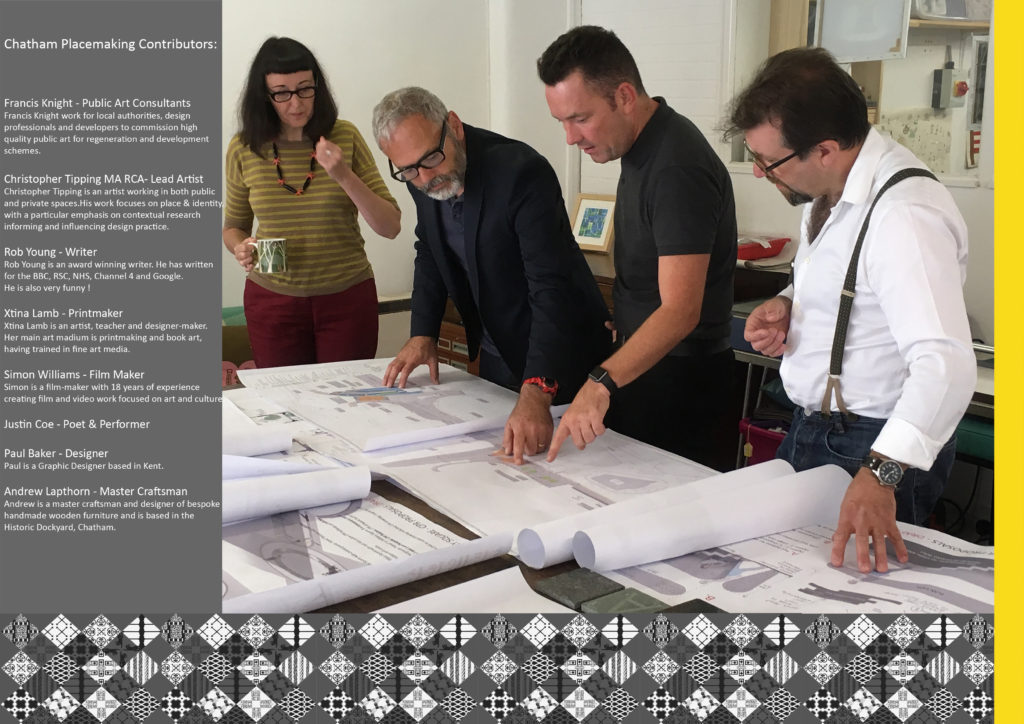
Chatham Placemaking Project – Left to Right – Project Artists: Xtina Lamb, Christopher Tipping, Simon Williams, Rob Young
A review of current and recently completed works –
I am an experienced Artist working in Public Realm, Urban Regeneration and Healthcare environments for Local Authorities, NHS Trusts and the Private Sector.
My projects exhibit contrasting variations in scale, budgets and delivery programmes. They illustrate how I can creatively collaborate within and successfully contribute to a variety of multi-disciplinary teams working in diverse locations and communities.
What underpins my approach to every project however, is a passion for contextually driven creative research and site analysis with which to inform, influence or drive a project forward. What actually delivers the project thereafter is an ability and a desire to collaborate from the outset, respectful of and creatively responsive to the contribution of all members of a client group.
I want to be involved in projects which create spaces and places which resonate with the people who will ultimately use them and which enhances their personal enjoyment and experience of it.
Click on the project titles for links to more detailed information.
Chatham Placemaking Project. Draft Magazine page for ‘A Circle of Words in a Military Square’.Chatham Placemaking Project. Draft Magazine page for ‘St John’s Steps & Crossing’. Artist: Christopher Tipping
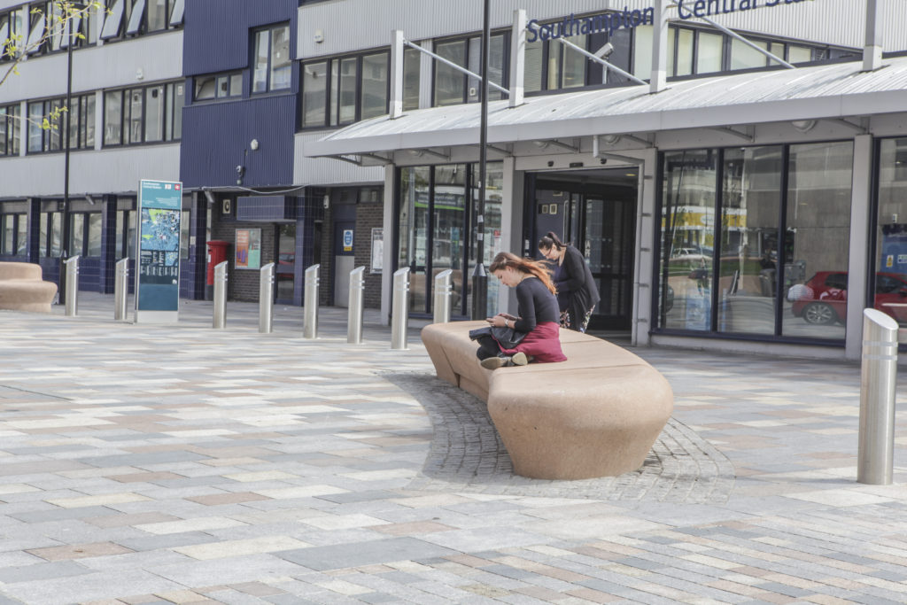
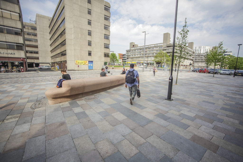
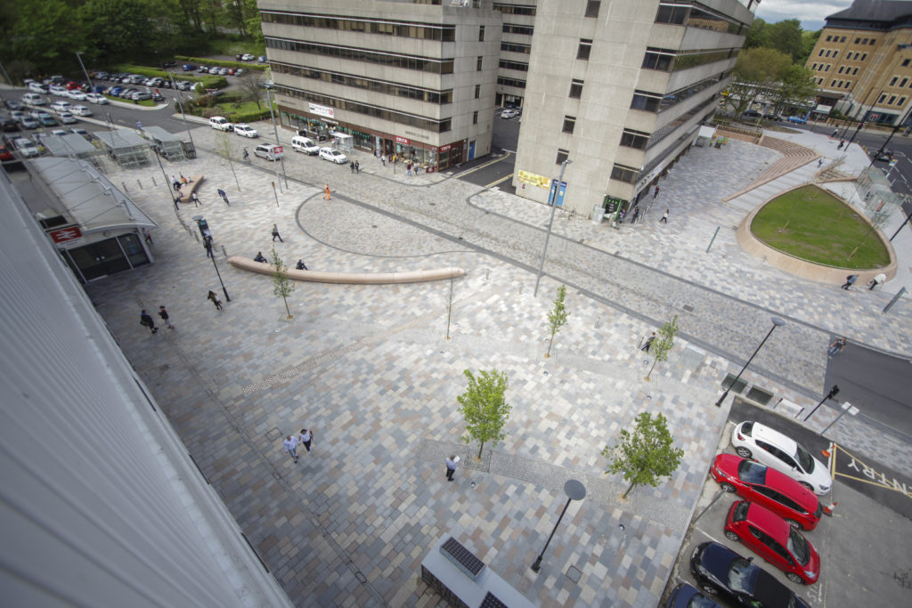
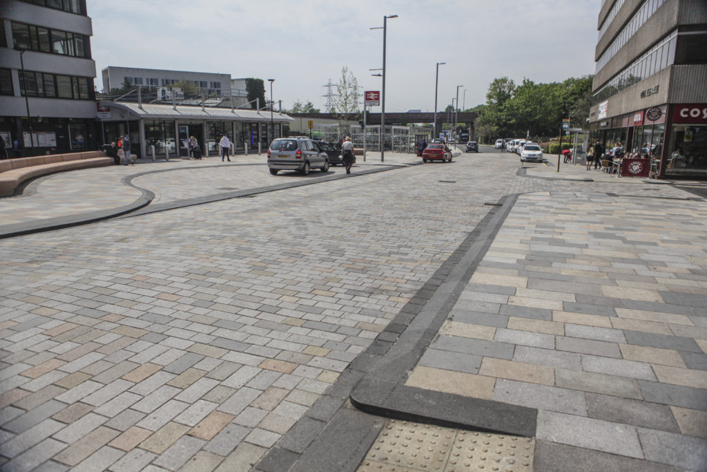
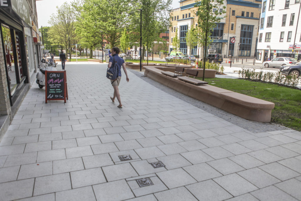
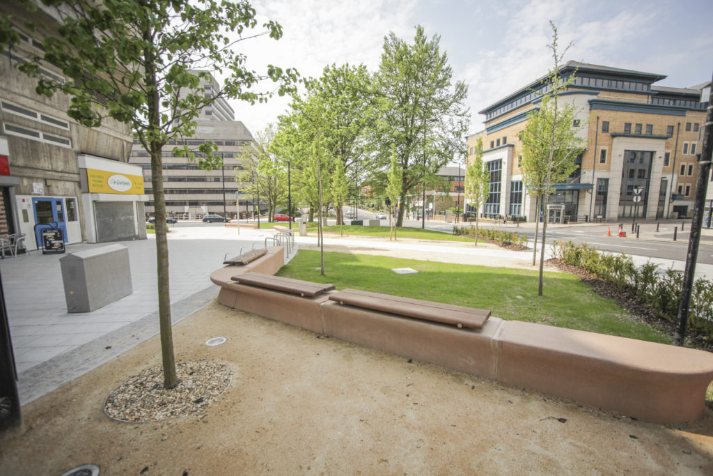
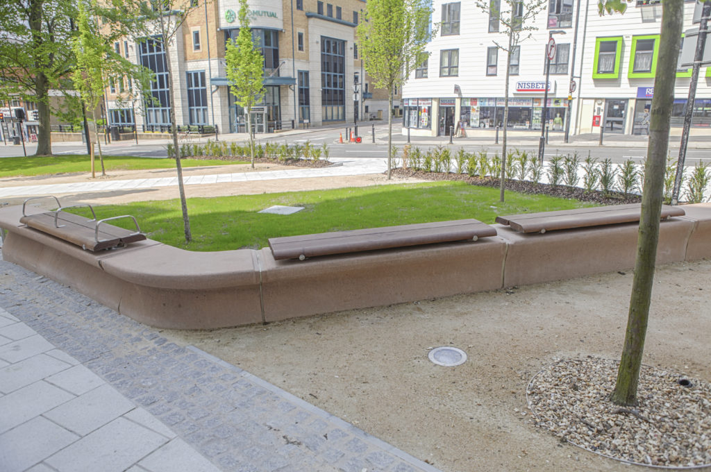
Southampton Station Quarter North – Frobisher House Forecourt. Image: Wilson Massie. Project Artist: Christopher TippingSouthampton Station Quarter North – Station Forecourt. Image: Wilson Massie. Project Artist: Christopher Tipping
HARRISON PARK, ORCHARD PARK, HULL – Extra Care Housing Scheme – digitally printed glazing vinyl and wall mounted work – Status: Ongoing
Detail: Glazing Vinyl installation Harrison Park, Hall Rd, Hull Extra Care. Artist: Christopher TippingDetail: Glazing Vinyl installation Harrison Park, Hall Rd, Hull Extra Care. Artist: Christopher Tipping
Draft Artwork for Wenric Ward, Littlemore Mental Health Unit, Oxford. Artist: Christopher TippingDraft Artwork for Wenric Ward, Littlemore Mental Health Unit, Oxford. Artist: Christopher Tipping
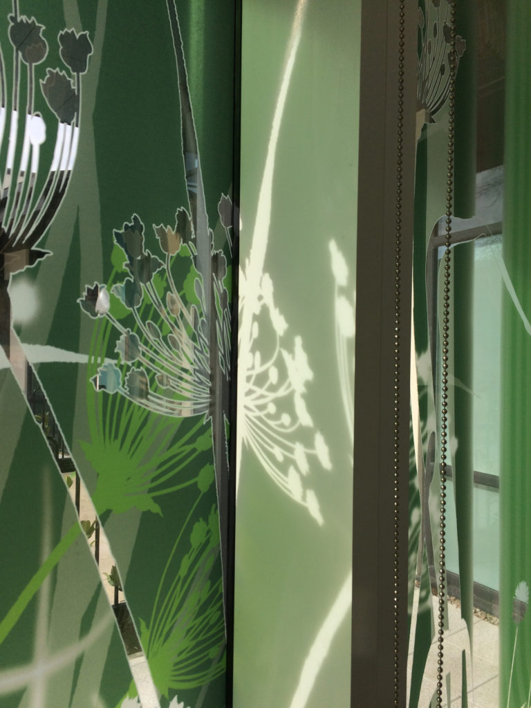
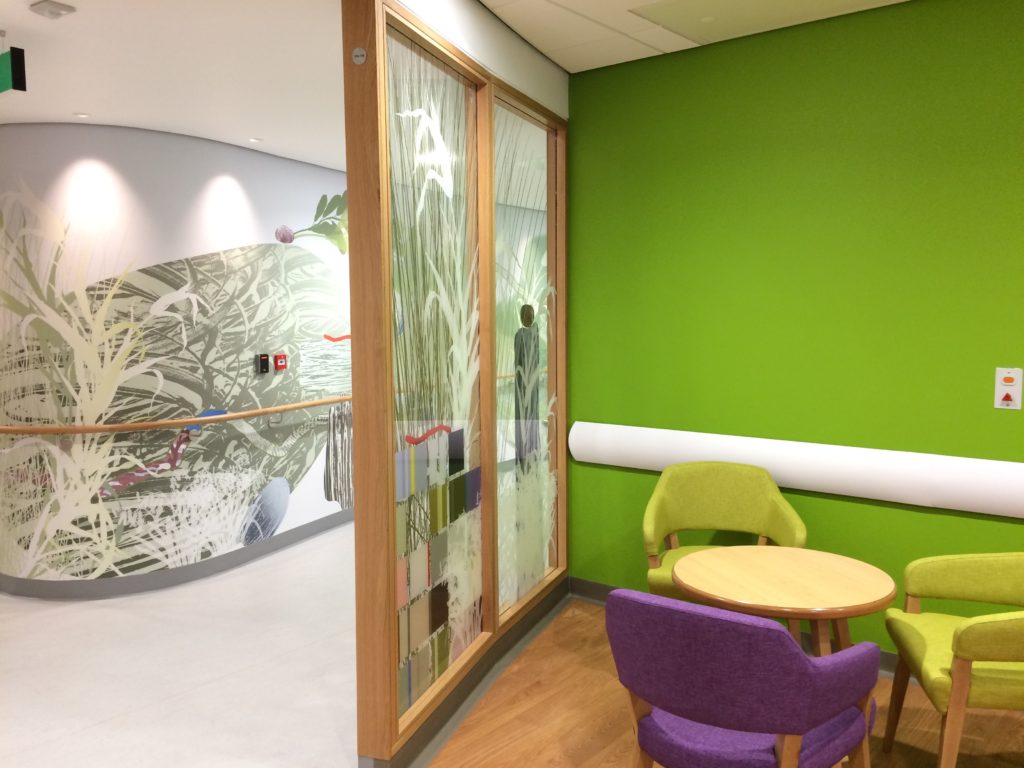
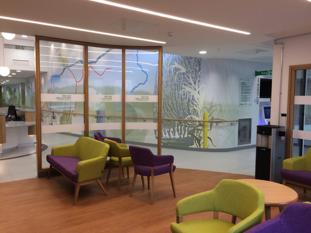
Interior of the New Macmillan Unit, showing a detail of the main corridor bespoke wall covering as seen through the laminated glazed screens. Project Artist: Christopher TippingInterior detail of the New Macmillan Unit at Tameside Hospital – Project Artist: Christopher Tipping
KINGSBRIDGE LANE, SOUTHAMPTON – Public Realm project currently in development. An extension of the Southampton Station Quarter North Project – Status: Ongoing
Southampton Station Quarter North was shortlisted for the 2016 Solent Design Awards, which were awarded in November 2016 – A much needed update on the project. Better late than never !
Southampton Station Quarter North – Public Realm. Image: Wilson Massie. Project Artist: Christopher Tipping
Although our project was not one of the winners… it was very encouraging that the collaborative approach which delivered the project and the role of our Champions Group, which endured throughout the build programme was recognised via the shortlist process.
‘The Solent Design Awards are all about the encouragement of quality place-making; schemes that create special places, lift communities, create richer experiences … not just iconic buildings, but also the places in-between’.
The following set of images from the site were produced by Wilson Massie of Balfour Beatty Living Places – thanks Wilson !
Southampton Station Quarter North – Station Forecourt. Image: Wilson Massie. Project Artist: Christopher TippingSouthampton Station Quarter North – Station Forecourt. Image: Wilson Massie. Project Artist: Christopher TippingSouthampton Station Quarter North – Station Forecourt. Image: Wilson Massie. Project Artist: Christopher TippingSouthampton Station Quarter North – Station Forecourt. Image: Wilson Massie. Project Artist: Christopher TippingSouthampton Station Quarter North – Station Forecourt, Southbrook Road. Image: Wilson Massie. Project Artist: Christopher TippingSouthampton Station Quarter North – Frobisher House Forecourt. Image: Wilson Massie. Project Artist: Christopher TippingSouthampton Station Quarter North – Frobisher House Forecourt. Image: Wilson Massie. Project Artist: Christopher TippingSouthampton Station Quarter North – Amphitheatre Steps, Frobisher House Forecourt. Image: Wilson Massie. Project Artist: Christopher TippingSouthampton Station Quarter North – Amphitheatre Steps, Frobisher House Forecourt. Image: Wilson Massie. Project Artist: Christopher TippingSouthampton Station Quarter North – Amphitheatre Steps, Frobisher House Forecourt. Image: Wilson Massie. Project Artist: Christopher TippingSouthampton Station Quarter North – Amphitheatre Steps, Frobisher House Forecourt. Image: Wilson Massie. Project Artist: Christopher TippingSouthampton Station Quarter North – Views from Wyndham Court. Image: Wilson Massie. Project Artist: Christopher TippingSouthampton Station Quarter North – View along Commercial Road from Wyndham Court. Image: Wilson Massie. Project Artist: Christopher TippingSouthampton Station Quarter North – View along Commercial Road from Wyndham Court. Image: Wilson Massie. Project Artist: Christopher TippingSouthampton Station Quarter North – View along Commercial Road from Wyndham Court. Image: Wilson Massie. Project Artist: Christopher TippingSouthampton Station Quarter North – View along Commercial Road from Wyndham Court. Image: Wilson Massie. Project Artist: Christopher TippingSouthampton Station Quarter North – View along Commercial Road from Wyndham Court. Image: Wilson Massie. Project Artist: Christopher TippingSouthampton Station Quarter North – View along Commercial Road. Image: Wilson Massie. Project Artist: Christopher TippingSouthampton Station Quarter North – View along Blechynden Terrace towards the Station. Image: Wilson Massie. Project Artist: Christopher Tipping
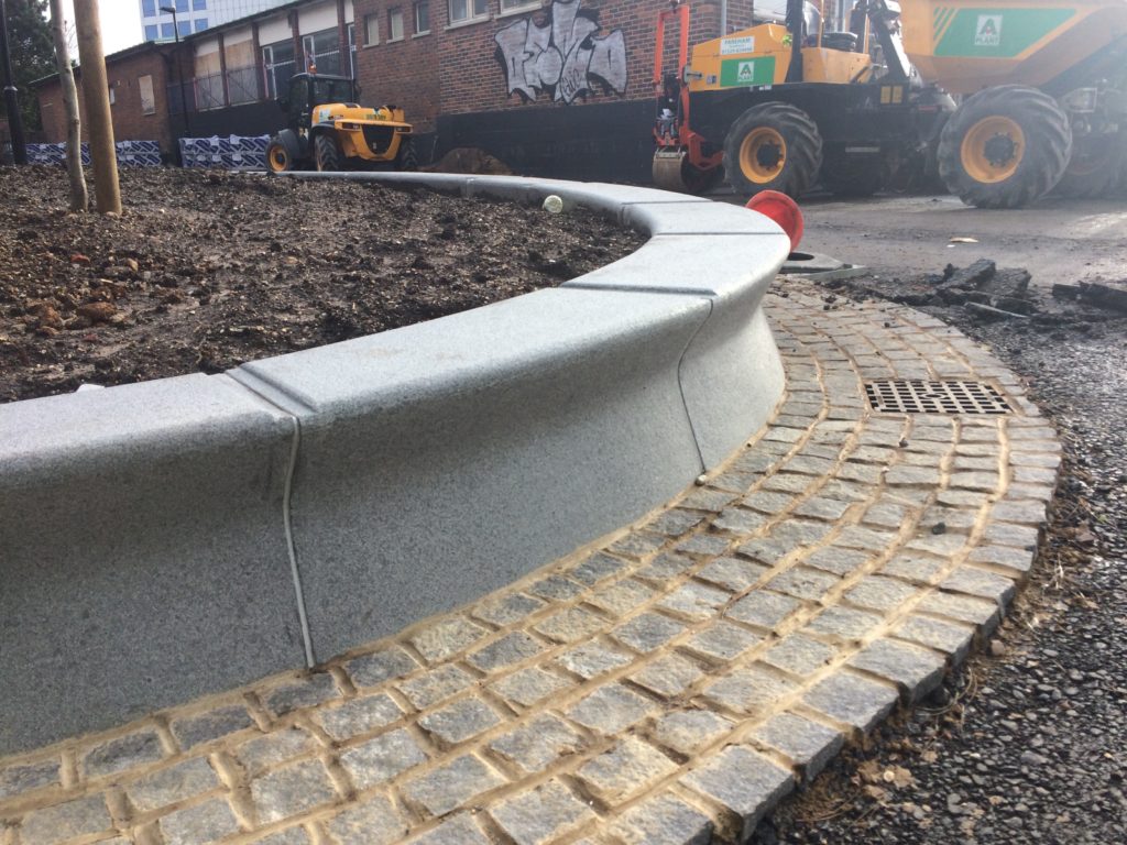
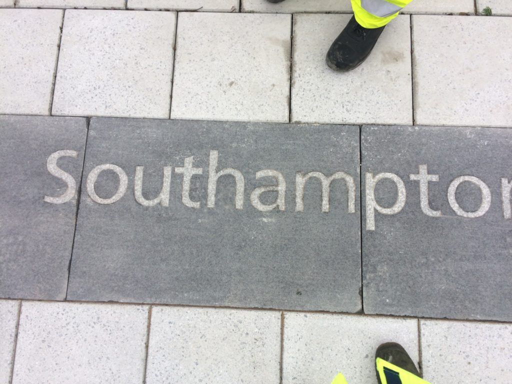
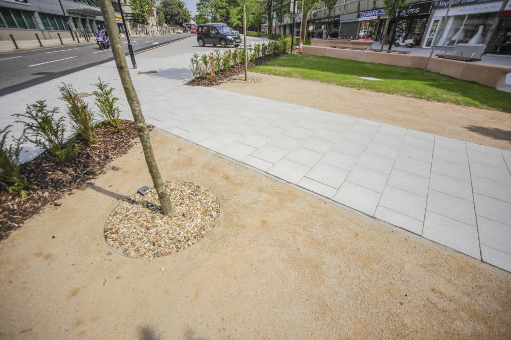
The artwork ‘Canal Shore’ runs for almost 200m along the South side of Blechynden Terrace. Bespoke extra wide Black Basalt kerbs are inset with white granite text referencing the site.
Quarter North – View of Basalt Kerb along Blechynden Terrace towards the Station. Image: Wilson Massie. Project Artist: Christopher Tipping
With thanks to Hardscapefor their excellent collaboration on the ‘Canal Shore’ artwork.
Christopher Hazeldine, Production Manager at 3Fox International Ltd has kindly allowed us to publish the following images:
‘These are our Streets’
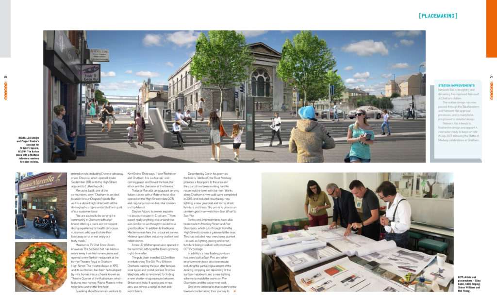
Front Cover: Medway 1 Magazine Issue 10 2017 3Fox International Ltd. Chatham Placemaking Project. Lead Artist Christopher Tipping‘Future Routes’ Page 17: Medway 1 Magazine Issue 10 2017 3Fox International Ltd. Chatham Placemaking Project. Lead Artist Christopher Tipping‘Future Routes’ Page 18: Medway 1 Magazine Issue 10 2017 3Fox International Ltd. Chatham Placemaking Project. Lead Artist Christopher Tipping‘Future Routes’ Page 19: Medway 1 Magazine Issue 10 2017 3Fox International Ltd. Chatham Placemaking Project. Lead Artist Christopher Tipping‘Future Routes’ Pages 20-21: Medway 1 Magazine Issue 10 2017 3Fox International Ltd. Chatham Placemaking Project. Lead Artist Christopher Tipping‘Future Routes’ Page 22: Medway 1 Magazine Issue 10 2017 3Fox International Ltd. Chatham Placemaking Project. Lead Artist Christopher Tipping
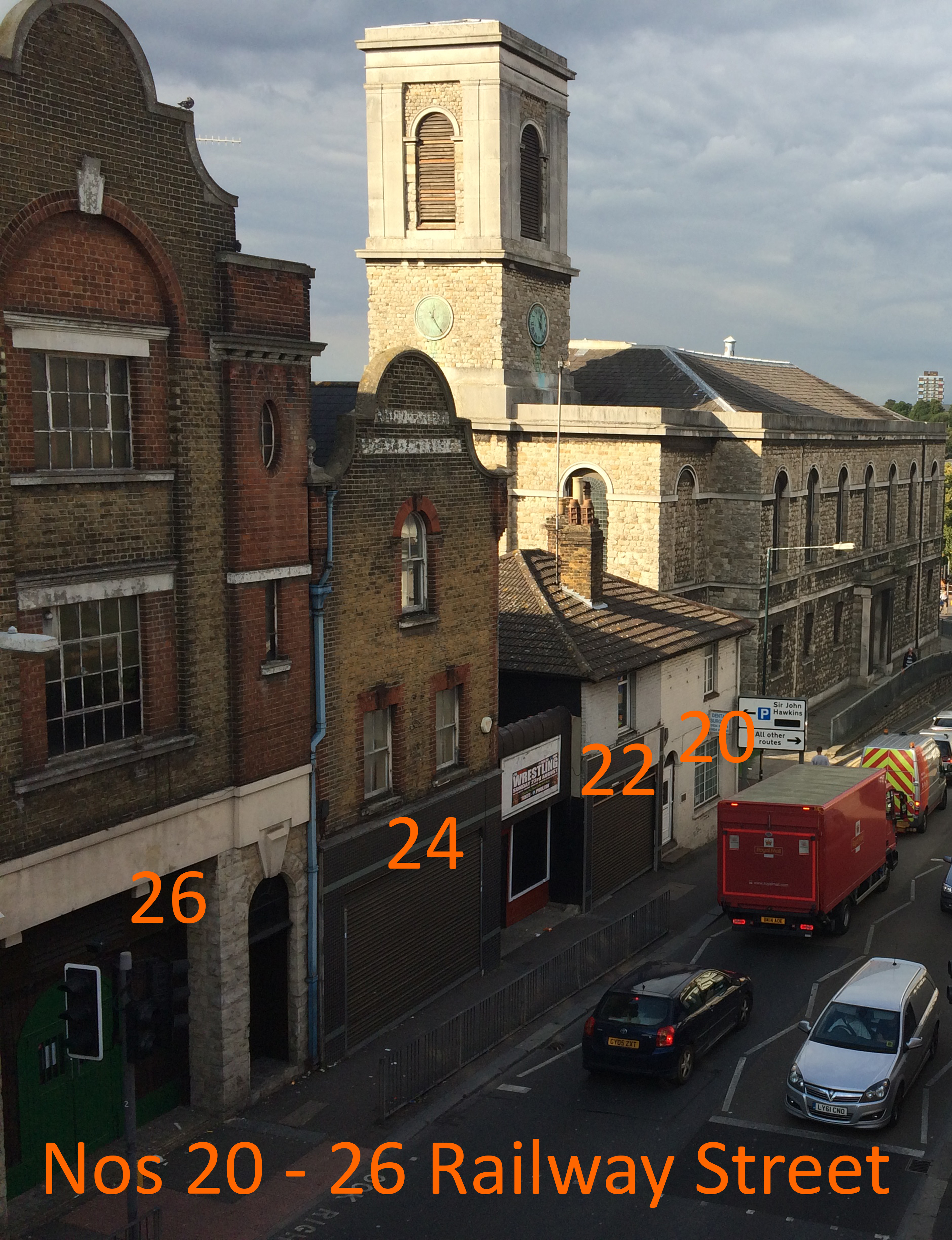
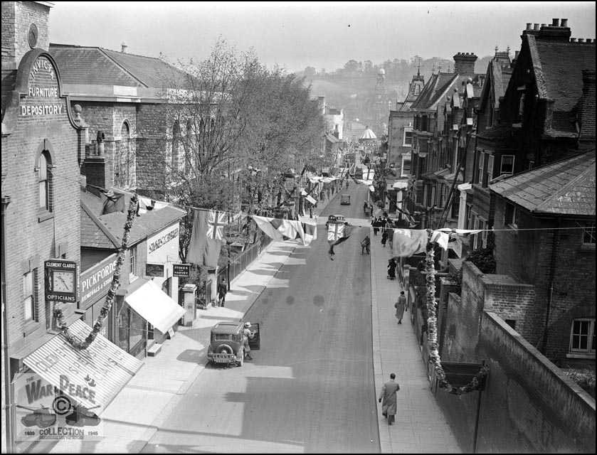
B.R. Philips made Home Brewed Ginger Beer at The Invicta Works, Nos 22 – 24 Railway Street – Chatham Placemaking Project – Chatham Patterns – Image: Christopher TippingRailway Street from New Cut Viaduct date unknown. Collection of Rex Cadman. by Permission of Rex Cadman and Kent Photo Archive.No. 26 Railway Street. In 1961, this was the premises of Frank Bannister & Son Ltd – Motor and Motorcycle Engineers. Chatham Placemaking Project – Chatham Patterns – Image: Christopher Tipping
In 1912 – No 26 was the home of the Invicta Furniture and Baggage Depository. No 28 was a Garage and Cycle Works.
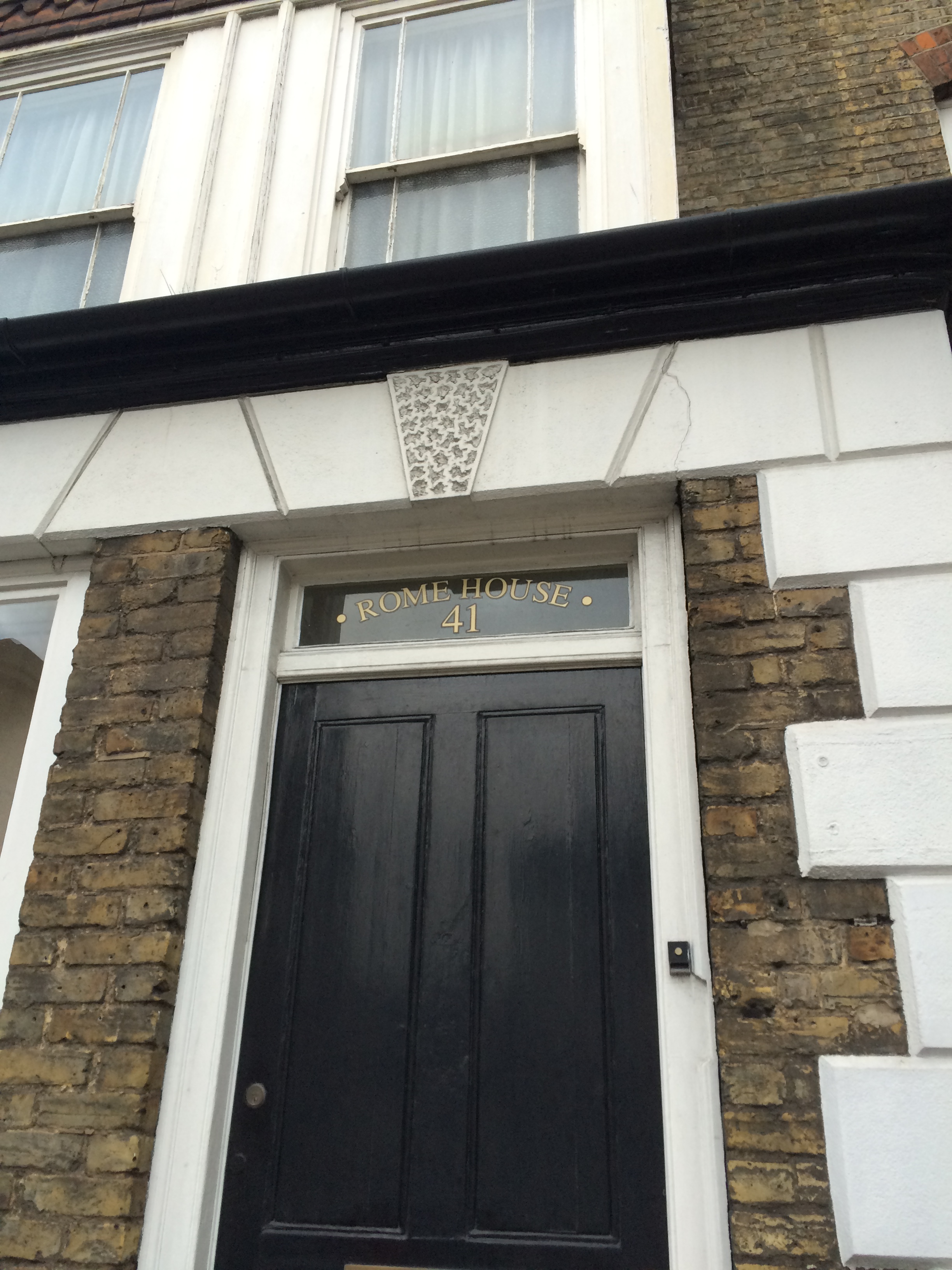
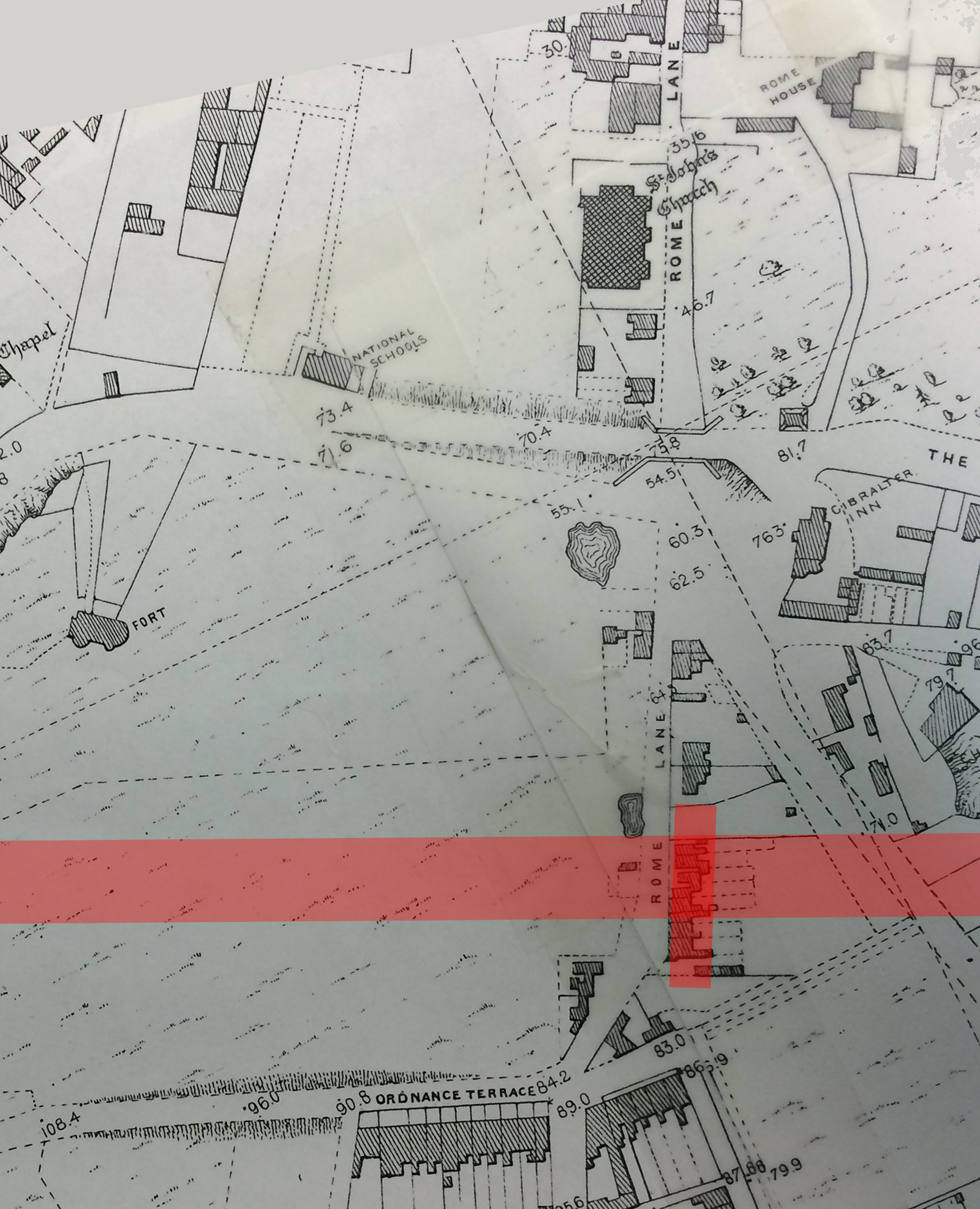
Rome House, No 41 Railway Street. Chatham Placemaking Project – Chatham Patterns – Image: Christopher Tipping
The 1848 Ordnance Survey Public Health Map of Chatham shows Rome House – a large detached mansion set in landscaped gardens – opposite St John’s Church on Rome Lane. Following the building of Chatham Railway Station, Rome Lane became Railway Street sometime after 1871. No 41 would have been a new property named after the original house.
A detail from the 1848 OS Public Health Map of Chatham, with St John’s Church and Rome House on Rome Lane at top right. The pink line shows the eventual route of the railway and Chatham Railway Station, which opened in January 1858. By permission of Medway Archives and Local Studies Centre. Chatham Placemaking Project.A detail of the OS Map of Chatham from 1864. By permission of Medway Archives and Local Studies Centre. Chatham Placemaking Project. Image: Christopher Tipping
This detail of the OS 1864 Map of Chatham shows Chatham Station at the bottom of this image. Railway Street to Military Road runs from the middle of the image to the top of the image. St John’s Church and Rome House can clearly be seen.
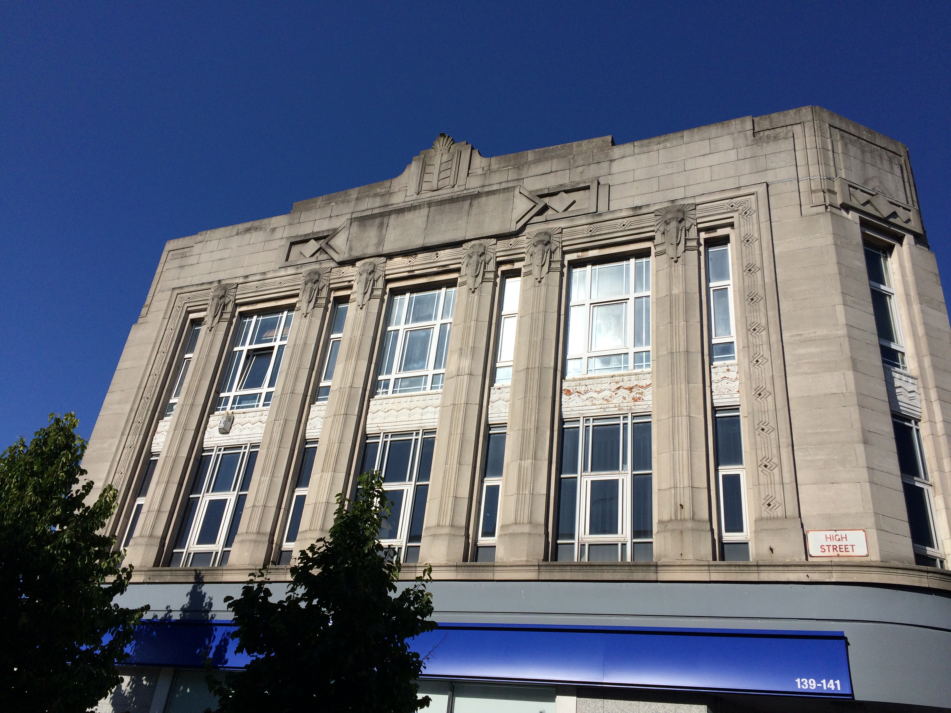
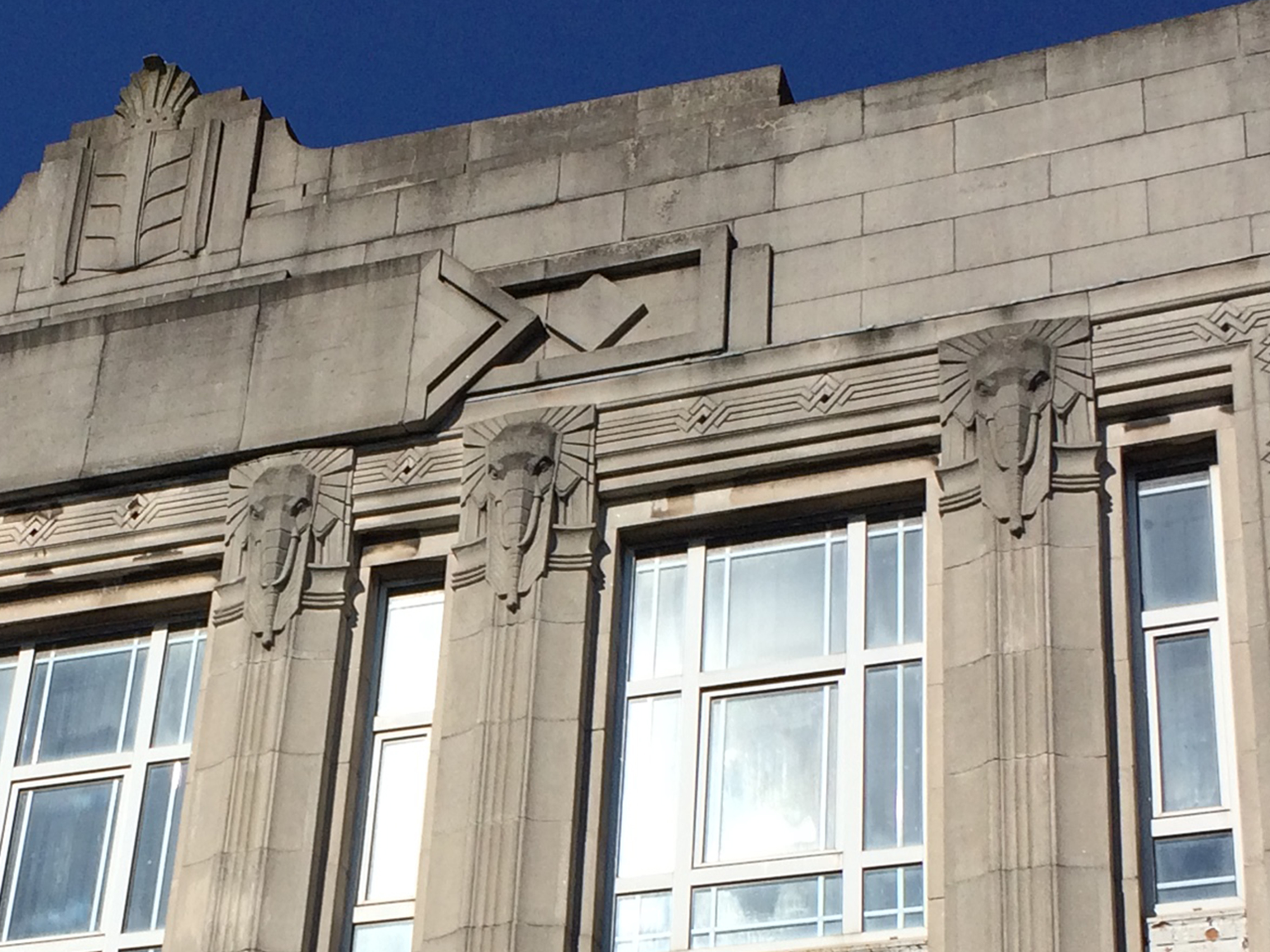
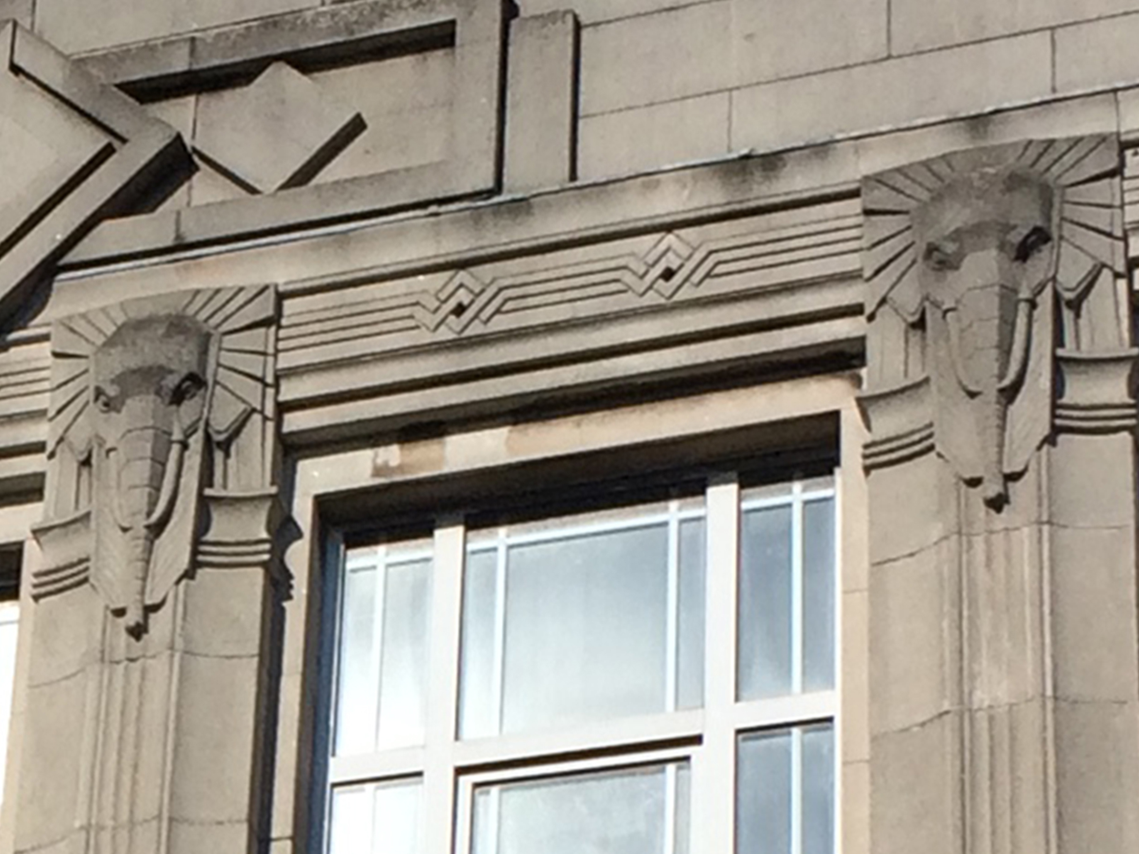
Halifax Building Society now occupy the Burton Art Deco Building on Military Road and High Street, Chatham. Image: Christopher TippingHalifax Building Society now occupy the former Burton Tailors Art Deco Building on Military Road and High Street, Chatham. Image: Christopher Tipping
“Burton’s long history in men’s clothing is a remarkable story. It was founded in 1903 by Montague Burton (originally named Meshe Osinsky), one of several Russian Jewish immigrants who built enormously successful businesses from humble beginnings.
Burton became a household name because of good public relations and the way it treated its workers. Burton bought shops in the prime town centre spots and were instantly recognisable because of their design. There were few men in England who didn’t at some time enter the portals of a Burton’s “gentlemen’s club” and get measured for a Burton suit.
On the eve of the 1939-45 war, Burton again turned to the production of uniforms for troops. After the war, Burton produced a suit for war veterans nicknamed “The Full Monty”. By the end of the war, Burton was estimated to be clothing around a fifth of British males.” On:Yorkshire Magazine20th December 2012
The Art Deco Elephantmotif on the building on Halifax Building on Military Road was common to all Burtons buildings throughout the 1930’s. It is a large and significant building in Chatham and one which assists in anchoring our site on the route from the Station to the Waterfront – not insignificantly because of it’s wonderful Elephant motif’s.
The Halifax Building Society now occupies the former Burton Art Deco Building on Military Road and High Street, Chatham. Image: Christopher Tipping
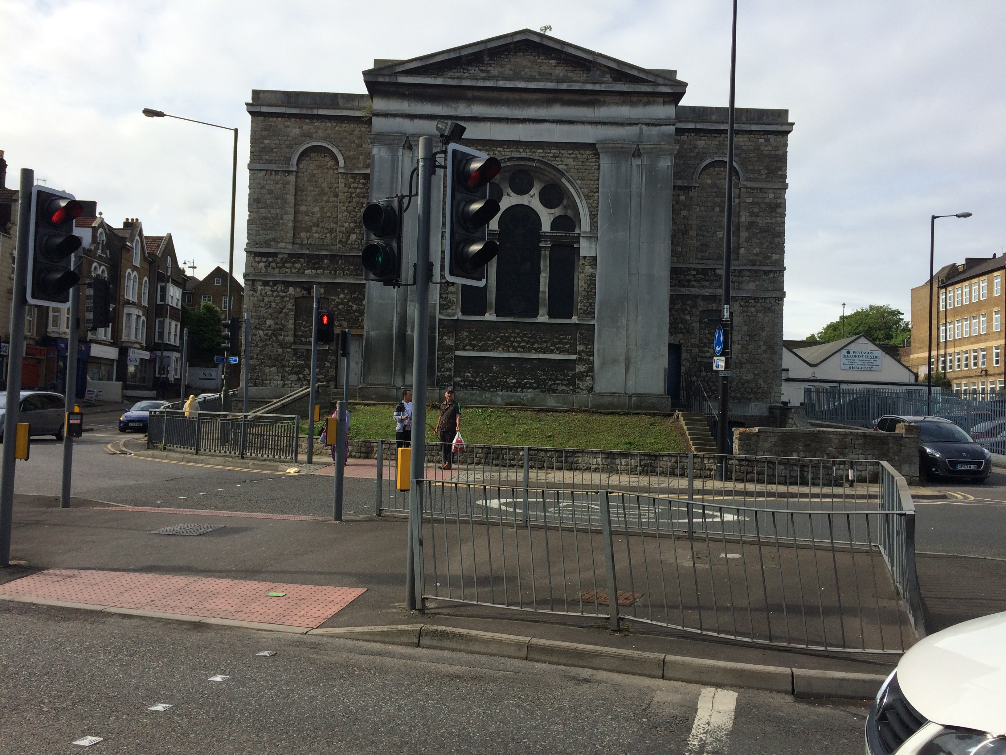
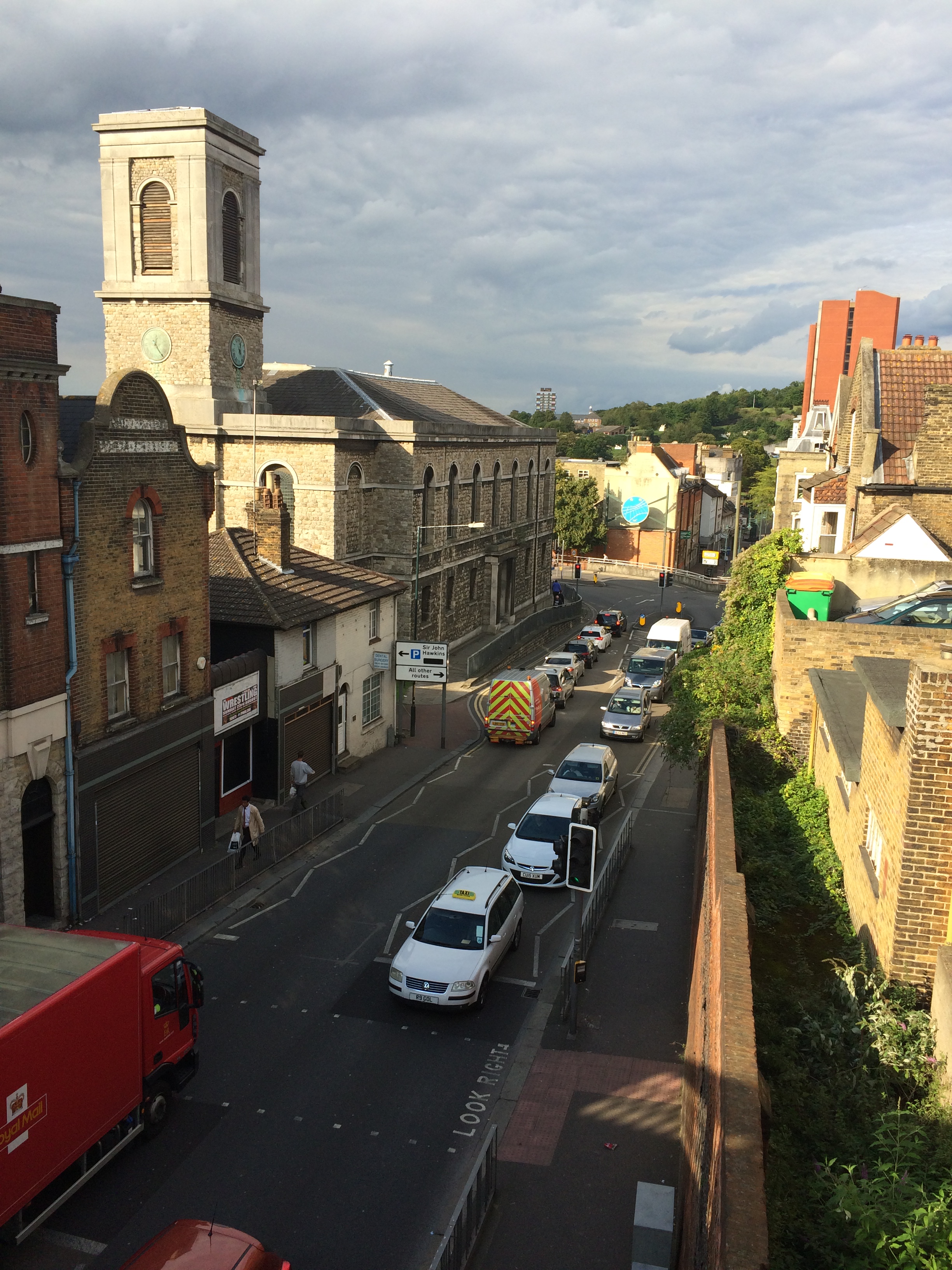
St John’s Church on Railway Street Chatham, is a jewel in the crown of Chatham’s Architectural Heritage. It is certainly an important anchor site for us working on the Chatham Placemaking Project.
St John’s Church, Railway Street, Chatham 2015. Image: Christopher Tipping
Maybe you don’t agree !
St John’s Church, Railway Street, Chatham 2015. Image: Christopher Tipping
What about now…? No?
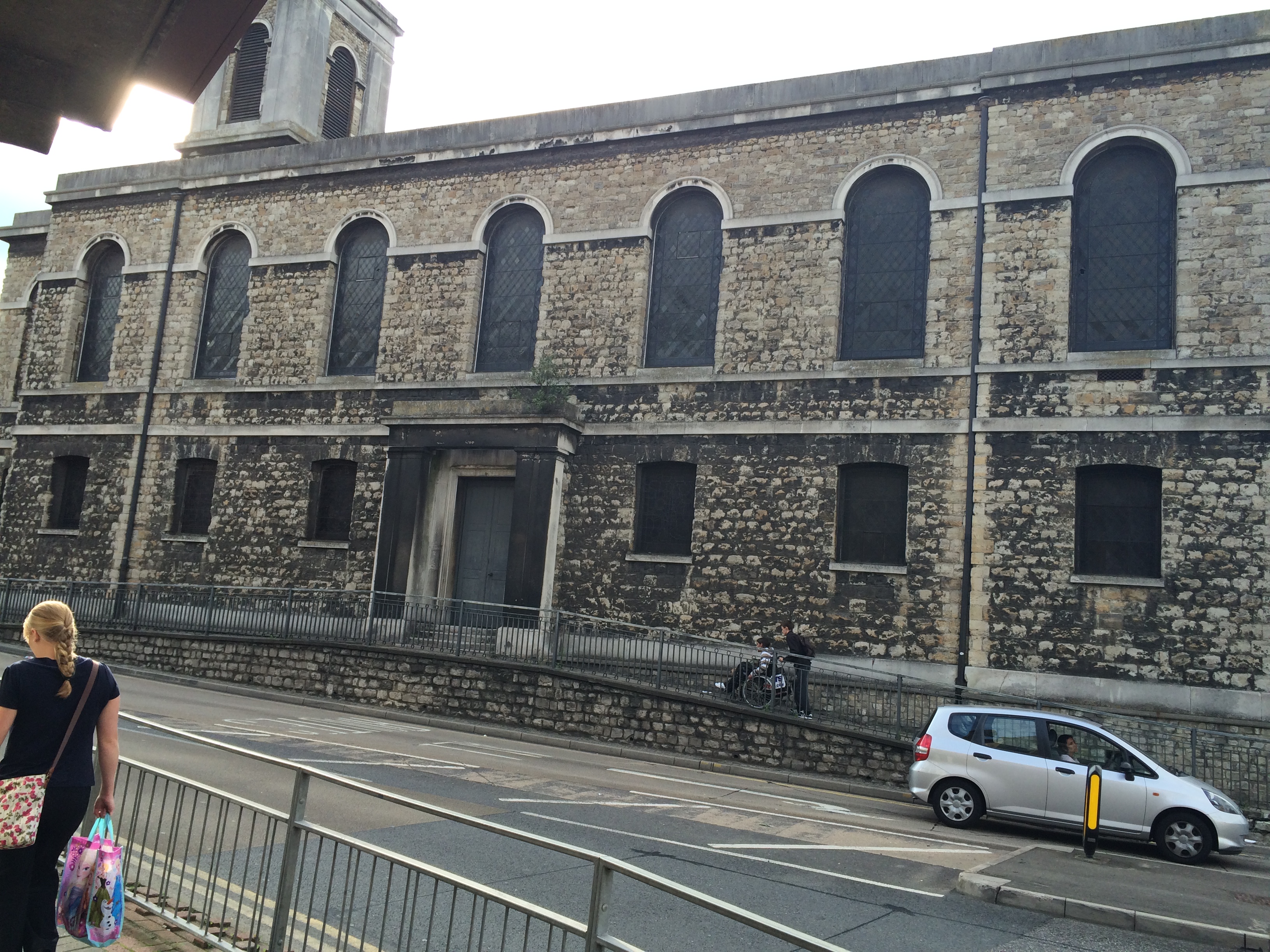
St John’s Church, Railway Street, Chatham 2015. Image: Christopher Tipping
A much better image in great light – showing off it’s tower and Italianate form.
Built in 1820/21 by the Architect Sir Robert Smirke – who by the way also built the Facade and main block of the British Museum – the Grade II Listed Italianate Style Anglican Church is one of the few Waterloo Churchesleft intact.
The Church has been closed since the early 1990’s – but has in the interim been used for an arts installation – Chatham Vines in 2006.
I only came to Chatham for the first time in 2015 to start work on the Chatham Placemaking Project – I loved the building from the start – with its robust symetric form and landmark tower. It is the anchor building along our route. However – those familiar with Chatham will know all too well the condition of the building today. It has been bypassed by most and is diminished by the constant flow of traffic and cut off from lower Railway Street and the town centre by the busy road. Stained glass windows are dark. The stone elevations are dirty. The paintwork on the doors is peeling. It is forlorn – but actually it has not been forgotten !
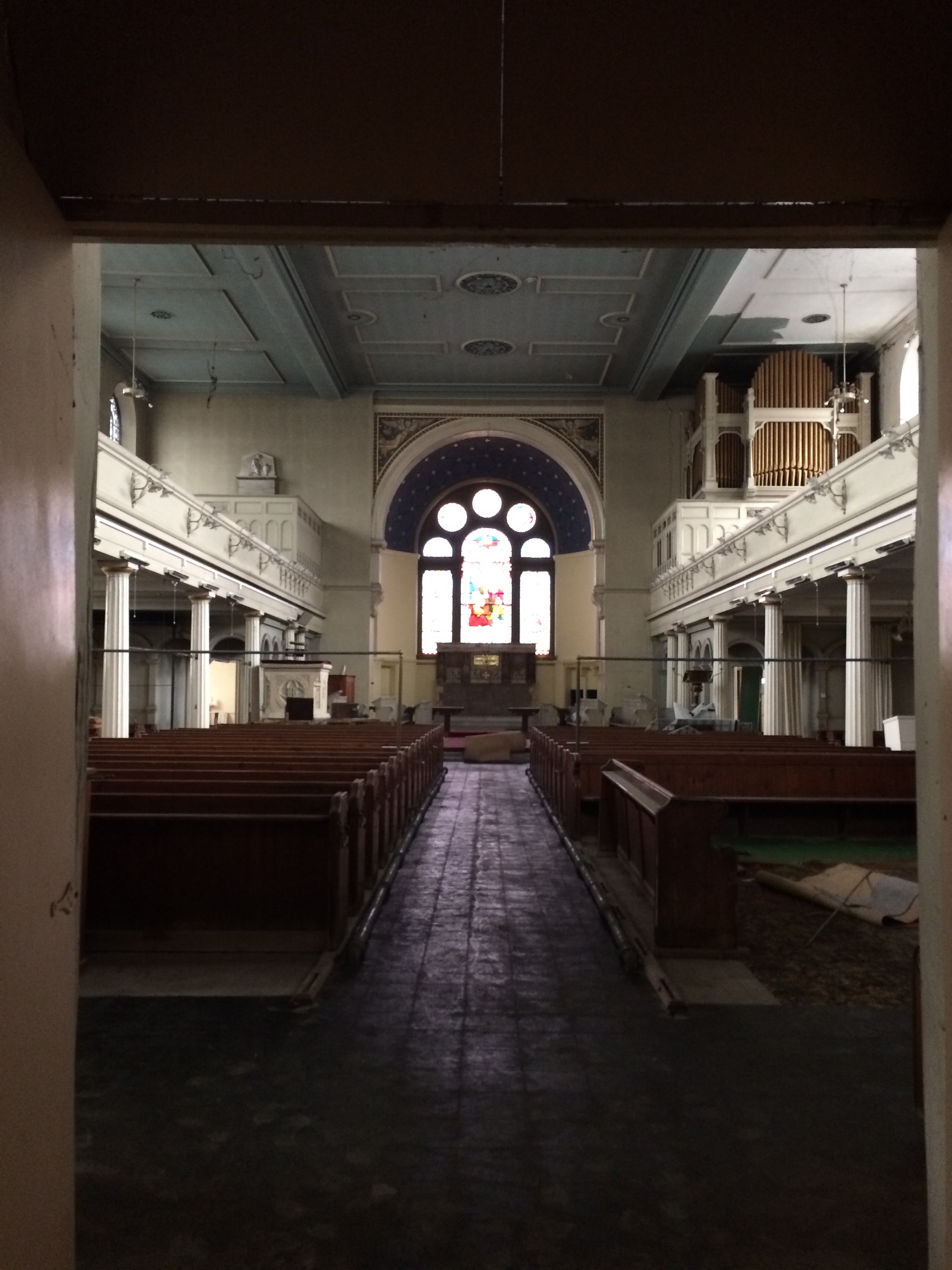
My images aren’t brilliant – but just take a look inside …
Interior of St John’s Church, Railway Street, Chatham. Image: Christopher Tipping by permission Diocese of Rochester.
Laura Knight of Francis Knight and I were accompanied by Project Manager Peter Welshof the Diocese of Rochester. He had agreed to show us around & allowed us to take pictures whilst discussing the Chatham Placemaking Project and the importance of this building to our project. The building is still of importance to the Diocese too. ‘The strategic project at Chatham includes re-establishing a worshipping community for St John’s Church, bringing the building back into use (potentially with an interim solution) and establishing mission activities in the local community. The area around St John’s is one of the most deprived in the Diocese in terms of employment rates, income, education and quality of life’.
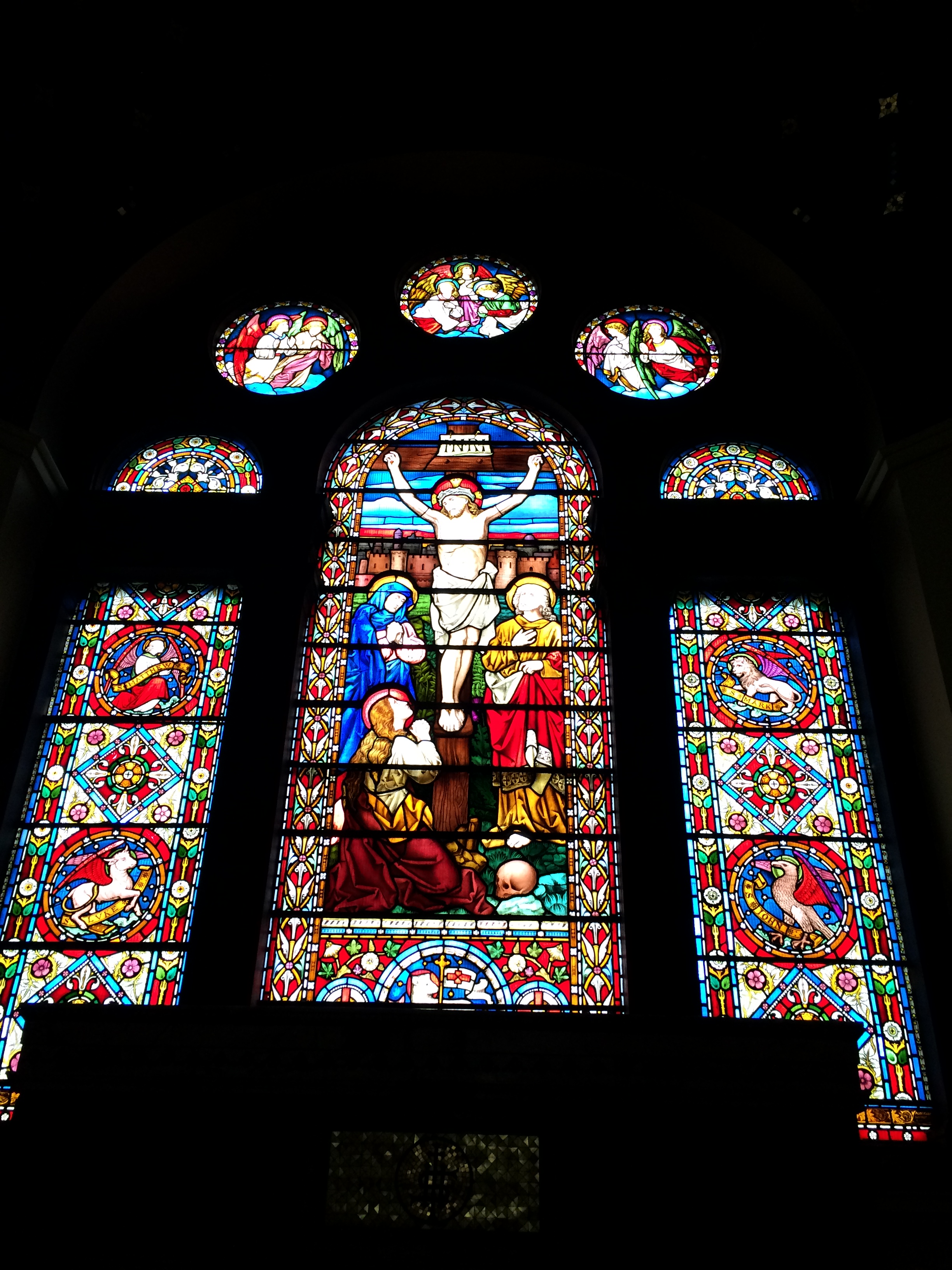
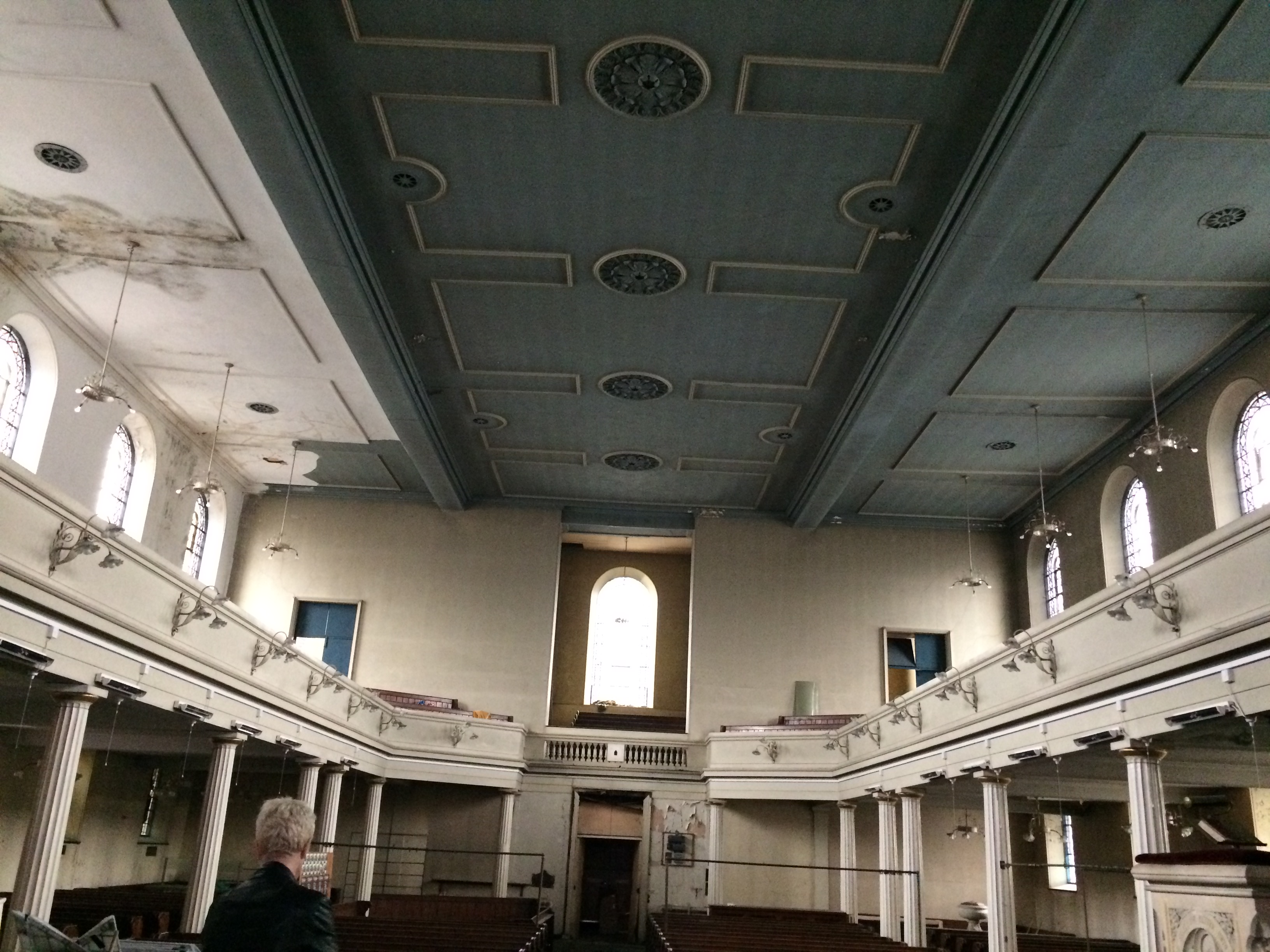
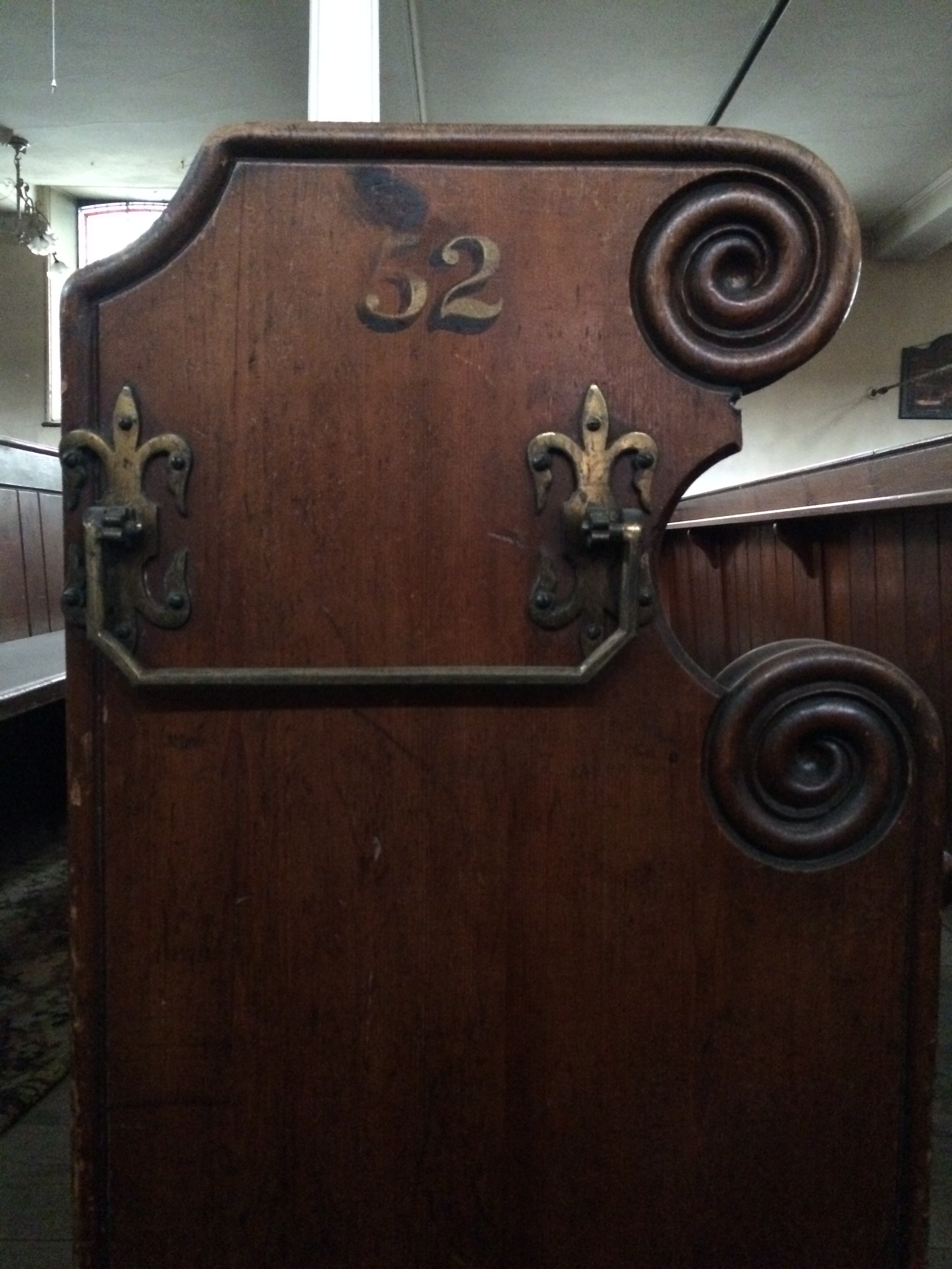
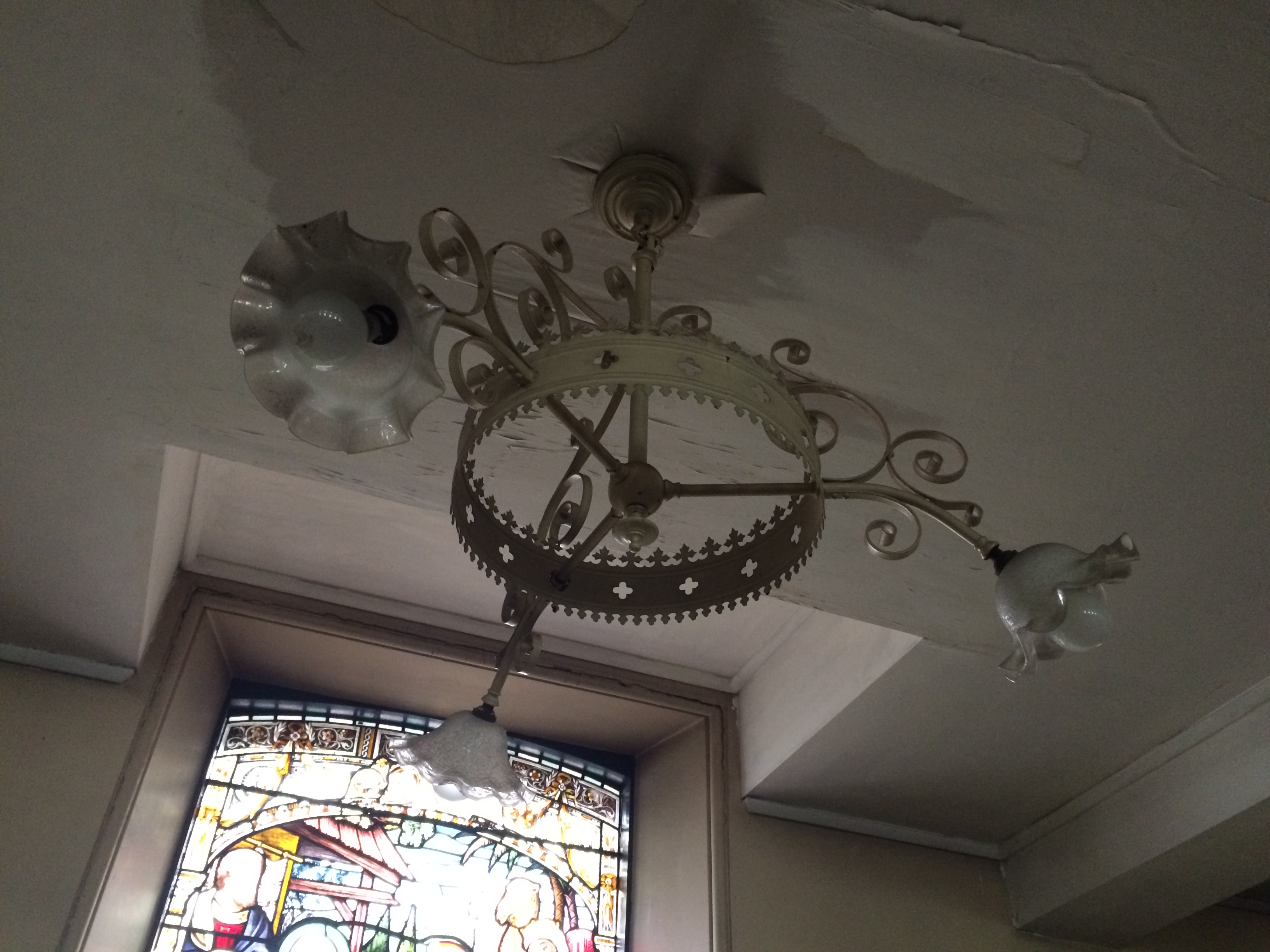
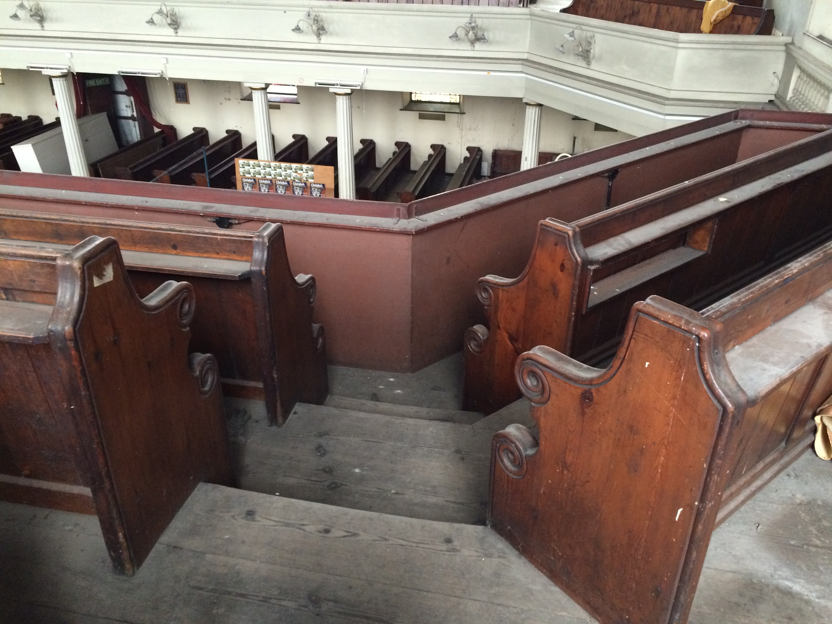
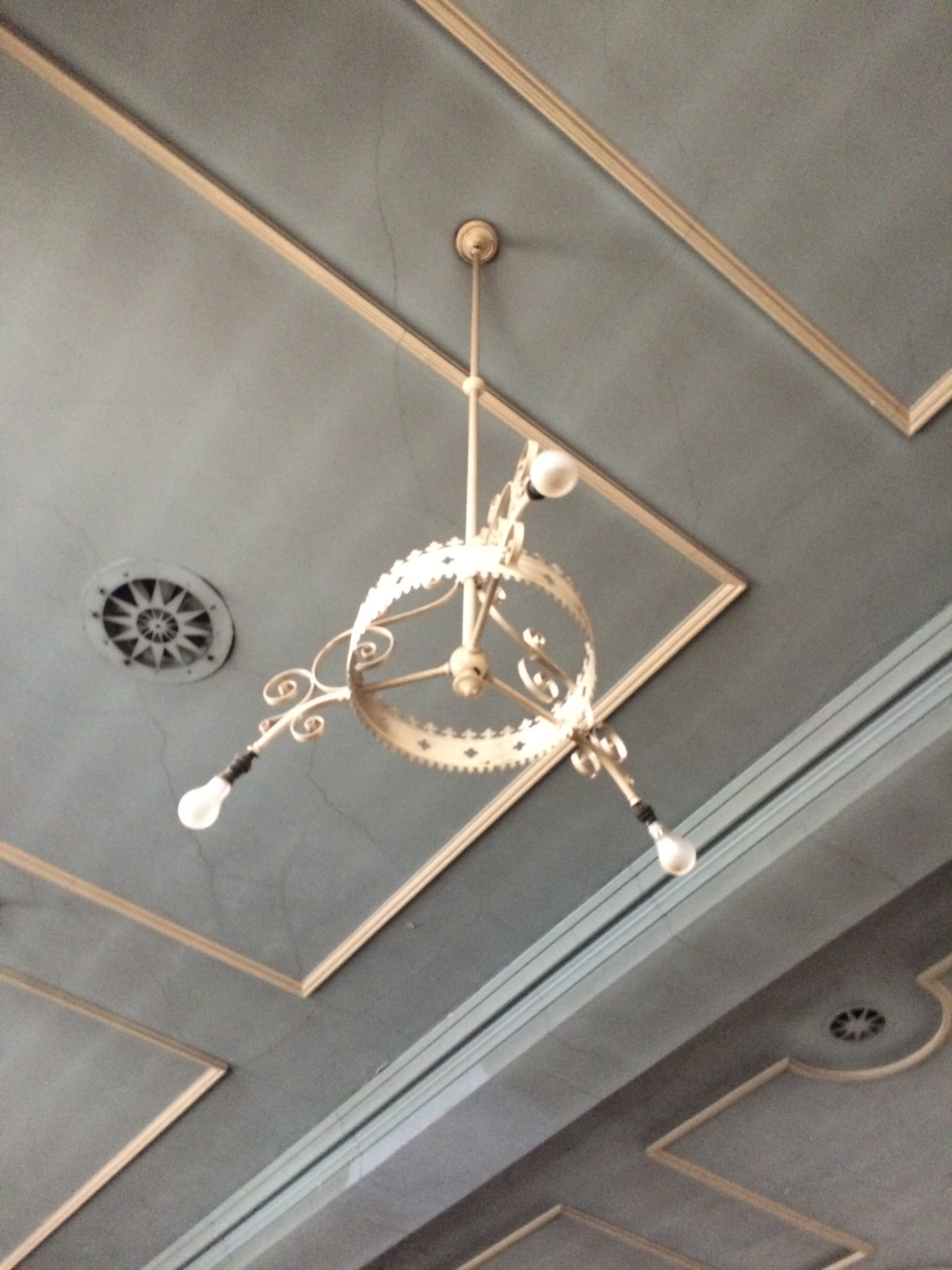
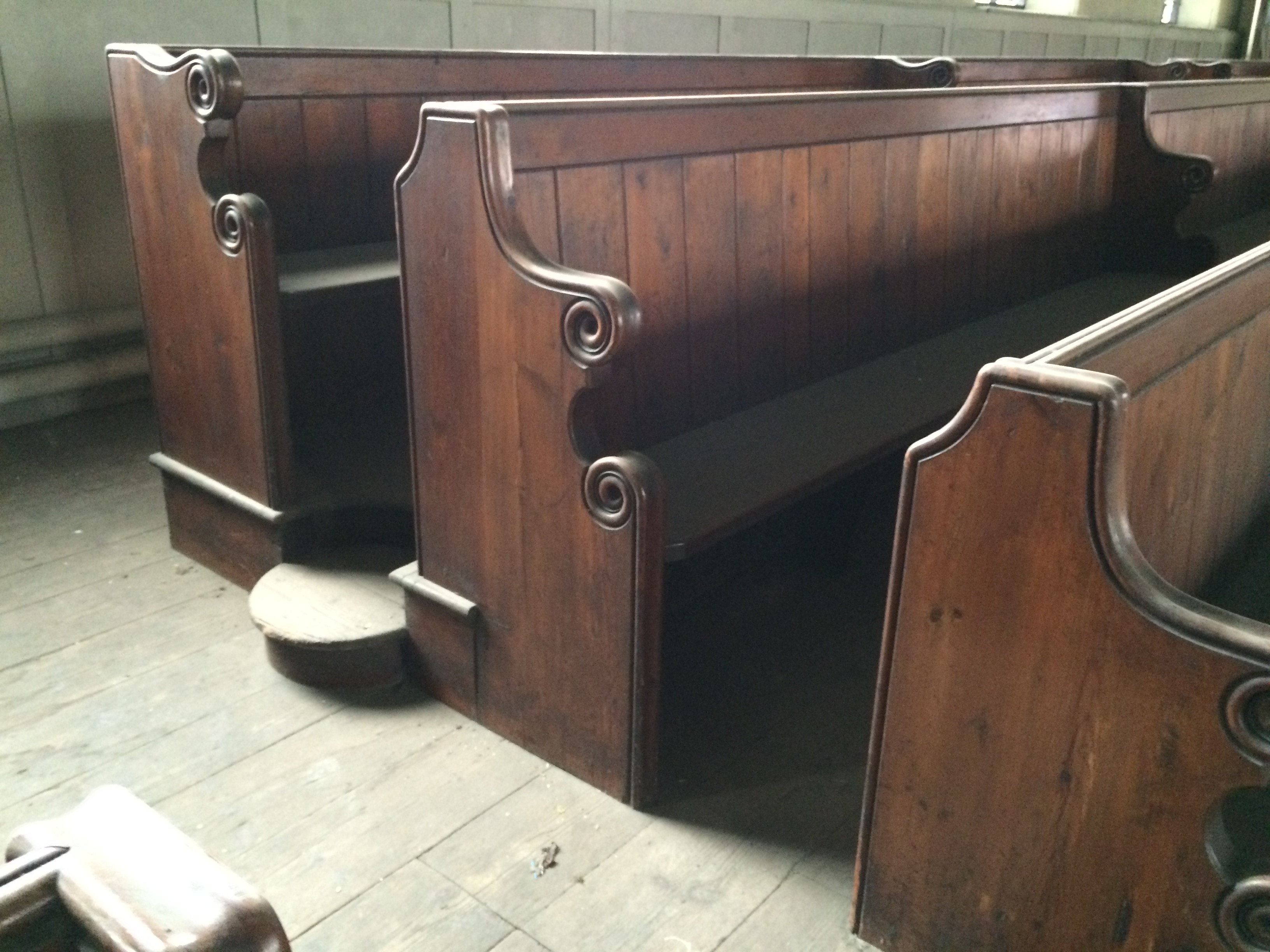
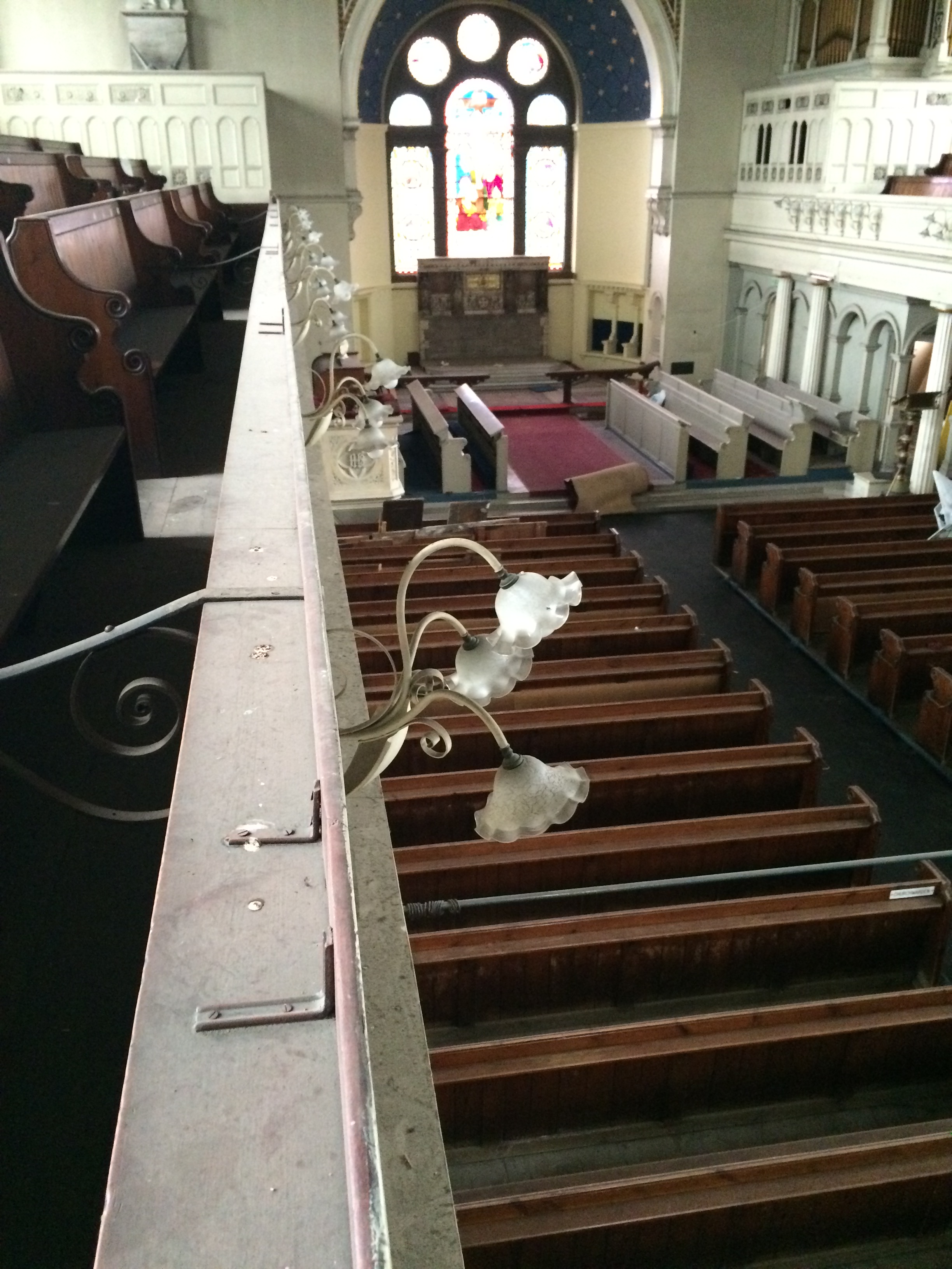
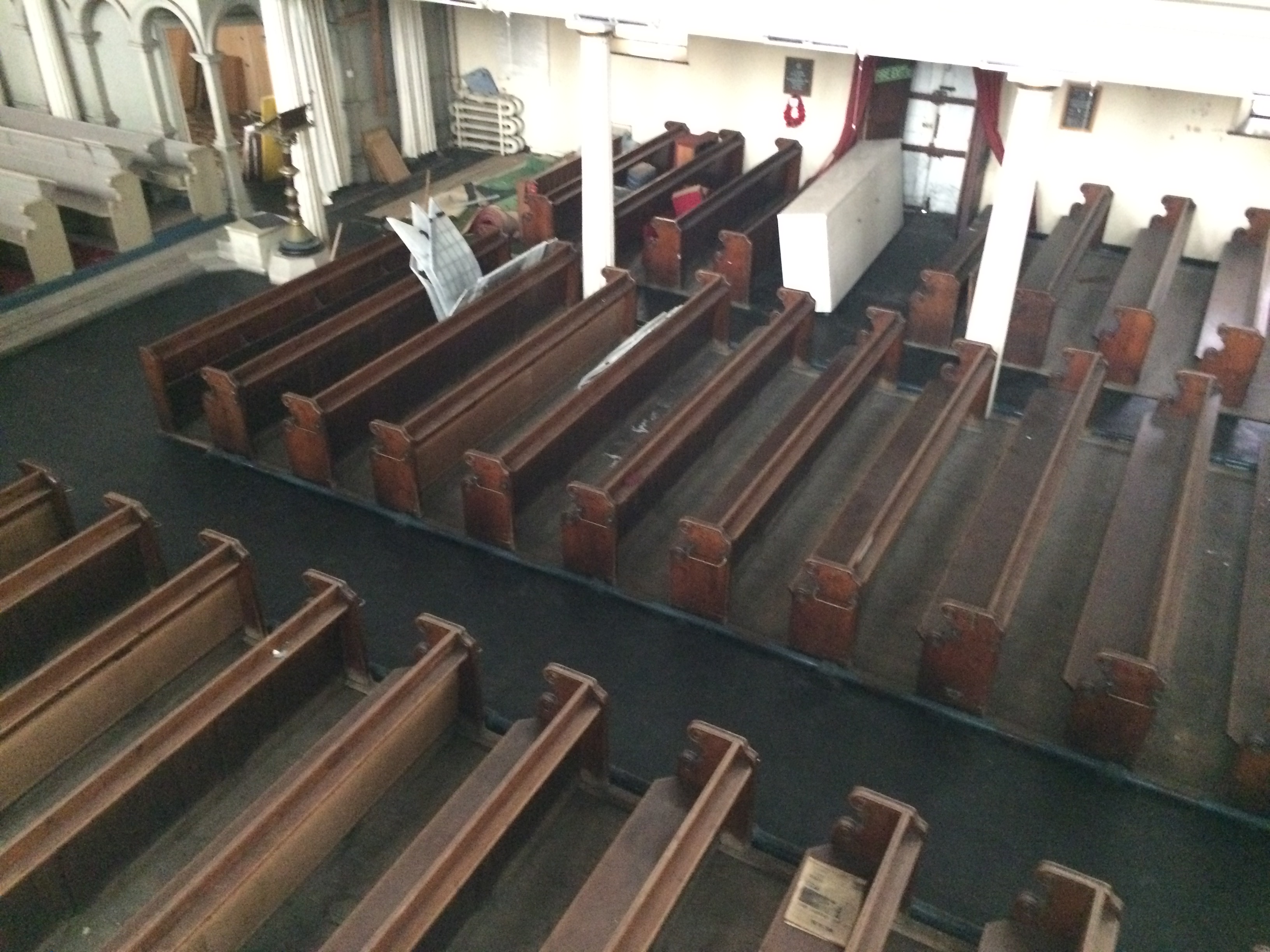
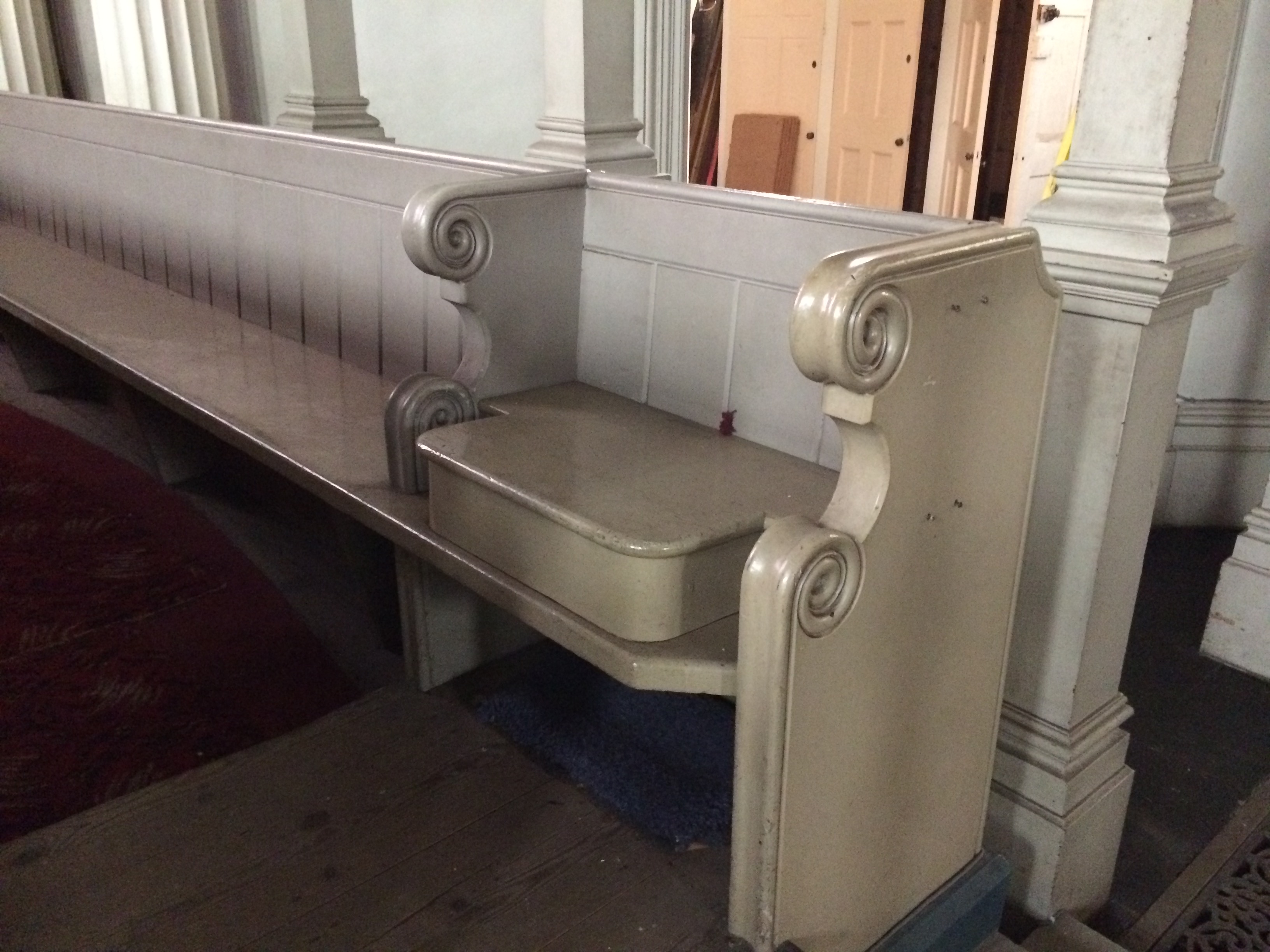
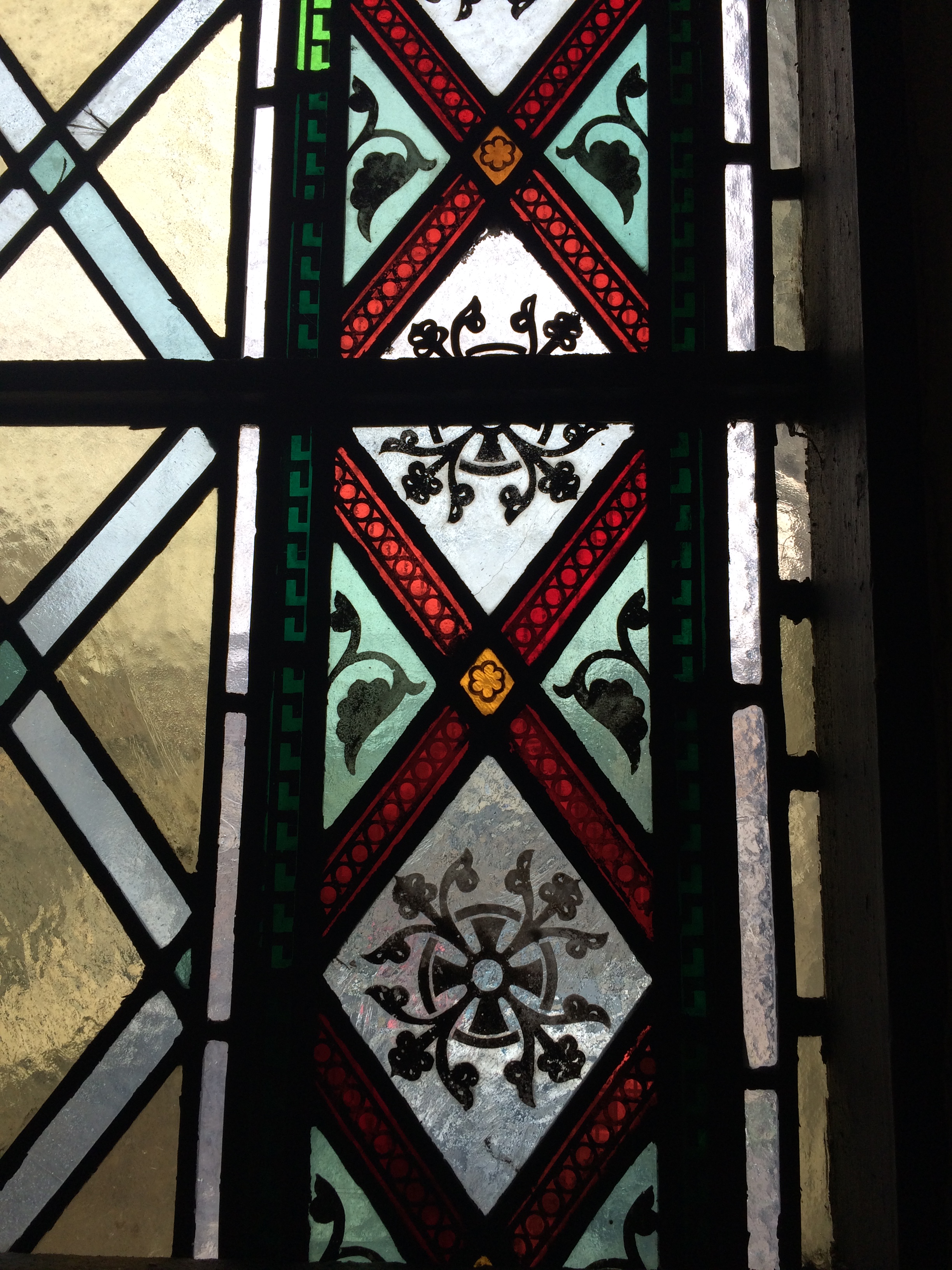
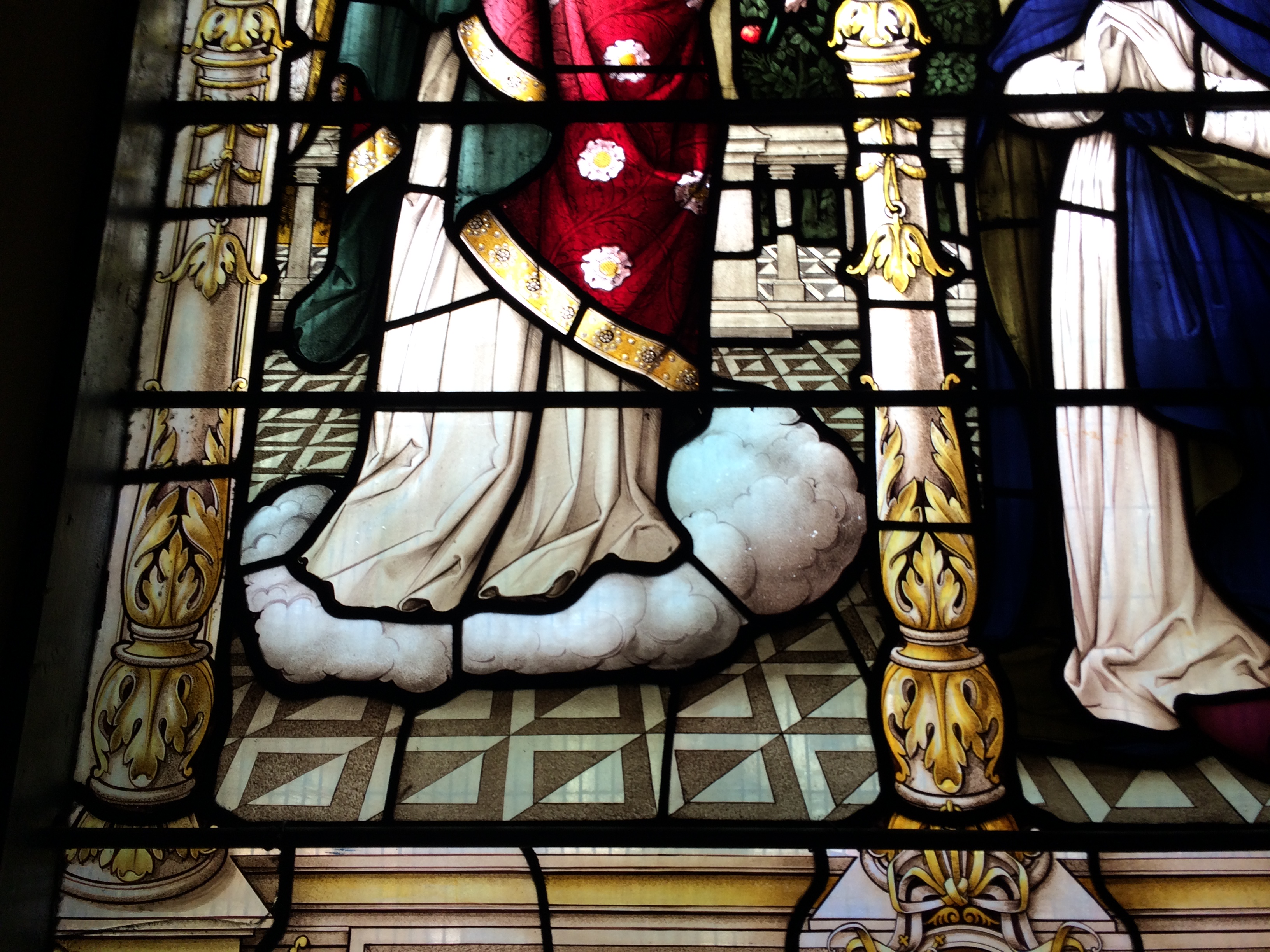
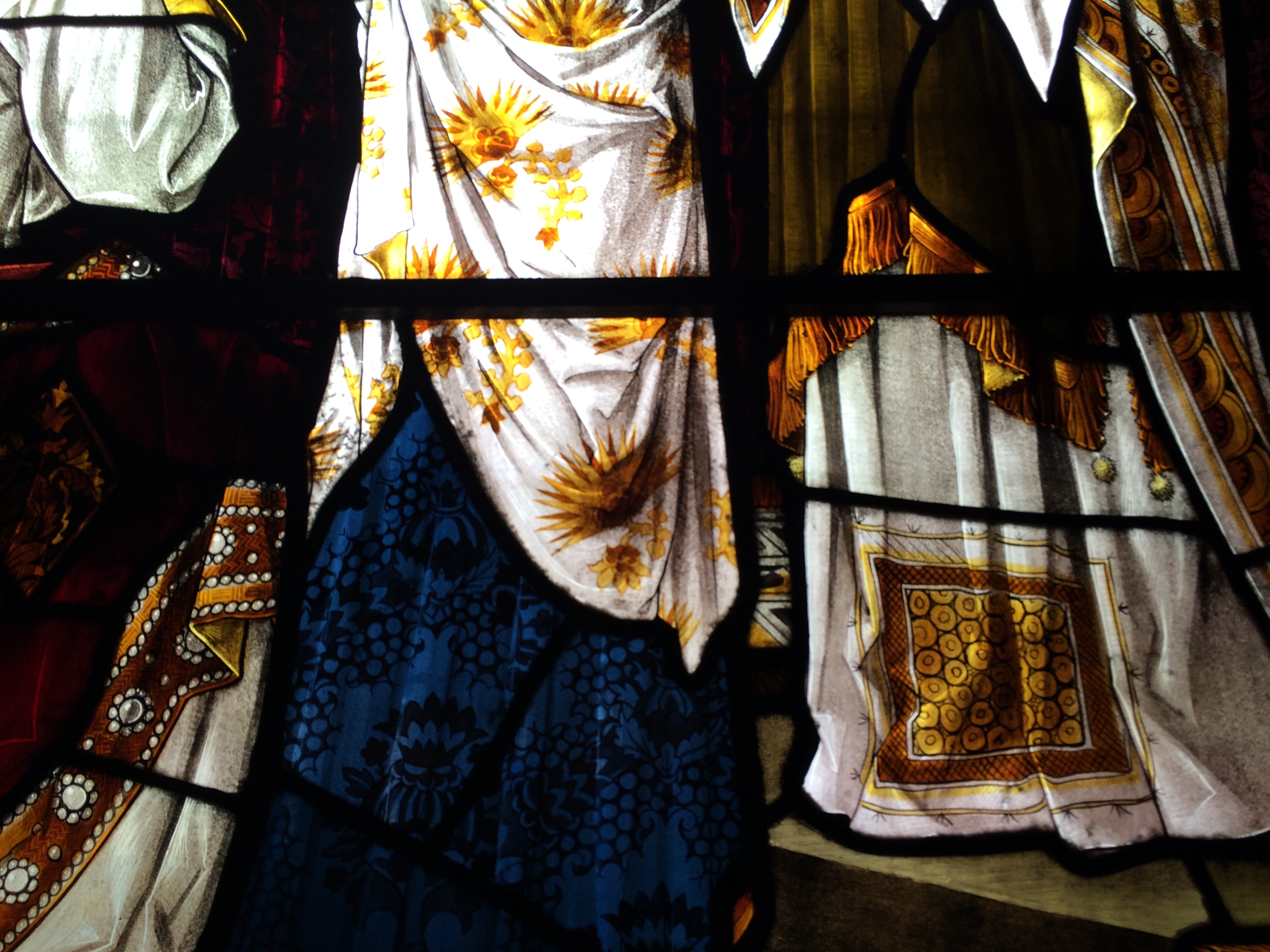
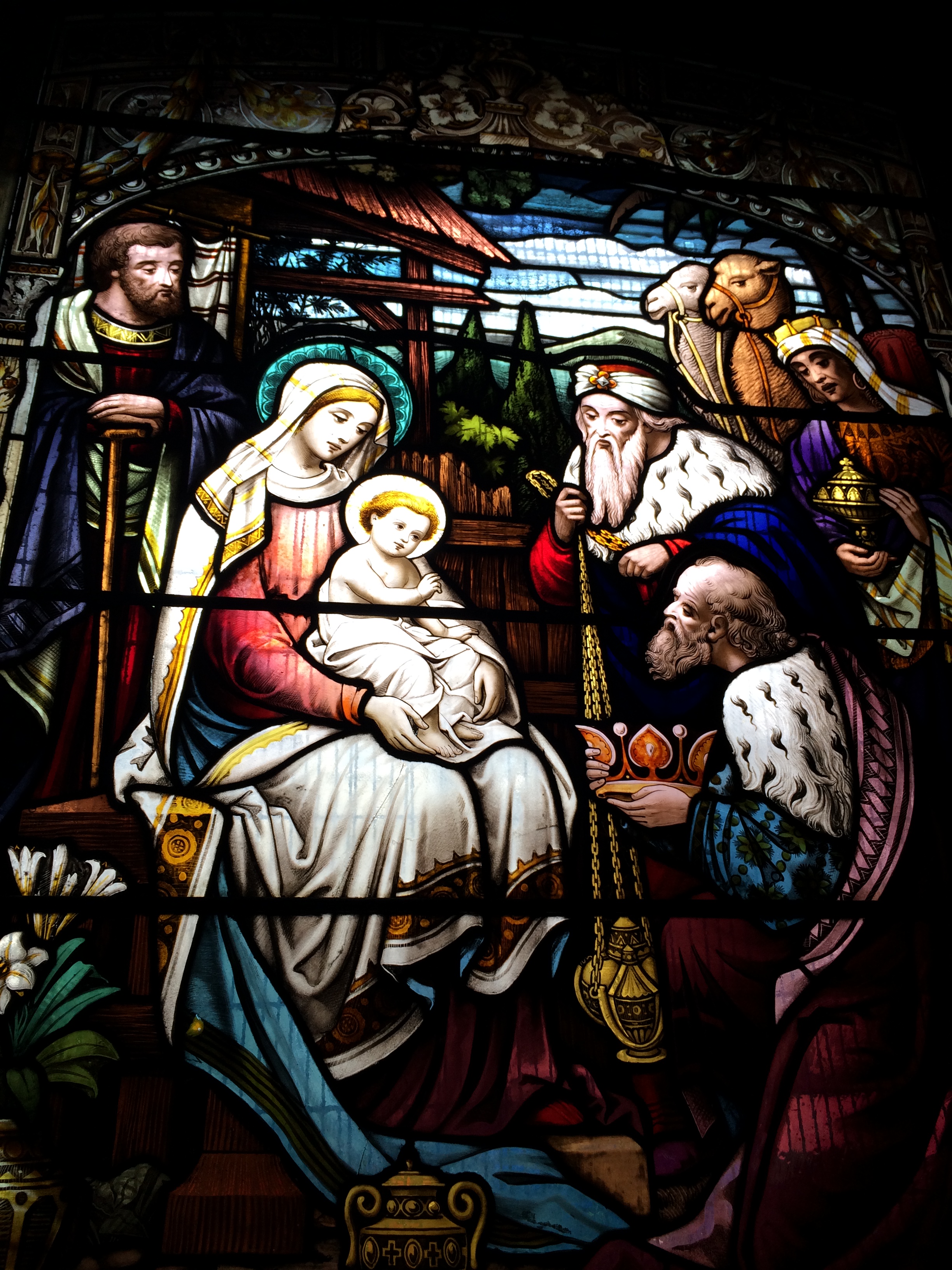
The interior is quite stunningly beautiful with interior furniture and finishes – albeit dirty and in need of repair & a little tlc – hardly touched since the day the doors were closed and locked. So much original detail and wonderful features remain, including bespoke benches and seating, lighting, plasterwork, ironwork and of course brilliantly coloured stained glass. Could you have guessed that from the outside?
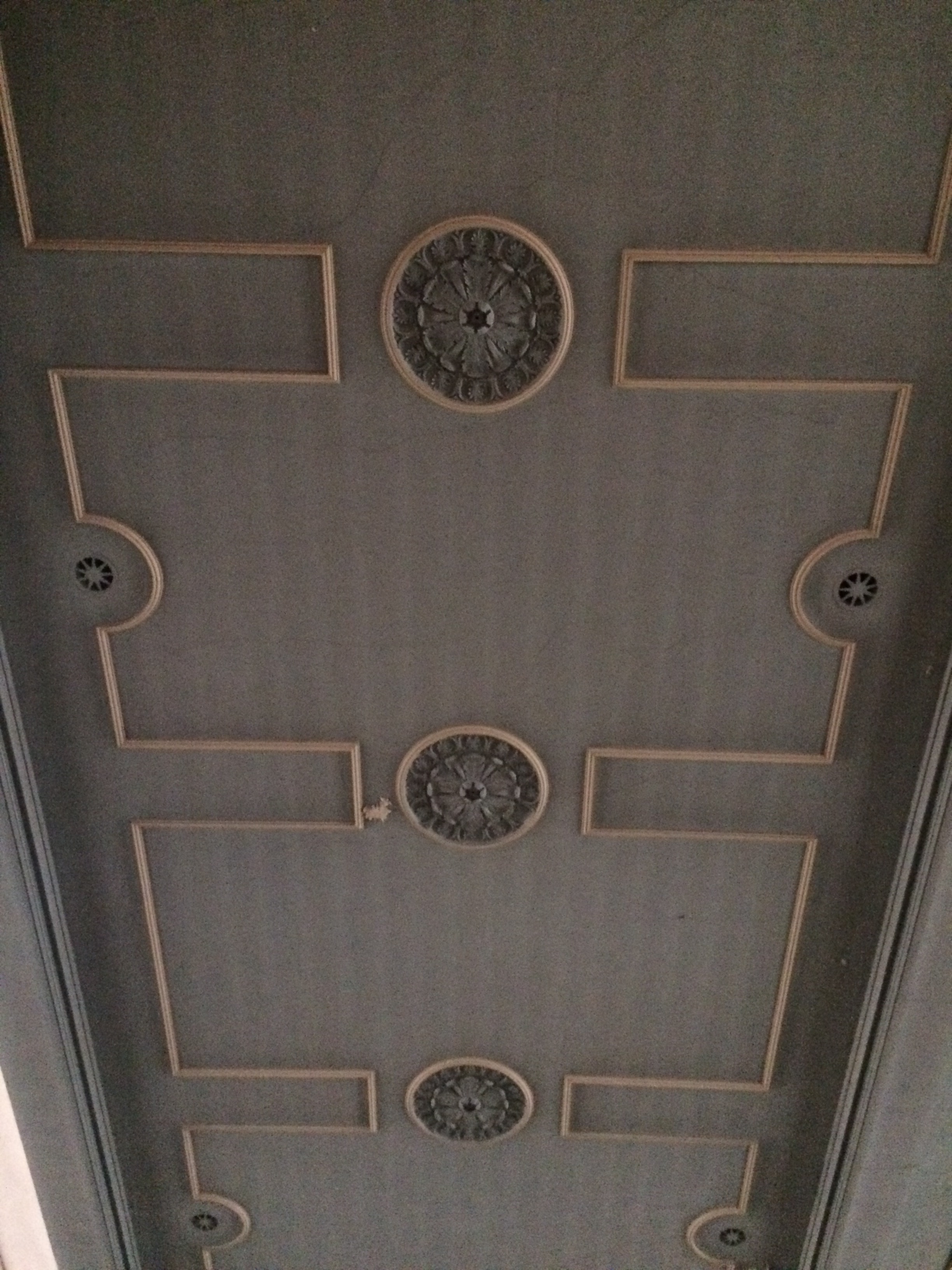
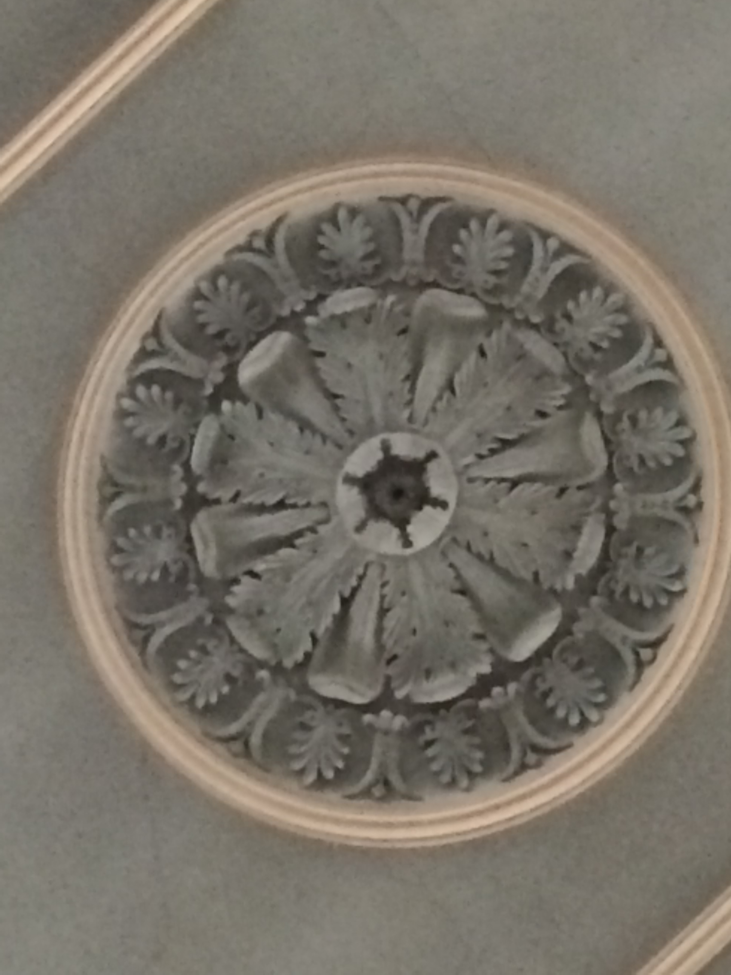
Interior of St John’s Church, Railway Street, Chatham. Stained Glass window above the alter. Image: Christopher Tipping by permission Diocese of Rochester.Interior of St John’s Church, Railway Street, Chatham. Image: Christopher Tipping by permission Diocese of Rochester.Interior – Ceiling detail of St John’s Church, Railway Street, Chatham. Image: Christopher Tipping by permission Diocese of Rochester.Interior of St John’s Church, Railway Street, Chatham. Ceiling rose detail. Image: Christopher Tipping by permission Diocese of Rochester.Interior of St John’s Church, Railway Street, Chatham. Detail of Benches – Image: Christopher Tipping by permission Diocese of Rochester.Interior of St John’s Church, Railway Street, Chatham. Image: Christopher Tipping by permission Diocese of Rochester.Interior of St John’s Church, Railway Street, Chatham. A view from the upper balcony. Image: Christopher Tipping by permission Diocese of Rochester.Interior of St John’s Church, Railway Street, Chatham. A view from the upper balcony. Image: Christopher Tipping by permission Diocese of Rochester.Interior of St John’s Church, Railway Street, Chatham. A view from the upper balcony. Image: Christopher Tipping by permission Diocese of Rochester.Interior of St John’s Church, Railway Street, Chatham. Image: Christopher Tipping by permission Diocese of Rochester.
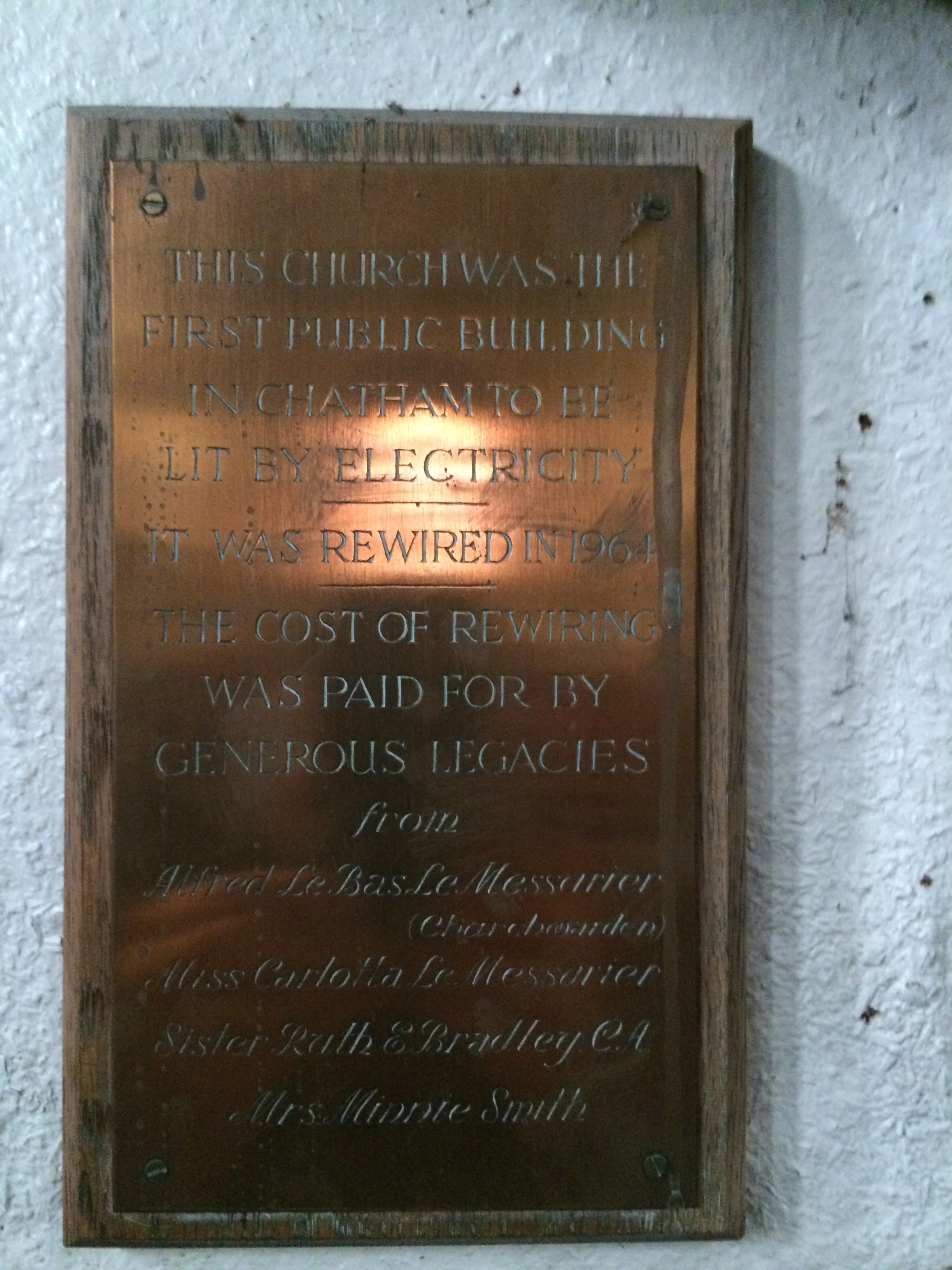
The first public building in Chatham to be lit by electricity !
Interior of St John’s Church, Railway Street, Chatham. A view of benches on the upper balcony. Image: Christopher Tipping by permission Diocese of Rochester.Interior of St John’s Church, Railway Street, Chatham. A view from the upper balcony. Image: Christopher Tipping by permission Diocese of Rochester.Interior of St John’s Church, Railway Street, Chatham. A view from the upper balcony. Image: Christopher Tipping by permission Diocese of Rochester.Interior of St John’s Church, Railway Street, Chatham. A view from the upper balcony. Image: Christopher Tipping by permission Diocese of Rochester.Interior of St John’s Church, Railway Street, Chatham. Timber screen fretwork. Image: Christopher Tipping by permission Diocese of Rochester.Interior of St John’s Church, Railway Street, Chatham. A seat in the choir . Image: Christopher Tipping by permission Diocese of Rochester.Interior of St John’s Church, Railway Street, Chatham. Image: Christopher Tipping by permission Diocese of Rochester.Interior of St John’s Church, Railway Street, Chatham. Image: Christopher Tipping by permission Diocese of Rochester.
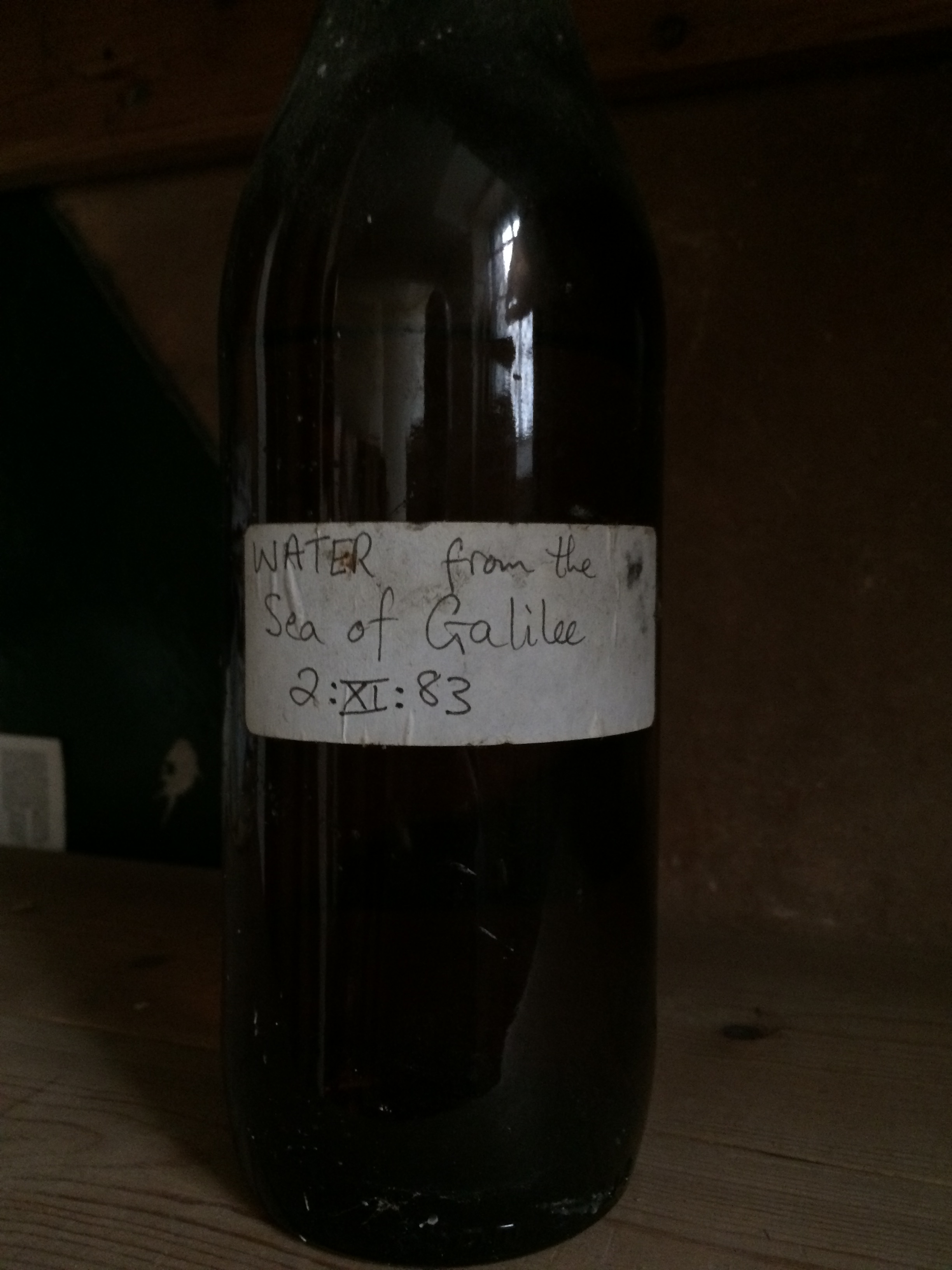
Interior of St John’s Church, Railway Street, Chatham. Wonderful delicate lighting. Image: Christopher Tipping by permission Diocese of Rochester.Interior of St John’s Church, Railway Street, Chatham. Image: Christopher Tipping by permission Diocese of Rochester.Interior of St John’s Church, Railway Street, Chatham. Image: Christopher Tipping by permission Diocese of Rochester.Interior of St John’s Church, Railway Street, Chatham. Image: Christopher Tipping by permission Diocese of Rochester.‘Water from the Sea of Galilee’ – Interior of St John’s Church, Railway Street, Chatham. Image: Christopher Tipping by permission Diocese of Rochester.Exterior pathway of St John’s Church, Railway Street, Chatham. Image: Christopher Tipping by permission Diocese of Rochester.